Download Agreement, Release, and Acknowledgement of Risk:
You (the person requesting this file download) fully understand mountain climbing ("Activity") involves risks and dangers of serious bodily injury, including permanent disability, paralysis, and death ("Risks") and you fully accept and assume all such risks and all responsibility for losses, costs, and damages you incur as a result of your participation in this Activity.
You acknowledge that information in the file you have chosen to download may not be accurate and may contain errors. You agree to assume all risks when using this information and agree to release and discharge 14ers.com, 14ers Inc. and the author(s) of such information (collectively, the "Released Parties").
You hereby discharge the Released Parties from all damages, actions, claims and liabilities of any nature, specifically including, but not limited to, damages, actions, claims and liabilities arising from or related to the negligence of the Released Parties. You further agree to indemnify, hold harmless and defend 14ers.com, 14ers Inc. and each of the other Released Parties from and against any loss, damage, liability and expense, including costs and attorney fees, incurred by 14ers.com, 14ers Inc. or any of the other Released Parties as a result of you using information provided on the 14ers.com or 14ers Inc. websites.
You have read this agreement, fully understand its terms and intend it to be a complete and unconditional release of all liability to the greatest extent allowed by law and agree that if any portion of this agreement is held to be invalid the balance, notwithstanding, shall continue in full force and effect.
By clicking "OK" you agree to these terms. If you DO NOT agree, click "Cancel"...
Trailhead: Mile Marker 5 on CO 7 south of Estes Park Route: Lily Mtn Trail for a bit, then bushwhack to the south ridge and then up Length: 4.5 miles Vertical: 1700 feet Partners: Solo
Teddy Roosevelt is my all time favorite president. Not gonna go into all the reasons why as I don't think a political discussion belongs in a TR, but I think a lot could be learned from his approach to many things. Anyway, I had spotted Rams Horn Mtn on a topo map while I was researching Lily Mtn and started doing some research. There isn't much beta on Rams Horn but Lisa Foster writes about it her book and states that the east, north and west sides are all private property and the only legal access is from the south ridge that connects it to Lily Mountain. As a HUGE proponent of private property rights (again, not gonna start that argument), that meant the only route I would consider was that south ridge and it worked out well. Yeah - there was some bushwhacking but it really wasn't all that bad - nowhere near what goes on in the LCW as I described in my report on Shawnee Peak here
I had less than an alpine start. On the trail at 10:30AM, but this was gonna be a short day and I needed to get home a bit on the early side due to some personal plans. And I made it with ease.
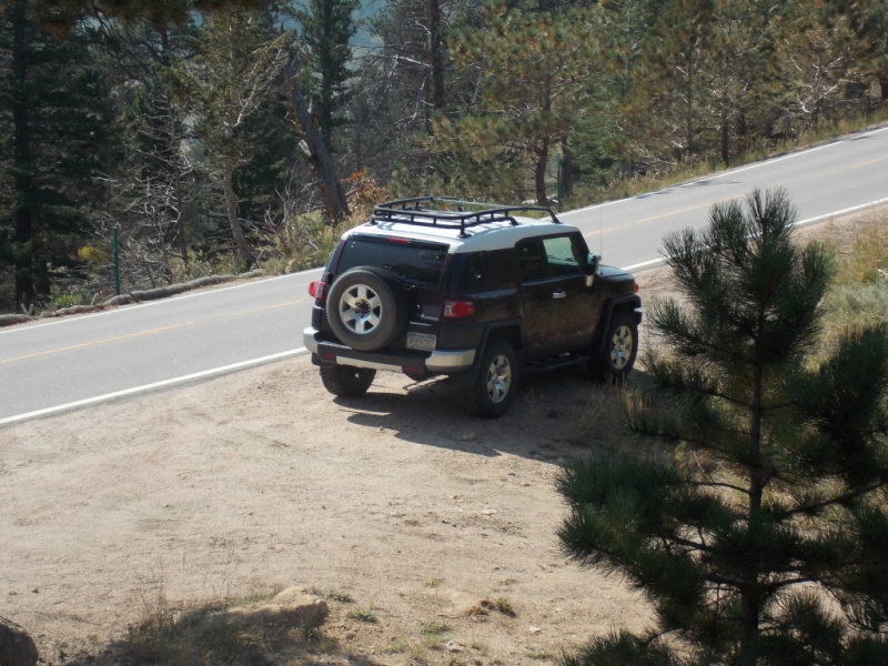
My FJ at my starting point.
User Flying Magpie had told me about a pull-off right at mile marker 5 that would allow me to shortcut the Lily Mountain trail by a bit. That suited me fine as there tends to be a lot of people on that trail and solitude is the name of the game for me in the mountains. There is room for probably 3 or 4 vehicles at this spot.
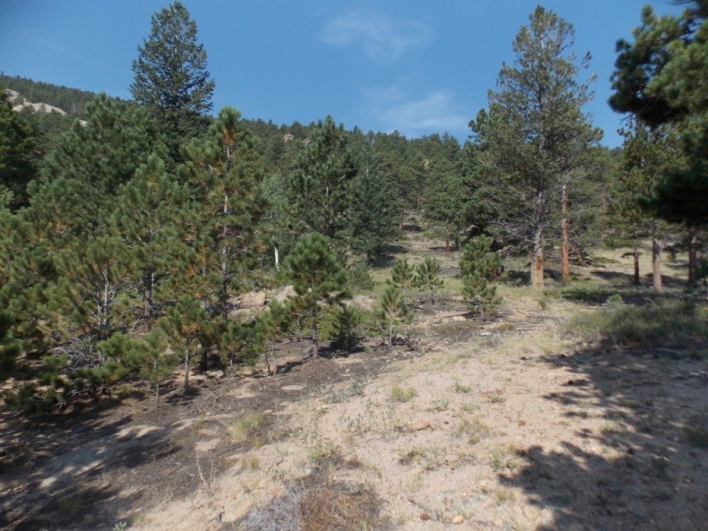
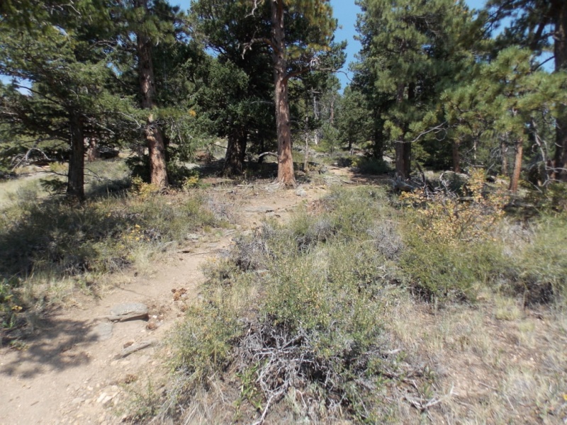
Starting up in a fairly open area.Nearing the Lily Mtn trail.
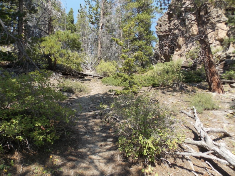
I didn't take any pictures of the Lily Mtn trail. I wasn't on it all that long plus it is a very wide and obvious trail. After maybe 100 yards or so after the trail cut back south, I headed west and started my bushwhack.
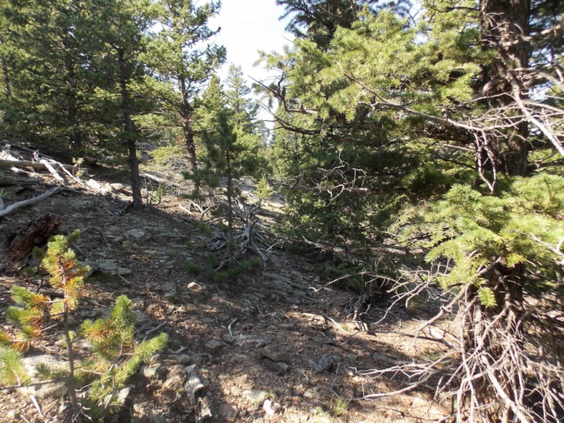
Starting the bushwhack. Pretty easy at this point.
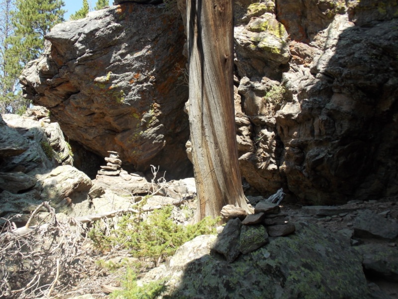
The bushwhack did get a little tougher and when I reached the saddle between Lily and Rams Horn, I was surprised to find an obvious (and VERY well cairned) trail that led all the way to the summit. On my return trip, I followed this trail down past where I initially joined it but it faded out quickly and I was left to take a slightly different bushwhack route back to the Lily Mtn trail.
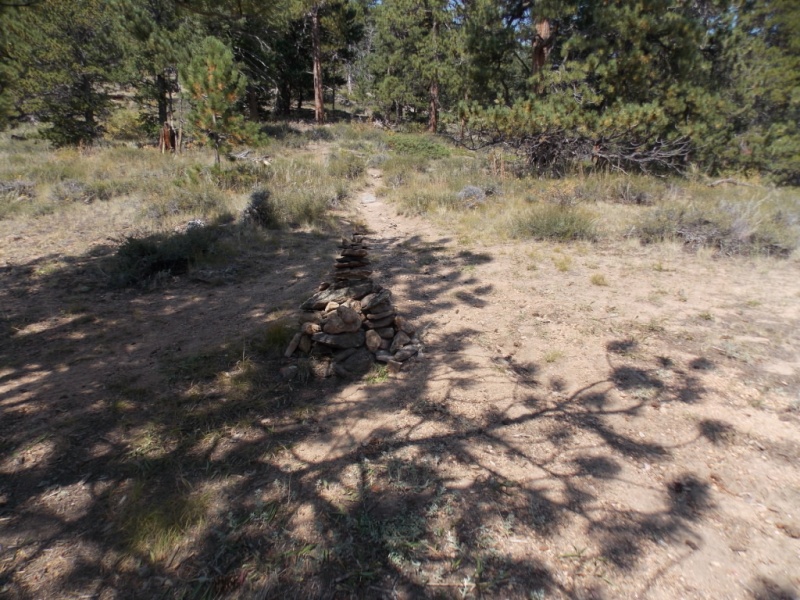
Nice trail!Large cairn at a trail intersection. Continue straight.
Lisa Foster had mentioned that there was a trail on private property on the west side and it appears to meet the south ridge at the cairn pictured above. There also seemed to be a trail heading east from this same spot. In any case, I believe that both of those trails are on private property.
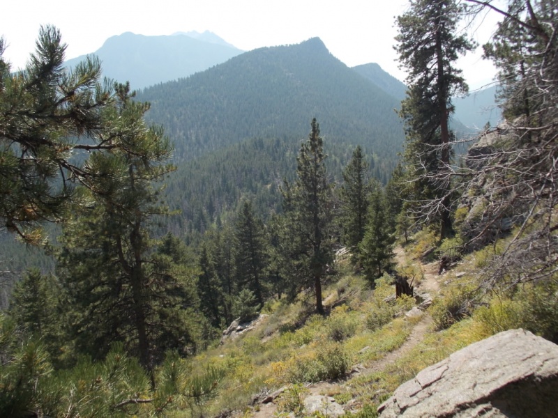
Farther along and looking back down the trail.
.
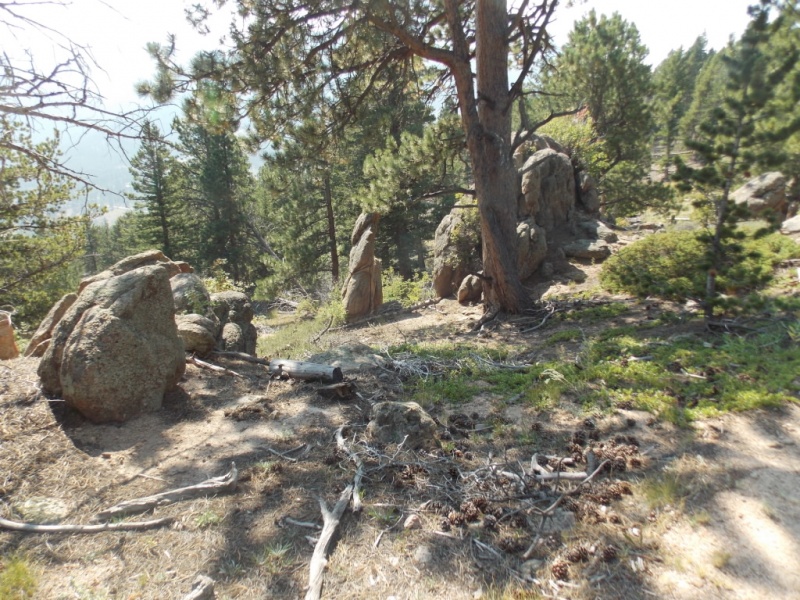
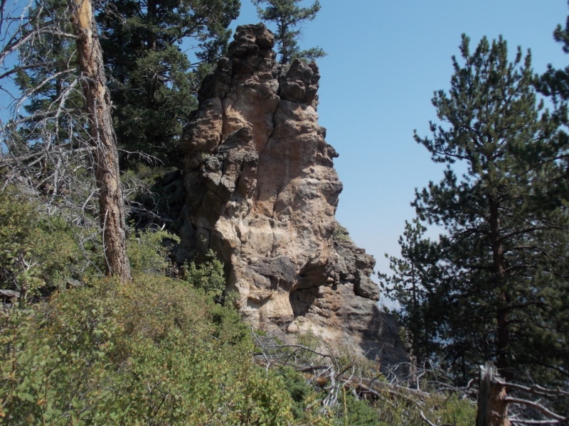
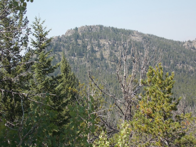
Cool rock formation.Nearing the summit.
A short 360 vid from the summit. Not sure why I called it "Peak" rather than "Mountain" in the vid. Old man disease setting in? <smile> And for some reason, I couldn't get the embed vid link to work so I have a clickable link below that should work.
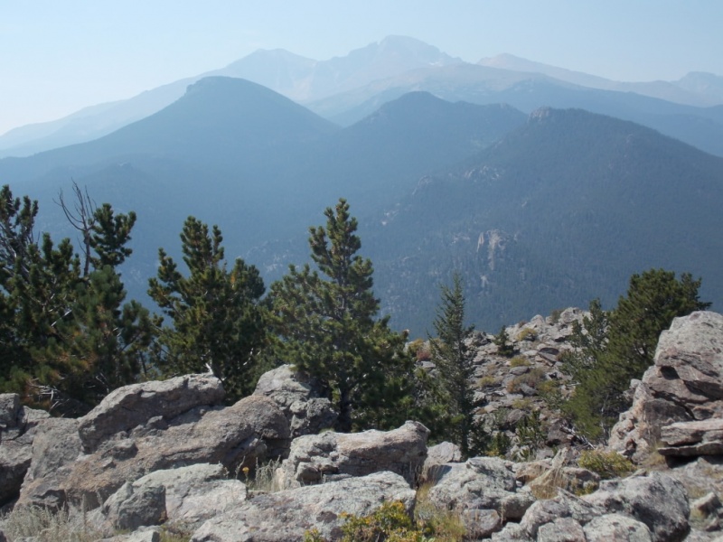
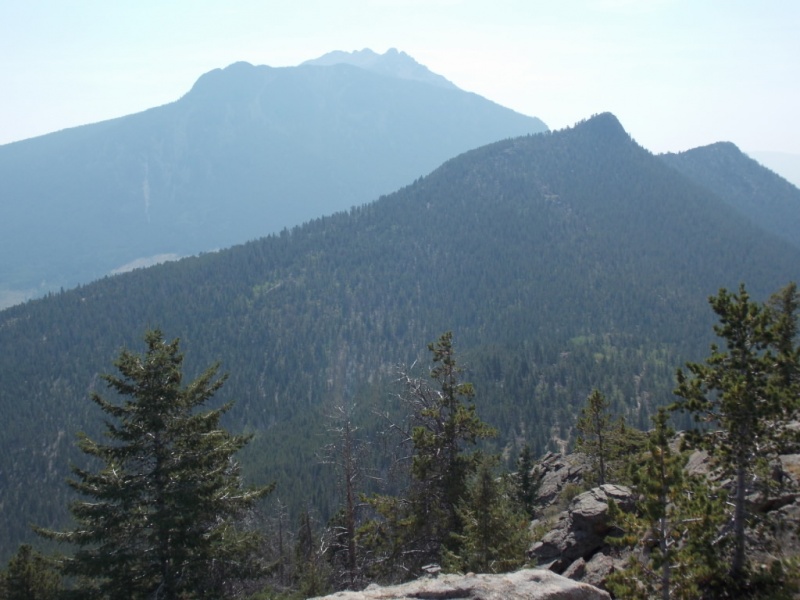
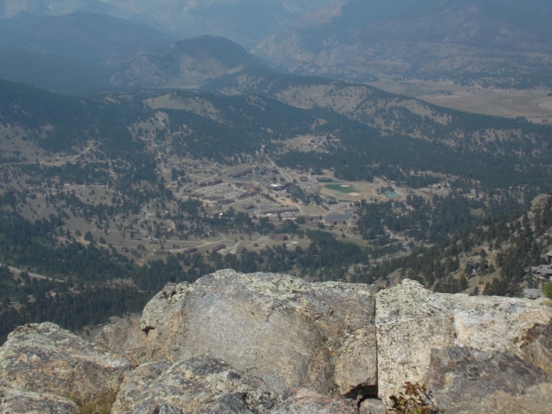
And some shots from the summit. The smoke got in the way of what should have been some stellar views. Damn smoke...
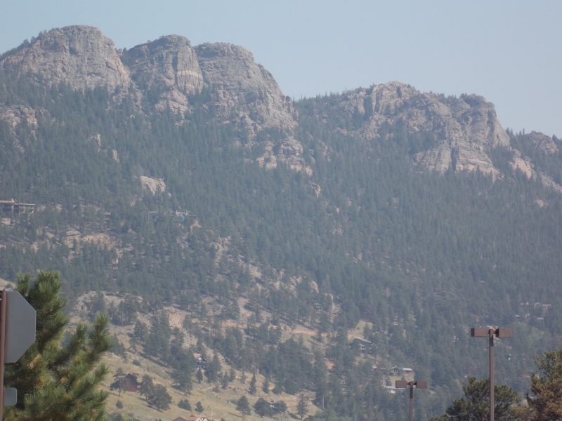
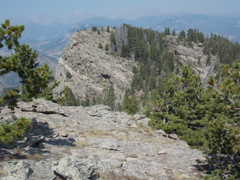
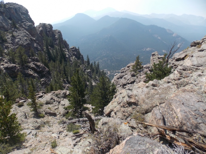
Longs Peak in the smoky haze.Twin Sisters in the background with Lily Mountain in the foreground.Looking across to the top of one of the teeth...
Naturally, I just HAD to go over to stand on that tooth!
And the trail continued there...Can you say "cairns" ?
And some shots from the top of that tooth.
Looking down on the YMCA camp.Heading back.And one last view of Rams Horn from the Lily Mountain trail.
Regarding the name "Teddy's Teeth". According to Lisa Foster, that name was given to the granite formations by boys at the YMCA camp in the early 1900's Apparently, cartoonists of the day did caricatures of President Roosevelt as having very prominent and large front teeth and hence the name. The topo map I used for this hike had that moniker on it.
This turned out to be an easy fun day. Other than a few folks on the Lily Mountain trail, I didn't see a soul.
As always, thanks for taking the time to read this and please be careful out there!
Thumbnails for uploaded photos (click to open slideshow):
Teddy helps launch the National Park system, yet Teddy's Teeth are not in the national park and are about 100x easier to access than the terrain actually inside the NP. But I'm not here to argue about that. I'm here to talk about the gems around Estes Park that you can just drive up and get if you just need a quick fix - Castle Mtn, Prospect Mtn, Oldman Mtn (not ranked but you have to do this simple scramble), Lily Mtn...of course (the only mountain my chihuahua has reached the summit of), Kruger Rock, Mt Olympus.
All summer long, the smoke from the west coast fires interfered with photos in the Colorado mountains. My brother, son, and I were on Twin Sisters on August 7th and couldn't even see Longs Peak that day. At least your day wasn't as bad as that!
Of those trails do kick into private property, but this is all legal/public. To continue north to Gianttrack Mtn involves some fairly heady trespassing on a well worn horse trail. Not that I would know!
I love seeing your trip reports, the pics, the descriptions. I know I've always got a lot of great hiking/climbing options thanks to the info you provide!
Dave - Thanks for posting a list of what I have to put on my agenda.
Eddie - Sorry to hear you missed those views from Twin Sisters. At least I could at least see the outlines of most of the peaks. Thanks for your nice compliment.
Andrew - as you probably know, your TR of your work in the Park was the only TR I could find that mentioned Rams Horn.
Nice report, I enjoyed it. I've done a little bit of climbing in that area, there's an unnamed 5th class (5.0?) scramble up a point that I did many years ago, not far from the road outside Estes. And for the history buffs, while the press may have poked fun at Teddy's teeth, he was no slouch when it comes to the outdoors. Most know about his hunting, etc. exploits, but a couple of years ago I read an account of his final journey down an unnamed tributary of the Amazon, a trip which ultimately hastened his death. That was a monumental undertaking, he deserves credit for coming out alive at his age.
A shortcut to Lily Mountain Trail?? I wish I would have known about that when I lived up there. Nice report, Jay. I love that country, that dry, earthy piney smell is wonderful. Your pictures evoke memories of that.
And that smoke! Ugh....
Teddy's isn't the easiest thing up there.
Yeah - it cuts off probably 1.5 miles total if you park right at the mile marker 5 sign. Links into the Lily Mtn trail just before it makes that U-turn south. Thanks for your comments!
Caution: The information contained in this report may not be accurate and should not be the only resource used in preparation for your climb. Failure to have the necessary experience, physical conditioning, supplies or equipment can result in injury or death. 14ers.com and the author(s) of this report provide no warranties, either express or implied, that the information provided is accurate or reliable. By using the information provided, you agree to indemnify and hold harmless 14ers.com and the report author(s) with respect to any claims and demands against them, including any attorney fees and expenses. Please read the 14ers.com Safety and Disclaimer pages for more information.
Please respect private property: 14ers.com supports the rights of private landowners to determine how and by whom their land will be used. In Colorado, it is your responsibility to determine if land is private and to obtain the appropriate permission before entering the property.


")
")
")
")
")
")
")
")
")
")
")
")
")
")
")
")
")
")
")
")
")
")