| Report Type | Full |
| Peak(s) |
Jagged Mountain - 13,833 feet |
| Date Posted | 09/04/2021 |
| Date Climbed | 08/29/2021 |
| Author | Nathan Hale |
| Jagged Centennial Finisher for World's Worst Scrambler |
|---|
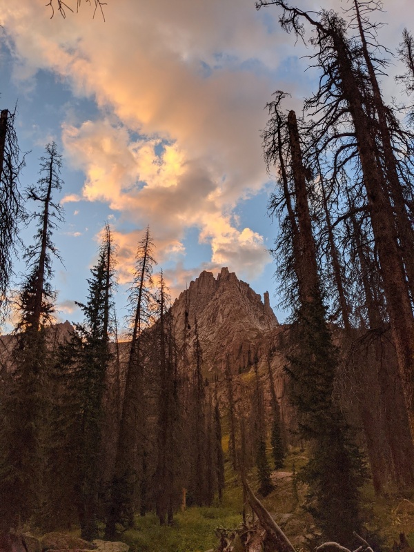
I climbed my first 14er (and first mountain) when I was 10 or 11, way back in 1994 or 1995, Mt Democrat, because I remember being struck by the view as Kenosha Pass descends into South Park and being shocked when my parents told me it was possible to climb some of the peaks we could see. A week or two later they took me to climb Democrat. I'd say I was hooked at that point, but I only climbed a few others over the next few years, and it wasn't until I was about to leave for college in New York City when I revisited climbing, thinking that it would impress others once I got there (it didn't). I climbed the Decalibron with my friend Sean, who I'd eventually climb 20-30 14ers with. In the years between August 2002 and August 2008 I climbed all the 14ers, including repeats of those I'd already done, figured I'd never finish the centennials, and then in 2009 started climbing centennial 13ers anyway. I wrote the initial versions of the 14ers.com app(s) in this time and kept climbing centennials slowly and it seemed like a foregone conclusion that I'd finish them after a while, especially as I finished some big scary ones like Thunder Pyramid in 2016 and Dallas and Teakettle in 2018. But as the list dwindled, I found my tolerance for exposure going down with it. I almost didn't go on our trip up Dallas, though once I was on it I felt good. Soon Jagged was the only really tough one left, though events kept transpiring to avoid it and I found myself not being bothered by this because I was scared of it. In fact, I welcomed the delays. In 2019 it was an infected cut from a trip to Papua New Guinea (though not from the barefoot trundling through the jungle I did, oddly). Various events of 2020--a pandemic that you may have heard about, some family death, getting stuck in Morocco, classic stuff really--had me in an especially bad mental state such that even going up the class 2+ route on the back side of Trinity Peak was doing my head in. But by the end of summer 2020, Jagged was all that remained. Over Labor Day 2020 I backpacked up Sunlight Creek from Beartown/Kite Lake as a partial scouting trip and partial trip to an amazing place and got the feel for the road and the trail. 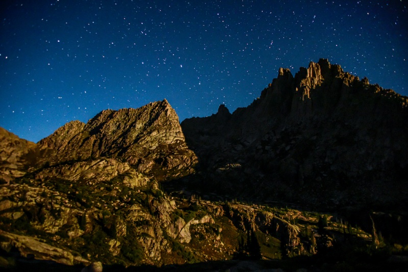
I'd climbed perhaps 60 or 70 different mountains with my friend Brian by that point, including our mutual 14er finisher on Snowmass, Rainier, and Kilimanjaro. We intended to finish the centennials at the same time as well, and he was significantly more excited for it. To be honest this was probably for the best, because left to my own devices I may have always stayed at 99/100 centennials. I continued to dread the exposure and danger and instead crave simpler summits and backpacking trips to read a novel by a lake. But his excitement meant that I tried to put aside my reservations and we set aside the last two weekends of August 2021 for an attempt, depending on the weather. We also recruited John, his brother, who's a much better lead climber than either of us. The first reserved weekend was preceded by a San Juan summer snowstorm that briefly left snow down to almost treeline and we decided to postpone to the following week rather than risk ice or snow on the shady spots on the Jagged route. I'd been busy at work, including a trip to Denmark immediately before that weekend so hadn't had time to fret. But as the final weekend approached, all looked good weatherwise and I tried to put my concerns to the back of my mind by obsessively studying the route. There are a number of high quality trip reports for Jagged out there. If you've looked at them, you won't be surprised by anything the route has to show you. It's generally obvious and the difficulties are well documented. I don't expect that this trip report will add all that much to general route finding, but I can provide some info on two important pieces:
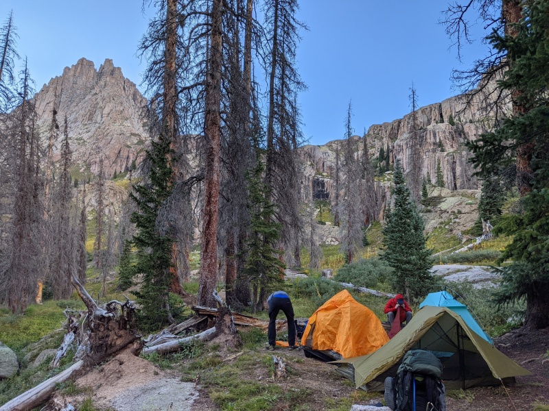
Trailhead and Approach Sunlight Creek Trail It does ease up slightly in difficulty between perhaps 10k and 10.9k, when there's less growth and it just climbs steadily and crosses Sunlight Creek to the south side. After a bit of meandering, you end up in the flattish area around 11,100', where I believe the trail to be impossible to follow. This area is indicated in the map below by the yellow area. But if you head towards that open hillside you will eventually find a nice trail that has switchbacks and is by far the best way to proceed. Eventually you level off around 11,500, and shortly after you do is the best time to cross Sunlight Creek in order to approach Jagged. We camped at the area circled in blue on the map. 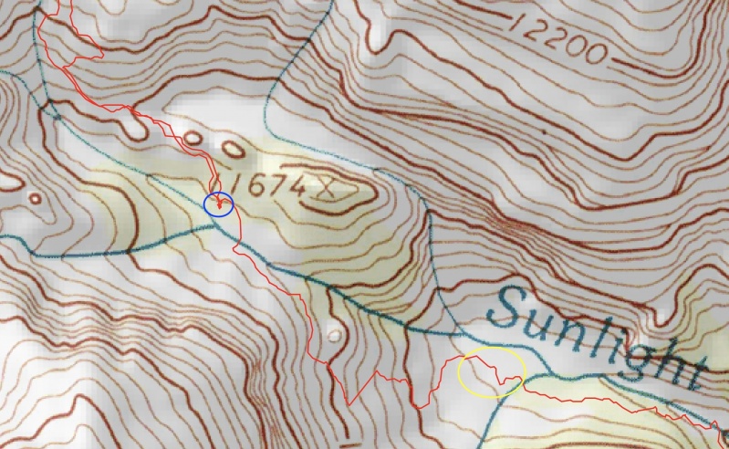
Climbing Jagged 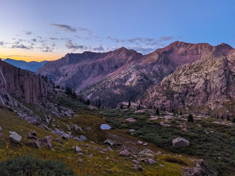
I left trekking poles here, positioned upwards to prevent marmots from chewing them, as well as my packed rain shell given the forecast and the weather. As would become the rule of the day, Brian and John set up the climbing pitch while I watched and tried to keep my mind right. 
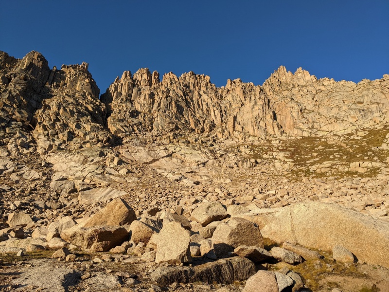
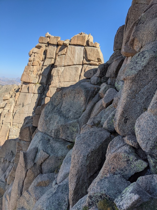
The first crux was the easiest. In terms of moves, if you're more comfortable than I am with exposure (which constitutes 90% of people climbing Jagged) you could probably do the normal way without rope, though in our case there was some water running down the middle that required some more difficult (Class 5) moves to avoid. It sounds like this is the case more often than not. With three of us and a long rope (more on that later) the easiest way was to have John, our lead climber, lead the pitch, me follow with a figure-eight on a bight, and then Brian go last tied into the end of the rope. So at the top of each crux I had some time to explore the next parts of the route. It's very easy to follow between the cruxes, at least assuming you've read the TRs/Roach. From the top of the first, it always seemed clear where to go, with occasional third class moves. Follow the Roach route description to where you hit the base of the cliffs and cut across and descend slightly to the base of the second crux. There were cairns where you might get confused, but it was fairly clear. 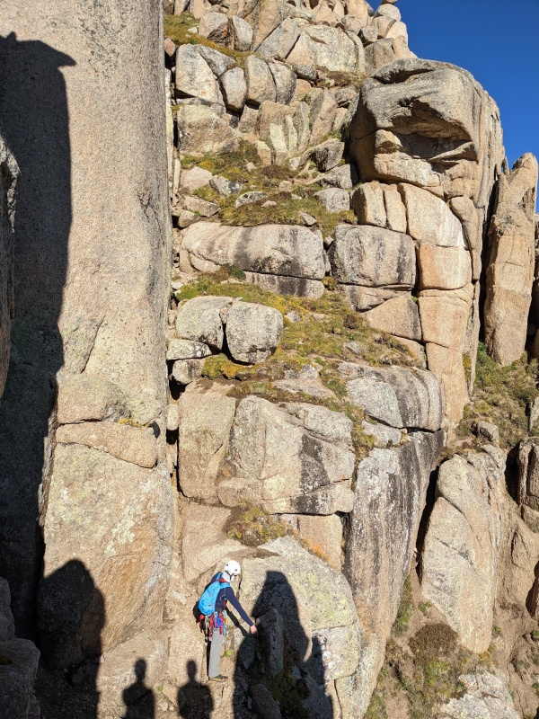
For the second crux, most TRs I've seen show people climbing the crack on the left, which is what we did. The 6-10' of crack you see in the pictures is all there is to it -- it's just walking after that. Its awkward and you may want to protect it (as I certainly did) but that's all there is. The rappel station is a ways above it though. Roach's directions are slightly different and may be slightly easier though more exposed, but we didn't investigate. We roped up for this section because I'm a wimp, and John was kind enough to place a nice sling to help out on this part. 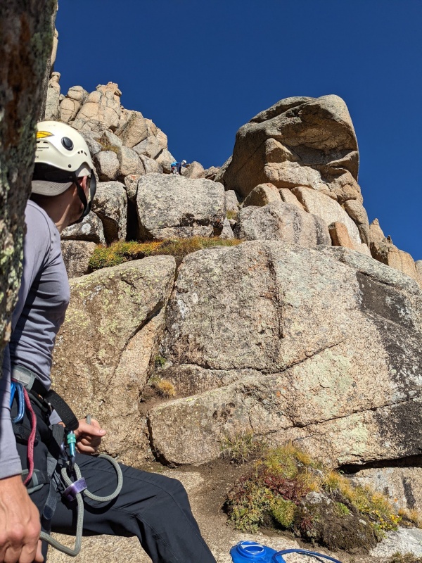
From the second crux's rappel station to the base of the third crux is barely any distance at all. It would be more if you didn't rope and were free climbing the crux, though still less distance than crux 1 to crux 2. It seemed very obvious where to go, and heading towards the rock shaped like a piece of pie (from a previous TR) was helpful guidance. Crux #3 was the hardest of the standard cruxes, but 5.2 feels like a fair rating of it to me. And at that point you're at the notch that leads to the far side. 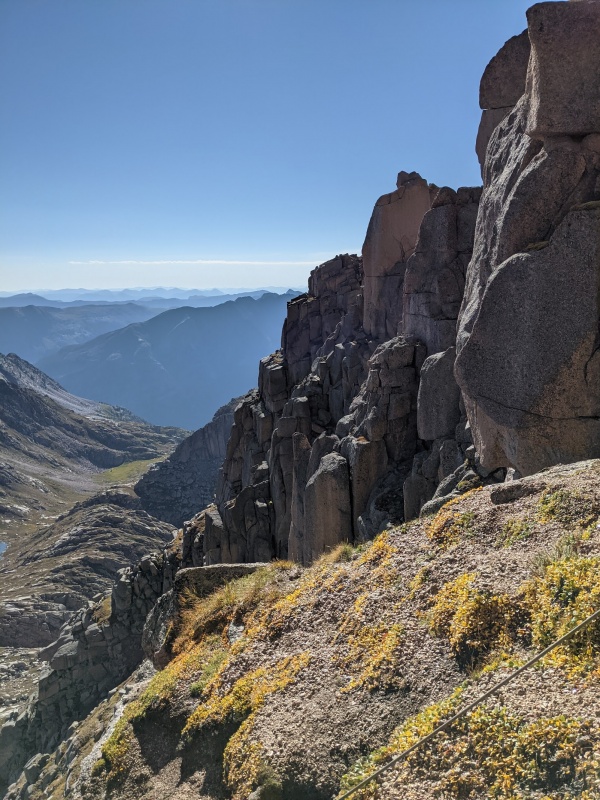
The far side was where my worries grew. That was the part of the route that I'd been nervous about and had kept me from sleeping the night before. For the first part, you climb high and to the left of the boulders that you see immediately after the notch. This is class 3 and not very exposed. 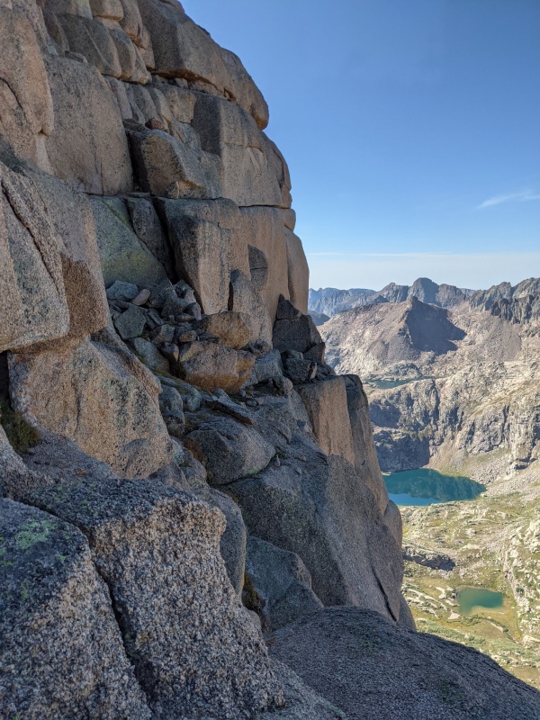
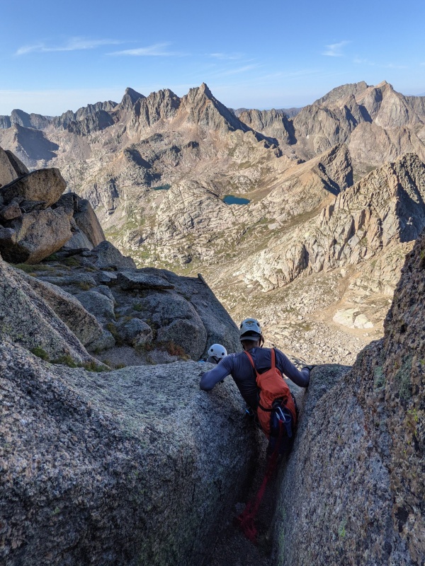
But then it gets harder, and was one of the moves I'd read about that worried me the most. You can stay along the edge and step across a LOT of air, or climb behind and through a boulder and descend down onto a wobbly rock and step around. We opted for the latter and Brian was kind enough to give me a supportive belay hand as I stepped down and off. This works well since he's got about 80 pounds on me. 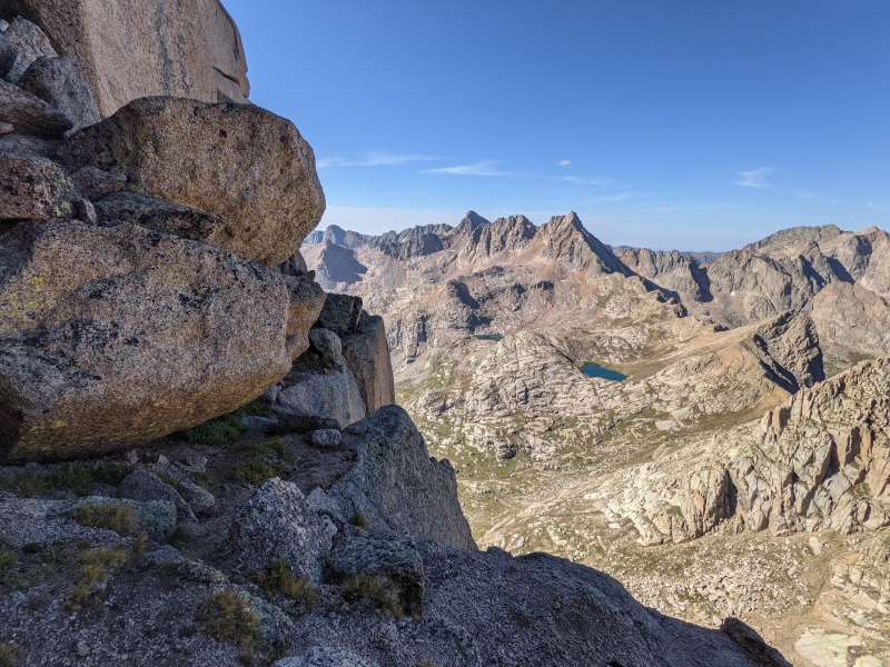
At that point was more ledges, but I could tell we weren't at the chimney of the standard route yet. That would require another step around a boulder with a lot of air that I was REALLY not wanting to do. John stepped around, eyeballed the final chimney with its new(ish) rockfall, and wasn't feeling great about it. This was great news to me personally because it meant that he'd want to lead someplace closer and I wouldn't have to step around over that air. We'd met only one other party since crossing Vallecito Creek, and one of them had climbed Jagged before (without ropes -- there's always someone better than you when you climb in Colorado) and had mentioned a place to mantle up before the normal chimney so we knew it would go. John led this section, which I regrettably don't have a picture of. But it went up a crack a bit to the left, and seemed awkward to lead. There was one difficult move this way that required a bit of a pull up and was maybe 5.4 or 5.5? It definitely felt harder than anything on Dallas, so let's say 5.5. From there, after climbing back and through a narrow spot between some boulders we were on a platform rock at the top of the belay station for the final crux (crux #4, now that the rockfall has happened). And it was mostly easy scrambling from there, at least for those who weren't me. There was a mildly airy move that was objectively not that hard just below the summit ridge, and I just froze a bit, as I'm wont to do. John was kind enough to set a sling for me to comfort myself with, and then I was on top of the centennial world with amazing views all around. 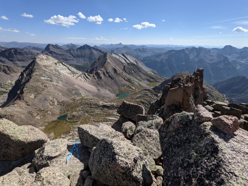
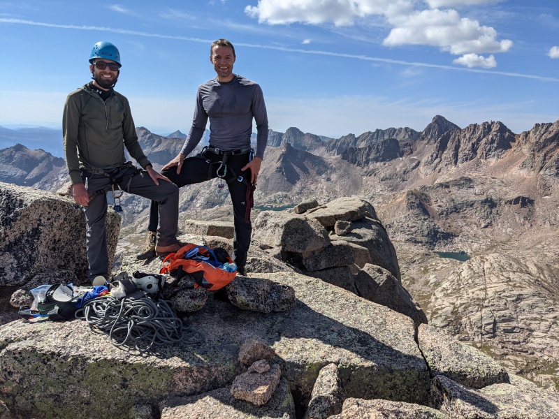
The summit pictures have many smiles, but they were mostly forced, honestly, because I knew we had to get down and I couldn't relax. We spent some time on a beautiful summit though. We had some snacks, I spread some of my dad's ashes, and we prepared for the rappel. And by we, I mean Brian and John. I was just trying to maintain my composure and confidence. I was definitely glad that I would never be revisiting the south side of Jagged though. Brian and I wore the exact same party hats that we'd worn when completing the 14ers, though we covered the text that said "14er Finisher" with something more appropriate. 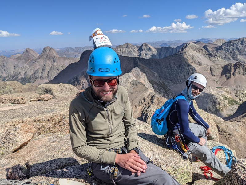
The Summit Rappel 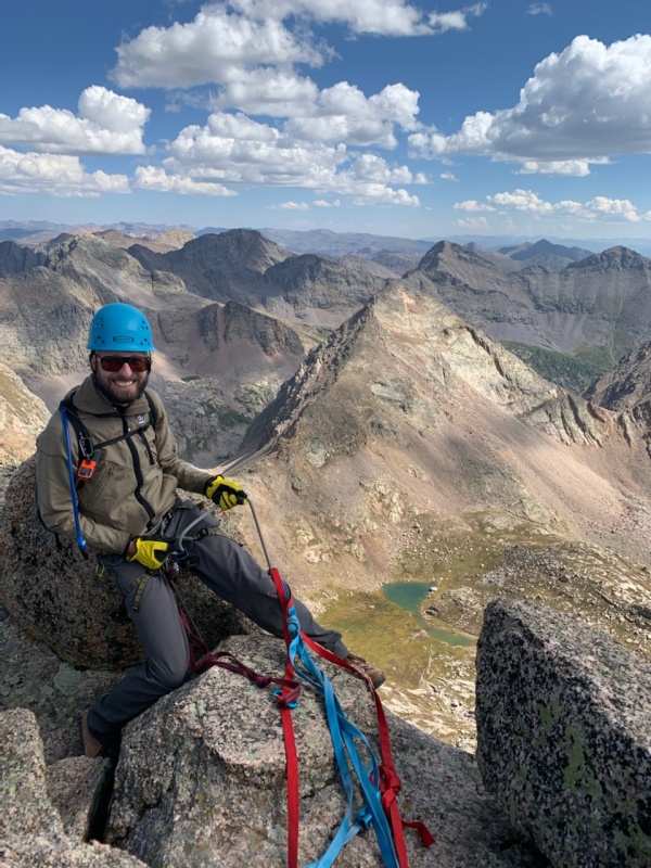
One challenge was that our parachute cord that we were going to use to pull the rope turned out not to be quite long enough, ending on a ledge about 30 feet above the end of the rope. Fortunately we had an extra long length of sling for just such an eventuality, which you can see in blue in the picture of Brian rappelling down. I think a 70m rope would still hit that grass on the 2nd crux without much difficulty, but I was glad to have the 80m. 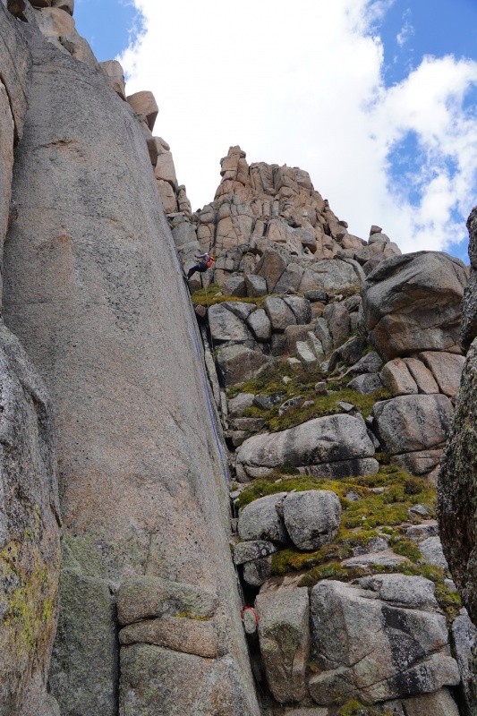
I was super happy to have done this rappel because it avoided all the most difficult parts. Many people will balk at carrying an 80m rope, but for us it was totally worth it. For me in particular, since Brian carried it. I'd highly recommend getting someone much bigger and stronger than your scrawny self to carry this rope -- it makes it much easier. Pulling the rope was a challenge because there were 260' worth of spots for it to get caught, but we got it down. Having bypassed the worst of the cruxes it wouldn't have been the end of the world had it gotten stuck, but I'm glad it didn't. At the high point between crux 1 and crux 2, from which you descend slightly to the base of crux 2, someone had set up some slings to rappel from. Not wanting to bother with some annoyingly difficult class 3 downclimbs we took the opportunity. We actually had even more trouble pulling the rope here, but again, we got it. And then we descended a short distance on fairly obvious grass ramps to the top of crux #1, and made the easiest of the rappels down to its base where I found that a marmot had gotten at my poles despite my best efforts. But it felt amazing to be back on solid ground and to feel unexposed again. It was here that I began to feel good about having completed the centennials. 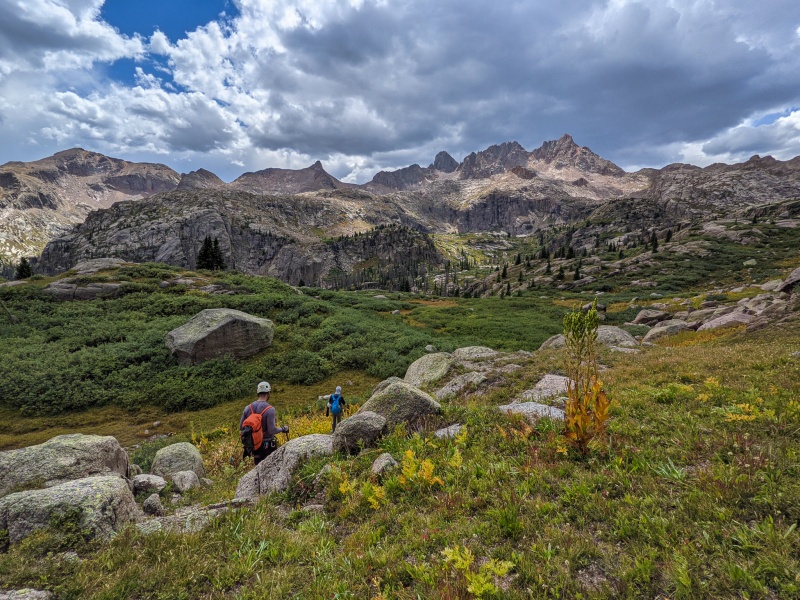
The trip down was very straightforward. We caught a bit of rain at camp, but packed up and packed out to where Rock Creek trail meets the Vallecito trail. We set out first thing the next morning and were back at the car around 9:30. The drive out was more difficult, for whatever reason. A couple of obstacles that looked more awkward from above (and definitely harder than last year). I ended up using the rock crawling mode on my 4Runner to make it easier. We took the far side of Stony Pass towards Creede on the way out, and it was also harder than last year. Quite rough and a couple of sketchy parts with fallen timber, though still easier than the last section of the Kite Lake road. The way home also ended up being faster, 7 hours vs. 7.5 Final Thoughts Thumbnails for uploaded photos (click to open slideshow): ")
")
")
")
")
")
")
")
")
")
")
")
")
")
")
")
")
")
")
")
|
| Comments or Questions | ||||||||||||||||||||||||
|---|---|---|---|---|---|---|---|---|---|---|---|---|---|---|---|---|---|---|---|---|---|---|---|---|
|
Caution: The information contained in this report may not be accurate and should not be the only resource used in preparation for your climb. Failure to have the necessary experience, physical conditioning, supplies or equipment can result in injury or death. 14ers.com and the author(s) of this report provide no warranties, either express or implied, that the information provided is accurate or reliable. By using the information provided, you agree to indemnify and hold harmless 14ers.com and the report author(s) with respect to any claims and demands against them, including any attorney fees and expenses. Please read the 14ers.com Safety and Disclaimer pages for more information.
Please respect private property: 14ers.com supports the rights of private landowners to determine how and by whom their land will be used. In Colorado, it is your responsibility to determine if land is private and to obtain the appropriate permission before entering the property.


