| Report Type | Full |
| Peak(s) |
Peak Eleven - 13,530 feet Peak Fifteen - 13,671 feet Monitor Peak - 13,707 feet Peak Thirteen - 13,725 feet Animas Mountain - 13,789 feet |
| Date Posted | 09/01/2021 |
| Modified | 03/05/2023 |
| Date Climbed | 08/25/2021 |
| Author | Dobsons |
| Ruby Basin Bicentennials |
|---|
|
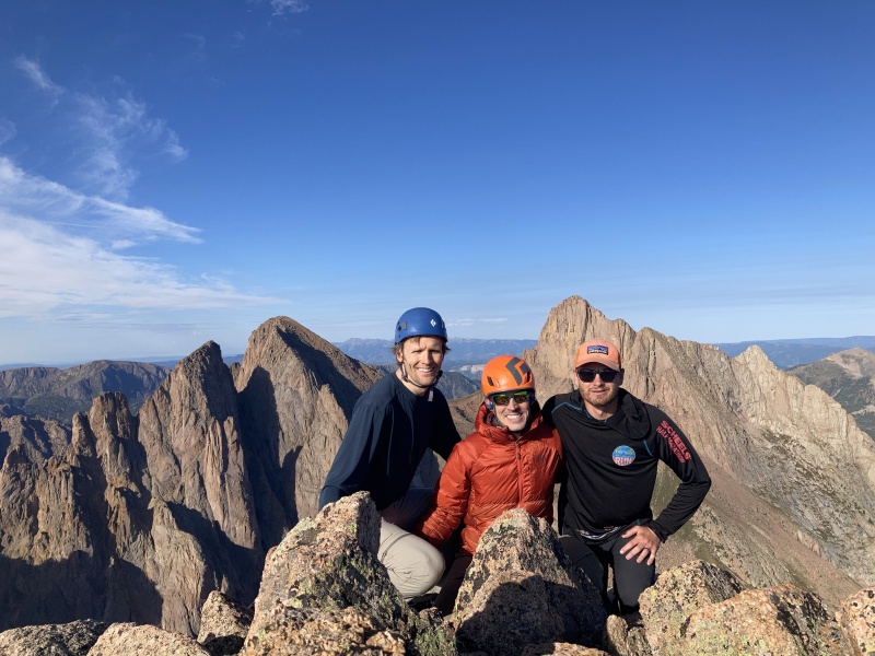
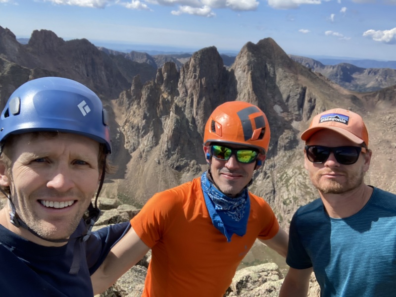
Ruby Basin Bicentennials Date climbed – August 25-28, 2021 Members – Me (Corey), Brent and Luke 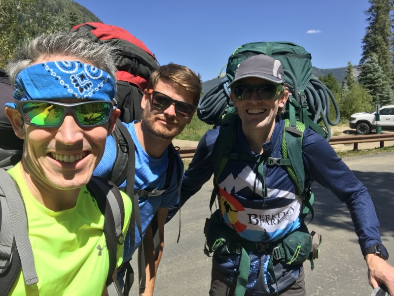
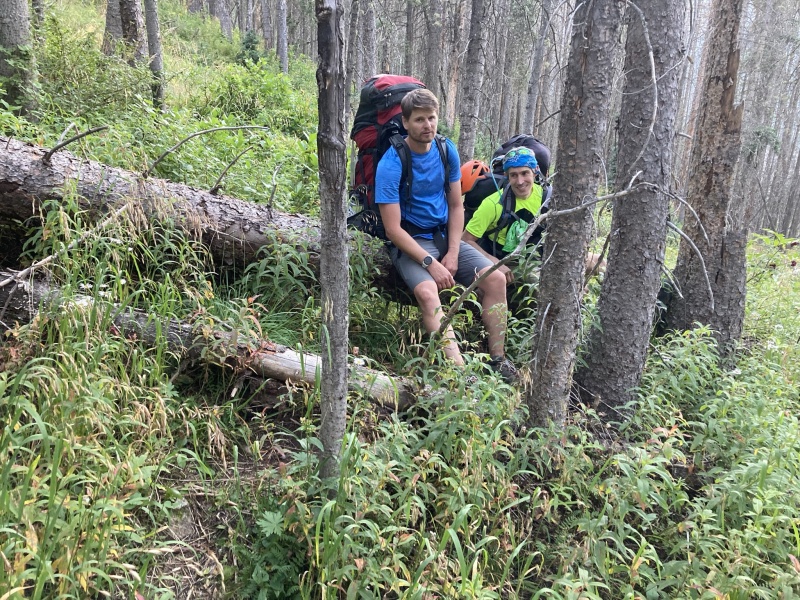
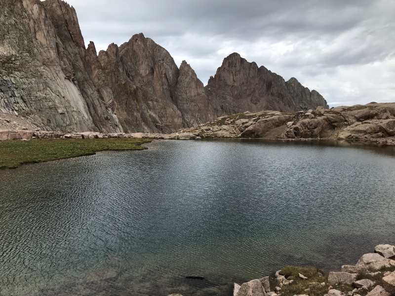
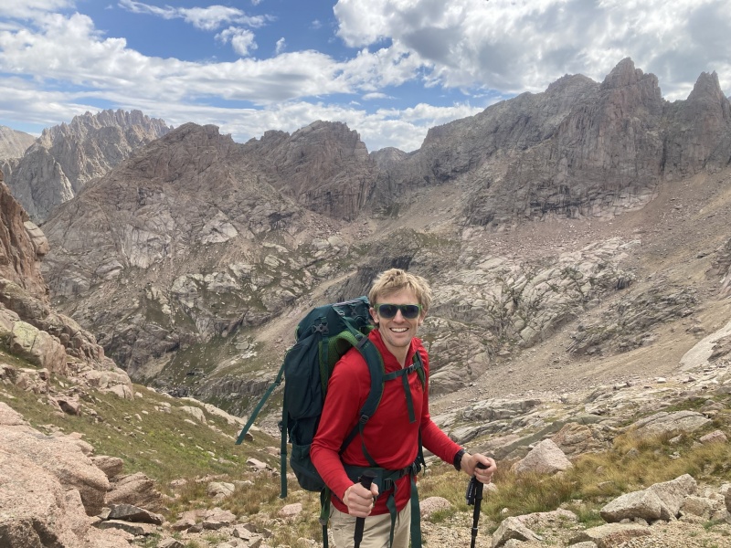
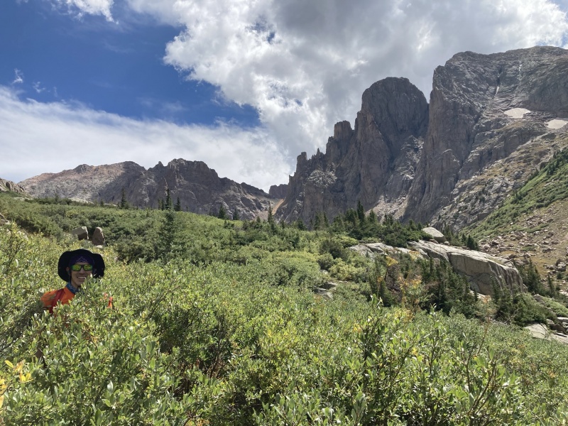
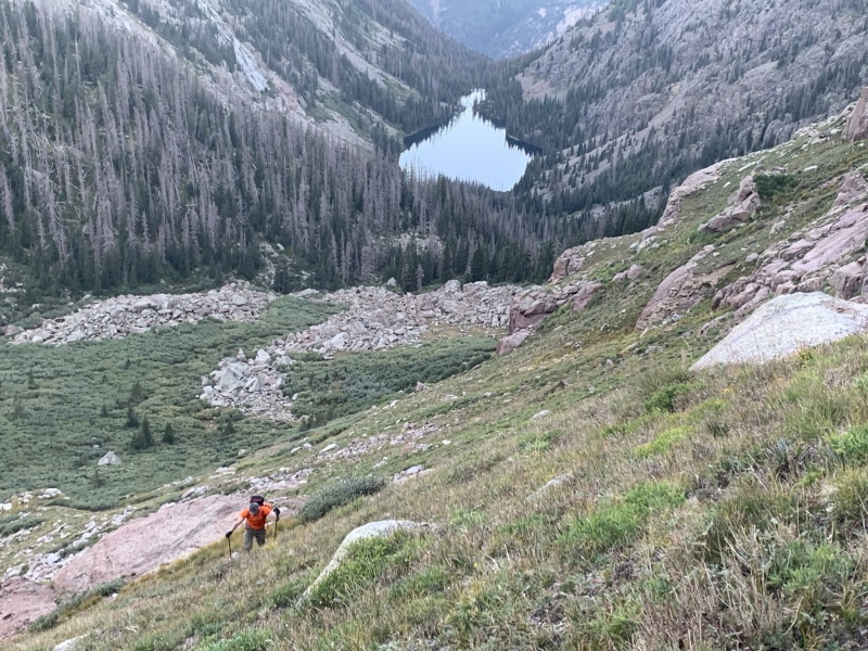
Intro – This is my first trip report. It’s high time I started contributing some collective knowledge to this amazing site. I have frequented this website for over a decade since falling in love with the 14ers fifteen years ago but have rarely commented or added a trip report. This is in part due to life just being busy as a family doc and a husband/father and also just feeling I didn’t have much to add to the already significant amount of information out there on most the peaks I had climbed. As I finished the Centennials this year on Rio Grande Pyramid and start to look at the smaller 13ers, Bicents, etc. it seems like the info on the peaks is much less (I no longer have Roach to guide my way…) so I hope to add some reports when it seems like it could benefit others in the future. This report specifically is to shed a bit more light on the alternate peak 15 5th class route to avoid the slabby traverse and also a bit more info on Monitor/13/Animas that hopefully will be helpful to some. This trip was my 5th time into what I (and likely many others who have experienced it) consider the best part of Colorado - the Weminuche. The people on this trip were Brent, Luke, and I. We met in Med School at CU in 2008. Our class of 160 at the time had 3 married dudes in the entire class and as luck/fate would have it, we would all be in the same small group and all found out that we loved playing in the mountains. A lifelong friendship started then and we have had a blast over the years in so many places. A couple trips in med school specifically bring back great memories. One was a trip leaving Denver at 5 PM after classes, arriving at Grand Teton TH at midnight, climbing through the next day on Upper Exum, then driving home immediately to get back to church on Sunday morning and study that afternoon. We also had the fortune in 4th year of med school (the easy year) to take 2 weeks to do a west coast trip where we summitted Rainier, Hood, Shasta, Whitney via the East Buttress, and Muir. So many countless other trips with these fellas over the years! Nothing like taking the mind off the medicine career and life duties like playing in the hills with buddies. Medical careers have taken us three apart over the years as residency training spread us all over the country but over the past 5 years we have started trips into the San Juans yearly as a reunion of sorts. Last year Luke, Brent, and I made a trip into Noname basin for knife point, peak twelve, Jagged and Peak Six (Luke is still pissed about me having him add the talus hop of Peak 6 after Jagged!). This year I hoped to get to Ruby as I had never been (Brent and I had previously done Pigeon and Turret from North Pigeon Creek approach) and Luke and Brent were game. A tradition has begun and I am hoping we continue this yearly for the foreseeable future! To the trip… Day 1 – August 25 Ruby approach from Purg Luke flew in from Minnesota the night before to join Brent in GJ where Brent is living, and I left Eagle at 6AM to meet them in GJ then continue the trip to Purg. We ditched my car at the Gunnison Bluffs/Spanish trail trailhead outside of Whitewater and joked that I’d be lucky if my car wasn’t pieced out when we returned in several days (fortunately it was intact when we returned). We arrived at Purg at noon to no parking spots but fortunately as we were unloading packs someone left and we snatched the last spot and were off. A note on Purg… I love this approach. Yes, it is 10 miles but never steep, never brutal either way I feel. It just seems like such a wonderful warm up to the peaks. I have done Purg 4 times now and have enjoyed it each time. Some may find that crazy but I love the flexibility of not having to catch the train in Durango and spend an extra day getting there and then being able to leave whenever we desire not tied to a train schedule. It has overall worked wonderful for me over the years for accessing the Weminuche. Someday I hope to use the train too to access these peaks but I have no issues with Purg at all. It took us 3:30 to reach Needleton Bridge. Then 8 hours total to reach Ruby lake. Luke coming straight from Minneapolis had issues with the altitude but soldiered on and just got stronger as the trip went along. Ruby approach has to be one of the harder approaches I have done with a pack just due to the relentless steepness. When it is not steep it is littered with down fall. It’s just a tough trail every step but I did feel it was easy overall to follow to the Lake. We were tired and near night time so settled on Ruby Lake for our base camp at a wonderful spot just west of the lake. This was going to add ~3 miles each day round trip to the upper ruby meadow but a price we were willing to pay to get the packs off and not try to do the upper meadow approach in the dark. 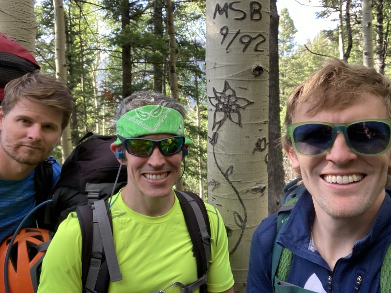
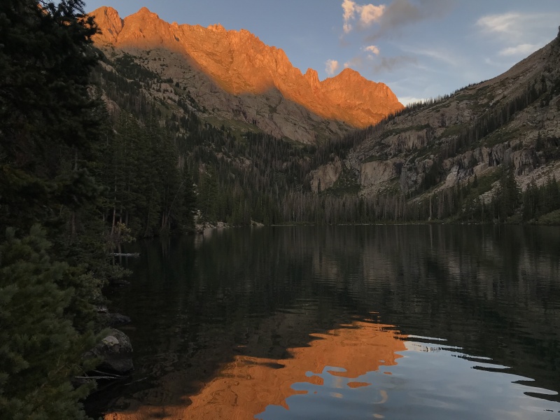
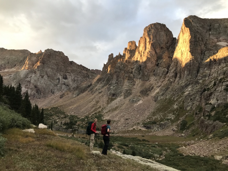
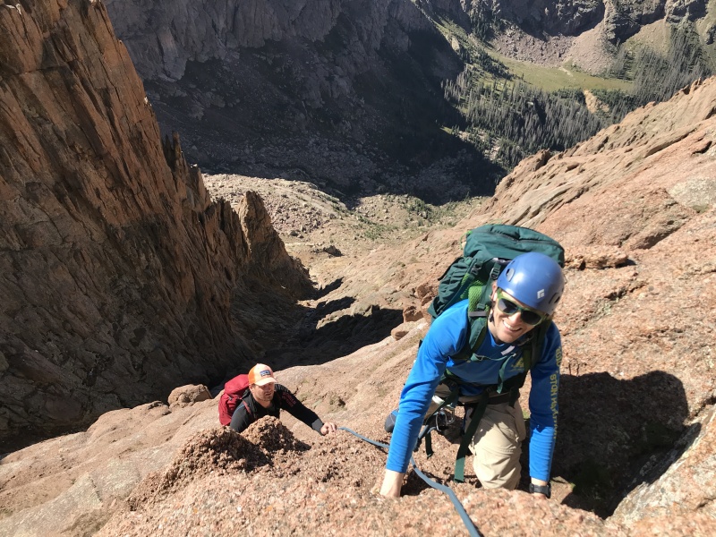
Day 2 – August 26 – Peak 11 NOAA had weather and moisture forecast on Thursday starting early and then Friday and Saturday looking beautiful and fairly dry. I joke of NOAA standing for (No Outdoor Activities Allowed) but overall, they nailed the forecast for our 3 day Ruby Adventure this go around. Since Thursday was the moister forecasted day, we planned on Peak 11 to keep the more technical peaks to the drier days. The ruby upper meadow trail is difficult and sticks in line with the ruby approach overall. For the lake section stay as close to the lake as possible. You really never need to go more then 5 yards above the shore. Trails and cairns may try to pull you up the hill but we found over 6 trips around the lake that staying close to the lake was the best. After the lake there is a significant downfall section that obscures the trail. We found that staying low through this downfall section worked well then once through it turn left and climb up trending slightly right and you will once again find the good/yet steep trail through the headwall to the upper ruby basin and willows. The 0.7 mile section of willows to the upper meadow had a decent trail that we seemed to master by the end of the trip. We made our way to the upper meadow then angled to the north side of the basin and found a trail heading to peak 12 area. We skirted peak 12 to the Peak 12/North Eolus saddle passing a wonderful small high lake. This area is just sublime. We did the peak 12 noname saddle the previous year to do peak 12 from noname and both of these saddles are just pleasure walks in an amazing place! From this saddle we contoured down around the cliffs to Twin thumbs pass. From twin thumbs pass we dropped just a bit into Chicago Basin then contoured under the cliffs of twin thumbs peak until a grassy ramp became obvious. Take this ramp which seems to be the key to the climb. Above the grass there is a short 3/4th class step then upper kitty litter filled gully to the summit. Peak 11 summit was wonderful! Such a great summit and amazing perch in Chicago Basin. We got sleeted on at 9AM but then weather cleared to allow for some time on the summit. We considered glacier point or twin thumbs but the weather was not ideal and we knew we had some big days to come so decided to settle with peak 11 and head back to camp before the storms started. Peak 11 is a wonderful spot and I really enjoyed this route from Ruby lake. Really cool to jump ruby to noname to Chicago basin in one day. The day took 6 hours and we were back in camp by noon. Thunderstorms were on and off throughout the afternoon and eve but ruby lake is a wonderful place to hang during thunderstorms!
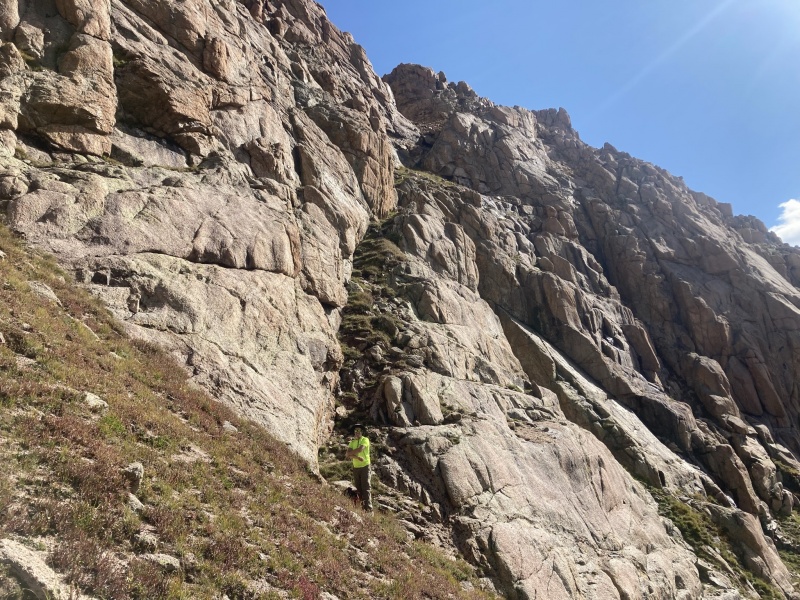
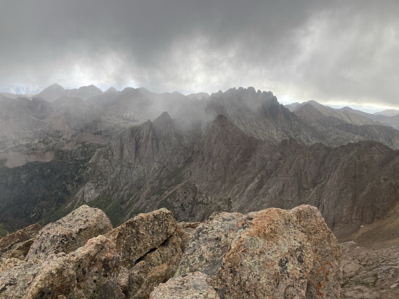
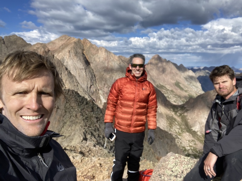
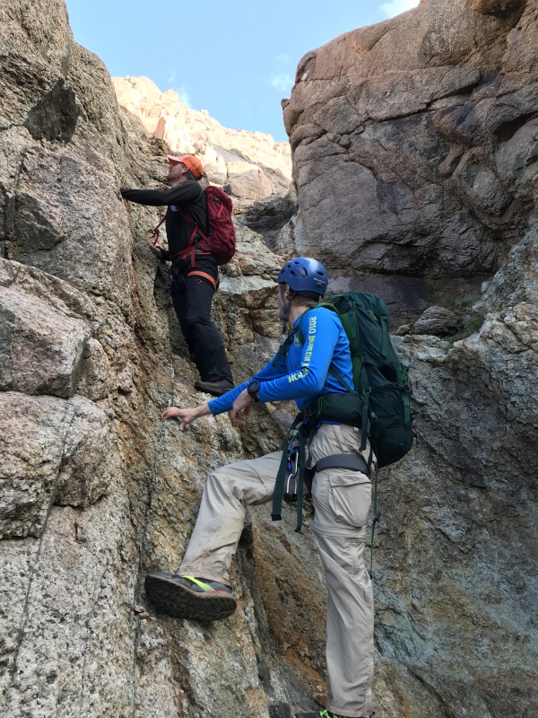
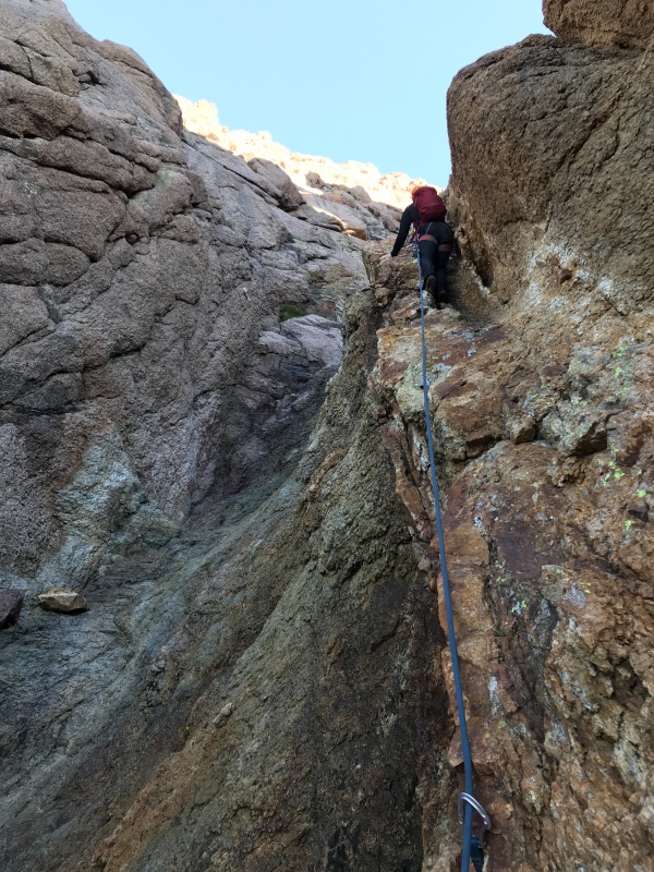
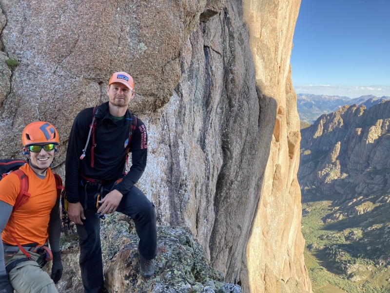
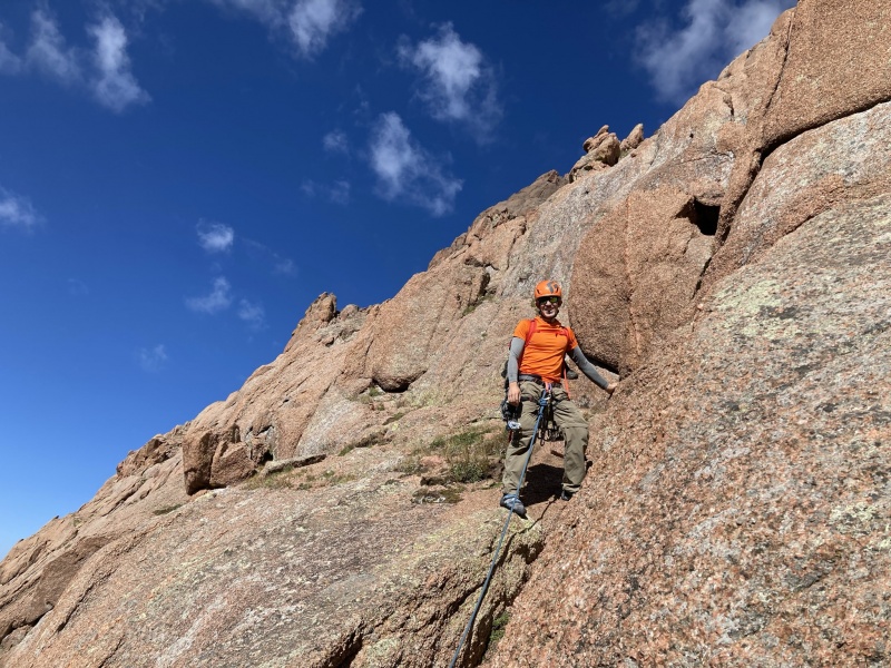
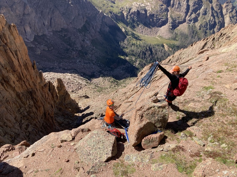
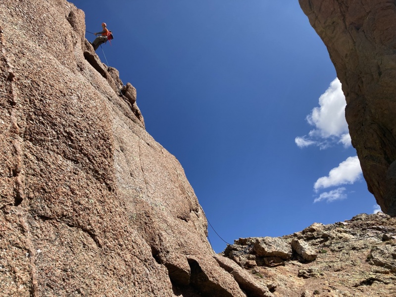
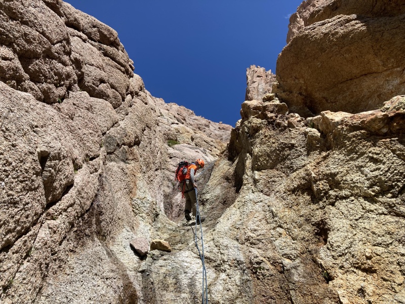
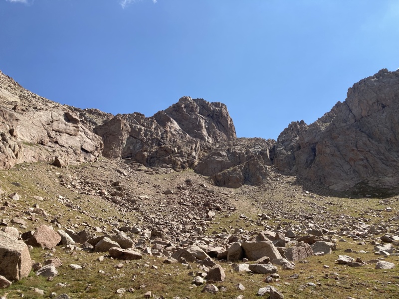
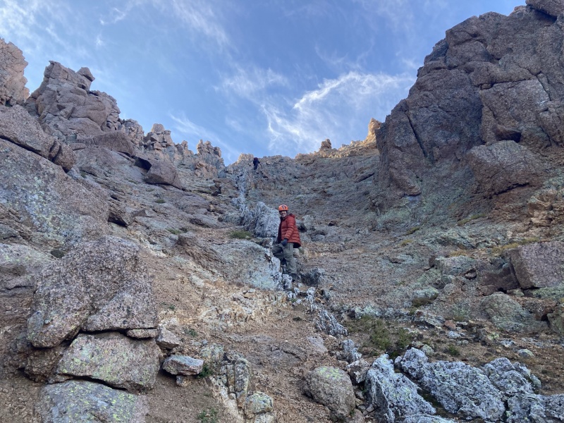
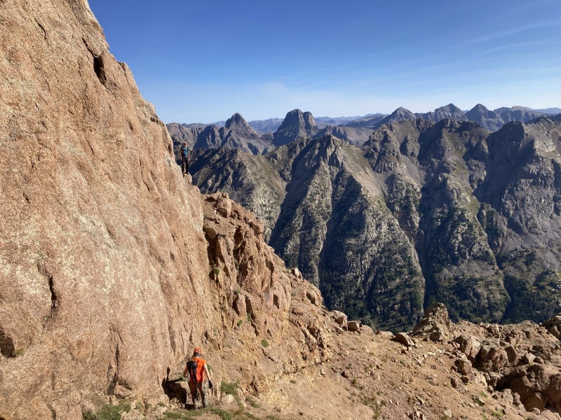
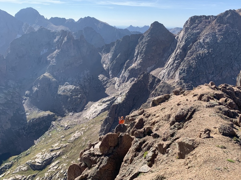
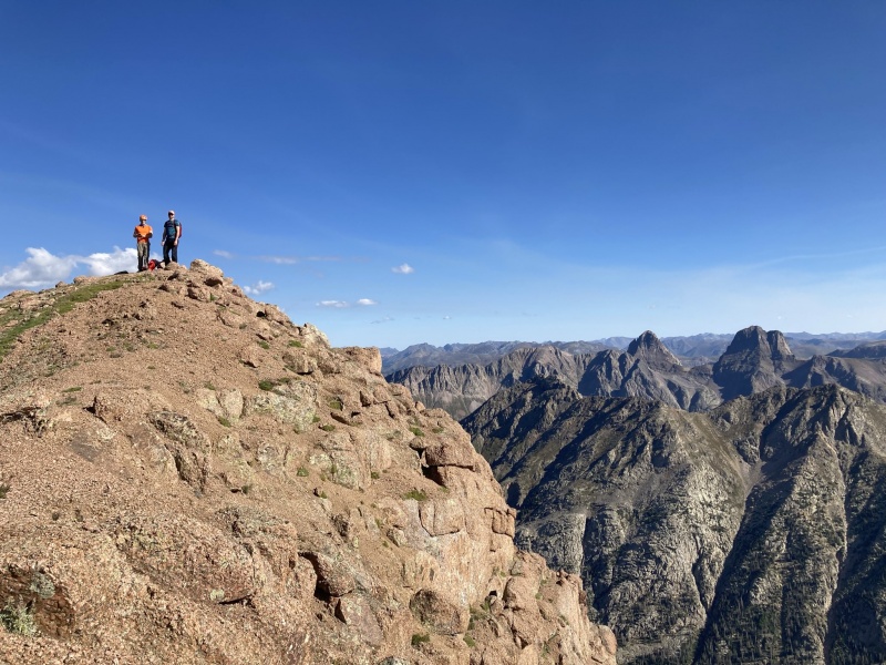
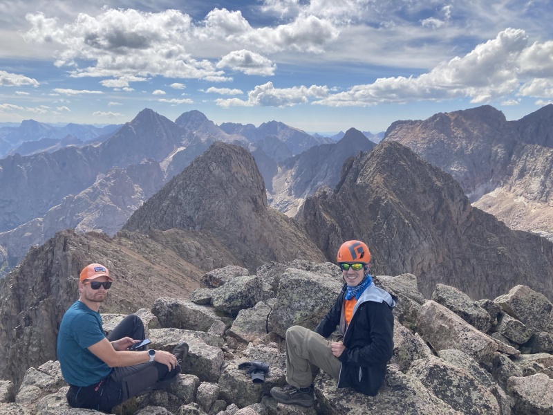
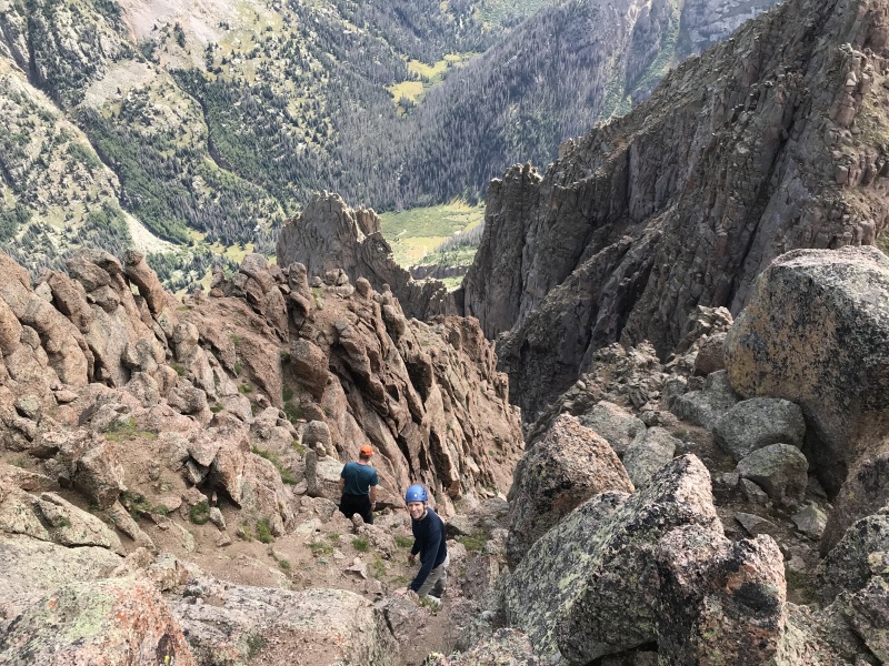
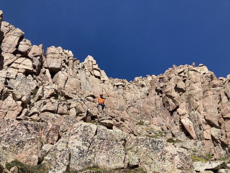
Day 3 August 27 – Peak 15 Peak fifteen has been somewhat of a mythical mountain to me since I started reading about Colorado 13ers. I had hoped to climb it some day but never knew if I would be able to. I certainly don’t have the climbing skill or background personally (I hope to get better) but Luke and Brent to the rescue! Luke and Brent are studs in the hills and great trad climbers. There is pretty much nothing that rattles them and they are such good climbers and partners in the mountains. Pretty much any true climbing I have done in my life has been with them. The night before the climb we had rain on and off and a solid rain around 3 AM for a while which was not making me feel great about the upcoming climb on one of Colorado’s most difficult peaks. However, we awoke to nothing but stars in the sky at 530 and we were off at 6 AM. The ruby basin willows were a hurdle to the day with all the rain the night before so we started in full rain gear and were drenched by the time we reached the climb to the little finger saddle. The rain gear was clutch in the willows. However, the rain did us some mild favors in the gully as I had read about it being bullet proof and slippery when dry but we actually could kick soft steps into the harder dirt. We took a few sections one at a time to mitigate rock fall danger and crested the saddle a couple of hours after we started from Ruby Lake. We then started the descending traverse to the couloir. I was a bit surprised as this contour was a bit longer than I expected and there were no cairns that we could find. However, the peak 16/15 couloir is quite obvious when you reach it. Nothing else seemed really inviting for upward travel prior. The couloir was very wet from the rain which would prove to be a bit of a hurdle. At the first class four step we took some ledges left of the main couloir which worked out nice, then continued up to the second class four step. This was drenched and going to be difficult. We decided to rope up at this point and Luke was able to climb onto a little shelf climber’s right of the main drenched gully placing a single piece of pro until he reached the rap station. Brent and I followed simal-climbing and it worked out nicely. After the second step I was surprised at how continuous the class three climbing was for several hundred vertical feet. At the top of this section there was another rap anchor (3 total in the gully). We kept working upwards until the couloir gets nasty looking then went left around the difficulties on broken class 3 terrain then started angling for the Peak 15-16 saddle and climbed directly into the saddle (what a saddle!). I had read the standard route description on 14ers.com and several trip reports all doing a ledge traverse to the crux pitch which I kept reading was hard to protect, fairly rotten, etc. This sounded not optimal to me. Through reading other info about peak 15 and the Garratt and Martin guide book it seemed there was another route more directly from the saddle with better protection options. Chicago Transplant mentioned this route recently as well (his photo on summit post was very helpful) which peaked my attention. We decided to go for the more direct approach from the saddle. This was fantastic in my opinion. Very easy for Brent and Luke to protect and just nice climbing. We left the saddle on a slight downward ramp only about 30 yards before roping up. Luke led us up a crack to the first rappel station (the slinged horn can be seen from the 15/16 saddle). Then Brent took us directly up a crack just left of that rappel station about 10 yards from the horn to the second rappel station. None of this was overly difficult or sustained 5th class climbing and felt very safe, not rotten at all. We trended right slightly around a difficulty to the upper easy to walk on ramp and worked west to the class 3 gully and then through the broken ledges to the summit, where I let out a holler, WHAT A PLACE! We enjoyed a good amount of time calling the wives and taking photos having snacks then retreated the exact same way. We just downclimbed the 3rd class upper headwall, then did the rappels to the saddle. I was very content with the amazing day we were having, amazing weather and such a great day on peak fifteen so I just settled into the saddle while Luke and Brent went for 16. Luke said there were no rappel anchors on 16. Luke just downclimbed 16 and felt it was stiff class 4 by easiest route (who knows if that is to be trusted however), they took a bit more spicy route up it seemed. On decent we bypassed the upper rap in the couloir through the third class but then rappelled the two class 4 steps. We took turns down the access gully from ruby then marched back to Ruby Lake. We were getting pretty good at finding the way through the willows and lower trail at this point. I think this day took us 8.5 hours but we were certainly not rushing. Peak fifteen was amazing. I do feel it was harder then Jagged with more consistent hurdles and certainly the hardest peak I have climbed in Colorado yet but such an amazing peak. I feel humbled to have been able to stand on Peak 15! 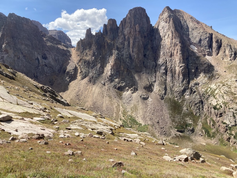
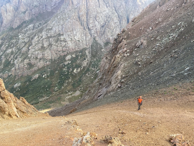
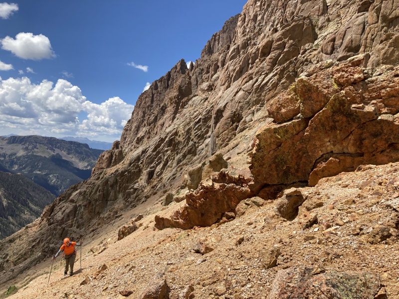
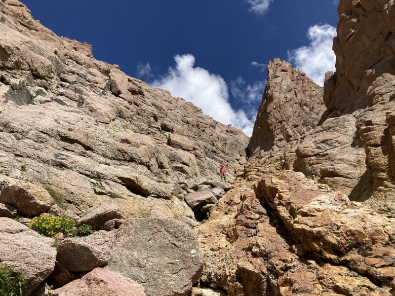
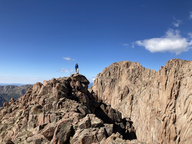
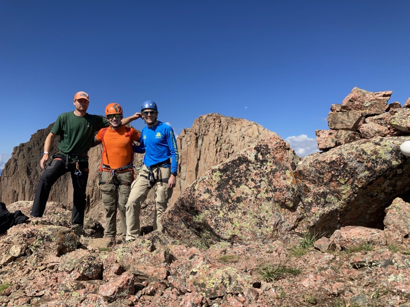
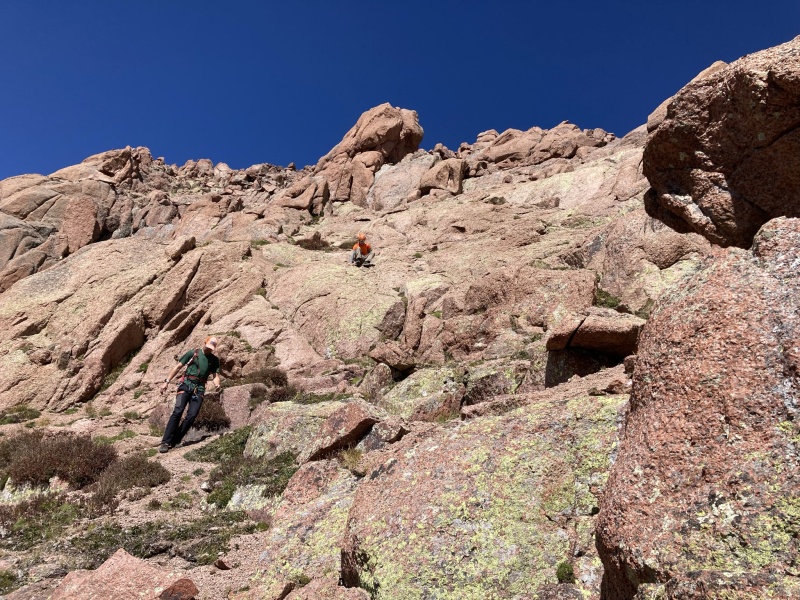
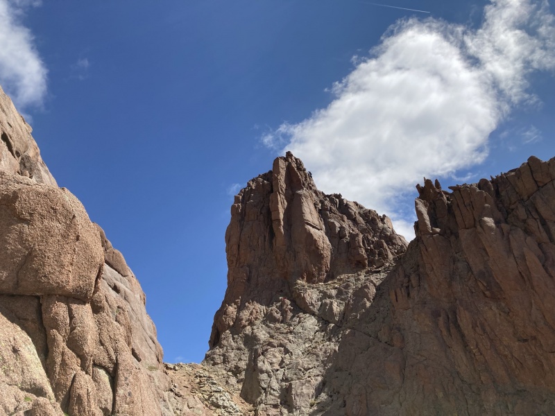
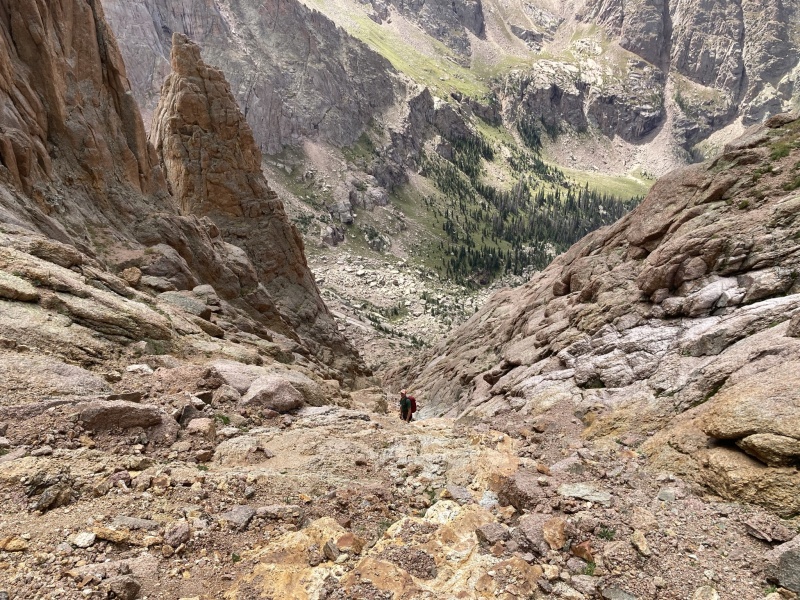
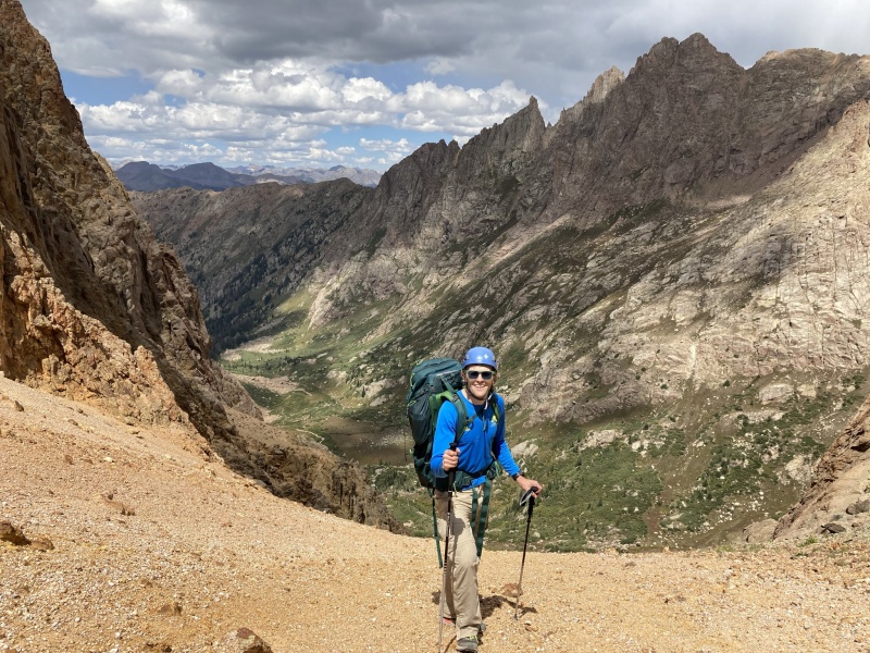
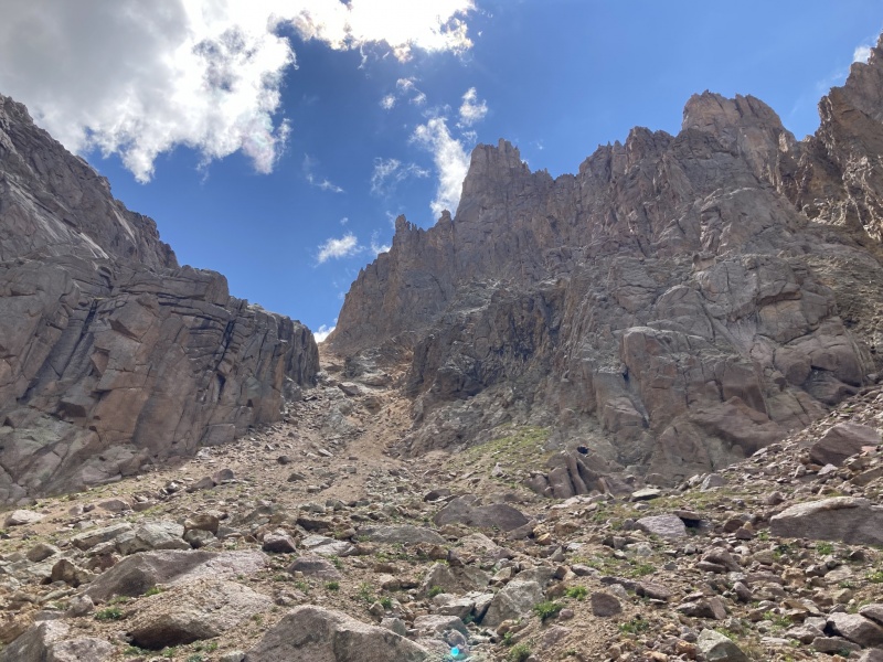
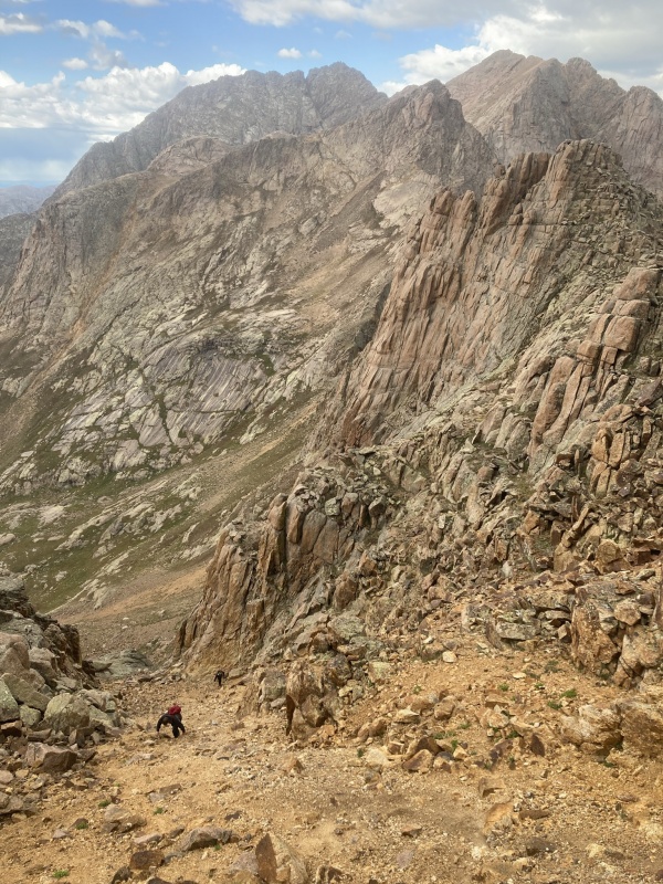
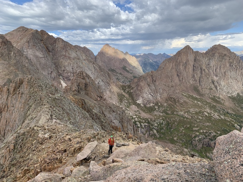
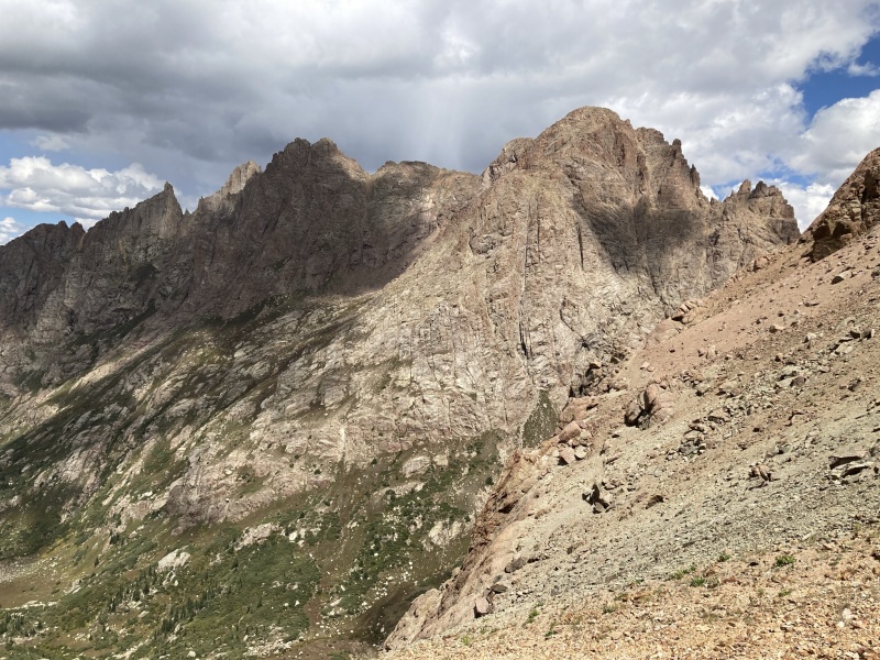
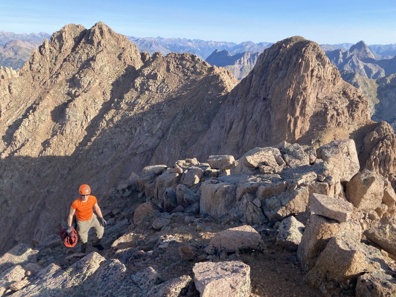
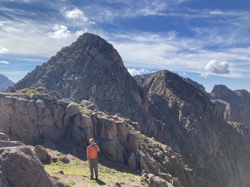
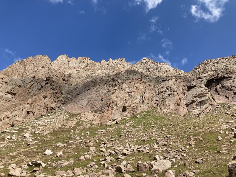
Day 4 – August 28 – Monitor, Thirteen “the scepter”, Animas then hike out to Purg I had spent most of my “scouting” on 15 and admit had only briefly scanned a few reports on Monitor and Animas. The view from across the valley is sobering and it was obvious these peaks would be difficult with lots of scrambling and route finding. It looked like descending Animas would be a bear blocked by cliffs but it turned out to be a wonderful decent on the correct route. We spied from 15 that grass could take us all the way to the monitor/animas basin right from the ruby trail shortly after it tops above the headwall over ruby lake without really any willow bashing. This was a wonderful find and I would highly recommend doing this rather then going all the way to the 11,600 upper ruby climbing meadow if climbing these peaks from ruby lake. We really avoided almost all the willows on a sublime grassy ascending traverse to the upper basin. Taking the grass below the cliffs also allowed us to find the proper animas decent gully as we passed very much near it on the way into the basin which we could not identify from the peak 15 side of ruby. This gully seems to be the key to decent off animas as getting back to the basin from animas without this gully would be a stiff downclimb it seems. Looking up at 13 and Monitor from the grassy basin there are two obvious upward slanting ledges sweeping eastward across the face of 13 heading in the direction of the the saddle with Monitor. We couldn’t decide which was the right ledge so decided to take the lower grassy one as it was closer. I think now that the upper ledge is likely the standard route and a bit easier from reading other reports. Once we reached the end of the grassier ledge there were a few harder 4th class moves but with little exposure which then deposited us on broken ledges with Kitty litter which all seemed broken class 3 and we trended up towards the Monitor/13 saddle. From the saddle the spires and ridge is impressive so we dropped slightly into the main gully coming from the saddle to a rough looking ascent over the rib which was less nasty then it looked. We then contoured through a few more gullies, even a trail was present at times until the obvious 3rd glass gully to summit ridge becomes visible. This gully has a quartz-like vein running down the middle which allowed for some fun scrambling to avoid the kitty litter. Easy Class 3 on the ridge was wonderful to the summit. We retraced our ascent of Monitor down the ridge, to the white quartz vein filled gully, over the few gully shoulders then back up to the saddle. Most of the day up until this, peak 13 looks formidable and hard to imagine an easy way up it without a rope (at least for me). I carried one the entire day but we never ended up electing to use it. The key for the easiest climbing to the summit seems to be to circle around the east side of peak 13 from the saddle with monitor. We stayed on the path of least resistance on ledges below the impressive cliffs of the upper 13 summit pyramid. Once we circled all the way around to nearly the north side of 13 (practically looking straight down into noname valley) the terrain eases back a bit and easier climbing reveals itself. From here a broken ledge system can be used to the summit from the north. I was surprised by how far around you have to contour until the steepness eases up a bit. The ascent up the upper north aspect of 13 seemed mixed 3/4th class terrain but broken up with sandy ledges. It was a special climb to a special summit. Thirteen has to be one of my favorite views from a summit. It's just right in the middle of the Weminuche and many of my favorite peaks! We then descended north of 13 for a hundred feet in elevation and contoured towards animas to the ridge and the obvious decent to the saddle. This could all be kept class 3 on that decent with less exposure then I feared from looking at it. The rest of the traverse to Animas was straight forward, the final gully climb was mostly class 3 but I was surprised by the single class 5 move at the bottom of the gully (just hadn’t read about it) but fortunately it had minimal exposure and seemed to be the obvious way to climb the final summit portion of Animas. I had been nervous about the decent off Animas from the view across the way from peak fifteen but it was actually quite enjoyable. We descended to the 13,500 saddle then scree skied down until nearing the cliffs above the grassy basin then contoured right until the obvious 2nd class gully showed itself. We dropped in, took turns to mitigate rock fall risk and were soon back to the grass and enjoyed a nice walk back to camp. I added the gpx file for this day as I think it is by far the hardest route finding of the trip. We were hoping to pack up and get back home to our families so once returned back to camp around noon we ate, packed, and were off by 2. We made the trip back to the Purg TH at 8 and made the drive home. 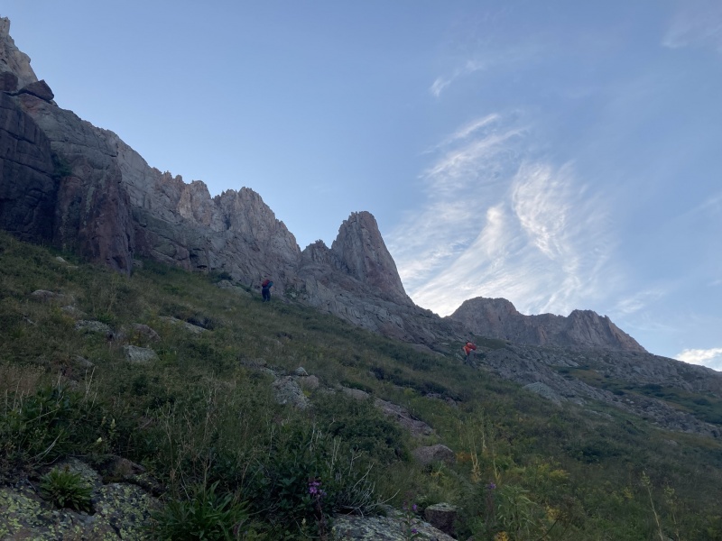
Final Thoughts Ruby Basin truly is a special place. I can not think of many places that match it and each peak is so amazing. I feel very blessed to have had this trip and the amazing weather we had and to have shared it with Luke and Brent. God is good! Also feel amazingly blessed for the lack of smoke we had in the middle of a very smoky summer. I hope this report is helpful to some and if nothing else helped me relive the trip in a way that was very fun. Please don’t hesitate to reach out to me if any specific questions Strava links if you want to study maps or see other data from Ruby Lake https://www.strava.com/activities/5869951784 - monitor animas 13 Thumbnails for uploaded photos (click to open slideshow): ")
")
")
")
")
")
")
")
")
")
")
")
")
")
")
")
")
")
")
")
")
")
")
")
")
")
")
")
")
")
")
")
")
")
")
")
")
")
")
")
")
")
")
")
")
")
")
")
")
")
|
| Comments or Questions | ||||||||||||
|---|---|---|---|---|---|---|---|---|---|---|---|---|
|
Caution: The information contained in this report may not be accurate and should not be the only resource used in preparation for your climb. Failure to have the necessary experience, physical conditioning, supplies or equipment can result in injury or death. 14ers.com and the author(s) of this report provide no warranties, either express or implied, that the information provided is accurate or reliable. By using the information provided, you agree to indemnify and hold harmless 14ers.com and the report author(s) with respect to any claims and demands against them, including any attorney fees and expenses. Please read the 14ers.com Safety and Disclaimer pages for more information.
Please respect private property: 14ers.com supports the rights of private landowners to determine how and by whom their land will be used. In Colorado, it is your responsibility to determine if land is private and to obtain the appropriate permission before entering the property.


