Download Agreement, Release, and Acknowledgement of Risk:
You (the person requesting this file download) fully understand mountain climbing ("Activity") involves risks and dangers of serious bodily injury, including permanent disability, paralysis, and death ("Risks") and you fully accept and assume all such risks and all responsibility for losses, costs, and damages you incur as a result of your participation in this Activity.
You acknowledge that information in the file you have chosen to download may not be accurate and may contain errors. You agree to assume all risks when using this information and agree to release and discharge 14ers.com, 14ers Inc. and the author(s) of such information (collectively, the "Released Parties").
You hereby discharge the Released Parties from all damages, actions, claims and liabilities of any nature, specifically including, but not limited to, damages, actions, claims and liabilities arising from or related to the negligence of the Released Parties. You further agree to indemnify, hold harmless and defend 14ers.com, 14ers Inc. and each of the other Released Parties from and against any loss, damage, liability and expense, including costs and attorney fees, incurred by 14ers.com, 14ers Inc. or any of the other Released Parties as a result of you using information provided on the 14ers.com or 14ers Inc. websites.
You have read this agreement, fully understand its terms and intend it to be a complete and unconditional release of all liability to the greatest extent allowed by law and agree that if any portion of this agreement is held to be invalid the balance, notwithstanding, shall continue in full force and effect.
By clicking "OK" you agree to these terms. If you DO NOT agree, click "Cancel"...
Borah Peak, Idaho High Point and Mesa Falls Marathon
Saturday, August 28, 2021 - Mesa Falls Marathon:
After hiking the highpoint of Utah, Kings Peak, I drove 5 hours to Ashton, Idaho, and setup my tent at a local campground. I arrived at the campground and finished setting up camp around 10:30 pm. The next morning, I work up at 4 am the next morning, so that I could get to the race area, for the bus to the start line. I picked up my race gear and jumped on the bus. The buses started towards the start line around 5:30 am. The race started just after sunrise (around 6:30 am). I knew going into the marathon that I would be slow. My early miles were 10-minute pace. Some of the early miles were on a dirt road, and later pavement. At about the halfway point (13 miles), the course provides a long, fast downhill portion, eventually landing on a nice flat dirt trail. That dirt trail continues flat for about 3.5 miles. The downhill section had given me a big boost, and I was able to run solid on the trail section, passing several people. As the course left the trail, it goes back onto the streets. Soon after getting back onto pavement, there is a nasty uphill (around mile 17). I was able to keep the legs running on the uphill, but greatly slowed. The elevation gain was only 100ft per mile for the next 3 miles, but it felt steeper, probably because it went on for so long, and since the rest of the course had been mostly downhill. I survive the hill and was able to keep my legs moving sold for the final 6 miles, ending in 4 hours 33 minutes. I was very happy with that time, considering the cumulative mileage and adventure on my legs.
After the marathon, I grabbed some food and drink and started the 4-hour drive to Borah Peak, the highpoint of Idaho.
Sunday, August 29, 2021 - Borah Peak
I arrived at the trailhead parking lot late in the day, but people were still coming down from their hikes, and everyone looked beat. I parked in a nice flat spot, where I could setup my tent next to the car. Once I got everything setup, I just hung around until it was time to go to bed.
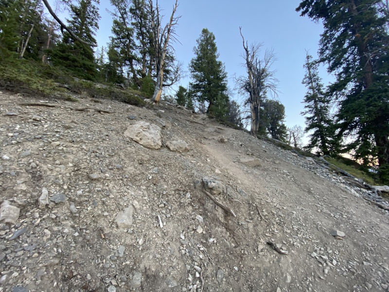
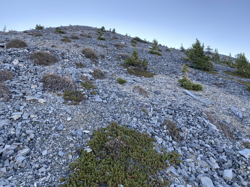
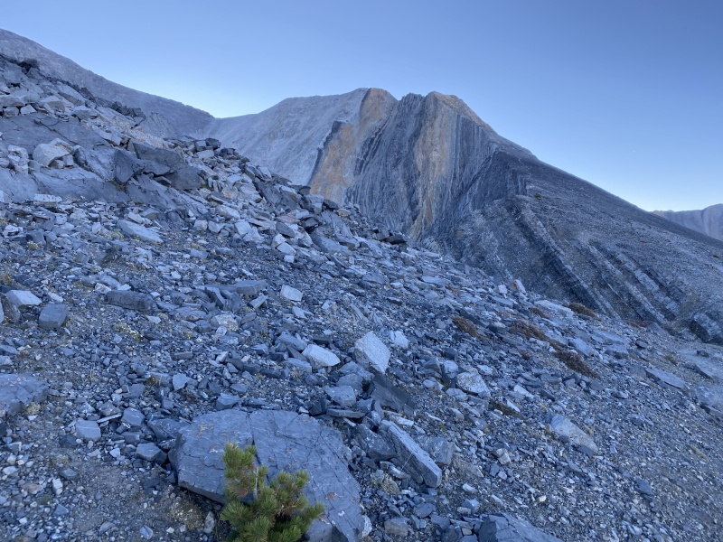
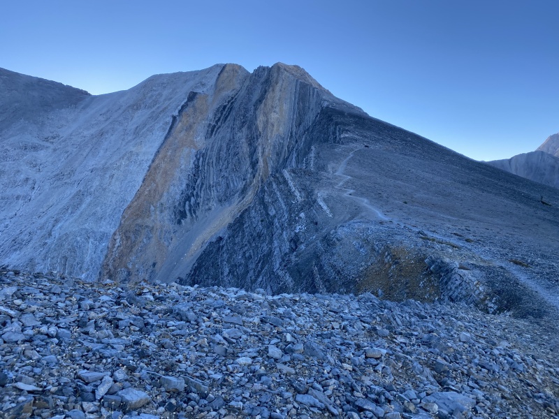
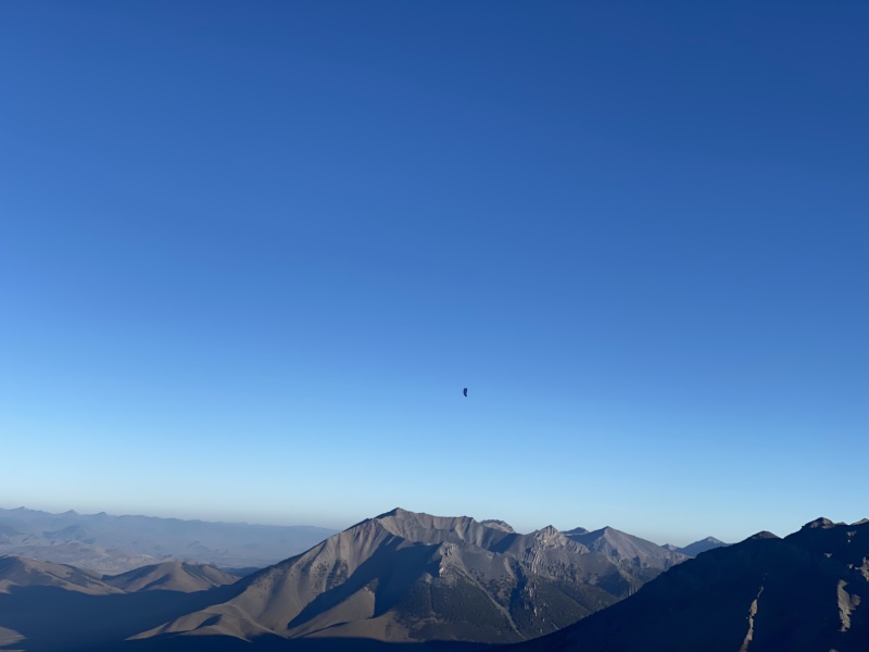
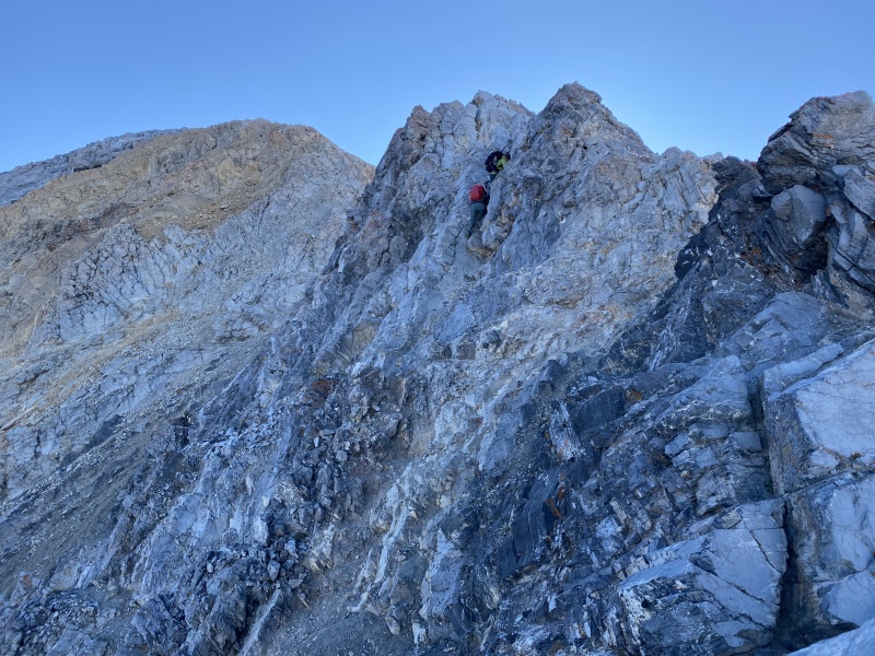
I got started up the trail just before 6 am in the morning. The initial trail was very steep, but mostly dirt. I was glad to be gaining a lot of elevation quickly. I finally reached the initial ridge (about 10,000 ft) in just under 3 hours. At this point, I had a very clear view of Borah Peak. As I walked along the ridge, I was watching the peak. The previous day, I had met some people who were going to be parasailing off the summit, and they were planning on starting just after sunrise. As I got closer to the crux of the climb - Chicken Out Ridge - the first of the parasailers launched. For the next 30-40 minutes 3 others followed. It looked like fun. It took me about an hour to traverse the initial ridge walk and get to the base of Chicken Out Ridge.
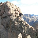
Lower TrailLower TrailBorah Peak Summit Beginning of Initial RidgeChicken Out Ridge (COR)COR Crux in the middleParasail in the middle
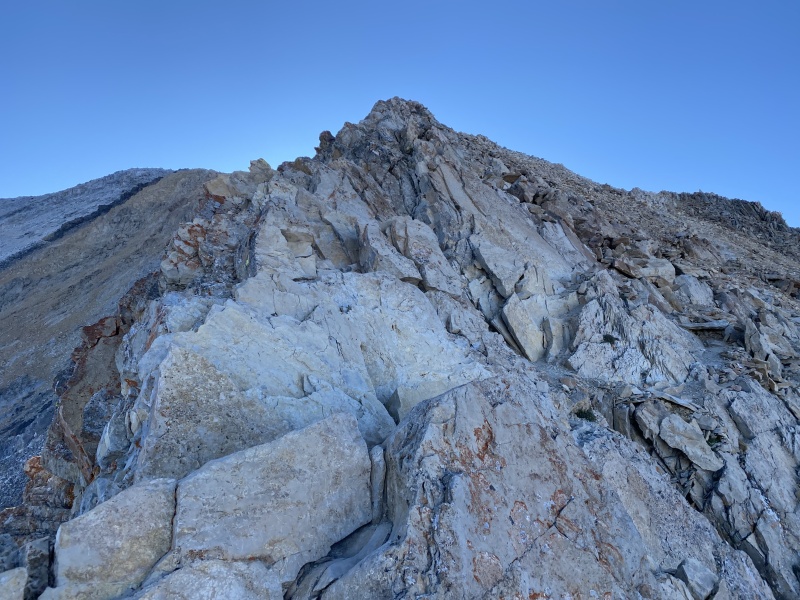
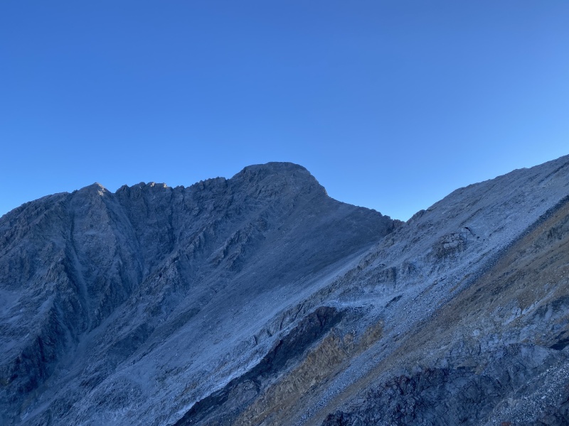
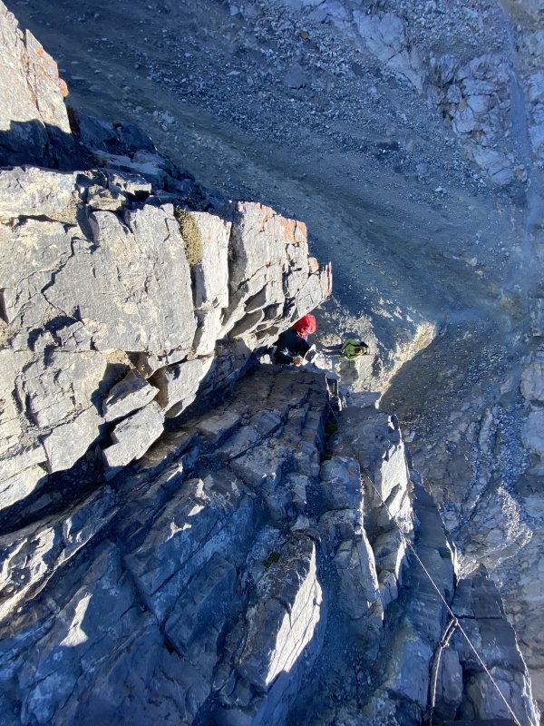
The beginning of Chicken Out Ridge was solid class 3. I found out later that I was off route at the beginning and made it more interesting for myself. After 30 minutes of moderate scrambling, I reached the true crux. At the end of Chicken Out Ridge there is a stout downclimb. There was a rope hanging at the crux, but I chose to downclimb without trusting the rope. The downclimb was about 30 feet, and probably low class 4. I safely made the downclimb and was on solid ground for the remainder of the hike. The rest of the hike to the summit was just a class 2 hike. I ultimately arrived at the summit in just over 4 hours from the trailhead.
I spent about 15 minutes on the summit, then started back down. I had a long drive ahead of me, so I was trying to descend as quick as I could. The climb down Chicken Out was easier on the descent. I got off Chicken Out Ridge just over an hour from leaving the summit. The remainder of the hike was class 2 downhill, and I was mixing hiking and running.
I got back the trailhead in just over 2.5 hours from the summit, almost exactly 7 hours roundtrip. I jumped in the car and started driving towards Nevada.
My GPS Tracks on Google Maps (made from a .GPX file upload):
I've been looking hard at this area for a long time now - and regretting that when I lived in Missoula back in 90s i didn't make a point to get down this way.
Was there a lot of other people around? Curious how popular this area is now.
Definitely looks like class 4 in your photo, but I don't recall this section when I climbed it in 2013. The only semi-technical part was at the beginning of COR, just before the route bends around to the north. I'm thinking that there is an alternative route that avoids that class 4 section, though I can't figure it out by looking at your photos or GPS track. I see your track leaves the trail that appears on Google Maps. Is that where the class 4 is located? Congrats on a great climb following a marathon, unbelievable!
Caution: The information contained in this report may not be accurate and should not be the only resource used in preparation for your climb. Failure to have the necessary experience, physical conditioning, supplies or equipment can result in injury or death. 14ers.com and the author(s) of this report provide no warranties, either express or implied, that the information provided is accurate or reliable. By using the information provided, you agree to indemnify and hold harmless 14ers.com and the report author(s) with respect to any claims and demands against them, including any attorney fees and expenses. Please read the 14ers.com Safety and Disclaimer pages for more information.
Please respect private property: 14ers.com supports the rights of private landowners to determine how and by whom their land will be used. In Colorado, it is your responsibility to determine if land is private and to obtain the appropriate permission before entering the property.


")
")
")
")
")
")
")
")
")
")
")
")
")