| Report Type | Full |
| Peak(s) |
Kings Peak 13,528 ft |
| Date Posted | 01/07/2022 |
| Date Climbed | 08/27/2021 |
| Author | rob runkle |
| Kings Peak, Utah Highpoint |
|---|
|
My initial plans to climb Gannett Peak, Wyoming fell through, so I changed my flights, my rental car, and implemented my "Plan B itinerary." Plan B would be the following:
I didn't even know if this was possible to complete in 4.5 days. The drive time alone would be over 30 hours, and the climb mileage would be over 40 miles. But I decided to go ahead and kick it off, just to see what happened. The night before I left, I came up with the "brilliant idea" to see if there were any marathons in the area this weekend. Sure enough. the Mesa Falls marathon, in Idaho, was on Saturday. Plan C" was now in play...
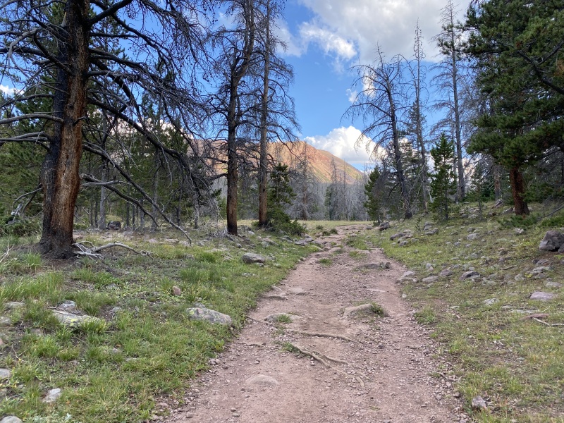
I got early flights into Salt Lake City on Thursday, hoping that I might be able to hike a few miles up the Kings Peak trail the first half day. I arrived in Salt Lake around noon. I jumped in the rental car, picked up a few groceries (mostly water), grabbed a Chipotle burrito, then drove to the Kings Peak trail head. I arrived at the trailhead around 5 pm. I started pulling my pack together to begin my hike in. My plan was to hopefully get to Dollar Lake (7.5 miles) in around 2.5 hours. I really wanted to get to camp, and setup my tent, before it got dark. I started hiking around 5:30 pm, with a full pack. I was able to keep a solid pace. The lower trail was very nice, and very runnable, if I weren't carrying a 30-pound pack, and going uphill. The grade was moderate with only about 1,350 feet of gain, over 7.5 miles. The trail starts under a light tree cover. As, it gets closer to Dollar Lake, the trees get sparse. I made it to Dollar Lake, in just a few minutes over 2.5 hours. I setup my tent, and grabbed a handful of energy bars, and other snacks for dinner. I decided to leave the stove and cooking foods at home, for this trip. I was hungry enough that the dry snack foods tasted pretty good. I tucked myself into bed and got to sleep a little after 9 pm. 
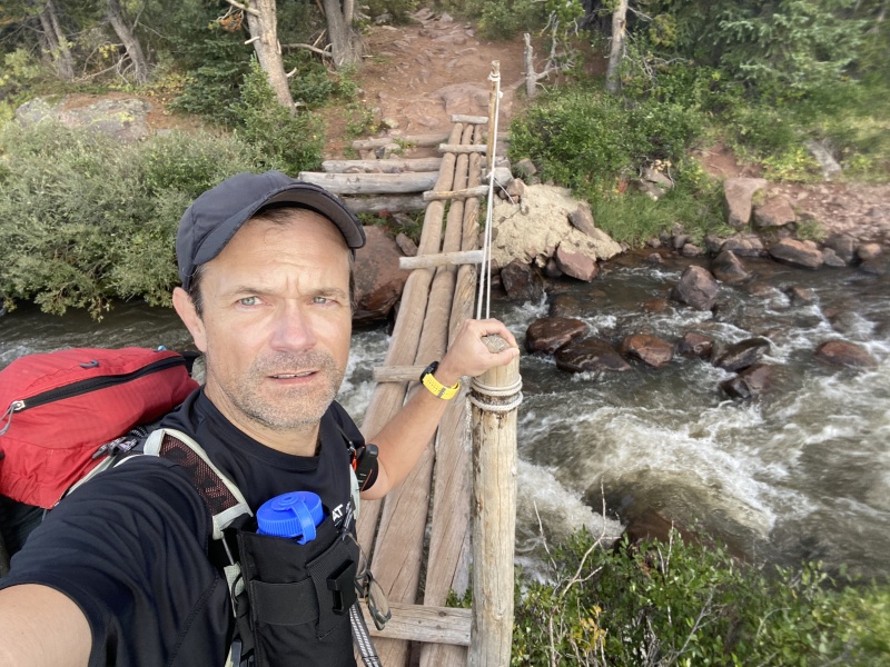
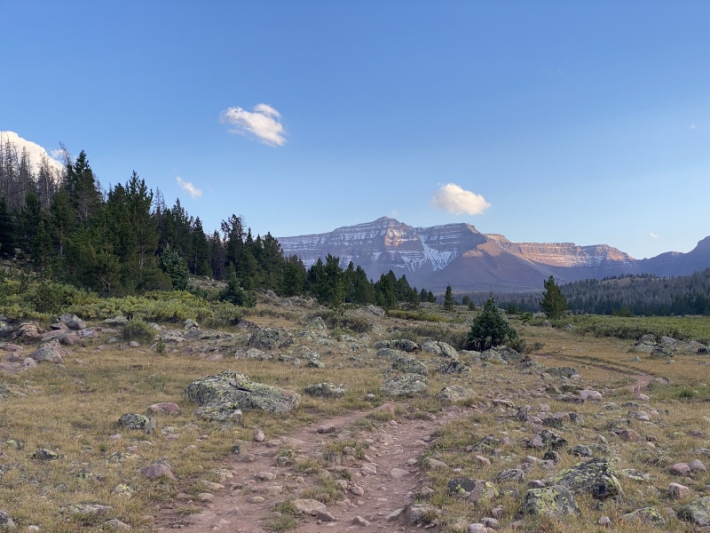
I was hoping to get an early start in the morning. I had set a few alarms. I turned off my first alarm, and my second one ended up being victim of “the am/pm mistake.” But luckily, I naturally woke up around 6 am. I grabbed a dry breakfast (pop tarts) and started up the trail at 6:30 am. It was only a little dark at this point, so I didn't use my headlamp for very long. I filtered some water shortly after leaving camp. The trail from Dollar Lake to the ridge is like the lower trail; very gentle and not too steep. The climb up to Gunsight Pass was not too bad. There is a massive switch back that keeps the grade gentle. After Gunsight Pass, the trail circumnavigates the East base of Dome Peak. This ends up being an additional mile or two more than a direct route, but it was a very easy and fast hike. 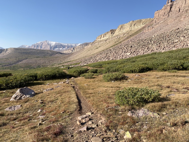

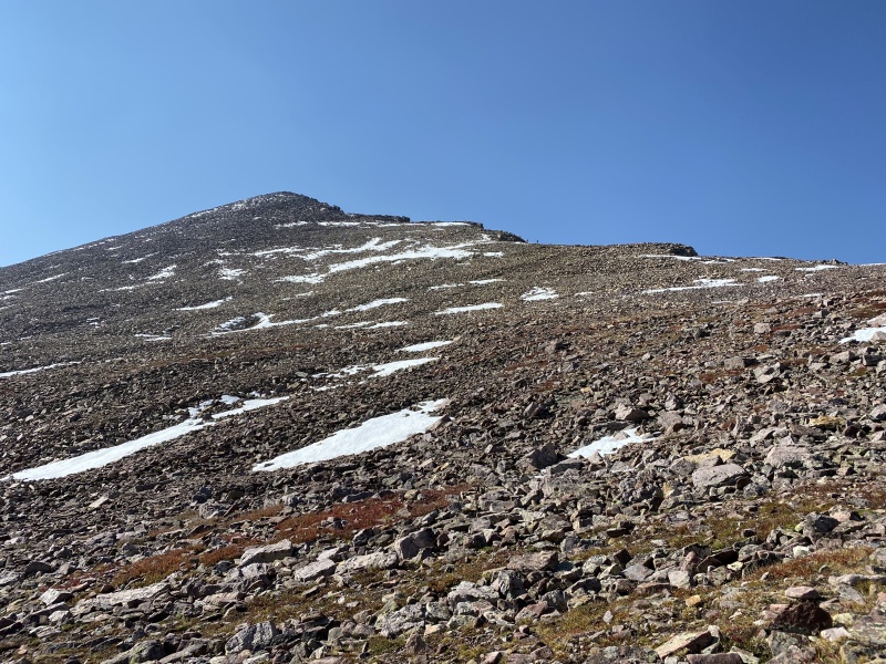
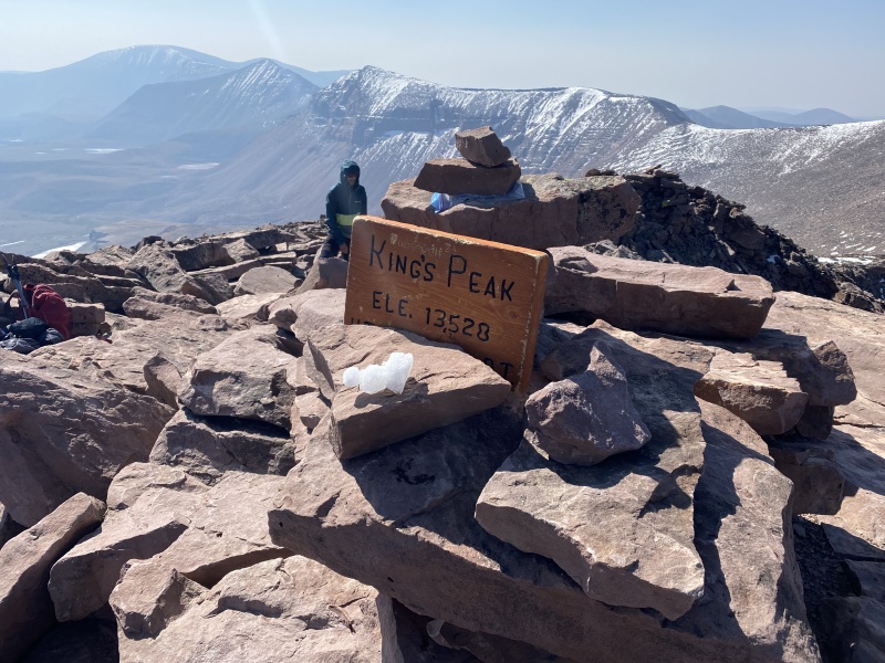
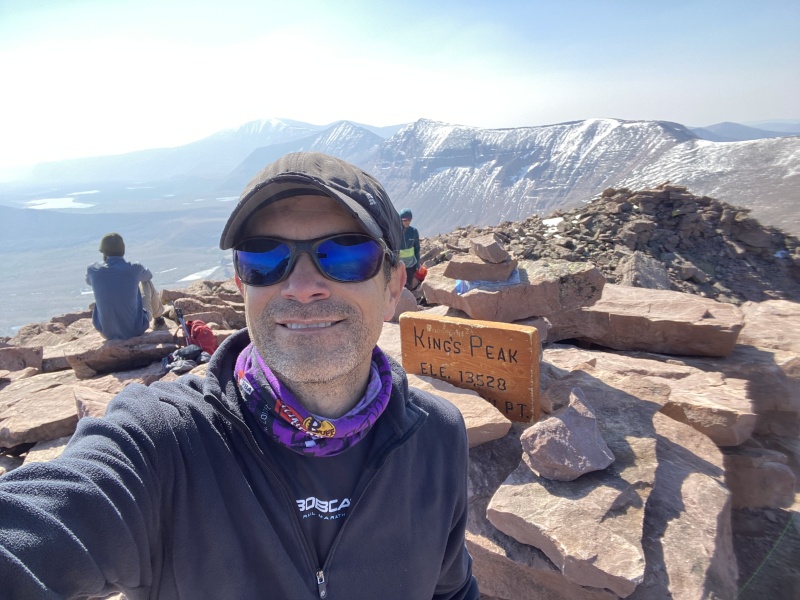
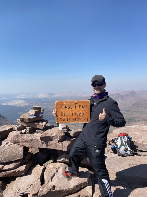
I arrived at Anderson Pass, the base of the final climb, in around 2.5 hours from camp. This put me around about 12,600 feet of elevation, with just under 1,000 feet left to climb. The last bit of climb was steep, and brutal. There was no exposure, but it was rocky, and required hands down, sometimes. It never got more than class 2 hiking unless I wanted to scramble. I made the summit (at 13,528 ft) in around 4 hours 15 minutes from leaving camp. I spent about 25 minutes on the summit, taking pictures, eating, and drinking a bunch of water. I was starting to run short on food but was glad that I had been able to get a bunch of calories into my belly. I was also glad that I didn't over pack for this hike. 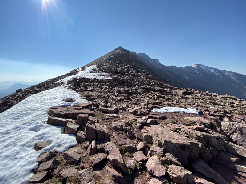
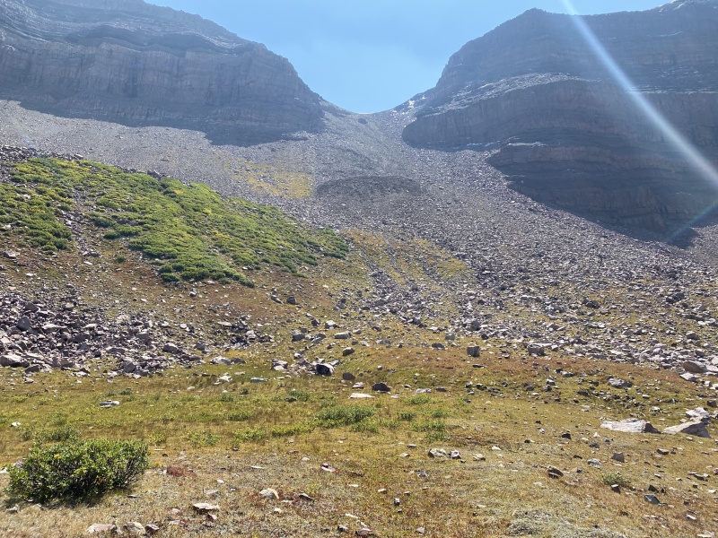
I left the summit and decided that I would take the "Anderson Pass Scree Route." Or at least that is what people were calling it. People on the top were saying that it was a preferred route for the descent because it saved 2 miles of hiking, but it would be a miserable ascent route. At the base of the final pitch, I took a hard left, following a clear trail. About 10 minutes of hiking, and I realized that I had turned too soon, and was not going down the Anderson Pass route. So, I hiked back up, and continued towards Anderson Pass. As I got to the Pass, it was obvious why people were calling it the "Scree Route." It was clearly loose, and nasty. It wasn't dangerous but looked like it might be frustrating, and I might end up on my backend a few times. I did! I fell on my backend several times and had to empty pebbles from my shoes a few times. But ultimately, I made it down the Scree Route. It was faster. I had lost a huge amount of elevation, very quickly, and I was already down in the valley, with a relatively flat hike back to camp. At the base of the scree route, there was a huge mound of rubble. It was clear that it had been part of a recent mud slide. The pebbles and rocks in this rubble pile were covered in dry mud. This pile had to be the size of a football field, and at least 50 feet high. It was unnaturally steep off the backside of the rubble pile. It looked crazy loose, and I didn't want to create my own 50-foot rockslide. So, I traversed sideways, and was able to get around this rubble pile. My buddy Jim had been up Kings Peak a few days before and told me about a nasty mud slide that was blocking the "Short Route" to the summit. I would not have wanted to be anywhere near that rubble pile if it were saturated with water. Luckily that day I was hiking, it was bone day, and had been dry for a few days. 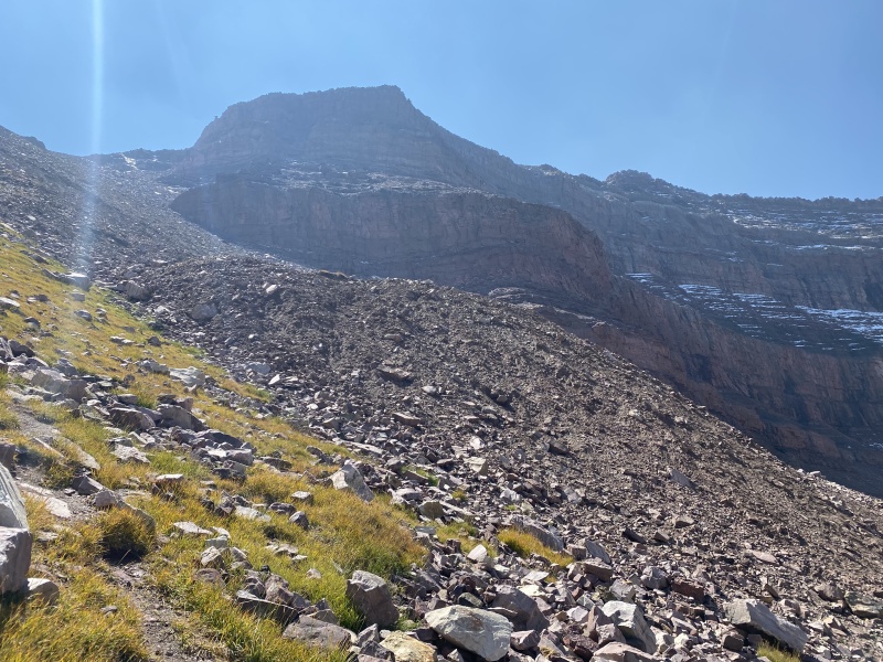
I continued my hike through the valley, towards camp. Along the way, I saw some Cowboys, herding sheep. I've seen free-range cattle several times in Colorado, but never free-range sheep. I got back to camp in about 7 hours 15 minutes from leaving camp that morning; about 2.5 hours from leaving the summit. The descent down the Scree Route saved me some serious time and mileage. 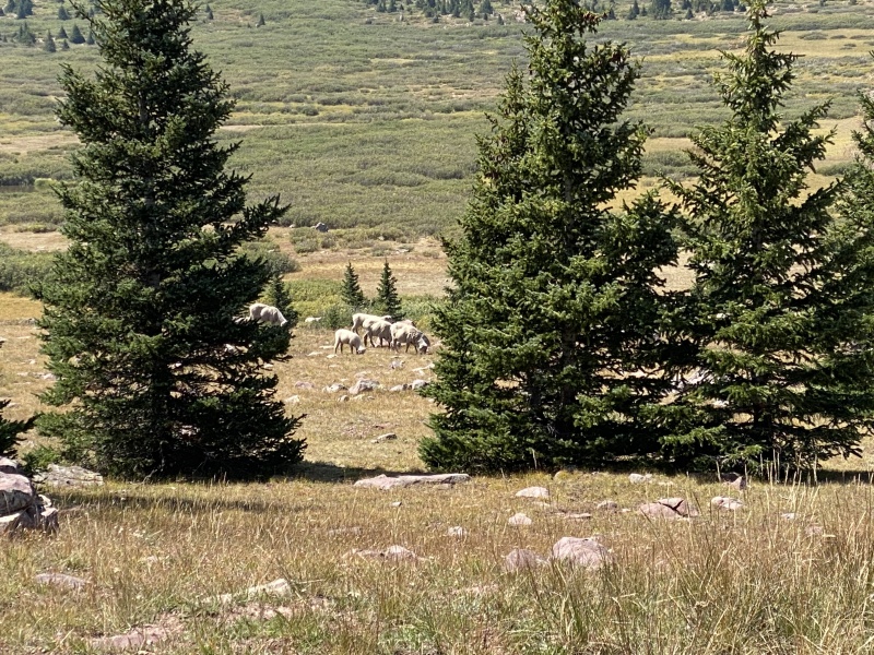
At camp, I chilled for a bit, snacked, filtered some water, and packed up my tent and gear. I departed camp around 2:30 pm, hoping that I could get back down in 2.5 hours, or faster. My descent from camp was only slightly quicker than my ascent the previous night; just under 2.5 hours. I jumped into the rental car and started driving towards Ashton, Idaho, where I was planning to run the Mesa Falls Marathon in the morning. Overall, my legs felt strong, and I was not totally wasted. The total hike was 27 miles round trip. The overall distance could be 25 to 29 miles, depending on your ascent/descent options. Another state highpoint completed, and hopefully another state marathon on Saturday. Thumbnails for uploaded photos (click to open slideshow): ")
")
")
")
")
")
")
")
")
")
")
")
")
")
|
| Comments or Questions | |||
|---|---|---|---|
|
Caution: The information contained in this report may not be accurate and should not be the only resource used in preparation for your climb. Failure to have the necessary experience, physical conditioning, supplies or equipment can result in injury or death. 14ers.com and the author(s) of this report provide no warranties, either express or implied, that the information provided is accurate or reliable. By using the information provided, you agree to indemnify and hold harmless 14ers.com and the report author(s) with respect to any claims and demands against them, including any attorney fees and expenses. Please read the 14ers.com Safety and Disclaimer pages for more information.
Please respect private property: 14ers.com supports the rights of private landowners to determine how and by whom their land will be used. In Colorado, it is your responsibility to determine if land is private and to obtain the appropriate permission before entering the property.


