Download Agreement, Release, and Acknowledgement of Risk:
You (the person requesting this file download) fully understand mountain climbing ("Activity") involves risks and dangers of serious bodily injury, including permanent disability, paralysis, and death ("Risks") and you fully accept and assume all such risks and all responsibility for losses, costs, and damages you incur as a result of your participation in this Activity.
You acknowledge that information in the file you have chosen to download may not be accurate and may contain errors. You agree to assume all risks when using this information and agree to release and discharge 14ers.com, 14ers Inc. and the author(s) of such information (collectively, the "Released Parties").
You hereby discharge the Released Parties from all damages, actions, claims and liabilities of any nature, specifically including, but not limited to, damages, actions, claims and liabilities arising from or related to the negligence of the Released Parties. You further agree to indemnify, hold harmless and defend 14ers.com, 14ers Inc. and each of the other Released Parties from and against any loss, damage, liability and expense, including costs and attorney fees, incurred by 14ers.com, 14ers Inc. or any of the other Released Parties as a result of you using information provided on the 14ers.com or 14ers Inc. websites.
You have read this agreement, fully understand its terms and intend it to be a complete and unconditional release of all liability to the greatest extent allowed by law and agree that if any portion of this agreement is held to be invalid the balance, notwithstanding, shall continue in full force and effect.
By clicking "OK" you agree to these terms. If you DO NOT agree, click "Cancel"...
Party: Myself (25 year old small female), my boyfriend (25 year old tall male), and our dog (1 year old / 65 lb / German Shepherd mix). These peaks were #25/26 for us and #3/4 for the pup - she's previously done Gray's and Missouri.
Vehicle: 2005 4Runner with off-roading tires and 1" lift
Route: Northwest Face ascent up Sunshine (non-standard), traverse to Redcloud, Northeast Ridge descent from Redcloud (standard)
Conditions: Snowfall overnight above ~12k', cold for August, very windy on the ridge, bluebird for hiking day
Car camped Thursday night 08/19 at the Silver Creek / Grizzly Gulch Trailhead. Driving from the east, I agree this trailhead is 2WD accessible, but be prepared for rough patches and some serious exposure. The road is wide enough in most places that encountering opposite traffic wouldn't be terrible, but could be a bit nerve-wracking. We drove west the rest of the way through Cinnamon Pass to get to Silverton the next day, and portions of that stretch of the road do demand 4WD (or some serious skill with 2WD that I certainly don't possess), so be aware of that if approaching the trailhead from the west.
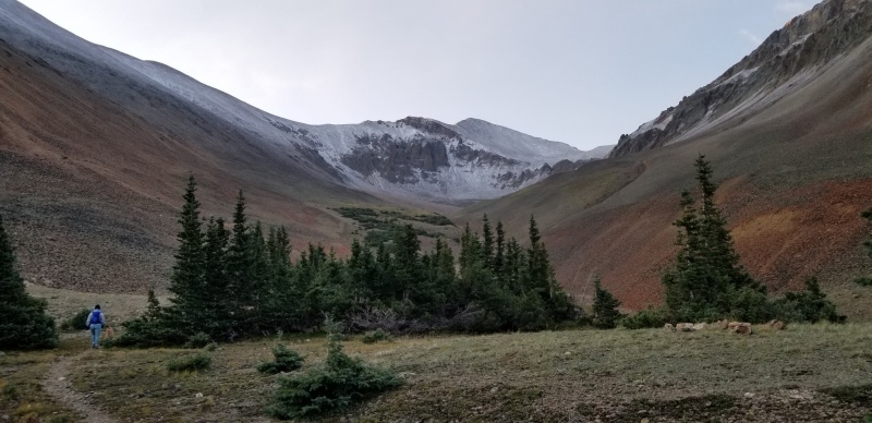
We started hiking around 5 am. The cold front which came through made for a chilly but comfortable start and blanketed the peaks in a few inches of crunchy snow. Finding the turn-off for the Northwest Face route wasn't easy by headlamp, but following the route description perfectly at this point isn't critical -- the creek has an obvious branch off to the southeast, so following that into the valley gets you going where you need to be. We found the trail along the left side of this branch of the creek after about 0.1 miles of bushwhacking. Once reaching the boulder field above treeline, staying on the trial isn't necessarily easy or critical -- just head for the gendarmes in the route description. We reached the base of the gulley that's shown in the route description when it was light out, but the sun hadn't yet hit the North face of the mountain, so it was extremely cold. Identifying the correct gulley to climb was very straightforward. Approximately half of the vertical gain in this gulley is on loose talus as the description suggests, but even with the rocks frozen together (and therefore more stable), this was absolutely class 3 climbing. It took me about 15 minutes to reach the more stable rock halfway up on the right side of the gulley. Boyfriend and dog did it in about 10 minutes. From there, it was about 5 minutes of scrambling up stable rock on the right side and then the left side to get back to level ground. I know this route is rated as "difficult class 2," but I would say this section is absolutely class 3, and not easy. This assessment is my main purpose for writing this trip report. Once we made it through the gulley, we agreed that going back down that way would be very dangerous and difficult to self-arrest. All this being said, we were still happy with our decision to do the CCW loop route and avoid the re-summit of Redcloud that's required for the standard route double summit; but we would not recommend doing the loop clockwise.
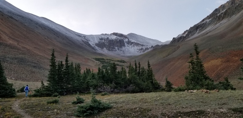
View of Sunshine leaving treeline. Gendarmes are visible where the snow begins.
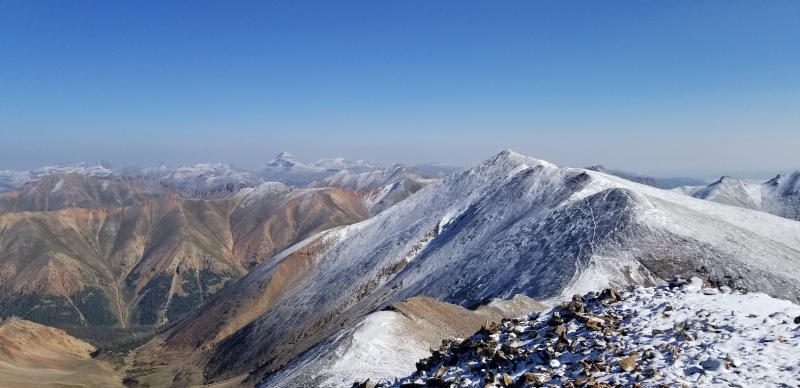
Summiting Sunshine was very straightforward Class 1-2 climbing for the remainder of the route, and the traverse to Redcloud was very easy Class 1. Prepare for wind though! Based on all the rock semicircles that people have built along the way, it would seem that strong winds typically buffet these peaks, and our experience wasn't just a consequence of the cold front.
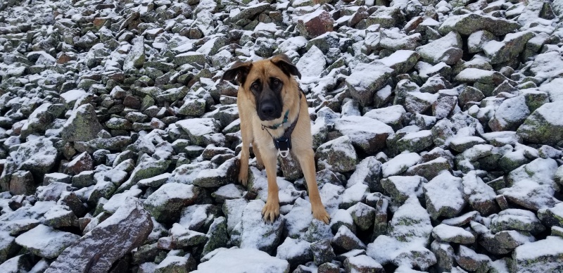
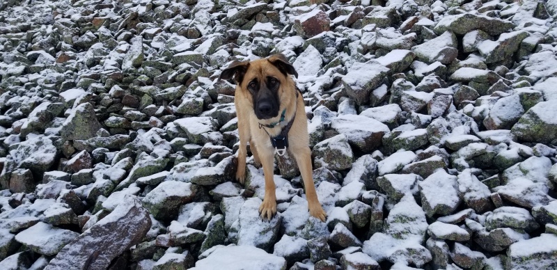
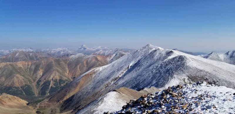
View of Redcloud from the summit of Sunshine. Although there looks like multiple tracks go between the peaks, only the uppermost vein was used by all the hikers we saw, and ourselves.Puppy posing on the descent from Sunshine on our way to the saddle.
Summiting Redcloud was gentle and easy. Descending it was a bit tough on the knees but still Class 1 the whole way back to the car. Much of this hike is above treeline, so be sure to bring sun protection! Lots of water sources with the creeks, so filtering water was a great option for us to keep pack weight down, especially with the extra food needed for the pup.
Hope this report is helpful for anyone debating which route to take for these peaks!
Thumbnails for uploaded photos (click to open slideshow):
I am going to do these peaks this weekend and I was debating doing the loop and which way (thinking faster descent clockwise but wondering about terrain difficulty). Your notes about the gully being a dangerous descent have encouraged me to to just do the out and back over Redcloud. It sounds like I can ascend the standard route faster (and preserve energy) rather than climbing loose scree/talus as well.
Was the trailhead crowded? Are there many places to set up a tent near the car?
@cfmitchell Glad the report was useful to you!! The trailhead was definitely more crowded than I expected for a Thursday evening -- maybe 10 cars there overnight, which filled the dedicated parking spots. But the TH is co-located with the public bathrooms on Cinnamon pass, so there are some extra parking spots for that, and the road is very wide at this point. I'd expect 20 cars could fit easily, and even more if you're willing to park a few hundred feet away further along the road. As for tent camping, the ground may be a little rocky for getting stakes in, but there was a good amount of space at the TH that could be used for tents.
Me and another climber were about an hour behind you and saw your group/dog reach the top of the gully (kudos to the pup btw). We also ascended the gully and agree that the section is definitely class 3, especially with the snow/icy conditions that day. We saw one climber descend the gully but he seemed very uncomfortable. We climbed up the rock climbers right of the gully but be aware that we experienced loose hand/foot holds near the choke point so test everything before you put your weight on any rock. Totally agree that anyone contemplating this route should ascend the gully rather than descend.
Nice report. I hiked the same loop on Saturday, and my hiking partner and I both agreed with your assessment that the gully between the gendarmes is class 3, and that going up is way more doable than down. It's short but very steep and loose.
Just did the CCW loop (September 18, 2021) and have to agree that this should be a Class 3. The gully can be very tough depending on the conditions and the line you choose immediately after the choke point. My friend and I entered through the right side and found the soil and rock to be extremely loose in the center and to the right of the choke point.
Once caught in the central area there are few options to arrest. You are committed to one side or the other because the soft soil and rock mixture is so unstable. My friend navigated it after quite a bit of very slow and deliberate scrambling. The rocks and soil kept giving way and I lost all my hand and foot holds - leaving me in a pretty precarious position. I was able to find a way to the far right after a long, slow, exhausting effort.
After reaching the ridge above the gully it appeared to us that most people ascend to the LEFT of the chokepoint where the rock appears to be more stable.
Two of us and a dog did this same loop 9/24/21. I would definitely agree that the gully is class 3. We stayed to the left of the gully most of the way up and through the choke point. It is short and steep. Maybe took 20 minutes. Definitely would not recommend this route going down. Took us ~9 hours and we clocked it at ~10.5 miles. Thanks for this report! It was a great help and gave us the confidence to get it done.
Heading out there this weekend, and this is exactly the level of detail I needed. Thank you.
Caution: The information contained in this report may not be accurate and should not be the only resource used in preparation for your climb. Failure to have the necessary experience, physical conditioning, supplies or equipment can result in injury or death. 14ers.com and the author(s) of this report provide no warranties, either express or implied, that the information provided is accurate or reliable. By using the information provided, you agree to indemnify and hold harmless 14ers.com and the report author(s) with respect to any claims and demands against them, including any attorney fees and expenses. Please read the 14ers.com Safety and Disclaimer pages for more information.
Copyright: Route information, text, risk factors, maps, GPX files, charts, photos, 14ers.com-created map imagery, flythroughs, and other content provided in this route description are copyrighted by 14ers.com and may not be copied, reproduced, republished, distributed, modified, or used to create derivative works without prior written permission.
Please respect private property: 14ers.com supports the rights of private landowners to determine how and by whom their land will be used. In Colorado, it is your responsibility to determine if land is private and to obtain the appropriate permission before entering the property.