| Report Type | Full |
| Peak(s) |
Pfeifferhorn Peak - 11,248' Mt. Timpanogos - 11,669' |
| Date Posted | 08/24/2021 |
| Date Climbed | 08/15/2021 |
| Author | jfm3 |
| Wasatch Mini Camp |
|---|
|
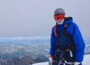
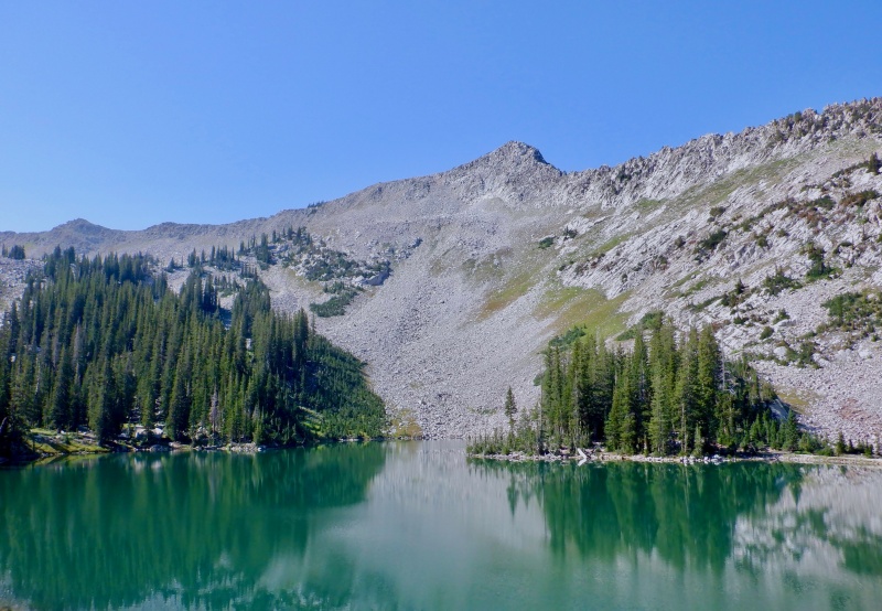
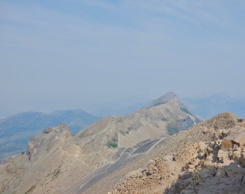
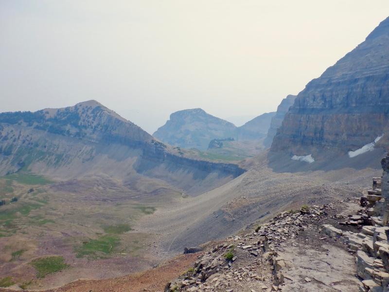
Earlier this month I went to the Wasatch Range in northern Utah for a 3-day training camp. Once again, the ongoing pandemic situation forced me to rearrange my summer mountain plans. Like last year, I was going to go to a summer cross-country ski camp on Eagle Glacier outside Girdwood, Alaska. And like last year, the camp was canceled this year. With the Olympics taking place this winter, the glacier facilities were essentially off-limits to everyone but the probable Olympic skiers. I also couldn't travel to Banff National Park in Canada to pick up a few stray summits I missed when I was there in 2019. And finally, though travel to Europe was possible early in the summer, I'm still training for a big trip to Chamonix next summer. Hopefully travel and accessibility are back to normal next summer. I stayed with my best friend, who lives in Salt Lake City. I ran up & down Pfeifferhorn Peak, completed a difficult rollerski intensity session on the summer track at Soldier Hollow (the cross-country skiing venue at the 2002 Olympics outside Midway; I won't detail that here since this is a hiking website, but you can look at my entry on Strava if you're interested: https://www.strava.com/activities/5794359986) and hiked up & down Mt. Timpanogos outside Provo. It was HOT all 5 days I was in Salt Lake. 100+ degrees in the city, 80 degrees in the canyons and 70 degrees on the summits. There was a fast-moving fire that broke out just south of I-80 at Parleys Summit while I was there. The last 2 days I was in Utah there was a very thick, opaque smoke haze that rendered the Wasatch invisible from the city. It felt like I was in a giant oven whenever I went outside. Pfeifferhorn Peak is a relatively easy summit above Little Cottonwood Canyon. It is shorter and easier than some of the well-known summits of Big Cottonwood Canyon, like Broads Fork Twin Peaks. I took the standard route up & down via Red Pine Lake: https://www.trailrunproject.com/trail/7023366/pfeifferhorn. The peaks towered above as I drove up the canyon. It was cool and shady as I set out. The trail was runnable in a few spots on the climb to Red Pine Lake. The Twin Peaks summits and the city to the west were occasionally visible through the dense trees. The climb from the lake to the ridge was steep. There were many trail segments so I meandered along and grunted up the hill. The views to the north opened up dramatically as I gained elevation. When I reached the ridge I saw Timpanogos & Provo to the south. The top of Pfeifferhorn loomed behind the false summit. A large cloud provided some shade as the day rapidly warmed. 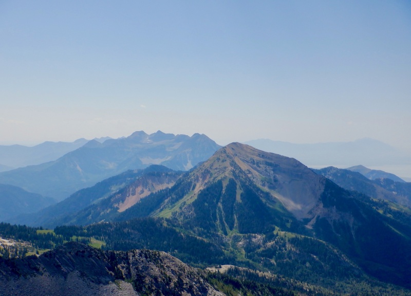
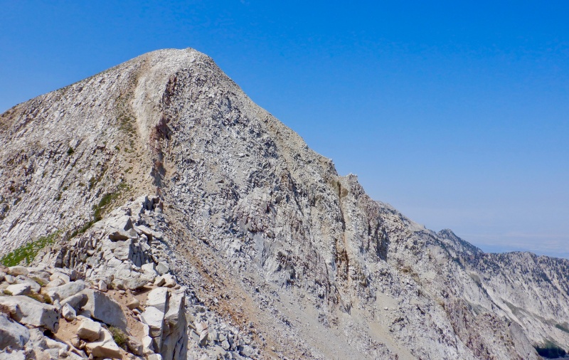
After the false summit there was a large jumble of awkward boulders. There weren't many options for a clean line so I found the best route I could. The final slope to the top was very steep. I climbed up the class 3/4 ledges and slabs instead of dealing with the loose dirt path. The summit was small with big exposure to the north. Other than being accosted by bugs it was nice to sit up there, gazing through the binoculars and enjoying the silence. There was steady traffic on the trail both up & down so the solitude on top was nice. 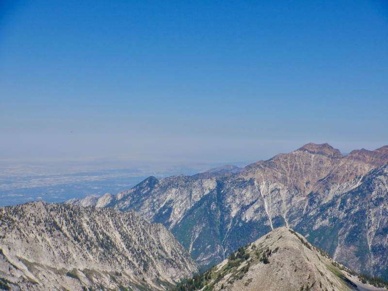
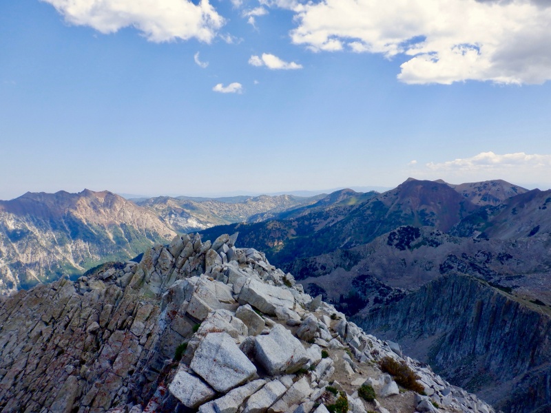

After a long pause I started down. I retracted my route down the rock, again eschewing the crappy dirt trail. IT was a very slow & tedious downclimb. No real exposure, just steep and less-than-solid rock. I turned north off the ridge as the cloud above grew dark. I quickly descended to the lake, pausing to refill water & splashing to cool off. 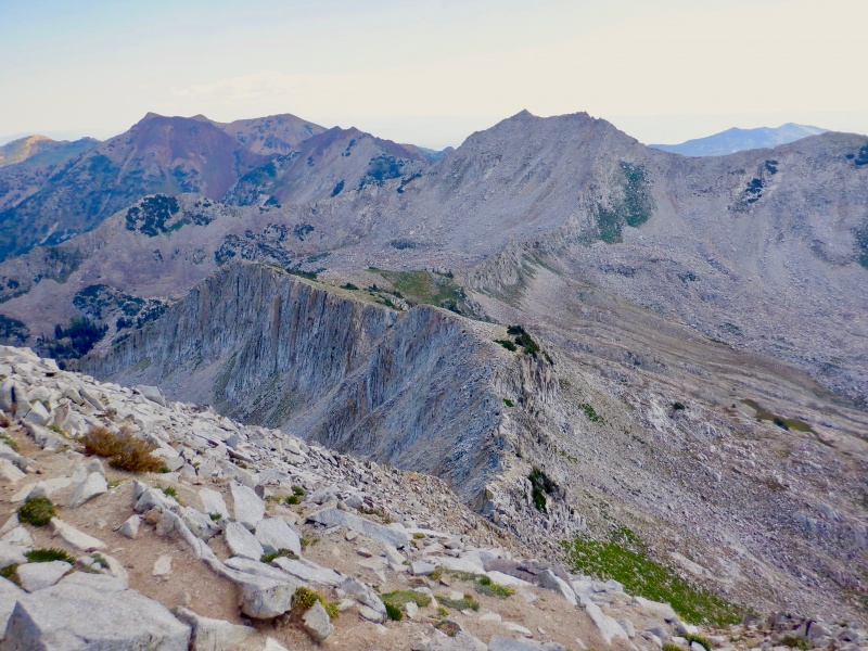

The descent back to the car took only an hour. The good trail allowed for easy running the whole way. I soaked myself in whatever creek crossings I could find- the heat was really noticeable in the trees. I got stung on the ankle through my sock by a wasp at one point. It hurt a lot for about 10 minutes but I didn't have any reactions so I guess I'm not allergic. First time I've ever been stung. Legs felt great when I reached the bottom. It was 100 degrees on the drive back to town. 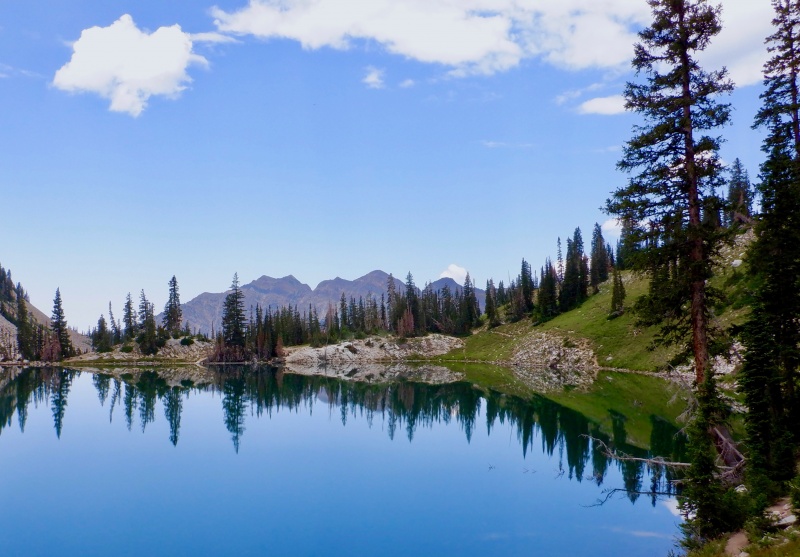

Mt. Timpanogos is an ultra-prominent peak that rises dramatically above Heber City (viewed from the north) and Provo (viewed from the south). My friend and I took the east side route up (https://www.trailrunproject.com/trail/7006727/mount-timpanogos-trail-052) starting just above Sundance to the west of Provo Canyon. We then joined the route from the west side for the final section of ridge to the summit (https://www.trailrunproject.com/trail/7006729/timpanogos-summit-trail-054). I've wanted to go up this mountain since I first started skiing at Soldier Hollow and saw it towering above the parking lot. It was great to finally be on the summit, though I'm really getting tired of seeing smoke all the time everywhere. We drove for over an hour through Salt Lake & Orem to reach the trailhead. The sky got light as we went up Provo Canyon and past Sundance. The parking lot was quiet and cool with the huge creek drainage looming overhead. 
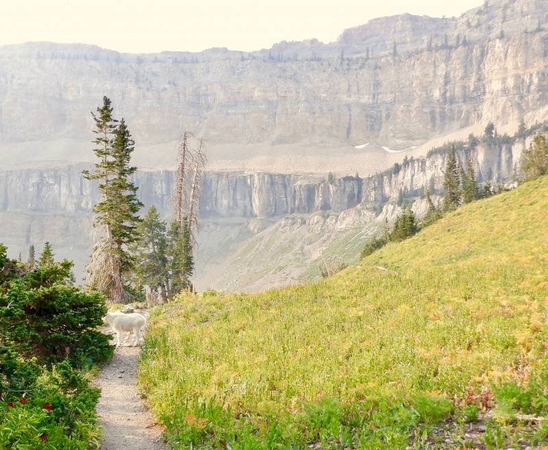
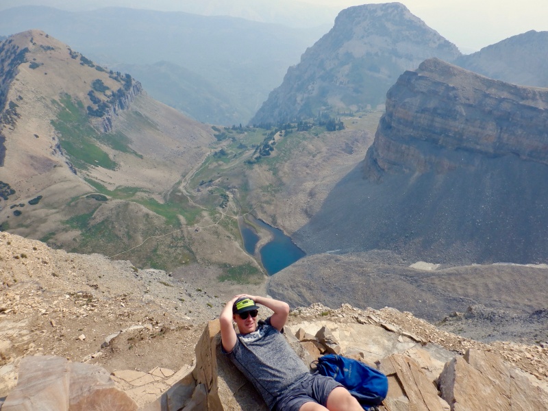
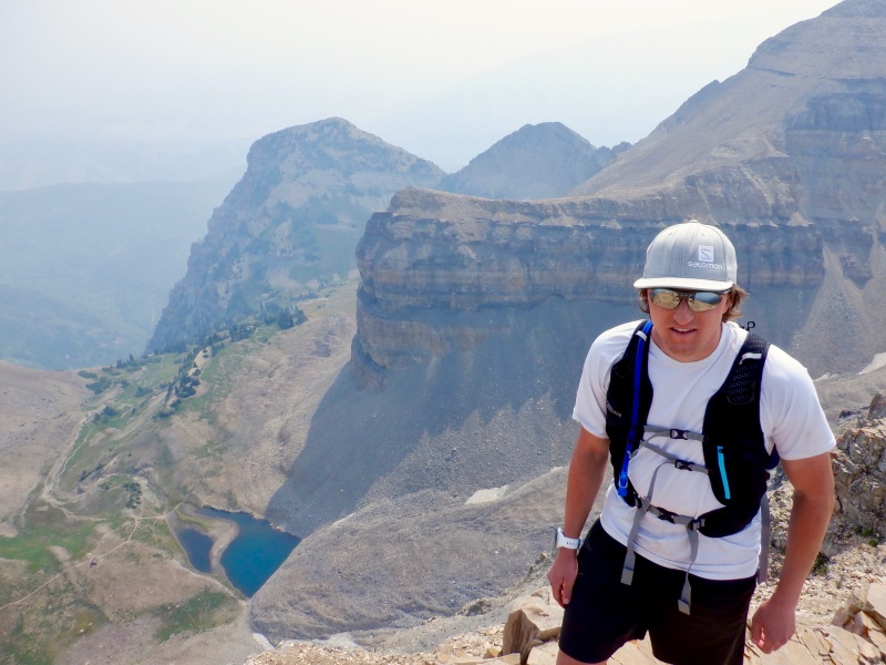
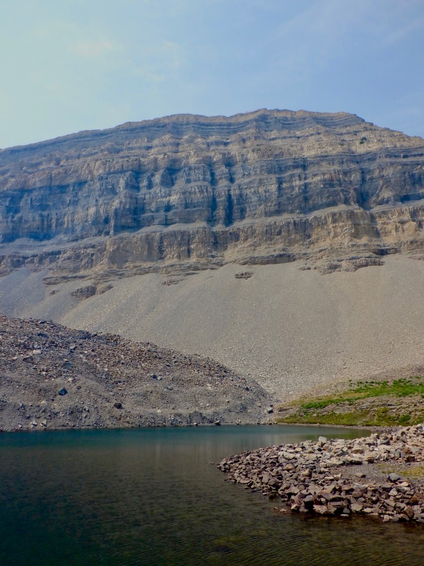
I led almost the entire way to the top. The ascent was steep but easier than I expected for almost a vertical mile of climbing. The trail was excellent and the lower elevation knocked 5-10 bpm off my heart rate. We passed several groups as we moved up the many switchbacks. The sun was red as it rose through the smoke. The vertical relief of the drainage was quite striking. Huge, sheer walls covered with green. Only one waterfall was running. The rest of the creek bed was dry all the way to the top of the cliffs. The water is probably roaring in June or July. It took over 2 hours to finally reach the amphitheater above treeline. The summit still towered overhead and the multiple lower peaks blocked out the views. The smoke was thick enough to give the sun a golden tint even in the morning. There were dozens of mountain goats grazing at Emerald Lake. We quickly traversed the tundra and the talus moraine under the summit ridge. The only bad section of trail was a dirt chute leading up to the saddle. Not much was visible from the ridge. Everything to the north was lost in the haze and only a slice of the lake beyond Provo could be seen to the south. 

The final climb to the summit went quickly. The ledgy rock reminded me of some of the terrain in Banff. The ridge was wide enough to avoid the exposure but it still felt big and expansive with a lot of relief on either side. The smoke washed out everything beyond the Timpanogos massif. The scenery was still good- big drops, steep slopes and a long way to the valley floor. We spent over 30 minutes on top. It was warm with no wind. There were dozens of people arriving and leaving while we were up there. 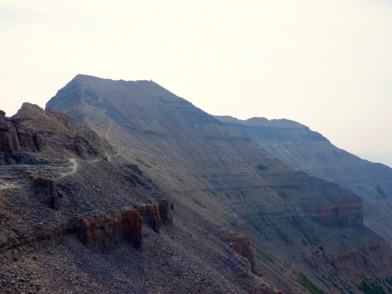
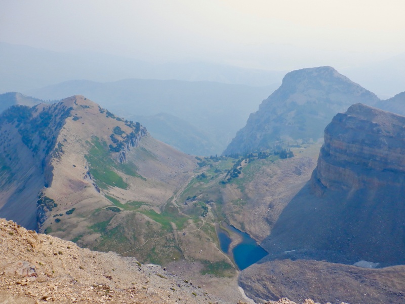
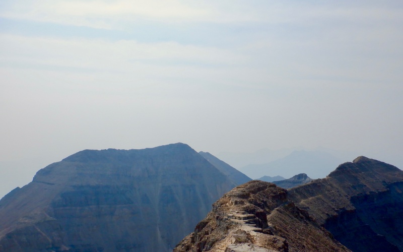
The descent took almost as long as the ascent. I let Corey lead and ambled along behind. The trail is quite runnable- I could probably run from the top down to the car in under 2 hours solo. The smoke lifted somewhat as we crossed the moraine. The top of Pfeifferhorn was barely visible to the northwest. We refilled water at Emerald Lake before starting the long, steep drop down the cliffs. 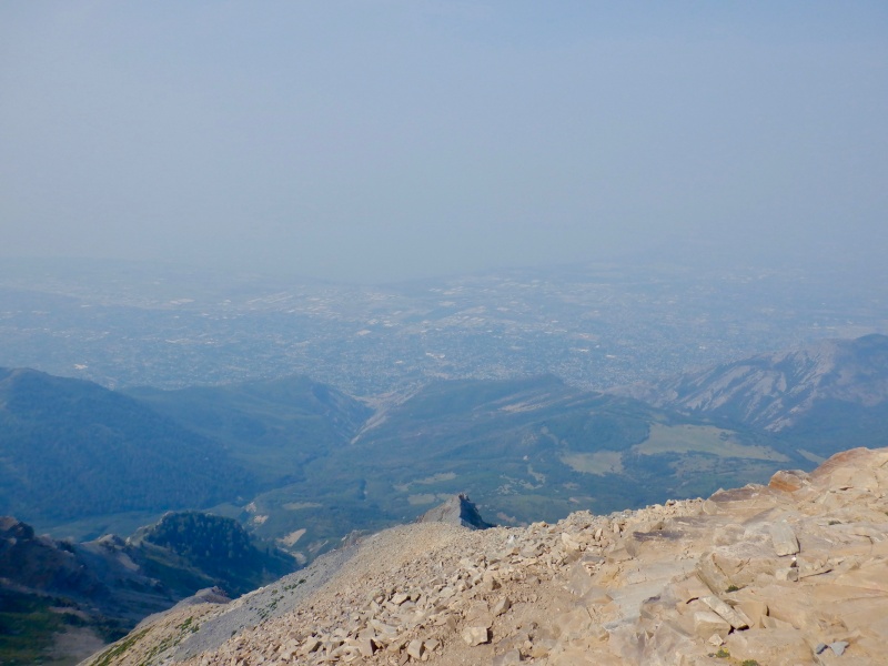
The upper switchbacks flew by and a gusty wind kept the air cool. The temperature rose quickly on the lower trail. The heat was radiating off the ground and the lack of running water was unpleasantly apparent. The last few miles were slow and really hot. We did cool off in the one running waterfall but it was still a scorching 90 degrees at the car. 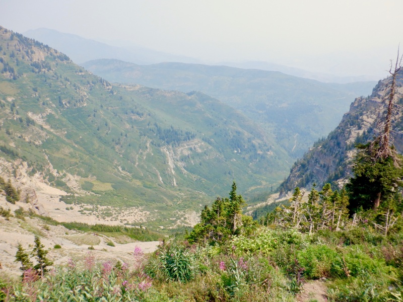
There is certainly more to explore in the Wasatch. I found both summits to be easier than I expected. The lower elevation makes a significant difference. The trails up the peaks are quite steep, but a 4,000-foot climb is much easier when starting below the elevation of Denver. Access is also quite easy, since the mountains are essentially in Salt Lake. I do wish the smoke had cleared out for the Timpanogos day, since the views from the top are so expansive. Overall it was a good weekend in a new place. Thumbnails for uploaded photos (click to open slideshow): ")
")
")
")
")
")
")
")
")
")
")
")
")
")
")
")
")
")
")
")
")
")
")
")
|
| Comments or Questions | ||||||||||||
|---|---|---|---|---|---|---|---|---|---|---|---|---|
|
Caution: The information contained in this report may not be accurate and should not be the only resource used in preparation for your climb. Failure to have the necessary experience, physical conditioning, supplies or equipment can result in injury or death. 14ers.com and the author(s) of this report provide no warranties, either express or implied, that the information provided is accurate or reliable. By using the information provided, you agree to indemnify and hold harmless 14ers.com and the report author(s) with respect to any claims and demands against them, including any attorney fees and expenses. Please read the 14ers.com Safety and Disclaimer pages for more information.
Please respect private property: 14ers.com supports the rights of private landowners to determine how and by whom their land will be used. In Colorado, it is your responsibility to determine if land is private and to obtain the appropriate permission before entering the property.