Download Agreement, Release, and Acknowledgement of Risk:
You (the person requesting this file download) fully understand mountain climbing ("Activity") involves risks and dangers of serious bodily injury, including permanent disability, paralysis, and death ("Risks") and you fully accept and assume all such risks and all responsibility for losses, costs, and damages you incur as a result of your participation in this Activity.
You acknowledge that information in the file you have chosen to download may not be accurate and may contain errors. You agree to assume all risks when using this information and agree to release and discharge 14ers.com, 14ers Inc. and the author(s) of such information (collectively, the "Released Parties").
You hereby discharge the Released Parties from all damages, actions, claims and liabilities of any nature, specifically including, but not limited to, damages, actions, claims and liabilities arising from or related to the negligence of the Released Parties. You further agree to indemnify, hold harmless and defend 14ers.com, 14ers Inc. and each of the other Released Parties from and against any loss, damage, liability and expense, including costs and attorney fees, incurred by 14ers.com, 14ers Inc. or any of the other Released Parties as a result of you using information provided on the 14ers.com or 14ers Inc. websites.
You have read this agreement, fully understand its terms and intend it to be a complete and unconditional release of all liability to the greatest extent allowed by law and agree that if any portion of this agreement is held to be invalid the balance, notwithstanding, shall continue in full force and effect.
By clicking "OK" you agree to these terms. If you DO NOT agree, click "Cancel"...
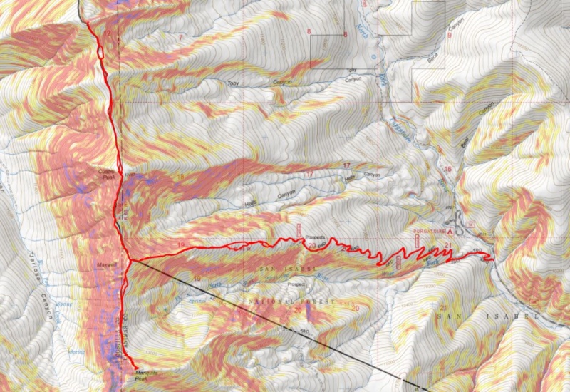
Mt Maxwell – 13335, Mariquita Peak – 13,405 – Cuatro Peak – 13,487, Leaning South Peak – 13,203
RT Length: 15.73 miles
Elevation Gain: 6807’
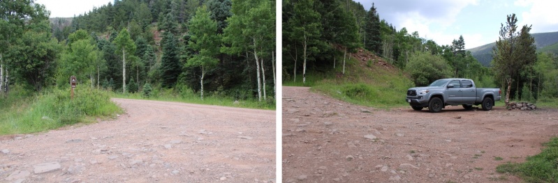
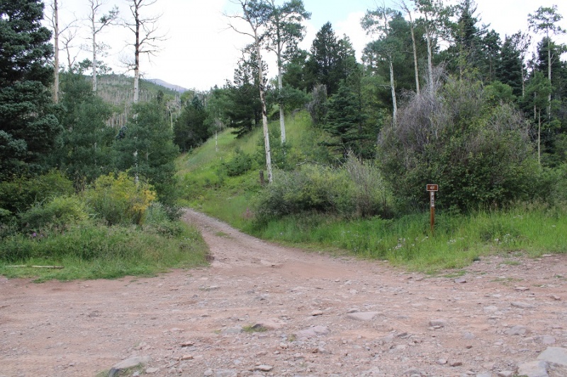
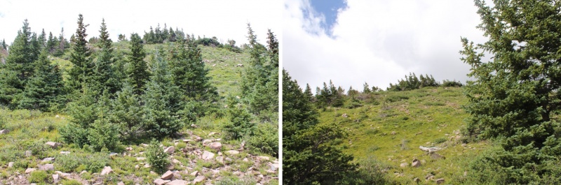
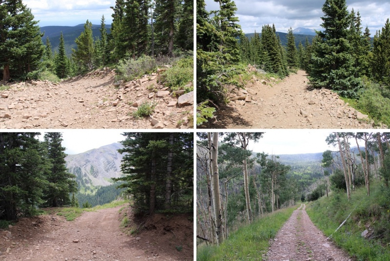
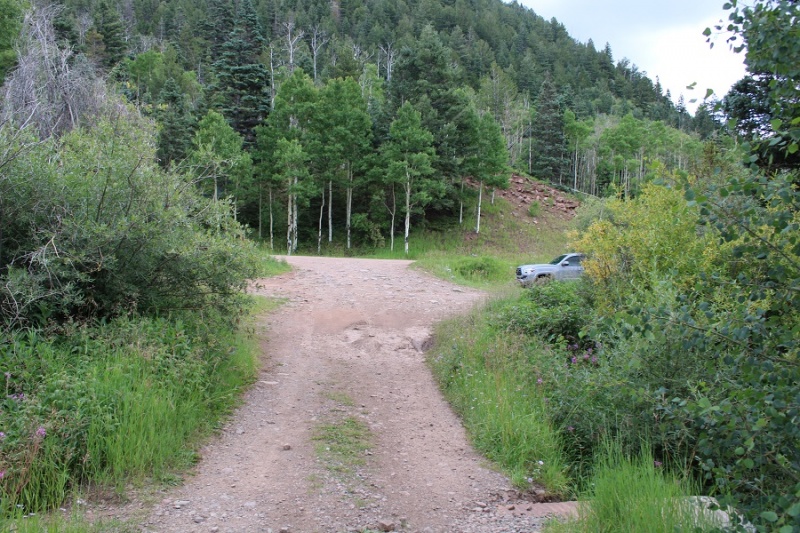
There’s a lot of dispersed camping spots along 34, and just before reaching the Purgatorie Campground off 34 there’s dispersed camping spots on the left, at the junction with 437. It was dark when I arrived, so I parked at the camping spot on the side of the road and was on the trail at 4:30am.
The trail follows road 437, and, although I didn’t know it at the time, my Tacoma could have easily made it all the way to 11700’ (the end of the road). However, by the time I figured this out it wasn’t worth going back to get my truck, so I kept on hiking.
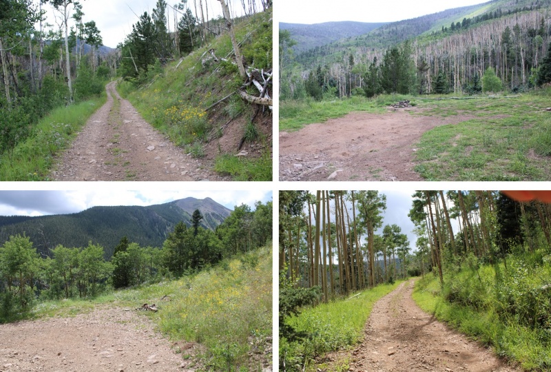
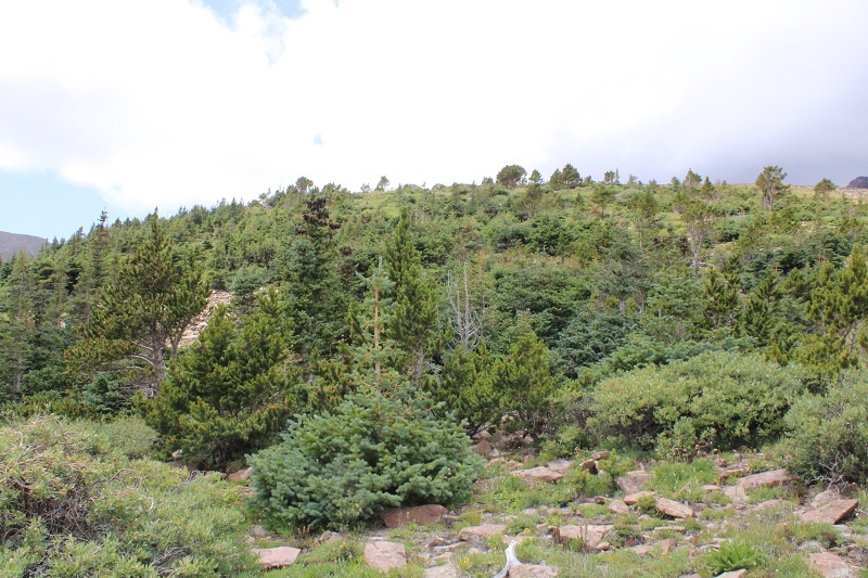
I followed 437 for just over 3 miles to 11700’. There were several dispersed camping spots along this road as well, mostly at switchback junctions.
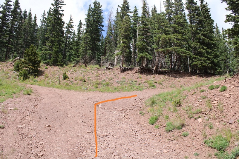
Just before the last surge of elevation gain there’s a kind of junction in the road. Turn right here, as taking the road to the left doesn’t go anywhere. There will be a nice camping spot on the right, and then a steep section of road and you’re at the end of the road (and another campsite)
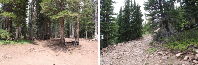
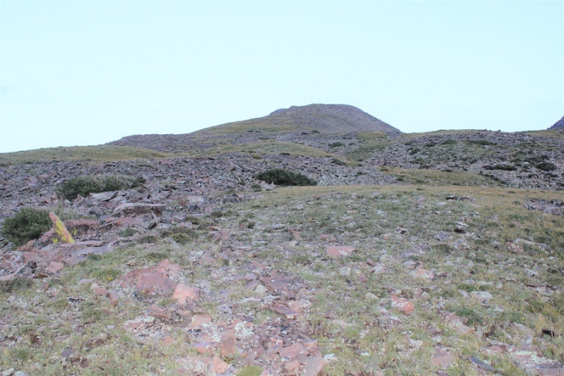
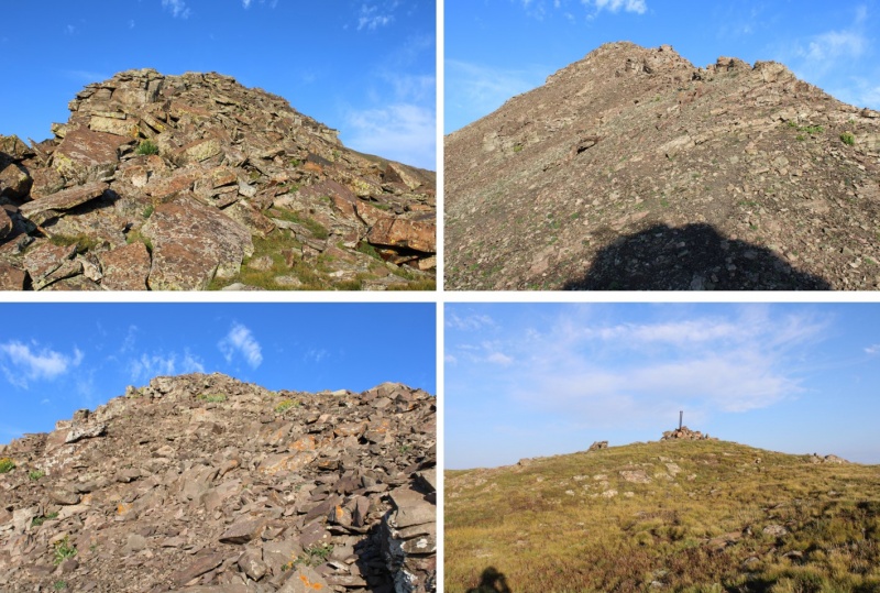
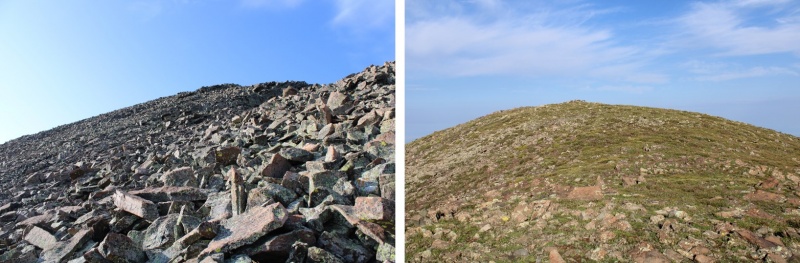
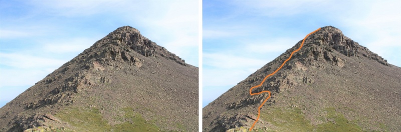
Where the road stops the fun begins! I headed west to treeline by ascending this hill. If you look carefully, you’ll find cairns here that will get you to treeline: there are several cairned routes here.
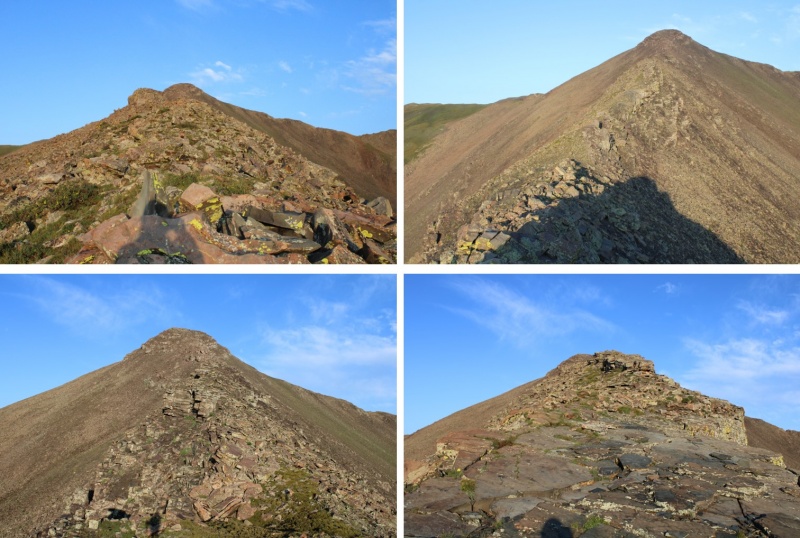
Once at treeline the route will be obvious: Juts follow the ridge west. I brought a helmet, but didn’t feel the need to wear it at all today. The toughest part of this route is easy class 3, and usually just a move or two at a time.
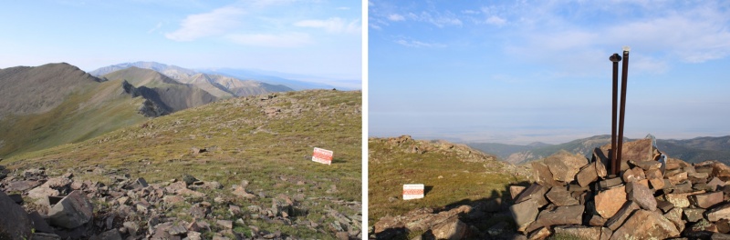
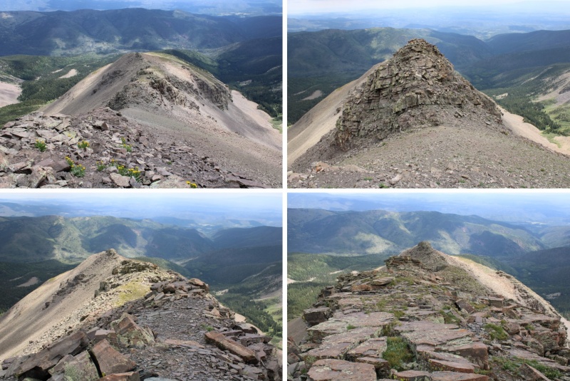
You can stay on top of the ridge the entire way to the summit: even if it looks like you’ll cliff out from far away, you won’t. Here are some ridge views…
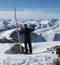
I summited unranked Mt Maxwell and took a look around. On the summit there was a property boundary marker, and just a little further west was a “No Trespassing” sign. I’m not sure why anyone would want to continue west, as the terrain cliffs out, but this is the boundary for the Trinchera Ranch. This was the one and only “No Trespassing” sign I saw. I did see property/boundary markers, and made sure to stay on the San Isabel National Forest side of the markers.
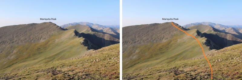
I decided to give the boundary line plenty of space, knowing they have game cameras set up here, and turned and headed south towards Mariquita Peak, being sure to stay at least 50 feet east of the ridge to ensure I was on San Isabel National Forest Land, even if I couldn’t see a boundary marker. I hear the rules for accessing this property change, so be sure to have the most up to date information. This was the most up to date info I could find: https://cpw.state.co.us/learn/Maps/RFW_Trinchera_South_geo.pdf
Here’s the route I took to Mariqueta Peak
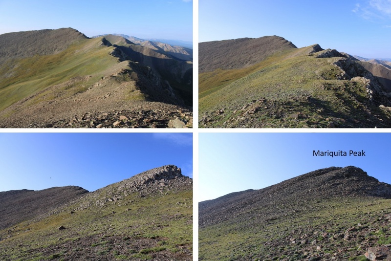
The beginning of this hike was rocky (better pictures on my way back), then became an easy tundra/ridge hike, before once again becoming rocky. There was nothing technical about this hike. I descended just under 300’ to the saddle, and then ascended about 400’ to the summit.
On the summit there was another property marker, this one placed inside the summit cairn. I made sure to stay east of this marker as well. I summited Mariquita Peak at 8am.
Mariquita Peak:
Here are some pictures of the path back to Mt Maxwell (once again, I stayed east to remain on National Forest Land)
As I ascended Mt Maxwell I stayed right, avoiding the rocky sections
I re-summited Mt Maxwell at 11am
Mt Maxwell:
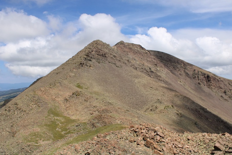
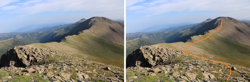
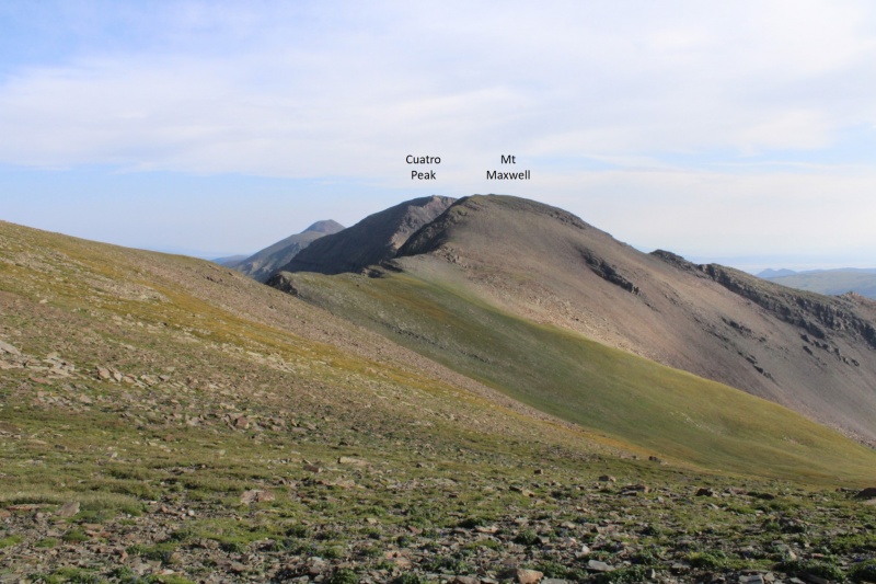
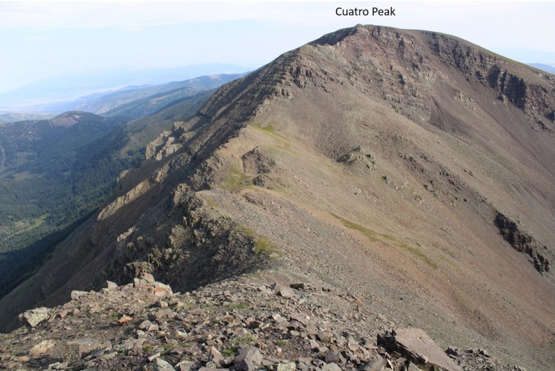
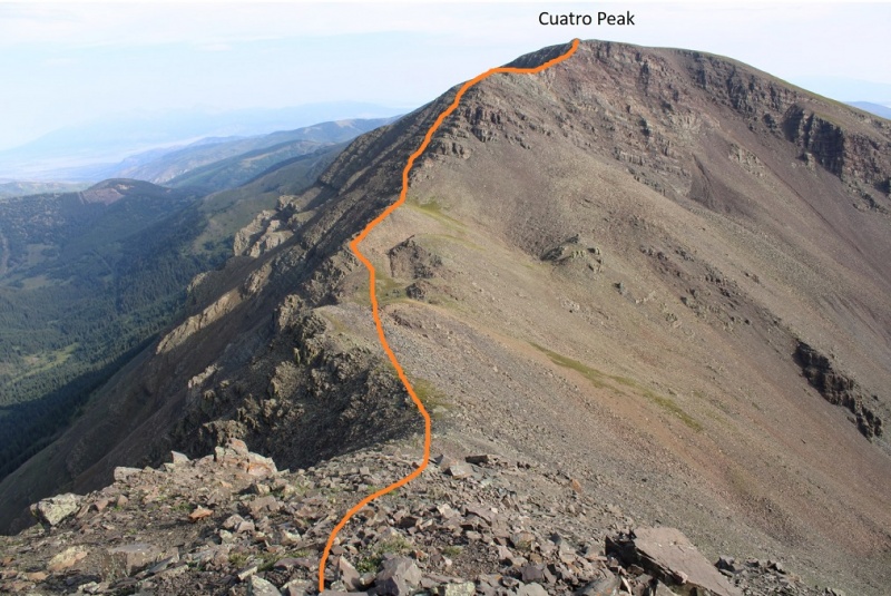
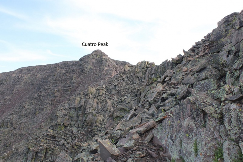
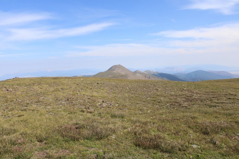
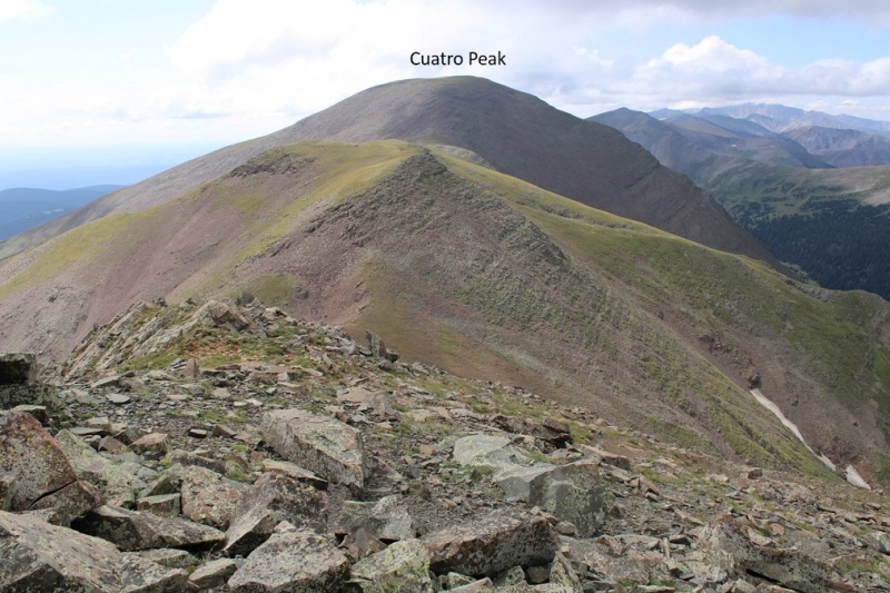
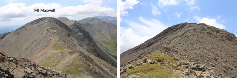
From Mt Maxwell, Cuatro Peak (to the north) looks daunting
It’s actually a lot easier than it looks. Most of this hike is class 2, with just a few easy sections of easy class 3. Here’s the overall route I took, staying west initially until I made it to the ridge, and then taking the ridge all the way to the summit.
I headed down to the saddle. This was rocky but easy to find traction
Once at the saddle I made my way to the ridge
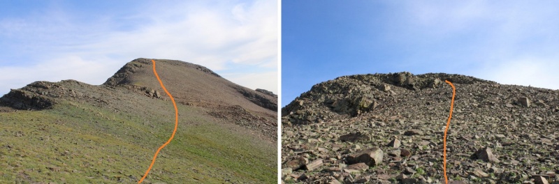
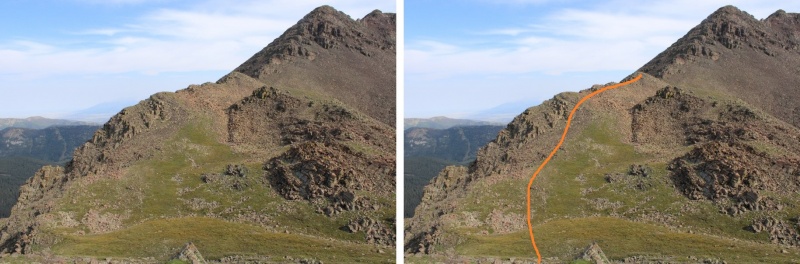
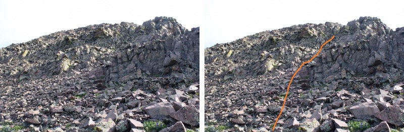
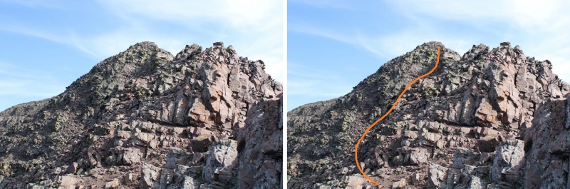
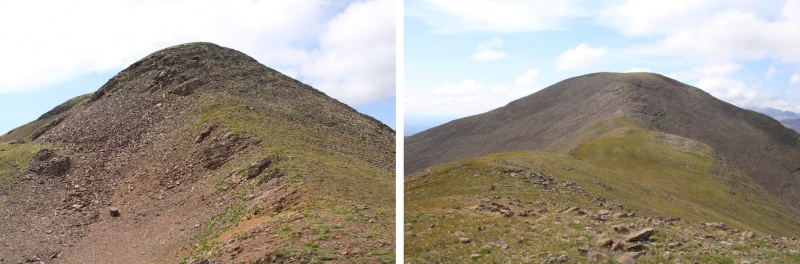
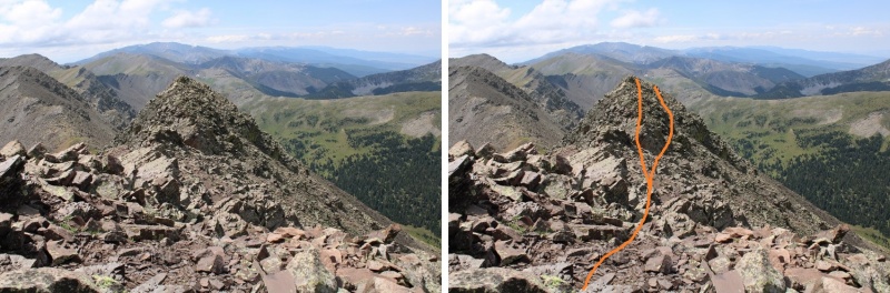
This next part looks daunting, but it’s all class 2. Here’s the route I took to the upper ridge
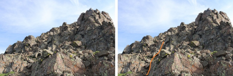
It’s choose your own adventure, but there are plenty of game trails for reference. Here are some pictures of the route up to the ridge. There’s an easy class 3 gully, that really only requires one or two class 3 moves.
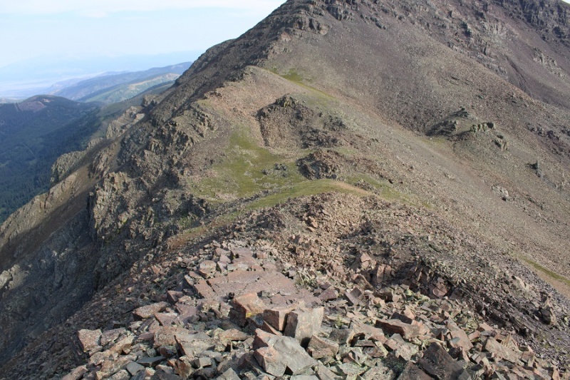
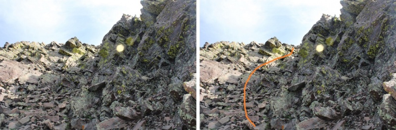
Once on the ridge it again looks daunting, but you can pretty much stay on top of this ridge the entire way to the notch. If you do feel you need to dip down, go left (west). You’ll lose and need to regain elevation, but there’s less exposure.
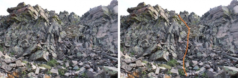
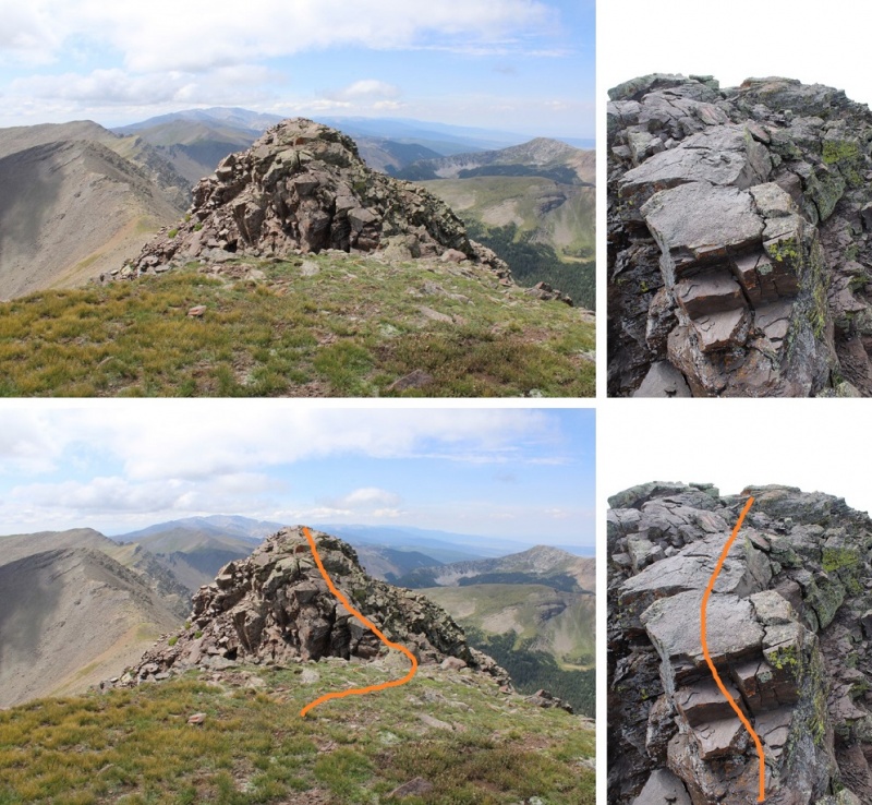
There was one final gully to ascend with some class 3 moves to get out of the gully. Here’s the overall view
And the final push to the top
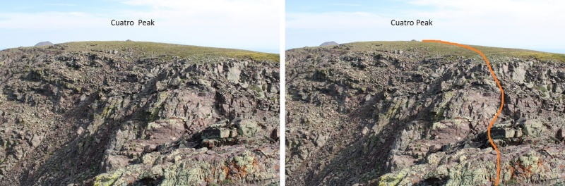
Back on the ridge you’re so close to the summit! But there’s a final chasm to cross. I stayed on the ridge proper, downclimbed a short, easy class 3 section,
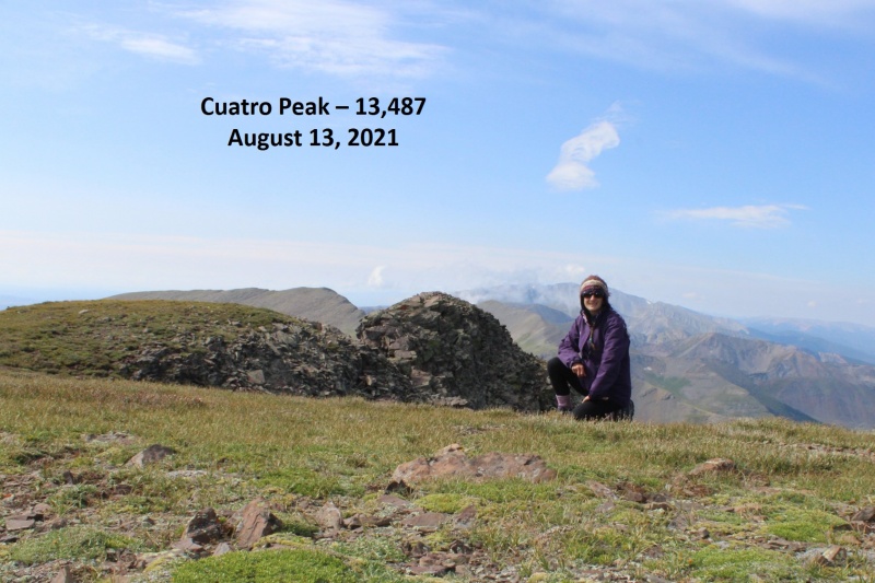
I summited Cuatro Peak at 9:40am
Cuatro Peak:
I followed the ridge north to continue on to Leaning South Peak
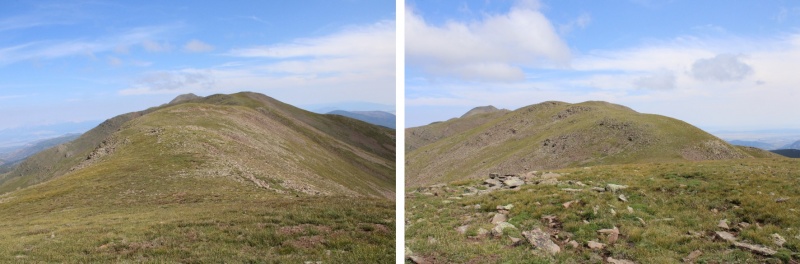
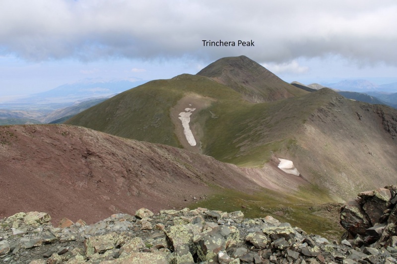
This was a class 2 ridge hike, mostly on tundra, except for the areas that lost elevation, where there were rocks and scree thrown in. I was aiming for Leaning South Peak, but there’s another ranked peak (Trinchera) beyond
I continued following the ridge north
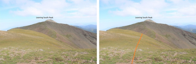
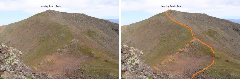
Just before the last bit to Leaning South Peak I lost 240’ of elevation, then gained 310’ of elevation to the summit of Leaning South Peak. No need to stay high here, as you’ll be losing elevation anyway (although on the way back it was easier to go straight up to the ridge).
Here’s the path I took to the summit, solid line up, dotted line down. I liked the dotted line better on the way back.
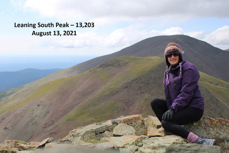
I summited Leaning South Peak at 10:30am
Leaning South Peak:
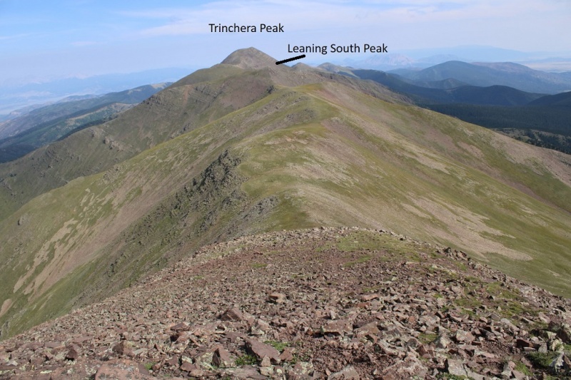
There was a summit register, but it was broken and the papers inside were wet and unreadable. I replaced the summit register and turned and headed back, as the weather was starting to turn and it’s a long way back. You can make this a loop if you’d like, by continuing on to Trinchera and then heading down to Blue Lakes Campground (etc., depending on where you park your vehicle), but I already had Trinchera Peak, so I decided to turn back. Here’s looking over to Trinchera for those interested
From Leaning South Peak, here’s a view of the route back to Cuatro Peak
And a few pictures from along the way to Cuatro
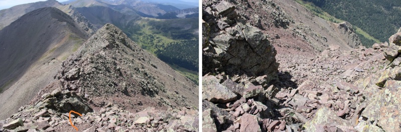
Once back at Cuatro Peak I made my way back onto the ridge. This is easier than it looks
Then back down the gully…
And across the ridge. Route finding here was much easier on the way down. You can either stay on the ridge, or dip to the right
And back to the saddle and up Mt Maxwell
Then it was back down the ridge. This is also easier than it looks, and goes to easy class 3.
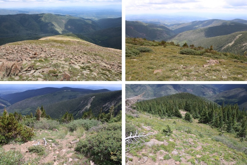
From the ridge I aimed for the willows and treeline, and eventually the road
And followed the road back to my ruck
I made it back to my truck at 2:30pm, making this a 15.73 mile hike with 6807’ of elevation gain in 10 hours
Thumbnails for uploaded photos (click to open slideshow):
Were you able to get permission to climb Mariquita? I have been emailing with Bar NI for several years now and they have repeatedly asked me to stay off this peak. They had talked about a reservation system but decided against it. I would take this report down if you didn't get permission.
The above comments are correct, and the reason you didn't see any more no trespassing signs after that one on Maxwell is because you were already on the ranch at that point. The big diagonal black line at the bottom of your map coming off the ridge from Maxwell is from my understanding the Bar NI/San Isabel NF boundary. The PDF you linked to with the map of Trinchera Ranch's boundaries is accurate, there just is another ranch up there on the east side of the ridge to the south of Maxwell.
I agree that you may want to take your TR down, or edit out the Mariquita part. I don't know if ranch staff frequent this site at all, but Cielo Vista staff do so its possible Bar NI does too.
The legality of this peak has been discussed frequently on the forum. How did you not know? Your actions will make it more difficult for the rest of us to gain access.
According to Gaia mapping, the Private Property layer shows that Mt Maxwell and Mariquita Pk summits belong to Las Animas Co.
West of ridgeline belongs to Trinchera Ranch, and East of the ridgeline down ~200' belongs to Bar Ni.
And then all PP beyond Mariquita.
Whether or not that is exactly true, how is one to know, especially when the Las Animas GIS gov sources can't even claim perfect boundary accuracy.
WW did not disobey No-Trespassing signs, so I'd claim complete innocence!
Whatever you saw on Gaia is incorrect. Bar NI is everything east of the ridge and Trinchera/Cielo Vista is everything west. Everything south of Maxwell is private.
And there are blatant Bar NI signs up on Maxwell. You can't miss them.
The public does not realize that even the County does not record highly accurate records of property boundaries, hence why their GIS websites have all these disclaimers. Only the property owner in possession of their plat survey have the best & most accurate record of the boundary, and even then it could possibly be in dispute. Laura relied on maps & signs which did not indicate clearly any issue with her route. She respectfully followed all publicly & environmentally available info. Instead of investing in cameras maybe the owners should put up a fence like most other property owners or at least clear signage. To all of you who say it's so clear, please provide the evidence! And please don't mention a map - since all maps come with disclaimers for accurate boundaries.
I'm of 2 minds on this one. On one hand, total BS for the Bar NI Ranch to make a stink out of this. WW was on the ridge the entire time, probably didn't even get below 13k. There was absolutely no harm done to the environment or to any enjoyment by the esteemed guests on the ranch. However, it's pretty selfish to poach a peak when it is coveted by others. It makes gaining legal access so much harder.
We aren't talking a minor quibble over an exact boundry. ALL of it south of Maxwell is private. All of it. There's no wiggle room after you leave Maxwell. None. At best you can argue which ranch has the authority to prosecute but that's all.
So let me get this straight: a rancher put game cameras on an obscure 13,000-foot peak, spent time going through the footage, spent even more time trawling the internet trying to identify the person in the footage, and is now threatening to prosecute that purported person for trespassing. All of this over someone hiking to the top of a forgettable peak that probably sees more people maintaining the cameras than "bagging" it. How many hours were spent, how much property damage was done, and how much money and/or pain can be achieved by a trespass conviction?
It's all so stupid. But let's get back to chanting "burn the witch!"
Poachers are gonna poach. The first rule of poaching a peak is don't post a public trip report about it. Trespassing is not my thing, so I will be skipping the private peaks. I don't care if others poach, but follow rule #1 and don't freaking post about it. The ranch would have no way of tracking someone down with just a trail cam photo.
Yes, puzzling that people openly post about hiking into disputed territory in the Sangre.
But according to the Las Animas county assessor, Bar NI doesn't own Maxwell, or Mariquita, or De Anza. I get that they say they own it, but signage and gates aren't proof of that. If they're sitting on deeds that demonstrate ownership to the ridge crest, they might have their lawyers work with the county to get the boundaries fixed. And as they're so overly possessive of those several square feet of worthless land, you would think they'd have succeeded at this already.
I do wish I could get hold of CV's drone footage for my sick TR.
I haven't climbed these peaks and have zero interest in doing so. But IF (a big "if"...) Boggy's comment is accurate that the ranch doesn't own these peaks according to legal records then I don't see how she was trespasssing. Fencing and signage don't count legally in the short term, that's how non-owners eventually seize property that isn't theirs through the legal doctrine of adverse possesion. That's a long term process (fwiw in Colorado it's generally a minimum of 18 years, and there are caveats to how it can be enforced). Again, I have no idea who owns what but if legally they don't have title to the peaks they can fence and post all they want but it doesn't create a possesory interest that would support a claim, certainly not criminal prosecution. And fwiw if they think they own the property? Legally irrelevant. I think I own Fort Knox....
But if they do own the peaks and/or land at issue, or if they have satisfied the doctrine of adverse possesion (untitled seizure) it's a problem for sure.
Interesting information on the ownership, but the question then would be if not Bar NI, then who owns it? Because the San Isabel NF boundary is still the diagonal line off Maxwell, it is not NF land to the south from the available information. Is it then just unincorporated county land? The county line is a straight north-south line, and the ridge is not, so that may be part of the issue of determining ownership? I have always been under the impression that its private because it is not San Isabel NF, even if its not Bar NI, the question would be what entity is it.
This is pretty easily solved by a title search. I say that, however, with the understanding that in some areas down there there are goofy old land grants that apparently go back to the Spanish. So accurately determining ownership make prove vexing. But nonetheless the issue at hand is if the ranch owns it, and a tilte search should (?) clear that up. That map from CO Parks is also a puzzler: The express disclaimer of accuracy makes my legal radar buzz that true ownership may have been an issue down there in the past. Absolutely no idea if that's true, but it's an interesting disclaimer for such a simple map.
Fwiw, adverse possession isn't just an academic issue. I was up in WY last month doing a recon on a remote peak. Went up a ranch road that crosses I believe leased BLM land. Locked gate, which I suspected I'd find, I turned around. That wasn't the issue, turns out another ranch has now claimed the preceding section of the road as a "private drive." Very recent signage tacked to some fenceposts, they just completely made it up and are obviously working on an adverse possession strategy...for a taxpayer-funded road. Adverse possession is alive and well in the American west. No idea if it applies to the current dispute, but maybe.
I believe those disclaimers are just CYA in case something has changed since the map was put out. I mean in theory Bar NI could sell a chunk off and the map wouldn't be updated right away to reflect that.
I don't think it has anything to do with the map being wrong at the time it was made. I'd wager given the fact Bar NI has gone after trespassers in the past that they know full well what they own.
I don't mean to pile on here, but weren't we talking recently (on our Cielo Vista trip over 4th of July) about the legality of this one? It seems you were under the impression that it wasn't on private property, and that confuses me. What did you find to make you think it would be legal?
conflicts with both Las Animas and Costilla county assessor maps.
Notice the line is west of the ridge and gives everything north of Culebra to Bar NI. The Costilla map has CV's boundary on or near the ridge crest from Culebra north to a spot just south of De Anza, and the Las Animas map has Bar NI's boundary rather east of that.
@Mike, Las Animas doesn't specify parcel ownership for the DMZ but just notes the school district it's in. OnX curiously has a couple acres adjacent to the summits of Maxwell and Mariquita on the west side labeled as "Sangre de Cristo Conservation Area," which as far as I can tell is a placeholder for what's not claimed by either county (Costilla parcel data does not extend east of the county line).
I was just using Caltopo's parcel map and it is curious that it shows the ridge is owned by neither ranches. It shows a thin ribbon of land that appears to be unowned that runs down the ridgeline. I dont know the accuracy of this parcel data, but it appears Bar NI may not actually own what they think they own. I am sure this would require a more accurate description of the land, but as others have stated I wonder if they have overstated what they think they own. Maybe this is why they have never gone the route of CV and charging for the hike because it is not actually their land if you stick to ridge proper.
the land that it claims, then perhaps someone who would like to hike that route (or an interest group) could bring a declaratory judgment action to settle the matter for good.
Nobody should be chased off of, or receive threats based on questionable or bogus claims of ownership.
And how long have those signs and cameras been there? Is that part of Bar NI's plan to acquire the coveted land by adverse possession?
This is, as I wrote above, easily solved with a title search. Not rocket science. It's interesting that no one on this thread who has actually looked into the issue, via county assessor records, etc. can find any evidence of ranch ownership. None. They may claim ownership via adverse possession if they've publicly laid claim to it for 18 years (or a shorter period if under color of title, per the statute), but that's unknown. If I were interested in hiking these peaks (zero interest, no rope required) I'd do the title search and if there was no evidence of ownership I'd respectfully ask them to prove their claim. If none shown, hike away. I was a litigator, I like disputes. That's just me, not offering legal advice. And btw, I graduated from law school with honors, made partner in a Denver law firm, still licensed in Colorado state and federal courts. Not sure if that makes me an "armchair lawyer" or not. And I gave a "like" to WW's report just to give a nod to her, seemed like people piled on without clear evidence of fault. Ambiguous ownership at best. I don't like bullies, whether ranchers or otherwise.
When I commented above, I just assumed the rich people owned it. Maybe that isn't the case though and I shouldn't be so quick to just assume. I also am liking this report for WW raising awareness of possible legal access to this peak and for a good description of most of the rest of the ridge. I feel like "English Saddle" shouldn't have been neglected though.
The Los Animas County records show that Bar NI ranch owns about 36,000 acres in Los Animas and Costilla counties. Consistent with history (and size) described on the Bar NI website. The property boundaries haven't been surveyed in (no surprise considering the location and that it is part of the Mexican Land Grant (Maxwell). The west side of the Sangres was part of another Mexican land grant. I suspect the boundaries of the land grants are contiguous. Therefore, it is private property from Maxwell south. [url=http://assessorweb.lasanimascounty.net:8080/assessor/taxweb/results.jsp[/url]
if they do not own the land now, but acquire it because they publicly claim it for 18 years and nobody challenges them.
I'm not in Colorado, but am an attorney in another state. In my state, certain acts count toward the adverse possession period. For example, posting no trespassing signs and fencing boundaries. In this case, perhaps their other public claims and attempts to chase people away could count.
A couple of people have looked at the public records and didn't see evidence of their ownership. That's a pretty good starting indicator. If a more detailed search confirms their ownership claims are not established, in my opinion they should be challenged in court. Posting on the internet is not sufficient to stop the clock.
Going back to earlier, its still not in the San Isabel NF. That boundary is defined, and it is also incidentally the northern edge of the Maxwell Grant. Anything south of that boundary is owned by somebody, it could be public, it could be private? All I know is its not NF.
Anyway, you can get a map of the NF here, but I don't know if its a "legal document", it is what the NF website links to for their official travel management map, so it does represent what the USDA claims anyway. https://www.fs.usda.gov/Internet/FSE_DOCUMENTS/fseprd795021.pdf
As far as bullies, a couple of us were posting to tell her to take her TR down to protect her from prosecution, we were trying to help her avoid getting busted, not bullying anyone.
...of 14ers.com have claimed ascents of Mariquita Peak. And no, you don't need to tell me who those 83 are. At least one of those ascents dates back to 1998, long before signs on the ridge or so much info available online.
Logically, they own it. But legally, the source of truth (county assessor records) available to the public does not clearly indicate ownership, in light of which their overzealous defense of this property would seem to be unjustifiable.
It's not National Forest, that much is certain.
I hiked Maxwell and Mariquita before there were signs or internet police serving trespassing warnings. There is such a thing as tolerated trespass, wherein the property owners don't give a shit and would rather you get on with your activity than bother them petitioning for access. Obviously that's not currently the case with Bar NI, but as Mtnman suggested, it hasn't always been clear.
At any rate, if I were name redacted I'd be taking down lots of GPS tracks right about now.
According to most dictionaries, poaching means ILLEGAL HUNTING. So please don't call hikers who unknowingly or intentionally trespass a private property poachers. I would say that most hikers continue trespassing until they are caught which rarely takes place. We need to make a good judgment to do it or not. I agree with Boggy B on a tolerated trespass. I would say that most private owners don't care about hikers, but not so about hunters or poachers. There are many mining structures left abandoned and many old roads leading to those sites, all on private properties. Some people post "No trespassing" signs simply to scare people away. Sometimes we unawaredly cross some narrow, but long strips of private property in order to reach a summit. In that case, we all are guilty of trespassing, not different from speeding 5 mph over a speed limit.
Caution: The information contained in this report may not be accurate and should not be the only resource used in preparation for your climb. Failure to have the necessary experience, physical conditioning, supplies or equipment can result in injury or death. 14ers.com and the author(s) of this report provide no warranties, either express or implied, that the information provided is accurate or reliable. By using the information provided, you agree to indemnify and hold harmless 14ers.com and the report author(s) with respect to any claims and demands against them, including any attorney fees and expenses. Please read the 14ers.com Safety and Disclaimer pages for more information.
Please respect private property: 14ers.com supports the rights of private landowners to determine how and by whom their land will be used. In Colorado, it is your responsibility to determine if land is private and to obtain the appropriate permission before entering the property.
")
")
")
")
")
")
")
")
")
")
")
")
")
")
")
")
")
")
")
")
")
")
")
")
")
")
")
")
")
")
")
")
")
")
")
")
")
")
")
")
")
")
")
")
")
")
")
")
")