| Report Type | Full |
| Peak(s) |
"East Trinity" - 13,752 feet Vestal Peak - 13,867 feet Teakettle Mountain - 13,815 feet Jagged Mountain - 13,833 feet Leviathan Peak - 13,534 feet Pigeon Peak - 13,977 feet Trinity Peak - 13,816 feet Turret Peak - 13,837 feet Arrow Peak - 13,817 feet Peak Seven - 13,682 feet |
| Date Posted | 08/18/2021 |
| Modified | 08/23/2021 |
| Date Climbed | 08/07/2021 |
| Author | Camden7 |
| Teakettle+Wem Backpack |
|---|
|
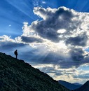
This is the big one. We marked it on the calendar months in advance. Stacks of gear and supplies collected in the corners of the house, then crept inward. Maps spread across tables and then expanded to the floor. As August appeared with surprising speed, we made trips to the store nearly every day. Bars and freeze dried foods piled high. Bins of gear emptied onto the living room floor. Soon ropes were coiled, gear racked, food packed, and spirits high, ready for a final hoorah before the return to school. We were going to the Weminuche Wilderness. I have climbed all of the 14ers but Pikes, and now hunt the Centennials. Starting as a freshman (this Tuesday), I am hoping to be the youngest to climb the cents, and am yet to find anyone younger than 17 to finish them. I was sitting at 79, my dad at 81, and hoping to get a big trip down to the San Juans (almost all of my remaining ones were there) before school. I debated going for volume on the easier ones, but settled instead for a cool family backpack in the needles. The planning began months in advance, and soon we had decided on an 8 day trip, one for Teakettle, then a 7 day backpack from Needleton to Elk Park, using the train one last time, to collect Pigeon, Turret, Jagged, and Vestal. Note: I know that the following format is not ideal for the reader, but with only a couple hours to work on this before school starts, convenience in writing was my primary goal. If you are looking for info on a singular mountain, just scroll to it. Sorry for the inconvenience. Day 0: The Warmup Summits: Teakettle Mountain 13,819 Mileage: 4.8 miles Vertical Gain: 2,800 feet Climbers: Camden and Dad Time: 5ish hours 
What I have read: worst chosspile in the state. Absolutely sucks What I experienced: a short section of loose rock on the approach, then connecting cool weaknesses and finishing it off with a fun climb up an interesting summit block. 
We slept in our pop up camper at 11,300 in Yankee Boy Basin, and enjoyed a spectacular meteor shower that night. We started hiking around 6:30. Overnight, catastrophe! A wall of smoke had enveloped us during the early morning. An AQI of 180 prevented views of any peaks. We unenthusiastically started trudging towards Teakettle, across from the outhouse. From the small boulder field just north of the trees, we chose the broad, right gulley. It is basically just steep grass. Reach the top of the gulley and tree line at 11,800. We continued up and left on grass, careful to get east of the ridge coming off of the Coffeepot. We moved into the sun as the slope transitions from firm grass to loose rocks at about 12,600, but couldn’t feel it’s much needed warmth through the thick smoke. 300 feet up the rightmost gulley on the face lead to a cliff band. We escaped to the right. The next 200 feet above the cliff band are the worst on the route, with potential for a moving hillside in some spots. Persevere and at 13,200 start traversing left, until reaching a cairned shoulder at 13,300, below the coffeepot. The view from here is discouraging, as the loose descent looks horrendous, and the Black Couloir appears nothing short of impossible. 
We began down the obvious trail, and found that it was loose, but not nearly as bad as we had feared. The trail drops below some cliffs, then ascents to the base of the Black Couloir at 13,200. As you come around the corner into the couloir, a shock awaits. The gulley is deeply inset at the back. The previously-impossible looking couloir is really low angle. Hop up the astounding weakness until it steepens. Climb left out of the couloir. A few moves of fun 3rd class over a chockstone bring you to a large flat area with dramatic cliffs above and below. The wind was howling, the temp 43 and the sun obscured by smoke. Brrr. The face you are on is as complex as it gets. Traverse left on the vast exposed ledge. We spooked some bighorn sheep here. The cliff above relents, and the obvious sandy gulley provides a passage. The ball bearings here are deep, providing good footing, but lots of rocks in the approach shoes. If you don’t mind the extra weight, it might be worth wearing boots, then trade into approach/climbing shoes for the summit block. 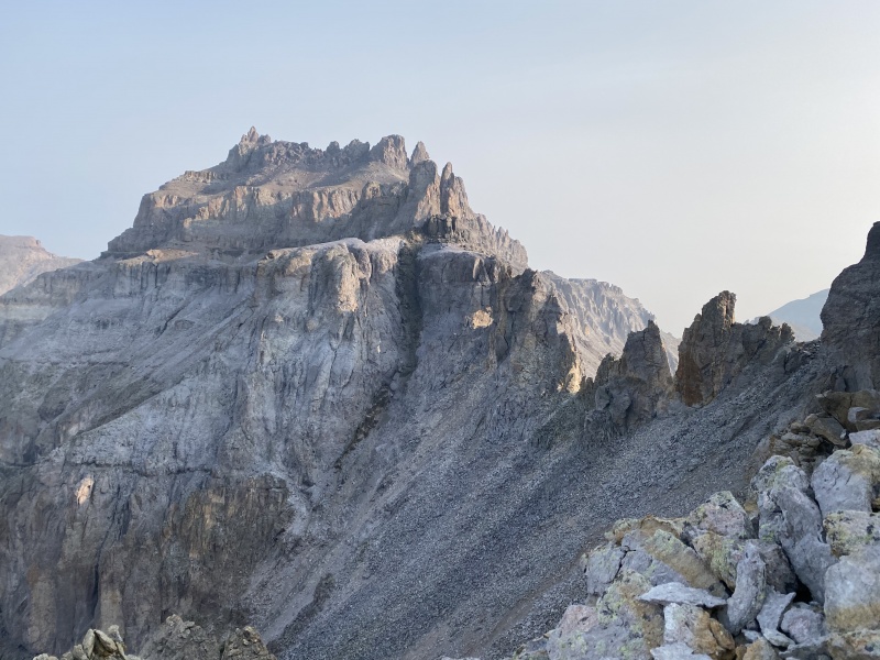
Reach the ridge for the first time at 13,600. Cliffs soar above and below. I bet the view is great. I wouldn’t know. We couldn’t even see Gilpen Peak or Mt. Emma across the creek. Traverse left on another ledge, until a passage through the scruffy cliff above presents itself. Climb the class 2+ ball bearings and then crest a horizon. Gasp. Is that an arch? Wow! The teakettle is perfect. I have never seen anything like it in the alpine. Only in Utah’s canyon country have I seen similar features. 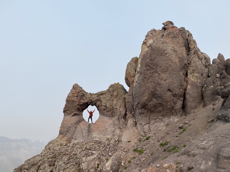
After taking the mandatory arch picture, scamper up a steep gulley to the the ridge (2+), east of the summit. Pull a few moves of 5.0 onto a ledge hemmed in by walls on 3 sides. Stem up the insecure chimney. I thought it was 5.3ish. We used a number 8 nut and a 0.75 Camelot. As of August 7, 2021, the anchor was fantastic. The summit is a 3 by 4 foot block. The smallest of the centennials I have visited so far. The rappel is about 30 feet long, but if you swung out to the right, you could limit it to 20. After rapping, we enjoyed lunch at the base of the teakettle, and talked about what all mountains we might be able to see. We descended to the truck, and drove over red mountain, molas, and coal bank passes to Durango. We checked into our hotel, and spread 120 lbs of gear and food on the tiny floor. We packed everything tightly, then slept, knowing we wouldn’t see a bed for a very long time. 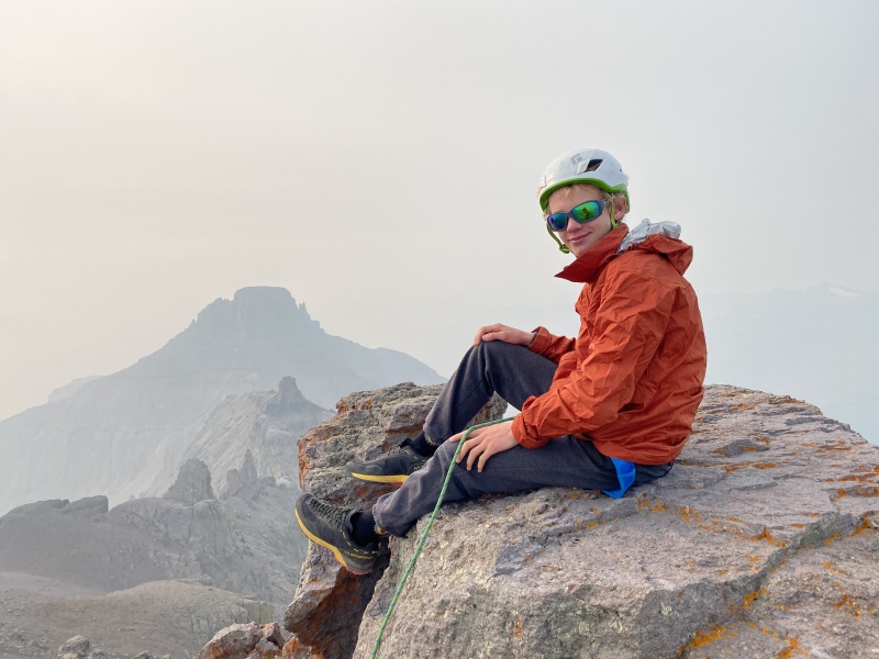
The Backpack Summits: Pigeon Peak 13,972, Vestal Peak 13,864, Turret Peak 13,835, Jagged Mountain 13,824, Trinity Peak 13,805, Arrow Peak 13,803, East Trinity Peak 13,745, Peak 7 13,682, Leviathan Peak 13,528 Mileage: 38.5 miles Vertical Gain: 27,200 feet Backpackers: Camden, Michelle, and Tory Time: 6 nights Time over 12,000 feet: about 84 hours Day 1: North pigeon creek backpack + pigeon peak Summits: Pigeon Peak 13,972(Climbers: Camden, Mom, and Dad) Mileage: 5.2 miles Vertical Gain: 5,800 feet Time (does not include setting up camp, but does include all other stops): 7.5 hours Note: For those who haven’t taken the Durango to Silverton Narrow Gauge Railway, you should. It is expensive, inconvenient, and slow, but saves days worth of hiking and after the first 2 hours next to the highway, it turns into the Animas River Canyon, and becomes absolutely incredible. It is part of the Needle Mountains experience. This was the big morning. We had packed everything over and over until it all fit into our packs just so. The smoke was much better today (~130 AQI). We arrived at the train station, and hopped onto gondola (open air car) 22 and found our seats. The train started moving through durango, loudly whistling at every single road. Soon we made it out of town, and the scenery slowly improved. We chatted with a friendly couple that was headed into Chicago Basin. Eventually, we left the highway. Suddenly things got interesting. This was my third train ride (once as a family gathering, twice for mountains), and still I was gasping with all the tourists as the train winds along the cliff face, the Animas river below. Then Pigeon Peak and Turret Peak greeted us. They were faint in the smoke, but still one of the most impressive sights I have ever seen from the comfort of a vehicle. 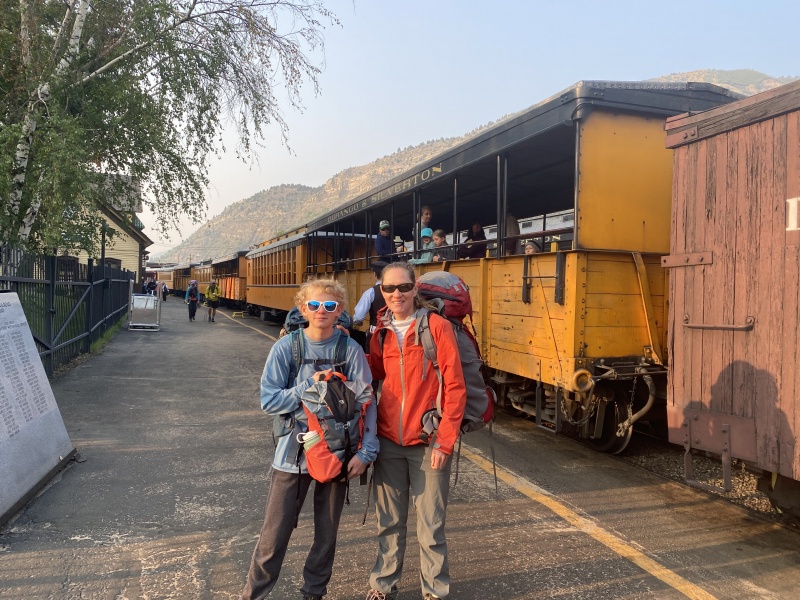
We hopped of at needleton, took the required Bridge Photo, then started on our way. 
We walked to the meadow on the other side of Pigeon Creek, and set up a bear hang, stashing 25 lbs of food, 10 lbs of climbing gear, and a large fuel canister. We started up the Ruby creek trail, crossed N Pigeon creek at 9,500, and at 9,800 feet, reached the famed Columbine Carving. To this point, the trail is steep, but well beaten and efficient. 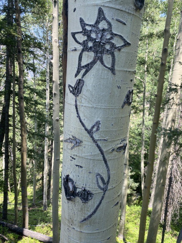
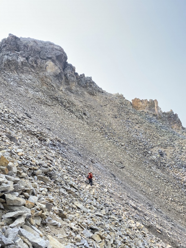
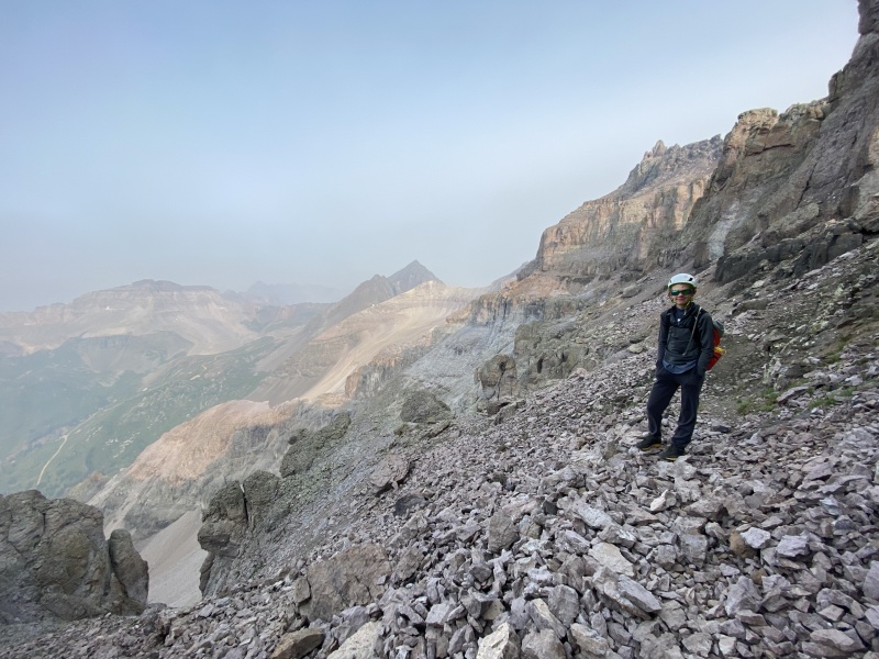
We turned right onto a faint trail at this point, rather than continuing up the ruby creek trail. After about 2 minutes we encountered a sweet smell. Further inspection; the groundcover of the entire forest is covered in little purple and maroon berries. A closer look, thousands upon thousands of wild blueberries and huckleberries. After consuming handful after handful of delicious fruit, we continued on our merry way. The trail immediately disintegrated into occasional cairns, then to steep talus with fallen logs that you must do an ascent traverse across for 1,200 vertical. The route finding isn't as bad as Canon Diablo (nonstandard route on Phoenix peak...), but it is really hard to figure out where to go. There is a long section with no trails, no cairns, and no signs of human presence. We reached a bench and sighed with relief as the going got much easier. At 11,300, the hateful valley gave one last attempt at thwarting us. A cliff band blocked easy access into the upper basin. we stayed south of the creek, and had to do some wet 3rd class along with steep ball bearings, covered in downed logs. North of the creek is likely much better, but the creek and deadfall prevented easy passage, so we struggled up on the south. As you crest the next ench, there is suddenly a heavily trodden trail. It just starts as soon as you don't need it, and ends in some incredible camp spots in the meadow at 11,800, below the astounding west ridge of Pigeon Peak. So annoying... why could that not have been lower down? Note: On the way down, we still found the upper cliff band to be super obnoxious. We then found a minor use trail in the lower angle section between 11,300 and 11,000. we followed the trail all the way across, and it did all the traversing that needed to be done, then suddenly ended, leaving you 1,000 feet above where you want to be. this slope was steep talus with deadfall, and very little fun to be on. From the end of the obvious fork off of Ruby creek trail at 10,000, the two options we found were going up then right over and over until we reached the upper basin, or going straight up until reaching the use trail, and following it over. I would probably recommend option 2, but neither are great. Anyway, we set up camp in the idyllic meadow, then checked the clock and decided we had time for a stab at pigeon. We climbed up the grassy bowl around granite slabs. You cannot go wrong here. Stay left out of the rubble gulley. At 13,000, grass ramps allow an ascending traverse right, into the loose gulley. The decomposing granite pea-gravel in the gulley is loose and obnoxious. At 13,600, a rock wall blocks access to the ridge above. Traverse up and right, and negotiate intimidating cliff bands. With meticulous route finding, the route through here can be kept at class 2+/3-. Reach the minor saddle between the two summits walk east to the highest point. In Gerry Roach's guidebook Colorado 13ers, From 13,800 to 13,999, he says this is a class 4 route, and mentions a chimney. I found none of this. 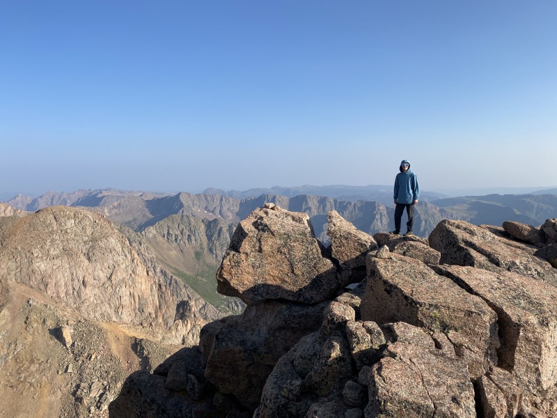
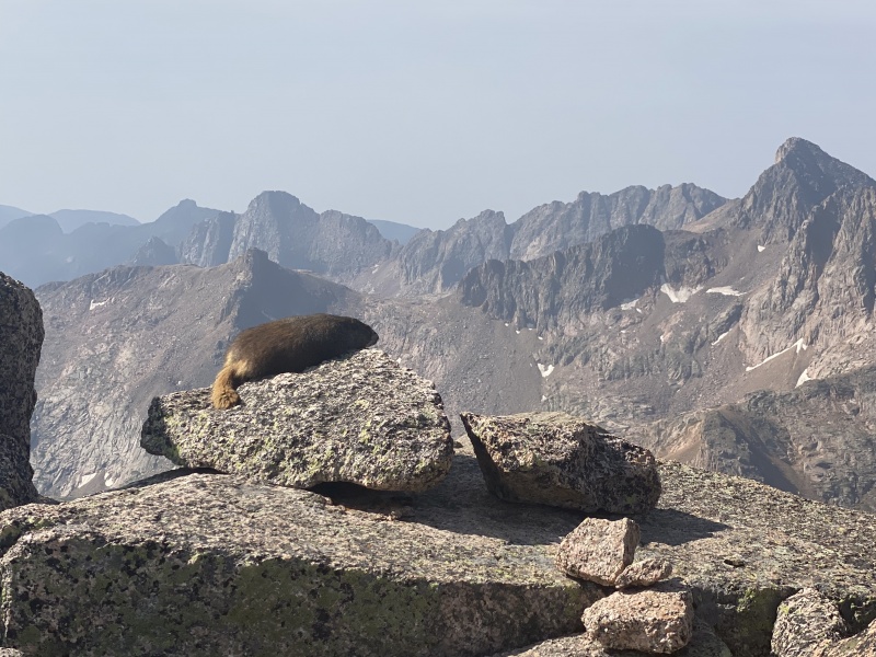
after lounging on the summit for a while, we descended during the last hours of light. Around 12,200, we encountered an ermine (also known as a short-tailed weasel or a stoat). the tiny adorable little creature bounded along with us. curious, yet cautious, leaping down the hillside in front of us, disappearing into the rocks then appearing above us. It was the cutest thing I have ever seen. Watch for these little guys, out of our wildlife sightings on the trip (bear, moose, marmot, goat, bighorn, deer, and pika) this little dude was by far my favorite. And that wasn't the only treat that evening. The smoke was disappointing during the day, but in the evening, it made for magic. 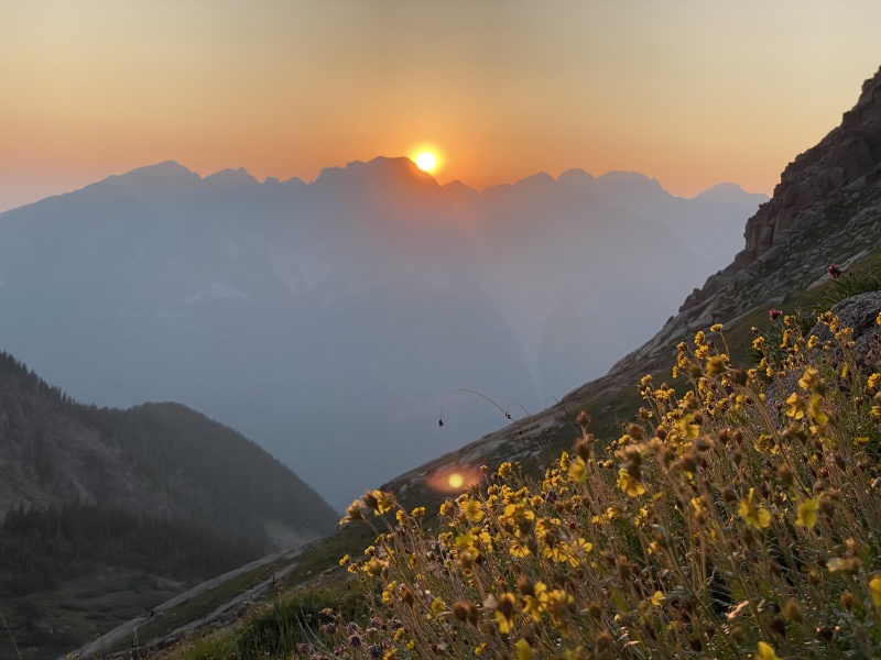
It got dark just as we tore into our dinner. We climbed into our tent and enjoyed much needed sleep. Day 2: Turret Peak and descent to Animas River Summits: Turret Peak 13,835(Climbers: Camden and Dad) Mileage: 8.4 miles Vertical Gain: 2,400 feet Time (does not include setting up camp, but does include all other stops): 9.5 hours We woke up to frost and frozen water bottles. And a split camelback bladder. Our 6 liter water storage is down to 4. We quickly started walking towards the saddle on the south side of Pigeon. We made short work of Turret. There is no route finding, it is class 2 but no harder, and easy fast walking the whole time. We spent forever on the summit enjoying the view, then dropped down to camp, and packed up. We bushwhacked back down to the ruby creek trail, then followed it down to our stashed gear. Our packs became very heavy. The Noname creek trail is hard to find leaving the meadow 0.4 miles north of Needleton station. Enter the northern lobe of the meadow, then walk until you find a tree fell into the meadow on the left of the trail this spring. Turn 20 feet after that, and find a faint trail about 150 feet into the trees. Follow it into another, lower meadow. The trail disappears. Move north until the faint trail picks up again. Follow it across north pigeon creek, and finally the trail becomes stronger. The going is easy, until a steep hill about 100 feet tall. Drop back down until you are near the river. Climb 200 feet up the hot, dusty, steep Watertank Hill. This is obnoxious. Then descend the "Legendary Watertank Hill." It is well known for being "steep and terrifying" and Roach says that "many parties make good use of a rope here." The whole thing is a joke. I walked right down it with a pack 40% my weight. It isn't even class 2. 
We continued along the river, crossing Ruby Creek on slippery boulders, then reaching Noname Creek after some nasty deadfall. Noname would have required a forn, but I spent 5ish minutes stacking rocks in the creek until we could hop across very carefully. I am the only one who kept my feet dry. we camped at the nice site right on the river, just past the cairned trail heading up noname creek. We were absolutely exhausted, and enjoyed some recovery cheesecake (from powder) Day 3: Animas River to Leviathan Tarn via Noname Creek Summits: None Mileage: 8.8 miles Vertical Gain: 5,100 feet Time (does not include setting up camp, but does include all other stops): 8.5 hours We started up the cairned trail, and were surprised by its quality. it looks like it may have once been dug in by the forest service, which is weird, because the trail segment along the animas had definitely not been. 2.5 miles of quality trail with very few downed logs leads to 10,000 feet, above the creek to the north. The steepness relents and the trail traverses and climbs gradually through significant areas of deadfall, until finally regaining the creek. the trail follows the creek for a while. negotiating a ton of deadfall. Then suddenly the trail disappears. Into a 15 foot tall wall of fallen trees. Climb it, and hop from log to log, as they roll, crack and teeter totter. This is the most dangerous part of the approach, as the logs are really unstable and could easily cause serious injury if you fell. We broke through the fallen logs, and continued through the following meadow. This meadow appeared benign, but was really quite terrible. there were still large trees to negotiate, but the waist high fireweed concealed tripping hazards, and this was very frustrating. Reach the other side of the avalanche path, and another wall of wood. This second one is not as bad as the first, but still not fun at all. Cross the piled trees, and find the trail picking back up in the forest north of the creek and east of the avalanche path. 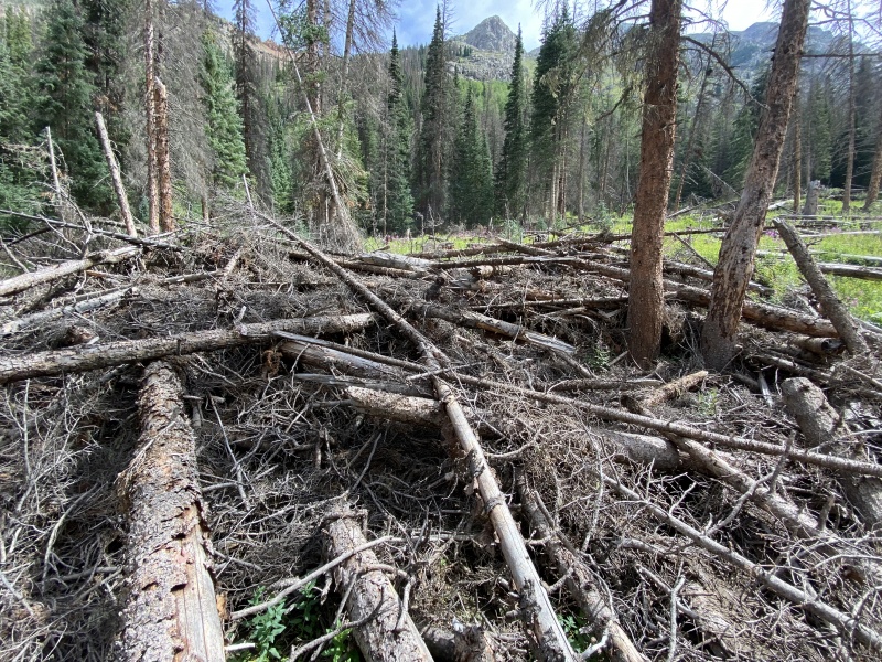
Enjoy the much needed reprieve, then enter the next meadow. This meadow is 3/4 mile long, and a good trail exists all the way through it, there is no logjams, and very little vertical is gained. It should be less than 20 minutes. Except... huge downed trees must be negotiated every 20 steps. Never piled up like earlier. No one offender is problematic. But the sheer volume with drain time and energy at an astounding rate. There is a mudslide in this area. It is the easiest section to cross in this meadow. scary how much of the mountain came down though. Another headwall leads to 10,700, where the broken remains of a cabin can be found on the left. Another 3/4 mile long meadow awaits, but thankfully there is little to no avalanche debris in this one. In this meadow there is a second mudslide. There are also abundant harebells, fireweed, and gension.
We passed a tent in a nice site, then by some miracle I noticed the tiny indistinct trail leaving on the left, an itty-bitty cairn marking the junction. This trail climbs steeply up a headwall to 11,000 feet. Cross through an idyllic meadow with camping and a spectacular view of knife point and Peak 10. Start up the next headwall. This is where a lot of the remaining vertical is gained. The steep trail is a lot of work, but at least the views are nice.
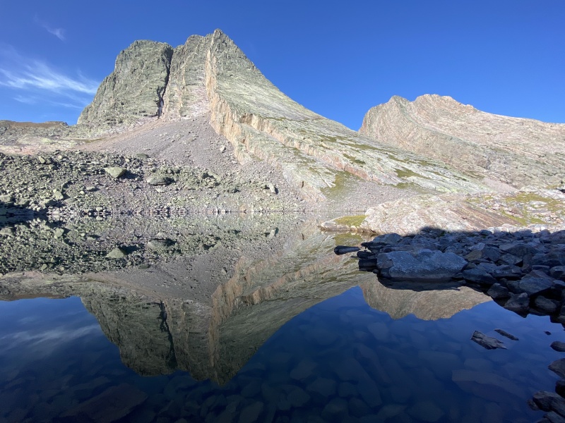
At 11,800, reach the next bench, and a perfect campsite overlooking a gorge. The mosquitos were a non issue the whole trip, but here they were absolutely terrible. Just the wrong elevation I guess... but the same elevation in north pigeon creek had very few, so kind of weird. Another small step, followed by a long traverse, brought us to a small but beautiful lake at 12,200. The flowers here were spectacular. We started the last leg of our climb up to jagged pass at 12,700, we stopped for water, and realized our single bottle that still had water was missing. I descended back down to 12,000, checking every rock and crevice, before giving up. I filtered water into one of our three remaining litres, and defeatedly walked back up the pass. If anyone finds a green Nalgene... We reached the 13,020 foot pass, and found the other side to be 60° grass, which we didn't want to deal with carrying our heavy packs. We traversed out to the right, then descended the boulder field down to a glorious campsite near a spring, above Leviathan Tarn. This perfect place is untouched by mankind. If you choose to camp here, please keep it that way.
Day 4: Leviathan Tarn to 7-8 Pass via Kodiak High Route + Jagged Mountain and Leviathan Peak Summits: Jagged Mountain 13,824 (Camden and Dad), Leviathan Peak 13,528 (Camden, Mom, and Dad) Mileage: 4.8 miles Vertical Gain: 2,700 feet Time (does not include setting up camp, but does include all other stops): 11 hours Here is the big day. Jagged Mountain. Longest approach of any centennial. 5.4 crux. Here goes. 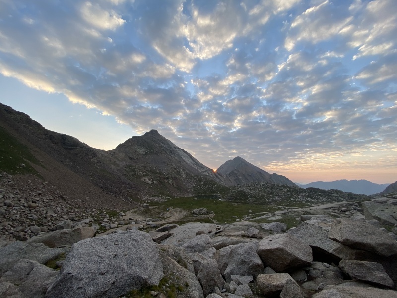
We started hiking around 6:45 and quickly ascended to the base of the climb. Nice view from here. 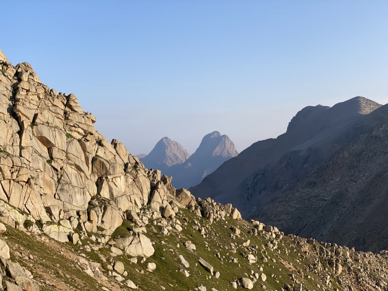
We had a hard time locating the first crux, as Gerry Roach's description is pretty useless right here. He says "a 10 foot tall 1 foot wide vertical crack, class 4." This is not at all accurate. The crack is about two feet wide, 3 feet tall, and is located 20 feet off the ground. It is also not anywhere near vertical. It might be easy 4th, although I would call it 3rd. 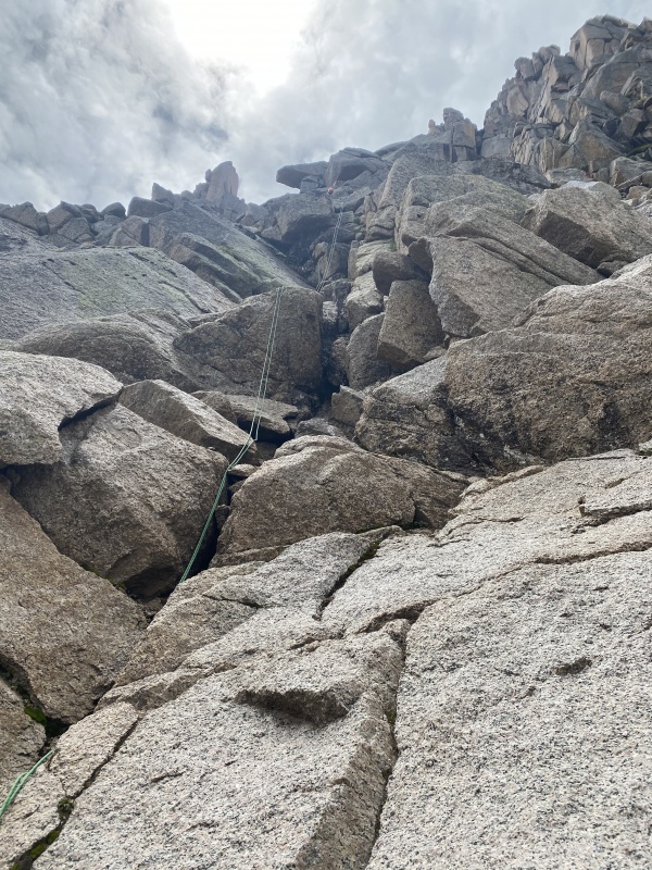
Above the crack, scamper up exposed low 3rd class, with a single move of 4th, to the anchor. This is the top of the first crux. I enjoyed having a rope for the single mve of fourth, as it involved a committing high step, but it would be very reasonable for a competent team/climber to forgo the ropes on this first section. 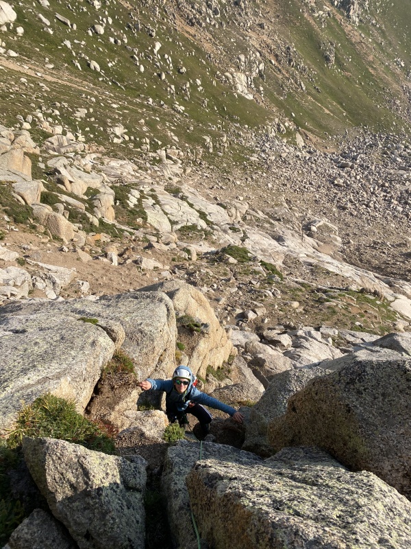
According to Roach, the first crux is the 4th class ramp after this that is covered in ball bearings. We never found it. From the first anchor it is class 2 with occasional 3rd to the second crux. 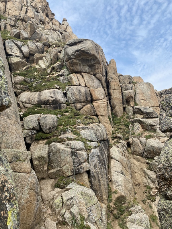
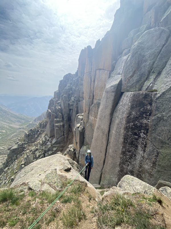
The second crux is a short rock band that must be navigated to exit the minor couloir. Going directly up the rock band is an awkward 5.6 crack. This is the Morons' Chimney, for all the people in the world who just aren't very smart. Roach specifically says not to climb this crack, but to instead descent 20 feet then bypass the rock band on the right with a single move of 4th class, no rope required. We read his description, then went straight up the crack. Continue up class 2+ grass until a 20 foot rock band blocks access. There are two systems to choose from. We chose the right system, and climbed the left crack of the two in the system. It felt like 5.2 and was surprisingly fun climbing. A rope was really nice to have here. 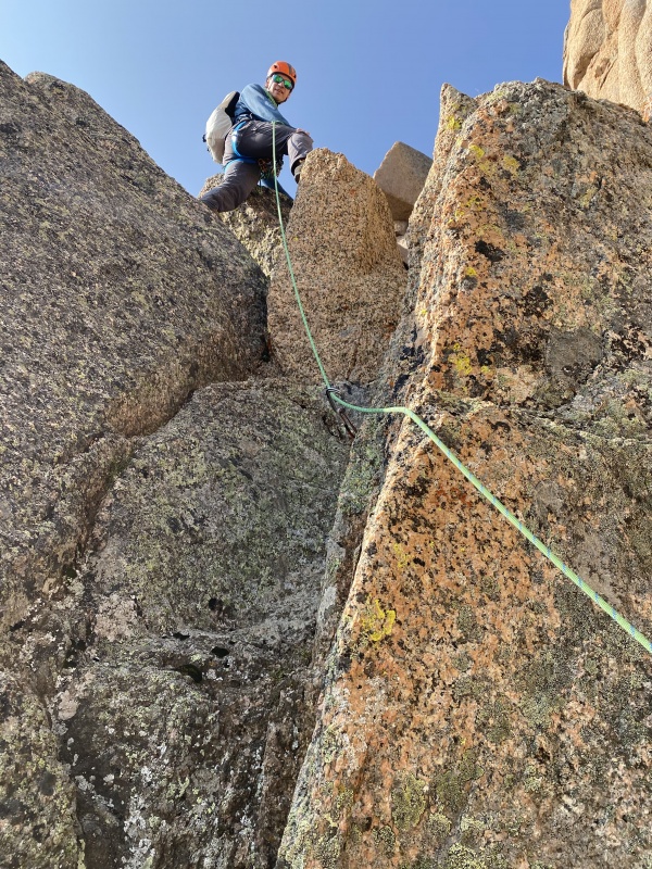
From the top of this, 30 feet of exposed ball bearings lead to the notch west of the summit. The view did not fail to impress. 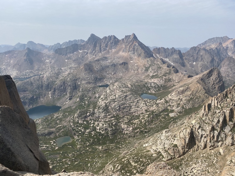
The traverse to the east across the south face is 3rd class and deliciously exposed. I thought the hardest part was an airy step across with very poor hands, so you must trust in the rubber of your footwear. 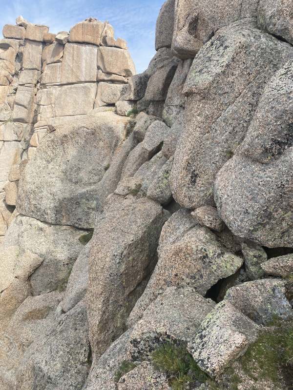
That last picture is taken from the first large sandy ledge. The final pitch does not start here. 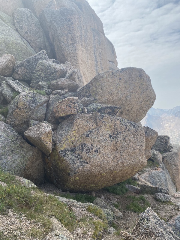
The crux chimney rears its nasty head as you come around the corner. 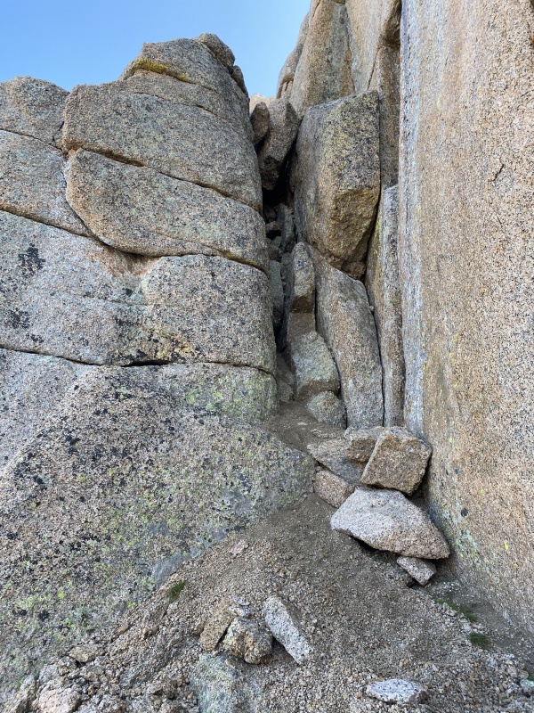
I found that the best way to get up was by having both feet on the left wall, and my back against the right wall. I moved upward like this until I could grab and pull over the chockstones. Above here some really fun and exposed 3rd class climbing brings you to the ridge. 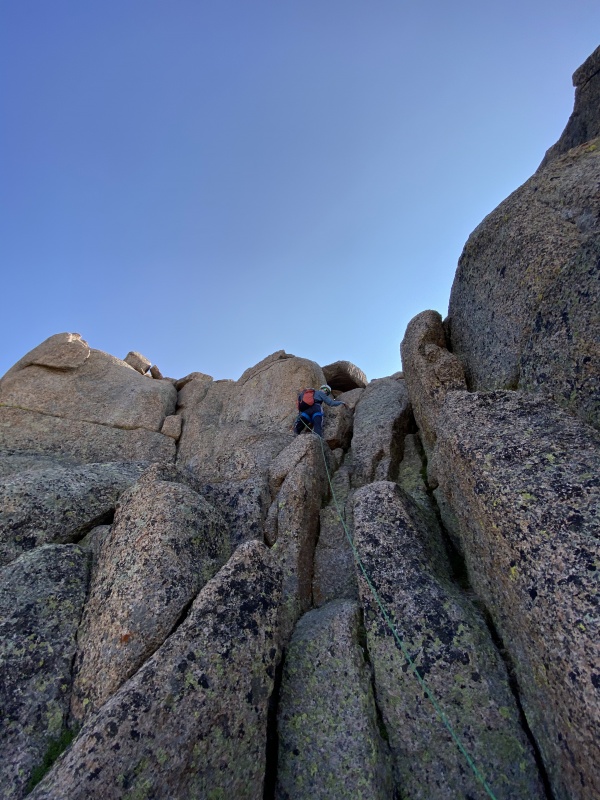
Once on the ridge it is class 2 boulder hopping to the summit (it is to the left of where you gain the ridge). The summit is well equipped for lounging. 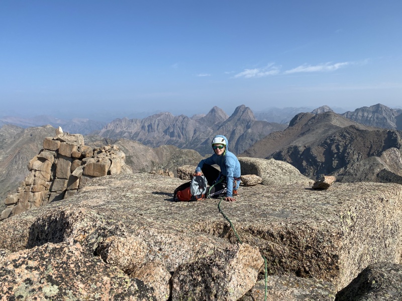
After enjoying a summit treat and the spectacular view, we started down. The first anchor was busted. 
So we reinforced it (on August 11, 2021). 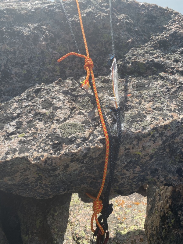
We safely rappelled back to the ledge. 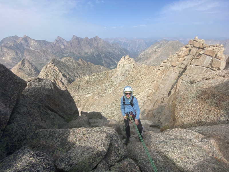
We then traversed to the notch, inspected the anchor and started our second rap. 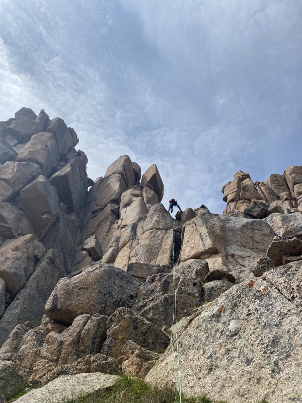
We safely made it down. Nice flowers. We packed up camp and headed up Leviathan Pass. We made a quick trip up Leviathan peak. I would call it class two plus. Follow the ridge to a major false summit, then drop off the left side of the ridge to bypass the notch. continue up on the ridges left side, connecting weaknesses. The from the summit is spectacular. We then returned to our packs and descended the north side of Leviathan Pass. The Kodiak Route is really slow through here, as it includes 3 miles of meandering boulder hopping, often unstable. From Peak Seven Pass we enjoyed a nice view back south. 
We had intended to sleep at the tarns a t 12,200 in the upper tenmile creek drainage, but the gruelling talus drained energy and time, so we stopped on the continental divide at 7-8 Pass. 
Day 5: 7-8 Pass to Vestal Lake via Kodiak High Route + Trinity, East Trinity, and Peak 7 Summits: Trinity Peak 13,805 (Camden and Dad), East Trinity 13,745 (Camden and Dad), and Peak 7 13,682 (Camden and Dad) Mileage: 6.4 miles Vertical Gain: 5,600 feet Time (does not include setting up camp, but does include all other stops): 9 hours We woke up to a major issue. My dad's phone, which is the family GPS and camera, which we thought was fully charged, wasn't. The fancy new battery we had for recharging the phone had died. Perhaps the cold got it? Anyway, from this point on, I have very few pictures to share. Because we had not made it as far as planned the previous night, but mom didn't want to get up early and move camp, we pulled some wacky logistics. Me and Dad descended 600 feet from camp, climbed Trinity and East, then returned to camp, climbed peak seven, went back down. into the valley, then went up and over trinity pass. Knowing little about the routes on these 3 peaks, we found something that worked up each one, but ay not have been the easiest way. I will explain what we did on each. From the base of obvious rock gulley leading into the Trinity/east saddle from the south, we ascended class 2+ loose rocks to 13,200. A clear weakness presented on Trinity's face in the form of a gulley. We followed this couloir upwards. After negotiating some 3rd class we joined a cairned route, and followed class 2+ ledges in the gulley directly to the summit, careful not to get to far right. On our way down, we followed the cairned route to the 13,400 foot saddle. This avoids all class 3 climbing on Trinity. East Trinity is terrifyingly steep from this saddle, and looks really hard. To cross the inset couloir leading to the saddle, descend 150 feet south, then cross the gulley and climb northeast up class 2+ ledges until reaching the main couloir on the imposing west face of East Trinity. Follow the class 2 gulley, avoiding a rock band on the left (class 2+) When the gulley steepens and splits, take the smaller right fork. There is exposed class 3 in this section, and not all the rock is good, so use caution. At the base a vertical orange wall, we traversed right, and found a weakness that gained the tiny southwest ridge (class 2+ ledges). Come around the corner to find an impressive view east to Storm King, Silex, and the Guardian. From here, prospects don't look good for summiting. The broken south face is a maze of loose rock and dead end ledges. Do not engage it. Instead, traverse right around a tiny step in the ridge, then climb back up to the ridge. Meet another step, and do a short traverse across a sloping slab with a lot of exposure. climb and obvious weakness to a notch in the ridge. This is very exposed, arguably 4th class, and not all the rock is good. The definitive crux of our route up East Trinity. Traverse along the west side of the ridge, until you reach another notch. Step through to the east side. You have cracked the egg. Walk up easy but exposed class 2+ to the summit. We descended the same route then slogged back to camp. Peak 7 is more interesting to climb than it first appears. From the tiny lake on the continental divide at 12,800, walk up boulders to a saddle between peak seven and a huge gendarme at 13,100. Follow the ridge, traversing left to avoid minor cliffs whenever they block direct ascent. When the terrain eases, regain the ridge, then follow below the ridge to the right around another scraggy cliff. Regain the ridge and walk to a point overlooking a notch. Backtrack 20 feet, then follow a ledge system and downclimb a single move of 3rd to reach the notch. Start up loose class 2. As you gain elevation, exposure increases greatly, and some mild route finding is required to avoid 3rd class. Class 2+ slabs with ball bearings and exposure near the summit are arguably the trickiest section of this climb. We retraced out steps, packed up camp, and dropped to 12,200, then slowly started the long and arduous traverse to trinity pass at 12,900. We had planned on climbing West Trinity, but just didn't have it in us. Besides, the weather was a little suspect. We descended to Vestal Lake and camped. Day 6: Wham Ridge and Arrow Peak Summits: Vestal Peak 13,864 (Camden and Dad), Arrow Peak 13,804 (Camden, Mom, and Dad) Mileage: 3.4 miles Vertical Gain: 3,700 feet Time (does not include setting up camp, but does include all other stops): 7.5 hours We woke up and enjoyed nice morning light. We decided it warranted some of our remaining battery. 
We started walking at 6:45, and after ascending the obvious ledges and harnessing up, started climbing at 7:20ish. We immediately started simuling, but felt no need to put a piece in until the 3rd class above a large block perched on the face. The difficulty soon increases to 4th, then at a nice belay ledge, the crux rises steeply. We belayed this pitch. It was fantastic crack climbing in a spectacular location. I thought the hardest move was 5.0-5.2. I certainly enjoyed a rope but for many people it would be reasonable to solo up it. We continued up the 4th following the crux. At one point, the route circles around to the right side of the ridge. A class 2+ weakness allows some fast progress, but detracts from the quality of the climb, as it is rather loose. Pull a few moves of third, and reach the well cairned traverse. Follow it left until a weakness presents above and the ledge disappears Climb up, switchbacking right then back left on ledges. Class 2+ with some 3rd and occasional 4th. Step around the corner to the left, entering the east face for the first time. Follow near the ridge crest up class 2+ to the top of Wham Ridge. Follow a trail to the summit (class 2). 
The descent route is interesting... Roach cals it class 2+. I have often heard it described as class 4 moving hillside with death exposure. What will it be? After enjoying our summit treat, we started down. At first it is class 2. Then there is a point where you must choose between 3 gulleys. We chose the leftmost, and looking back from below, this was definitely the right call. Soon, short cliff bands block the way. we followed the path of least resistance and the boot beaten path. There was a significant amount of 3rd class on rubble strewn ledges with substantial exposure. I am generally really good about not kicking rocks. I kicked a grapefruit sized rock, and it went down to Tenmile creek. This is steep and dangerous terrain. Tread with care. Find a well cairned route and traverse right to the saddle between Vestal and Arrow. A trail starts heading down the scree slope. We took it. In hindsight, it would have been so much better to follow the ridge over the tiny point to the lowest point between Vestal and Arrow. Our descent required 300 feet down a true moving hillside. Absolutely terrifying. looking back, the gold colored rocks west of where we were look annoying, but not nearly as bad. We descended the rock glacier, and rendezvoused with reinforcements (Mom with food and water). We knew nothing about the route on Arrow, other than its supposed difficulty. We hopped onto the northeast ramp of arrow, and followed the class 2 slab until the cliffs above relented to scree. We continued along the slab, then turned right and gained the small rib separating the steepening slab from the next "gully" over. This is very important, and if you don't turn you will soon encounter 5th class. Once on the rib, follow it, route finding some to limit the difficulty to occasional 3rd class. The rib and associated gully end below a small saddle on the north ridge. Traverse up and left, connecting ledges to the summit. If you find yourself on anything harder than class 3, backtrack and find an easier way. The rock is great, but the ledges hold rubble. The summit is one of Colorado's best. 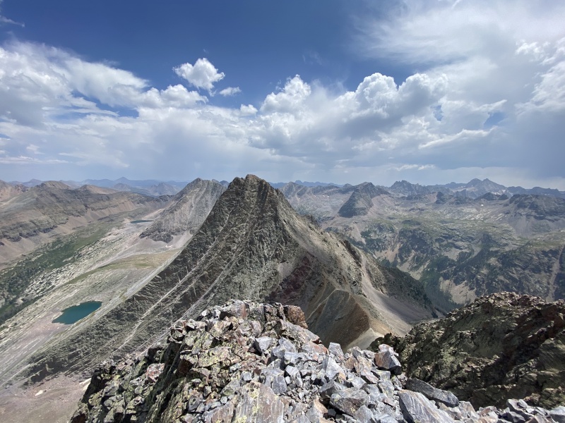
A darkening cloud to the south suddenly intensifies and started pouring on pigeon peak, and producing an impressive amount of lightning. We took the hint, and started down. We reached camp, played cards, then started making dinner. Just as we started eating, a storm moved in. We through on rain gear, gobbled up our meals, then dove into the tent. It rained for a long time. We finished our card game and talked about how great of a trip we had. Eventually, I fell asleep, and when I woke an hour later, the rain had quit, and last light graced the clouds above the Sneffels Range. Day 7: Vestal Lake to Elk Park Station Summits: None Mileage: 5.5 miles Vertical Gain: 700 feet Time (does not include setting up camp, but does include all other stops): 3.5 hours We were all tires and ready to be done. we had climbed all the mountain we were going to, and all desired a comfy seat and a large meal. We slogged out to the train stop, and were about an hour early. We washed up in the river, and ate the last of our food (we still had 2 Nuun tablets, but I don't think that counts). The train ride back took forever, and we were all so done by the time we reached our truck. We drove straight to a friends house, scarfed down a sinful volume of tacos, enjoyed badly needed showers, and stayed in their guest house. What a treat to enjoy such hospitality when you need it most! Thanks guys! 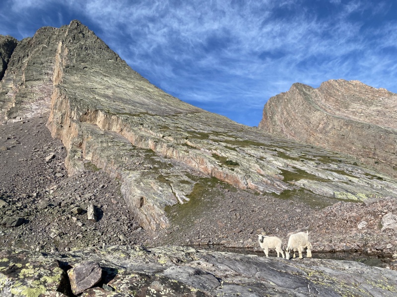
In all, this was a wonderful loop. Every peak we climbed was spectacular, and every valley we visited was gorgeous. I cannot highly enough recommend these dramatic peaks. We were incredibly lucky to have 7 days with few bugs and only one serious storm. All my previous Weminuche experience involves hours of pounding rain, so I was really grateful for the weather we received. If anyone chooses to repeat this loop, please help keep this pristine land natural and beautiful. Good luck out there everyone! Be safe! Thumbnails for uploaded photos (click to open slideshow): ")
")
")
")
")
")
")
")
")
")
")
")
")
")
")
")
")
")
")
")
")
")
")
")
")
")
")
")
")
")
")
")
")
")
")
")
")
")
")
")
")
")
")
")
")
")
")
")
")
")
|
| Comments or Questions | ||||||||||||||||||||||||
|---|---|---|---|---|---|---|---|---|---|---|---|---|---|---|---|---|---|---|---|---|---|---|---|---|
|
Caution: The information contained in this report may not be accurate and should not be the only resource used in preparation for your climb. Failure to have the necessary experience, physical conditioning, supplies or equipment can result in injury or death. 14ers.com and the author(s) of this report provide no warranties, either express or implied, that the information provided is accurate or reliable. By using the information provided, you agree to indemnify and hold harmless 14ers.com and the report author(s) with respect to any claims and demands against them, including any attorney fees and expenses. Please read the 14ers.com Safety and Disclaimer pages for more information.
Please respect private property: 14ers.com supports the rights of private landowners to determine how and by whom their land will be used. In Colorado, it is your responsibility to determine if land is private and to obtain the appropriate permission before entering the property.