| Report Type | Full |
| Peak(s) |
Vestal Peak - 13,867 feet Arrow Peak - 13,817 feet |
| Date Posted | 08/14/2021 |
| Date Climbed | 08/08/2021 |
| Author | yaktoleft13 |
| Additional Members | BKS, handonbroward |
| Double Whammy |
|---|
|
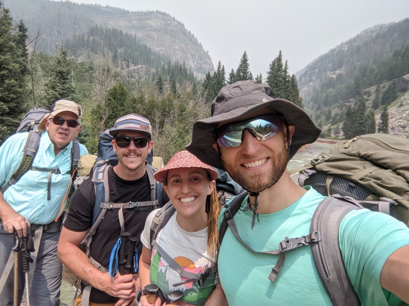
I'd had this trip planned for months. I took the whole week after my birthday off with the intention of climbing Vestal, Arrow, and the Trinities. My wife Amanda also took some time off, but had no interest in the 5.4 Wham, soloing or roped. Enter Brandon, an excellent climber I got out with a couple of times last year, who was recently freed from the confines of a crappy, all-consuming job (haven't we all been there?). I floated the idea to him, and despite not backpacking in 10 years, he was in. Then, in a fortunate twist of fate, my longtime hiking partner Brian got a respite from his busy construction schedule back in Kansas, and had a few days free to come to Colorado and adventure before returning to the home-building grind. He was able to confirm Thursday evening that he could make it, and Friday morning began the long drive from Eastern Kansas to Colorado. He arrived at our house at 8 PM Friday, crashed for a few hours, and we took off for the trailhead at 5 AM Saturday morning, with Brian, Amanda, and I in one car, and Brandon following in his. We arrived at the Molas trailhead after a lengthy drive and hit the trail around 11:45. We trudged through the smoke down 1700 vertical feet over four miles to the Animas River, cautiously optimistic that the gentle grade of the trail would make the reascent tolerable. 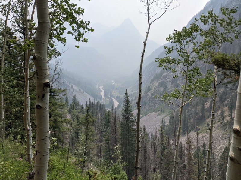
From the bridge crossing, we followed the tracks for about 100 yards before turning left to begin the ascent on the Colorado Trail. Since most of our approach route, at least until the beaver ponds, was on the CT, the trail was phenomenal: smooth, a mellow grade, and wide as you'll find in the Weminuche. After a mile and a half or so, Brian said he was starting to blister and needed to do some foot care. He stopped to fix his shoes, while the other three of us sat down on some rocks around a corner and filled up water bottles. The next thing we know, Brian came around the corner, pantsless. He explained that he hadn't brought shorts and his softshell pants/Goretex boots combo was causing sweaty feet and blisters, the solution to which was apparently underwear hiking. We didn't see him with pants on the rest of the weekend. Even though his solution solved the shoe problem, we all knew he just wanted to show off his legs. 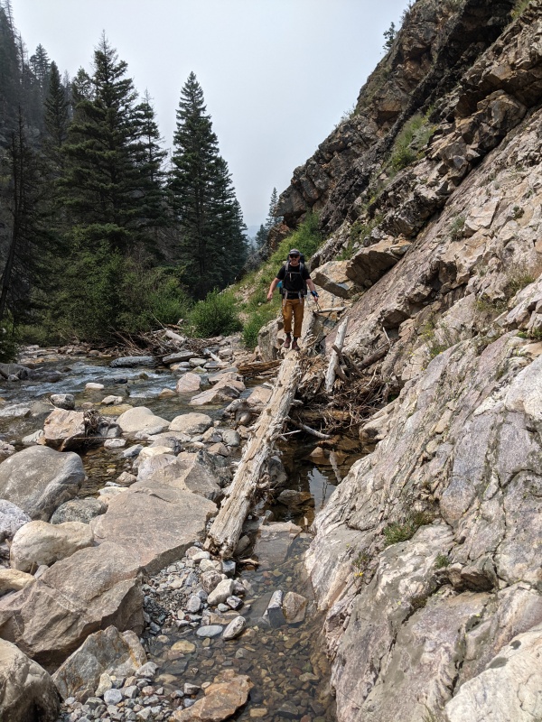
We made good time to the beaver ponds, where we took a break to gear up for the final push up to Vestal Basin. We were warned by a guy camping near the ponds that the trail was rough, but anyone who has hiked into any Weminuche basin other than Chicago will be pleasantly surprised. There was a very strong, defined trail all the way into the basin, and the only areas of fallen trees are between 10k and 10.3k, and are relatively minor (tell that to my head, which I whacked on every single tree possible). However, this trail was steep! It was tiring, especially with a very heavy pack, and the two-ish miles from the ponds to the basin took nearly as long as the eight to get to the ponds. On the bright side, once we got there, a group consisting of our friends Kirsten, Monica, Katie, and Becky were also camping in the basin, so we were greeted by some friendly faces after a long hike in. 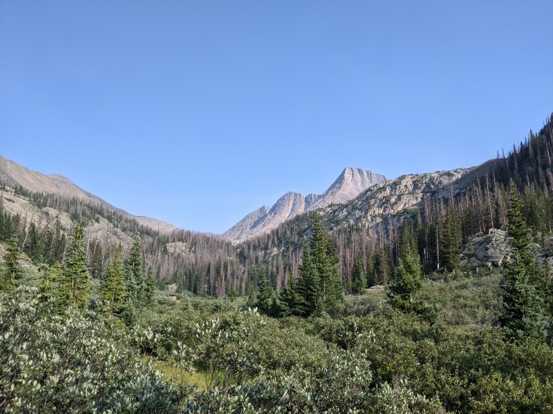
We set up camp at the far end of the basin in a stand of trees, filled up water, and made food. We chatted with Katie and Kirsten (the others had passed out after their Arrow/Vestal day), then hit the sack for a cold, sleepless night. The weather forecast for the weekend was perfect (other than the smoke), so we aimed for a leisurely 6 AM start. Day 1's plan was Brian, Brandon, and I go up Wham, then I'd walkie-talkie Amanda on the summit, and she'd meet us at the base of the Arrow ramp. We backtracked down the trail a couple hundred feet, found the turnoff for Arrow/Vestal, and started up the steep slope to reach the upper basin. Partway up the slope, Brian told us he wasn't feeling well and wasn't going to be able to make it up Wham today. He was dehydrated and dizzy, likely the result of being at near sea level 36 hours earlier. Dizziness and Wham Ridge don't mix, so we respected his decision. We stashed the rope and anchor-making material, as Brandon and I felt comfortable sans-rope, and now a group of two, we continued upward, while Brian worked to recover. 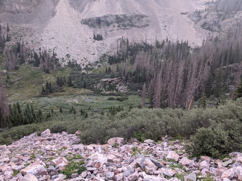
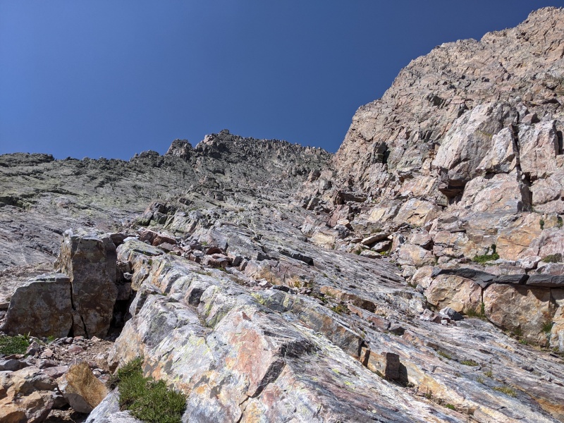
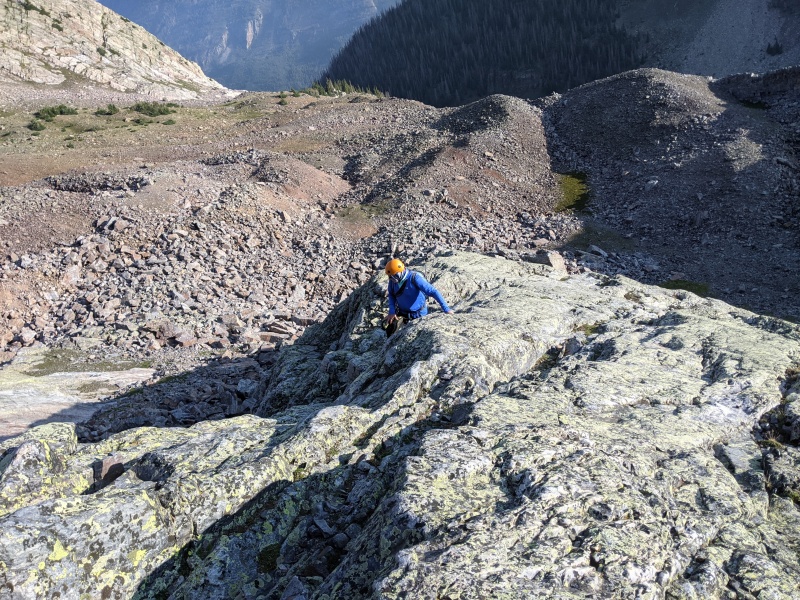
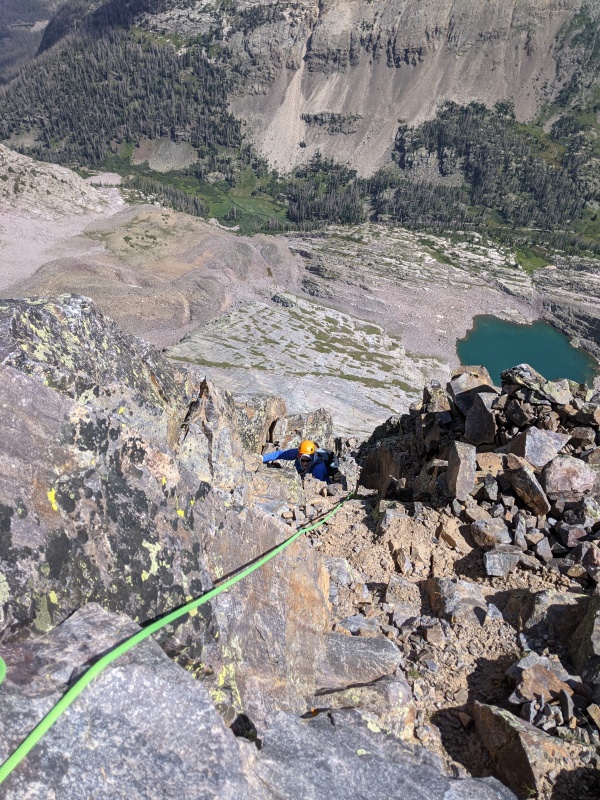
We both decided that we didn't want to waste any time getting on the rock, so we opted for a direct start up broken, greenish slabs, rather than following the wide swing out to the left on the grassy ledges. This start went at easy class 3, and, after a hundred or so feet, put us on the low angle slabs of the bottom portion of the face. It was easy class two slab walking and remained that way for several hundred vertical feet, until we passed the highest grassy ledge. 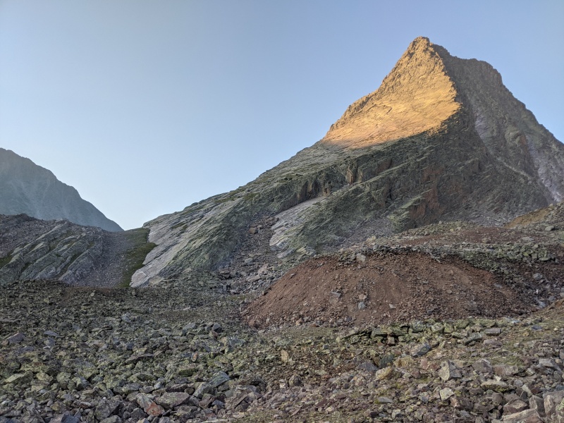
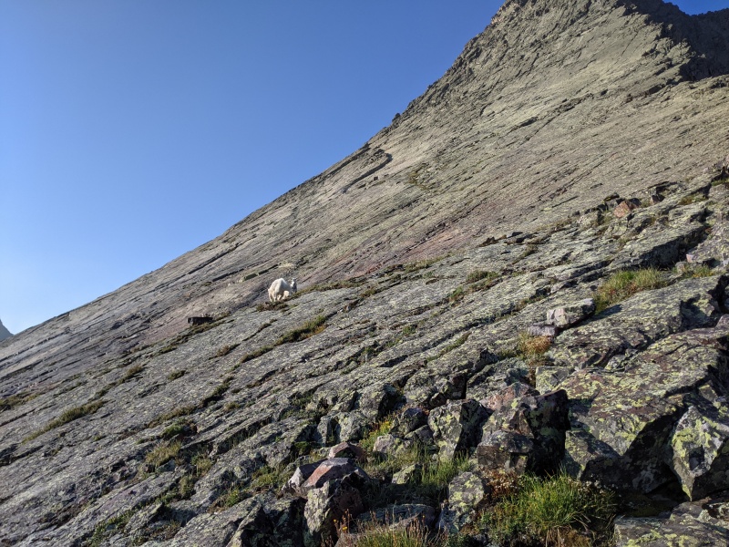
Once across the last grassy ledge, the steepness increased, becoming easy class 3. Routefinding didn't matter at all, because everything goes at approximately the same angle and difficulty. I smeared my way up the face and various cracks on the right side, while Brandon found a wide crack a couple hundred feet left that suited him. 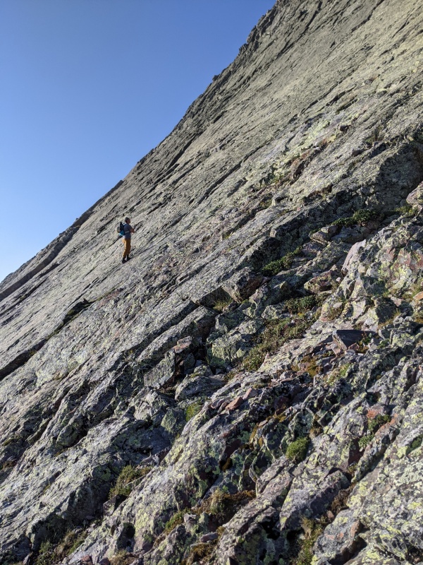
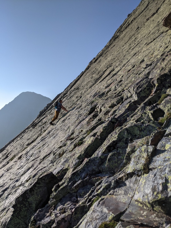
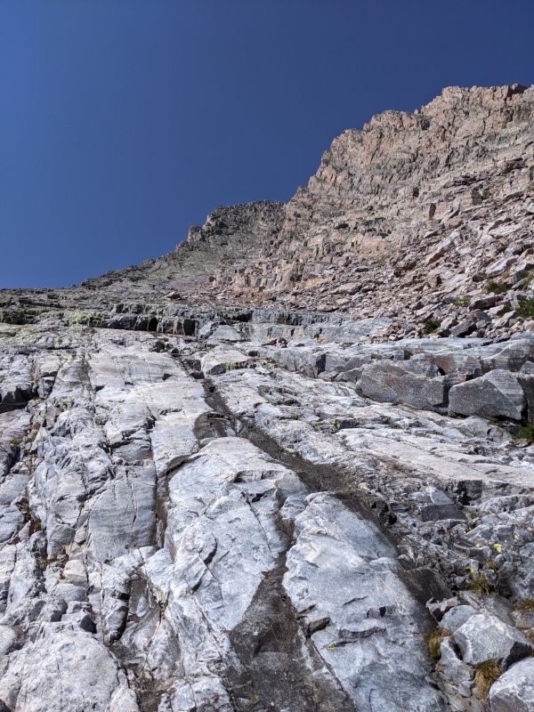
At the terminus of the leftmost crack, the angle ramped up once more. It was featured, blocky, and easily climbed, but was a notch harder than anything to this point. After about 200 feet, the climbing logically led to a ledge on the ridge, where we assessed the last of the slabby face. We stepped left about 15 feet below a an obvious crack, identifiable by a small alcove. We climbed through the alcove into a couple of foot jams, then scampered up to another ledge that marks the end of the slabs and the start of the blocky upper face. 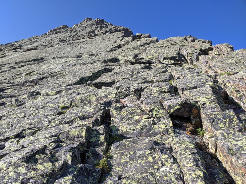
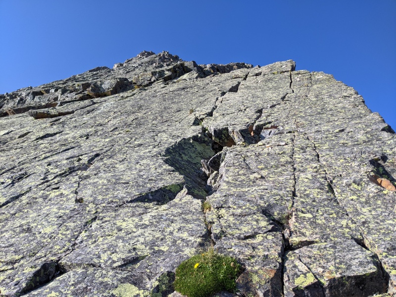
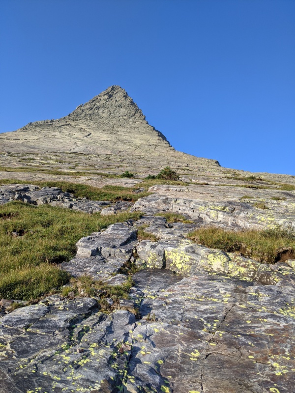
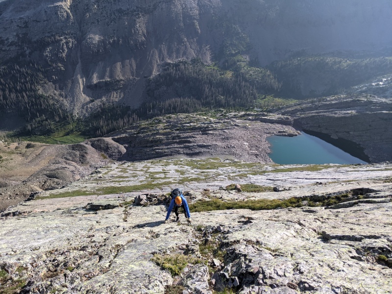
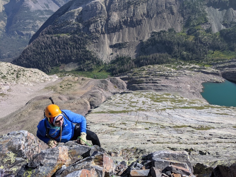
From here, the nature of the ridge changes. The blocky upper face features much ledgier terrain. It's also much longer than it appears, around 600 vertical feet. The beauty of the route we took is that everywhere we climbed, there was always a way to push upward that clocked in at no harder than easy fifth class. We stayed generally as right as possible on the ridge until we came to a steep slab that would likely go in the 5.10 range. However, we made an exposed step around to the left and found more featured terrain, which led straight to the summit. 
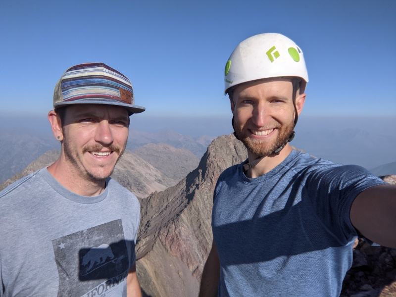
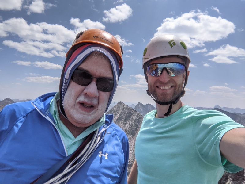
Two hours and ten minutes after leaving camp this morning, we topped the false summit and scrambled up to the true summit. Views from Vestal (or the smoke, who knows) were breathtaking! This marked Brandon's first San Juan summit; heck of a peak and route to start on! 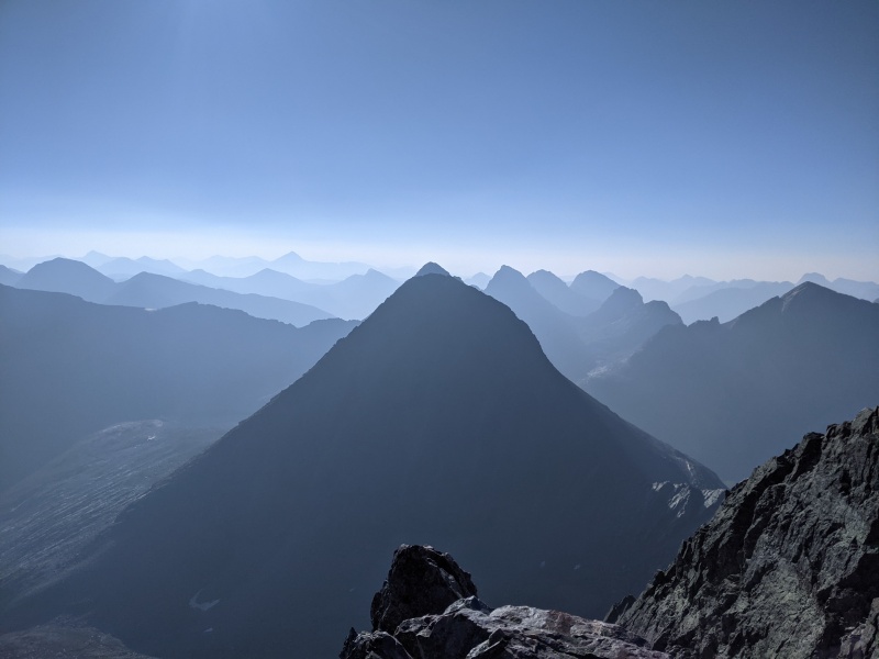
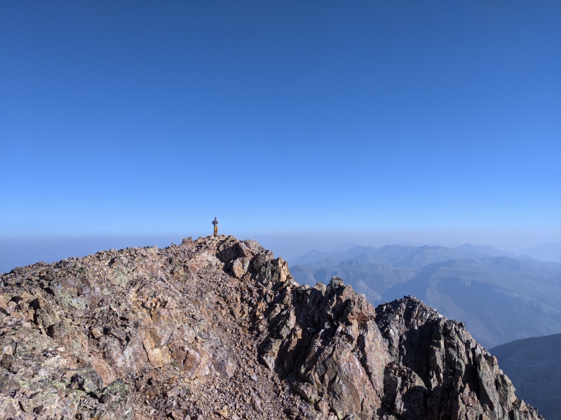
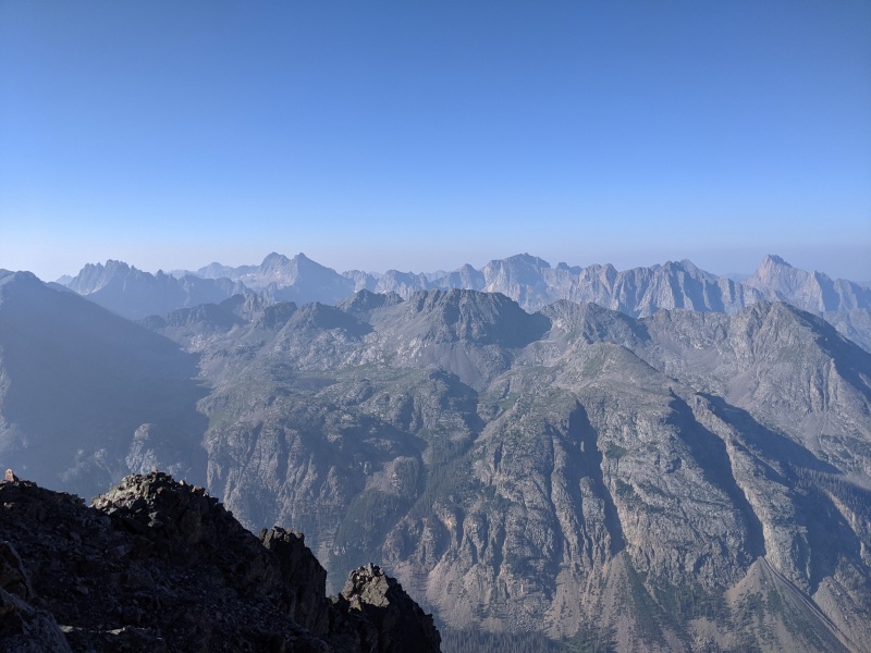
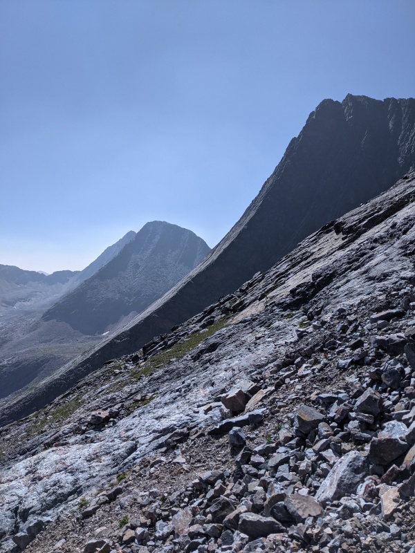
On the summit, we ran into a minor snafu: the cold temperatures the night before had drained the battery of the walkie-talkie I'd brought to radio Amanda to head up to Arrow. I tried warming it back up, turning it on and off multiple times, and changing settings, but it was dead as could be. We came up with a new plan: descend to the top of the steep slope above the basin and yell. Hopefully, Amanda would hear and start her hike up. This would only delay us by 30 or so minutes at the most, and since weather wasn't a factor, we should be fine. Worst case scenario, I'd hike down to camp, grab her, and we'd hike back up. The night before, the girls had cautioned us that we didn't want to take the first trail we found off of the Vestal summit. Rather, we should traverse further along the ridge and descend more toward Trinity than Arrow. However, we don't listen well, and we took the first trail we saw and descended about 800 feet reminiscent of Snowmass's west slopes. It was kitty litter on top of rocky ledges, with 15 foot class 3 downclimbs interspersed. But it wasn't particularly dangerous terrain, since we were the only people on the mountain, and we intercepted the trail to the saddle around 13k. The descent from the saddle was easy scree, but we honestly wished it was looser to get better surfing. Regardless, we were off the slope and on the lower rock moraine in about 10 minutes. There's a cairned trail that generally stays on the top of the moraine all the way back to the top of the slope leading to the camping area. 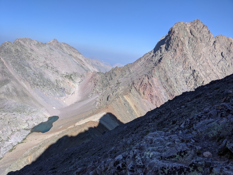
As we walked along the moraine, I suddenly heard Brandon let out a "WHOOP!" I looked up, and what did I see? Amanda, standing at the entrance to Arrow's ramp! We hurriedly traversed the talus over to her. As it turns out, her walkie-talkie had died as well, so she guessed our ascent time, and considering she had just reached the ramp a minute before, she had done with shocking precision. She'd also passed Brian on her way up and discovered he'd had to turn around, so she'd sped up. What can I say, our schedules were jiving that day! 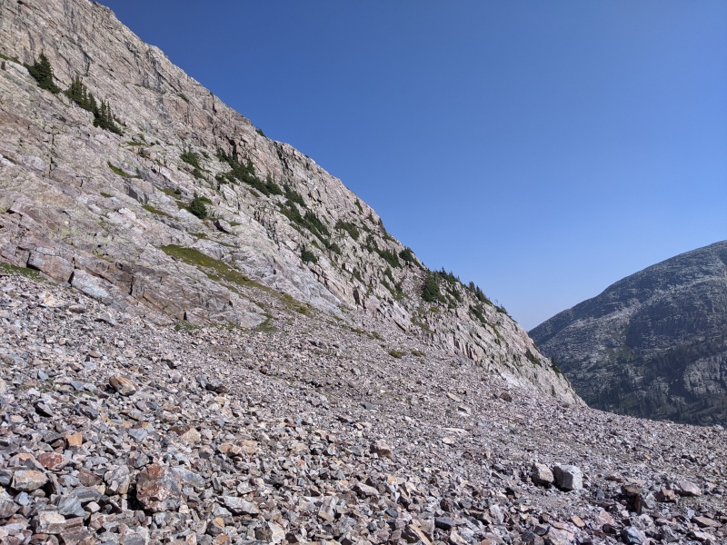
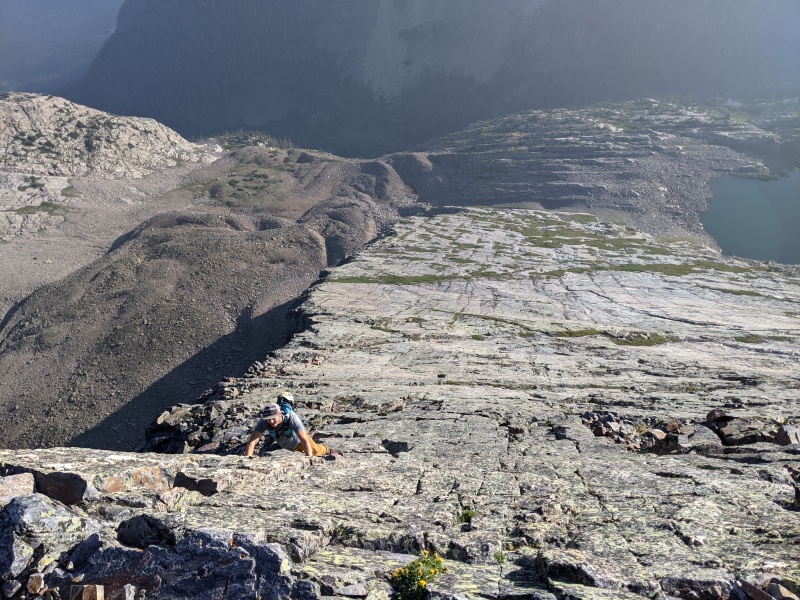
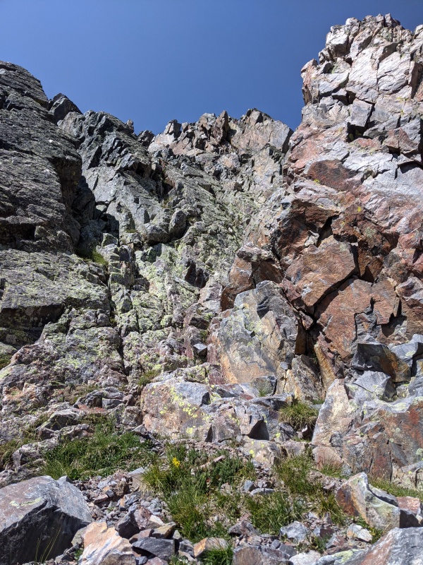
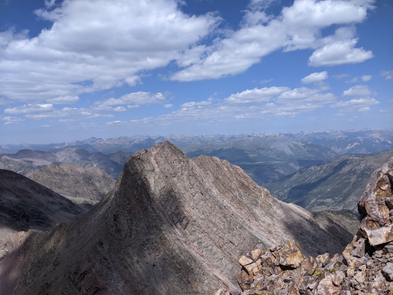
We stashed gear in the most marmot-proof spot we could find at the base of the ramp and started up. Arrow was like a baby version of Wham: solid and slabby at the bottom, steeper and blockier on the upper mountain. The slab was probably easy 3rd class for the first 100 feet, then dropped to class 2 for the remainder of the lower ramp. We followed the lower ramp until a large red boulder, which marked an easy crossover spot to the upper ramp. 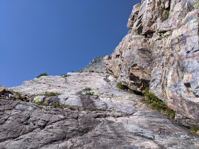

Once on the upper ramp, we followed more slabs and cracks until a cairned trail took us to the arete that formed between the lower and upper ramps. The route then crossed the arete several times, following the path of least resistance, before depositing us at the base of the upper blocky slope. There was tons of great scrambling to be had on the mountain, almost all of which was on solid rock. 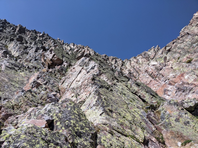
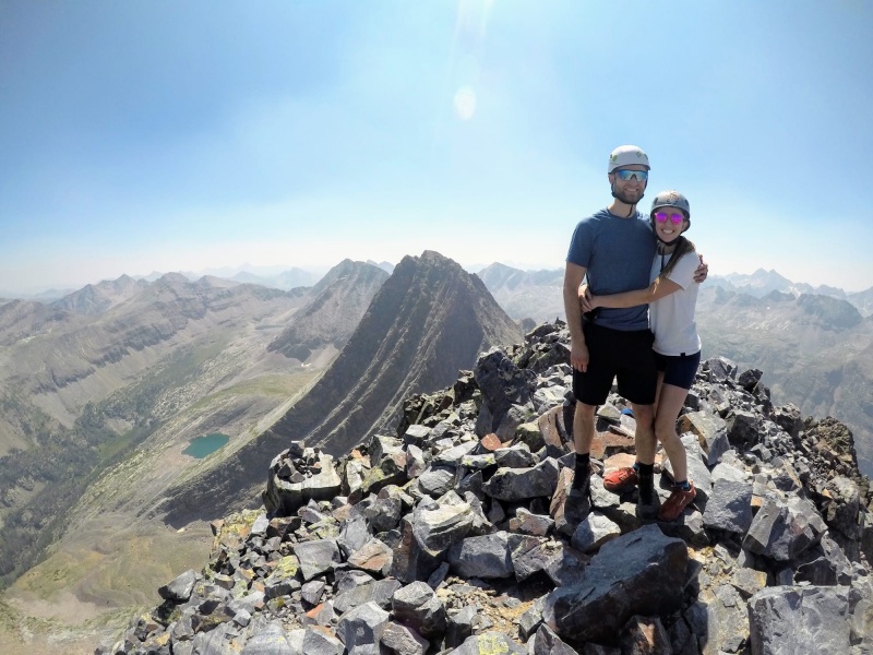
Summit! We topped out about an hour and twenty minutes after starting up the ramp. We all loved Arrow, one of the best sub-5th class scrambles any of us have ever done, if not the best. It was a perfect day and none of us were in any rush to descend, so we lingered up top. 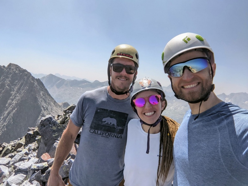
When we finally willed ourselves to head down, we were thrilled to find the descent surprisingly easy. The climbing on the upper mountain and the ramps all went just as easy as they did on the way up, and we were at our gear before we knew it. 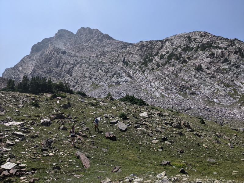
We arrived back at camp to a pantsless Brian (theme of the weekend), made Ramen, set up the hammock, and waited for the girls to make their way down from the Trinities. There was a nagging issue though: Brian didn't get Vestal yet, primarily due to living in the opposite of Colorado. He was only able to manage one trip to Colorado this summer, and since he's on the Centennial grind too, Vestal was the prize for him. I felt I needed to do something. I talked with Brandon, and he was struggling with his brand new shoes, especially after the toe-ramming descents of Vestal and Arrow. He wasn't sure whether he was going to be able to hike the trinities tomorrow, as was the plan. And honestly, Amanda would rather just hike to the lakes than summit any peaks. I asked them if they'd be okay with me potentially calling an audible, and they were. I explained the situation with Brandon and Amanda, and I offered to go with him on whatever route on Vestal he'd prefer to do: Wham if he was feeling up to it, or the backside if he just wanted to make sure he summitted. He said he was feeling much better, primarily due to drinking a gallon and a half of water and eating plenty of calories. He also said that while Brandon and I were climbing, he'd hiked up the grassy ledges to their end to scope Wham, and felt pretty confident on it. He wanted to give it a shot. So a new plan was hatched. We'd forego the Trinities, and I'd solo Wham again, trailing a rope and setting anchors periodically to belay Brian up. Brandon would stay at camp and rest his feet, and Amanda would hike to Vestal Lake and the lake below the Trinities. Shortly thereafter, the girls arrived from the Trinities traverse and reported varying perspectives on the fun of the route. We ate dinner, hung out at their camp chatting for a couple of hours, and went to bed. 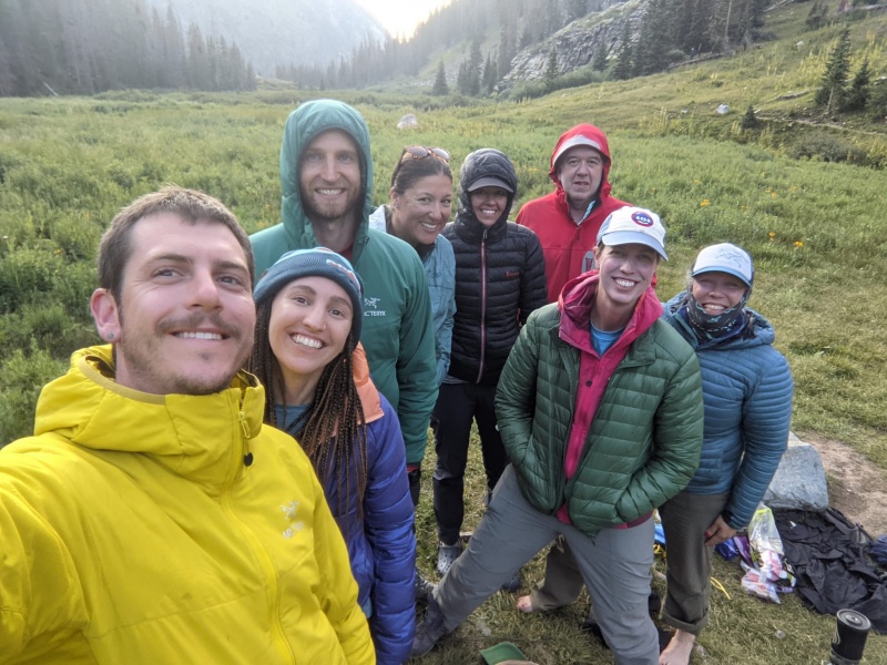
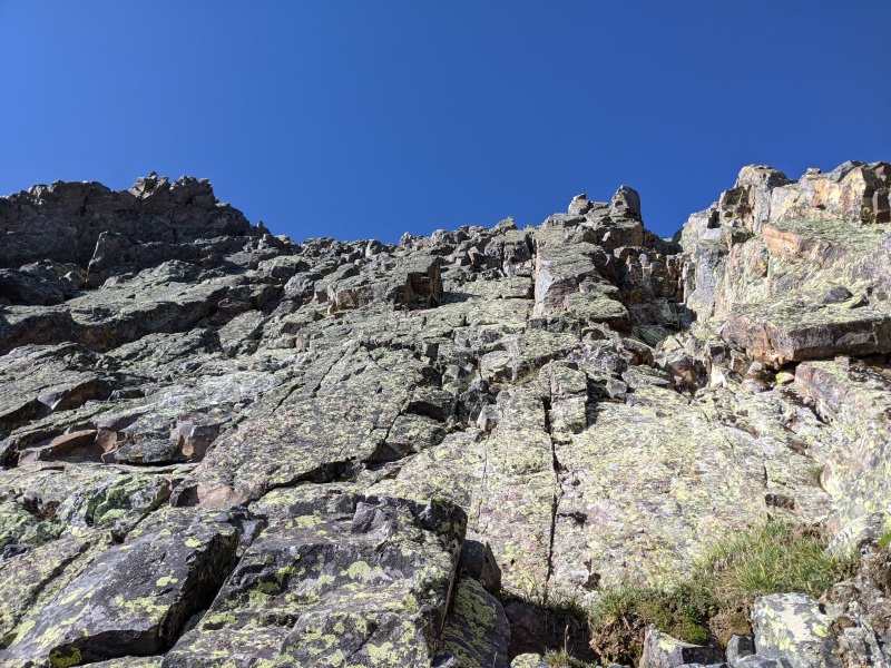
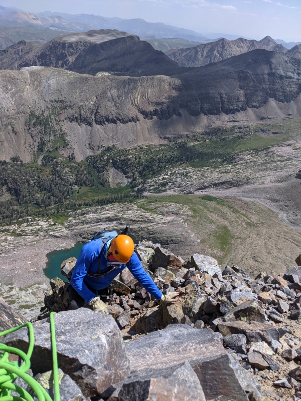
The weather was supposed to be perfect again, so another restless night of sleep led to a quasi-late start time of 7 AM. Brandon stayed at camp, while Amanda, me, and Brian (moving much better than the day before) ascended the slope leading to the upper basin. Brian and I opted for the direct start as well, so we said farewell to Amanda, who traversed under the face of Vestal toward the lake, as we ascended the easy third class start again. 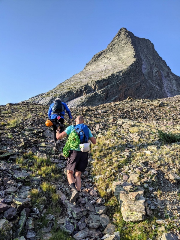
We took a different route up the lower face this time. Brian felt it easier to climb the grass than the low angle slabs, so we worked to connect as many of the grassy patches as possible. This definitely was a calf saver. We ran out of grass (no goats this time) at the last ledge and found a good looking crack to ascend. He had climbed this high the day before and had scoped his preferred route, so up we went. 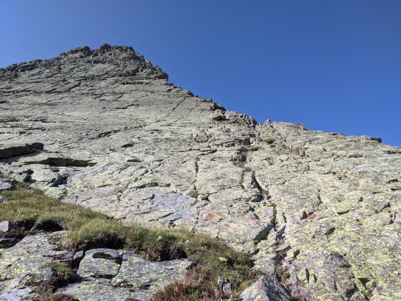
We scrambled up to a ledge, where the face steepened. We agreed this was a good point to rope up. I put the harness on, tied in, and started climbing, trailing the rope behind me. I climbed a full 60m pitch to the ledge below the alcove crack, slung a solid boulder, and belayed Brian up. He climbed as fast as I could belay and was on the ledge before I knew it. 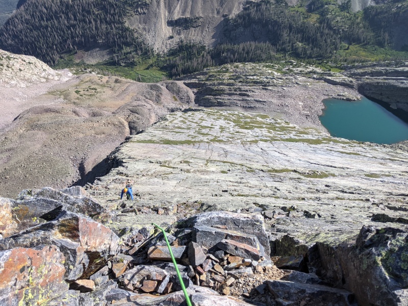
The next section is the alcove crack, which to me was the crux of the prior day. I climbed to the ledge past it and continued on another 100 or so feet up the blocks to belay spot number 2. Brian switched to climbing shoes (the only pitch he used them for, just for foot jam purposes), but again climbed so quickly past the crack I didn't even realize he had reached it. He reached my belay ledge after less than 5 minutes. 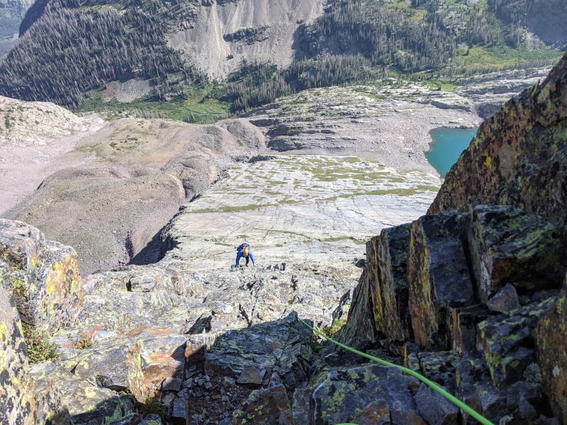
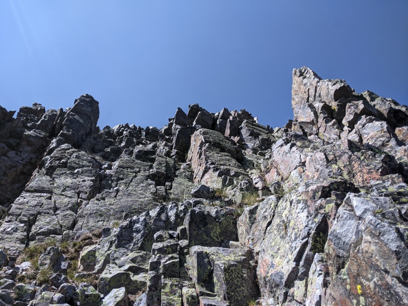
We continued setting belays up the rest of the mountain. P3 was 5.easy, heading up more blocky terrain. On P4, I climbed up a similar way that Brandon and I had the day before, and upon reaching a vantage point, I saw two other climbers and a cairn on a ledge below. I waived to them and descended to their ledge and brought Brian up. Upon reaching me, he made fun of me for belaying him up a class 2 pitch. Oh well, better safe than sorry! The fifth pitch, which launched from the cairned ledge, brought me into terrain that I didn't encounter yesterday. There was a mantle move about 30 or 40 feet up that felt every bit as hard as the alcove crack, maybe 5.4 or 5.5. At the top of the fifth pitch I was able to see the steep slab wall Brandon and I encountered the day before, so it appears us climbing to the right and making the step across move avoided this mantle move. I brought Brian up to me, who again flew past the mantle move, and climbed the sixth and last pitch, topping out on the false summit. For anyone interested, there was always a solid boulder to sling for anchor building purposes. We brought four cams just in case, but only plugged them in twice; once on the cairned ledge so Brian could clove hitch into something, and once at the top of P5 to back up the slung boulder. I was concerned about possible anchor difficulties, but it ended up being a non-issue. 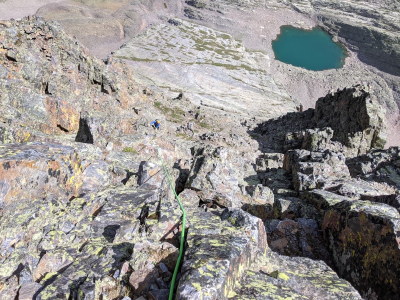
From there, Brian set off to the real summit while I stowed the rope and took pictures. He dispatched the class 4 chockstone with no problem, and moments later was on his first summit of the year, via his hardest alpine YDS route! 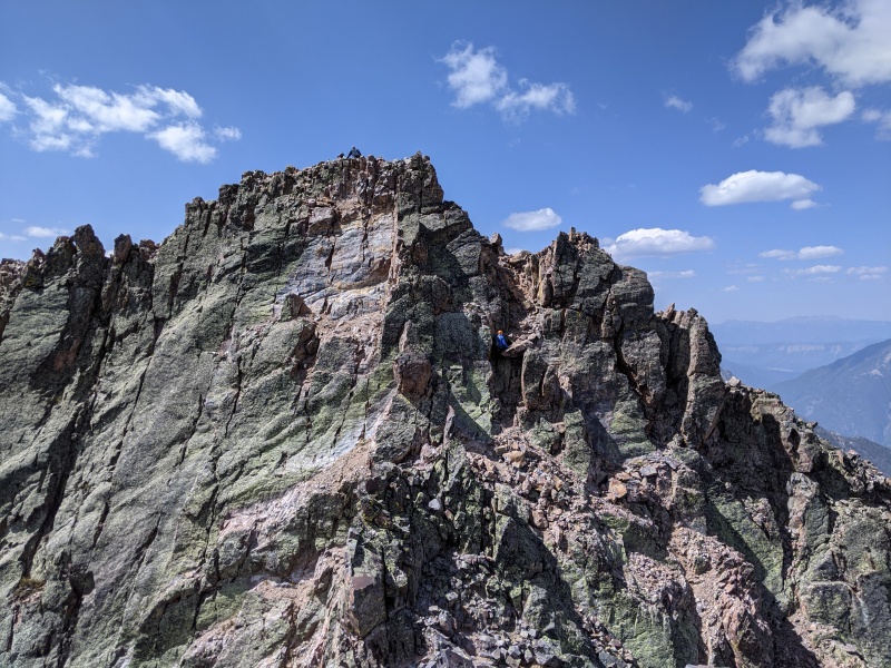
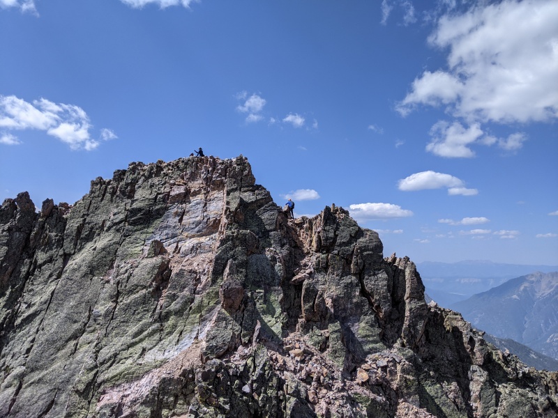
I stowed the rope and followed, and despite soloing Wham twice in two days with no slips, managed to eat it on the trail around the gendarme in between the summits. Oh well, better there than elsewhere! I topped out a couple of minutes later, and the celebration began! 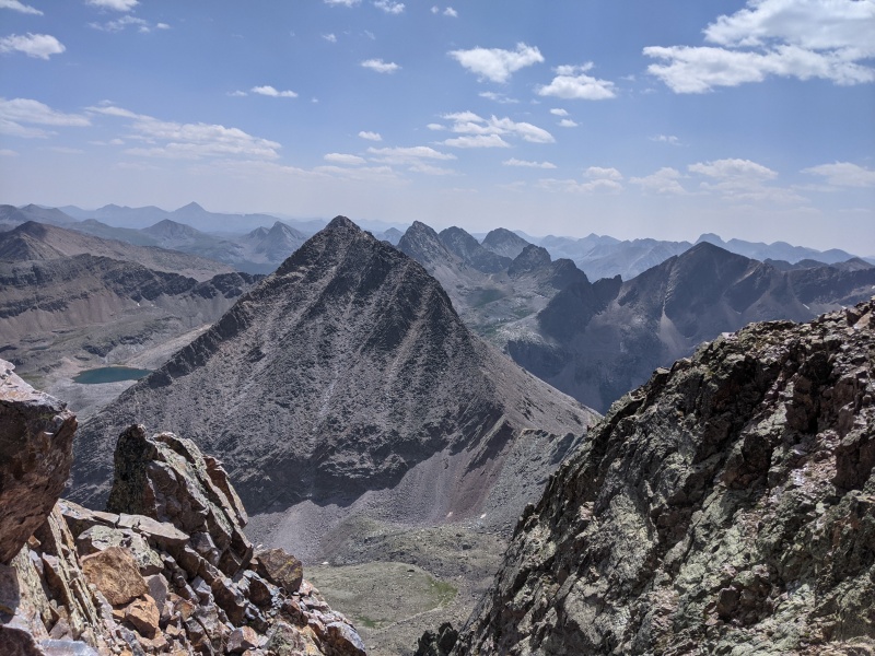
With the hard part done, we set off to descend the proper way this time. The girls' beta was right: skip the first trail you see, and go off the back of the subsummit down another gully. It's loose, but never hits class 3. We followed it down a few hundred feet until we saw a cairned break in the rock rib on the right. We took it and relatively easy terrain led us to the trail to the saddle. We followed it down to the rock moraines, provided some incorrect beta to a group eyeing Arrow (don't worry, I caught my mistake and went back and told them!), and made it back to camp. We ate (not enough), drank water (also not enough), packed up, and headed down to the beaver ponds to camp for the night and give us an easy day the following day. I bonked hard on the way down; a lack of water and calories made the last 300 feet absolutely exhausting and me grumpy. Once we got to camp, the decision to hike down was well worth it. It was much warmer that night, and we set out to eat as much of our respective food as possible so we didn't have to carry it out. Brandon was the undisputed winner at that game. After chatting around camp and talking with some CT hikers, it was time to sleep. I think we all slept much better that night. Brandon had some work obligations the following day, so he woke up early and was on the trail by 5. The rest of us opted for a lazier and more coffee-fueled start, which let us avoid the bear Brandon encountered on his hike out (though we did get charged by a rabbit!). Progress past "No Pants Point" and the log bridge was quick, and soon all we had left was the reascent up to Molas Pass. As we'd hoped, the massive number of switchbacks and gentle grade on the trail helped the ascent go by quickly. We made it back to the car around noon, with my GPS logging 29.5 miles for the full weekend. 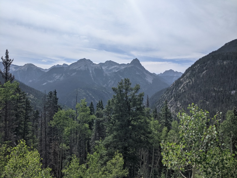
This weekend ranks as one of my favorite in the backcountry ever: high quality routes, beautiful weather, great people. I'll be back for the Trinities someday, but for now, we all went home happy.
Thumbnails for uploaded photos (click to open slideshow): ")
")
")
")
")
")
")
")
")
")
")
")
")
")
")
")
")
")
")
")
")
")
")
")
")
")
")
")
")
")
")
")
")
")
")
")
")
")
")
")
")
")
")
")
")
")
")
")
")
")
|
| Comments or Questions | ||||||||||||||||||||||||
|---|---|---|---|---|---|---|---|---|---|---|---|---|---|---|---|---|---|---|---|---|---|---|---|---|
|
Caution: The information contained in this report may not be accurate and should not be the only resource used in preparation for your climb. Failure to have the necessary experience, physical conditioning, supplies or equipment can result in injury or death. 14ers.com and the author(s) of this report provide no warranties, either express or implied, that the information provided is accurate or reliable. By using the information provided, you agree to indemnify and hold harmless 14ers.com and the report author(s) with respect to any claims and demands against them, including any attorney fees and expenses. Please read the 14ers.com Safety and Disclaimer pages for more information.
Please respect private property: 14ers.com supports the rights of private landowners to determine how and by whom their land will be used. In Colorado, it is your responsibility to determine if land is private and to obtain the appropriate permission before entering the property.