| Report Type | Full |
| Peak(s) |
Middle Palisade, 14,019' Excitement Peak, 13,877 Disappointment Peak, 13,917 Bear Creek Spire, 13,726' |
| Date Posted | 08/12/2021 |
| Date Climbed | 08/08/2021 |
| Author | ellenmseb |
| MidPal + Disappointment on Disappointment |
|---|
|
After 2 weeks of storms in California, I took advantage of a clear weather window to head out and climb Middle Palisade, my 7th California 14er and 56th US 14er. The hike to Middle Palisade gains 7k' elevation, contains little good trail and lots of california class 3 (not just on the final summit push but also in the vicinity of lakes on the approach). It's most commonly day-hiked. But after my misery on the approach to Williamson & Tyndall's 12k' campsite from sea level, i knew that I could not climb from sea level to 14k' in a day. So I nabbed a last-minute, 1-person backpacking permit. I worried about the smoke creeping southwards from the Tamarack Fire near Tahoe. I adjusted my later plans southwards from Yosemite to Mammoth for that reason. The smoke was thick in Bishop. But it quickly cleared as I drove up to the trailhead at 8k', and even more so as I hiked up. Nevertheless, one party turned back from their attempt on Norman Clyde Peak because of smoke. They were carrying rope; the 4th class route on that peak is notoriously hard to find. But I never encountered any debilitating smoke in my trip. I also encountered a party who had roped up for only Middle Palisade. I wonder why. They said they'd taken the Red Rock route - whose rockfall danger could only increase with rope. maybe it was a guide and client. 
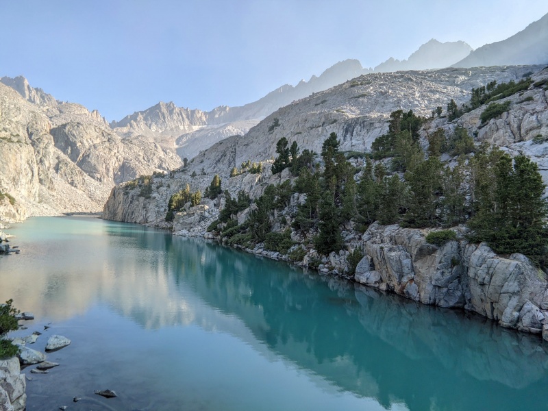
I packed up the highest lake I could find, at 11.2k'. This might be the last comfortably-warm backpacking night of the year. 2 days later certainly was not. 
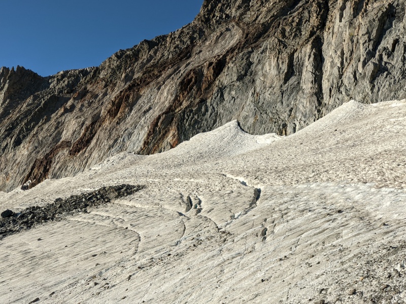
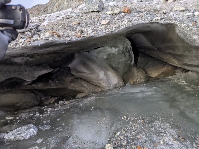
I headed out at 4am because I was at that point planning to meet a climbing parter at 8pm the same night. Routefinding in the dark wasted a lot of time. Eventually I made my way to the Middle Palisade Glacier. Even in its shrunken state, Middle Palisade Glacier was really cool to investigate! I still haven't seen its bigger and more impressive cousin, the main palisade glacier. It's completely dry, hard ice, and crevassed. Rockfall was heard like clockwork for the hour after sunrise. The glacier is bisected by a medial moraine, which I ascended. 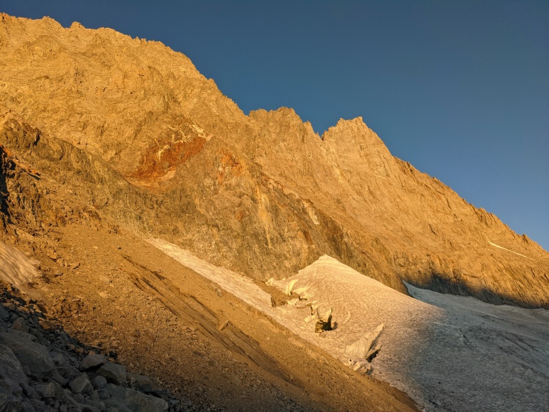
Sad evidence of climate change: the routes up Middle Palisade have changed very recently with the recession of the glacier. There are two routes:
Reading beta from last year, I brought an ice axe in order to access Secor's Chute. But, the glacier has receded so much that I no longer needed to travel on the glacier in order to access it. I did pull out the axe and wander around the highest part of the ice investigating. But above the relevant part of the glacier, I could see only vertical rock. After upclimbing route #1 and downclimbing route #2, and under the assumption that I did find the easiest line on #1, I'd have to recommend #2 despite the loose rock, unless you are very confident soloing (the rock on #1 would take pro, but at that point just take #2 if you aren't comfy soloing #1.) Just be very careful of rockfall among your party... there won't be a glut of other parties like there are on Colorado 14ers. I continued another 1500' of 3rd class up to Middle Palisade. Uneventfully but slowly, beause apparently 1 night's backpacking is not enough acclimitization. 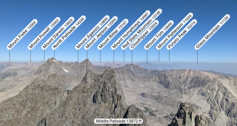
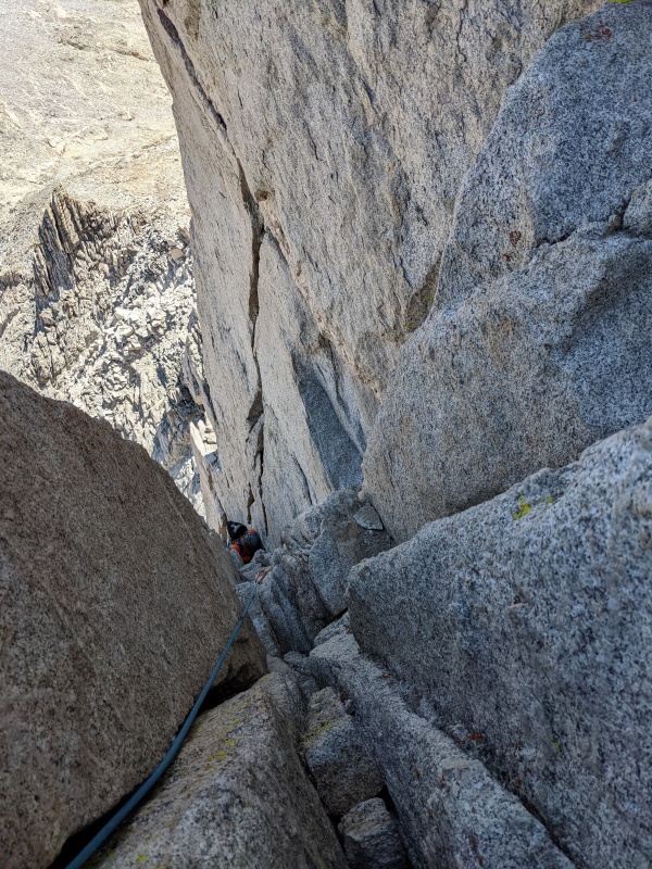
Next, I planned to traverse over to Disappointment Peak, whose only accolade is being an SPS peak and being very close to Middle Palisade. Disappointment pk was also my excuse for backpacking whereas most people would day-hike MidPal. And might as well get Excitement Peak between the two as well. The traverse from MidPal to Excitement, and from Excitement to the Excitement/Disappointment saddle, was difficult, loose and tedious. I seriously do not understand the difference between 5.6 and 4th class. It took 2 hours. I arrived at the Excitement/Disappointment saddle at noon. My turnaround time was noon. Ahead of me, I saw no easy way forward. The GPX track that i was following led to an overhanging hand crack with no feet. i suspect that another block had previously provided footholds, but had since fallen; there was evidence of rockfall below it. I tried two other routes. They were too hard to solo, and in fact I wouldn't rope up on them either because they're complete no-pro choss. This ate up 40 minutes. A 4th route looked unlikely but possible. My energy, time and water were running out. My obligation to meet someone at 8pm had been moved to the next day. But I was clearly signing up for a very late night. The call to turn around was obvious. The traverse back to MidPal took only 1 hour, although i was forced to re-summit it. 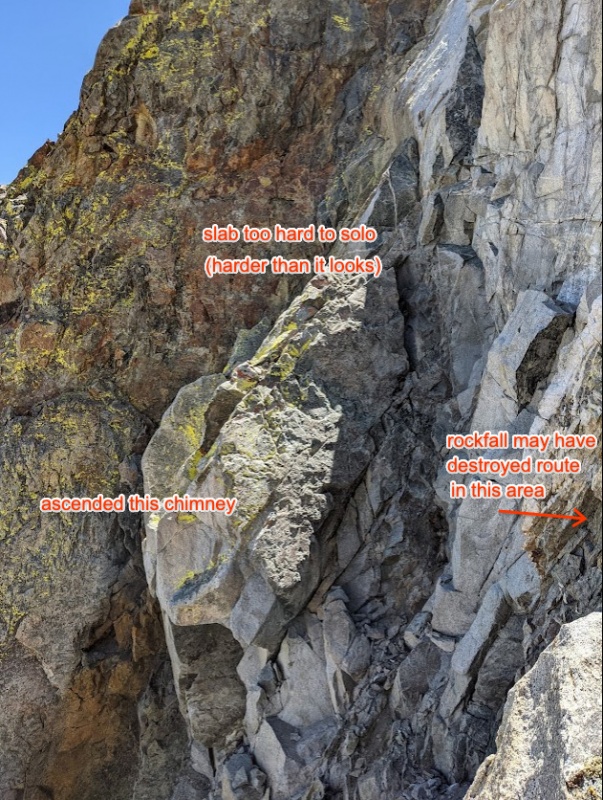
I packed up camp and started the tedious descent. When I was almost done at 10pm -- Only 2 miles of good trail back to the car -- I made a horrifying discovery: Big Pine Creek was too high to cross. It was ~3ft higher than on my ascent. This is strange because it's late season, a low snow year, no rain for a week, and a cool day. Anyways, I had 3 choices:
I chose option 3. The bushwhack was bad - but not the worst I've done. I had to backtrack out of willows only once. My ice axe constantly got snagged on branches. It took 1.5 hours. Mercifully, 2 miracles happened:
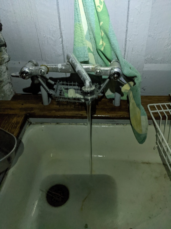
I could've cried out of gratitude for these 2 miracles. I washed up in the sink and walked down the road by starlight (my headlamp dying only after I reached the safety of the road). 
Thumbnails for uploaded photos (click to open slideshow): ")
")
")
")
")
")
")
")
")
")
")
")
")
")
")
")
|
| Comments or Questions | ||||||
|---|---|---|---|---|---|---|
|
Caution: The information contained in this report may not be accurate and should not be the only resource used in preparation for your climb. Failure to have the necessary experience, physical conditioning, supplies or equipment can result in injury or death. 14ers.com and the author(s) of this report provide no warranties, either express or implied, that the information provided is accurate or reliable. By using the information provided, you agree to indemnify and hold harmless 14ers.com and the report author(s) with respect to any claims and demands against them, including any attorney fees and expenses. Please read the 14ers.com Safety and Disclaimer pages for more information.
Please respect private property: 14ers.com supports the rights of private landowners to determine how and by whom their land will be used. In Colorado, it is your responsibility to determine if land is private and to obtain the appropriate permission before entering the property.


