| Report Type | Full |
| Peak(s) |
Culebra Peak - 14,053 feet San Luis Peak - 14,023 feet Wetterhorn Peak - 14,021 feet Uncompahgre Peak - 14,318 feet Handies Peak - 14,058 feet Redcloud Peak - 14,037 feet Sunshine Peak - 14,004 feet El Diente Peak - 14,175 feet Mt. Wilson - 14,256 feet Wilson Peak - 14,021 feet |
| Date Posted | 08/09/2021 |
| Date Climbed | 07/24/2021 |
| Author | JDG7 |
| 2021 Exped. - Culebra to the Wilson Group |
|---|
|
2021 JDG7 Expedition (14ers No. 44 - 53) I have climbed 14ers off and on for 25 years. Only in the last 5 (since 2017), have i been serious about elevating my 14er game. The last 2 years, i finished the big hitters, Capitol, Little Bear, N. Maroon, Pyramid, etc), and now i needed to finish Culebra and the entire San Juan. I live in St. Louis and have a demanding career. I get 1 week a year to finish what i can, and i make it a blowout 9/10 day set each year. I ran into many of you on the forum each year, and it is a blast going over the itinerary with you. It's nuts and i love it. So here is the 2021 report, in a nutshell. 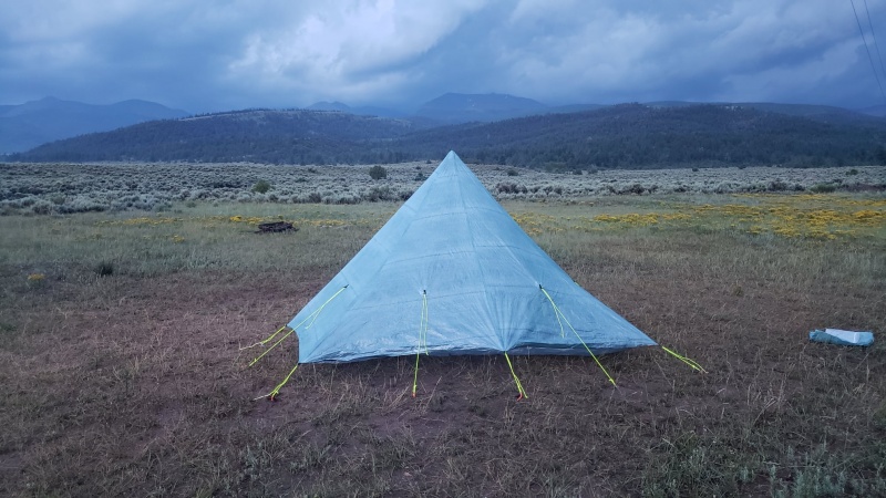
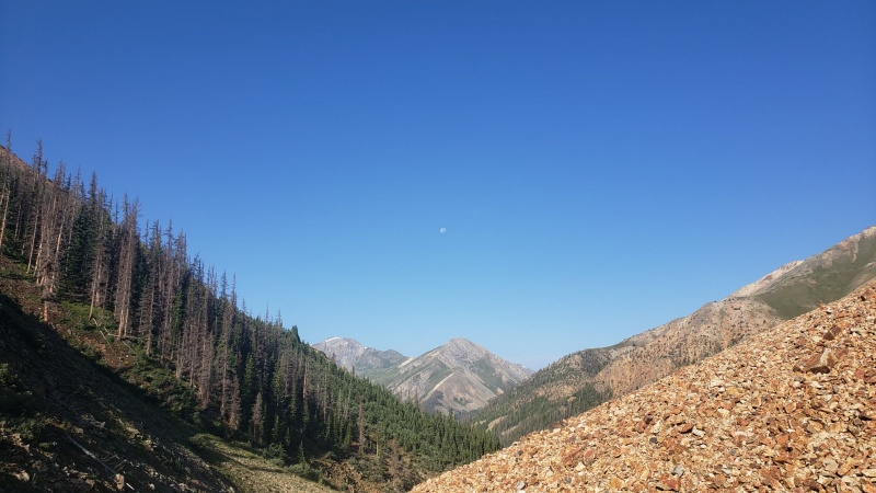
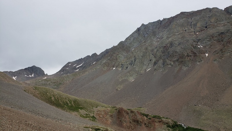
CLIMB DAY 1 - SATURDAY: JULY 24, 2021 - CULEBRA (14er No. 44) Culebra, 14er No. 44. - On July 23, flew into Denver, rental car, drive to CVR. slept overnight at the north gate, as is standard. Climbed on 7/24. met nice guy, Kevin, who is on this platform. good to meet you. Massive T-storms hit overnight. Portended to the monsoon week that lie ahead. Kev and I were the fast climbers that day, and we plowed through the driving white-out fog in these pics. Winds were likely 45-50 mph steady, with 30-40 foot max visibility the entire way. We would have done Red, but not worth it given the conditions. It was good to get Culebra done. Never know when it will not be available anymore. It is one of the least inspiring peaks, though. Stats: Distance: 9.44 (km) (we got off route a bit in the white out); Ascent: 930meters; Duration (04:16:51) (includes 20 min at summit) GPS File: Culebra 14er climb (+1 route finding error) 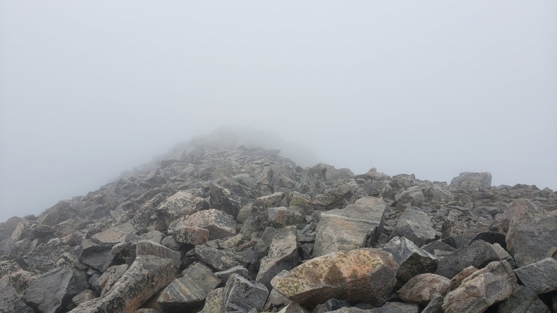
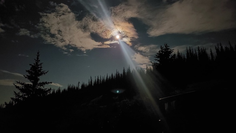
That afternoon, drove couple of hours from CVR and over the the mining town of Creede to start on the San Juans. Drove up West Willow Creek TH, set up high camp and enjoyed the Full Buck Moon overnight. CLIMB DAY 2 - SUNDAY, JULY 25, 2021 - SAN LUIS PEAK (14er No. 45) 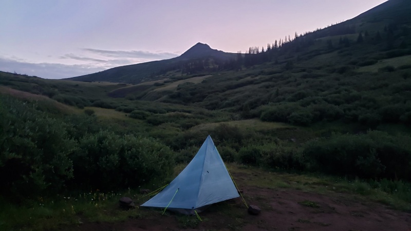
14er No. 45 - San Luis Peak Climb from the south ridge was a fun walkup, and crossing the two "bowls" on the Colorado Continental Divide Trail, including several re-ascents, were not bad. Just some fun cardio work. Wild flowers were beautiful. Weather held until about noon. Started the climb at 0550 hours. One way: 9km up. Took 2 hours 17 min to climb up. Then returned by 1015 hours. 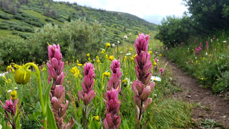
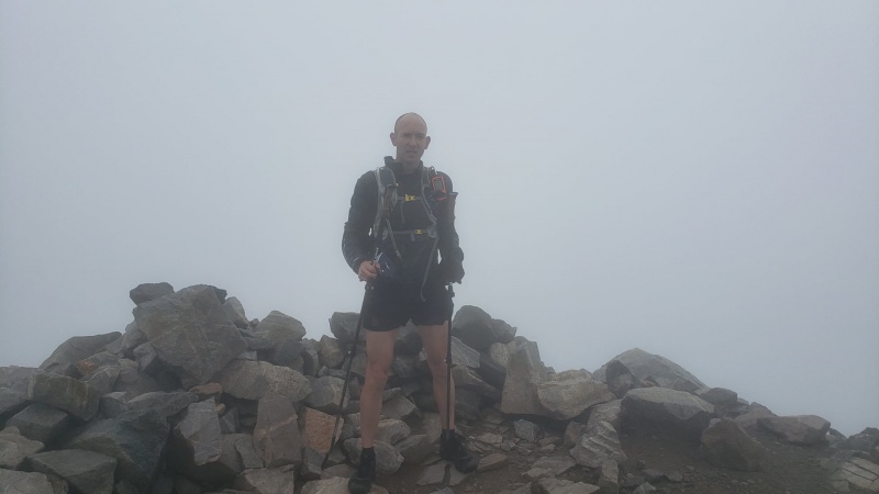
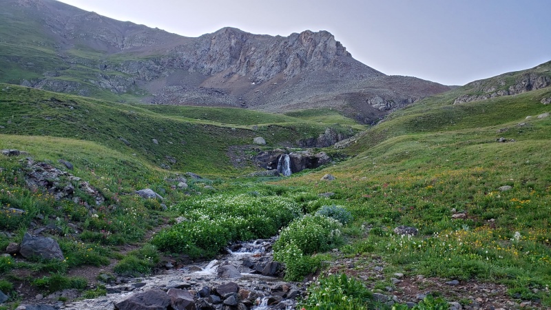
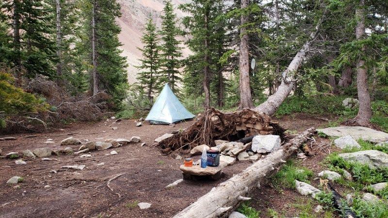
Stats: Duration: 04:20:00; Distance: 18.18km; Ascent: 1,055m GPS File: https://flow.polar.com/shared/7e584d01b56a471fd7bb409650022e23 Then it was time to jump back in the wrangler and boogie over to Lake City, then over to Matterhorn TH. The North Henson Creek Road was not boring. Need good 4WD clearance. it was fun. Then hiked up 2km to a great campsite before exiting the trees. Highly recommend this place (on left side of trail, after the switchback hill climb, but just before exiting the trees). Matterhorn ABC Location Info: Here is the GPS track to the location, if you're interested. https://flow.polar.com/shared/7e584d0893d70b05fd5222ada8ab1f4b Just after establishing Advanced Base Camp, was pounded by hail & intense T-storms for 4-5 hours. This was more than afternoon storms, it was def the summer-monsoon-system. so....slept early. CLIMB DAY 3: MONDAY, JULY 26, 2021 - WETTERHORN No. 46 & UNCOMPAHGRE No. 47 I knew the weather windows would be tight, and i had two 14ers to do, and the 5 mile expanse between the two was exposed above tree line, so speed was the order of Day 3. 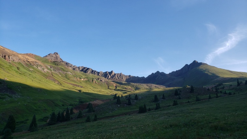
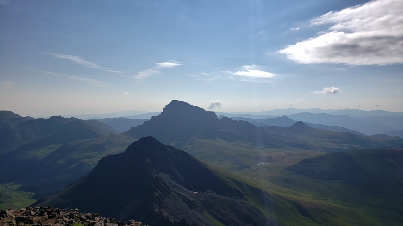
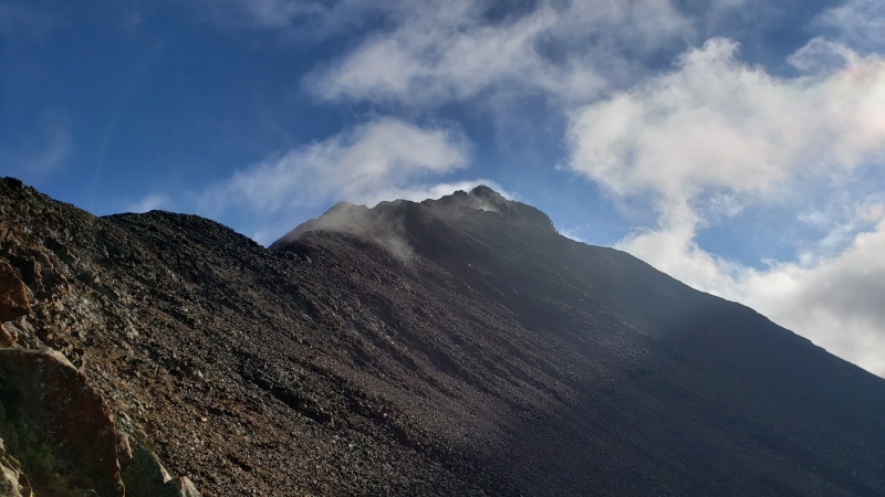
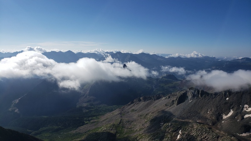
Starting late (0659 hours): I went for Wetterhorn first, and summitted in 1 hr 40 min. The views of the traverse to the Matterhorn, and Uncomp beyond it, were absolutely stunning in the morning light. But at 0906 hours, i noticed the first cloud building over Uncomp. 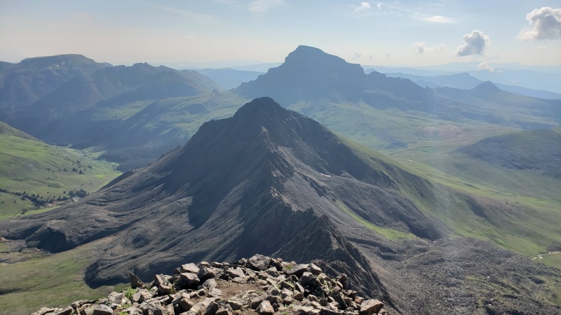
This meant i needed to rush down Wetterhorn, run the 5 miles over, climb Uncomp, back down, then back across the 5 miles to the campsite. 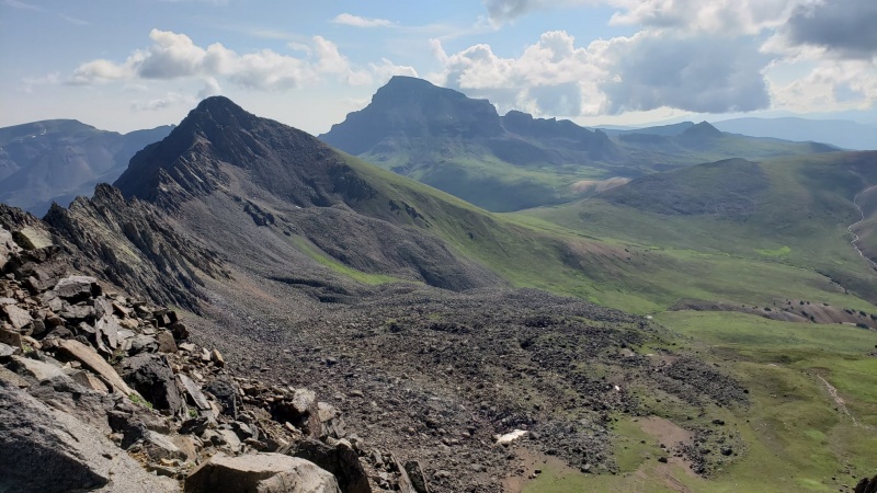
Descent took 40 min (the 2:25 min mark) and 1 hour to reach the standard Uncomp Trail connect (the 3:24 min mark). Then i turned the screws. Summiting in 45 minutes, (04:09:00 mark) i was looking back at Wetterhorn's summit, the place i had been standing at 2.5 hours previously.
Data: Duration: 5:54:08 hours; Distance 22.41km; Ascent: 1,575m GPX Data: https://flow.polar.com/shared/7e584d23d6b43fbc088f2f4ac0d53336 Made it back to ABC b4 storms hit, broke camp and hiked it down to the wrangler, drove back to Lake City, then down Hwy 30, and to Silver Creek/Grizzly Gulch TH. Decided to push on to American Basin TH to set up for Handies first. CLIMB DAY 4: TUESDAY, JULY 27, 2021 - HANDIES, No. 48; REDCLOUD No. 49 AND SUNSHINE No. 50 Woke at 0330 hours, and started handies at 0403 hours, summiting in 1hr 40 min. Caught the sunrise on top and then raced down in about 57 min. 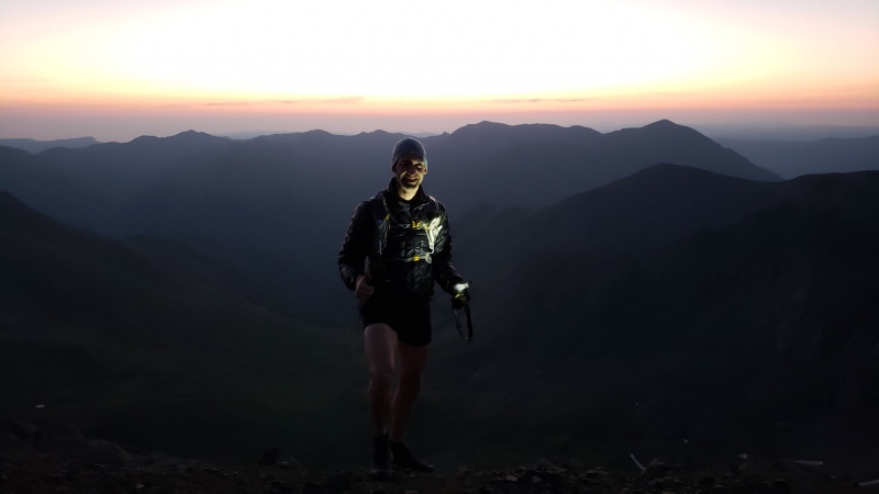
Data: Duration: 02:38:39 hours. Distance 10.37km; Ascent: 805m Handies GPX File: https://flow.polar.com/shared/7e584d38c2f37c2c03b38f8c817a7396 Now that the appetizer was finished, after a 30 min drove down to Silver Creek/Grizzly Gulch TH, it was time to attack the main course: Redcloud & Sunshine. Choosing the standard Redcloud/Sunshine/Redcloud route, and starting at 0733 hours, it was time to turn the screws. I hit the trail hard and pressed. Summiting Redcloud in 2 hours 3 min, i sprinted for Sunshine without stopping, trying to hit all 3 14ers by 1030 hours. Hitting Sunshine at the 2 hr 40 min mark, I summited the 3rd 14er at 1021 hours, beating my goal by 9 minutes. Although arbitrary, that was nice. Then it was time to race back down in an out-and-back manner. 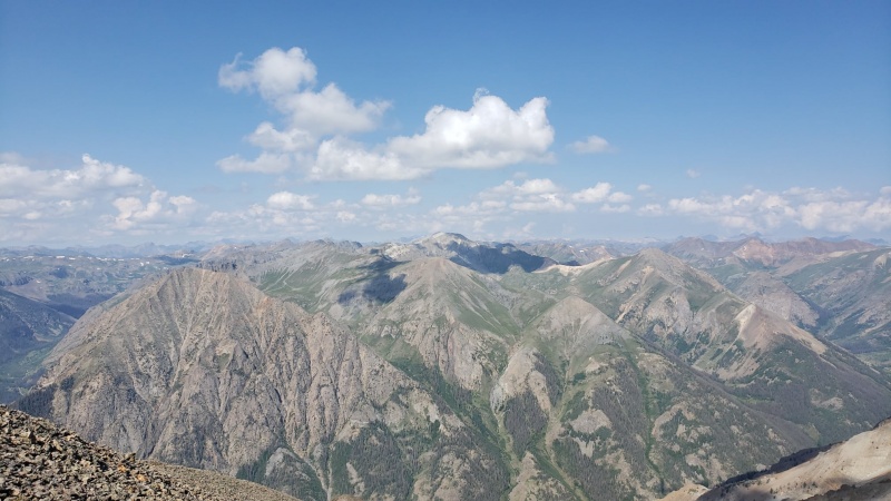

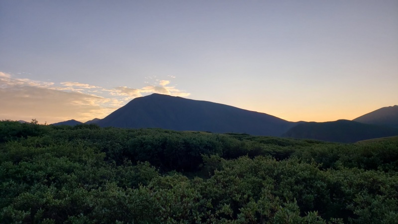
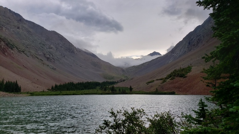
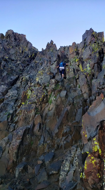
Data (Redcloud & Sunshine): Duration: 4:41:07. 18.78km. 1,390m Ascent. Redcloud/Sunshine GPX File: https://flow.polar.com/shared/7e584d3a7265ae63c307dcf0b576f413 Then I had to drive 6 hours back out to Lake City, up to near Gunnison, taking Hwy 50 to Montrose, diverted by way of Hwy 92 around the blasting work, through Telluride and finally arriving that evening at the Navajo Basin TH. The next morning set off to spend several days at Nav Lake. Set up ABC next to the lake. Beautiful location, and waiting for 3 of my brothers to drive in and join me for the Wilson group starting the next day. CLIMB DAY 5 - JULY 29, 2021 - EL DIENTE (b/w/o North Buttress) No. 51 & Mount Wilson (b/w/o Traverse) No. 52 I had told the gang that i would guide them up the North Buttress of El Diente, and then we would do the Great Traverse to Mt. Wilson, finishing with the North Slope descent of Mount Wilson. Since this was a Class 4 x3 set up, route finding was important. I reconn'ed the route the evening before, and got some nice, shots of Nav Lake and the campground area. 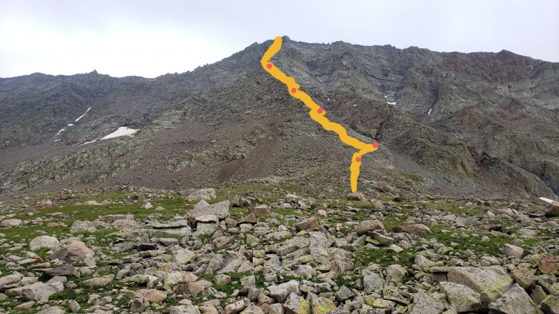
Guiding the guys up El D's N. Buttress was a blast, although my GPX data failed on this one. We took it slow and enjoyed ourselves. Piecing the route together was great. We made it back in time before the hail came in torrents in the midafternoon. 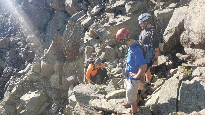
The old grizzled route finder. Upon locating "The Ledge" location.
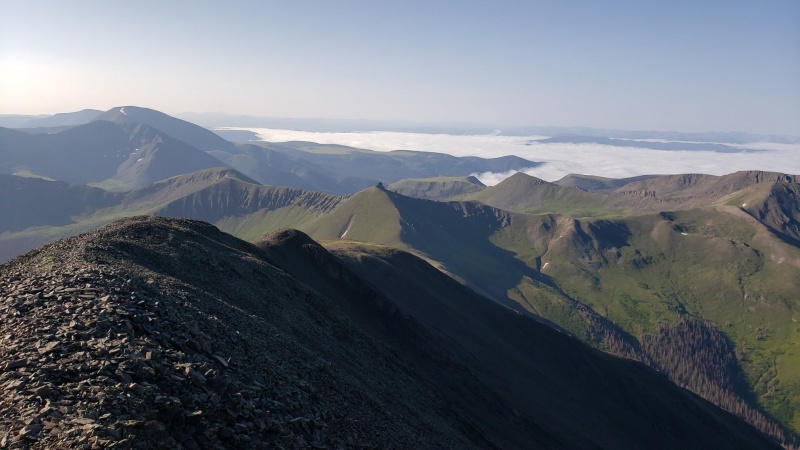
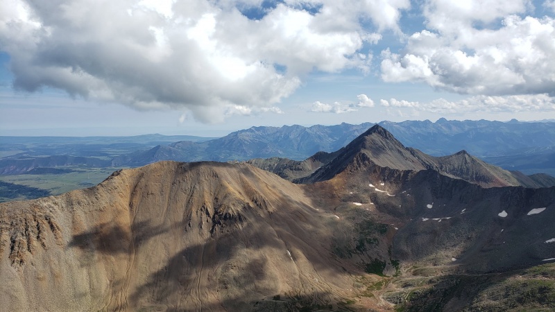
Summit of El Diente - looking across the traverse to Mt. Wilson (center) and Gladstone beyond (left)
After just passing the Gendarmes
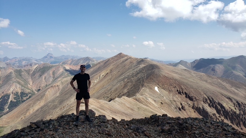
CLIMB DAY 6 - FRIDAY, JULY 30, 2021 - Wilson Peak (SW Ridge) - No. 53 & Gladstone Peak (N. Ridge) (Centennial) 2 of the brothers had enough, and only 1 would continue on for this day. Joshua said he would hit Wilson Peak with me, but he didn't want to hold me back for the sprint over to Gladstone. So we set off at 0524 hours. We took a leisurely pace up Wilson Peak, as we could tell the weather would hold. This was sort of a victory lap for the week. We went by way of Rock of Ages pass, then enjoyed the Class 3 approach and summited, enjoying the views of Lizard Head coming in and out of the fog. 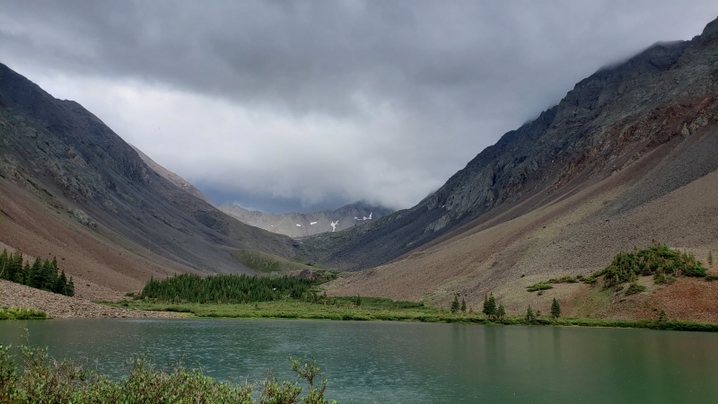
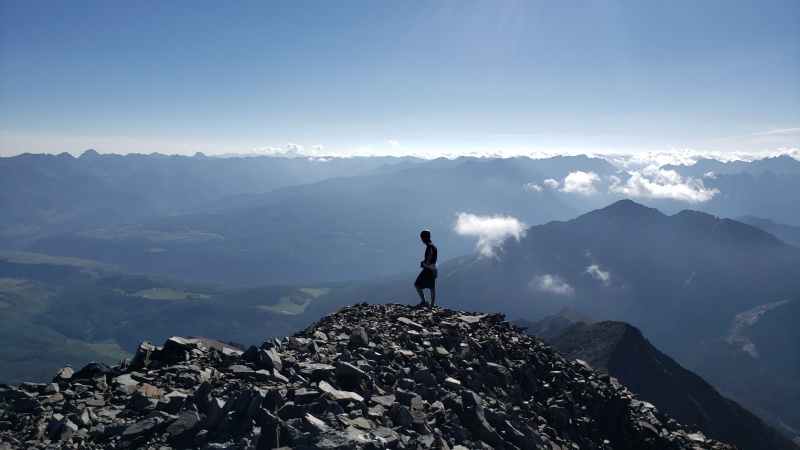
Then we separated at the Rock of Ages and I sprinted the long Class 4 traverse to Gladstone, completing it in 80 minutes, spending 5 minutes at the summit, then descending Gladstone, crossing half the traverse, and exiting straight down on the connecting, running for Nav Lake. Upon reaching Nav Lake in 80 minutes, we packed up and hiked out and then drove back to Denver. Then it was time to fly back to St. Louis. 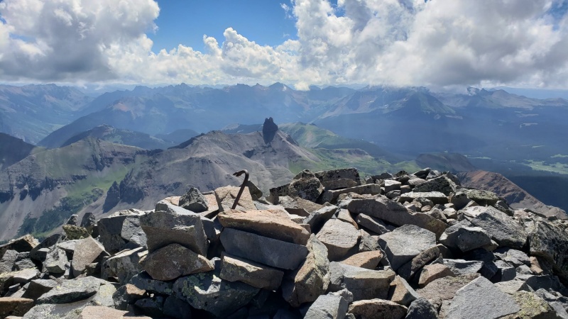
Data: Duration: 06:39:20 hours; Distance: 12.18km; Ascent: 1,265m GPX File: https://flow.polar.com/shared/7e584d57f0d1320fae3ae7f9853e2fdd This was a great week, and many wonderful memories were made. I met several of you here as i was pushing on these summits, and it was a pleasure meeting each of your. Next year, God willing, will be the end of this quarter century long project, and then it will be time to move to the next step in mountaineering. Hopefully i will get to meet more of you next year before it will be time to move on. Thumbnails for uploaded photos (click to open slideshow): ")
")
")
")
")
")
")
")
")
")
")
")
")
")
")
")
")
")
")
")
")
")
")
")
")
")
")
")
")
")
")
")
")
")
")
")
")
")
")
")
")
")
")
")
")
")
")
")
")
")
|
| Comments or Questions | |||||||||
|---|---|---|---|---|---|---|---|---|---|
|
Caution: The information contained in this report may not be accurate and should not be the only resource used in preparation for your climb. Failure to have the necessary experience, physical conditioning, supplies or equipment can result in injury or death. 14ers.com and the author(s) of this report provide no warranties, either express or implied, that the information provided is accurate or reliable. By using the information provided, you agree to indemnify and hold harmless 14ers.com and the report author(s) with respect to any claims and demands against them, including any attorney fees and expenses. Please read the 14ers.com Safety and Disclaimer pages for more information.
Please respect private property: 14ers.com supports the rights of private landowners to determine how and by whom their land will be used. In Colorado, it is your responsibility to determine if land is private and to obtain the appropriate permission before entering the property.


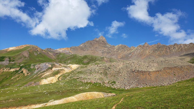
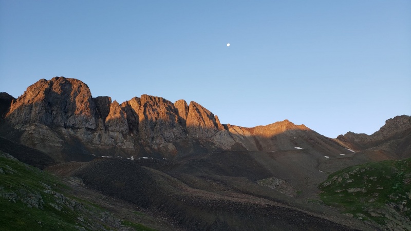
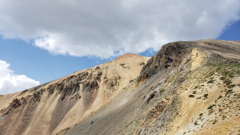
 Wetterhorn, it's Prow and its beautiful yellow band of rock.


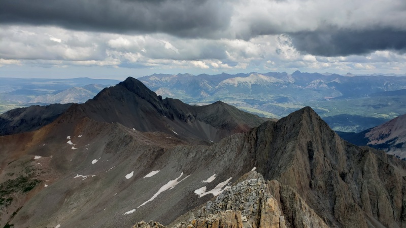
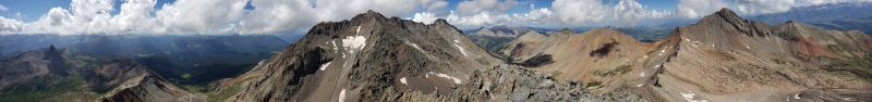
 The Great Traverse between El Diente & Mount Wilson

