| Report Type | Full |
| Peak(s) |
All 100 CO Centennials |
| Date Posted | 08/09/2021 |
| Modified | 10/09/2024 |
| Date Climbed | 08/05/2021 |
| Author | SpeedWalker |
| The Highest 100 in 2 Summers |
|---|
|
The Highest 100 in 2 Summers Alex "SpeedWalker" Walker Introduction I climbed my first 14er at the age of 14, quite appropriately. It was August 2016, and our Boy Scout troop had a camping trip where we did Mount Bierstadt. My friend Tim and I started out ahead of the pack, but I slowed to a crawl by 13,000ft. I was by no means an athletic kid; I had never played a sport in my life. Nonetheless, I enjoyed the experience… just not enough to want to do any more. That was, until June 2019. Soon after that first hike, Tim convinced me to join the track team. Before I knew it, I had become a competitive distance runner. So when a few friends from cross country invited me to hike Grays Peak, I said sure. We woke up before sunrise and drove to the trailhead, or at least as far as the avalanche debris blocking the road would let us. We strapped some snowshoes to our packs, since the condition reports said they were necessary. The entire mountain was covered in close to a foot of spring snow from the exceptionally high snow year. Upon reaching the upper part of the mountain, we lost the packed-down trail, but it was easy enough to boot up the low-angle slope to the summit. The views were incredible, the weather was great, and we hadn't seen a soul. We made the traverse over to Torreys Peak, and passed our first other hikers of the day, who were toting impressive ice axes. I had to convince Tim not to follow them down a steep thousand-foot glissade. We were almost back to the upper trailhead when an afternoon thunderstorm rolled in, and not paying attention, we managed to lose the trail again. By the time we realized, we were postholing through waist-deep powdery snow while bushwhacking through willows. We were so close to the end that I didn't even consider stopping to put on our still-unused snowshoes. Worn out and with wet feet, we eventually made it back to the car. Though my reintroduction to the 14ers was a little rough, I thoroughly enjoyed the trip. The altitude was still intense, but 3 years of endurance training made it feel infinitely easier than Bierstadt. A couple weeks and a lot of research later, I got the same group together to camp at Kite Lake for the DeCaLiBron. They were exhausted by the end, but I just wanted to do more. Later in August I also got them to do Mount Elbert, along with my unacclimated best friend who lives at sea level, which was quite interesting. We then did Bierstadt and Evans via the Sawtooth, where Tim dropped his bike helmet over a hundred feet, and I scrambled down to save it. Finally, Tim and I finished off the season with Pikes Peak's Barr Trail, which was a fun 8-hour endurance adventure. Still, I couldn't stop thinking about when I could climb my next 14er. More out of curiosity than intent, I wanted to see how much hiking was required to do them all. About 500 miles? It dawned on me that we could just about fit that into a summer. This led me down a rabbit-hole of dozens, if not hundreds of hours of research. I made a massive spreadsheet listing each group of peaks, the mileage and gain required, their class rating, trailhead, and route descriptions. I downloaded GPX files for all the routes, then started tweaking them in Google Earth to align to the trails perfectly. I researched non-standard routes and combinations to minimize hiking and driving times, finding the perfect order to complete each range. Despite barely having done a class 3 scramble in my life, I felt ready to go finish the 14ers in a single summer. But first, I had to go ask Tim if he was willing to embark on this ambitious adventure with me. Hesitantly, he said yes. Day 1 - June 22, 2020 Mount of the Holy Cross & Holy Cross Ridge Holy Cross seemed like the perfect starting point for our summer of 14ers. It was the northernmost peak in a big range of nontechnical routes, where we could test out our multi-day endurance. Plus, the trailhead opened on the summer solstice, so we drove up that night and started the next morning at 4:00 AM. The timing was perfect for watching the first sun hit the peak just before descending into the valley; it was absolutely beautiful. The ascent went very smoothly, and we soon headed in the opposite direction towards Holy Cross Ridge. Clearly I was already thinking about the centennials, since I chose the Halo Ridge loop route to grab this extra peak. The rocky ridge was slow and tedious, a good introduction for routes to come. We got a nice view of the Cross Couloir before descending back to the car, still feeling pretty good. I had been considering a plan to drive to Mount Massive and climb it in the same day, but by the time we got there, it was a little too late in the day. 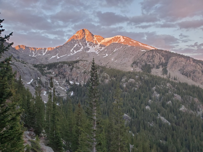
Day 2 - June 23, 2020 Mount Massive & Mount Elbert My goal for the first week of summer was to complete all 15 Sawatch 14ers, roughly from north to south. This put Massive and Elbert on the agenda, a pretty ambitious day with 8,000ft of gain. We repeated yesterday’s start time and started hiking from most of the way up the 4WD road towards Massive's Southwest Slopes. The ascent was uneventful, just unrelentingly steep, and with an abundance of false summits. I would stand near the top of one, waiting for Tim to catch up, only to point to the next potential summit in the distance. We made it to the true top pretty early in the morning, so I was feeling good about being able to hike Mount Elbert in the same day. We quickly headed back down, and I decided to switch things up by climbing the (supposedly faster) East Slopes route on Elbert, to avoid repeating the North Ridge. We again didn't make it all the way up the 4WD road, which combined with the new trail reroutes, actually made it slower than last summer's ascent. It just seemed to go on forever, which isn't surprising after how long of a day we had. We got pretty lucky with afternoon sunshine on the summit, even though there was rain on many of the peaks in the distance. After a long slog down, we drove down to Leadville for gas, then up to the Missouri Gulch trailhead, arriving just after dark. 
Day 3 - June 24, 2020 Mount Belford, Mount Oxford, & Missouri Mountain The first two days had made me more exhausted than I expected. The next few days, I figured, were our test as to whether this summer 14er experiment would be possible. I insisted on keeping the wake-up at 4:00 AM, but it was difficult to get out of bed. The climb up Belford is about as consistently steep as it gets, with seemingly constant switchbacks all the way from the trailhead to the summit. Physically, I was still feeling good; I had been training hard for this all spring. Tim, on the other hand, started to struggle. I stopped to wait for him after only the first mile, as he had already fallen behind, and he was taking so long that I got concerned and went back down looking for him. He was still moving slowly and steadily, so I commited to hike at his pace all the way to the summit. By the time we (finally) reached the top, he told me that he just couldn't do it, and that I should go ahead and do the other two peaks by myself. I racked my mind about how I could solve this: could we take a rest day then reattempt the peaks at a slower pace? There just wouldn't be enough time for him to do them all. Unsure of what to do, I went on to standard routes of Oxford and Missouri by myself, while Tim went down the gentler trail past Elkhead Pass. A storm rolled in as I was descending the high ridge from Missouri, so I essentially ran until I reached the switchbacks, where I heard my first thunder of the trip. I made it back to the car with ease, and drove to the next trailhead while discussing what to do with Tim. 
Day 4 - June 25, 2020 Huron Peak & La Plata Peak I woke up at the usual time and started the hike up Huron from the upper trailhead, but this time alone. Tim needed a rest day, and he told me to just keep climbing peaks like I had originally planned. I reluctantly agreed, not wanting to finish the 14ers without him, but also realizing that there was no other choice if I wanted to finish this summer. Without a partner, I sped up and down the moderately steep trail, surprising Tim by making it back before 8:00 AM. This made me super confident, since I was now halfway through the week and still feeling good. I drove back down the rough 4WD road, made it most of the way up the adjacent road, then took off towards La Plata's Southwest Ridge. My excitement was soon put on hold as I saw considerable storm clouds overhead. I watched their speed and direction as I approached the ridge, and figured that I had a decent window. After an annoying false summit, I reached the top, happy with my decision to continue, then quickly headed down. Minutes later, there was a sudden shift in the wind, such that the clouds that had been drifting away from me were now speeding right towards me. I ran as fast as I could across the ridge, but soon got caught by hail, with thunder close behind. By the time I made it back to treeline and mentally recovered from the close call, I looked behind me to see clear blue skies and sunshine over the peak. Annoyed, I made it back to the car and drove to the North Cottonwood Creek trailhead. 
Day 5 - June 26, 2020 Mount Columbia & Mount Harvard For me, the fifth morning went just like the first four. For Tim, he had made the decision to attempt the first peak of the traverse, then consider his options from there. We went up the newly constructed standard route on Columbia, which was the best rock staircase we had ever seen. Tim said it might be his favorite 14er so far, in great contrast to the old horror stories of ascending a vertical scree slope. He was feeling a lot better, but still chose to take it easy and descend the same way we came. That was a good decision, because I soon found myself struggling to find a route through a series of unpleasant boulderfields. At one point, a large rock came loose under my weight and snapped my $100 trekking pole in half. I eventually found my way up Harvard and down its standard route, surprised at how long the day felt compared to the mileage on paper. It's difficult to move more than about a mile an hour across the traverse. I heard an intense thunderstorm above the peaks as I neared the car, but stayed dry. We ended another fairly successful day by driving to the Denny Creek trailhead. 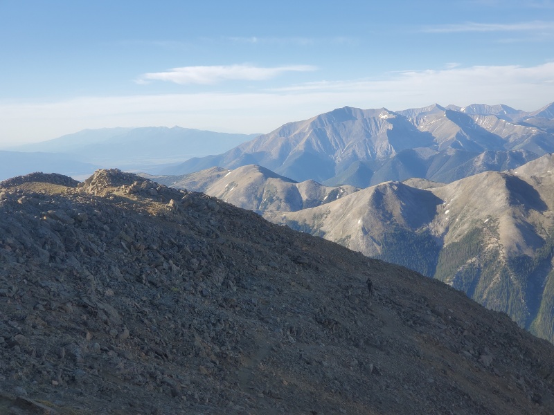
Day 6 - June 27, 2020 Mount Yale & Mount Princeton I started off the day alone; it was by far the hardest early wake-up yet. I sped up the 4,500ft of Yale in just a couple hours, and was the first person on top out of an usual amount of other hikers on the trail. As I headed down, my jaw dropped at the conga line of hikers heading my direction, with easily 50 people in my immediate view. I eventually realized that it was a Saturday, which led to passing 196 other hikers on the way down (yes, I counted). We quickly drove over to Mount Princeton road, which is notoriously steep and narrow, although not the worst of 4WD roads. After a couple of annoying encounters with oncoming cars, we made it to the radio towers and started hiking. Tim decided to come along for what would actually be the last peak of our first trip. Unfortunately, due to a scheduling miscommunication, we ended up only having 6 days available to complete our 7-day itinerary, so we would have to come back to the Sawatch later. Princeton was a super short and easy hike, albeit unusually time-consuming because we were walking on unpleasant rocks the whole way. Fortunately, the hike was fairly uneventful, other than a potential storm cloud encouraging us off the summit. We made it back to the car, back down the road (with a couple more passing maneuvers), and back home at a reasonable hour. 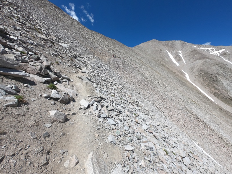
Day 7 - July 4, 2020 Pikes Peak After a few days' break from our fairly successful first week of peaks, we headed down towards the Sangre de Cristo range. But before our Sunday reservation for Culebra, we decided to stop halfway to do Pikes Peak, which turned out to be on the Fourth of July. It seemed to rain all night as we slept in the car for our usual 4:00 AM start, but luckily it stopped just before we set out on the Crags trail. Hiking in the dark, I managed to miss a key intersection, and the sound of the nearby stream must've drowned out my watch's "off course" beep. We hiked nearly a mile up the wrong trail before I checked the map and realized; Tim immediately turned around without a word. As we approached the summit road, we broke through the clouds, getting an overhead view on an unusual weather formation. Tim was feeling a little bit of altitude sickness, so he decided to turn around before the final climb, to save himself for tomorrow's extremely expensive peak. We had already climbed Pikes Peak from the other side, anyway; I just wanted to repeat them all in one summer. On the final rocky climb, I snapped yet another trekking pole in half, leading to an afternoon adventure to buy a third pair. I stood triumphantly atop the summit construction zone, then quickly became overwhelmed by the number of tourists and headed down. Where the trail parallels the road for a few agonizing miles, I decided to start running and saw how fast I could go at 13,000ft. I barely managed a sub-10 mile, then immediately tripped and rolled my ankle as I looked at my watch. I caught back up with Tim, and we made it back to the car well before the afternoon thunderstorms rolled in. After a few more hours of driving, we spent the night outside the gate of Cielo Vista Ranch. 
Day 8 - July 5, 2020 Culebra Peak & Red Mountain For the first time of the summer, we didn't wake up at 4:00 AM. Instead, the ranch let us in at a relaxing 6:00 AM, and we headed up the 4WD road. As a bit of a perfectionist, I had decided to follow the “3,000ft rule” for all of the 14ers and centennials, so I got out of the car at a predetermined spot and let Tim drive the remaining couple miles to the trailhead. We started up the unusual trail-less peak, where you essentially choose your own adventure up a steep grassy slope before following the summit ridge. In contrast to the expectation of solitude on a $150 peak, there were actually way more people around than normal, since everyone starts at the same time. Regardless of whether you're doing the centennials, it'd be ridiculous to pass up Red Mountain while you're there, so Tim and I made it to the summit and continued down the other side. Both ascents were pretty uneventful, although there was a big storm approaching in the distance. I made it all the way back down to my starting point, 3,000ft beneath both peaks, where Tim picked me up. We signed out of the ranch, restocked on ice, then drove a pathetically short distance up the start of Lake Como Road. I told Tim we could either start from the bottom at 2:00 AM, or backpack in tonight for a normal start time on Little Bear, aiming to be the first group in the Hourglass. He chose the backpack, so we hiked in and set up a tent near the lower gully, falling asleep around dark. 
Day 9 - July 6, 2020 Little Bear Peak, Blanca Peak, & Ellingwood Point Little Bear would be our first ever Class 4 peak, although the real difficulty comes more from the steep, unstable rock. We woke up in our tent at 4:00 AM, and persisted up the terrible loose gully to reach the initial ridge. It was a lot more unpleasant than I expected, and Tim climbed very slow and methodically. After a comparatively nice rock hop along the ridge, we arrived at the Hourglass, where another climbing party caught up to us. The scrambling on solid rock was lots of fun, but it was shorter than I expected before reaching the upper minefield of loose rocks. We all managed to spread out enough that rockfall wasn't a big overhead hazard, although the final slope was extremely tedious in both directions. The other party headed off on the traverse towards Blanca, who I would later pass along the standard route. We had to wait for another slow group in the Hourglass, before finally making it down, across to the first gully, and back to the tent. Tim stayed and packed up camp while I continued on to Blanca and Ellingwood, not minding a bit of extra elevation to avoid the Class 5 ridge. The standard routes were fun Class 2's, including the "traverse" between them, although the upper slopes of Ellingwood lacked any discernible route. I made it back to Tim with the weather still nice, and eventually all the way back down to the car. Google Maps got us a little bit lost on the drive to the remote Lily Lake trailhead, so we got there an hour late, in the dark. 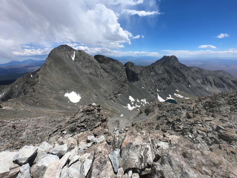
Day 10 - July 7, 2020 Mount Lindsey & Huerfano Peak I was so tired from the previous night that I decided to delay my start by an hour, while Tim just took a rest day and slept in. With more daylight than usual, I made my way up the initially gentle, then intensely steep trail. Upon reaching the saddle, I chose to ascend the gully rather than the ridge; I figured I could handle anything after Little Bear. Holding on to solid rock along the sides, I found the route quite easy and not particularly loose. Even with the later start, I was still the first person to summit this relatively obscure peak, and was even alone for most of the way down. Rather than go back down the trail, I continued along the ridge towards the small unranked "Iron Nipple," which blocks passage to centennial Huerfano Peak. Though I was still focusing on the 14ers, I chose to climb any centennials that were easy to add on, and I especially didn't want to orphan the peak that literally translates to "orphan." The remaining slopes to Huerfano were very gentle, and I found the elevation-saving shortcut on the way back. I made it back to the standard trail, down to the car, and away from the long 4WD road. I planned to drive all the way up to the South Colony Lakes trailhead for a short backpack up to the lake, but I bailed after barely driving a half mile. Instead, we loaded up for our now much longer backpack up the road, which took a couple grueling hours. We set up the tent in a beautiful but extremely windy spot above the lake, and got to bed fairly late once again. 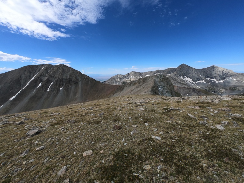
Day 11 - July 8, 2020 Crestone Needle & Crestone Peak Even waking up later than usual, I was already very tired as we headed up Broken Hand Pass. Though I still felt physically capable, it was the most sleepy I would be all summer, due to a series of late nights and early wake-ups. After a bit of scrambling, we reached the saddle and began the standard route of Crestone Needle. The steep but solid gullies were so much fun, and even Tim admitted to enjoying the scramble. The crossover move was the crux of the route, and the route-finding isn't bad if you know what you're doing. We enjoyed the views from the top and headed down, which I found equally fun, whereas Tim was quite a lot slower and more careful. We split ways at the pass, him going back to the tent, and me down to Cottonwood Lake to ascend Crestone Peak, again trying to avoid the Class 5 traverse. Compared to the Needle, this gully was long and tedious on worse rock, although there's a bit of fun scrambling at the top. The summit has some of the best views in the Sangres, and the weather was perfect, even though it was past noon. After carefully heading all the way down, I faced the agonizing climb back up Broken Hand Pass before I could reach the tent. But once I got there by mid-afternoon, I immediately fell asleep for a number of hours. I got up briefly to eat dinner, then soon fell back asleep for the night. 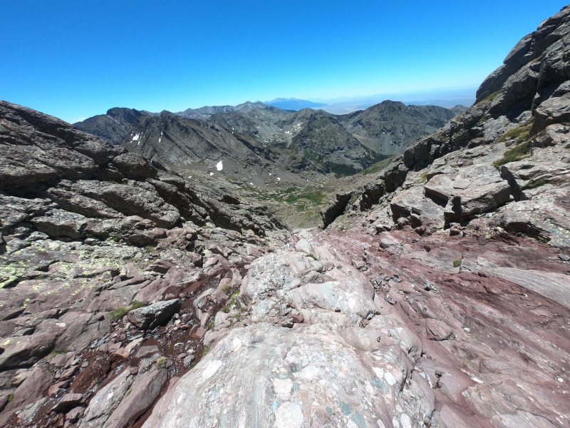
Day 12 - July 9, 2020 Humboldt Peak, Columbia Point, Kit Carson Peak, & Challenger Point I was so tired the night before that I pushed my alarm back even later, now to 6:00 AM. For once, the sun was already rising when Tim and I headed up the standard route of Humboldt. The interwoven mess of trails up the ridge were hard to follow, but the climb was altogether easy, and we were still on top quite early. After descending to where the standard trail meets the ridge, Tim set off back to the tent, while I headed towards the final two 14ers of the range. But first, there were a series of obstacles: an annoying unranked bump on the ridge, a near-centennial literally called "Obstruction Peak," then an actual centennial called Columbia Point. I was glad to get at least one useful extra peak on this non-standard approach to Kit Carson, which is much shorter but more difficult than the standard route from Willow Lake. The crux of this ridge is a series of fairly solid Class 3 gullies heading down from Columbia, joining in with the standard route on Kit Carson. After climbing up the final scree slope, I headed across the Avenue to bag barely-ranked Challenger Point, then across again to where I came from. The worst part of this approach was re-summiting all the intermediary peaks on the way back, resulting in a long slog before I finally reached the tent, again in the mid-afternoon. We packed up and backpacked out, then I made Tim drive (I was still really tired) to the southern Sawatch for some unfinished business the next day. 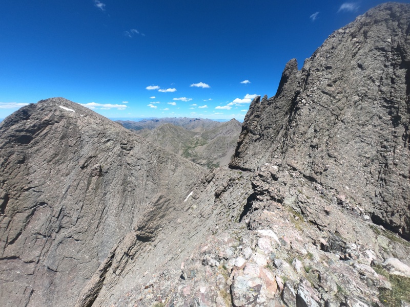
Day 13 - July 10, 2020 Tabeguache Peak, Mount Shavano, Mount Antero, & Cronin Peak I forced myself to get up at 4:00 AM because I knew how long a day I had ahead of me; Tim would be staying in the car. After not getting to attempt the 7th day of our Sawatch adventure, I was now 7 days deep into an even more brutal Sangre de Cristo trip. I started from the old Jennings Creek trailhead to the new, legal West Ridge route up Tabeguache. The upper slopes were rocky but relatively pleasant, and I soon made my way over similar terrain to Shavano. After getting two easy peaks out of the way, it was time for the hard part: I planned to take the standard "Nolan's" route over to Antero, which drops then reascends nearly 3,000ft in the process. I went down a long scree gully on Tabeguache's north side, walked briefly along a Jeep road, then moved up another gully and slope before joining in with Antero's standard route. The sudden transition from miles of complete solitude to a tourist parking lot on the side of a mountain was definitely a little strange. I quickly went up and down the busy ridge to the summit, and this time headed further down the standard route. Rather than follow the road to the northern trailhead, I kept moving along the ridge up another thousand feet to centennial Cronin Peak. From here, the rest of the ridge back to the saddle with Tabeguache looked fine, so I followed it over a couple more ranked 13ers. The worst part of the day was going down an extremely unpleasant steep scree-covered ridge back to the trail. Soon enough, I reached Tim and the car, done with the most difficult day at the end of an intense week of adventures. 
Day 14 - July 14, 2020 Quandary Peak, Mount Sherman, & Dyer Mountain Since there are so few 14ers in the Mosquito range, I decided to do them over just two days, making for a relatively short trip. I met Tim near Breckenridge the night before and began early the next day on Quandary. The trail was enjoyable and not too busy in the morning, as we watched the sunrise from just above treeline. There were good views at the summit, but we quickly headed down to beat the weather to Mount Sherman. Even in the middle of the week, the trail was a crowded mess on the way back; I counted a record-breaking 202 people in just 3 miles. Anyway, we then drove up Fourmile Creek road to the perfect spot for the 3,000ft rule, and I made up for the ludicrously-short 2-mile route to the summit by adding on a 3-mile approach. Tim met me at the trailhead, and we headed up the still-crowded trail to the least scenic 14er. With the weather still looking good, I split off from Tim down the opposite ridge to Dyer Mountain, one of two easy centennial add-ons. After summiting, descending, then reascending Sherman, the weather was starting to deteriorate, so I decided to pass on Horseshoe Mountain in the opposite direction. Instead, I went back down the standard route to the car, only to realize that I never gave Tim the keys, and he was now standing outside in the rain. I passed them over and ran back down the road to my starting point, then I drove down to drop Tim off before heading towards Kite Lake trailhead. 
Day 15 - July 15, 2020 Mount Bross, Mount Lincoln, Mount Democrat, & Mount Buckskin Once again, I actually parked a handful of miles down the road, so that I could attempt all the peaks with a net gain of 3,000ft. After an hour of hiking quickly up the road in the dark, I decided to begin the DeCaLiBron loop counterclockwise, to switch things up from my last visit. I may or may not have touched the top of a certain peak south of Mount Lincoln, before quickly heading across the ridge to Lincoln itself. There were still some early morning clouds hiding the sun, which combined with the crazy wind on these rounded peaks, made my fingers extremely cold. I didn't stay long at each summit to try to stay warm, and quickly headed over the imperceptible bump that is Mount Cameron, towards the lower but more peak-like Democrat. I had barely seen another person up to this point, but I was immediately bombarded with dozens of casual hikers along the ridge and on the summit. My hands were no longer cold, but I left that peak equally fast to get away from the crowds. Fortunately, I was heading down the scarcely-traveled southwest ridge of Democrat, so I had the mountains all to myself for the rest of the day. Unfortunately, this ridge between Democrat and centennial Mount Buckskin was pretty terrible. I chose to stay on steep, loose terrain rather than mess with scrambling on the ridge crest, which probably wasn't a great choice. I eventually made it atop my final peak of the day, headed down its gentle slopes, and ran back to my car, for a successful 2-day trip containing 7 ranked centennials. 
Day 16 - July 21, 2020 Longs Peak, Grays Peak, Torreys Peak, & Mount Edwards After a handful of days away from the mountains, I packed up my car and drove solo to the Longs Peak trailhead. Arriving late enough in the evening, I didn't need a reservation, and slept in my car until 4:00 AM. I moved efficiently up the trail, passing a few other groups with even earlier starts, plus some camped at the boulderfield. I stopped to put on my helmet and put away my trekking poles at the Keyhole, and had a fun time scrambling up the remainder of the route. The summit was already busy before even 8:00 AM, and there were even more climbers along the route on my way back. I have never seen so many people on a Class 3 route; even the rock was noticeably worn slick from the constant traffic. After a pleasant descent all the way back to my car, I decided to drive to Steven's Gulch trailhead to attempt Grays and Torreys, since the weather was still pretty nice. I parked a little ways down the road (as per the 3,000ft rule), and started up the trail as most people were arriving back at their cars. I did Torreys first to switch things up from my last ascent, traversed to Grays, then decided to add on centennial Mount Edwards. This peak was over a mile away from Grays along a harder Class 2 ridge, which was very tiring to negotiate twice. I finally made it down to the car around 7:00 PM, and made it to Guanella Pass by dark. It was my longest day of the summer, with over 25 miles and nearly 10,000ft of gain. 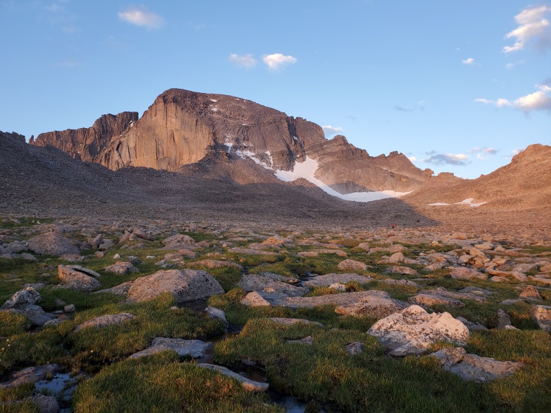
Day 17 - July 22, 2020 Mount Evans & Mount Bierstadt I started hiking up the road nice and early from a pull-off about 3,000ft below Bierstadt. I took the standard winter shortcut up the first switchback, then decided to try shortcutting the second switchback by heading straight towards the boardwalk trail. This ended up being a huge mistake, involving much bushwalking and wet feet. Since I had already done the Sawtooth traverse from Bierstadt, I decided to switch things up and summit Evans first. I wouldn't recommend it, since you get your shoes muddy first thing in the morning, but I was already past that point. Still, after a long hop across the rocky ridge, it was nice to reach the top before anyone else. I made my way back over to the entrance of the Sawtooth, put on my helmet, and began the scramble. I ended up on a lower route than last year; it was more "Class 2+" terrain than Class 3, and probably less enjoyable. In comparison to my solitude on Evans, I was shocked to see over 50 people loitering around the summit of Bierstadt (again, in the middle of the week). Avoiding crowds on the descent would've been reason enough to do the loop in the opposite direction. I counted a new record of 254 hikers passed, solely on that 3-mile descent, then stupidly took the same marshy shortcut back to the car. I was driving home by around noon, for a good 6 ranked centennials in a day and a half of hiking. 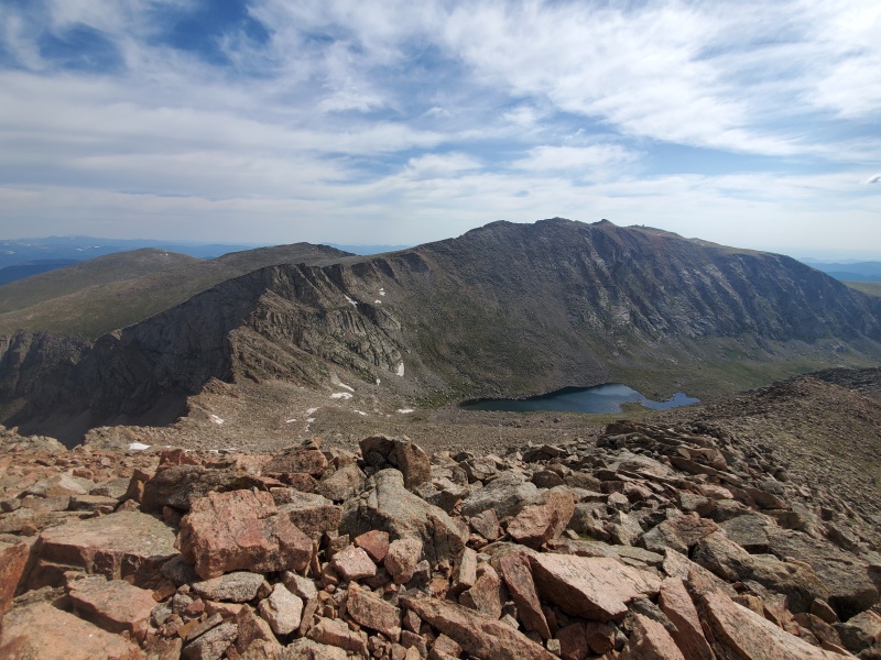
Day 18 - July 30, 2020 Mount Wilson, & Wilson Peak The San Juan trip seemed like the most ambitious of the summer: 14 14ers, many of which technical, in under a week. It took an entire day beforehand just to drive to the Kilpacker trailhead, where we stayed the night and got up at our usual 4:00 AM the next morning. I had an ambitious plan in mind: the entire Wilson group in a day, whereas Tim would just summit the first peak, El Diente. We went up the standard South Slopes, which I found easier than expected. There's a nice trail to the upper basin, where there's lots of talus hopping, followed by some fun scrambling around occasionally loose rock. We summited together and headed back down the ridge, where Tim split off back down the standard route. I continued along the ridge towards Mount Wilson, for my first of the Great 14er Traverses. The worst part was the loose descent from "West Wilson," followed by some scarily steep Class 3 scrambling. Overall, I found it super enjoyable, including the Class 4 crux up Mount Wilson. I soon headed down the standard North Slopes of this peak for nearly 2,000ft into Navajo Basin, which was extremely tedious. I then regained all that elevation by heading to the Rock of Ages saddle, and up the standard route to summit Wilson Peak. It was also a pretty fun scramble, with some scary exposure and steep Class 3 near the end. Finally, I went back down into Navajo Basin, took the connector trail back over to Kilpacker, and finally reached the parking lot with Tim waiting in the car. 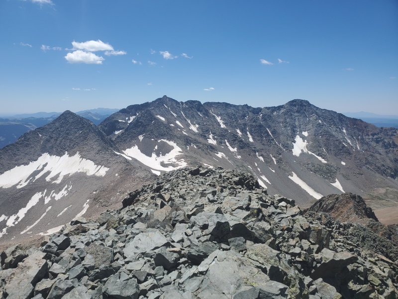
Day 19 - July 31, 2020 Mount Sneffels The night before, we drove up to the ideal location in Yankee Boy Basin to gain 3,000ft on the way up Mount Sneffels. Tim wanted to save his energy, so I got my usual early start, solo. The majority of the mileage was a quick hike up the 4WD road, which was followed by a short section of trail, then a couple of steep sections to the summit. The first slope up to Lavender Col was unpleasant, but at least an efficient way to gain elevation. The upper rocky gully, where I put on my helmet, was slower but a little nicer. The Class 3 crux move through a notch near the summit was easier than I expected, and I reached the top at my earliest time of the summer, about 6:00 AM. I watched the sun rise with a couple of other hikers, then quickly headed back down for our next objective of the day. I surprised Tim by arriving well before 8:00 AM (he had just woken up), and we were soon on our way to Purgatory trailhead. We spent nearly an hour in the parking lot packing all our supplies and food, then set off down the trail (as in, literally descending) just past noon. This would be our longest of 3 backpacking trips this summer, both in mileage and duration. After the initial descent, there's a gentle climb along the Animas River to Needleton, followed by an intense climb up to Chicago Basin. Tim was really struggling with the final few miles, so I went ahead of him to set up the tent, and we fell asleep around dark. 
Day 20 - August 1, 2020 Mount Eolus, Sunlight Peak, Windom Peak, & Jupiter Mountain I slept in for an extra hour, since the peaks were closer than usual in elevation. I tried to wake up Tim, but he would not move, and insisted that I go on without him. I tried to bargain with him to do at least one peak, but he was so exhausted that he refused. So, I began without him up the somewhat-tricky route towards Twin Lakes as the sun began to rise. I took the great trail most of the way up Eolus, then walked across the Catwalk and up some fun scrambly paths to the top. The early light combined with some clouds made for an otherworldly look to the surrounding peaks. I retreated down all the hard parts, quickly tagged the top of North Eolus, then went back to the lakes. The lower approach in the basin to Sunlight Peak was much less pleasant, with a scree gully leading up to the ridge. But past that point, the scrambling was amazing, with lots of fun Class 3 and 4 moves, the chimney section, and of course the summit block. With grippy shoes and long legs, I found getting to the top quite easy, and I actually hung out up there for about a half hour. It was then back down, across the shortcut, then up to Windom, my final 14er of the day. It was definitely the easiest peak, although with slightly more loose rock. On the descent, I snapped my third trekking pole of the summer, which I had just gotten replaced under warranty. Upon reaching the tent, I requested to borrow one of Tim's trekking poles and headed up a frequently-orphaned centennial, Jupiter Mountain. The ascent wasn't very noteworthy: just short, steep, and fairly quick. I made it back down to camp by mid-afternoon and quickly fell asleep, after a long day of 7,500ft of gain, all above 11,000ft. 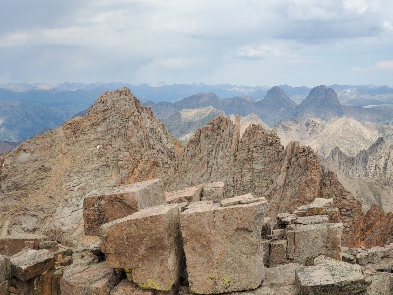
Day 21 - August 2, 2020 Handies Peak We woke up in our tent for the second morning in a row, packed everything up, and started the hike back down around sunrise. Even after a full rest day, Tim was still feeling terrible, so I outpaced him and waited around a lot on the descent. It was a lot easier than the approach, but still very long with a lot of elevation gain, going back up to Purgatory from the Animas River. I reached the car around noon, just under 48 hours from when we started. But now, having finished the western San Juan 14ers, we had to decide how to reach the eastern San Juan. The standard drive to the Grizzly Gulch/Silver Creek trailhead would take over 4 hours, whereas the 4WD shortcut over Cinnamon Pass supposedly took just 2. We decided to go for it, and it actually went pretty well. It was funny to see our SUV lined up at the summit amongst dozens of Jeeps and 4-wheelers. Upon reaching the trailhead in about 3 hours, I decided to go up Handies to film the sunset at the summit. Weighed down with extra camera gear, I still made good time up the beautiful Grizzly Gulch trail, only passing one person (and his dog) along the way. They left the summit a little before me, giving me a perfect view of the sunset. I hiked down in the dark using the full moon and my headlamp, arriving back to Tim in the car around 10:00 PM. 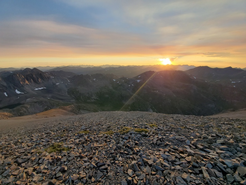
Day 22 - August 3, 2020 Redcloud Peak & Sunshine Peak Finishing so late the night before, I turned off my alarm and woke up at a random time, totally unprepared for the morning's hike. I finally repacked my bag and started with Tim up the Silver Creek trail (immediately opposite the Grizzly Gulch trail) around 7:00 AM. It was strange to set out in the daylight, and to be catching up with so many people along the way. This trail was also very nice, except for the steep confusing switchbacking section up to a false summit of Redcloud. We both made it to the top at a leisurely time, then headed down the other side towards Sunshine. The traverse was very straightforward, and I passed the same person and his dog from the night before. I wasn't too keen on retracing our steps back up and over Redcloud, so we headed down the much shorter Northwest Face route. It wasn't so bad aside from the steep gully through a cliff band, followed by a loose scree slope, where we were glad to have brought our helmets. The route back to rejoin the trail was a little tedious from there, but still definitely faster than the standard route. Even with our late start, we reached the car by early afternoon, for my shortest day of hiking all summer. We made the quick drive over to the Matterhorn Creek trailhead, or at least just before the short but intense 4WD section at the end. Here we encountered the worst mosquitoes of the entire summer, so we hung out in the car until nightfall. 
Day 23 - August 4, 2020 Wetterhorn Peak & Uncompahgre Peak I wanted Tim to at least attempt Wetterhorn, the more fun first peak of the day, but he had had enough hiking and just wanted to stay in the car again. So, I woke up early and set out alone along the recently-improved trail towards Wetterhorn. The upper route was a ton of fun, navigating through a gentle boulderfield, traversing along a steep ridge, then scrambling up to the summit. I reached the top well before we had even started hiking the day before. I soon scrambled back down and cut across an open field to save a bit of time on the way to Uncompahgre. But immediately, I ran into a massive herd of hundreds of sheep, who cautiously moved out of my way as I rejoined the trail. It was a few more miles above treeline to the base of Uncompahgre, all relatively flat and easy. I joined in with the standard route, passed the same person and his dog for the third day in a row, and reached the summit. For the first time of the summer, I noticed an intense haziness in the distance, which I soon learned (and came to accept as normal) to be wildfire smoke. After descending the standard route, I essentially ran all the way back down to the car, surprising myself and Tim by arriving before noon. We then drove a few hours to the trailhead for the non-standard (but closer) South Ridge route up San Luis, my final of 14 14ers in the San Juan. We were starting to get sick of the food we brought, so we did our fanciest cooking of the summer by making some pancakes along the dirt road. 
Day 24 - August 5, 2020 San Luis Peak Tim once again wanted me to go solo, so we could get done and go home as early as possible. I started from my position 3,000ft below the summit, an obnoxious 2 miles from the actual trailhead. I made it past the flat dirt road and onto the trail around sunrise. It starts out steep, before reaching the gentler Colorado Trail and following it for a number of miles. There were a bunch of tents set up at the final saddle under San Luis. They must've been CT hikers adding on an early morning 14er, since I passed a lot of backpackers who were heading down the ridge. Still, I had the top to myself for a long time, admiring the nice views and 116-year-old summit marker, which read 1904. I headed carefully back down the rocky ridge, then decided to just run all the remaining downhills. I was amazed at how good I still felt after 7 days and 14 peaks, and I again reached the car much earlier than Tim or I expected. Even with a 5 hour car ride, we made it home by mid-afternoon. 
Day 25 - August 11, 2020 Castle Peak After a few more days off from hiking, Tim and I drove up to Aspen and to the Castle Creek trailhead. We made it over a mile up the road (to the creek crossing) before giving up and calling it a night, prepared to wake up at the usual 4:00 AM the next morning. After hiking the rest of the precarious-looking 4WD road, we made it to the upper trailhead around sunrise. The rest of the route was short but slow-going, starting with a steep boulderfield. Luckily, given the time of year, we were able to avoid most of the snow. We finally made it to the fun Class 2 ridge and followed it the rest of the way to Castle Peak. Having never seen them in-person, I was amazed by the distant views of the Maroon Bells, Pyramid, Snowmass, and Capitol, which was essentially my itinerary for the next week. We followed the ridge over to Conundrum, an unranked 14er on my list of 58, although not considered a centennial. Negotiating the small cliff bands was a little bit trickier, and there was a pretty ambiguous false summit well before the true one. Not wanting to reascend Castle, we went back to the saddle and descended the terrible gully down into the lower rocky basin. This forced us onto a steep snow slope, which was even more unpleasant to pass through. But we eventually made it safely back to the rocks, down the road, and finally to the car. After realizing there was absolutely no parking along Maroon Creek road, we drove part way back up Castle Creek road to spend the night in a random pullout. 
Day 26 - August 12, 2020 Maroon Peak & Pyramid Peak We woke up at 4:00 AM and drove up to Maroon Lake trailhead, for which I had bought two days of parking reservations months in advance. I started up the trail in the dark without Tim, until reaching the unmarked turnoff towards Maroon Peak. I headed up the 3,000ft to the ridge, which I actually somewhat enjoyed; where else can you gain that much elevation in just an hour of steep hiking? The scramble to the top was also lots of fun, with the first gully being by far the loosest and most unpleasant part. Since it was still early and looking nice, I decided to continue on the traverse towards North Maroon, another unranked 14er on my list. I felt fairly comfortable soloing all the cruxes, despite the exposure and Class 5 difficulty. The hardest part of the traverse was simply route-finding; I was glad I studied the route so well the day before. I made it to North Maroon within an hour, and descended the tricky ridge, followed by the two massive gullies. I was still feeling great, and started to realize that I could conceivably hike Pyramid Peak within the same day. I ran past dozens of backpackers and tourists in the mile between turnoffs, and went up the steep trail to the Amphitheater. The gully was unpleasant, the scrambling was fun, and it felt slightly harder than the other two standard routes. I summited and headed back down, ran out of water, then finally reached the car after about 12 hours of hiking. It was a huge day, with 8,500ft of gain on difficult terrain, although I managed to shave a day off our trip, which made Tim happy. 
Day 27 - August 13, 2020 Snowmass Mountain We slept at the Snowmass Creek trailhead, and I got my usual early start. Due to our shortened schedule, Tim would be taking another day off in order to be completely ready for the hardest 14er tomorrow. But first, it was time for my second-to-last peak, Snowmass Mountain. The trail was very long but very gentle up to Snowmass Lake, with the only obstacle being a huge water crossing over the "log jam." I managed to choose the worst possible route across it, and got my foot wet by messing up the final step towards dry ground. The morning light and reflections off the lake were absolutely beautiful. The terrain from that point to the top was much steeper and rockier, although mercifully dry (I have zero experience with snow climbing). I hopped over constant boulders, before finally reaching the ridge and scrambling up to the summit. Technically, this peak is fairly easy, with only a few unavoidable Class 3 moves. But as a 20 mile day on variable terrain, it could be considered one of the hardest 14ers, definitely in the top 10. I reversed my route across the ridge and down the massive boulder field, then decided to start running once I hit Snowmass Lake. I did the final 8 miles back to the trailhead in a little under 2 hours. Even at this fast pace, I got back in the mid-afternoon after more than 8 hours of hiking. We drove to the Capitol Creek trailhead for my final 14er, and set our alarms for 4:00 AM. 
Day 28 - August 14, 2020 Capitol Peak The day started like many others that summer: an early morning wake-up from the car, followed quickly by setting out on the trail with Tim. We took the ditch trail, which saves a bit of elevation over the standard Capitol Creek trail. The sun rose as we got our first views of Capitol looming in the distance, and we soon made it to the turnoff by Capitol Lake. I sped up the steep slope to the ridge, where the real climb begins. It took a surprisingly long time to traverse the bouldery slope, which felt similar to Snowmass, but ironically with more snow crossings. We made it to K2, packed our trekking poles away, and put our helmets on. The downclimb from this subpeak was probably the technical crux of the route at a solid Class 4, although it can be bypassed on a loose, exposed slope. The ridge from there was very flat with fun Class 3 scrambling, and a couple sections of the famous "Knife's Edge." The movement across it was slow and awkward, but felt very secure. In contrast, the final slopes up to the top were the scariest part, moving up and across exposed ledges on loose rock. I reached the summit, took out the celebratory root beer I had carried to the top, then proceeded to knock it thousands of feet off an edge before even opening it. Still, we briefly celebrated the achievement before heading back down the tedious route. Luckily, the descent was fairly uneventful, which could not be said for our drive home. I-70 and Independence Pass were both closed because of fires, which would over double our 4-hour drive home. Instead of arriving after midnight, we decided to take the precarious Hagerman Pass, which was, let's say, quite the 4WD adventure. 
Day 29 - August 21, 2020 Fletcher Mountain, Atlantic Peak, Pacific Peak, Crystal Peak, & Mount Silverheels One week after finishing the 14ers on Capitol Peak, I decided to start tackling some of the easier centennials. I knew they were still a distant goal, but I had at least a month of great weather to make as much progress as possible. So, I headed just past the Quandary Peak trailhead onto the McCullough Gulch trail, with an early start from just below 11,000ft. The trail was rough and hard to follow, although apparently extremely popular. I first hiked up to the saddle between Fletcher Mountain and Quandary, then headed up Fletcher. On this trail, I managed to break the tip off not one, but both of my trekking poles in less than a mile. On the summit, I started to notice just how smoky the air was, by far the worst I'd ever seen, and I started to consider stopping for my own good. But instead, I headed back into the basin and up a rough, loose gully towards Atlantic Peak, which was at least better than the traverse from Fletcher. The ridge over to Pacific Peak was easy, and getting to Crystal Peak was a little trickier, but not bad. I retraced my steps all the way back over Pacific and down the gully, then passed well over a hundred people on my way back to the car. The smoke had started to clear up a little bit, so I drove over to attempt Mount Silverheels from the south. I reached the top by the late afternoon, happy that at least the weather was nice. It was a short and easy hike, but felt long and hard after nearly 25 miles and over 10,000ft of gain. This remains the most centennials I've ever done in a day at 5. 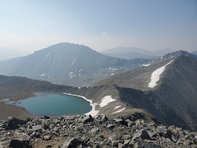
Day 30 - August 29, 2020 California Peak After a semi-successful single-day outing the week before, I decided to tackle the two distant but easier centennials I had left in the Sangre de Cristo range. It was my first weekend of the fall school semester, and the smoke seemed to be a lot better. I drove 4 hours the night before to the Zapata Falls trailhead, and started up California Peak from its standard eastern route. It was strange having to learn to route-find up very faint climbers' trails, although this soon would become a fact of life for my remaining peaks. The rest of the way up the ridge was easy, and I got there so early that I decided to continue along the ridge to bag the two lower ranked 13ers. I considered a descent straight into the basin, but it didn't seem feasible (or pleasant), so I backtracked along the entire ridge to California, the way I came. I checked out Zapata Falls before returning to the car, which was busy but pretty cool. Still having a lot of time left in the day (but not enough to climb Mount Adams), I decided to head over to the Great Sand Dunes National Park for a short sandy hike. I got charged an extortionate $25 to park for a couple hours, went up to High Dune, and ran down a different way to make a fun loop. I then drove over to the Willow Creek trailhead to spend the night for tomorrow's peak. 
Day 31 - August 30, 2020 Mount Adams & Mount Ouray I woke up as early as always and headed up the Willow Lake trail towards Mount Adams' West Ridge. It was cool to be able to see the standard approach that I'd never done for a couple of 14ers; it was a great trail but very steep. At the lake, I headed off-trail on some slopes towards the saddle between Adams and another ranked 13er. I decided to quickly split off to climb the 13er, requiring only a few hundred extra feet, before tackling the Class 2+ ridge on Adams. In reality, it's way easier and more fun if you just call it Class 3 and scramble up the ridge direct, at least on the upper half. After reaching the summit, I headed down the other side towards South Crestone Lake and another easy bonus 13er. This side of the peak was steeper and looser, and getting down to the established trail by the lake was an unpleasant bushwhack. Still, it was cool to make a loop using two major trails from the same trailhead. I got back to the car with some extra time, so with the weather still holding up, I decided to head to Mount Ouray, which was practically on the way home. It's a short and relatively easy hike from the trailhead, so I raced my way up while carefully watching a distant storm. I turned around at the summit as fast as possible, but still got caught by a bit of hail on my way down the ridge. Luckily, there was no thunder, and I made it back to the car safely. I got home around dark, happy with checking off 3 centennials, 4 bonus 13ers, and 1 sandy hill in a weekend. 
Day 32 - September 4, 2020 French Mountain, Casco Peak, & Lackawanna Peak The next weekend, I had a day off school for Labor Day, so I decided to drive up on Thursday night to try and maximize my number of centennials. I had 9 left in the Sawatch range, and figured I could just about fit them all into 4 days. I parked under Independence Pass, arriving unusually late, but got up just as early on Friday. I headed up an old mining road, then split off on a faint, intermittent climbers' trail. I finally got above treeline, where movement was easier, then ascended a steep, unpleasant scree slope to the ridge. From there, I hiked straight to Frasco Benchmark, a high but unranked 13er. I continued a short distance to French Mountain, which held beautiful views of Massive, Elbert, La Plata, and even the Elk peaks far in the distance. I retraced my steps over Frasco, down to the saddle, then up a slightly harder section of the ridge to Casco Peak. On top of here, the cheap pair of sunglasses I had been using all summer finally gave out and broke at the hinge. I continued down the even longer stretch of ridge all the way to Lackawanna, my third centennial of the day. I turned around and headed down the very steep slope back to the old mining road, and eventually the car. I had wanted to try Mount Oklahoma on the same day, but my first hike had taken longer than I expected, plus I was getting a little bit of altitude sickness, which is unusual for me. So instead, I took some Advil, drove into Leadville, and attended one of my online classes from the back of my car. 
Day 33 - September 5, 2020 Mount Oklahoma & Grizzly Peak I started the day from the trailhead for Mount Massive, where I had started out the 14ers just two months before. But instead of taking the commonly-missed turn up Massive's Southwest Slopes, I continued straight towards Mount Oklahoma. I diverged onto some faint convoluted paths until eventually reaching treeline, then headed up the final steep slopes to the summit. The top of this peak not only had great views of Massive, but was also massive in and of itself. I quickly headed back down while begrudgingly listening to a boring audiobook for one of my classes, and reached the car well before noon. I drove back up the road towards Independence Pass, and turned off near the standard trailhead for La Plata. I drove up quite a remote valley for the Sawatch, along a very bumpy 4WD road. I parked and started hiking before the final turnoff, and soon found myself on a faint trail in the Collegiate Peaks wilderness. I went all the way up the valley and turned right towards a steep slope, with somewhat complicated terrain to gain the ridge. I finally made it to the summit of Grizzly Peak, the tallest 13er in Colorado, which had amazing views of the entire western Sawatch. With good weather and wanting to avoid descending the same route, I took the ridge in the opposite direction towards bicentennial 13er Garfield Peak. I had fun skiing down a steep scree slope (which would've been a nightmare to ascend), before rejoining the trail at the bottom of the valley. I hiked back down to the car then drove all the way over to another familiar trailhead, below Mount Huron. 
Day 34 - September 6, 2020 Ice Mountain, North Apostle, & Mount Hope I again woke up in the same spot as about two months ago, but this time headed up the Lake Ann trail, splitting off towards the Three Apostles. The official trail ended quickly, turning into a mess of climbers’ trails through some willows and towards a steep, rocky basin. I quickly found myself right in the middle of this basin, ascending an unusually-unpleasant scree slope up to the saddle between Ice Mountain and North Apostle. I started with Ice, the significantly more difficult Class 3 peak, by heading up a series of faint paths intermixed with scrambling up the ridge. The crux of the route was a steep, loose scramble just before the summit, which happened to hold the first freshly-fallen snow I had seen all summer. I extremely cautiously made my way up this precarious section, and sighed with temporary relief at the summit. I enjoyed some more great views of remote peaks before heading back down the ridge, and then up the much nicer ridge to North Apostle. The rest of the way back to the car was easy, aside from descending again into the steep rocky basin. I drove back down the 4WD road, then a short distance over to the trailhead below Hope Pass for my next peak. The 2,500ft to the top was unrelentingly steep, followed by a rockier ridge than I had expected to the summit of Mount Hope. I made my way back down to the pass, tired from a long day, but decided to take a brief detour up nearby 13er Quail Mountain. I finally went back down from the steep pass, made it back to my car at a reasonable time, then drove a very short distance to my next trailhead. 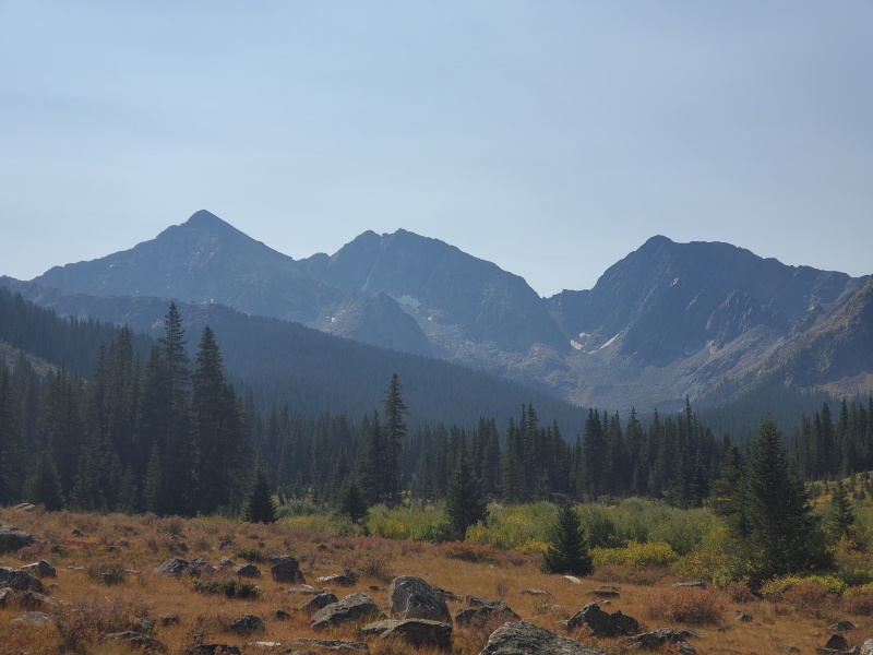
Day 35 - September 7, 2020 Emerald Peak I started my day between the two creek crossings at the very beginning of the Clohesy Lake 4WD road. The first one would've required getting my feet wet, but was easy to bypass in my car. The second one looked way too rough for my car, but I could hop across easily on foot. My solution was to spend the night parked right in between the two, so I could start without wet feet or broken cars. The remaining 3 miles up the 4WD road were very boring in the dark, but I knew it was still the shortest route up Emerald Peak. I headed into the wilderness on the rough and remote Pear Lake trail towards a saddle, where I turned left along the ridge. The crux of the route is a sudden extremely steep scree slope up the remaining few hundred feet to the summit. It was a lot worse than I expected, but I soon made it to the top of Emerald Peak, my 9th centennial of the long weekend. Rather than descend the way I came, I decided to continue along the much gentler ridge to Iowa Peak, an unranked 13er. It had suddenly gotten significantly more smoky, so I was glad I was almost ready to go home. From here, I decided the best way back to Clohesy Lake would be the somewhat-popular West Ridge of Missouri Mountain, which was very close by. I did my first 14er repeat of the summer, then started down the familiar standard route before splitting off on the opposite ridge. The trail was surprisingly nice back to the lake, where I merged onto the gentle road back to the car. I made the mistake of taking 285 rather than I-70 to get home, which resulted in a terrible 3+ hour Labor Day delay. 
Day 36 - September 14, 2020 Mount Meeker I was super busy with schoolwork over the next weekend, but I realized that I could fit in a quick Monday morning ascent before most of my classes started. Mount Meeker was the perfect candidate, since it was a substantial climb, but still super close to home. I chose the South Ridge route, which has an easy approach to a steep, mostly Class 2+ slope. I drove into Rocky Mountain National Park to a small parking lot the night before, then got up at 4:00 AM. The initial few miles up Sandbeach Lake trail were dark but super easy, followed by a couple miles navigating through a densely-forested climbers' trail. The route became super steep and slow-going above treeline, although none of it was particularly unpleasant. I eventually made it to the upper ridge, which held a small amount of slabby class 3 climbing to the summit. The views of Longs Peak and the surrounding terrain were incredible, especially in the early morning light. I watched a SAR helicopter repeatedly fly back and forth, looking for a climber who was eventually found dead on the Glacier Gorge traverse. I headed back down the same route, which was just as tedious as on the way up. I was finally able to start running once I reached the main trail, and I made it back to the car before noon. I drove home and got to class later that day, after a very short but fun hiking trip. 
Day 37 - September 18, 2020 Clinton Peak & Horseshoe Mountain For my final centennial trip of the summer, I wanted to finish up the Mosquito range, where I had aborted a trip a few weeks earlier due to smoke. It was the final weekend of the summer, so I decided to put the project on hold thereafter. I started out the night before near Montgomery Reservoir, where it was difficult to find a spot more than 3,000ft below Clinton Peak. I set out on the long dirt road, which turns into very rough-looking 4WD up to Wheeler Lake. From here, the route to the top of Clinton was very short and quite easy. The view on top of Mount Lincoln, lightly dusted in snow in the early morning light, was particularly beautiful. In contrast, the Climax mine in the opposite direction was distinctly not beautiful. I headed along the easy ridge to unranked 13ers McNamee Peak and Traver Peak, before merging back onto the same route and down to my car. I quickly drove the fairly short distance up and over Weston Pass, where I again parked exactly 3,000ft below Horseshoe Mountain. I chose the West Slopes route, essentially an old mining road which gives you a straight shot to the final mile to the summit. Despite its steepness, I found it quite enjoyable, and probably the easiest 13er I had ever done (by the 3,000ft rule). I was on top of my 82nd centennial of the summer, just about 90 days after the first. I spent my descent thinking about those final 18, which contained many of the hardest 13ers. But that would have to wait until next summer; instead, I finished off the weekend by hiking the non-centennial Buffalo Peaks the next day. 
Day 38 - July 9, 2021 Phoenix Peak The year was now 2021. I had spent the first few weeks of summer not climbing peaks, but backpacking. From June 21 to July 8, I hiked the entire 480-mile Colorado Trail, from Denver to Durango. My family drove an extra car down to meet me, so that I could jump straight into finishing the easier eastern San Juan centennials. I started by driving past Creede to the Phoenix Park trailhead, a short distance from the top of Phoenix Peak. I accidently took the harder upper road to get there (thanks, Google Maps), and stopped to pack my bag at the turnoff before the intense 4WD section. After walking this road for a couple miles, the route takes a sharp right up an unmaintained but seemingly official trail. Above treeline, I curved left up a small ridge then a steep slope to the summit. Despite starting well after noon (I had to drive 3 hours from the hotel, buy groceries, etc.), the weather seemed to be holding off. I hung out on the summit for a while, unconcerned, then started the descent. All of a sudden, a small group of storm clouds came from behind me and started crackling with thunder, blowing my direction far faster than I could run. Still, I made it down to treeline in a mere 30 minutes, probably the fastest I've ever descended 2,000ft. Somewhat shaken up, and now unavoidably soaked, I walked the remaining few miles back to my car, having already learned a lesson about weather on my first peak day of the season. I drove over to Rio Grande Reservoir, where I spent the night. 
Day 39 - July 10, 2021 Rio Grande Pyramid Accustomed to waking up with the sun during my backpacking trip, I decided to start at 5:30 AM, rather than last year's 4:00 AM. I guess I needed to ease back into climbing the high peaks, before breaking out the headlamp. I started up the Weminuche trail into the Weminuche wilderness, which seemed like a popular backpacking route. It was a long 5 mile approach before breaking off on a steep, unmaintained trail towards the summit. This trail also goes for quite a while, with a bit of controlled bushwhacking, before the final scree slopes to the summit. This final Class 2 push to the top was a lot steeper, looser, and generally more unpleasant than I had expected. It went by pretty quickly though, and I enjoyed the somewhat-hazy views from the summit. A handful of other hikers all reached the top within a short period thereafter, which surprised me. You hardly ever see anyone on the summits of 13ers, much less one hidden 10 miles into the wilderness. I soon headed back down, and the entire descent was much less eventful than yesterday's 30 minute ordeal. I was glad I brought my water filter, as I had to fill up after getting back below treeline. From there, I ran most of the gentle trail back to the trailhead, for a round-trip time of just over 8 hours car-to-car. I drove off towards Lake City, and was surprised to make it all the way up the narrow 4WD road to the Cuba Gulch trailhead. 
Day 40 - July 11, 2021 Jones Mountain & Half Peak I woke up in my car, alone in a remote valley, at sunrise. My first goal of the day was the American-Jones-Niagara combination, which are all over 13,800ft (but only Jones is a centennial). I started up the "Snare Stairs," a set of many switchbacks up a huge talus slope, which used to be open to 4WD vehicles. I broke off from the road above treeline, went up a steep slope, then sketchily gained the ridge up to American Peak. The traverse over to Jones was also pretty precarious for a Class 2 route, with lots of loose rock and steep slopes. Heading over to Niagara Peak wasn't as bad, and I was soon headed into a basin that led back to the old 4WD road. I reached my car around noon, and decided to go for Half Peak, since the weather forecast was perfectly clear. The trail was in extremely rough shape, starting with a well-marked but strenuous dance around uncleared avalanche debris. I then ascended too high, missing a critical footbridge, and then got totally lost looking for the continuation of the trail on the other side. I stayed way too high and never found the actual trail until the hike back down. Even worse, after breaking off from the trail, the route was essentially a steep bushwhack until I finally hit the Colorado Trail (back on familiar terrain!), which led to the long summit ridge. I was exhausted upon reaching the top, and there was nothing to show for it: the views had been completely enveloped in smoke. I trudged all the way back down, finding a much better (but still rough) series of paths down to the car. 
Day 41 - July 12, 2021 Point 13,832 & Point 13,811 I spent the night in the familiar Silver Creek/Grizzly Gulch trailhead, from where I had already hiked two routes the year before. I again woke up at sunrise, and headed up the Silver Creek trail towards the two centennials with the least interesting names: Point 13,832 and Point 13,811. I followed the standard route up Redcloud all the way to the ridge, where I broke off to the left instead of right. From here, there's a solid climbers' trail leading most of the way to the tops of both peaks. There were a few steep slopes to traverse, but it was altogether very pleasant. 13,832 comes first, with great views of Redcloud and Sunshine in one direction, and the upcoming centennial in the other. Quite a ways further along the ridge, 13,811 also would've held good views, except that the smoke was starting to roll in again. I traversed all the way back along the ridge, contouring slightly around the top of the previous peak, and back to the initial saddle. Here, I made the decision to go on and repeat the two 14ers, because I had extra time, and why not? The ascent to Redcloud, traverse to Sunshine, and initial descent went just the same as last summer. Except, instead of going down the unpleasant loose gully, I decided instead to go up a lower 13er called Sundog. There was a lot of fun Class 2+ terrain with easy route-finding, although the descent back to the Silver Creek trail was pretty tedious. Still, I made it back to the car by the early afternoon, paid a ridiculous $4/gallon for gas in Lake City, then drove some scenic back roads to the Eddiesville trailhead, near San Luis. 
Day 42 - July 13, 2021 Stewart Peak I knew the weather wasn't going to be great, and there were also a few bonus peaks I wanted to add on, so I started hiking just before sunrise. I counterintuitively started my day by hiking back up the road I had driven up on, before heading up the trail along Nutras Creek. This path was hard to follow in places, but otherwise not bad. I broke off up a steep grassy slope to reach Stewart’s East Ridge, which was altogether a very pleasant route to the top. I reached the summit pretty early in the morning, and had to get moving quickly to stay warm. I checked out a small unranked 13er called Column Ridge, before heading up and down a longer portion of the ridge to ranked 13er Baldy Alto. From here, I admired the views of Stewart and San Luis in opposite directions, plus my next objective: Organ Mountain. This was another one of the not-quite-centennials at just over 13,800ft, so I figured I'd grab it while I was here. But first, there was a long, steep descent nearly 2,000ft into the valley where San Luis' standard route runs, which I've never taken. I then headed back up one more steep grassy slope to the rocky summit of Organ. Though it was still before noon, the weather was starting to look bad, with dark clouds and the distant rumbling of thunder. I raced down the peak's East Slopes route, eventually finding the elusive Cañon Hondo trail, which led me straight back to the car. Altogether, it was a successful first 5 days of the season, having finished 7 of my 18 remaining centennials, plus an equal number of bonus peaks. Day 43 - July 24, 2021 Cathedral Peak A couple weeks later, just at the height of the 2021 monsoon season, I decided to start my final push to finish the centennials. I planned to finish the 3 Elks, followed by my 8 remaining San Juans. To start, I drove into Aspen over Independence Pass, and spent the night at the completely empty Cathedral Lake trailhead. Due to the poor weather and serious nature of these peaks, I returned to my standard 4:00 AM wake-up time. I hiked up the unrelentingly steep Cathedral Lake trail in the dark, then briefly bushwhacked past the lake, into the basin below Cathedral. The sunrise was beautiful from this high position, although the gully in front of me was not. Having zero snow climbing experience, I decided to climb the couloir in July, completely dry, aside from last night's rain. The slight moisture in the dirt did seem to help me get a hold on the otherwise steep and obnoxious gully. There's nothing really to call Class 3 until the ridge, which is still loose, but much more fun than below. I topped out very early in the morning, although the clouds were already looking a little threatening. I quickly and carefully negotiated down the ridge, then half-hiked half-slid down the dirt gully. The boulder field below felt amazing in comparison, and I decided to quickly head up lower 13er Electric Pass Peak, which has an amazing runnable trail to the top. From there, the rain seemed imminent even at 9:30 AM, so I ran most of the way back down to the car. I stayed the night in the same pullout along Castle Creek road that I had used last year. 
Day 44 - July 25, 2021 Thunder Pyramid I woke up early and drove to the Maroon Creek trailhead on the day of my first parking permit (again, no one ever checked my reservation). I started up the trail as if climbing Maroon Peak, passing no one else outside of a tent. I broke off to the left and up a steep slope leading to a series of nifty gullies, which let you bypass a couple of cliff bands. I ended up in the remote Len Shoemaker basin, a neat position to look down on the inevitable hoards of tourists below. Out of all the loose, steep, unpleasant gullies I’ve climbed over the last year or so, the one up bicentennial Lightning Pyramid easily wins the title as the worst. The first part was comparable to other bad gullies, until I reached a constriction that was impassable due to snow. I scrambled most of the rest of the way to the saddle on crumbling Class 4 rock to the right of the gully, kind of like the Bells Traverse but with no defined route and 10x more loose rock (I wish that were an exaggeration). I was extremely relieved upon reaching the Class 2 out-and-back summit ridge to Lightning, then I began the traverse over to Thunder Pyramid. This felt almost easy in comparison: contouring along some grassy ledges, climbing a milder gully, then following the summit ridge. I struggled to find a way to the top easier than exposed Class 4, but the rock was solid, so I made it work. Luckily, the weather was still nice, and I soon headed down towards the white gully, which was honestly nice in comparison. Still terribly loose, and I did get a little confused which way to descend at first, but I quickly found my way back into the basin. I went down the lower gullies back to the trail, then ran back to the car, happy to be down safe. 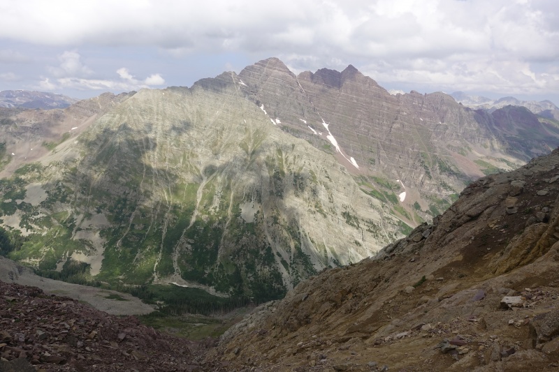
Day 45 - July 28, 2021 Hagerman Peak I took two "rest" days from the centennials: first a 19-mile day hike up Castleabra from Conundrum Hot Springs, then running the famous 26-mile 4-Pass Loop in under 8 hours. That night, I drove up the surprisingly reasonable high-clearance road up to the town of Crystal, and parked just above the private property sign. I then woke up and started on foot up the difficult 4WD road into Lead King Basin. Upon entering the wilderness, this turns into a long trail that gains a few thousand feet up to Geneva Lake, where I got my feet soaked on all the wet plants. I finally reached the intersection (where I had actually ran through yesterday), and broke off the trail towards Hagerman's Southwest Ridge. It was a great route, with over a thousand feet of fun scrambling that didn't exceed Class 3. The rock was actually decent for the Elk range, reminiscent of nearby Snowmass Mountain. I enjoyed the summit views for a while, although the weather was again turning bad very early. I headed down the easier but much less pleasant South Slopes route, which is essentially a row of steep scree gullies with occasional solid rock. I used Roach's description and headed down the adjacent drainage back to the main trail, making for a nice little loop. I ran much of the way back down the trail, which luckily had dried out by now, reaching the car before noon. I had finished the Elk centennials, so I drove towards the range holding my final 8 peaks: the San Juan. 
Day 46 - July 29, 2021 Gladstone Peak & Vermilion Peak I decided on the East Slopes route for Gladstone Peak, so I spent the night before at the East Cross Creek trailhead. I got my usual early start up the trail, with cool nighttime views of Lizard Head's silhouette. I went just over the pass before breaking off the trail, ascending grassy side slopes in the direction of Gladstone. I used my map and route description to take the proper zig-zagging route up the face of the peak, which was remarkably pleasant, maxing out at mild Class 3 near the top. After hearing horror stories of the loose Class 4 standard North Ridge route, I can't imagine why most people wouldn't take this alternative. I checked out the crowbar at the summit then retraced my steps uneventfully. I got back to the car around 10:00 AM, and realized I could probably squeeze in a short ascent of Vermilion before the weather turned bad. I quickly repacked my bag and drove 20 minutes up to the Lake Hope trailhead, which was packed with cars. I wanted to go all the way up to the saddle, then traverse a few peaks along the ridge to Vermilion, but I changed my plan to the shorter Southwest Basin route once I saw the clouds forming. The lower route was typical grass and talus, and the upper ridge was pretty fun, with a clear climbers' trail guiding the way. I summited around noon then raced back down, wanting to be out of the way of the developing storm. I reached my car with perfect timing, just as the rain started, and drove into Telluride to my next trailhead. 
Day 47 - July 30, 2021 Dallas Peak I woke up in the dark and started my day hike of Dallas, with my backpacking pack on. Over the last few weeks, I had been desperately trying to find partners for all the Class 5 centennials, but came up short for Dallas and Teakettle. I was still insistent on completing them with a rappel from their summits, so I decided to just buy my first climbing rope. I had spent all winter and spring learning and practicing basic climbing skills, so I was confident I could safely set up a rappel on my own. The downside was that I now had to carry a massive 10-pound rope, along with all my other climbing gear, all the way to the summit. I eventually left the trail onto a slope that increases gradually in steepness from gentle grass, to unpleasant scree, all the way to steep Class 3 scrambling. Some cairns brought me around the mountain to a large gully, where I worked my way up the Class 3-4 right side. Before I knew it, I was standing under the summit block, so I emptied everything non-essential from my pack, put on my climbing shoes (very useful!), and soloed up the Class 5 crux. I probably didn't quite choose the easiest route, but I felt comfortable enough on the terrain, and reached the summit by 8:00 AM. I signed and admired the summit register, full of recognizable names from the last half decade. I was happy to be rappelling off the summit so early, since the afternoon forecast looked bad. Everything went smoothly, so I repacked my bag and headed back down the mountain, reaching my car before noon. I drove a couple hours in pretty intense rain to Yankee Boy Basin, where I spent the night. 
Day 48 - July 31, 2021 Teakettle Mountain The day started much like the day before, backpacking pack on, and headed up a scree steep slope. It was exceedingly unpleasant, but I made it to the ridge quick enough to experience the beautiful sunrise. A comparatively-nice climbers' trail brought me through a series of gullies to the base of the summit block, which looked surprisingly like a Teakettle. I did the same as yesterday, soloing to the top with just my climbing gear in my pack, allowing me to set up a rappel at the top. The climbing was definitely easier, and I probably could have downclimbed it without trouble. I watched a helicopter circle around Sneffels for a while to rescue an injured hiker, then did my rappel. Everything went perfectly once again, so I loaded up my pack and set off back down the ridge. Rather than descend the same slope, I first decided to drop my pack and climb up "Coffeepot," a small unranked 13er with a short Class 5 crux. I used the in-place webbing to help lower myself back into the chimney before downclimbing, then returned to the ridge. I had my most exciting broken trekking pole yet, with a snap in 2 places at once. I eventually dropped my pack again and did a quick out-and-back to bicentennial Potosi Peak, which looks more intimidating than Teakettle, but is only Class 2 by its easiest route. I descended the slope in a different spot just as it began to rain (well before noon), then drove through some storms to the Purgatory trailhead. I packed my bags just like I had on my first visit, exactly one year before (funnily enough, I had also just come from Yankee Boy Basin for Sneffels). Luckily, the rain let up as I began my 11 mile hike to just past the Needleton train stop, where I camped in a field known as "Upper Camper Meadows." 
Day 49 - August 1, 2021 Pigeon/Turret Despite my long approach the day before, I got my usual early start, since I had over 5,500ft of net gain separating me from my first peak of the day. I headed up the faint but established trail towards Ruby Basin, before splitting off up an even steeper slope towards Pigeon Peak. There were long stretches of this slope that were well-cairned, and other sections that seemed totally blank. Still, I followed my GPS route all the way into the upper basin, where I first saw the dramatic view of Pigeon rising into the sky ahead of me. I stayed on steep but pleasant grass most of the way to the top, before gaining the ridge with the help of a single Class 3-4 move. I was surprised at how short and simple the upper difficulties of the peak were, and I was on top before I knew it. I got a good view of the much easier route up Turret Peak, before heading back down the same way, then around to a small pass. From here, it was a straightforward walk up to the top of Turret, which had even more amazing views. Arrow, Vestal, the Trinities, Jagged, Rio Grande Pyramid, and the Chicago Basin 14ers all sit right in front of you, plus the impressive eastern face of Pigeon behind. It had been cloudy all morning, so I quickly headed down before the weather got any worse, making it all the way back to camp without incident. I packed up my tent and filtered some extra water, before setting out on the 11-mile hike back to my car. I bought a way-too-expensive pizza from the resort before spending the night in the Molas Pass parking lot. 
Day 50 - August 4, 2021 Vestal Peak I had spent the day after my last two peaks waiting around in the parking lot for a new hiking partner to show up. I was hoping to begin the approach to Vestal Lake that day, but it ended up not working out until the next morning. We reached the lake around noon and set up camp, but it ended up raining all afternoon, so we only squeezed in an evening summit of bicentennial Arrow Peak that day. But the next morning, we finally set out up Vestal's impressive Wham Ridge, a Class 5 route I had insisted on climbing instead of the standard backside. The grassy ledges went by quickly, then we racked up for the steep climbing ahead. We belayed each other through a few short crux sections, with him doing all of the trad leading. The slab climbing was super fun, and altogether not too difficult. We eventually made it up to the broken upper face, which was looser, just as steep, but also a little easier. Due to a not-so-early start, plus the inherent time constraints of trad climbing, we reached the summit a ways after noon, which was unusual for me. We scrambled down the other side of the mountain, through a steep, polished gully that in a way reminded me of Crestone Peak. A simple trail brought us to an innocuous-looking scree slope, which actually was probably the worst I've ever had to descend, hence its "Dues Collector" nickname. We made it back to camp, quickly packed up, then headed out cross-country towards Jagged Pass. We went over the West Trinity-Vestal saddle, passed by Balsam Lake, then over the Peak Five-Peak Six saddle to camp at No Name Lake, arriving well after dark. 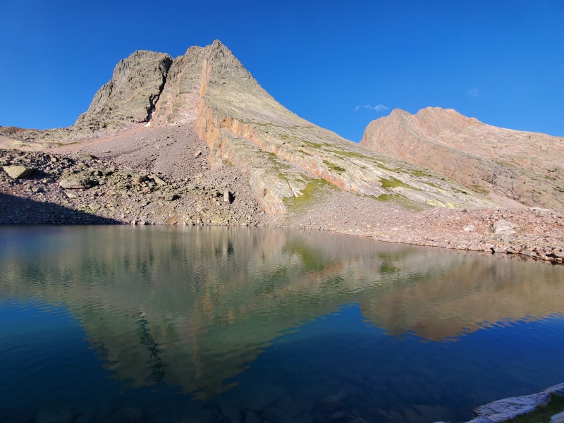
Day 51 - August 5, 2021 Jagged Mountain I woke up at sunrise and quickly hiked up the steep scree slope to Peak Six, giving my partner a head start on packing. I was back to camp in just over an hour, and we set out towards nearby Jagged Pass. For once, the scree under this pass was actually pleasant, and made for some fun scree skiing on the way down. Along the grassy slope, we intercepted some climbers who had just rappelled off Jagged, then arrived at the base of the technical climbing ourselves. I accidentally soloed up some Class 5 terrain, rather than taking the scree-covered ledge bypass, then set up an anchor to belay my partner up. After some class 2+ grassy ledges, I did my first ever trad leads up a few of the Class 4-5 sections. On the backside, we also belayed each other across the extremely exposed Class 3 ledges, and up the new Class 5 chockstone move. It was again after noon before we reached the top, but this time the weather wasn't so favorable. I had a matter of minutes to enjoy the incredible summit of my 100th centennial, before quickly rappelling off the top to escape an oncoming storm. Our rope wasn't long enough for the standard rappel route, so we were forced into the much longer task of retracing our ascent. It went a little quicker with the rappels, but we still got caught high on the mountain with thunder rumbling above (but luckily no lightning or rain). A little shaken, we made it back to camp safely and hiked down to Balsam Lake that night, before returning to Molas Pass the next day. 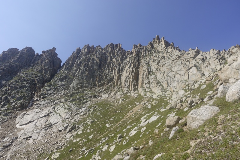
Statistics: June 22, 2020 - August 5, 2021
I also solved a Rubik's Cube on top of each peak, so here are my stats for that:
For the time being, I'm going to focus more on long-distance running & backpacking, plus perhaps some fun 14er routes I've missed. In the long-term, I may start working towards the bicentennial and 13er lists, but we'll have to wait and see! Thumbnails for uploaded photos (click to open slideshow): ")
")
")
")
")
")
")
")
")
")
")
")
")
")
")
")
")
")
")
")
")
")
")
")
")
")
")
")
")
")
")
")
")
")
")
")
")
")
")
")
")
")
")
")
")
")
")
")
")
")
|
| Comments or Questions | ||||||||||||
|---|---|---|---|---|---|---|---|---|---|---|---|---|
|
Caution: The information contained in this report may not be accurate and should not be the only resource used in preparation for your climb. Failure to have the necessary experience, physical conditioning, supplies or equipment can result in injury or death. 14ers.com and the author(s) of this report provide no warranties, either express or implied, that the information provided is accurate or reliable. By using the information provided, you agree to indemnify and hold harmless 14ers.com and the report author(s) with respect to any claims and demands against them, including any attorney fees and expenses. Please read the 14ers.com Safety and Disclaimer pages for more information.
Please respect private property: 14ers.com supports the rights of private landowners to determine how and by whom their land will be used. In Colorado, it is your responsibility to determine if land is private and to obtain the appropriate permission before entering the property.


