| Report Type | Full |
| Peak(s) |
Katahdin 5,267 ft |
| Date Posted | 08/03/2021 |
| Date Climbed | 07/06/2021 |
| Author | rob runkle |
| Katahdin, Highpoint for Maine |
|---|
|
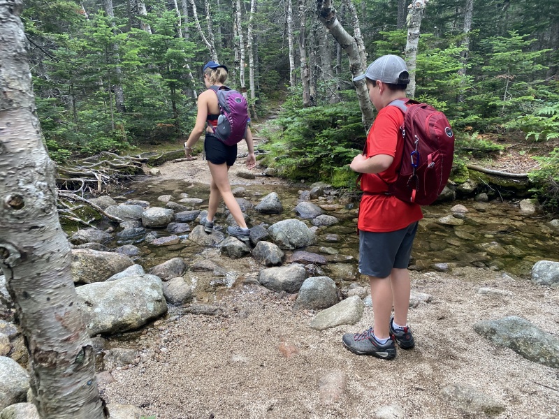
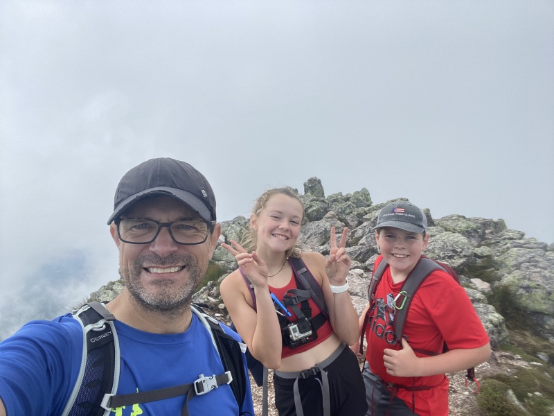
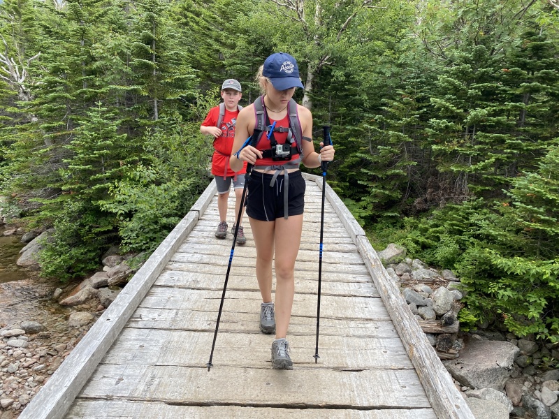
When the family started planning a trip to Maine, of course I had to designate a day to grab the highpoint of Maine - Katahdin. There are several options for hiking Katahdin. The main route is part of the Appalachian Trail; actually the end of the AT. This trail starts at the Katahdin Stream parking area. Another option is the Helon Taylor trail, which is also called the "knife edge route." The Knife Edge route starts at the Roaring Brook parking area. Two weeks prior to the trip, I was able to reserve a parking spot. For non-Maine residents, two weeks is the earliest that you can reserve a parking spot. Residents can book earlier. By the time I could reserve, there were only spots at the Katahdin Stream Parking lot (the main trail). So, I reserved for that parking lot, with the hope that we could upgrade to a parking spot at Roaring Brook the morning of the hike. We arrived at the gate at 6 am, just before they opened the gates. We were the 6th car in line at the gate. The gates opened at 6 am, and the ranger started letting cars in one at a time. I talked to the ranger and told him that we were hoping to upgrade to the Roaring Brook parking, but we had reservations for Katahdin Stream parking lot. He was nice and said that he thought we had a pretty good shot, and asked us to pull over to the side, while he let the rest of the cars in the line come through. Once the ranger cleared all the cars, he came back to our car and told us that we could upgrade to the Roaring Brook parking. We finished checking in at the entrance, then drove to the Roaring Brook parking area. The drive to the parking lot was solid dirt road. When we arrived at the parking lot, it was really pretty empty. There were a few groups getting ready to start hiking. For this hike, I had convinced Anna and Nolan to hike it with me, and they were pretty excited. Both of them had done over 14 Colorado fourteeners. This hike would be similar in distance to other hikes that they have done, but not at the higher elevation of Colorado. So, I was hoping that this would end up being a pretty easy hike for the kids. The hike was planned to be about 9.5 miles and 3,800 ft of elevation gain/loss. 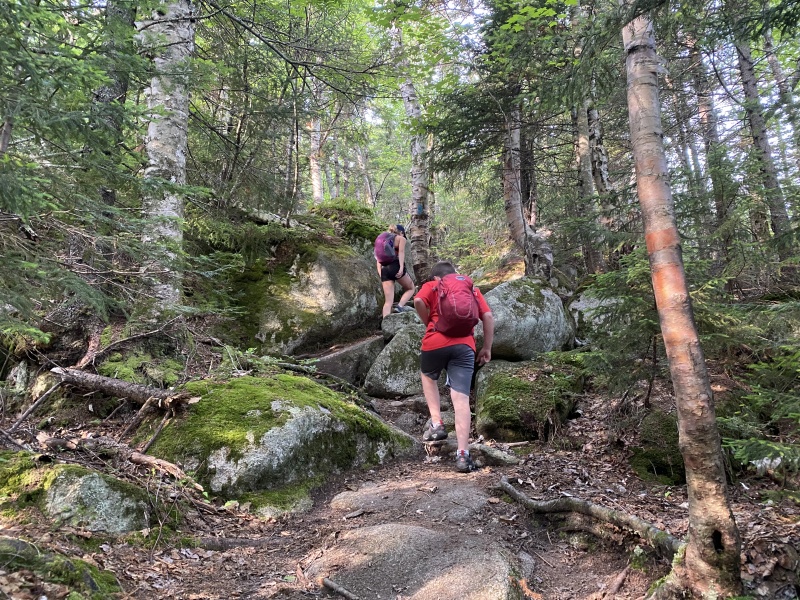
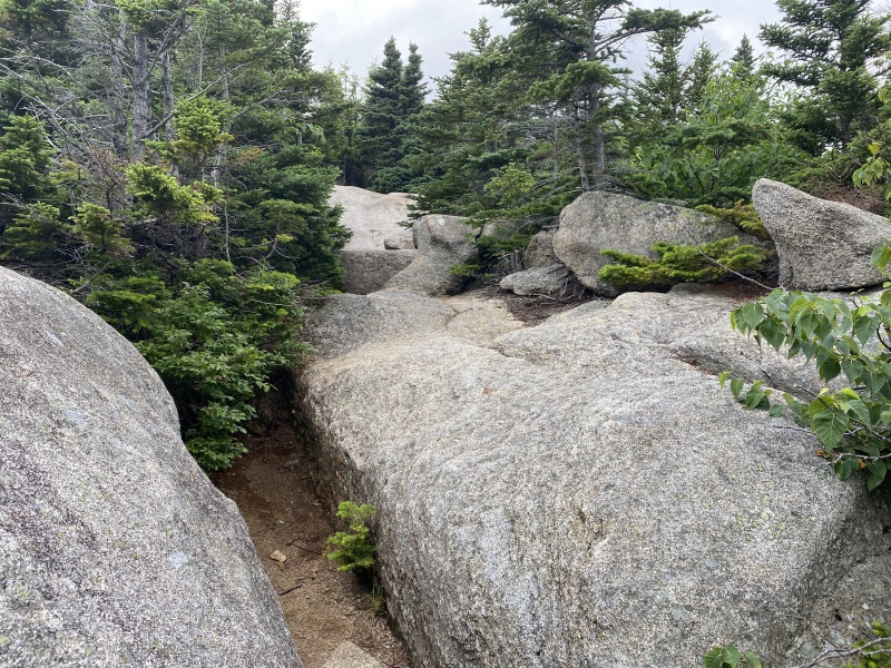
We got started on the trail right around 7 am. I was hoping for an earlier start, but it was unavoidable with the gates opening at 6 am, and the check in process. I had checked the weather report, and it looked like we might see afternoon thunderstorms. I was predicting a 5 hour roundtrip hike, so I felt that we could be done with the hike well before any weather moved in. My time estimate was way off, and I will explain why throughout this report. The lower trail was pretty nice, and easy to move fast. We were moving faster than 30 minute miles for the first mile or so. But, as we hiked, the trail got rockier and rockier. The trail was also getting steeper and steeper, and it just never seemed to let off. We continued to move solid, but the steeper trail, and the rocks definitely slowed us down. Luckily we were not climbing at elevation, and the kids and I talked about this several times. This was easier on the lungs, than hiking in Colorado for sure. Our breathing was solid. We were just slow, because of the steepness. At this point the trail was solid class 2. There were several minor scrambles, and a lot of boulder walking. As we got closer to the top of the first peak - Pamola - we saw another group hiking. We made it our goal to try to catch the other group. At this point, we had not seen anyone else on the route since the trailhead. We finally reached the summit of Pamola in 3 hours and 25 minutes. It was definitely taking us longer than I had initially thought. The scrambling and steepness was slowing us down a ton. At Pamola, we did catch up to the other group. They were two ladies that were from Maine. They mentioned that this route was a lot more difficult than they had expected. We only spent a few minutes on Pamola, then started our scramble towards the knife edge. At this point, we had just over a mile remaining to the summit, and very little elevation gain (~300 ft). But, the knife edge route would be solid scrambling. 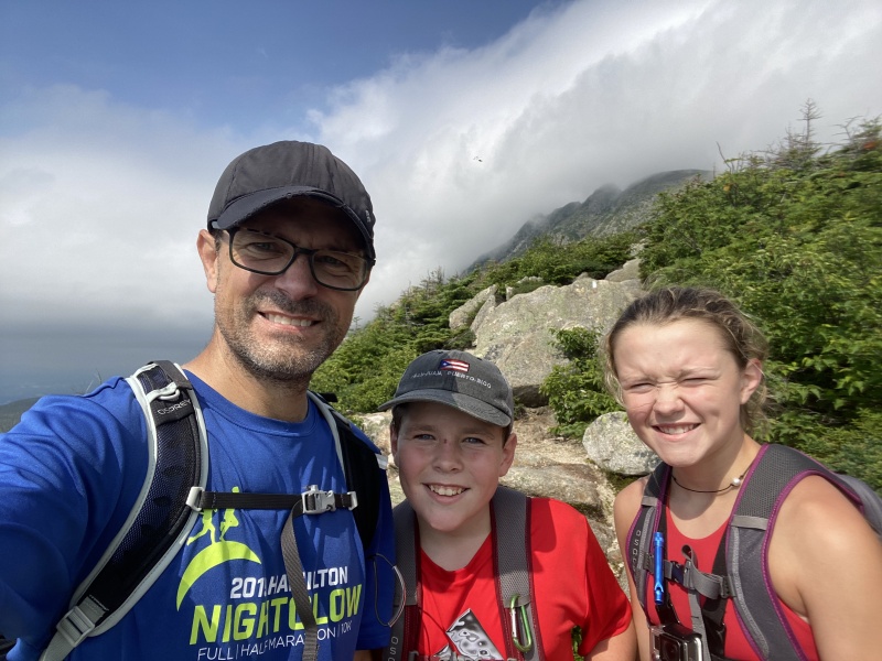
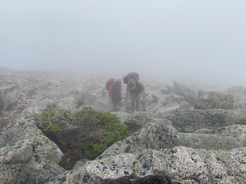
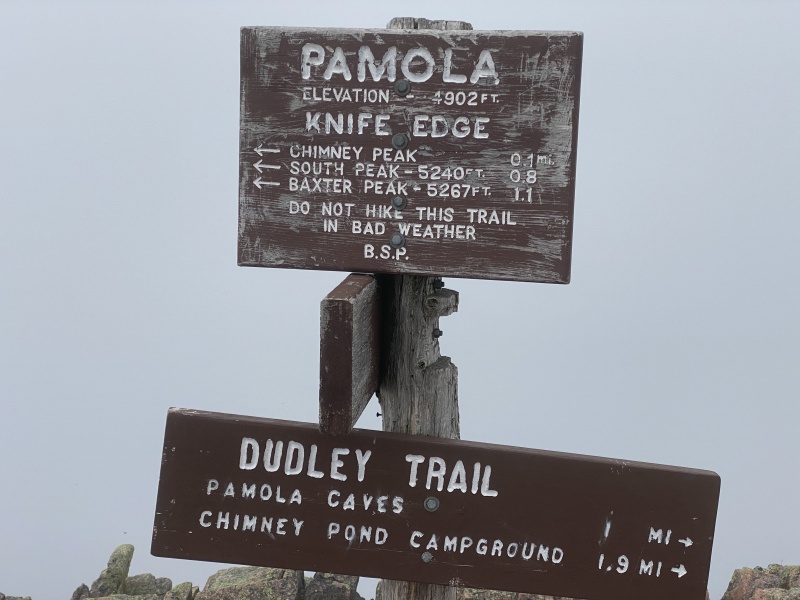
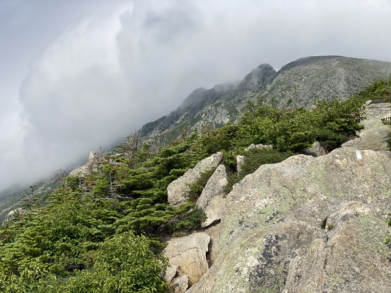
The crux of the route occurs just after you leave Pamola. There is a wicked down climb into the gash between Pamola and Chimney Peak. I missed this section in the route descriptions, but it was very notable. The downclimbing was class 3+, bordering on class 4. This would be the first class 3 or higher climb that the kids had done. Overall, the kids did an amazing job with that sketchy downclimb. From the bottom of the gash, we waited for the two Maine ladies. They were pretty intimidated by the scrambling and the exposure. We were able to help them negotiate the downclimb. The next challenge was an up-climb out of the gash, up to Chimney Peak. The up-climb was definitely easier, but it was pretty exposed and required a couple of decent scramble moves. The kids made it without any issue, and the ladies did also. I was almost positive that we had just climbed the crux, and that made everyone feel a little bit better about the remaining route. We reached the summit of Chimney Peak in about 20 minutes from leaving Pamola. We spent about 5 minutes on Chimney Peak grabbing a snack and water. 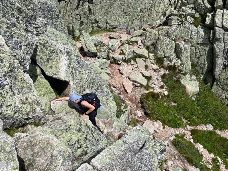
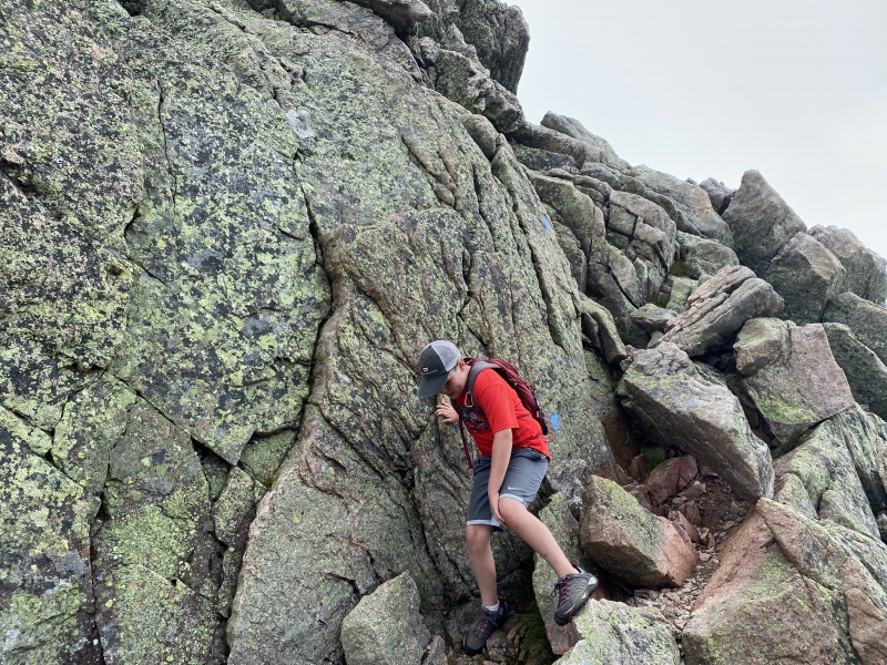
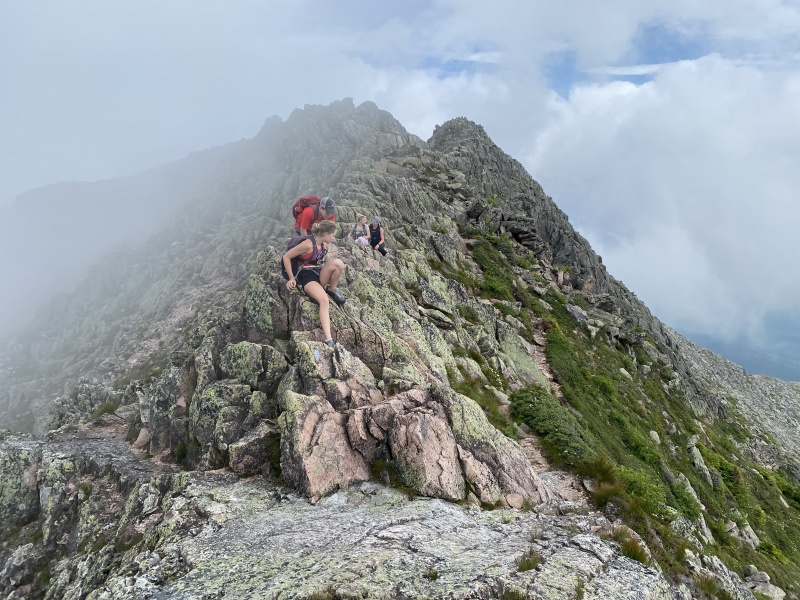
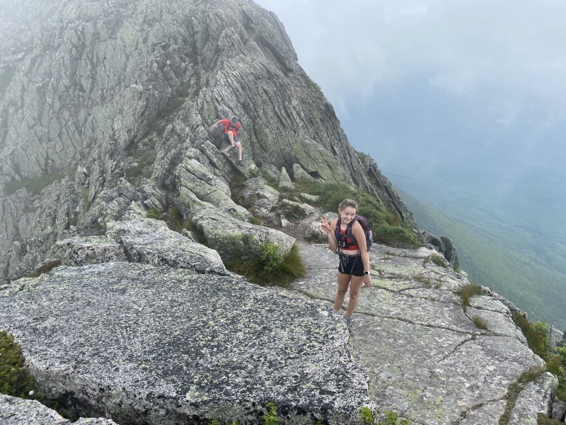
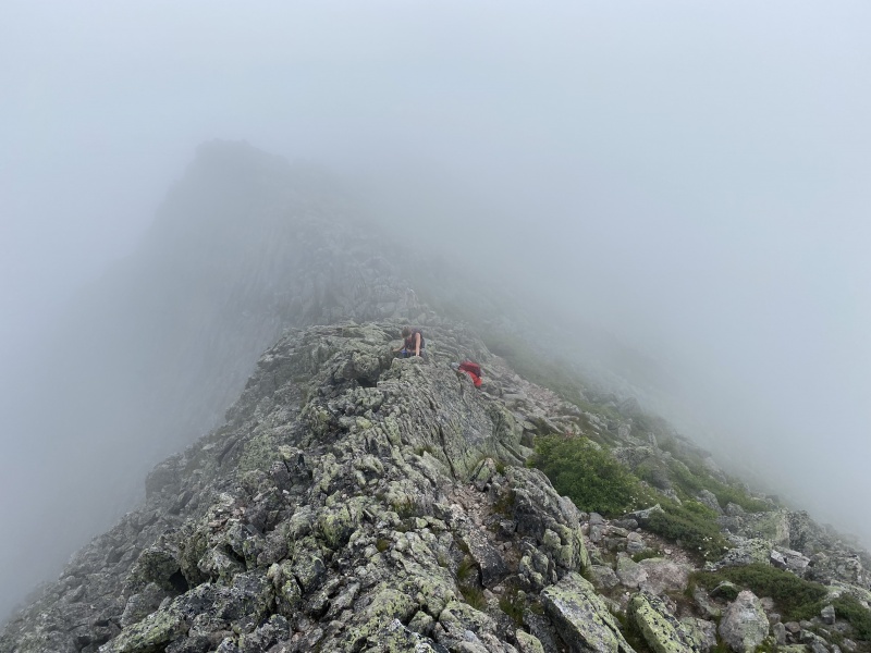
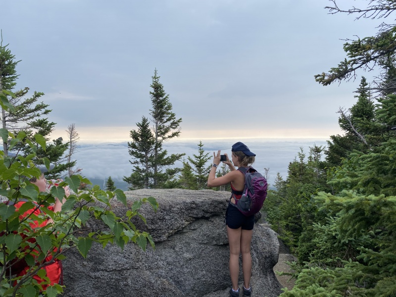
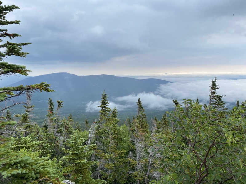
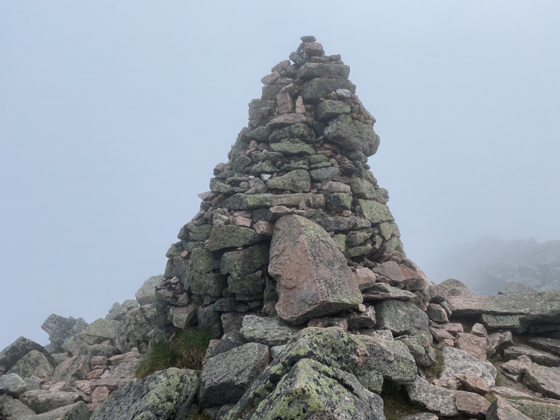
The Maine ladies started across the knife edge just before us, but we quickly caught up to them. We helped each other with the various challenging moves. There were probably 8-10 reasonably challenging scramble moves, and the exposure was pretty notable the whole way. In general, you would need to make a pretty big mistake to get hurt, but the knife edge route is not somewhere that you would want to stumble over your own feet. The kids did awesome through all of the scramble moves, and the Maine ladies were able to negotiate everything ok also. The majority of the scrambling occurred after Chimney Peak. It was pretty sustained for probably 2/3rds of the route to the Katahdin summit. It should be noted that there are three summit peaks: South Peak, Katahdin and Baxter Peak. Our visibility for most of the morning had been less than 100 ft, but I could see the peaks on the GPS. The last stretch to South Peak was a mild 300 ft boulder walk. We reached South Peak in about 1 hour 20 minutes from leaving Chimney Peak. It took us about 15 minutes to get to the next peak, and another 15 minutes to get to the final summit. On the GPS it was labeled Baxter Peak, but the sign at the top said Katahdin. Our time to summit from the trailhead was 5 hours 45 minutes. My 5 hour roundtrip estimate was way off. 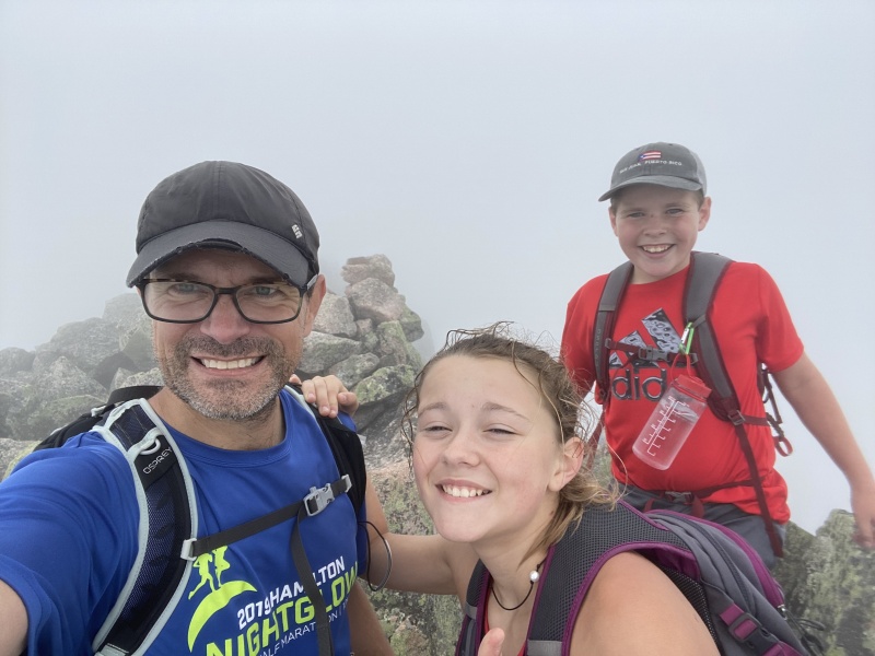
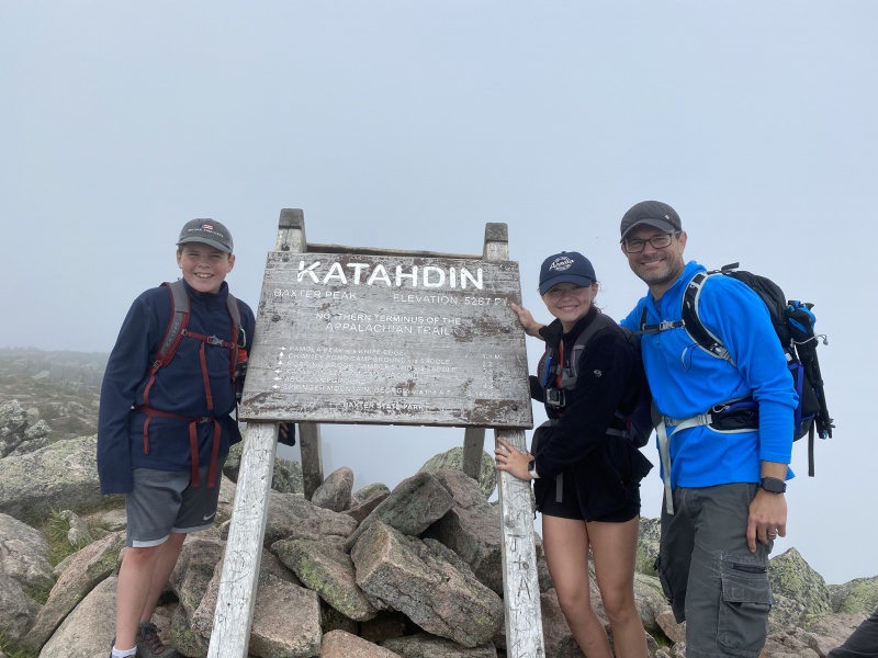
We spent about 20 minutes on the summit, eating and taking pictures. We also determined that our descent would be via the "Saddle trail." I knew going into this hike that we would not be going back over the knife edge, but I hadn't put a name on the descent route. There was another option called "Cathedral Trail" for the descent, but several people told us to avoid that trail for the descent, and take Saddle Trail, instead. The "Saddle" descent was about 1 mile from the summit. We were able to hike that portion pretty quickly, but I could definitely tell that everyone was starting to wear down. The trail was still pretty rocky, and we were all stumbling a bit. At the "saddle", I selected our downclimb. It was pretty steep, but safe. But, the steepness was exhausting, because every move required using legs and arms. It was definitely down climbing. During the downclimb, I pretty much followed the blue blazes that we had seen all day, painted on the rocks. The GPS route that I had downloaded for the trip showed the Saddle Trail turning more right of the route that we were on. But, we just kept descending via the blue blazes. I suspect that we actually missed the trail, and ended up on a more difficult down climb. Some of the moves during the downclimb were sold class 3. We eventually made it back down into the valley, and to the Chimney Pond Campground. We took a short bathroom break at the campground. At this point, the kids were mentally exhausted. We were running short on water, and I had been giving most of my water to the kids, to make sure that they were not depleted. 
The hike out from Chimney Pond Campground was an exercise in frustration. Rocks, rocks, more rocks and bugs. Earlier in the day, we had to deal with mosquitoes and some insane flies, but once we got onto the ridge, the bugs were non-existent. Now that we were down low, and by the creek, the bugs were starting to annoy us again. Anna's feet were hurting, and everyone was just tired. I would have offered to carry Anna for a few miles, but the rocky terrain would have made that impossible. Nolan was hiking pretty strong. As we got about a mile from the finish, both kids got a final spurt of energy, and it was hard to keep up with them. I was glad to see them perk back up. When we got back to the parking lot, everyone was excited and proud for having completed such a difficult hike. The hardest part of this hike really was the rocks. Normally, most trails out West will give you several miles at the end that are pretty easy walk outs, and often very "runnable." That just wasn't possible anywhere on this route. It was just mentally exhausting to have to negotiate rocks all day long, whether on the trail, or on the knife edge. We got back to the parking lot in about 10 hours from when we left in the morning. Descent time was around 4 hours 15 minutes. My estimate was way off. Overall this was a great hike. The exposure and scrambling was a lot of fun. This was the kids first class 3 route, and they absolutely "sent it." Both kids said that their favorite part was the exposure and scrambling on the knife edge. I'm glad that we were able to get onto that route. Thumbnails for uploaded photos (click to open slideshow): ")
")
")
")
")
")
")
")
")
")
")
")
")
")
")
")
")
")
")
")
")
")
|
| Comments or Questions | |||||||||
|---|---|---|---|---|---|---|---|---|---|
|
Caution: The information contained in this report may not be accurate and should not be the only resource used in preparation for your climb. Failure to have the necessary experience, physical conditioning, supplies or equipment can result in injury or death. 14ers.com and the author(s) of this report provide no warranties, either express or implied, that the information provided is accurate or reliable. By using the information provided, you agree to indemnify and hold harmless 14ers.com and the report author(s) with respect to any claims and demands against them, including any attorney fees and expenses. Please read the 14ers.com Safety and Disclaimer pages for more information.
Please respect private property: 14ers.com supports the rights of private landowners to determine how and by whom their land will be used. In Colorado, it is your responsibility to determine if land is private and to obtain the appropriate permission before entering the property.


