| Report Type | Full |
| Peak(s) |
Unnamed 13150 - 13,150 feet Sewanee Peak - 13,139 feet Pomeroy Mountain - 13,164 feet |
| Date Posted | 06/26/2021 |
| Date Climbed | 06/12/2021 |
| Author | Marmot72 |
| Sewanee/N Fork Reservoir tour |
|---|
|
Despite three trips to the area for neighboring peaks, I had managed to orphan UN 147. I recalled that unranked Sewanee had appeared more interesting - as viewed from Hancock Pass and from Pomeroy. So I resigned myself to a second (and last) trip up the 8 miles of rocky dirt road tp N Fork Reservoir to make the hike interesting. (This road is 10 miles; the first 2 are easy but the whole circuit takes an hour unless you have a "real" SUV and probably then 45 minutes, unless you drive like Kyle ("letsgoCU"). The straight/left fork in the road to park by the reservoir is closed due to danger of tree fall. I took the right fork and quickly found a parking area off to the left that allows access to the reservoir. It was a bit after 6 am and I was rewarded with a pretty view of UN 147 and Sewaneee reflected in the water. 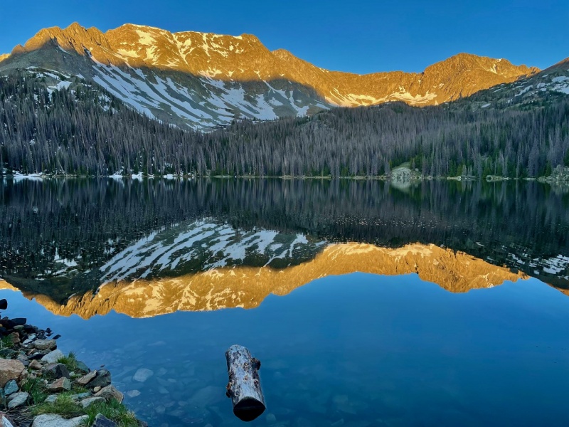
Crossing the outlet stream on the south side of the lake, I quickly found a logjam. However, it is not all solid - some of those logs are floating - and I doused my right foot. Scouting my approach, I aimed for an obvious thin spot in the trees that lies along a straight path from the reservoir. To my surprise, I found a trail. (This is not on the map.) Aided by the trail (and by the steam in a wide meadow where it became indistinct), I made quick access to the upper basin below the east face of UN 147. 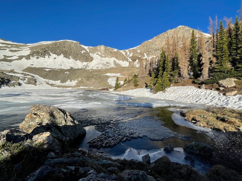
I stopped at the lake for a snack before heading around its north shore. The way was straightforward, although my progress was slowed by some side-hilling - swinging west would have avoided that, but I have a tendency to default to the most direct line. As I made the bend around the lake, I studied the mountain face before means determined to gain the base of it by the grassy slope at right and then wend my way up through the rocks from there. In doing so, my route took me between the two small snowfields near the right edge. From there, I don't exactly recall my route up, but it required no more than easy class 3 and a surprising amount of class 2 walking. 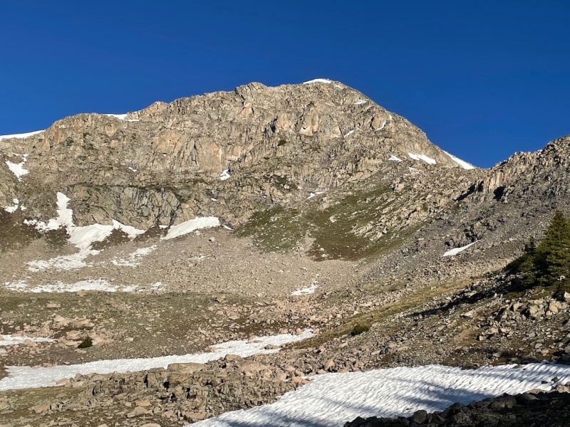
Once atop the ridge, I was presented with an easy, mostly level talus hop to the summit of 147. My time to the summit from the car was right at 2 hours, give or take a 2-5 minutes. I had not been moving quickly, and lingered at both lakes. Of this time, it took only 20 minutes along the ridge to the summit. I tarried on the summit just long enough to get some water and a couple bites to eat, as the view of Sewanee lured me ahead. 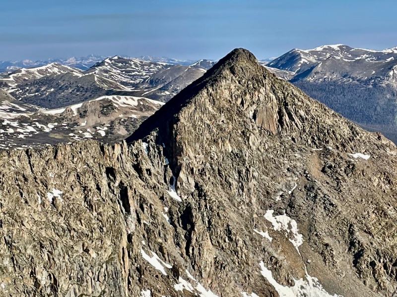
The first part of the ridge kept to the same terrain as the southern section - just class 2 tramping over talus. I expected spiciness as I approached Sewanee, but the ridge proved much tamer than it looked from afar. The rough flat section in the photo above is all a class two stroll, as the ridge crest slopes gently on its western side. I reached the summit of Sewanee without making but a couple class 3 moves. 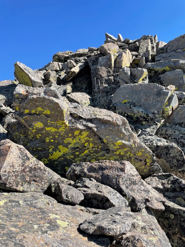
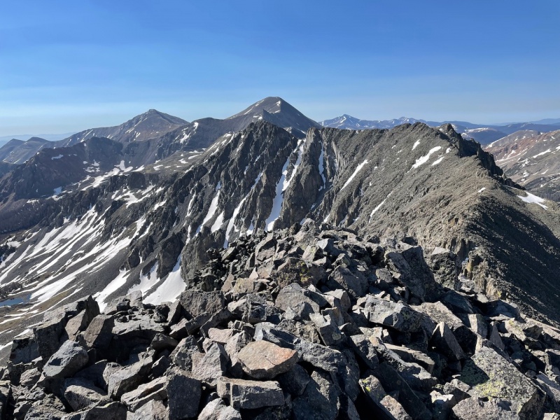
What I did not know was that this alpine meal would soon progress from chips with pico de gallo to a burrito smothered in green chile, complete with plenty of diced jalapeños. The ridge that arcs north and west from Sewanee is a complex, toothy jumble. That being said, it still involves more walking than scrambling, but there is plenty of that "sidewalk in the sky" feeling. That with the occurence of conglomerate recalled to my mind the traverse of the Deadman group in the Sangres. I moved onward warily, telling myself not to become complacent by the easy class 3 moves, because I knew that Natalie had done a 5th class down climb somewhere. I prefer to keep such maneuvers to class 4. Soon enough, I came to a spot that might be the one Natalie described. The way forward appeared dubious, and so I opted for a climb to my right (south) which was a great deal less steep, and only class 3. 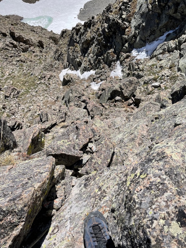
The ridge became more serious at this point, and I bypassed a gendarme that might have gone at hard class 4, but looked more like mid fifth class to me. 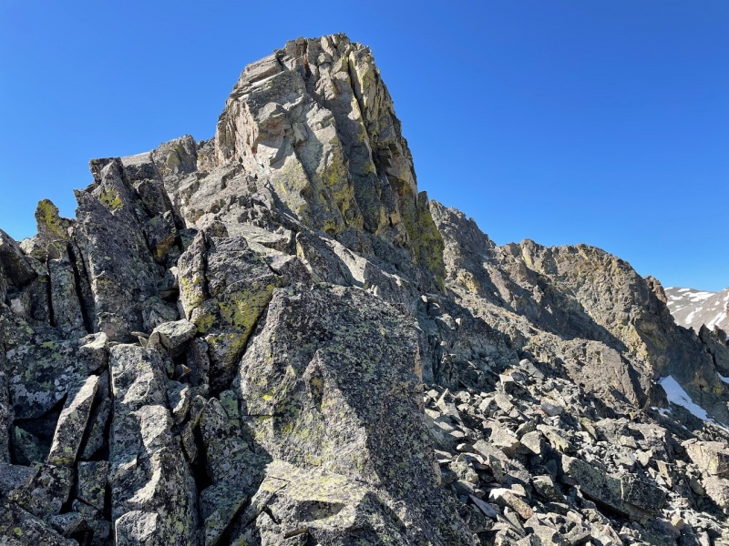
Soon after this, I came to the seeming end of the line. I was hemmed in, cliffed out. I thought, now I know the spot Natalie mentioned, as the way ahead certainly appeared north of 5.0-5.2. A quick scan of the north edge showed a sheer drop of 60 feet or so. As with the prior two spots, I found my exit on the south side, but I would say this descent required at least one class 4 move (I had to drop my single pole and face in). After picking my way down the slabs and ledges, I found myself in a notch between the prior high point and a final pinnacle on the ridge crest, but with a surprising and inviting egress down the north side. 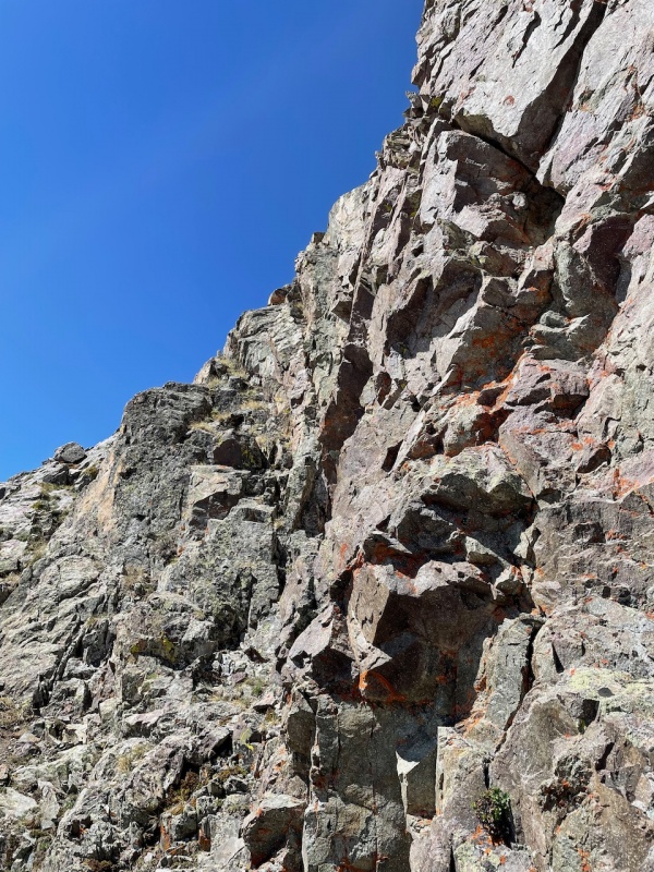
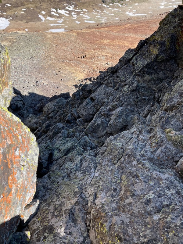
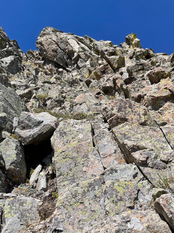
After motoring down this little section, Pomeroy's gentle saddle lay ahead of me. After walking that way several yards, I turned back to marvel at how ferocious Sewanee appeared from this vantage. The little chute between the two towers was completely obscured. 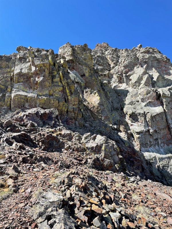
rock highlighted by the sun, in the middle of the photo. Reflecting on the traverse, I decided that it would probably be more enjoyable in the reverse direction, so one could climb up the more difficult sections instead of down them, but the route finding could be more challenging. It was only 10:20 am on a bluebird day, so I plowed onward to repeat Pomeroy, since it seemed a shame to return to the car so early. Sun-cupped and supportive snow gave some interest to what is otherwise an unremarkable mountain - a true molehill in the 13er world, but well-positioned. To descend Pomeroy, I back-tracked a bit westward as I zig-zagged down the talus-strewn south face to hit the mining road. I remembered just the one road from my trip here in 2013, but a couple offshoots exist. As I neared the trees, I looked across at Sewanee and 147, and marveled at the couloirs. 
Not the most expedient or efficient way to get 147, but a fun way to spend six hours and the day that all I care about is checking the peak off the list is the day I need to pick another hobby. Thumbnails for uploaded photos (click to open slideshow): ")
")
")
")
")
")
")
")
")
")
")
")
")
")
|
| Comments or Questions | ||||||
|---|---|---|---|---|---|---|
|
Caution: The information contained in this report may not be accurate and should not be the only resource used in preparation for your climb. Failure to have the necessary experience, physical conditioning, supplies or equipment can result in injury or death. 14ers.com and the author(s) of this report provide no warranties, either express or implied, that the information provided is accurate or reliable. By using the information provided, you agree to indemnify and hold harmless 14ers.com and the report author(s) with respect to any claims and demands against them, including any attorney fees and expenses. Please read the 14ers.com Safety and Disclaimer pages for more information.
Please respect private property: 14ers.com supports the rights of private landowners to determine how and by whom their land will be used. In Colorado, it is your responsibility to determine if land is private and to obtain the appropriate permission before entering the property.


