| Report Type | Full |
| Peak(s) |
Mt Whitney 14,505 |
| Date Posted | 06/22/2021 |
| Date Climbed | 06/20/2021 |
| Author | Tartay |
| Mt Whitney Loop in a Day (Fire on the Mountain!) |
|---|
|
The Training: Earlier this year we were notified that we had won a lottery slot for a single day hike up Whitney for June 20, 2021. Our group of 5 was ecstatic but the reality that we would need to get in very good hiking shape quickly soon set in. Living in Denver, it would be difficult to get in hikes that were both strenuous and at elevation as the Colorado mountains hold a lot of snow in May and June. Below was our training regime: Bergen Peak Trail: 10.3 Miles, 2200 Ft James Peak Trail: 8 Miles, 2950 Ft (Snow ascent with snowshoes, spikes, and ice axe) Payne Creek Trail: 13.5 Miles, 3100 Ft Mt Flora and Eva: 10 Miles, 3500 Ft McCurdy Mountain: 17 Miles, 4900 Ft Castle and Conundrum: 13 Miles, 5100 Ft (Some snow in the basin requiring spikes and ice axe) Mt Whitney Mountaineer's Route Up: The days leading up to Whitney was a bit stressful as lightning struck near the Whitney portal and started a 400 acre fire that threatened to shut down the portal road. We anxiously refreshed the Whitney facebook page as they were keeping close tabs on the fire. When we woke up Saturday morning (the day before our hike) we read that it was contained and the road to the trailhead was still open. We boarded our flight and made our way to Lone Pine, hoping that conditions would not change. Before we went to sleep on Saturday we got wind that another fire had started from a different lightning strike but that too was not currently a threat and the road would remain open. A 2:30 wakeup call on Sunday and we were out the door and hiking at exactly 3:30 am. 
50 Minutes into the hike we hit the E-ledges and easily found the entry location. As long as you stay on the well defined trail, accessing the ledges in the correct spot was quite simple. 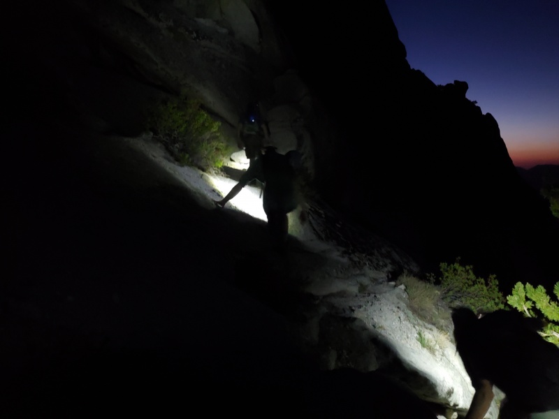 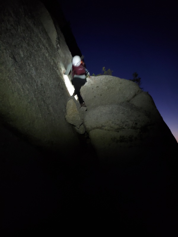
The E-ledges were easy scrambling in a few spots with only one spot where the trail really narrowed. Maybe it was just the dark but the exposure wasn't an issue and we were off the ledges 10-15 minutes later. 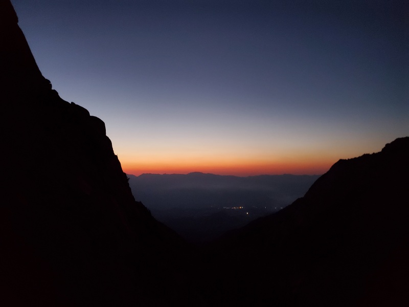
As the sun came up, we stashed our headlamps and continued up around the boyscout lakes. The terrain here was fairly steep and a mixture of good boulder hopping and loose/nasty scree. It reminded me quite a bit of La Plata as we hiked past. 

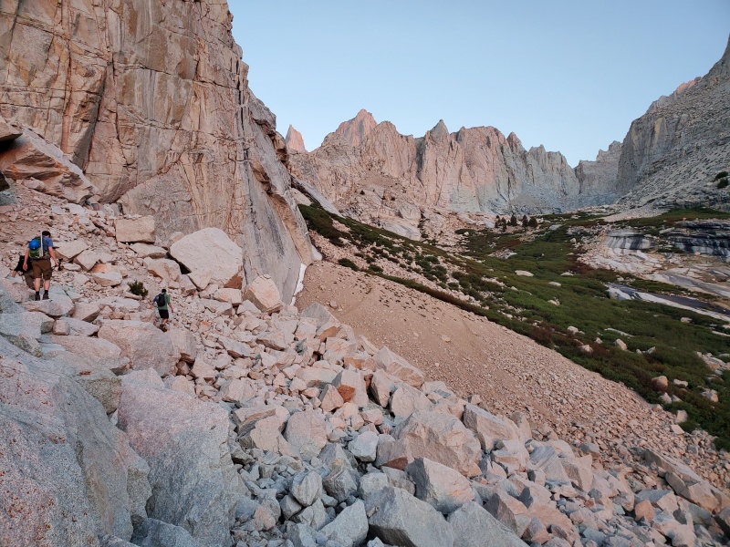

Hiking between the lakes, we kept left and didn't run into any difficulties outside of one section where we did a bit of bushwacking through the willows. The trail was well defined and our GPS made it very uneventful. 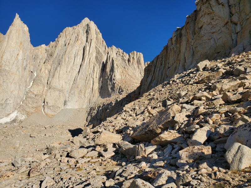

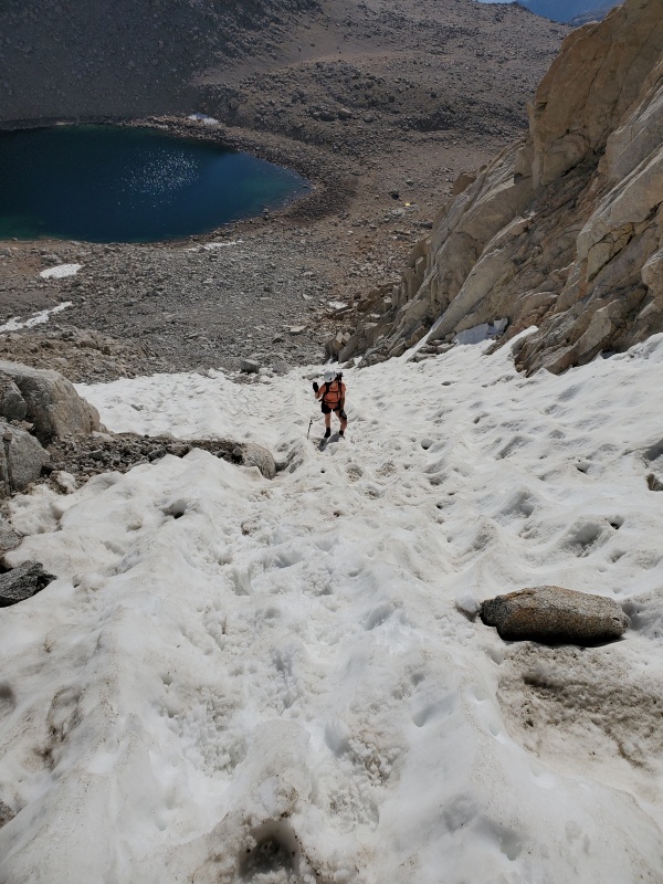
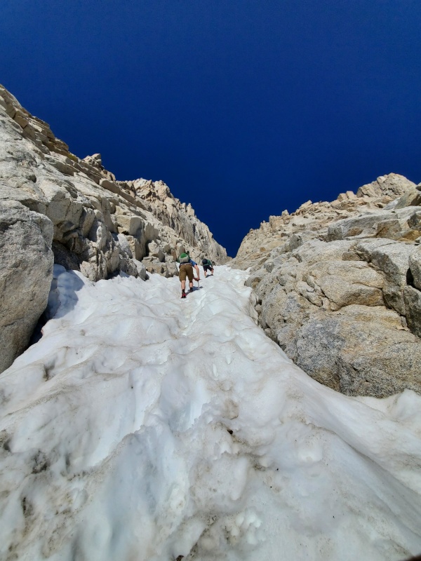
The section leading to Iceberg lake was easy to follow but the loose scree definitely started to slow us down a bit as we had to watch every step. At about 4 hours into the hike, we finally reached Iceberg lake, giving us the ability to refill our bladders and bottles as it would be a few hours until our next water source. After a 15 minute break we departed for the gully which would be the hardest and most dangerous part of the hike. In the picture below you can see what's left of the snow that we used to ascend directly in the middle of the gully. There was a potential alternate route up via the three tiny patches of snow to the left of the gully but our group decided that the snow was in good enough shape to ascend there. 
We made it to the base of the snow patch and strapped on microspikes and pulled out the ice axes. Crampons would probably have made the climb here a bit easier but spikes were sufficient. 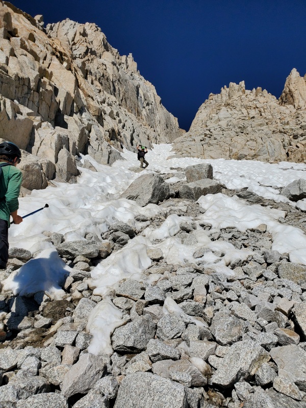
Once out of the first long patch of snow, we stashed our snow gear and started climbing the solid rock on both sides of the gully. With the gully being steep and loose, solid rock was greatly appreciated wherever it could be found. 
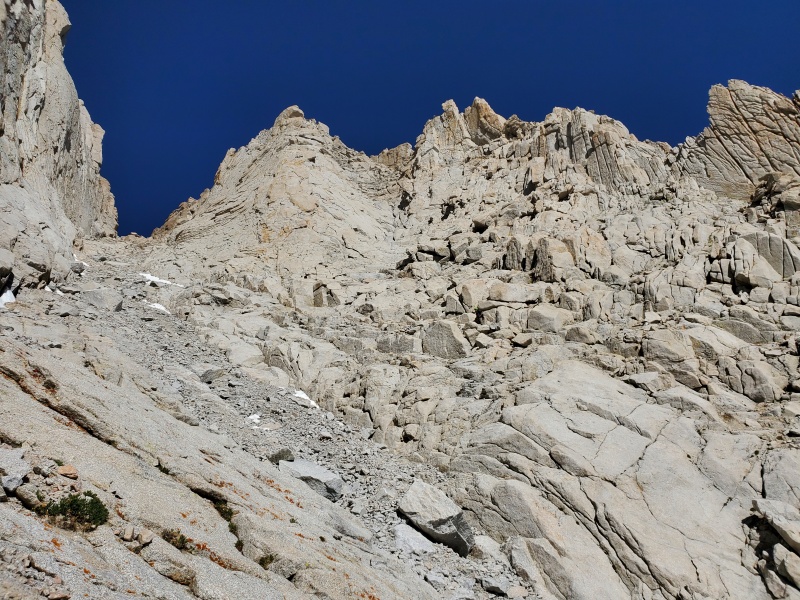

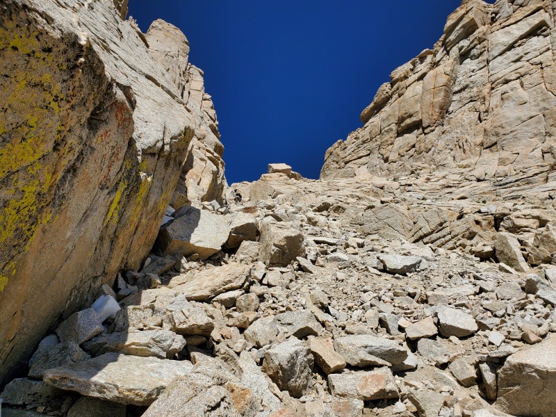

After several hours in the gully, we finally made the notch and started to assess the climb via the final 400 as the group took a well earned break, refueling and emptying their shoes of any pebbles. It was now time to climb! 

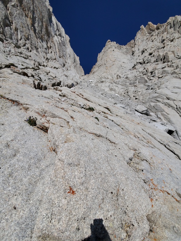
I wanted to specifically add the below image with our route highlighted as I found very few reports here that explicitly laid out how to climb the final 400 while keeping it class 3. The scrambling here was mostly solid but you did need to be cognizant of loose rock as there were several spots where we would grab a handhold, only for it to come loose. Everything here was class 3 although it would be easy to get into class 5 if you got off route. The exposure was minimal and nobody in our group ever felt unsafe at any point. The final 400 is greatly overhyped if you've climbed basically any class 3 14er in Colorado. The biggest thing you needed to worry about here (other than the route finding which honestly wasn't too difficult) was the loose rock and making sure you didn't send anything into the people below. As we were the only group in the final 400 during our climb, we just had to make sure to keep rockfall off each other.  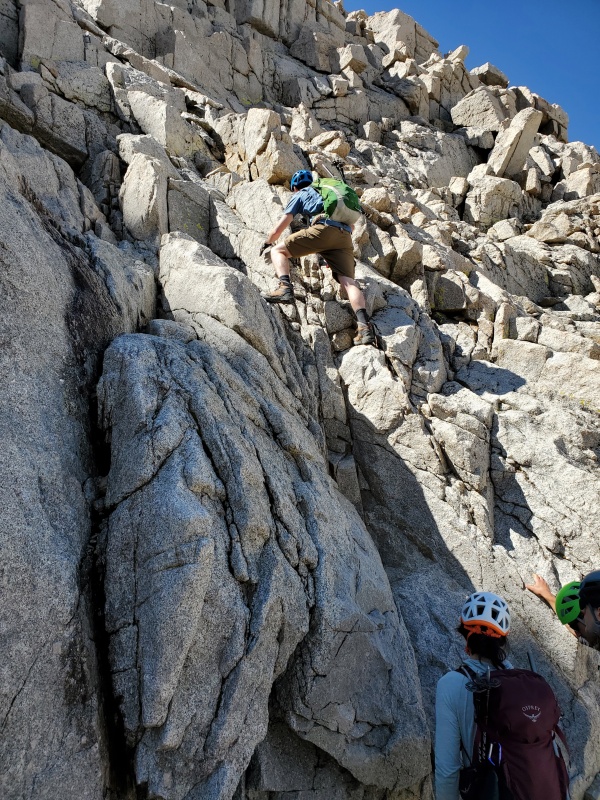
At almost 7 hours exactly, we hit the summit and took in the views. After climbing such a steep and loose route, it was nice to have such a flat summit to spread out and relax. 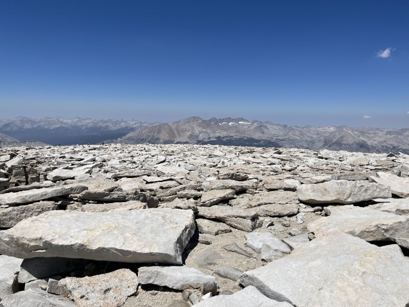
Standard Route Down: After a 45 minute break at the top it was time to head down the mountain. We opted for the standard route as we figured the loose gully down would be a huge pain. In retrospect, it would have been a pain but probably preferable to the 11 mile slog that awaited us. The descent from Whitney via the standard route was long. After climbing over 6000 feet in 4.5-5 miles, the 11 miles down felt like 20. Neverending switchbacks off the ridge (we counted 98) and then a few other spots with lots of switchbacks below. Not sure how many exactly over the 11 miles but I wouldn't be surprised if someone said it was between 150 and 200 total. Other than the 2 trail runners we ran into, I'd guess the vast majority of people we crossed paths with were camping and making it a multi-day affair. If I were to ever come back, I'd much prefer this approach. The route down was a slog and we made sure to refill our depleted water supply at the bottom of the 98 switchbacks. We made sure that we dunked our heads to cool down at every lake and stream crossing. Being from Colorado, we were not used to temps of 45+ at the summit and 80 degrees as we approached the trailhead. After 12 hours of hiking and just under 14 hours total, we made it back to the car. The Whitney loop in a day. Caltopo route here: https://caltopo.com/m/FMD9 Right around 15-16 miles (gpx accuracy a bit low through switchbacks) and 7K feet. Fire on the Mountain (run boy run): Throughout the day, the fire that had started near Lone Pine peak would periodically send gusts of smoke and ash over Whitney. We could not see flames in the dark and it appeared small so we were not worried. Generally, the smoke was not an issue as we ascended. However, as we started our descent off the peak, we noticed the smoke smell more and more often. About halfway down the mountain the helicopter and plane activity near the Whitney portal trailhead really picked up. As we were about 3-4 miles from the trailhead we could see the smoke by Lone Pine peak. 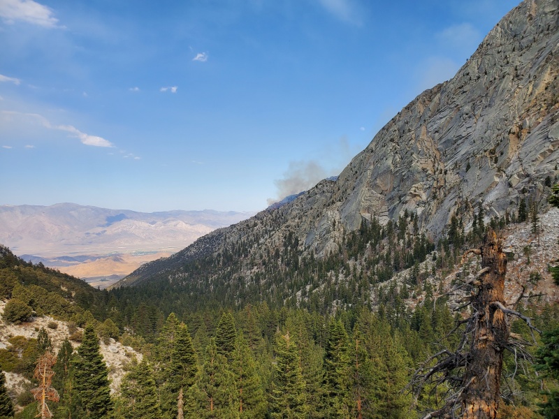
The mountain was on fire and it seemed to be growing larger quickly due to the 100+ temps at the base of the mountains. We reached the car just after 5pm and started back towards Lone Pine. It was then that the fire really came into view and we realized things were getting bad quickly. As we came into cell range, our phones all serenaded us with the emergency alert, informing us that anyone camping or hiking from the Whitney portal was to evacuate immediately. The road was now officially one-way with no traffic being allowed up. 
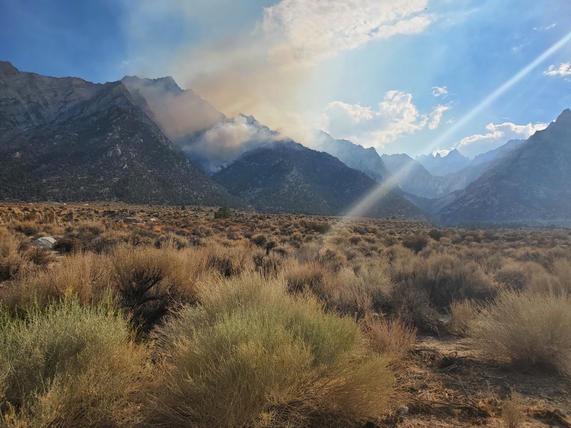 As of this report, the fire apparently jumped the ridge and is directly threatening the portal itself. Hopefully everyone camping and hiking on Sunday were able to make it out safely. Thumbnails for uploaded photos (click to open slideshow): ")
")
")
")
")
")
")
")
")
")
")
")
")
")
")
")
")
")
")
")
")
")
")
")
")
")
")
")
")
")
|
| Comments or Questions | |||||||||
|---|---|---|---|---|---|---|---|---|---|
|
Caution: The information contained in this report may not be accurate and should not be the only resource used in preparation for your climb. Failure to have the necessary experience, physical conditioning, supplies or equipment can result in injury or death. 14ers.com and the author(s) of this report provide no warranties, either express or implied, that the information provided is accurate or reliable. By using the information provided, you agree to indemnify and hold harmless 14ers.com and the report author(s) with respect to any claims and demands against them, including any attorney fees and expenses. Please read the 14ers.com Safety and Disclaimer pages for more information.
Please respect private property: 14ers.com supports the rights of private landowners to determine how and by whom their land will be used. In Colorado, it is your responsibility to determine if land is private and to obtain the appropriate permission before entering the property.