Download Agreement, Release, and Acknowledgement of Risk:
You (the person requesting this file download) fully understand mountain climbing ("Activity") involves risks and dangers of serious bodily injury, including permanent disability, paralysis, and death ("Risks") and you fully accept and assume all such risks and all responsibility for losses, costs, and damages you incur as a result of your participation in this Activity.
You acknowledge that information in the file you have chosen to download may not be accurate and may contain errors. You agree to assume all risks when using this information and agree to release and discharge 14ers.com, 14ers Inc. and the author(s) of such information (collectively, the "Released Parties").
You hereby discharge the Released Parties from all damages, actions, claims and liabilities of any nature, specifically including, but not limited to, damages, actions, claims and liabilities arising from or related to the negligence of the Released Parties. You further agree to indemnify, hold harmless and defend 14ers.com, 14ers Inc. and each of the other Released Parties from and against any loss, damage, liability and expense, including costs and attorney fees, incurred by 14ers.com, 14ers Inc. or any of the other Released Parties as a result of you using information provided on the 14ers.com or 14ers Inc. websites.
You have read this agreement, fully understand its terms and intend it to be a complete and unconditional release of all liability to the greatest extent allowed by law and agree that if any portion of this agreement is held to be invalid the balance, notwithstanding, shall continue in full force and effect.
By clicking "OK" you agree to these terms. If you DO NOT agree, click "Cancel"...
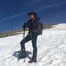
Hike up to Sentinel Point, a sub-peak on the Western flank of Pike's Peak. 9 miles with 3,200 ft. elevation gain. GPX included at bottom.
This is a great day-hike that can be done as a loop in the Pike's Peak area that takes you above the treeline for good views of the area.
I started at the Horsethief Falls / Pancake Rocks trailhead off Hwy. 67. I did this loop counter-clockwise, going up the Pancake Rocks trail to begin with and down the Horsethief Park trail. I'd recommend this way because there is a bit of scrambling on the ridgeline just above Pancake Rocks that would be done better going up than going down.
From the trailhead I stayed on the standard Pancake Rocks trail almost until it's end (around 2.7 miles), then turned Left/North, putting me on the ridgeline to ascend Sentinel Point's Southern ridge (refer to the GPX route below). The turn off of the trail on up the ridgeline is still in the trees at this point.
Once I turned off, there is no trail, but the general direction is just up and following the ridgeline. The trees are spaced out here and there's not much underbrush, such "bushwacking" was at a minimum.
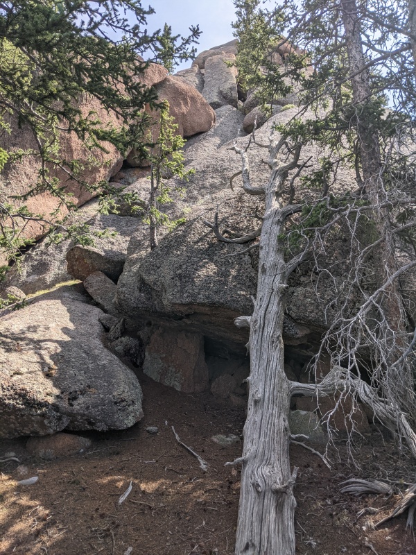
Just under half a mile from the turn-off, I encountered the only real obstacle on this hike - a scraggy rock-garden section that required some scrambling.
Start of the rock-garden section. Some Class 3 scrambling over boulders required.
After getting through the first rock-garden section, there is a small break and then...another scraggy rock-garden section! However, I simply went around, to the right of these rocks. This required some side-traversing, which is never fun, but I think it was faster than going up and climbing the rocks. Also, this is the must "bushwack-y" section of the hike.
Eventually the side-traverse will meet up with a flat saddle (still in the tress) at the other end of the rock-garden. From here, it is a surprisingly pleasant walk up the ridgeline that finally took me out of the trees.
Walking up out of the treeline. The second, scraggy rock-garden formation that I avoided by side-traversing is on the right.
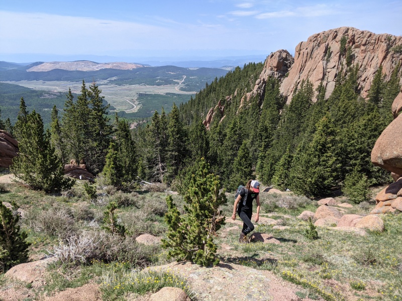
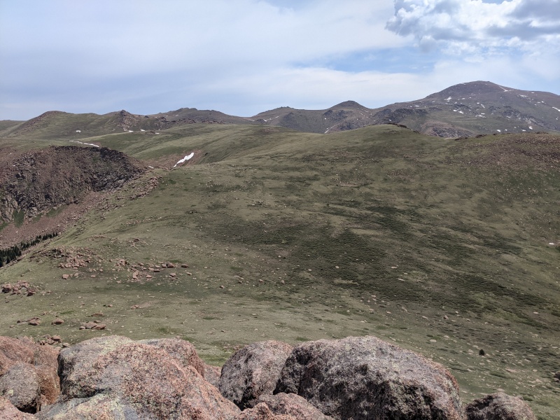
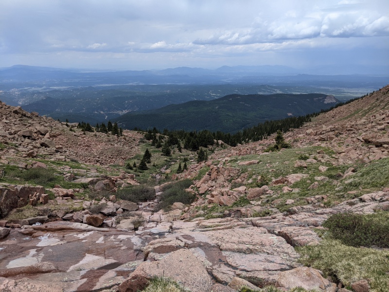
Once out of the trees, the remaining route just follows the ridgeline to Sentinel for just over a mile.
Finally out of the trees, looking at the remaining ridgeline over to Sentinel Point
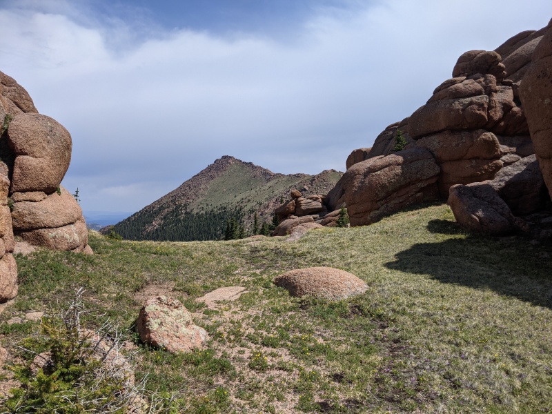
The rest of the ridgeline is on grassy meadow until the final push up to Sentinel's summit. This final push is rocky with some Class 2 climbing.
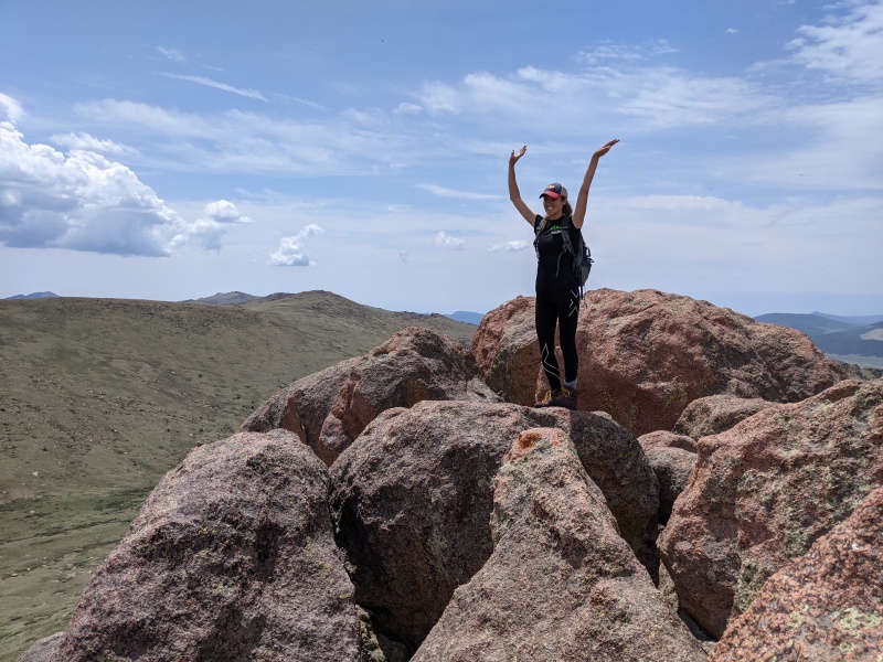
Summit!On Sentinel's summit looking towards Pike's Peak. The ravine that I took down is on the left.
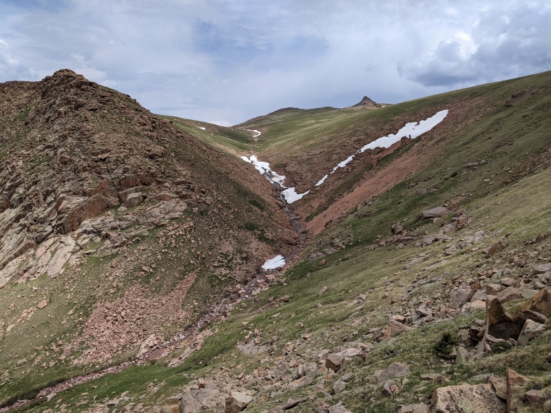
From the summit of Sentinel, I was able to see much of the route down. The loop continues Northeast for a bit before descending into a ravine that follows a creek.
Descending off of Sentinel's slope and into the ravineIn the ravine looking back up
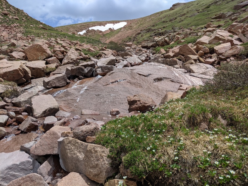
Once in the ravine, I followed the creek down until it re-entered the trees.
Route will follow the creek down until it rejoins the trees.
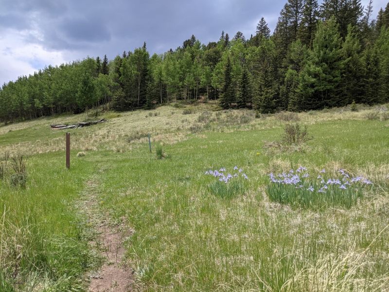
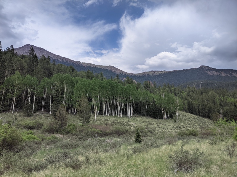
Once in the trees again, the easiest route is on the left side of the creek. I was surprised to find a carin'd trail once I was in the trees. I followed this trail through the forest, and it eventually met up with the established Horsethief Park / Forest Service 704C trail. This trail finishes going through the forest, then eventually into an alpine meadow, before meeting up with the original trail, completing the loop, about 3/4 mile away from the parking lot.
Out of the forest and in the alpine meadowIn the alpine meadow, looking at Sentinel's South ridgeline
My GPS Tracks on Google Maps (made from a .GPX file upload):
Nice job! We do this one almost every year.
Interesting to go through Pancake Rocks, haven't gone that way before. Time to give it a try.
We usually go up right behind the falls and follow a faint trail, until the rock rib and take a left, probably a bit shorter than your southern section of the route.
Thanks JQDivide! I was wondering if there was a route straight up from the Falls, sounds like there is! The Pancake Rocks route is pretty nice, just getting around some of the rocks once you initially get on the ridge, but after that it is very gradual.
Caution: The information contained in this report may not be accurate and should not be the only resource used in preparation for your climb. Failure to have the necessary experience, physical conditioning, supplies or equipment can result in injury or death. 14ers.com and the author(s) of this report provide no warranties, either express or implied, that the information provided is accurate or reliable. By using the information provided, you agree to indemnify and hold harmless 14ers.com and the report author(s) with respect to any claims and demands against them, including any attorney fees and expenses. Please read the 14ers.com Safety and Disclaimer pages for more information.
Please respect private property: 14ers.com supports the rights of private landowners to determine how and by whom their land will be used. In Colorado, it is your responsibility to determine if land is private and to obtain the appropriate permission before entering the property.
")
")
")
")
")
")
")
")
")
")