Download Agreement, Release, and Acknowledgement of Risk:
You (the person requesting this file download) fully understand mountain climbing ("Activity") involves risks and dangers of serious bodily injury, including permanent disability, paralysis, and death ("Risks") and you fully accept and assume all such risks and all responsibility for losses, costs, and damages you incur as a result of your participation in this Activity.
You acknowledge that information in the file you have chosen to download may not be accurate and may contain errors. You agree to assume all risks when using this information and agree to release and discharge 14ers.com, 14ers Inc. and the author(s) of such information (collectively, the "Released Parties").
You hereby discharge the Released Parties from all damages, actions, claims and liabilities of any nature, specifically including, but not limited to, damages, actions, claims and liabilities arising from or related to the negligence of the Released Parties. You further agree to indemnify, hold harmless and defend 14ers.com, 14ers Inc. and each of the other Released Parties from and against any loss, damage, liability and expense, including costs and attorney fees, incurred by 14ers.com, 14ers Inc. or any of the other Released Parties as a result of you using information provided on the 14ers.com or 14ers Inc. websites.
You have read this agreement, fully understand its terms and intend it to be a complete and unconditional release of all liability to the greatest extent allowed by law and agree that if any portion of this agreement is held to be invalid the balance, notwithstanding, shall continue in full force and effect.
By clicking "OK" you agree to these terms. If you DO NOT agree, click "Cancel"...
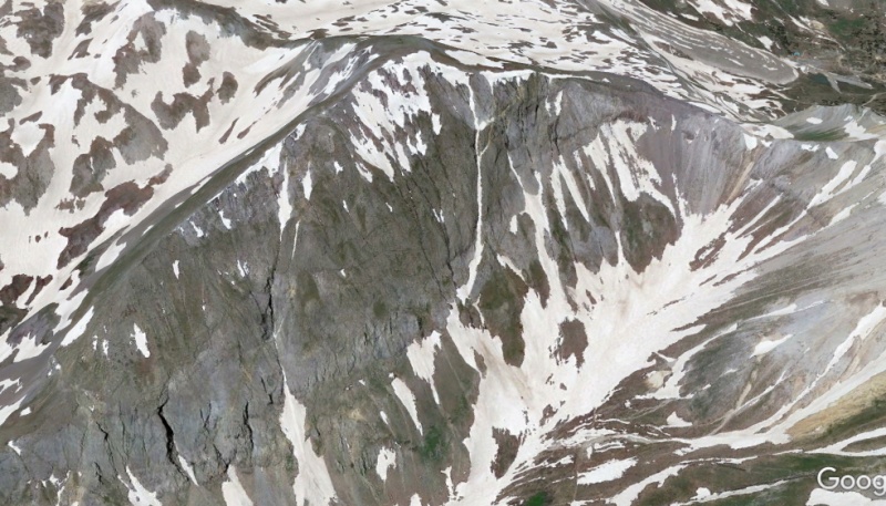
This winter while scrolling around Google Earth as I'm wont to do, I noticed a finger of snow on the east face of T 7 that looked like it should make a good climb. I first hiked T 7 eons ago with Abe (FireOnTheMountain) on an Imogene Basin circuit, but apart from a hairy traverse of the west ridge of U. S. Mountain, all I remember is that he was pissed at me for insisting on bypassing the difficulties between T 7 and T 8 in the face of impending weather. We're still friends (I think). Anyway, in light of my discovery, I started to probe the area in late May.
Looks Goog
After the late snow, a wintery scene greeted me on Hayden Mountain (south). The next weekend on Telluride Peak we found snow hardened by an overnight freeze but otherwise rotten. The height of the loose slush phase seemed to coincide with an ill-begotten--but ultimately fun, in the "Exercise is fun!" sense--wallow up the northeast face of Niagara Peak the following week, and conditions were only marginally better on Three Needles the day after. Up until this point we'd been swimming (veritably) in melt, but nighttime sky cover was preventing the freeze needed to transform the remaining snow into what I consider good climbing shape. Probably atmospheric pressure is at the root of the radiative cooling dynamic, but clouds are the indicator.
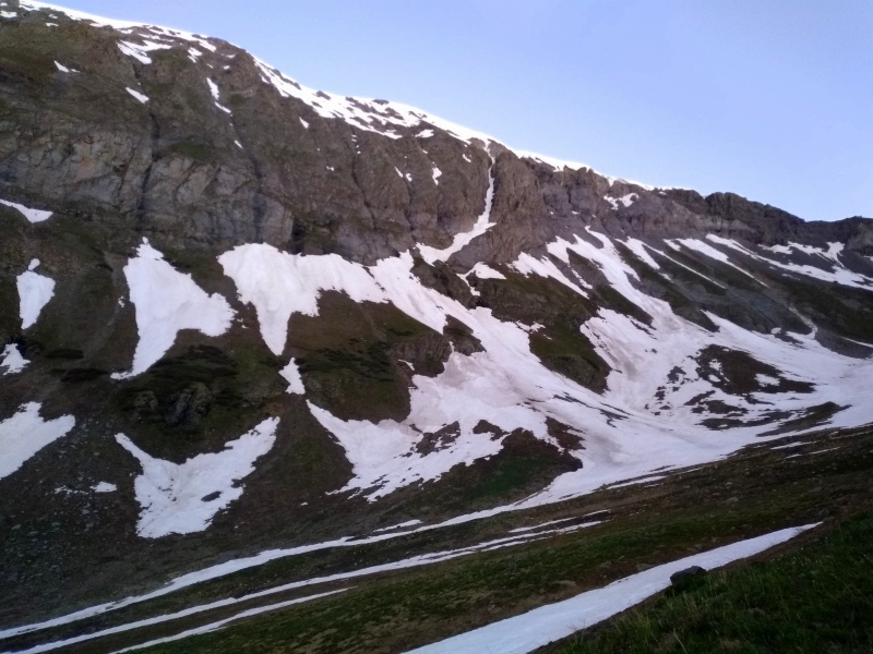
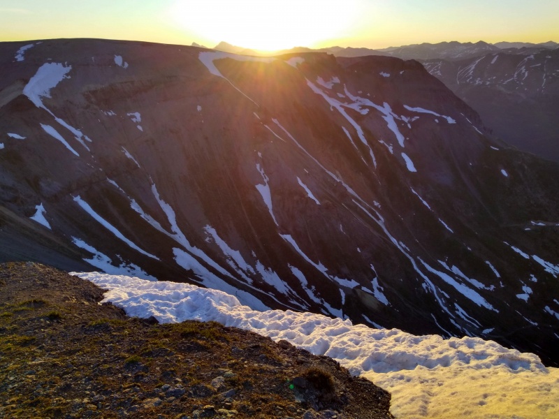
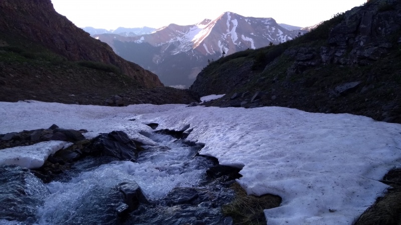
Finally, a stretch of "mostly clear" nights rolled into the forecast late last week, and I decided to suss out conditions in Spirit Gulch and, maybe, climb the route. Running late, I arrived at the Idarado gate (the acting trailhead for Commodore and Spirit Gulch) at 4:30, futzed around with the first creek crossing, from which the log used to cross a few weeks prior had washed away, and eventually splashed across in my approach shoes, so that I didn't reach the upper basin until 5:40. Since the top of the climb faces due east, it gets sun right at 6 am, and I didn't want to deal with bad snow on what would likely be a steep exit, so I salvaged the morning by cramponing up the surprisingly continuous 1,000-foot south gully of T 8. Snow conditions were fantastic despite an overnight low of 39 degrees at 13,000', and even running water had frozen below 12,000'.
View from Spirit Gulch 6/12
I planned to return earlier the next day but failed to wake up. Clear skies were forecasted to continue through Tuesday (June 15), so when my alarm sounded at 2:30, I mechanically stumbled out of bed and scraped my gear together. After a sweltering day (99 degrees in Montrose) the overnight low would be 42 degrees at 13,000'. I started at 4, tromping across the creek without hesitation, and sloshed up the road into Spirit Gulch, where I continued directly to the apron below the couloir. Caffeine and the rapid drop in pressure conspired to delay my mission, but I was soon gleefully cramponing up the initial slope.
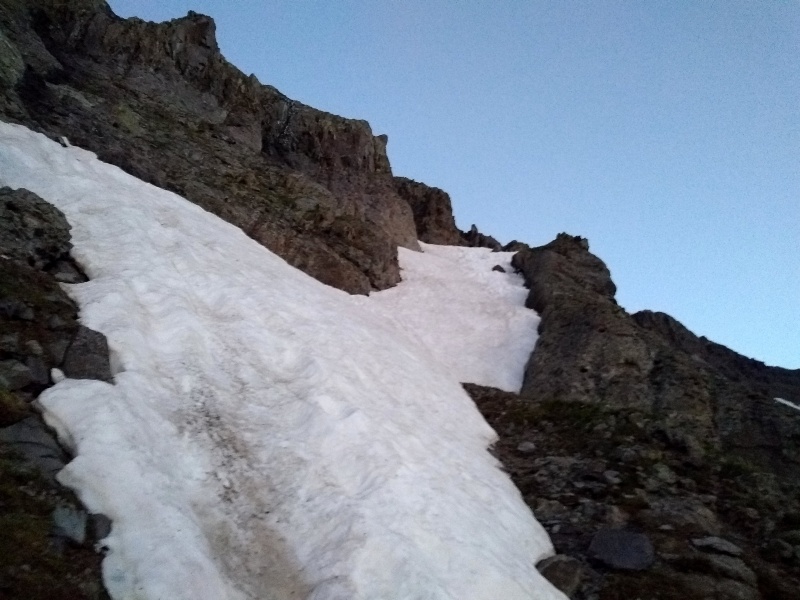
After 300 feet of increasing pitch to meet the base of T 7's steep east face, I stepped right across a strip of tundra at 12,400' to enter the couloir proper. An initial 200-foot sloping diagonal quickly ramped up into an aesthetic chute, which I climbed for 450 feet as it narrowed further through a flattish S-curve before opening to the upper face at 13,000'. As I watched the snowy headwall above begin to glow pink and then orange, I realized I hadn't checked the time since leaving the truck. Snow conditions had been excellent, with just a few brief soft spots, and while there was ample evidence of rockfall in the couloir, not even a pebble had whizzed by during my ascent. Now only snow lay ahead and, conveniently, directly above the top of the couloir was a break in the cornices, a body length of off-vertical neve capping the ruffled slope. As I climbed the final 200 feet I was startled by (I had to look this up) Bach's Cello Suite No. 1 Prelude, signaling that it was 6 am. Indeed, except when blaring harshly from the speakers on my phone, the piece goes nicely with alpenglow.
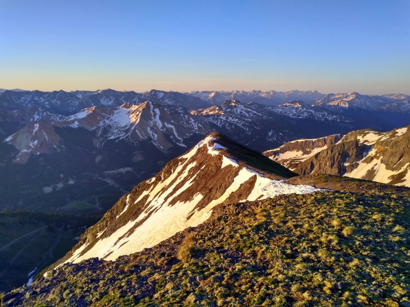
Work commitments pending, I stayed on the summit only long enough to appreciate the familiar views before descending west to the T 7-Telluride Peak saddle and then south down Commodore Gulch, returning to the trailhead at 7:30.
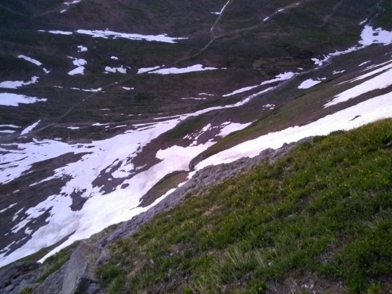
Looking down apron from grassy strip
Diagonal start
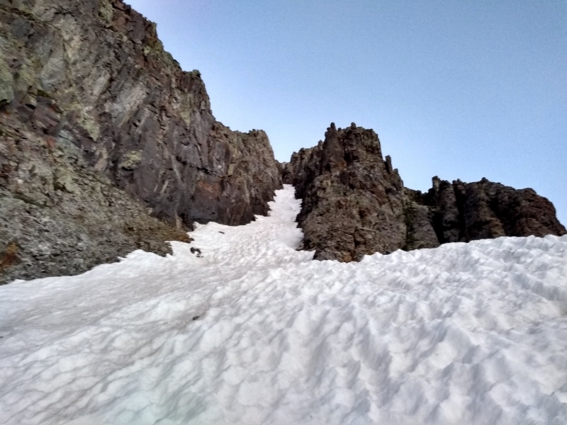
Main couloir
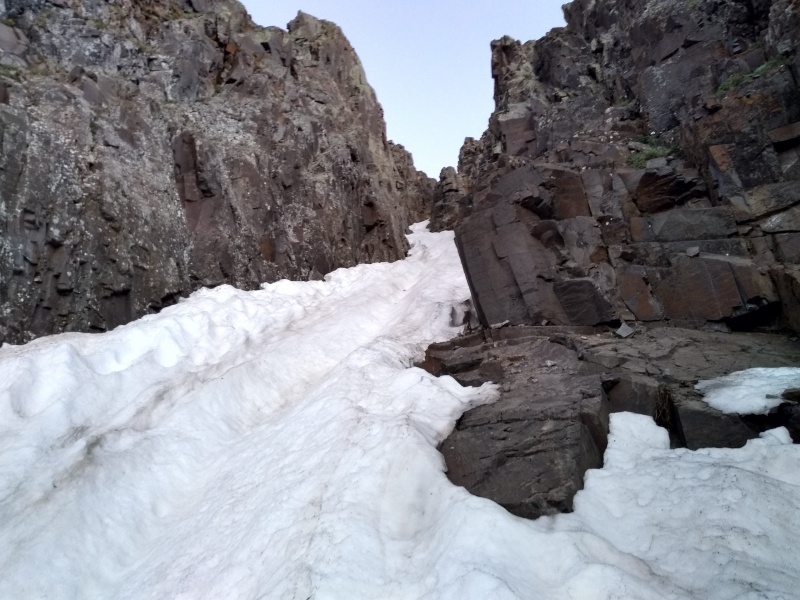
S-curve
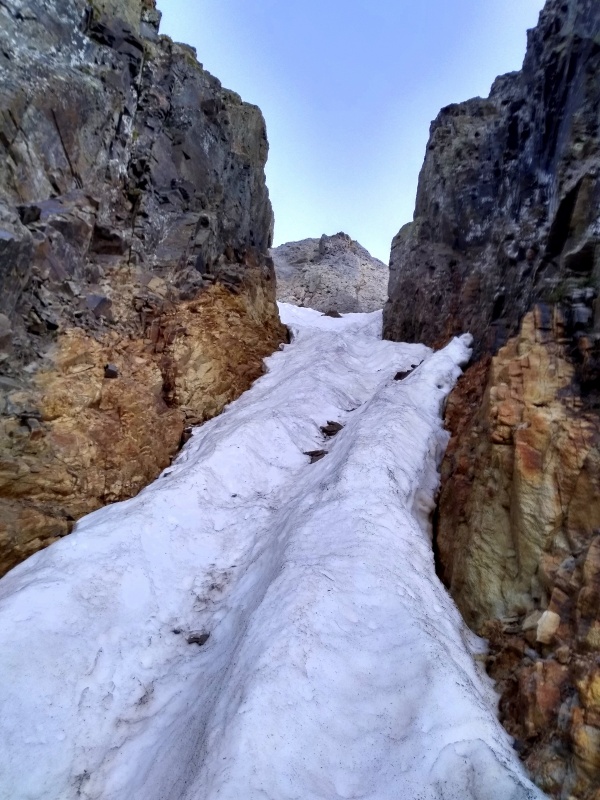
Opening up
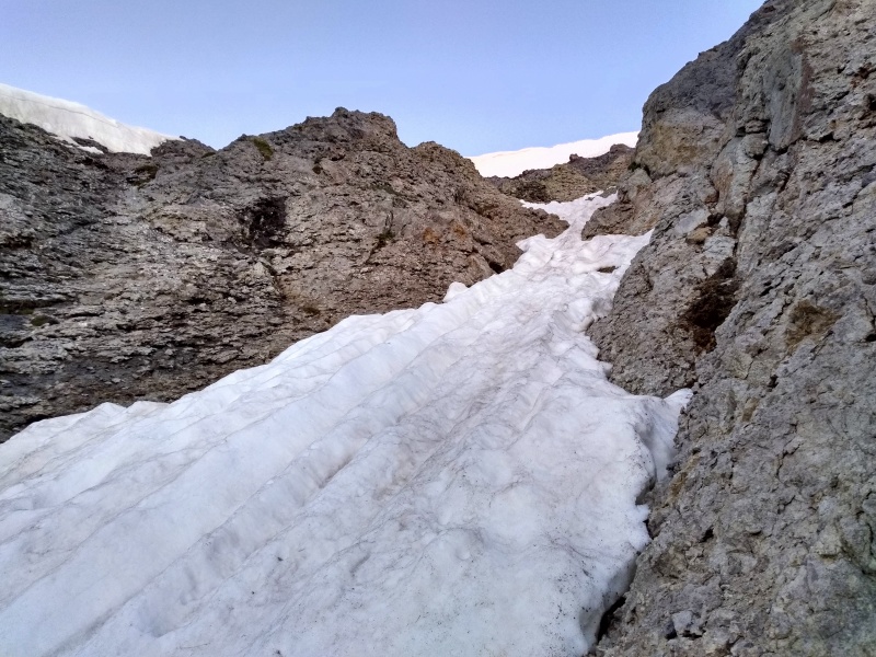
Above narrows
Final slope
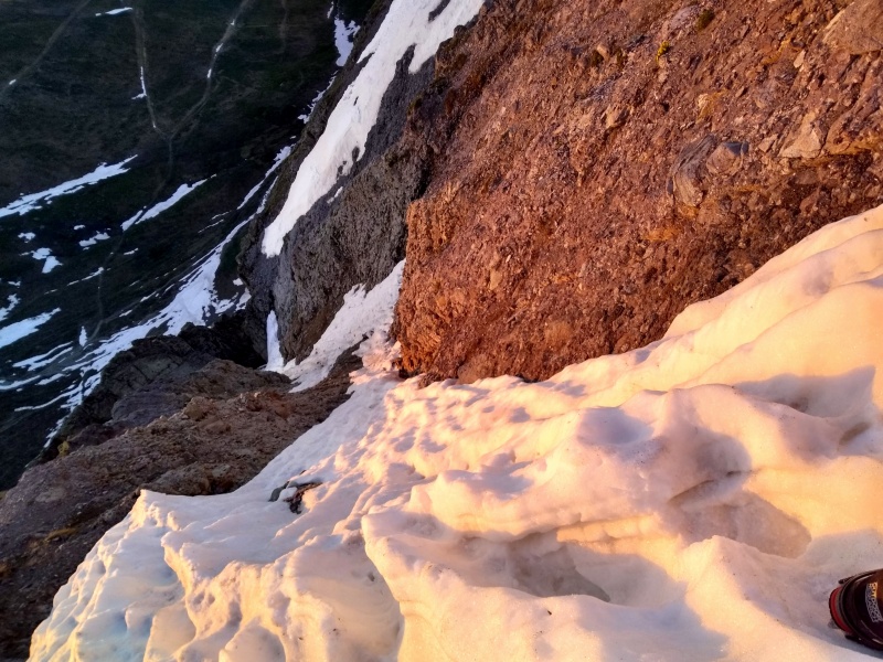
Looking back down
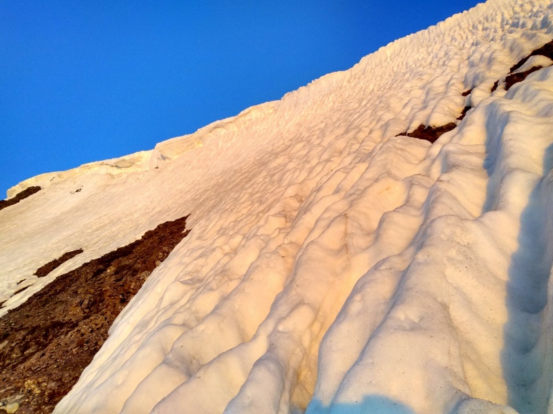
Upper east face
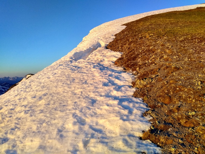
Mind the hole behind that cornice
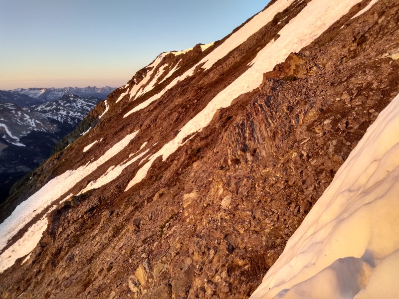
View of earlier route on T 8 (long strip of snow)
Summit view south
View west to Telluride Peak et al
Ice at 42 degrees in Commodore Gulch
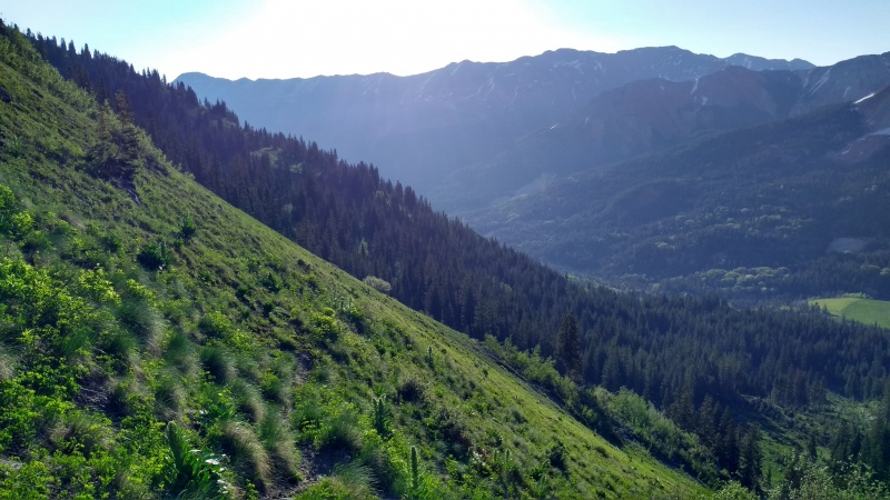
A social trail traverses left out of the creek in Commodore here
Greenery
Counting the apron, this route provides almost 1,200 feet of moderate snow climbing with a steep finish. The couloir is a peach and would probably make for a fine ski descent in winter. Judging by the number of wands scattered around the summit (endemic to area peaks, I've noticed--does someone pick these up?), T 7 appears to get a fair amount of heli traffic, so perhaps this line gets skied often.
My GPS Tracks on Google Maps (made from a .GPX file upload):
Caution: The information contained in this report may not be accurate and should not be the only resource used in preparation for your climb. Failure to have the necessary experience, physical conditioning, supplies or equipment can result in injury or death. 14ers.com and the author(s) of this report provide no warranties, either express or implied, that the information provided is accurate or reliable. By using the information provided, you agree to indemnify and hold harmless 14ers.com and the report author(s) with respect to any claims and demands against them, including any attorney fees and expenses. Please read the 14ers.com Safety and Disclaimer pages for more information.
Please respect private property: 14ers.com supports the rights of private landowners to determine how and by whom their land will be used. In Colorado, it is your responsibility to determine if land is private and to obtain the appropriate permission before entering the property.


")
")
")
")
")
")
")
")
")
")
")
")
")
")
")
")
")
")
")


