Download Agreement, Release, and Acknowledgement of Risk:
You (the person requesting this file download) fully understand mountain climbing ("Activity") involves risks and dangers of serious bodily injury, including permanent disability, paralysis, and death ("Risks") and you fully accept and assume all such risks and all responsibility for losses, costs, and damages you incur as a result of your participation in this Activity.
You acknowledge that information in the file you have chosen to download may not be accurate and may contain errors. You agree to assume all risks when using this information and agree to release and discharge 14ers.com, 14ers Inc. and the author(s) of such information (collectively, the "Released Parties").
You hereby discharge the Released Parties from all damages, actions, claims and liabilities of any nature, specifically including, but not limited to, damages, actions, claims and liabilities arising from or related to the negligence of the Released Parties. You further agree to indemnify, hold harmless and defend 14ers.com, 14ers Inc. and each of the other Released Parties from and against any loss, damage, liability and expense, including costs and attorney fees, incurred by 14ers.com, 14ers Inc. or any of the other Released Parties as a result of you using information provided on the 14ers.com or 14ers Inc. websites.
You have read this agreement, fully understand its terms and intend it to be a complete and unconditional release of all liability to the greatest extent allowed by law and agree that if any portion of this agreement is held to be invalid the balance, notwithstanding, shall continue in full force and effect.
By clicking "OK" you agree to these terms. If you DO NOT agree, click "Cancel"...
Longs Peak’s south face has an enticing couloir named Keplingers that sometimes seems like it never comes in and certainly doesn’t come in very often and rarely good. I’d been hoping to ski this line for sometime and have somewhat obsessed over its condition every spring. In example, I’ve hung out the window of many a plane as I flew it over, or near, it’s south face. One time I scared the hell out of a coworker by having her fly as close to its face as was safe and legal. This year’s poor snow fall made it seem totally out of the question, until April came with wet deep snows and transitioned to more of the same in early May. It certainly looked like it might be in from afar and when Brad McQueen was kind enough to share a photo of Longs’ south face from Pagoda showing it in, I hoped that this would be the year.
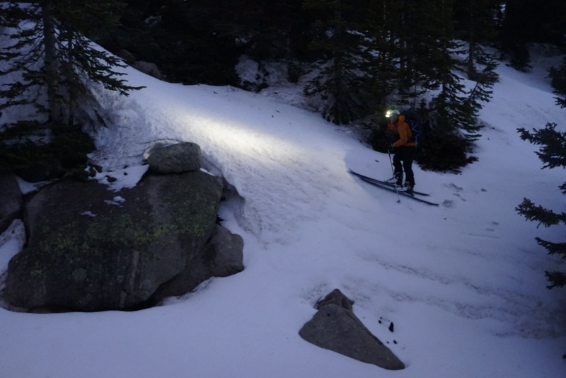
The big question was when could I find the time where work, family and conditions to attempt it. I was preparing myself for disappointment, but then a ski fell through due to the a summit melting out, this freed up a day. Luckily, I was able to talk my ski partners to exchange one massive early morning tour for another. We planned for a classic Longs start of 2:15 AM from the trailhead. Having read of people taking seven hours to ski out we assumed we also could get lost in the morass of the boulder forest, as many others had, and wanted as a early a start as we could tolerate.
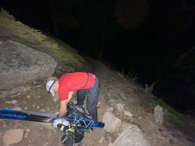
Terrence, Mike and I met at the Sandbeach Lake trailhead, in RMNP, at 2:00 AM after the drive up from Denver and amazingly we were moving up the trail near to onetime at 2:17 AM, an unusual occurrence for our group. We started out with our packs in full “junk-show” mode, skis, boots, helmets and jackets all hanging from our packs. The wind was howling off the trees as we ascended the rocky national park trail and we all inevitably had to stop and strip layers that were comfortable when we had first gotten out of the cars. As we climbed out of the valley we slipped into the comfortable conversations of people that had spent a lot of time together working out in the early morning, which typically consists of our children’s sleep habits and when we would find skiable snow. Mike and I both had different opinions, Mike thought it would be 10,500’ and I reckoned 9,500’ based on some of the local SNOTEL sites. I was right this time and made sure to rub it in. Although the snow was continuous not long after we found it, opted to keep skis and boots on our backs since we were moving quickly and the snow was supportive.
Terrence taking his jacket off a short hike from the car.
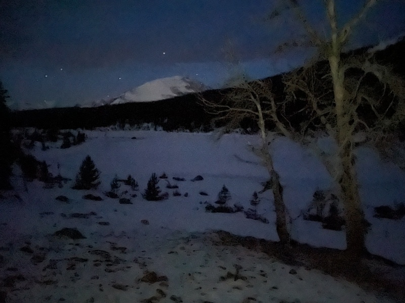
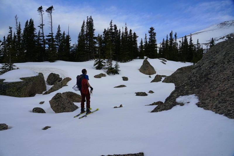
We made it up to Sandbeach Lake at around 4:30, which marked the end of the Garmin recognized trail and the start of my hand drawn track to the base of the mountain and the couloir. We stopped at the lake for a five minute snack break and then we transitioned finally to ski boots and skins and started touring through the forest towards the unnamed tarn that sites below Pagoda.
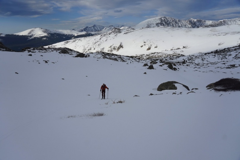
SandBeach LakeSunrise and a front range community
The touring was easy enough, but there was almost no indication of which way would be the most efficient, without the relatively good track on our watches its unlikely we would have been able to move as quickly as we did. After about a mile of rolling terrain we came to a boulder field which out track had us dropping through down to the drainage and then climbing out of to get the basin below Pagoda, Mt Meeker and Longs south face. There was some discussion of traversing around the basin to avoid having to pop the skis off and booting down the boulder field, but we abandoned that idea since it seemed to add distance with no time savings.
e
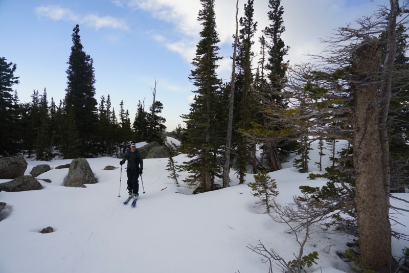
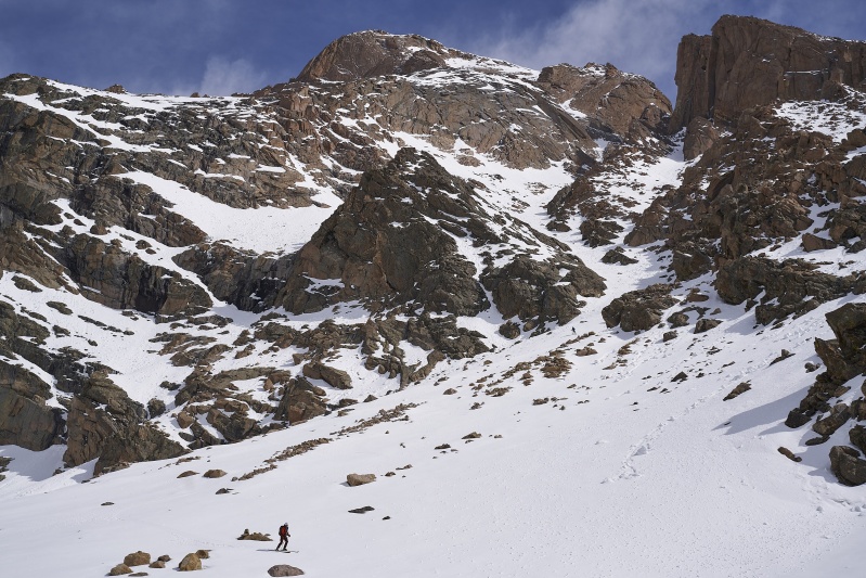
After the boulder down climb we re-skied our feet and quickly toured out of the boulder field and then into and out of the drainage and began making our way up towards the basin. It was in here that we realized how this forest could eat hours of lives on the descent if we didn’t manage the ski out well. Thankfully, it’s intuitive climbing out and we made quick work of the pitch above the creek and were a few hundred above the unnamed tarn by 6:30. Unfortunately we’d lost some of our pace in the forest and had only moved 1 mph over two hours. In addition to the loss of time, Terrence informed us his nausea he’d been dealing with since the car and the chest cold he’d been developing was going to prevent him from continuing past the base of the couloir. I don’t know if he told us to go on or if we even offered to turn around with him; looking back we probably should have been a bit more thoughtful and at least offered to turn around and head back. Regardless of whether or not Mike and I discussed it with Terrence we convinced him to at least get to the base of the couloir so we wouldn’t be skiing out separately. It was only about a 10 minute tour from here to the base of the climb, we continued on and made sure that Terrence was followed along and for a minute he looked like he might continue on up with us… he didn’t.
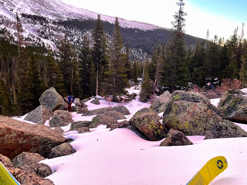
Mike Bean HereTerrence WongBoulder field booting.Mike, Terrence and the Indian Peaks
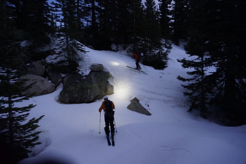
Credit: Mike-John Touring up with the summit above
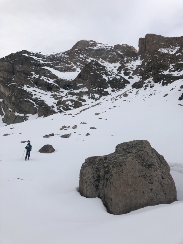
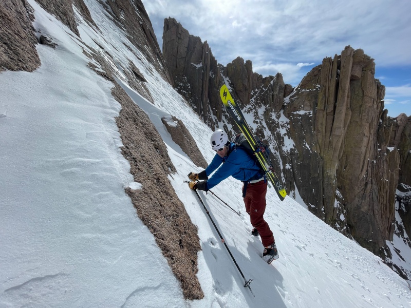
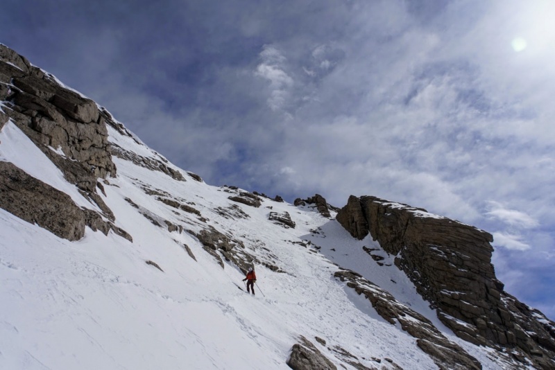
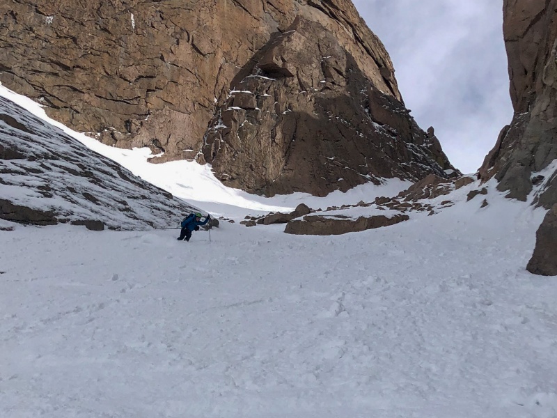
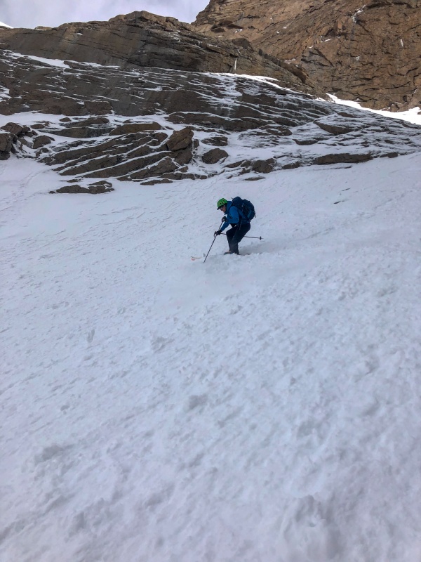
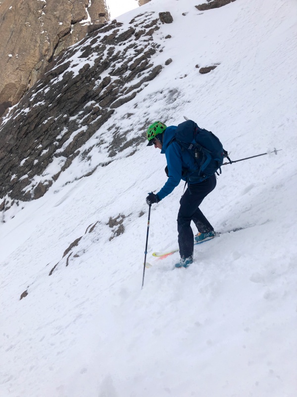
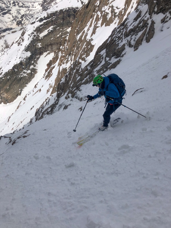
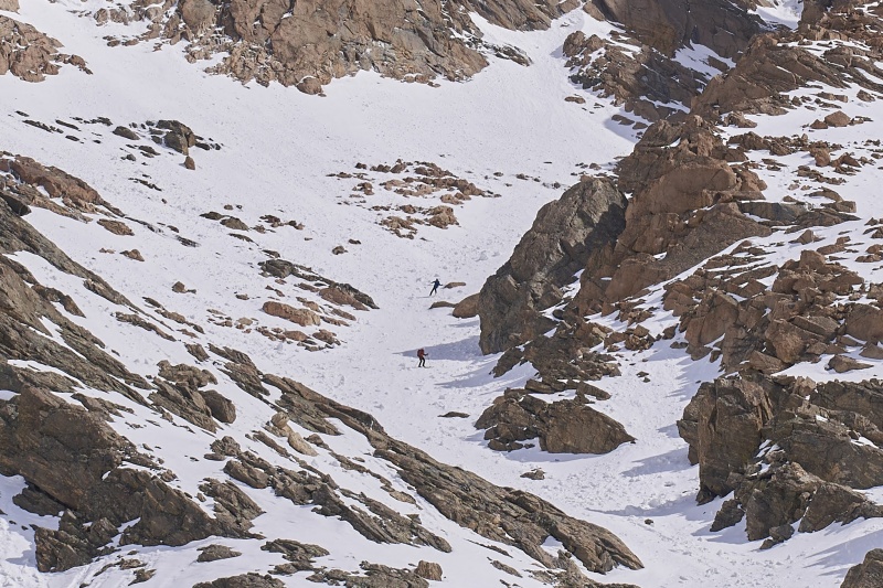
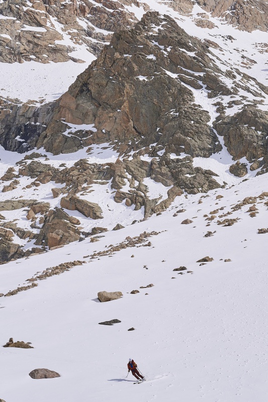
At the base of the couloir, I was able to hold an edge so I took it as a challenge to see how far up a 30-35 degree slope I could switchback. The answer was about 450’. About the time I stopped and was throwing my skis on my back, Mike caught up with me and started putting a boot pack up the couloir. The going was pretty tough, the recent storm had brought what appeared to be about a foot or two of wind deposited graupel. This didn’t provide a great base to hike up and it was a bit punchy, from a good freeze crust to loose down to the older surface. All the while the wind was blowing more grauple off the summit and a river of this stuff was silently running down the center of couloir. It was pretty weird looking.
Mike climbing with the Notch above him.
Caption Here
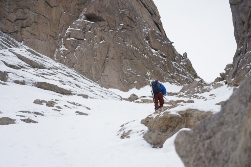
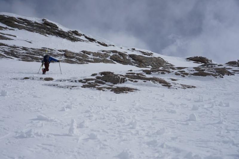
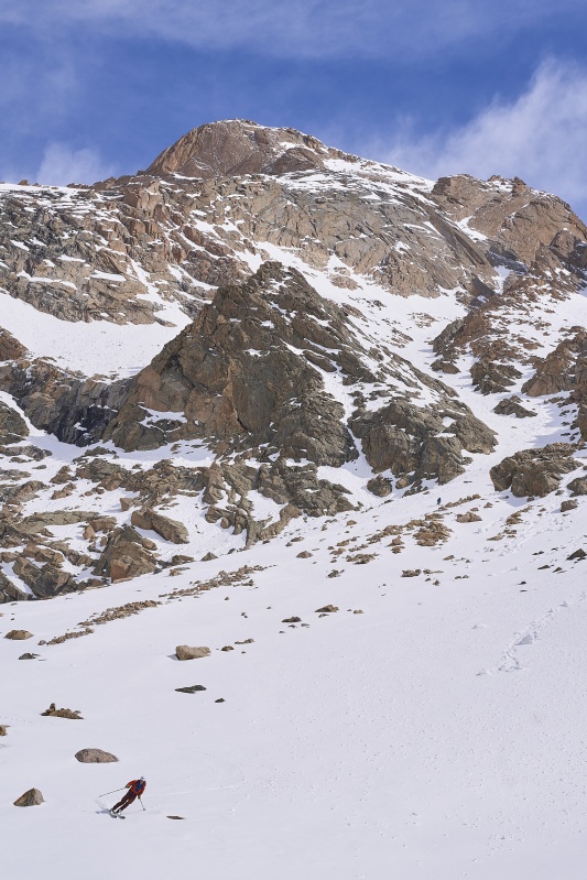
By the time we started up the steep stuff it was about 7:30 and we hoped to be skiing off the summit no later than 9:15, both due to snow conditions with the warming spring day and also because we had to be driving home no later than 3 pm and we wanted six hours to ski out if we encountered what literally every other trip report describes. So, we had about 2,500’ to climb in under two hours and conditions were not ideal for a quick ascent, ‘cool we can do that’… Mike was willing to wreck himself for my benefit and we made pretty good time to just short of top of the Notch and the traverse to the homestretch, where I took over.
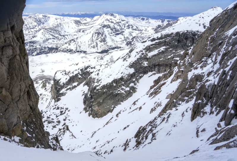
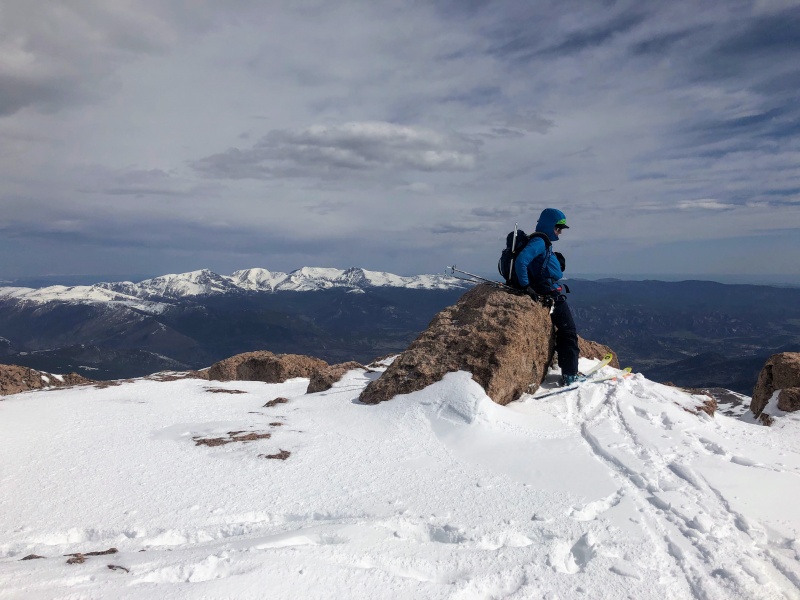
The traverse over to the homestretch, and the standard route, is truly the only really exposed section of the whole climb and its not really much to worry about if you dont think about the slide to your tumbling death down to Keplinger’s Lake. We however were tired and didn’t think much about the death slide and instead struggled across the nice freeze thaw snow towards the base of the homestretch. It was some work getting across this section and I was really started feeling the 7.5-8 miles and ~5,500’ of uphill. I was taking many short breaks and felt bad about it, but Mike wasn’t complaining, so I slowly worked my over to the final pitch and started up it. I took us up about 150’ form the traverse and Mike was nice enough to pass me and blast up to the summit. I followed after him and and almost exactly seven hours after starting we were on the summit of a snow encrusted Longs Peak.
Bean on the traverse with the Notch and Palisades in the background.Bean charging up the last bit to the summit.
Bean thinking about life, this mysteries of the mountains or why the fuck his phone doesnt have signal.
Credit: Mike- John: 'does this count as a summit ski?!'
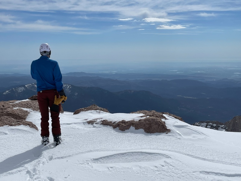
We took a few pictures, Mike attempted to text his wife, I sent inReach texts to the wives and we skied off at 9:42, right on time for that 9:15 drop dead ski down time. The wind had been blowing all morning and some high clouds had kept the snow cool so that aspect of our tardiness wasn’t an issue. It was still to be determined on length of the ski to the car, we hoped, mostly for our mental health it was not going to be a bad ski out.
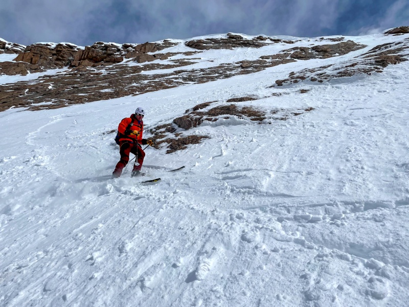
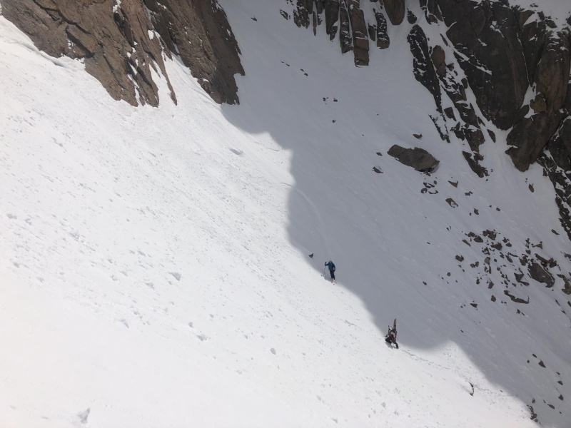
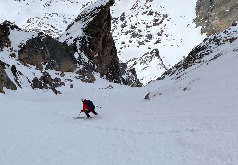
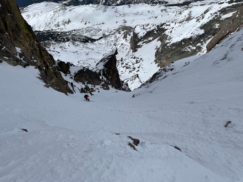
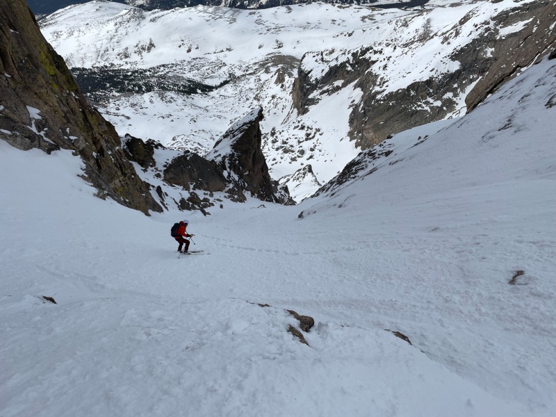
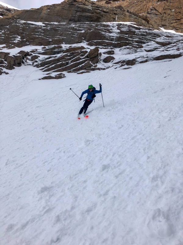
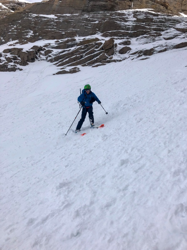
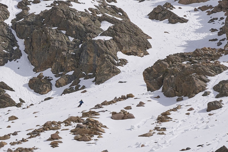
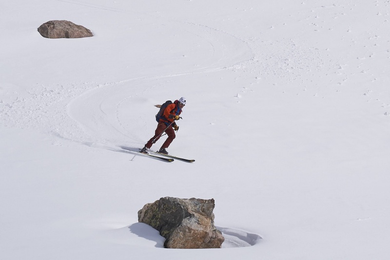
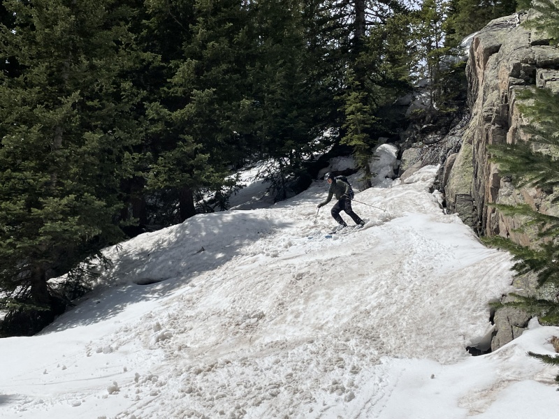
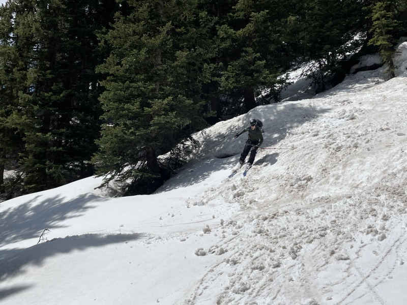
Since, it was my stupid ass idea to get three hours of sleep and schlepp our asses up here, I skied off first with Mike right behind me. The first few turns off the summit were pretty steep and the snow was pretty crusty and broke off and went sliding down the face towards Terrence. My legs were super stoked about all the sick TGR grade jump turns I was doing and started cramping. Nothing says fun like cramping quads while skiing over a three thousand cirque. Luckily I’d skied about 50’ down from the summit and pretty much done with the ski. During my silent bitching about my legs, Mike rolled up and commented that it would be a horrible idea to ski under each other with all the shit we were kicking off. I agreed and started working my way to the bottom of the homestretch and waited for Mike to catch up before skiing over to the Notch, leg cramping already forgotten. Once Mike caught up, I skied across the traverse and its super fun bulletproof snow over the death tumble and saw a guy I thought was Terrence. It wasn’t, but it was a 14er member named PostholePete and a split boarder. He thanked us for our booter and we went our separate ways. Mike I briefly mentioned the ski out on a board and how much fun that’ll be then started ski down. We leap frogged for picture purposes, but otherwise skied down together enjoying the great snow. The skiing was pretty amazing and made the seven years, seven miles and seven hours of waiting and travel worth ever minute of it. I can’t be certain, but having read many trip reports about the line, I wondered if we were skiing the line in as good conditions as Keplingers ever gets. We skied quickly down and out and were rolling up to Terrence on the ramp below the couloir no more than 25 minutes after leaving the summit.
Mike skiing off the summitMore Bean
Credit: Mike-John chatting with PostholePeteMike skiingMike skiing
Credit: Mike
Credit: Mike
Credit: Mike
Credit: Mike
Credit: Mike
Credit: Mike
Credit Terrence
Credit Terrence
Credit Terrence
Credit Terrence
Credit Terrence
Credit Terrence
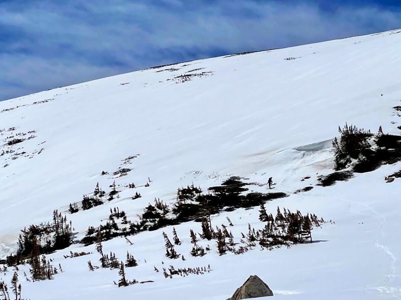
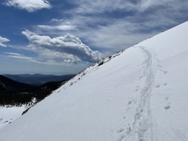
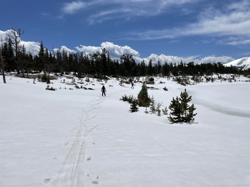
We’d been discussion climbing north flank of 11,730’ Mount Orton, which sits across the valley, so that we could avoid skiing down into the trap of the forest and be able to ski from there directly to Sandbeach Lake and the well tracked trail. We agreed this would probably be the right way to go and skied down together to the little unnamed tarn and then re-skinned for the two or three hundred foot climb. I can’t say any of the three of us were feeling more uphill, but Mike was nice enough to put the track in and we were up on the slope and over above the lake within a half hour and skiing down the east facing manky-spring snow towards the lake. We made quick work of the slope above the lake and were skiing the rolling trail back to the car within another half hour. In classic spring ski-mountaineering fashion the hiking trail out involved a lot of scary fast tree skiing, side steeping up little inclines and some gentle ski-on steeping across log bridges, gravel and roots. Before long we had gotten to within 1 1/3 miles of the car and we strapped our, skis, boots, helmets, skins, and ski pants for maximum junk show for the 30 minute stroll back to the car. It was remarked that it was breathtaking beautiful back where we had just come from and that many people plan vacations to the trail we were in hurry to get away from. Such is the spring skiers attitude, ‘cool skiing, pretty views, whatever can we just get to the damn car already.’
Mike and Terrence working their way up the flank of 11,700' Mount Orton
Track up to Mt Orton
Mank skiing
Skiing the mank above the lake
Sandbeach Lake
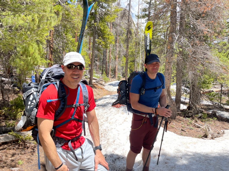
T and M and thier Junk show ready to hike
Keplingers is a helluva a ski that Im glad I waited to come in to ski. It ranks as one of my favorite skis, but it’ll always be a bit of an asterisk to the adventure since Terrence didn’t feel up to summiting. We did however get back to the car in half the time we feared, it was probably the most efficient the three of us have ever been during a spring climb and ski. So, it was a mix bag of success.
Thanks Terrence and Mike for going with me, sorry I almost ran out of gas.
Total Tome: 11 hours 13minutes
Time to summit: 7 hours 3 minutes
summit time: 25 minutes
Summit to car: 3 hours 40 minutes
My GPS Tracks on Google Maps (made from a .GPX file upload):
That was a great report with wonderful photographs.
Its always a lot of work, for such a short time of skiing, but once the skiing starts, the pure fun of it certainly feels like it was worth the work of getting to the top.
One of the best lines around when the conditions are right, and we did the approach back in 2006 as well, I feel like that gets you the full flavor of the route, reading this brough back some great memories, nice work!!
You guys are beasts coming at it from that TH! Looks like you caught some great conditions. The Mt. Orton climb on the way out sounds like a great idea to avoid getting into the trees too soon.
Nat, Rob-Based on everything I read, it seems like the penalty of additional milage on approach is rewarded with a more efficient ski out and no car shuttle. Mt Orton definitely seems like the way to go, adds a couple hundred feet max, but you gain additional fun skiing before the long ski out.
Schralp- Yea its worth the wait, your old trip reports are usually pretty helpful anytime I'm researching a big ski day.
I was gonna put a TR up at some point but this will suffice. Thanks again for the boot pack and the tracks up and back. Yes, the ride out kinda sucked but I enjoy split skiing so some parts were just more annoying than others. Orton does indeed seem the way to go but oh boy, it was HOT by the time I got up there. I enjoy seeing where I can go instead of getting lost in boulder fields and trees.
Conditions really were unbelievable. This is on my 5 top, without a doubt.
Seeing your times make me really proud of myself because my RT was 11 hours 50mins and 6 hours 50 to the summit. But, both of those times would have been much longer without y'alls help. Hit me up if you ever need an extra for a 2am start!
Heres a gopro edit I made of the climb & ride: https://www.instagram.com/p/CPRTVp7DL3H/
Again, thank you so much for the help!
Caution: The information contained in this report may not be accurate and should not be the only resource used in preparation for your climb. Failure to have the necessary experience, physical conditioning, supplies or equipment can result in injury or death. 14ers.com and the author(s) of this report provide no warranties, either express or implied, that the information provided is accurate or reliable. By using the information provided, you agree to indemnify and hold harmless 14ers.com and the report author(s) with respect to any claims and demands against them, including any attorney fees and expenses. Please read the 14ers.com Safety and Disclaimer pages for more information.
Please respect private property: 14ers.com supports the rights of private landowners to determine how and by whom their land will be used. In Colorado, it is your responsibility to determine if land is private and to obtain the appropriate permission before entering the property.
")
")
")
")
")
")
")
")
")
")
")
")
")
")
")
")
")
")
")
")
")
")
")
")
")
")
")
")
")
")
")
")
")
")
")
")
")
")
")
")
")


