Download Agreement, Release, and Acknowledgement of Risk:
You (the person requesting this file download) fully understand mountain climbing ("Activity") involves risks and dangers of serious bodily injury, including permanent disability, paralysis, and death ("Risks") and you fully accept and assume all such risks and all responsibility for losses, costs, and damages you incur as a result of your participation in this Activity.
You acknowledge that information in the file you have chosen to download may not be accurate and may contain errors. You agree to assume all risks when using this information and agree to release and discharge 14ers.com, 14ers Inc. and the author(s) of such information (collectively, the "Released Parties").
You hereby discharge the Released Parties from all damages, actions, claims and liabilities of any nature, specifically including, but not limited to, damages, actions, claims and liabilities arising from or related to the negligence of the Released Parties. You further agree to indemnify, hold harmless and defend 14ers.com, 14ers Inc. and each of the other Released Parties from and against any loss, damage, liability and expense, including costs and attorney fees, incurred by 14ers.com, 14ers Inc. or any of the other Released Parties as a result of you using information provided on the 14ers.com or 14ers Inc. websites.
You have read this agreement, fully understand its terms and intend it to be a complete and unconditional release of all liability to the greatest extent allowed by law and agree that if any portion of this agreement is held to be invalid the balance, notwithstanding, shall continue in full force and effect.
By clicking "OK" you agree to these terms. If you DO NOT agree, click "Cancel"...
Back in January this year I scouted out the East Face route on Mt. Wilson from the Cross Mountain trailhead. While I had a notion to tag a winter ascent, that just wasn't in the cards as the deep snow made travel very slow. How slow? In January, it took nearly 5 hours to reach treeline above the Slate Creek drainage. Yesterday, I was able to reach my previous high point in about 90 minutes. Also, the experience in winter was extremely helpful in navigating the section through the woods where there is no trail.
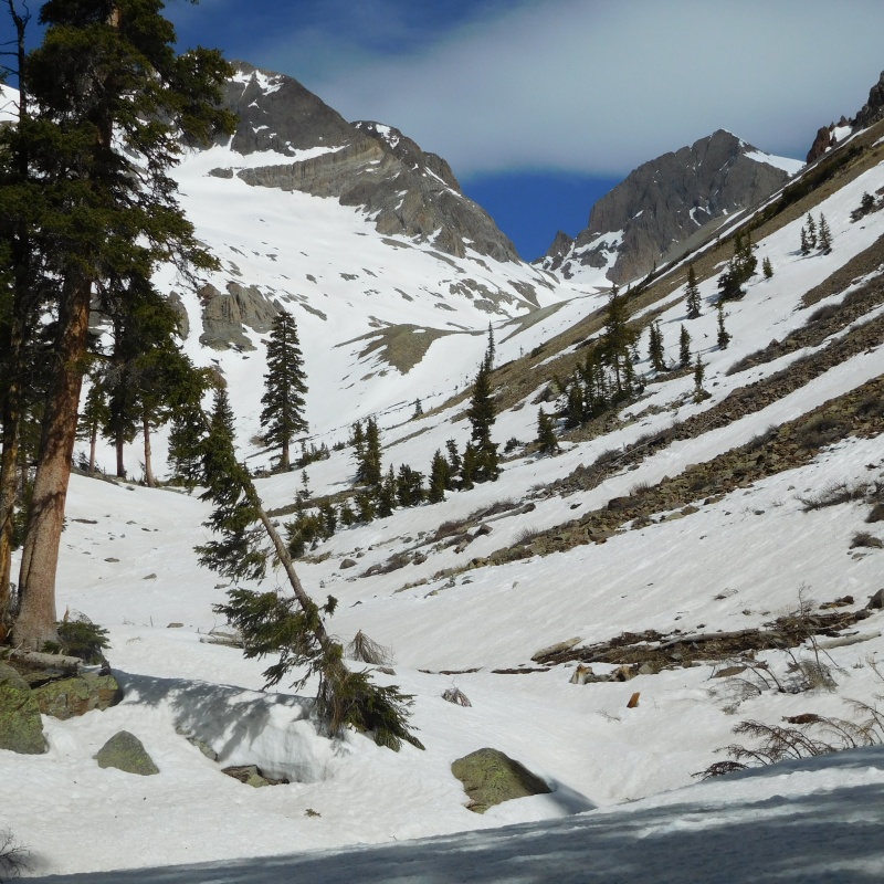
Cross Mountain Trailhead
Mt. Wilson is not in sight in the previous photo, but just tucked in behind the prominent peaks left of center. Lizard head visible just in the upper right corner.
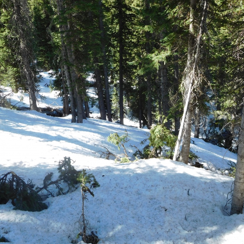
Since I don't travel with any sort of electronic navigation, the woods section was a bit unsettling, especially on the way out, since there was not hint of the tracks from earlier in the morning.
If I had to stress one thing about this hike, DO NOT RUN OUT OF DAYLIGHT AND EXPECT TO FIND YOUR WAY THROUGH THE WOODS BACK TO THE CROSS MOUNTAIN TRAIL IN THE DARK, unless you have a gps track to follow or some similar device.
I started at 8:15 a.m. and for the first mile or so there was no snow at all on the Cross Mountain trail. I left the trail after about 1.5 miles because the snow in the woods was firm and travel was easier than on the trail itself. In fact, I packed my snowshoes all the way to treeline, where I stashed them for most of the rest of the day. In January I had left the trail further up, but it made no difference as I soon saw familiar landmarks.
Through the woods
Expect to spend about an hour feeling somewhat lost
There is some finesse in getting through the woods and coming out in the right place. In January I think I hit it just right as the two creek crossings were simple. This trip I went too high, too far to the right through the woods, and when I came to the second creek crossing found myself looking across a small canyon.
Not exactly where you should come out of the woods
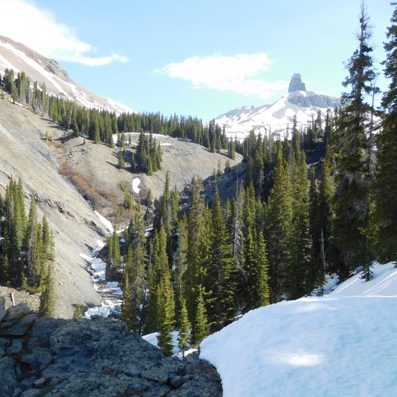
The mistake did afford a nice view of Lizard Head
Slight detour
After getting down off the ridge, and across the creek it was a simple thing to get back on track. I think if 10 people did this hike they would find 10 different ways to get to the top of Slate Creek.
Tall tree were I stashed snowshoes
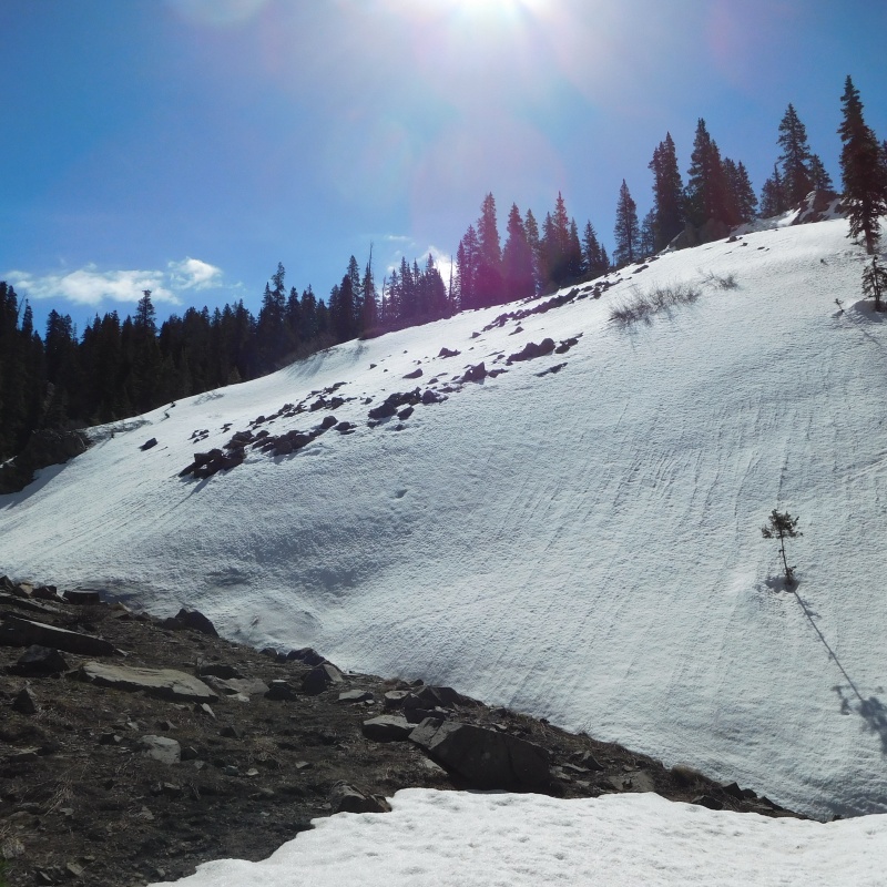
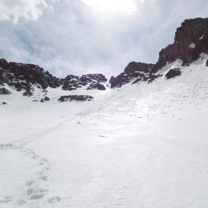
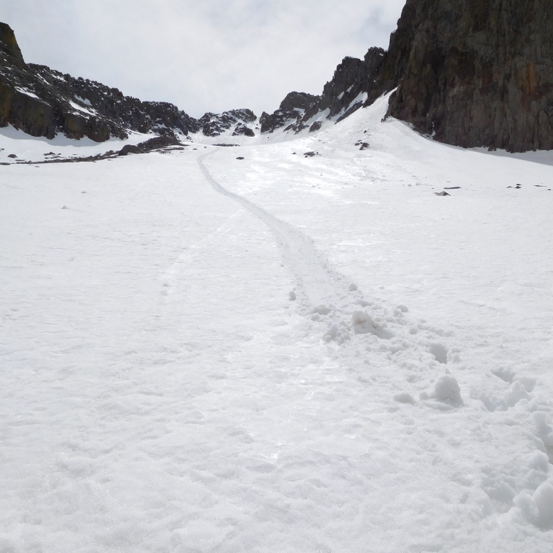
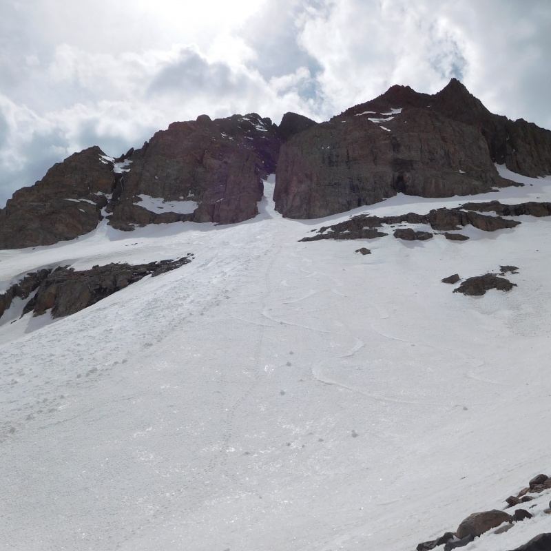
It was a little after 10:30 when I found myself in the drainage proper. From here, the route is very obvious and easy to follow. The snow was still nice and firm and the travel easy for the most part. In fact, it was firm enough that I found it easier to use crampons than to kick steps in sections where I was side hill walking. I had crampons on for most of the day above tree line.
Easy snow hike
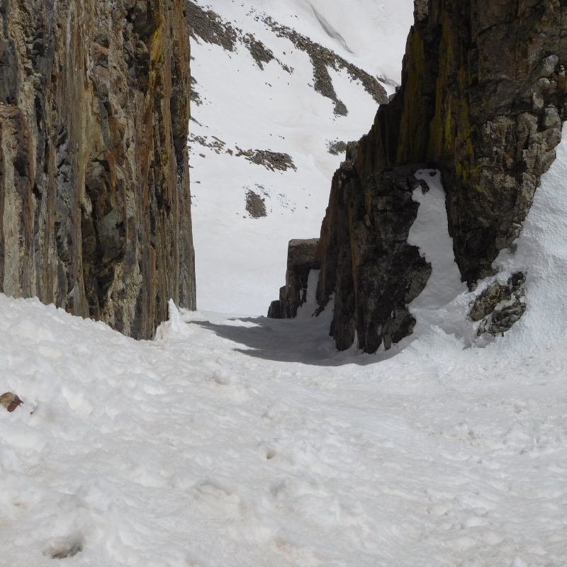
I had not made my mind up about whether to climb the Boxcar Coulior or not until it was right in front of me. Once I was there, the idea of making a loop won the day.
Boxcar Coulior
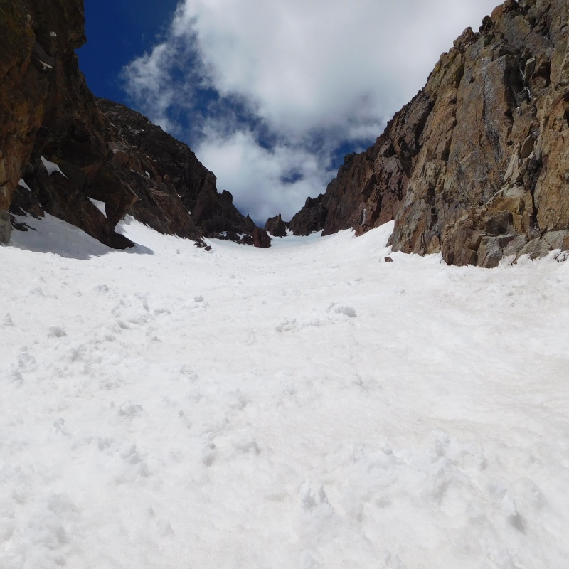
I don't think this was any shortcut. In fact, I am pretty sure it added some time to the climb, but it was fun. The snow was in great condition, firm so you did not sink in, but soft enough to kick nice steps.
Looking down from part way up Boxcar
Upper Boxcar
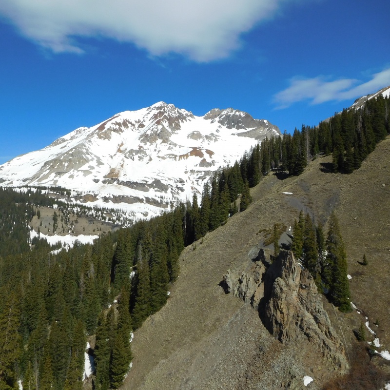
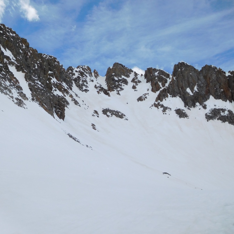
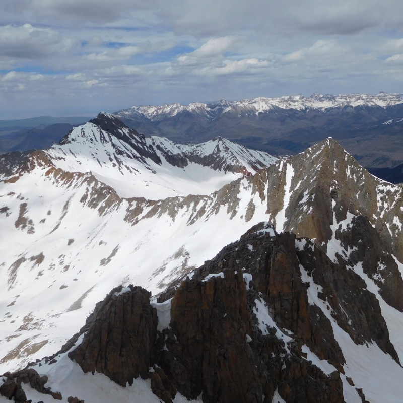
Once you exit Boxcar the view is a little disheartening. It looks like a couple more hours to the summit, but the view is misleading.
Mt. Wilson from the top of Boxcar
The previous photo is from the top of Boxcar looking right. But to the left is the start of a cirque of rock that looks like it might just get you to Wilson without crossing all the snow in the photo. I did spend about an hour exploring this option, but came to a roadblock that I didn't like. I think it would go, but didn't seem worth the risk this time. Anyone else tried this option?
Roadblock on the Cirque; Wilson in the background
So I backed down to the top of Boxcar, put the crampons back on and started what I expected to be a trudge to finish. It went surprisingly fast, which was nice.
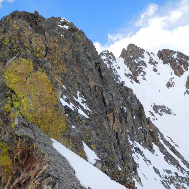
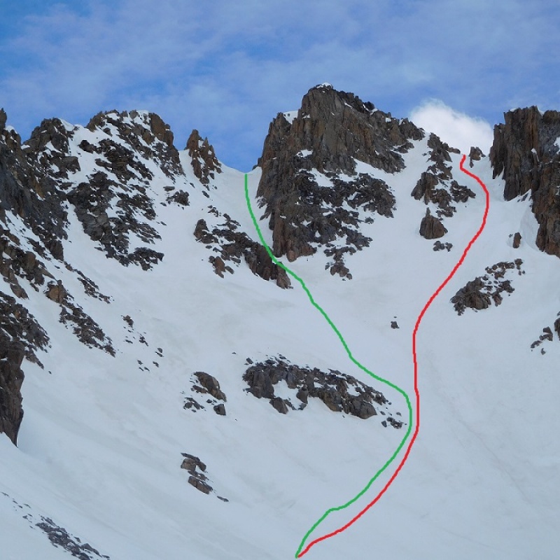
Now here is another thing. The high point is the summit and the route description clearly says go to the left of the summit. But I didn't like the look of that and decided to go to the right. If I have to trust my memory of a route description or my judgment in the moment, well, maybe I should start writing some of this stuff down and taking it with me!
Visual cue for next time.
The green line is the correct route. While it appears to lead to a cliff, there is an easy walk off around the corner. The red line, which I took, takes you to the saddle with Kilpacker Basin, and the standard route just below the 4th class move. I was a little disappointed not to finish on the route as described. If I had not been here before, and familiar with this final hard move, I might have backed down. But I knew what to expect and even in winter boots, the finish was not so difficult.
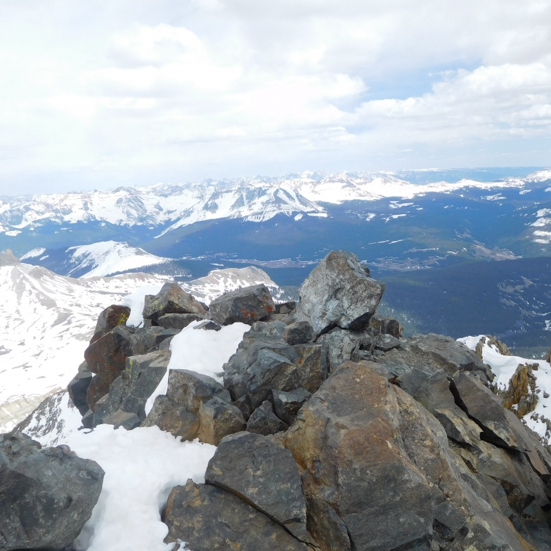
Mt Wilson Summit
I made the summit just around 2:30.
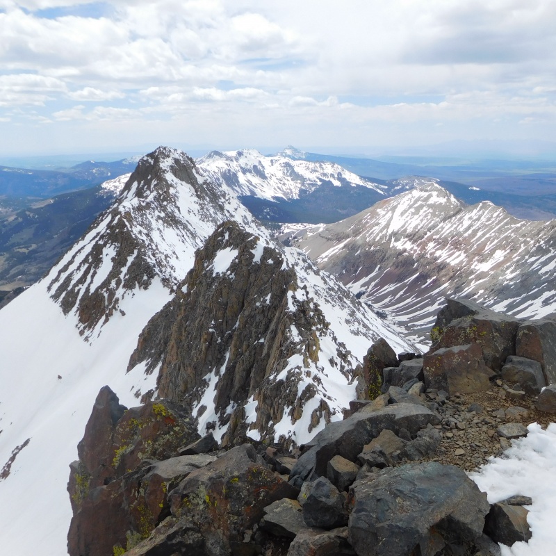
El Diente from Mt. Wilson summit
Gladstone and Wilson Peak
The descent was a BLAST! Even though crampons made it easier to climb, there was plenty of soft slushy snow on the surface to make for a fantastic sitting glissade.
First slide from the top
Slide home part 2
More than two hours up; less than 10 minutes down!
The snow conditions continued to hold up in the late afternoon. On the walk down, plunge stepping was easy and crampons stayed off for all of the descent.
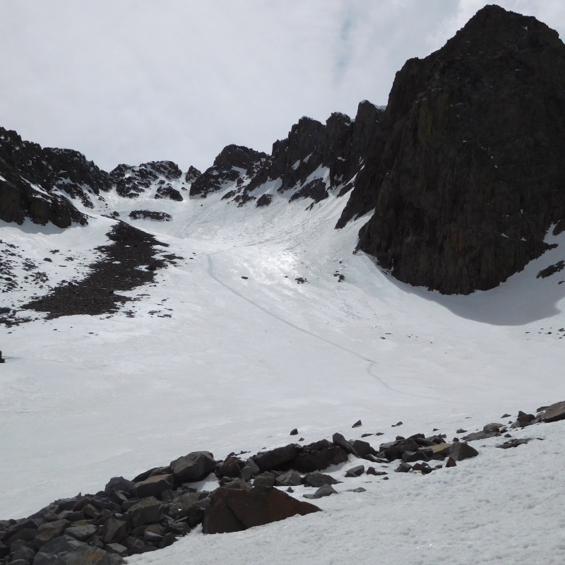
Another look at Boxcar on the way out
I got down to the big tree where I stashed my snowshoes and packed them for the next 30 minutes or so. But the snow in the woods finally softened up and I did use them for most of the hike through the woods on the way out. On the hike out, I came to the Cross Mountain trail almost a mile further up than where I went in earlier in the morning, just confirming my observation that there are many ways to make this work. But if I had to do it in the dark, I would still be there now! As it turned out, I was back at the car at 6:15, making a 10 hour day.
Thumbnails for uploaded photos (click to open slideshow):
Thanks for the comments. Also thanks to Snowalien for the several recent condition reports from the San Juans describing excellent snow conditions and to Coloradokid_ who put up a condition report on this route a couple days before my hike.
Caution: The information contained in this report may not be accurate and should not be the only resource used in preparation for your climb. Failure to have the necessary experience, physical conditioning, supplies or equipment can result in injury or death. 14ers.com and the author(s) of this report provide no warranties, either express or implied, that the information provided is accurate or reliable. By using the information provided, you agree to indemnify and hold harmless 14ers.com and the report author(s) with respect to any claims and demands against them, including any attorney fees and expenses. Please read the 14ers.com Safety and Disclaimer pages for more information.
Please respect private property: 14ers.com supports the rights of private landowners to determine how and by whom their land will be used. In Colorado, it is your responsibility to determine if land is private and to obtain the appropriate permission before entering the property.


")
")
")
")
")
")
")
")
")
")
")
")
")
")
")
")
")
")
")
")
")


