Download Agreement, Release, and Acknowledgement of Risk:
You (the person requesting this file download) fully understand mountain climbing ("Activity") involves risks and dangers of serious bodily injury, including permanent disability, paralysis, and death ("Risks") and you fully accept and assume all such risks and all responsibility for losses, costs, and damages you incur as a result of your participation in this Activity.
You acknowledge that information in the file you have chosen to download may not be accurate and may contain errors. You agree to assume all risks when using this information and agree to release and discharge 14ers.com, 14ers Inc. and the author(s) of such information (collectively, the "Released Parties").
You hereby discharge the Released Parties from all damages, actions, claims and liabilities of any nature, specifically including, but not limited to, damages, actions, claims and liabilities arising from or related to the negligence of the Released Parties. You further agree to indemnify, hold harmless and defend 14ers.com, 14ers Inc. and each of the other Released Parties from and against any loss, damage, liability and expense, including costs and attorney fees, incurred by 14ers.com, 14ers Inc. or any of the other Released Parties as a result of you using information provided on the 14ers.com or 14ers Inc. websites.
You have read this agreement, fully understand its terms and intend it to be a complete and unconditional release of all liability to the greatest extent allowed by law and agree that if any portion of this agreement is held to be invalid the balance, notwithstanding, shall continue in full force and effect.
By clicking "OK" you agree to these terms. If you DO NOT agree, click "Cancel"...
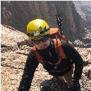
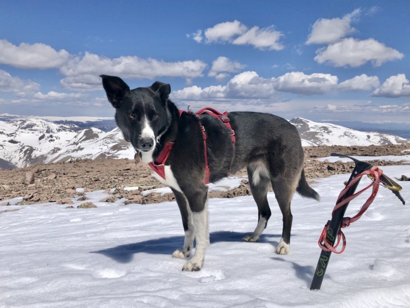
Mountain(s): "Phoenix Peak" (13,895') Route: "Southwest-ish" Ridge from Phoenix Park Date: May 2, 2021 RT Distance: 10.4 miles RT Gain: 4,200' RT Time: 7 hours moving, 9.75 hours total (long stops on summit and to search for a lost ice ax) Climbers: SurfNTurf (Jeff), durkan (Kevin), Fisching (Greg) + Zia the Dog
You don't hear much about "Phoenix Peak," even as the Centennials are getting more and more popular. That's accentuated by the dearth of trip reports here on 14ers.com. I tried to summit from the east last summer, and both Gerry Roach's guide and the National Geographic Trails Illustrated map contain significant inaccuracies. I had to bail at around 12,100' because the routefinding took too long. If you're looking to tackle Phoenix from the east, shoot me a PM. I have some helpful info. It's doable if you know where to go. For the purposes of this TR, however, I'm going to stick to Phoenix's west side—which is no less confusing.
Greg, Kevin and I had planned on the Cross Couloir for the first weekend in May, but the new snow falling earlier in the week and the prospect of snowshoeing an extra 8 miles each way up the still-closed Tigiwon Road caused us to pivot. We decided instead on Phoenix, a Centennial all three of us still lacked. We packed overnight packs assuming the backroads north of Creede would still be snow-covered, requiring an extra 8ish miles RT. Remarkably, the easiest way to reach the Phoenix Park TH—road 502—was in August condition. There wasn't a single patch of snow to be found. Kevin's 4Runner had no trouble whatsoever reaching the 2WD TH, and the same would go for most passenger vehicles.
A note on reaching the trailhead. The road you want is 502. Previous trip reports mention getting there via 503, and one even confused the two and mislabeled them throughout. If you follow Google Maps, it only shows 503. That's going to be a bad time, as Greg discovered the hard way. Yes, there are several viable options for reaching Phoenix Park, but here are the no-nonsense directions: head north out of downtown Creede. Pass the ice-skating rink and fire department and look for a bridge on the right, with several cabins and a huge information sign. Take the right-hand turn, cross the bridge and bypass the cabins. This is road 502. Drive for approximately 4 miles on a well-graded 2WD road to a medium-sized parking area with an informational sign about the Phoenix Park Mill Site. Park here, or continue a short distance up the road to a pull-off with room for 1-2 vehicles at the junction with 502.1A, which is a severe 4WD road. Most vehicles should call it quits here, but if you're feeling frisky you can take the 4WD road up another 1.5-2 miles into Phoenix Park.
There isn't much camping along 502, nor at the 2WD trailhead. We parked Kevin's 4Runner at the 502/502.1A junction and "backpacked" in about 0.25 mile to a nice secluded site with a fire ring and a great view of Phoenix. Greg, who was coming from hiking a few Centennials around Lake City, planned to join us in the morning. We all rendezvoused at 5 a.m. and hit the trail about 15 minutes later.
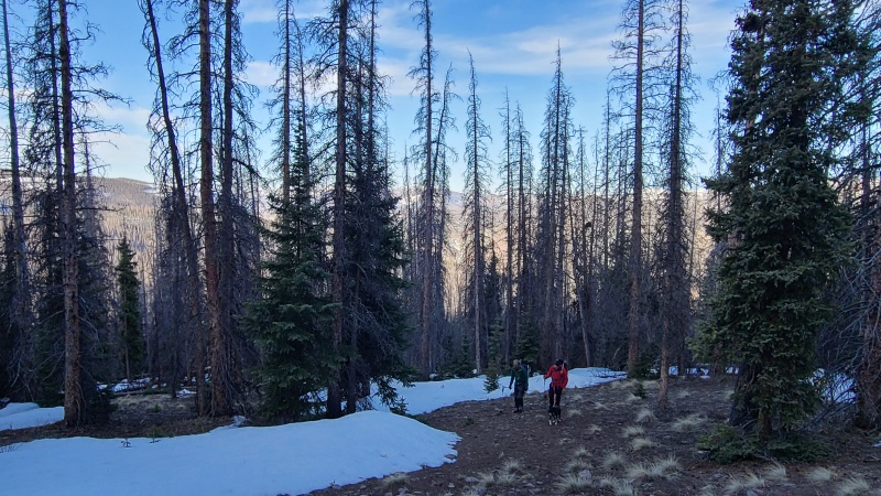
Enjoy the first 1.5 miles of road walking, as it's the only no-brainer section of the entire hike. Follow 502.1A, which goes downhill for about 200 feet before gradually starting to climb, for about 1.6 miles to an open clearing. Look for a signpost marking the junction for Trail #787. It's faded and hard to read, but it's the only metal pole in the ground so it's pretty hard to miss. Take a right onto #787 and immediately cross a stream. The trail is easy to lose—keep your eyes peeled for the faint depression and cairns. It meanders a bit south (hiker's right) after the initial stream crossing.
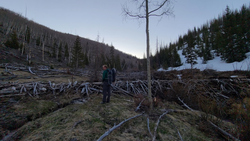
The standard South Slopes route allegedly follows #787 for about 2.5 miles before you're supposed to cut hard north on trail-less tundra. I say allegedly because we weren't able to follow it for anywhere close to 2.5 miles. We'd gotten lucky with the lack of snow coverage to this point, but our good fortune finally ran out. Trail #787 parallels a small stream for a while before eventually crossing it and weaving away to the south. The south side of the stream, however, was entirely covered in multiple feet of unsupportive snow. Even with snowshoes, in the early morning, we were looking at miles of miserable postholing to stay on the summer route. The north side was entirely dry by contrast. We forgot about #787 and followed the creek's north side for as long as we could, but before long the snow and the dozens of mondo beaver dams forced us to reconsider.
Insert beaver joke here.On the "Southwest" Ridge
Most existing Phoenix TRs highlight two possible routes: the West Ridge, primarily used for winter ascents, and the standard South Slopes. We'd planned for the West Ridge, but after seeing the lack of snow in the area decided to try the summer route instead. In reality, we ended up splitting the difference. The West Ridge (which is mostly steep talus and scree) was too dry compared with most TRs that detail going that way, and we easily could have lost an entire day wallowing around in snowshoes trying to stay on the summer trail. So, we chose our own adventure instead.
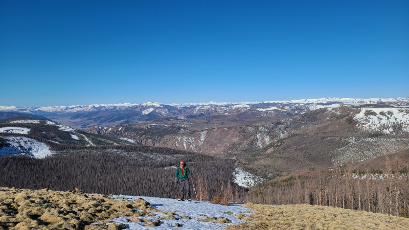
After studying our topo maps, we decided to grind straight up the hill north of #787 to gain what I'll call the Southwest Ridge—a small, gentle ridge just south of the more prominent West Ridge. It was steep and loose but seemed, by far, the lesser of all possible evils. We dodged enough sheep patties, fallen trees and snow patches to reach the ridge crest, which we then followed to a minor saddle around 11,300'. The section between this minor saddle and treeline was the worst we'd encounter all day. Deep snow was unavoidable, and we flailed uphill postholing crotch-deep in snowshoes until we finally hit the glorious sun-baked tundra above 12,000'.
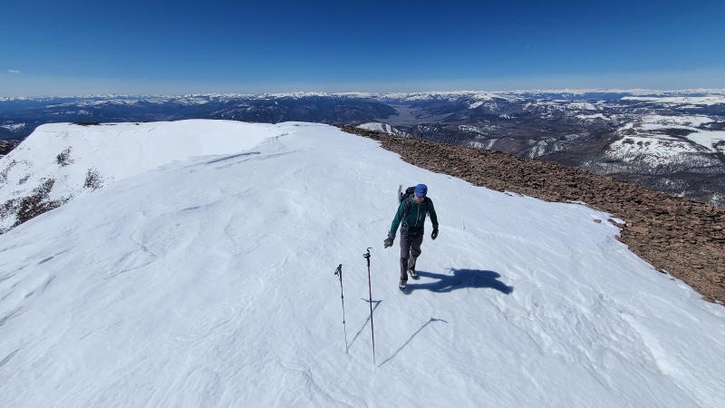
Greg, "enjoying" the bitter end of the snowshoeing portion.Riding the Southwest Ridge.
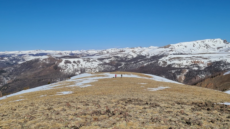
Our odds of a successful summit skyrocketed as we ventured above the trees. Any number of ascent options likely would have worked from here, but we kept angling east/northeast along the ridge crest in the general direction of the standard route. We were aiming for an obvious low-angle snowfield that served as a ramp almost all the way to the ridgeline between Phoenix and La Garita Peak at 13,500'. Kevin literally flew uphill using his snowshoes with the heel lifts engaged, while Greg and I lagged about 20 minutes behind in microspikes/crampons. Zia (the dog) tired herself out trying to herd all of our strung-out asses back together.
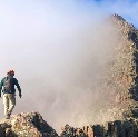
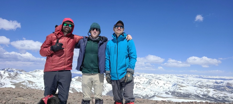
Once on the ridge at 13,500', the remaining 400 feet is a pleasure cruise. Follow the very gentle ridge over one false summit to the true peak, which is marked by a giant summit cairn. As with most San Juan peaks, the views are indescribable. We basked in the glory of Rio Grande Pyramid, San Luis, the Chicago Basin group, the Lake City peaks and the Sangres for 30-45 minutes before Kevin finally figured out how to downclimb the summit cairn, allowing us to begin the descent.
Greg ascending the snowfield.Kevin laughing at me and Greg from above.
Greg arrives on the summit in style.L-R: Jeff, Kevin, Greg.Zia was also there.
Time to go.
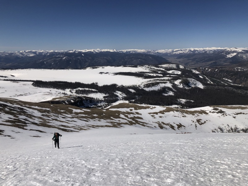
We'd harbored dreams of glissading the entire snowfield from 13,300' down to 12,000', but most of the line wasn't quite steep enough. We alternated between glissading, plunge-stepping and postholing until we reached consistently dry ground back on the Southwest Ridge. Greg dropped his ice ax at some point in this section (noob), so Kevin and I lounged in the sun on the tundra for another 30-45 minutes while Greg climbed back up about 500 feet and began a canvassing search. He did find it, thankfully, and we mentally prepared ourselves for another crack at the deep snowy section that had required snowshoes and ample self-loathing on the way up. It was everything we'd dreaded. The afternoon sun had made everything 10x worse. We all developed a thousand-yard stare by the time we dragged ourselves back onto dry ground. Even the dog.
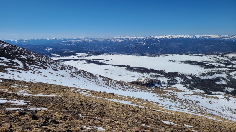
A single hurdle remained—we could either go back exactly the way we came, or take a potentially much-easier shortcut down the entire Southwest Ridge to its base, where it would dump us almost exactly at the morning's first stream crossing near the junction of Trail #787 and 502.1A. Obviously, being lazy, we opted for the latter option. It was the right choice. There were a few unavoidable snow patches and minor steep scree, but it was easier terrain than we'd come up and it shaved 0.5-0.75 mile off our route. Once across the stream, we slogged back up 502.1A to our camp and Kevin's car.
Kip's Cantina, by the grace of the mountain gods, had reopened for the season April 28. The Esteban Special was the perfect recovery meal after such a full-value day. Regardless if you go from the east or the west, in the winter or spring or summer or fall, it seems everyone has a Phoenix story. It's an easy mountain that's somehow incredibly difficult at the same time. I hope this TR clears up at least some of the confusion, but it probably won't. Enjoy the livestock poop and bushwhacking!
My GPS Tracks on Google Maps (made from a .GPX file upload):
for the report. I have noticed that Phoenix intel (even getting to TH) seems confusing. At a minimum you helped me clear up how to actually get to the TH.
Phoenix is like doing your college prerequisites. Required to get your degree but forgettable. Perhaps this is why there aren't many TR's?? Looking at your Aspens pic #10 vs. mine #6 on my conditions report from winter has me jealous. The class 2 steep bushwhack up the west ridge was gruelling but that was just the beginning of the torture. I chose a CR over a TR because I thought no one cared about getting up Phoenix in winter and now I realize I missed an opportunity. Thanks for posting.
In summer I came up Diablo Canyon via the CT from the east then connected over to Stewart in one long miserable day. Doing it your way from the west is the best way for many reasons including an easier drive. Nice report.
If anyone is interested, I just marked up an image showing the different routes to the TH on the Phoenix Park TH page:
www.14ers.com/php14ers/trailheadsview.php?thparm=xx9950526202011015349
It's currently the only image on the TH page, it's up in the top right corner of the screen.
And I personally loved my hike of Phoenix! Not at all forgettable, IMO. Very distinct landscape and a really gorgeous Fall day.
Thx for posting
On the list for June along with Stewart peak
Great pics
Caution: The information contained in this report may not be accurate and should not be the only resource used in preparation for your climb. Failure to have the necessary experience, physical conditioning, supplies or equipment can result in injury or death. 14ers.com and the author(s) of this report provide no warranties, either express or implied, that the information provided is accurate or reliable. By using the information provided, you agree to indemnify and hold harmless 14ers.com and the report author(s) with respect to any claims and demands against them, including any attorney fees and expenses. Please read the 14ers.com Safety and Disclaimer pages for more information.
Please respect private property: 14ers.com supports the rights of private landowners to determine how and by whom their land will be used. In Colorado, it is your responsibility to determine if land is private and to obtain the appropriate permission before entering the property.


")
")
")
")
")
")
")
")
")
")
")
")
")
")
")
")