Download Agreement, Release, and Acknowledgement of Risk:
You (the person requesting this file download) fully understand mountain climbing ("Activity") involves risks and dangers of serious bodily injury, including permanent disability, paralysis, and death ("Risks") and you fully accept and assume all such risks and all responsibility for losses, costs, and damages you incur as a result of your participation in this Activity.
You acknowledge that information in the file you have chosen to download may not be accurate and may contain errors. You agree to assume all risks when using this information and agree to release and discharge 14ers.com, 14ers Inc. and the author(s) of such information (collectively, the "Released Parties").
You hereby discharge the Released Parties from all damages, actions, claims and liabilities of any nature, specifically including, but not limited to, damages, actions, claims and liabilities arising from or related to the negligence of the Released Parties. You further agree to indemnify, hold harmless and defend 14ers.com, 14ers Inc. and each of the other Released Parties from and against any loss, damage, liability and expense, including costs and attorney fees, incurred by 14ers.com, 14ers Inc. or any of the other Released Parties as a result of you using information provided on the 14ers.com or 14ers Inc. websites.
You have read this agreement, fully understand its terms and intend it to be a complete and unconditional release of all liability to the greatest extent allowed by law and agree that if any portion of this agreement is held to be invalid the balance, notwithstanding, shall continue in full force and effect.
By clicking "OK" you agree to these terms. If you DO NOT agree, click "Cancel"...
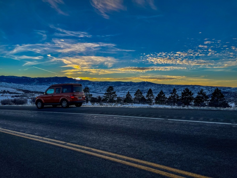
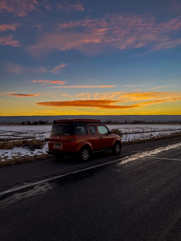
I fortunately ended up with some PTO to burn up this January, I have to use it or lose it by February 1 or I lose it. Weather was looking pretty agreeable this week so figured I'd head west and get a far away peak, Wilson would be tough to get to on a normal 2 day weekend. Left home on Sunday after a fantastic Chipotle burrito, plan was to stay in Montrose, I had enough hotel points for a free stay, and the trailhead was just 90 minutes away. The drive over was great, sun started setting as I passed Blue Mesa Reservoir, pulled over in a few spots for photos.
Blue Mesa Reservoir
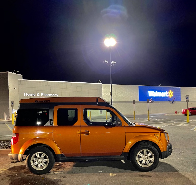
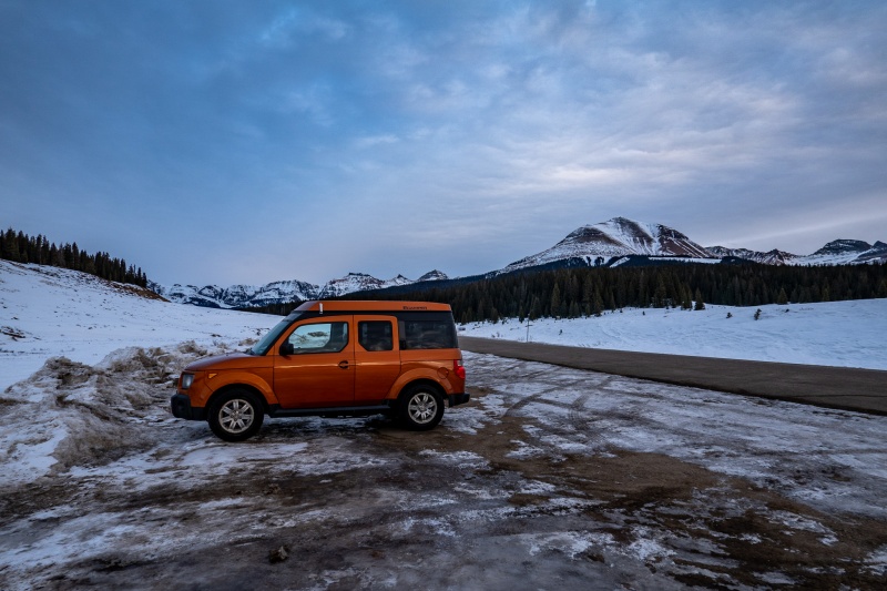
I love my toaster.
Just east of Montrose.
Stocking up on Clif Bars, Diet Mt. Dew, and Powerade.
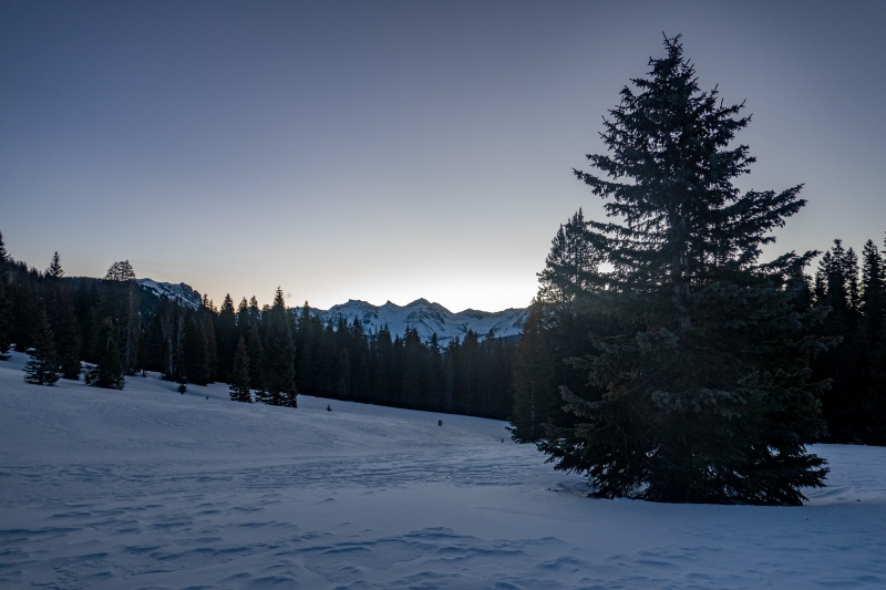
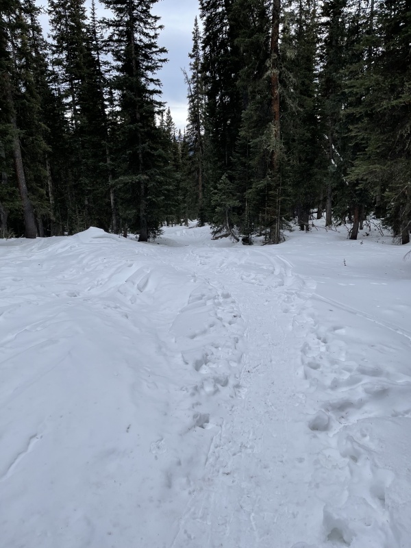
Plan was to start at sunrise, I hadn't done Wilson Peak from the Cross Peak trailhead, so didn't really want to be starting in the dark. Set my alarm for 4:30 am, planning to be hiking by 7am. Woke up at 3am, couldn't fall back asleep, so just started my day. Started hiking just before 6am. Didn't take any pictures until the sun started rising, was pleasantly surprised at having a well packed trail all the way to Cross Peak.
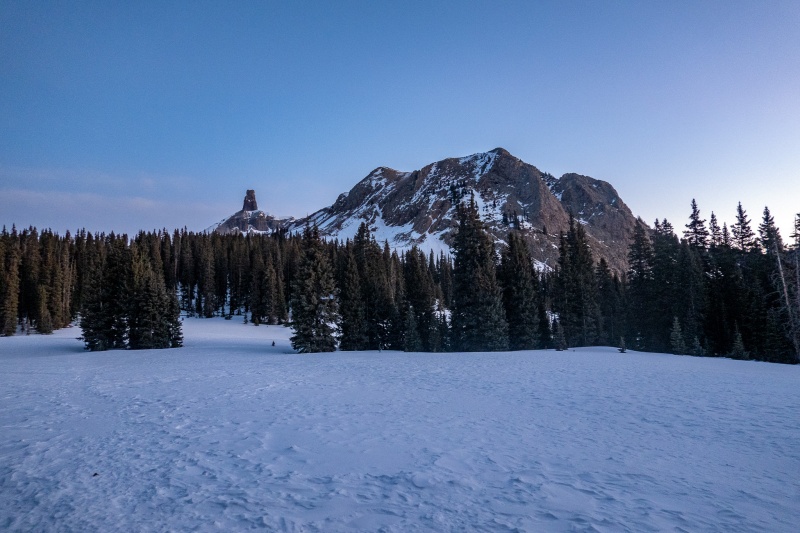
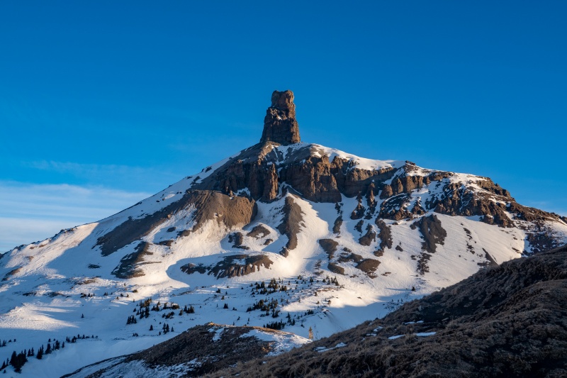
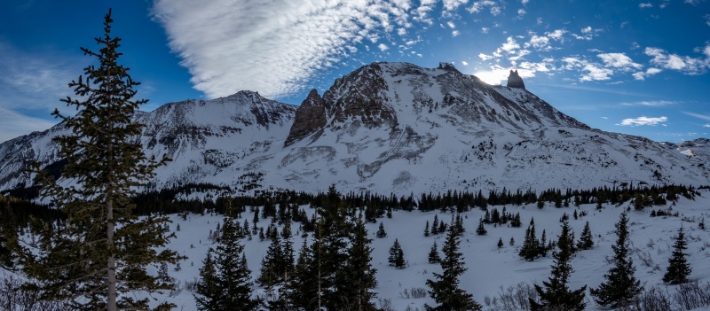
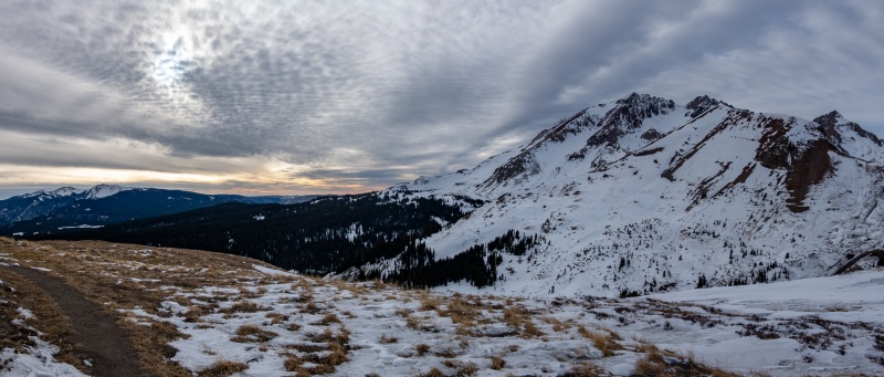
Cross Peak and Lizard Head.
Looking east as the sun begins to rise.
When I left the toaster I didn't initially put snowshoes on. I started at the wrong side of the parking lot, went wrong direction to begin, following tracks. Tracks ended, it was dark, so checked the GPX file and discovered I was way off. Put snowshoes on and made my way to the correct trail, and just left snowshoes on, and wouldn't remove them again until the base Wilson's west side.
Just west of Cross Peak.
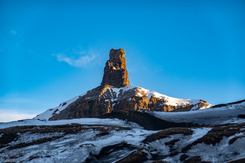
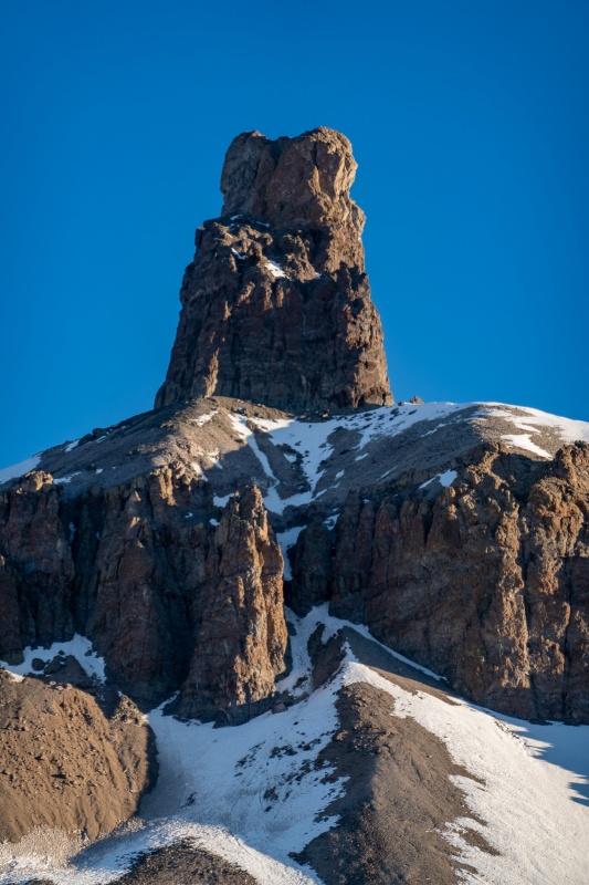
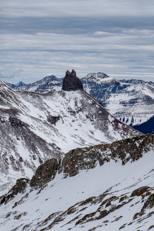
Zoomed in on Lizard Head.
Zoomed in a little more.
I took way too many pictures of Lizard Head.
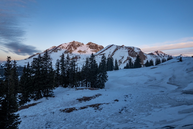
Gaining altitude on my way to Lizard Head Pass. Favorite sunrise shot, of which I took many.
The trench/tracks disappeared after passing Cross Peak, but it was still pretty easy going. The area from Cross Peak to Lizard Head Pass was a mix of melted out trail, hard snow, and thin, dirty slush. I was expecting a fair amount of trail breaking today, but so far it was easy going. When I reached Lizard Head Pass I went a little too far west (have I mentioned how sucky my route finding ability is?) before realizing the correct path to drop into Bilk Basin.
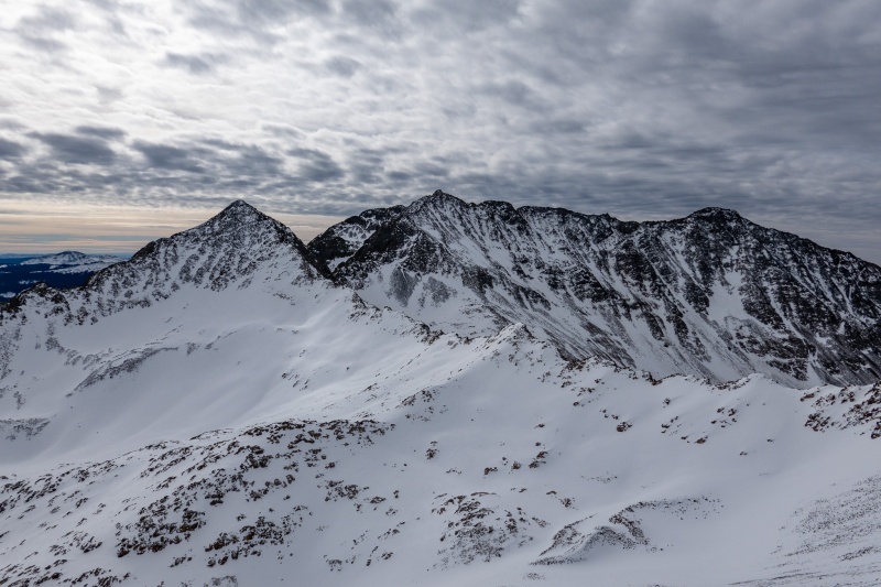
From Cross Peak to Lizard Head.
Something about getting above treeline and then having to descend to below treeline is demoralizing, but not much you can do to avoid it on this route. Fortunately you don't drop far below the trees, and there's a pretty easy to follow path through them.
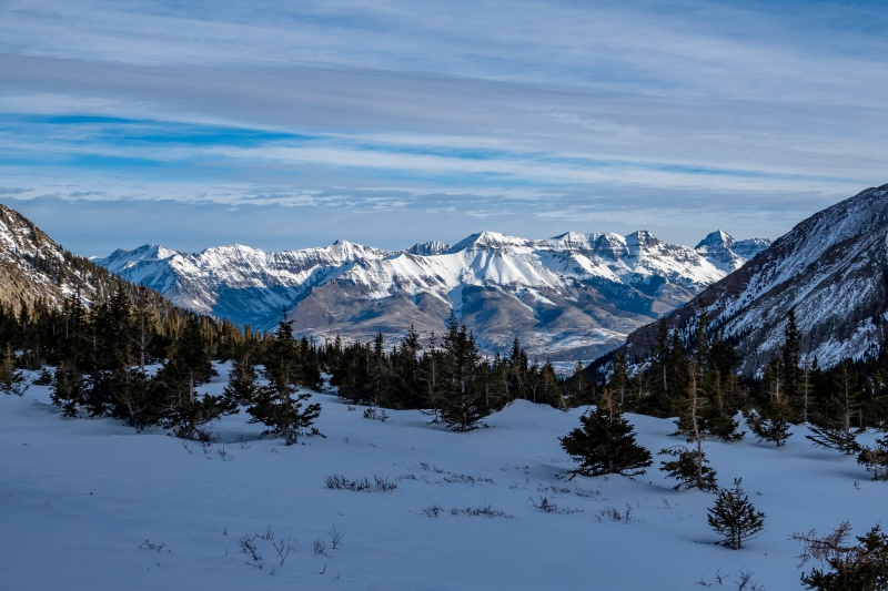
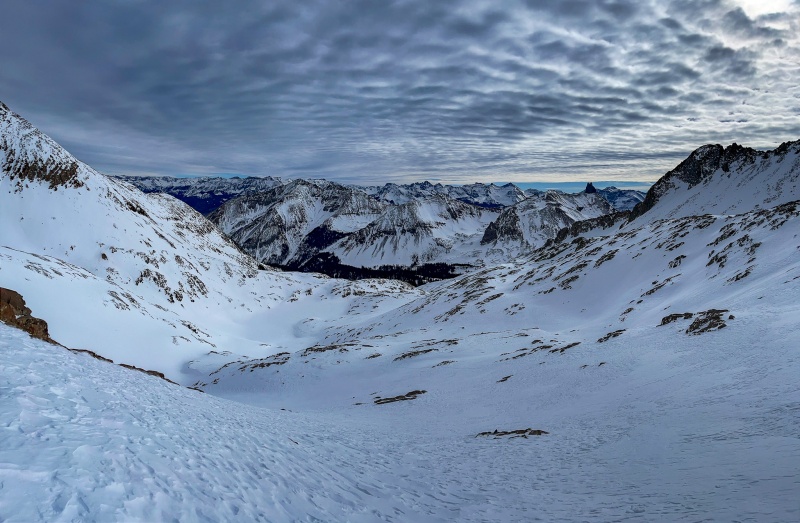
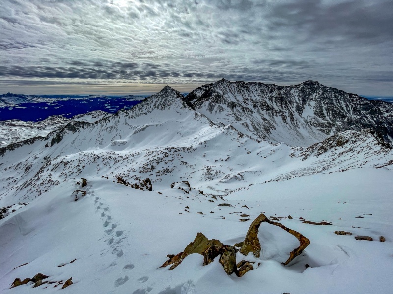
From Bilk Basin looking east.
Looking back towards Lizard Head. Clouds were really spectacular today.
Very little trail breaking today, and it wasn't difficult where it was required.
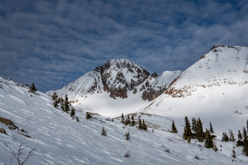
As I rounded the corner, Wilson finally showed her face.
After rounding the corner its a relatively easy walk up to the base of Wilson's west side.
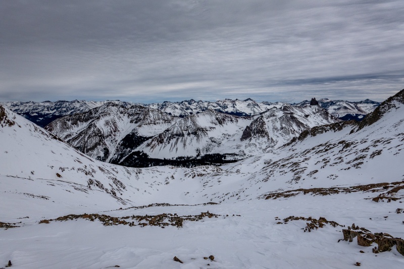
Looking back on the route to reach Wilson's west side.
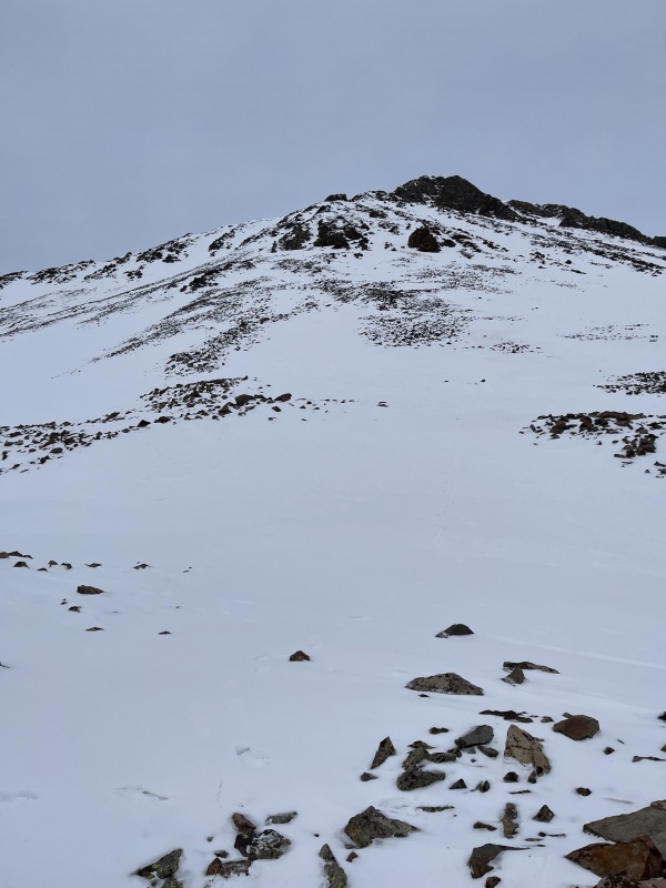
Close to the West slope.
Once I reached the base of the west side I stashed my snowshoes. I had all the tricks with me, crampons, micro spikes, and axe, but would end up using none of them. There were enough exposed rocks I could mostly avoid snow. Where I couldn't, the snow was soft enough to kick step.
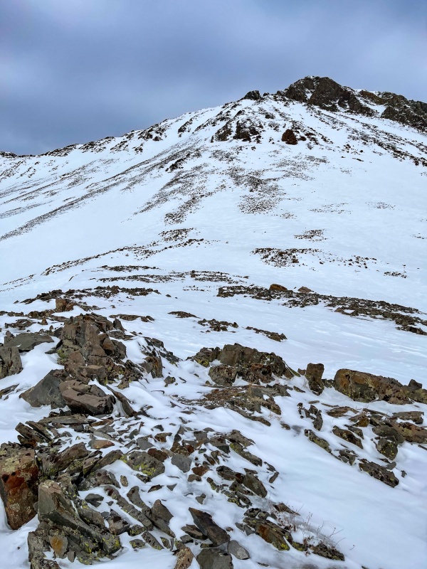
Mostly rock hopped to Wilson's false summit.
Further up.
Doesn't look nearly as steep going up than down. Why is that?;)
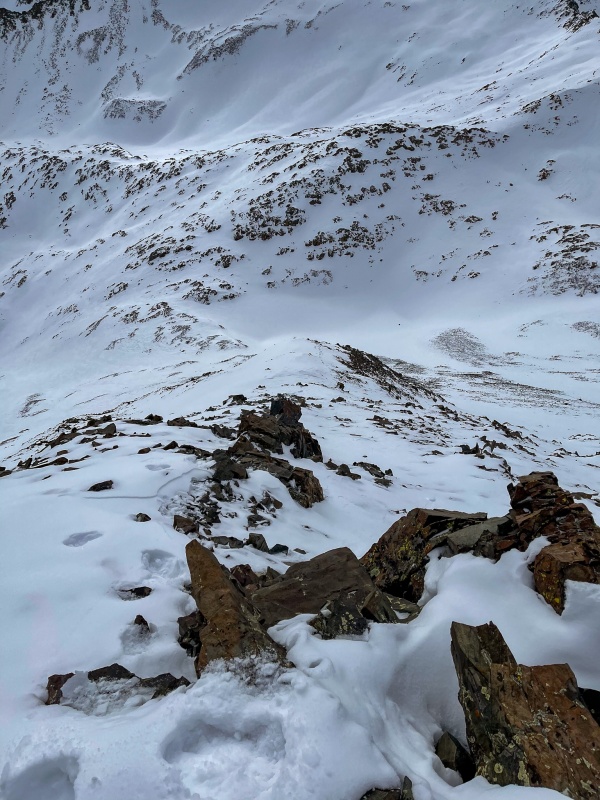
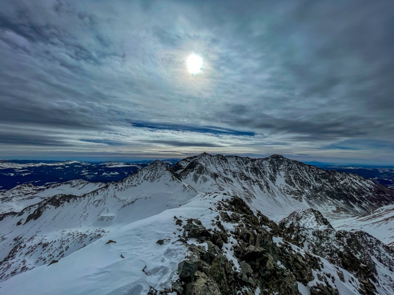
From high on Wilson's west side. Such cool cloud formations today.
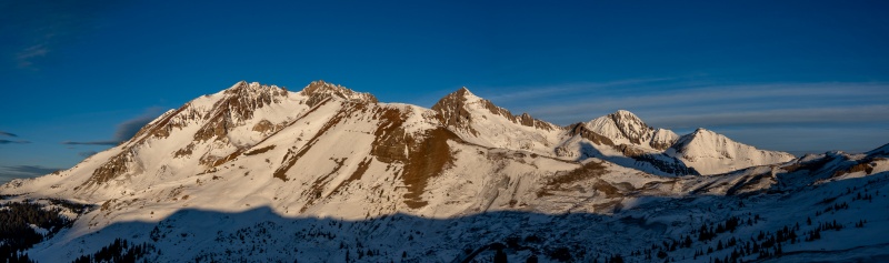
Great views of Gladstone, Mt. Wilson and El Diente as I ascend.
Just below false summit. My favorite shot of the day. Who'd have thought having a wide angle lense on a phone would be such a vital tool?
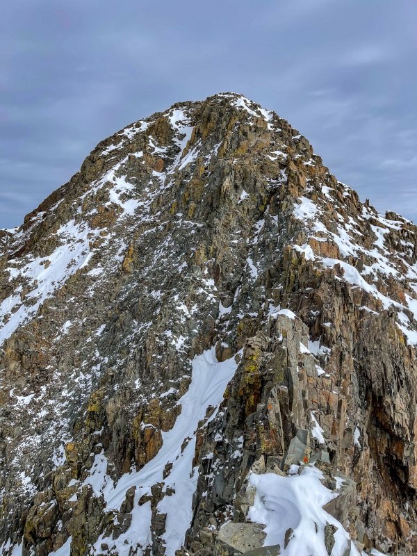
The one part of this route that I had a bit of anxiety surrounding was the short section after Wilson's false summit. My first (and only previous) ascent of Wilson Peak was in July 2019. When I reached the false summit that day, I looked at this section in disbelief. It looked totally impassable, couldn't believe its just class 3. Its one of those things that looks far more difficult than in actuality. I knew it would be magnitudes more challenging with snow, and how much snow would be there was a bit of an unknown. It was every bit as difficult as I anticipated, one of the most challenging sections I've done thus far in my short climbing career.
From the false summit.
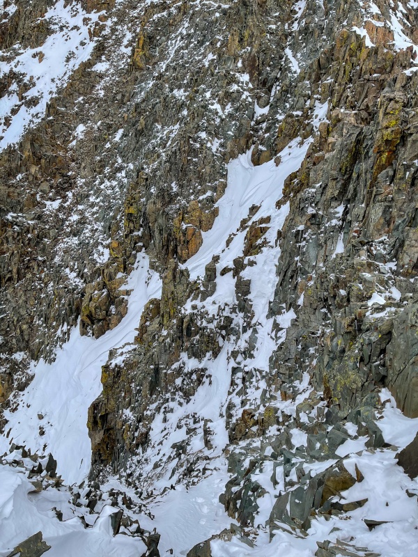
The crux. On steroids. A few of my footprints are visible, I mostly hugged the right side as tight as I could to find dry rock suitable for my feet/hands. It was tough.
After passing the short crux section, the intensity dialed down a notch or 4 and I was soon on Wilson's summit. It was incredible up there, reasonable temp and barely a light breeze. I spent almost an hour hanging out up there. Had 5G cell coverage, texted with my SAR friends for a bit, told them I made it and that the crux was every bit as hard as expected. One of them responded "Yeah, but it'll be easier on the way down." We'll go with that.
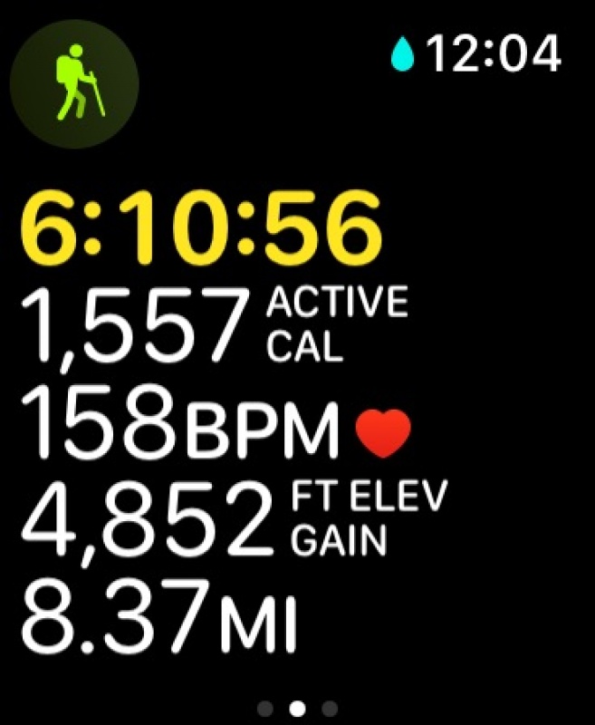
Took just over 6 hours to reach summit.
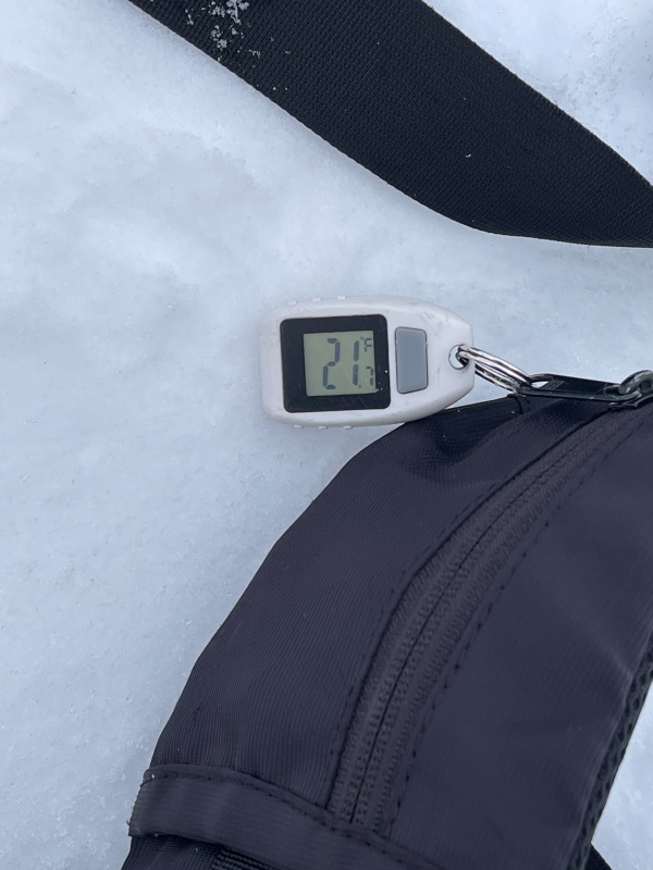
Summit temp. Crazy how nice 21° feels.
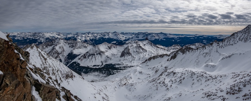
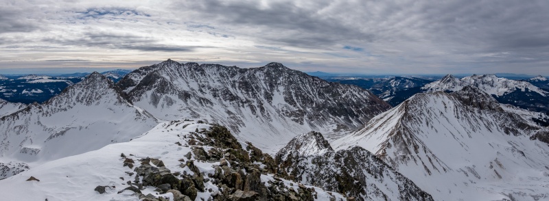
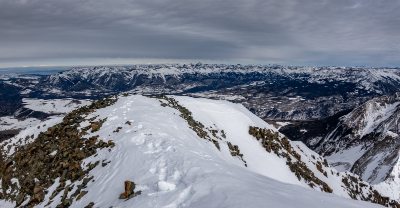
Took plenty of pics from summit.
I'm pretty sure Uncompahgre is the single most identifiable mountain in existence.
Started down about 1pm, knowing that the most difficult section would quickly be in front of me. For the most part I just retraced my route, and before I knew it I was back on the false summit. Wasn't difficult to descend to the base of Wilson's west side and was soon back to my snowshoes. Also found a slightly more efficient route to regain Lizard Head Pass.
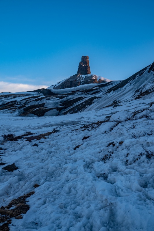
Yet another shot of Lizard Head on return.
Near Cross Peak on return.
The trench from start to Cross peak.
Finally back to the toaster.
Stats from Apple Watch/iPhone.
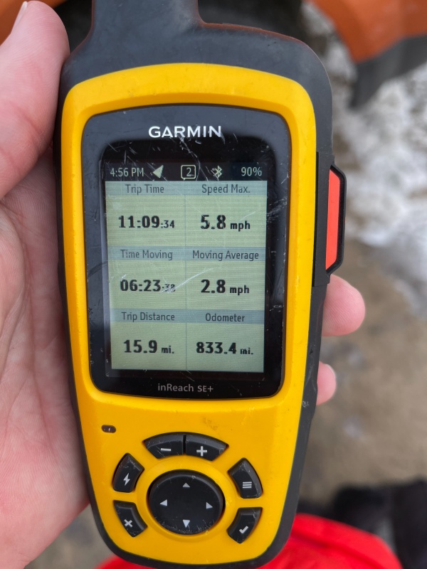
Garmin stats. Usually Apple gives greater distance than Garmin, today it was pretty close.
All in all it was one of the best winter climbs I've had, which I generally grade based on the quality of the weather, views and pictures taken. Thanks for reading.
Thumbnails for uploaded photos (click to open slideshow):
Thank you so much for sharing! The weather has been so nice I cannot imagine being at the summit at 21F... By the way, you recommended me your thermometer a while ago and I bought it. I love it!.
Absolutely KILLER pics. And some useful beta. Don't know much about Bilk approach but gonna give it a go next week. Thanks for such a terrific report. Kudos!!
Caution: The information contained in this report may not be accurate and should not be the only resource used in preparation for your climb. Failure to have the necessary experience, physical conditioning, supplies or equipment can result in injury or death. 14ers.com and the author(s) of this report provide no warranties, either express or implied, that the information provided is accurate or reliable. By using the information provided, you agree to indemnify and hold harmless 14ers.com and the report author(s) with respect to any claims and demands against them, including any attorney fees and expenses. Please read the 14ers.com Safety and Disclaimer pages for more information.
Please respect private property: 14ers.com supports the rights of private landowners to determine how and by whom their land will be used. In Colorado, it is your responsibility to determine if land is private and to obtain the appropriate permission before entering the property.


")
")
")
")
")
")
")
")
")
")
")
")
")
")
")
")
")
")
")
")
")
")
")
")
")
")
")
")
")
")
")
")
")
")
")
")
")
")
")
")
")
")
")
")