Download Agreement, Release, and Acknowledgement of Risk:
You (the person requesting this file download) fully understand mountain climbing ("Activity") involves risks and dangers of serious bodily injury, including permanent disability, paralysis, and death ("Risks") and you fully accept and assume all such risks and all responsibility for losses, costs, and damages you incur as a result of your participation in this Activity.
You acknowledge that information in the file you have chosen to download may not be accurate and may contain errors. You agree to assume all risks when using this information and agree to release and discharge 14ers.com, 14ers Inc. and the author(s) of such information (collectively, the "Released Parties").
You hereby discharge the Released Parties from all damages, actions, claims and liabilities of any nature, specifically including, but not limited to, damages, actions, claims and liabilities arising from or related to the negligence of the Released Parties. You further agree to indemnify, hold harmless and defend 14ers.com, 14ers Inc. and each of the other Released Parties from and against any loss, damage, liability and expense, including costs and attorney fees, incurred by 14ers.com, 14ers Inc. or any of the other Released Parties as a result of you using information provided on the 14ers.com or 14ers Inc. websites.
You have read this agreement, fully understand its terms and intend it to be a complete and unconditional release of all liability to the greatest extent allowed by law and agree that if any portion of this agreement is held to be invalid the balance, notwithstanding, shall continue in full force and effect.
By clicking "OK" you agree to these terms. If you DO NOT agree, click "Cancel"...
Weather: 30-50F, winds calm to 30mph, partly cloudy
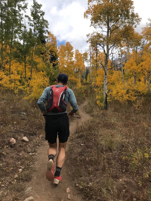
With winter looming, and months stacked on months of avalanche hazard to look forward to, decided one last high alpine hoorah with the Gore Dads was in order. But coordinating schedules with a bunch of fathers of youngins is tough! As a result we started this deep Gore mission with an alpine start of 1230. As in post meridiem, afternoon. We met at the Pitkin Creek TH. Figuring out clothing was a real issue. Mountain forecast was calling for a windchill of 10F over 13k and partly cloudy. We all decided to start in shorts and pack pants and wind shells. For a group used to going fast and light trying to stuff these extra clothes in our tiny vest packs was agonizing.
Eventually we started running. It was strange passing party after party along Pitkin; don't usually see a soul at our normal start time of 0500. With the sunshine and the autumn colors popping, the approach to Usable Pass was enjoyable. Guess this is what we've been missing.
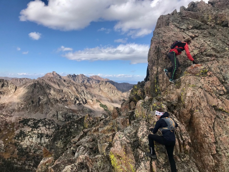
Jon foregoing the power hiking I so desperately desired.Approach to Usable
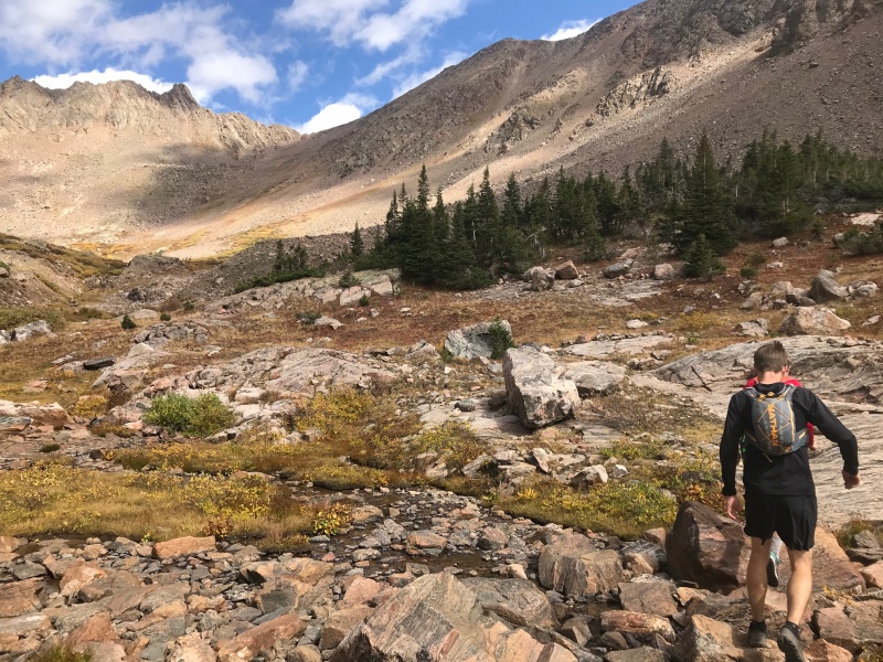
We hit the top of Usable greeted by 30mph wind gusts at 1425; threw on some extra layers and already it felt like we might end up racing the sun. After taking a quick look at the slabby climb to X', we decided just to bypass it and descend the east side of Usable before contouring over to the X-X' saddle. East Usable is short but loose and rotten.
Dan Descending Usable
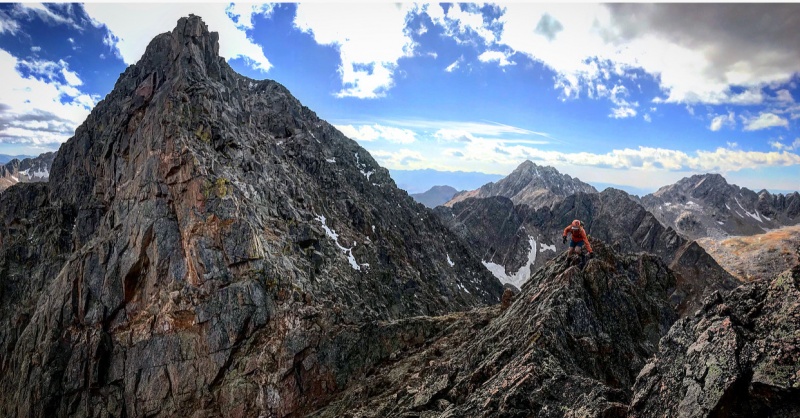
The traverse beneath X' is just a series of grassy ledges. X is guarded by fun, stable 3rd class boulders and catwalks. We made short work of it summiting X at 1451.
The remainder of the traverse to Z and Z' is clear from X, and they didn't seem at all close. The down climb from X was climbers left and straightforward; regaining the ridge it goes direct to Y from there.
Corey and I descending X
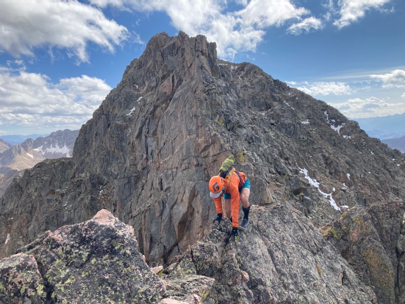
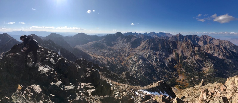
Traversing to Y is a classic Gore ridge run. Exciting exposure but nothing that ever feels desperate with a stacked backdrop of obscure 13ers. We bypassed any difficulties to the west, but there were few. Summited Y at 1520. Found an entry in the summit register from July of this year, and then nothing prior until 2016.
Ridge run off X, Partners back rightTraversing from XJon, Dan and Corey ascending Y
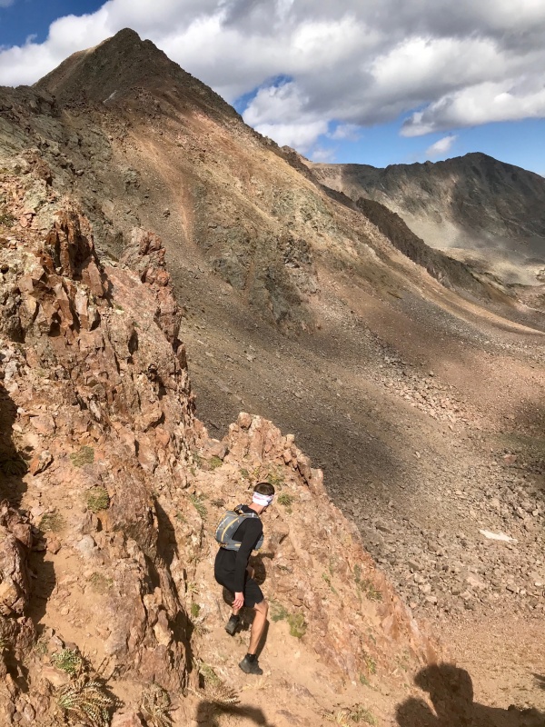
We found a couple dead ends descending from the summit of Y. The NE ridge proper feels like it will go but we were turned back by cliffs. Common to the Gore, there's a NW bypass that weaves you around the cliffs and puts you back on the ridge.
Dan scrambling off Y with Z behind
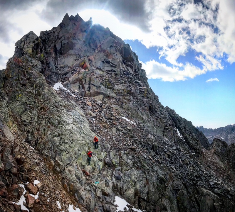
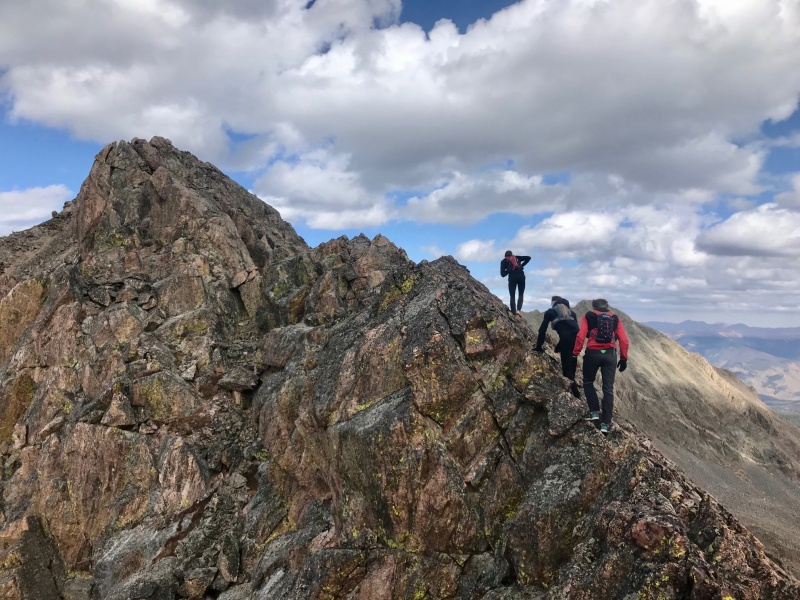
I don't have a whole lot of memory of the rest of the traverse to Z. Everything started to flow from there. Just perfect 2nd-3rd class movement in late afternoon sun. Dan rushed ahead and we followed his lead, summiting Z at 1614.
Corey and Dan scrambling on Y's summit block
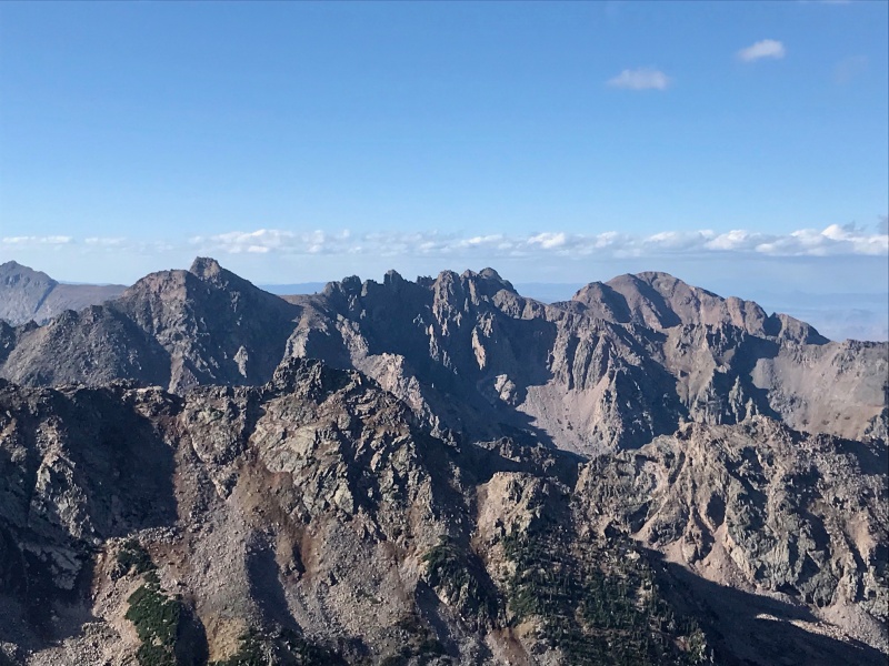
We took in the remote position: to the NE Bloodshaw, QRST to the NW across Slate Creek, X and Y behind, and Keller far across the Boulder Creek drainage to the SE. Z' just sticks out like an awkward appendage from the ridge begging to be summited, so despite the late hour we decided to hustle over. My research put it at 4th class but it didn't feel any more exposed or difficult than the main XYZ ridge.
LMNO from ZDan examining the soggy summit register on Z looking to the NWZ prime with Keller behind
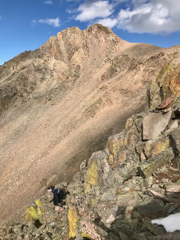
We summited Z' at 1643 about 4 hours after leaving the Pitkin TH. From there we didn't really have a plan for getting back. I had mapped the route just descending from the summit of Z' down to the Boulder drainage direct, but the talus looked like a buzzkill. We decided to backtrack to the Z-Z' saddle and descend into upper Boulder Creek from there. It was a good choice. Just a long, steep but painless descent on grass.
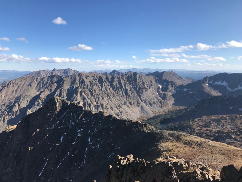
Grays and TorreysValhalla and Snow behind?
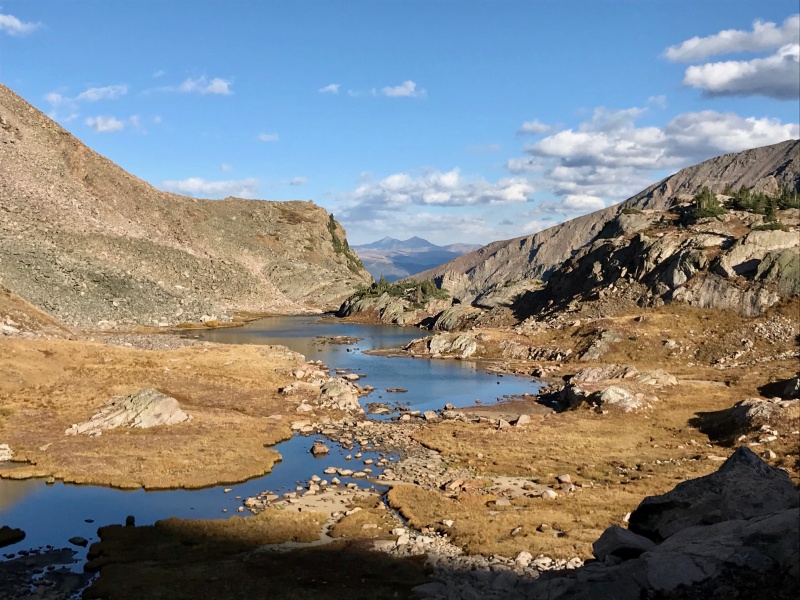
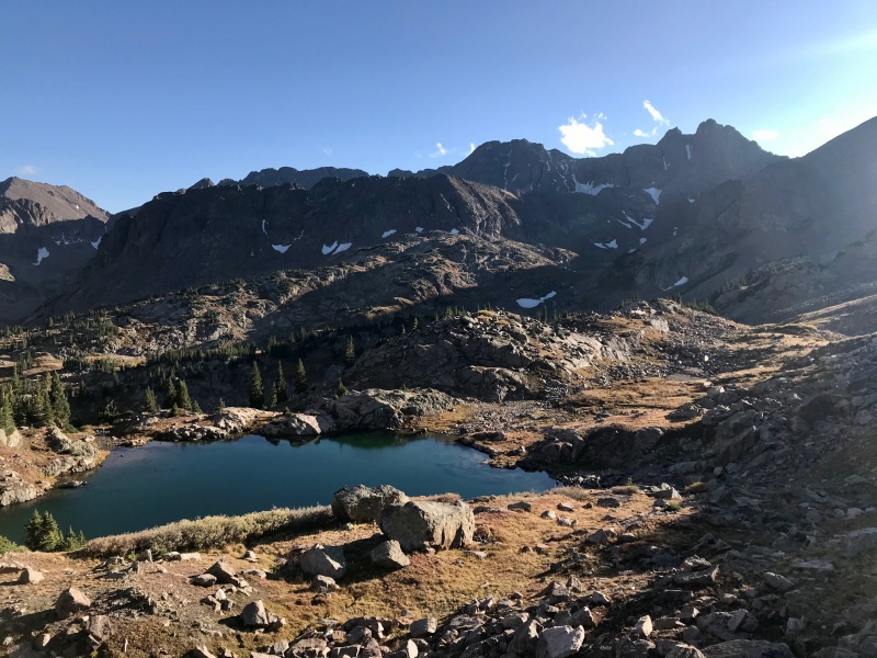
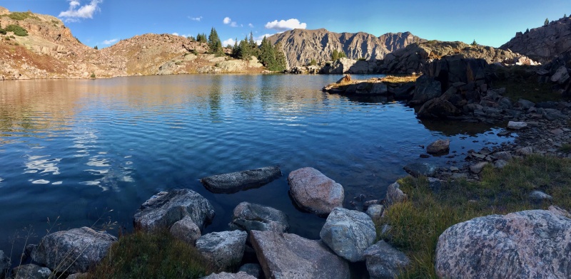
The upper lakes provide a convenient spot to restock water supplies. The light was approaching golden hour and kept us in high spirits back over Usable. We casually descended Pitkin despite the growing darkness arriving back at our vehicles at 1913 for a roundtrip time of 6:38.
Keller's ridgeline
Thumbnails for uploaded photos (click to open slideshow):
Of 6.5 hours roundtrip for those peaks by Gore Dads. As a Gore Senior I can make Useable Pass in 5-6 hours from the trail head but I usually stop short and camp in the grove of trees in Photo #2 when climbing in this area.
Caution: The information contained in this report may not be accurate and should not be the only resource used in preparation for your climb. Failure to have the necessary experience, physical conditioning, supplies or equipment can result in injury or death. 14ers.com and the author(s) of this report provide no warranties, either express or implied, that the information provided is accurate or reliable. By using the information provided, you agree to indemnify and hold harmless 14ers.com and the report author(s) with respect to any claims and demands against them, including any attorney fees and expenses. Please read the 14ers.com Safety and Disclaimer pages for more information.
Please respect private property: 14ers.com supports the rights of private landowners to determine how and by whom their land will be used. In Colorado, it is your responsibility to determine if land is private and to obtain the appropriate permission before entering the property.
")
")
")
")
")
")
")
")
")
")
")
")
")
")
")
")


