Download Agreement, Release, and Acknowledgement of Risk:
You (the person requesting this file download) fully understand mountain climbing ("Activity") involves risks and dangers of serious bodily injury, including permanent disability, paralysis, and death ("Risks") and you fully accept and assume all such risks and all responsibility for losses, costs, and damages you incur as a result of your participation in this Activity.
You acknowledge that information in the file you have chosen to download may not be accurate and may contain errors. You agree to assume all risks when using this information and agree to release and discharge 14ers.com, 14ers Inc. and the author(s) of such information (collectively, the "Released Parties").
You hereby discharge the Released Parties from all damages, actions, claims and liabilities of any nature, specifically including, but not limited to, damages, actions, claims and liabilities arising from or related to the negligence of the Released Parties. You further agree to indemnify, hold harmless and defend 14ers.com, 14ers Inc. and each of the other Released Parties from and against any loss, damage, liability and expense, including costs and attorney fees, incurred by 14ers.com, 14ers Inc. or any of the other Released Parties as a result of you using information provided on the 14ers.com or 14ers Inc. websites.
You have read this agreement, fully understand its terms and intend it to be a complete and unconditional release of all liability to the greatest extent allowed by law and agree that if any portion of this agreement is held to be invalid the balance, notwithstanding, shall continue in full force and effect.
By clicking "OK" you agree to these terms. If you DO NOT agree, click "Cancel"...
San Miguels, the premier chossineering destination in Colorado. If you have experienced the peaks here in all their summer-dry spell-no moisture chossy glory, you get it. There was very little beta about these peaks online, so these two were on the dread list as people had mentioned horrible choss conditions in summer. The cooney's have a good route on their website for these, I will recommend following those, I did for the ascent and had a great time. Special shout out to supranihilest, his trip and condition reports have been really helpful for me, especially on how to avoid the sucky parts of any routes. :D But for real, thanks to his trip report, I had a very good idea of what route not to take. :P
I am hoping this trip report helps those who want to climb these peaks in summer and looking for a better route up these. These are two very highly visible and dramatic peaks if you drive in this area. You have seen them from the Kilpacker trailhead, I didn't know which these peaks were when I was down there for the first time almost 5 years back. One thing I would like to highlight that this is an excellent area for dispersed camping. There are tonnes of dispersed camping sites on the road to the "trailhead". I would love to come back here and camp in summer, this can be really good if you want to bring family and kids here, lots of fun hiking in the area for everyone if the kids don't want to join for the peaks. Strava has the stats for these peaks at 6.39 miles with 4,134 ft of gain. (It might not be accurate.)
The fish creek trailhead is almost 2WD accessible. The final 100 yards need clearance, but any SUV or subie can make it to the "trailhead" Please look up climb13ers for the TH directions. There are a couple of camping spots at the trailhead and space to park almost 6-7 cars if people arent camping and haven't claimed the space. If you are visiting this area during hunting season, please make sure you are wearing bright colors and are visible, this is a popular area amongst hunters and you would be off trail from the get go. Same with pets, make sure they are wearing orange.
So now for the route, make sure you DO NOT follow the fish creek from the trailhead. There is a trail sign there and even a climber's trail but it will lead to terrible bushwack at some point. Also, I will absolutely recommend going up Middle Peak first if you are doing this in summer, the descent of Dolores is loose and will be not fun to go up in summer (more on that later). So for the starting point, if you are at the trailhead and facing towards the peaks, on your left side you will see a shelf that looks like a old road, just go up there and follow the road/gpx/map. There are a lot of old logging roads on the approach here. You will avoid any bushwack if you follow those to the correct drainage. I absolutely did not have any bushwack on my approach all the way to the Middle- Dunn Peak saddle. Extremely pleasant and mellow approach.
The Trailhead and the shelf section
On the shelf , old logging road , this is like 25 ft up the trailhead.
Taking the old logging road towards the Dunn-Middle Peak saddle. There are a lot of roads here, just follow whichever leads in the direction
Looking back, forest taking over the old roads.
Going deeper in the forest, still on old road, not a lot of deadfall and very pleasant hiking, the Dunn-Middle saddle is coming into view
Dunn Peak on left
Beautiful
Middle Peak comes into view
Aim for the saddle
Saddle
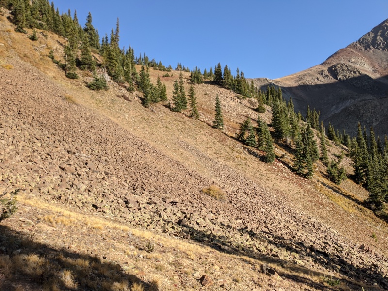
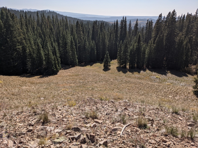
This is the most dense part of the approach, still no bushwhack or deadfall.
Forest regrowing
V pretty. I stayed from the creek on the approach, the area around the creek is extremely cliffy, no need to go there
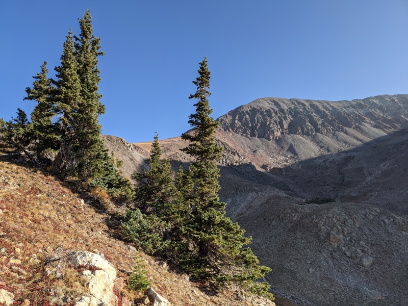
Middle Peak's ridge visible on the right. That's the ridge you will take
Some sidehilling on Talus, there was a use trail there
Looking back towards Dunn Peak's ridge. You can take this as an alternate route up Dunn Peak first
Dunn Peak ridge on the left
Approaching the saddle. Getting closer
Saddle visible on the center right.
I was very surprised to see a use trail all the way to the saddle. This area must get local traffic
Use trail
Getting closer, the saddle and the ridge up Middle coming closer.
Middle Peak's ridge
If you wanna add Dunn Peak, you can take the saddle to the left. I had enjoyed this approach so much that I decided to leave Dunn Peak for later.
Almost to the saddle
To the saddle, I absolutely avoided coming anywhere near the creek on the approach, this is the key to a good non bushwhacking, non cliffy approach.
Looking back in the basin
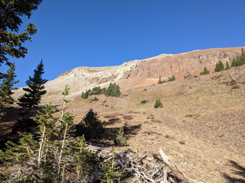
Looking towards the ridge to Middle Peak's false summit
Middle Peak's false summit is the high point in front
Approaching, some interesting colors on the rocks here. There is a use trail here, it's class 2 upto this point.
Looking back towards Dunn Peak
Great views
Up the red rock on the saddle. Class 2 talus at this point.
Use trail here
Looking back towards Dunn Peak's saddle.
Amazing views
OO things about to get spicy. At this point, the trail was class 2. Well, it can be still kept at class 2 if you want all the way to false summit. Sticking to ridge proper here will get to class 3/4, but the rock is very suspect. I personally recommend just going to the left of the ridge to keep it to class 2, there is a gully you can take all the way to the false summit.
Rock is suspect
This is the fully to the left of ridge proper, you can stick near to the wall on the right, rock is still loose so be careful if you are climbing with someone. Will recommend helmet.
Gully to the false summit
I came back to the ridge, false summit in view
Loose rock again here
A climber's trail exist here to the top of the false summit
Middle Peak's false summit
There is a giant cairn on the false summit
Middle Peak false summit
Middle Peak's true summit on the right.
There is a climber's trail all the way to the false summit
Approaching Middle Peak
Talus class 2
Looking back on the ridge
Golden slopes
Final few feet to the real summit
Middle Peak's summit almost there
There was no summit register on Middle Peak so I left one. The views were insane throughout, very uniqueviews of the Wilsons.
I spent quite some time on the summit just soaking in the views. Then I started the traverse over to Dolores Peak
Looking back towards Middle Peak summit
Dolores Peak is visible on the traverse
Dolores Peak
You can skirt across the false summit, no need to gain it.
Climbers trail exist to skirt the bump
Looking back after the false bump
Peak on left is not Middle Peak
There was a good climber's trail to the summit of Dolores Peak. I pretty much followed it to the top.
Summit of Dolores, great views all around.
Dolores Peak summit
Dolores Peak had an interesting summit register. There were quite a few entries of people this year, not a lot of the usual names. I was kinda surprised to see how many people had summited this obscure 13er. Lot of hunter entries too. There's gotta be an easy way up Dolores.
Mike Garratt placed register
Looking back towards Middle Peak. Lone cone also visible way back.
Middle Peak is the light colored bump
Looking towards Wilson group peaks and the 13ers and Navajo Basin
A very unique view
Beautiful views
Pretty
Now for the descent, I followed the ridge down towards fish creek. A few things I would like to point out here. If you want the easiest way back, just re-summit Middle Peak and take the same way back down as you took on the ascent. This will avoid the choss you will encounter on the descent here. The route I took on the descent has a crossover on a class 3 dry waterfall to get to fish creek. This will be impassable in early summer/spring or when there is snow there. Please plan accordingly before blindly following the descent path.
I followed the ridge all the way to the bottom
Mid way down the ridge
You can see the trailhead from here
Kept going down here.
I followed the rib all the way down
The last 300 ft of this descent is just pure choss scree skiing. You have to be comfortable on that kind of thing otherwise you will hate life.
This is where I dropped into fish creek and crossed back to the "trail" i used on ascent.
Extremely loose sliding choss here, NOT fun to go up
This is the gully I took to drop near fish creek. This will not be passable with water/ice. Also note, this was the only feasible gully in summer, all other gullies cliff out. I will repeat again, I donot recommend my exact descent route, better go back up Middle or traverse up high to the ascent route.
Looking back on the gully
Crossed the fish creek and back into the forest, going near the "trail" which I used on the way up
Not too crazy of a bushwhack
This is where I entered the forest near my ascent trail. Just pick a logging road here and follow it back to the TH. I dropped near the fish creek for the last 200 yards to the trailhead and found it extremely unpleasant and just took the ridge back to get to the old logging roads and eventually back to the trailhead.
Into the forest
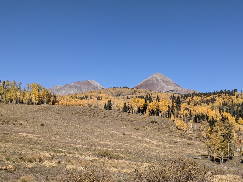
Beautiful fall colors on the drive back.
Looking on the peaks on the drive out
Overall a very beautiful day. I am glad to have done these two peaks and are pretty high up on the repeat list in the San Miguels, which is a very short list. The aspens were very beautiful on the drive out. Thanks for reading. I hope this report is useful to some people planning on hiking here.
My GPS Tracks on Google Maps (made from a .GPX file upload):
"San Miguels, the premier chossineering destination in Colorado." That wins the contest for best trip report opening line ever. Thanks for the beta, Yusuf, and especially for the descent advice.
Great report, Yusuf. I'm super happy to see these great peaks getting some love, and via a different and interesting route too! Middle's ridge from Dunn looks awesome, and it sounds like pretty much the entire south side of Dolores is a no-go zone. You and I and Whiley have all found that out now!
Eddie- Thanks for the kind words. Highly recommend this area, we didn't get snow from the last storm so these peaks will be snow free till the next storm.
TelaCity- Thank you.
Ben- I feel Dolores's south side should be a pre req if you want to attempt the slope up Mears. I had flashback! :D I was very surprised though to see the number of signatures on Dolores this year, there's gotta be an easy way up this as not a lot of people mentioned coming in from Middle or going to tag Middle.
Caution: The information contained in this report may not be accurate and should not be the only resource used in preparation for your climb. Failure to have the necessary experience, physical conditioning, supplies or equipment can result in injury or death. 14ers.com and the author(s) of this report provide no warranties, either express or implied, that the information provided is accurate or reliable. By using the information provided, you agree to indemnify and hold harmless 14ers.com and the report author(s) with respect to any claims and demands against them, including any attorney fees and expenses. Please read the 14ers.com Safety and Disclaimer pages for more information.
Please respect private property: 14ers.com supports the rights of private landowners to determine how and by whom their land will be used. In Colorado, it is your responsibility to determine if land is private and to obtain the appropriate permission before entering the property.


")
")
")
")
")
")
")
")
")
")
")
")
")
")
")
")
")
")
")
")
")
")
")
")
")
")
")
")
")
")
")
")
")
")
")
")
")
")
")
")
")
")
")
")
")
")
")
")
")