| Report Type | Full |
| Peak(s) |
Allen Mountain, 4,340ft Saddleback Mountain, 4,515ft Basin Mountain, 4,827ft Mount Marshall, 4,360ft |
| Date Posted | 10/10/2020 |
| Date Climbed | 09/27/2020 |
| Author | nyker |
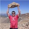
| Finisher: Adirondack 46ers, Allen Mountain |
|---|
|
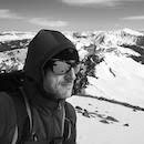
Adirondack 46er *Finisher*, Allen Mountain Last week after summiting Basin Mountain, Saddleback Mountain and finally the epic trip up and down Allen Mountain, after a journey of 13 years I completed the 46 Adirondack ‘46er High Peaks in New York. It’s been a long road to finish these. I climbed my first 14er, Longs Peak in September 2007, before I ever climbed my first ’46er (Mount Marcy) in November 2007. I figured being closer to home, I could always “find time later” to climb the local peaks in New York and I’d focus on the mountains in Colorado first which is what I did, completing the 14ers in 2014. However I realized I hadn’t put much of a dent in the local mountains over the last decade so was determined to change that. Given that COVID effectively shut down travel for 2020 it sort of made the decision for me to stay local giving me an opportunity to finish them. 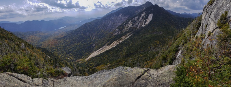
Taken from high on Saddleback Mountain, the above shot of Basin Mountain captures the rugged character of the mountains here well. Quick Adirondack Primer While well known to folks living in the northeast, I find many outside of the region have never visited and don’t know much about the mountains here. Comprising a vast six million plus acres of forests, mountains, rivers, lakes and a handful of towns, the lands of the Adirondack Park in northern New York form the largest protected conservation area in the lower 48 states. Protection of the forest preserve is built into the NY State Constitution as the “Forever Wild” provision. … The lands of the state, now owned or hereafter acquired, constituting the forest preserve as now fixed by law, shall be forever kept as wild forest lands...excerpt of Article 14 of the NYS Constitution (1). The Adirondack Mountains and surrounding park lands are very different from the wilderness in the Rockies or Sierra. Heavily forested with most peaks having treed over summits and many mountains having no marked trails to the top, casual hiking here is a bit more challenging compared to the more open terrain out west where you can often see the summit of your objective from far away as you hike and climb closer. In contrast to a “typical” western mountain, you can hike for eight hours here on your way to a summit, never seeing the peak then turn a sharp corner on the “route” lined with tightly packed fir and suddenly find yourself on the summit with no warning. Many mountains here have bald granite summits with grand views, but many don’t, if you’re lucky you’ll see a wooden sign on top evidencing which mountain it is. No summit markers, no registers, no fanfare. Given the dense forests, GPS often doesn’t get a fix and a map and compass are often better choices for navigation. Perhaps less often now with the advent of GPS/smartphone apps, but even now people often climb the wrong mountain and often don’t know until someone happens to tell them, particularly for the more off-the-run summits and some of the 46ers with unmarked routes. One other feature of routes and trails here is the lack of switchbacks. Unlike routes out west many of which had their origins in mining roads or horse/carriage trails, the norm for routes around here go straight up, loosely following a faint path up a badly eroded ravine, more often following the path of a running brook up the mountain. Using your best Cobra Kai voice, recite the following: Fear does not exist in this dojo, does it?? “NO Sensei!!” Pain does not exist in this dojo, does it?? “NO Sensei!!” Switchbacks do not exist in these mountains, do they? “NO Sensei!!” This pretty much sums up the routes on the High Peaks up here. Late September 2020 This report is for my final four peaks I did each of which were particularly interesting: Day 1 Mount Marshall ~19 miles, +3,574ft gain Complicating my plan, was that during the COVID shutdown I had developed a nagging plantar fasciitis, presumably related to the dramatic change in physical activity; like most of us going from the “real” gym everyday to doing makeshift bodyweight exercises in my apartment for nine months while gyms were closed. Whatever the case I was still able to hike, albeit in some pain and then doing a lot of post-hike massage/stretching/stim/ultrasound/icing each night, so I figured while I had a window I’d take it. Thanks again to those folks who gave me some suggestions on managing that over the last month. Mount Marshall Mount Marshall is one of just under half of the 46 High Peaks without a marked route to the summit and is named after Robert (Bob) Marshall, one of the original ‘46er finishers as well as being known as a conservationist, forester and champion of preservation of the Adirondacks among other areas. He was instrumental in another wilderness area dedicated in his honor, that many might know of, the Bob Marshall Wilderness in Montana. 2 Once the sun came up it was a beautiful morning and the scene did not disappoint. That is not Marshall in the pic. 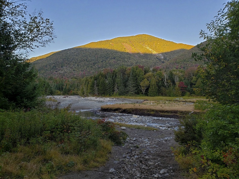
These peaks with unmarked routes usually begin with some sort of pleasant marked trail and then branch off into a herd path or something less defined resembling a game trail the beginning of which is usually marked by a cairn, then that’s about it. You’re on your own after that. Some are fairly well defined some are not. There are a couple of different ways to get to Marshall, all involving stitching together a few different trails to other peaks and then deciding where you want to break off from. For reasons relating to the aesthetics of a route, I opted to start from the ADK Loj Trailhead (the same trailhead for several other peaks including standard routes up Marcy and Algonquin, the first and second highest mountains in the state). Since this was going to be a long day, I started out about two hours before sunrise to give myself some extra time to navigate even with a good weather forecast. I had mapped out a route ahead of time starting from the Loj, heading towards Marcy Dam then moving along Avalanche Lake towards Lake Colden after which I'd find my way. Hiking up the class 1 approach in the pre-dawn hours I was on high alert given the recent bear activity in the area, including a big bruin that visited us the night before. As such I made my presence well known to all the assumed bears out there by yelling “hey bear!’ “yo bear!” especially when the trail got tight or when I was nearing any of the leantos and campsites in the area since those are usually bear magnets. I ended up seeing only a couple of deer and a bunch of chipmunks, a mouse, three toads and something in a tree I noticed staring at me when my headlamp caught its eyeshine. It was just me and the wildlife, I didn't see any other people all morning. 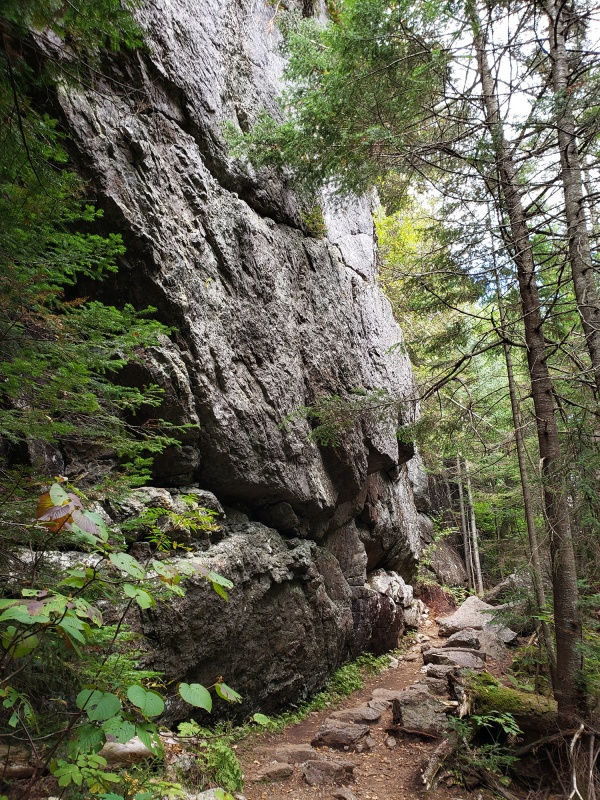 After you hike a couple miles in the woods, the initial route passes along the vertical granite canyon-like walls and then after dropping down a bit, the lakes appear. It was a nice change from the normal approach which is typically entirely in the woods that most peaks here have. At some points along the trail I was surrounded by cliffs with the thin trail snaking its way through. In the right season you might hear or even see a Peregrine falcon perched high above in the cliffs watching over its nest. 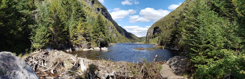 One unique feature of this route is that it traverses alongside and in between vertical granite walls of Mt Colden and its neighboring peak across the lake, which was pretty nice (and also is the turn off for the Trap Dike on Colden, another cool ascent). There is a narrow plank boardwalk here bolted to the cliff face referred to ‘Hitch up Matildas’, otherwise this is a deep ford or a careful ice walk in Springtime. Dipping my hand in the clear water, this water was ice cold. My bottle filled with fresh mountain water, I continued onward reaching Lake Colden but sticking in the woods. 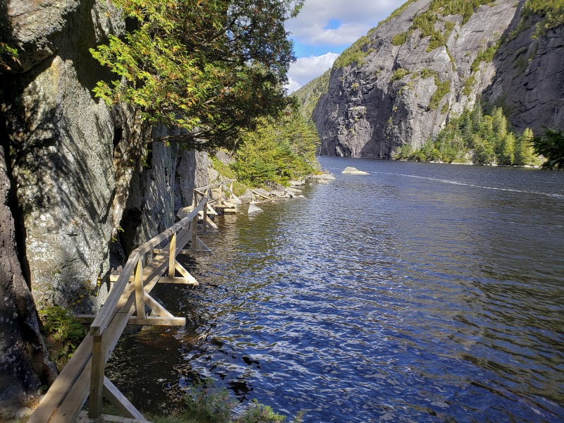 Overhanging granite  Moving past Avalanche Lake you’ll then need to partially circumventing Lake Colden after which you’ll reach a signed trail junction where the DEC Interior Outpost is down to hiker’s left and then a route following a creek is up to the right (west), which is the one which will get you towards Marshall eventually. You'll come across a few ladders and planks before reaching this point. This spot is roughly six miles from the Loj trailhead. There is a little confusion at this point where the turn off is and I first walked down to the DEC outpost cabin and across the meadow where two trails diverged, but the main trail died out and the other one was going lower to the lake so figured that was not the right way so I backtracked to that junction and went due west and began gaining ground which was the correct way. This minor detour cost me about half a mile. From here you are basically ascending a running brook up a steep hill for another 1.5 miles or so where the route becomes more faint and crosses the water a couple times as it goes in and out of the woods. Pay attention in there for the route disappears a few times and you need to hunt around for it. Towards the crest of this hill watch out for a slight clearing within which there are the remains of a plane crash from 1969. It’s is a bit overgrown now, but if you watch out for it you can probably see it from the trail. Apparently there was only one pilot in the aircraft and he survived this harrowing ordeal (source: http://www.adk46er.org). The stories the woods could tell… 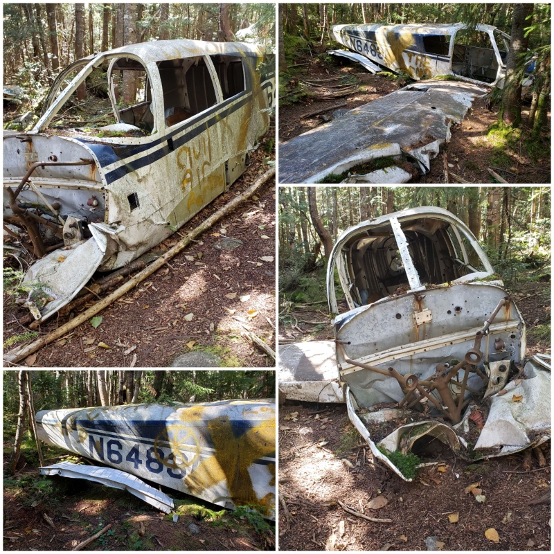
Shortly after the plane crash site, you’ll crest out on the summit of this initial hill then you’ll start to descend into the opposite basin and now you should look out for a small nondescript cairn, two stones high. This is hard to see even when you’re looking for it, but it marks the turnoff for the final section up Marshall so if you don’t see it keep looking but only look once you started descending the other side. After a bit of steep hiking and climbing over more than a few rock slabs over another mile/plus each way, without warning you will come to the treed over but signed summit of Marshall! 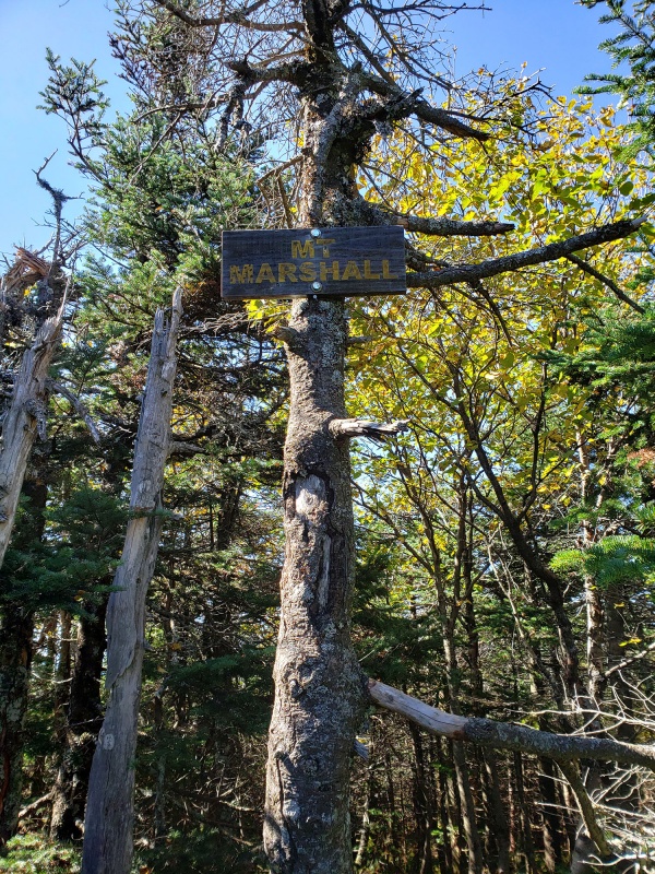 Note there are two trails that get you here. On the descent, one trail branches off yet again which will lead you down a different route from which you came, so as you start to descend take care to pay attention to which exact way you came up otherwise you’ll wind up in the wrong drainage, the two look pretty similar coming right off the summit. It's a rare day when you hike all day and see nobody but this was one of those days. Social distancing at its best. Basin and Saddleback Traverse Basin and Saddleback have a reputation of being among the harder mountains of the 46ers standard routes, largely due to the exposed summit sections on the northwest flanks of Saddleback and also the ascent up basin which has its own cliffy scrambling sections. Note however the cliffs on Saddleback can be avoided by doing this as a separate climb without adding on and doing the traverse over to Basin or vice versa. For doing the traverse, one can hike it from both directions as it can be put into a loop, but we opted to do the traverse by doing Basin first then up Saddleback which I view as the “classic” route and puts you in a position to ascend Saddleback’s cliffs rather than descend them which I think it a better option, especially if wet which is always a possibility here. We started out from the Garden trailhead, one of the busiest trailheads in the area. Oddly nobody else was starting out at this time and we were alone most of the day. Luckily it was still above freezing so ice shouldn’t be an issue higher up by the time we were 3,500ft higher. This was the main concern I had with the rock sections and cliffs near both summits. After a roughly 7 mile hike in from the trailhead you’ll reach a junction of sort marked by a huge slanted rock appropriately called Slant Rock after which you turn off headed to Basin (you can also reach Haystack from here if you’re climbing this too today to make the day longer). 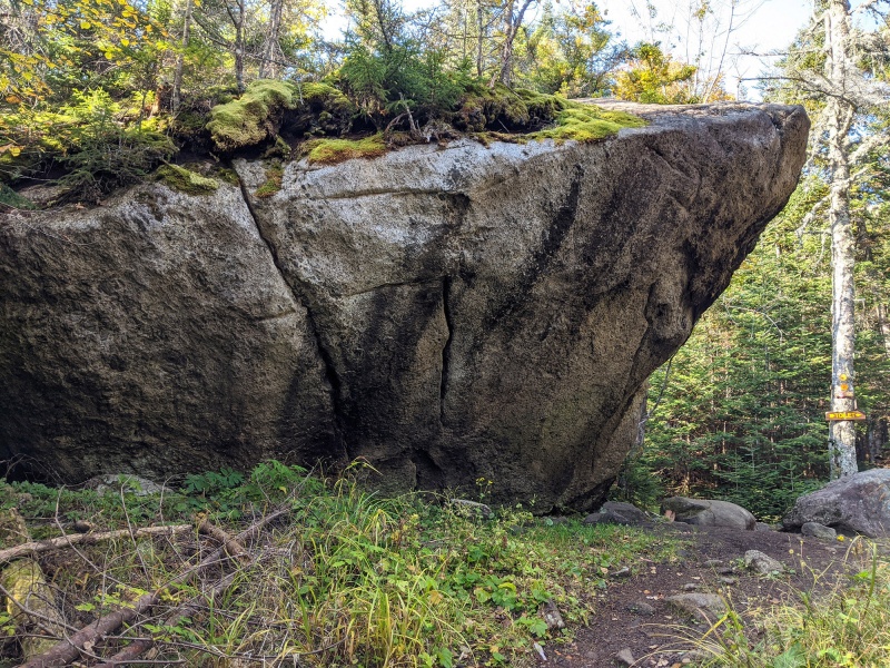 Not long after the above turn off you’ll pass through some blowdown and then begin to descend quite a bit into a steep col between Basin and Haystack which is a bit demoralizing to lose that hard fought elevation. The foliage around the area this past week was near peak and took our minds off the long approach in 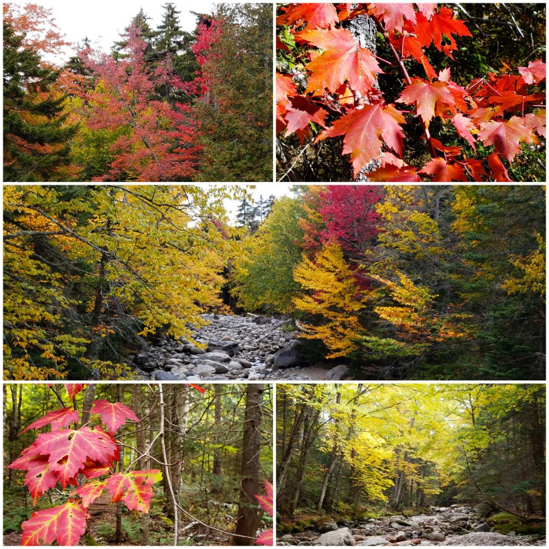 After the initial approach and turn southeast towards Basin, the well-marked trail is replaced by boulders and slabs where you continue on until another junction.  Straight up from here 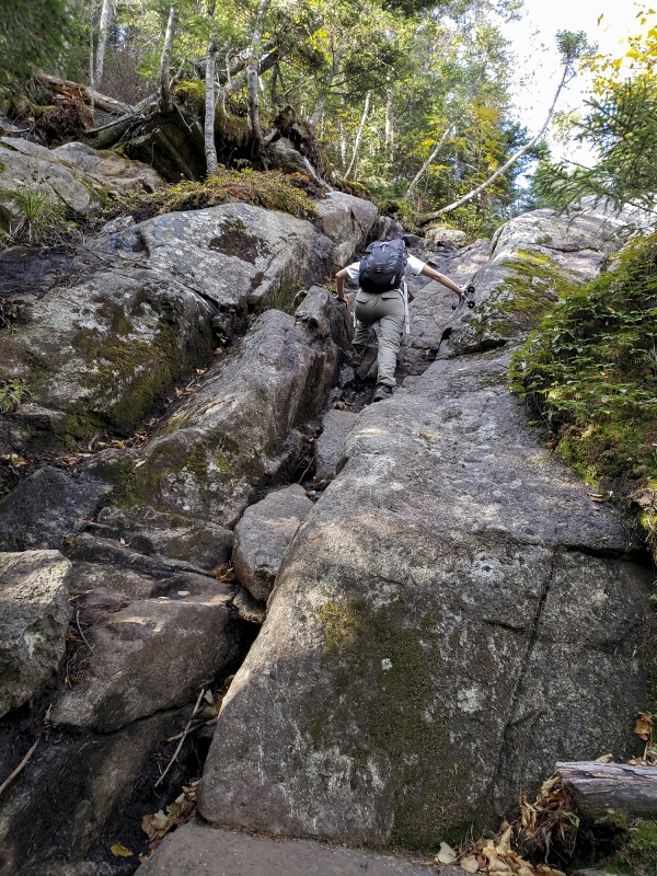 Once you reach the signed junction (always comforting to see a sign pointing to your target) which is above the saddle between Haystack and Basin the route continues but now is all straight up and passes up and over some sketchy rock sections and slabs. 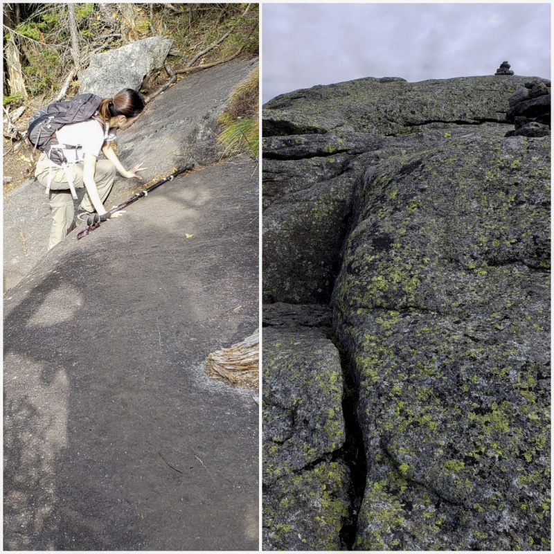
After 0.7mi of ascending the boulder strewn ravine and scrambling up the cold steep granite, the sharp summit soon appears. We had the summit to ourselves. 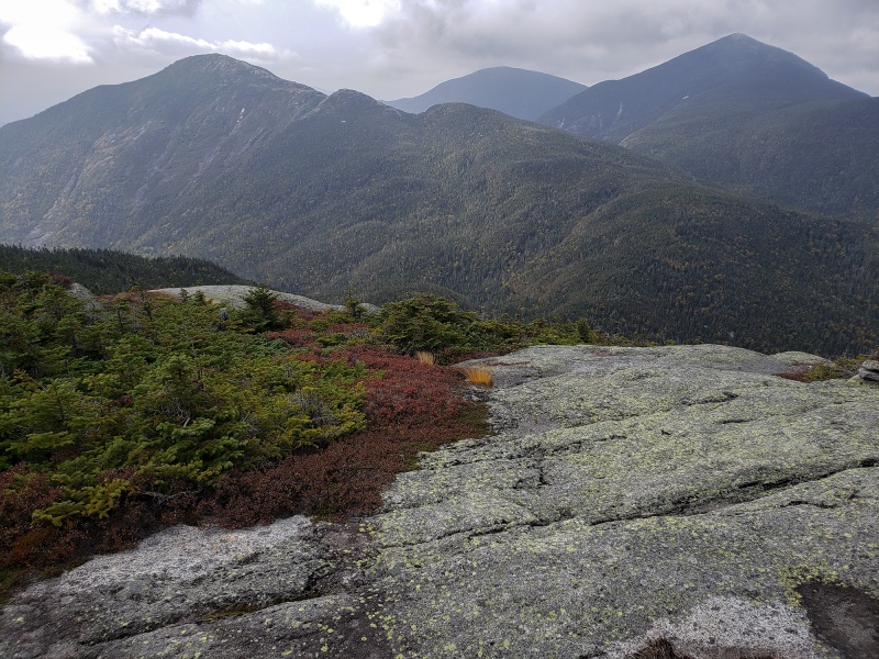
Had a great view of the surrounding high peaks and mixed in with foliage made for a fantastic scene. While clouds were gathering, there was no precipitation forecast today but we still wanted to get down the backside of Basin and up the Saddleback cliffs in the event some rain/snow did come in so we didn’t linger much more than to take this photo before moving on. Coming off the back end of Basin, you are met with steep cliffs off the northeast side so take care where you begin your descent; there is a trail here which you’d be wise to locate and follow, any trail-less option here will require gear. 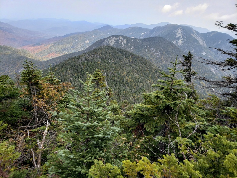 Saddleback comes into view now but it’s a still good mile away from Basin. Looking at the second zoomed in photo you can see a closer up shot of the rocky cliffs you need to ascend on Saddleback. 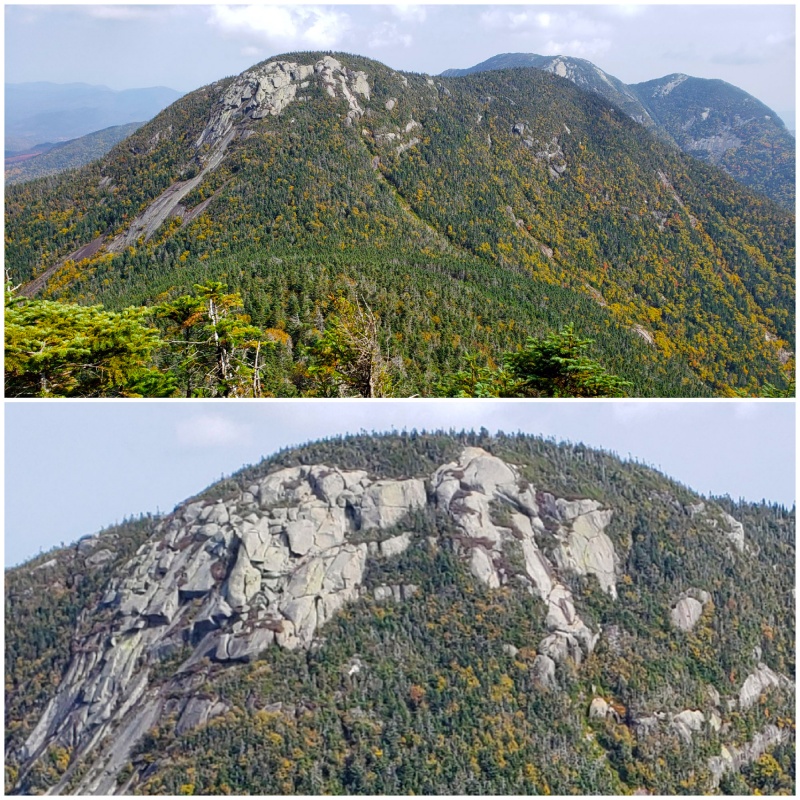 For scale, those are fir and spruce trees surrounding the rock above Looking back at Basin from the upper reaches of Saddleback 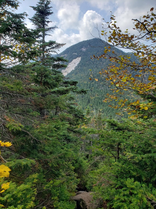 Towards the top of Saddleback the last obstacle are the cliffs to be surmounted. There are some options here. Going straight up you will need to find your line and maneuver yourself in ways to get up this rock. It's a mix of Class 3 and Class 4 and probably Class 5 depending on how you get up. 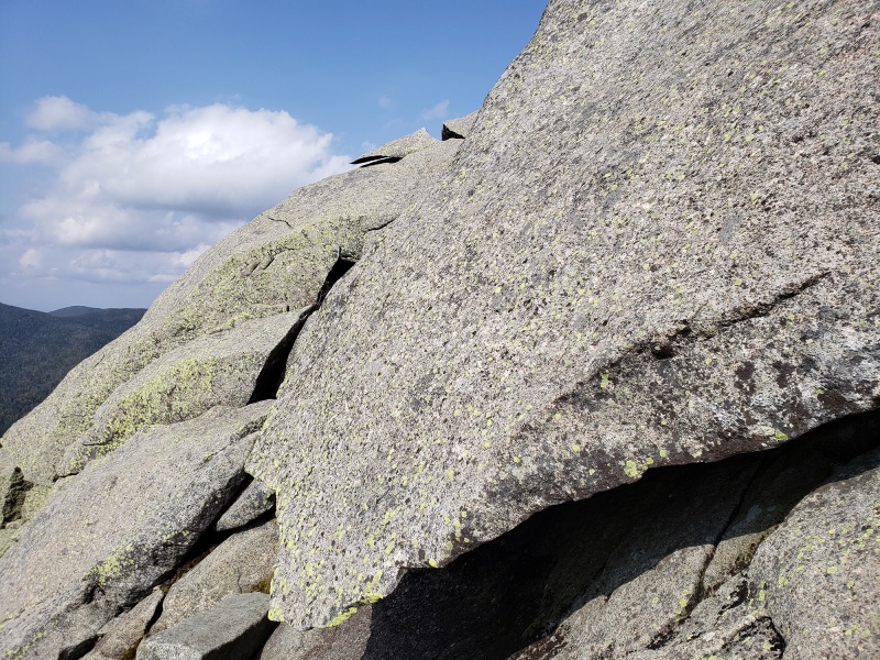 The lower section starts out low angle then abruptly goes pretty vertical There are some markings on parts of the rock for a suggested route but in my opinion, unless you’re very tall and very flexible with no pack, that way was too sketchy and would necessitate you to be hanging upside down to grab an upper ledge to get over it. This section collectively is the crux of the route. Moving up climbers right or halfway between the markings seemed a better option. 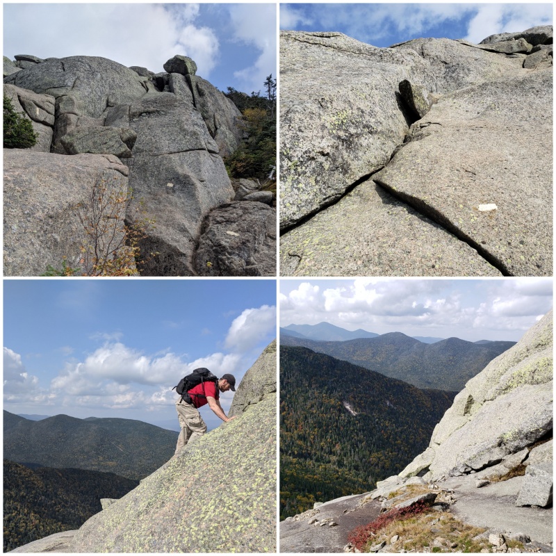 A couple of the sections you’ll l have no choice but to go straight up and most of these are no fall zones so be careful managing this section. Saddleback guards her summit well. On an outcropping just under the summit you’ll have an awesome view of Basin and the slides. For scale you can see Nicole scrambling up in the bottom part of the picture. The rock was mostly dry today 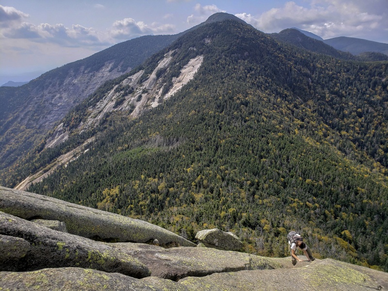
Like Basin Mountain, the summit comes without much fanfare, no sign, no significant marker as well as no people for that matter. Despite the popularity of these peaks from a crowded trailhead, we had both summits to ourselves today. We looked around for traditional USGS benchmarks but only saw these smaller marker plates. After all that effort there should at least be a normal size benchmark on the summit! 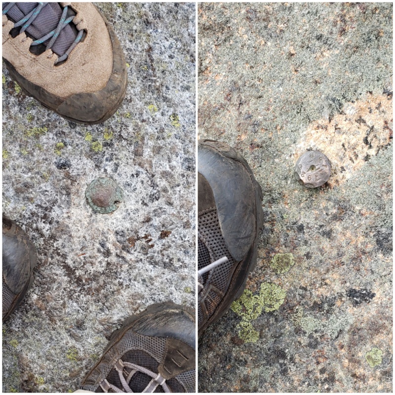
There is a great shot of Basin and its slide from Saddleback - I love this shot and it captures the range well. Without much further ado, we moved on down Saddleback on our way out as we were watching the clouds overhead and didn’t want to get caught high on slick exposed rock in the rain/snow. As we descended off Saddleback down back into the forest we got a great view of Gothics on the other side of the valley. Note those aggressive slides visible on this side and the steep rock on its southern face. 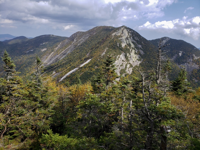
In the Heart of the High Peaks wilderness 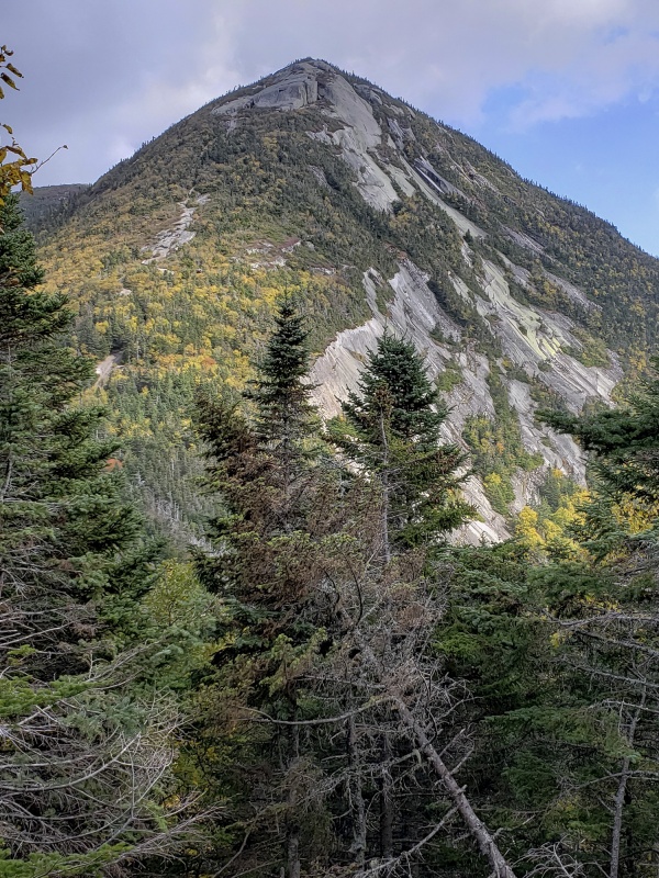 Another angle of Gothics from the other side (from another trip)  Once the rock slabs were behind us, the hike out from Saddleback was pretty straightforward. Once cool area was when we approached the slide on the east face below. The slide itself was steep and slippery and care is needed not to slip backwards and fall on your butt or inadvertently boot ski down to a bad ending here. The slick spots are pretty much unclimbable without some traction, stay on the dry parts. 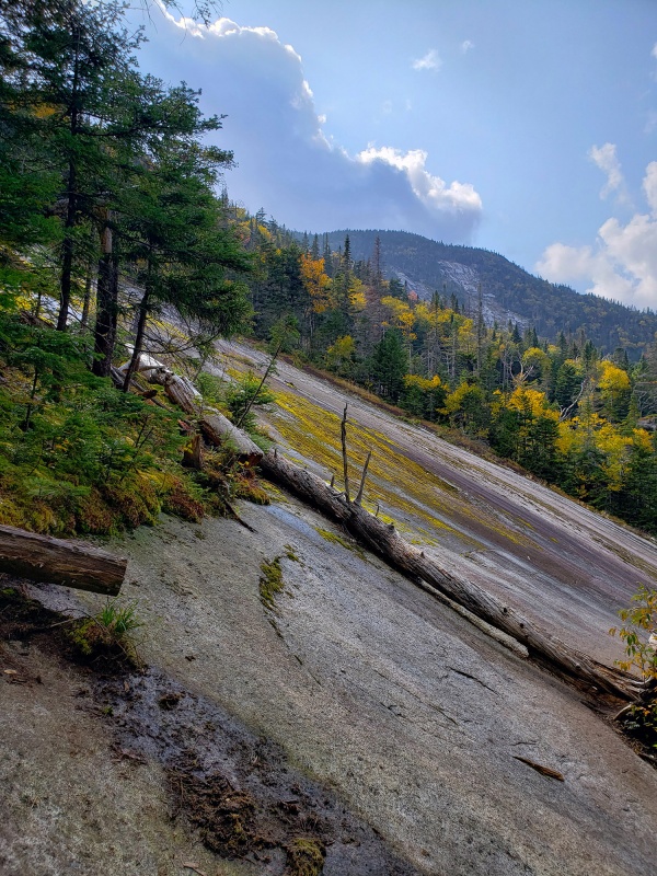 This slide was maybe a thousand feet high and towards the bottom on a particularly steep section a staircase was put in to prevent erosion of the fragile area and to provide better footing, which consequently provided a nice vantage point to see the foliage changing and mountains in the distance. The remainder of the trail merged back up with the original trail to complete the loop in a long day. 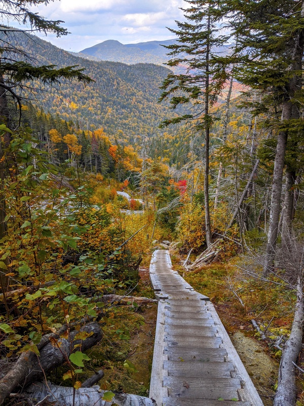
Allen Mountain Allen has a reputation for being a tough mountain. It’s located in a remote area in the heart of the wilderness and even the trailhead is a 90min drive from most other towns including where we were starting from. Similar to many of the more challenging Colorado 13ers, Allen and the other 46ers with unmarked routes sees less traffic and are usually only climbed by those seeking to get them all and is a step up in difficulty. The parking lot is small though with limited road parking available so if you’re committing to do this peak get there early. Allen is located in a beautiful area though. Eastern White Pine stand like sentinels watching over the forest. 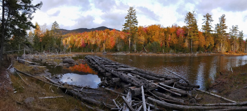
From its long winding approach, its multiple water crossings, unmarked route, the notorious red slime and final treacherous slide climb to its summit, Allen earns it stripes as one of the hardest. To complicate things the lower trail where there is one, has been re-routed at least once as a result of the hurricanes and storms over the last several years and also due to at least one bridge still being washed out. Depending on which route you follow, it’s an 18 - 21 mile roundtrip. Autumn is typically a better time to do Allen since water levels are lower so the water crossings are more manageable than earlier in the year there are less bugs and its cooler. A snow climb would probably work well if you’re willing to camp a day or two as it would make the slide easier (making it “just” a steep slope of snow/ice) and the deep snow would smooth over the rock enroute while the water crossings would be moot caked in thick ice. If you’re doing this route in snow, prepare for multiple days. Awakening at 2:30am, got ready and drove to the trailhead, and were on the trail about 90 min before sunrise from the Mount Adams/East River trailhead. The trail is nice and marked to start out and at the Mount Adams turnoff we continued right enroute to Allen. After several hours of not seeing anyone we were questioning again whether we were climbing the right mountain. There were cars in the parking lot but we ended up not seeing another person until near the summit. Soon after starting out, you’ll cross this rickety suspension bridge which is tilted to the left making you feel like you’re going to slide off into the creek as you wobble across it.  Surprisingly this shallow, boulder choked creek-looking waterway that the bridge crosses over is the Hudson River in its beginnings. The highest source of the Hudson River is located just northwest of this at Lake Tear of the Clouds under Mount Marcy and Mount Skylight. The bridge to nowhere. One of the main re-routes on this trail comes soon after the trailhead where you’ll need to walk (North) around the lake now instead of taking the bridge over the lake which is in a state of disrepair being damaged and broken apart by various storms. Lake Jimmy is a nice place to be when foliage is peaking and also seems like good Moose habitat but we didn’t see any this morning. 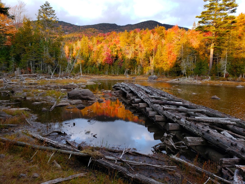 If you came across this bridge in the dark and started walking down its dilapidated wooden planks you’re in for a rude awakening as the planks are broken and you may punch through the rotten timber to the water, and if you make it to the end, you’ll find yourself nearly submerged in the middle of the water since the boards will sink when walked on and it only goes about halfway across the lake before disappearing underwater. The rest of the bridge sleeps with the fishes. The first five miles of approach is mostly on a nice trail in the woods. Color today was nearing peak in the hardwood forest with continued bursts of reds, oranges and yellows. 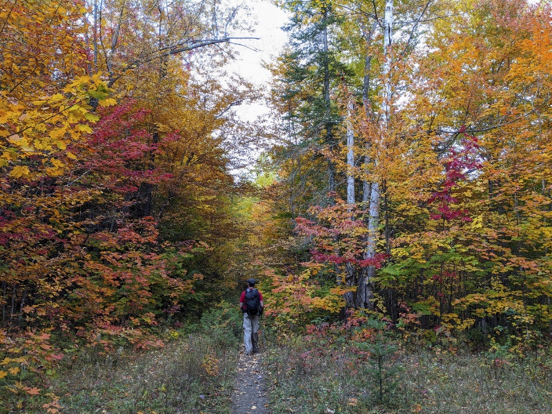 Soon you’ll pass two cabins indicating you’re on the right track.  Several spots you can see where there are large stands of maple, as evidenced by the carpet of red leaves on the forest floor. Pretty as it looks it obscures the trail in many places, so take care to pay attention as you walk through the woods as the trees change along the way changing the character of the woods and route. 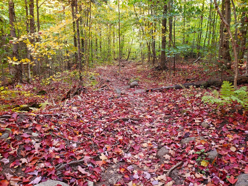 The approach hike takes a while and you’ll pass some nice lake views of Lake Jimmy and Lake Sally along the way. Also worth noting you will be gradually descending losing elevation the whole time for ~7 miles or so. 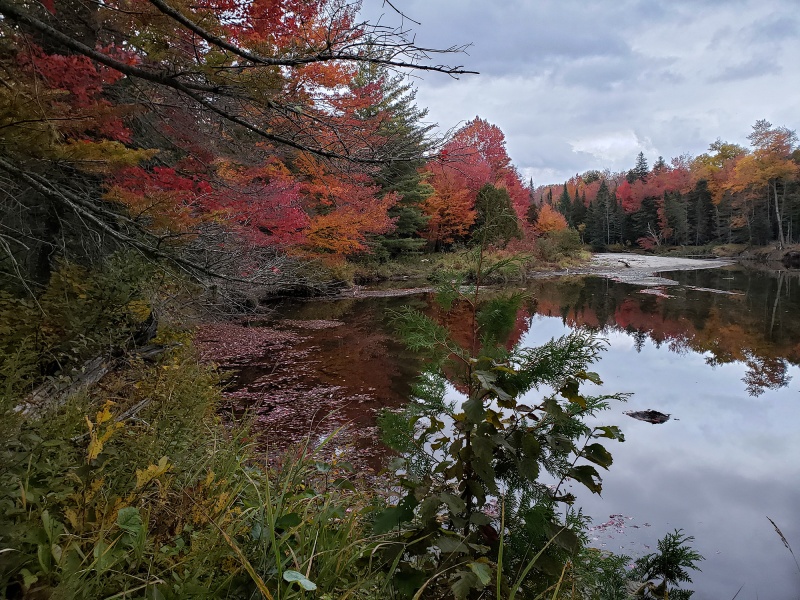 Maples were just around peak colors as they reflected in the mirror calm surface of the water 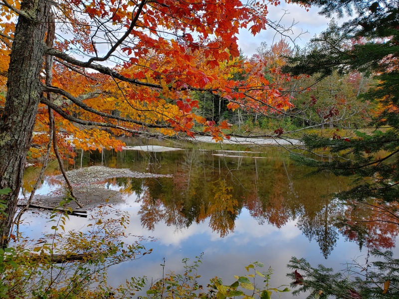 Lower water today  You’ll pass three more water crossings, which at this point in Autumn water levels were manageable and fairly easy to cross if you looked around for the best way to keep dry. While you don’t often see wildlife in these mountains because the brush is so dense, it is here and if you’re out enough especially in lower light periods you will see a lot. I’ve been on many mountains in the Rockies and often with longer approaches or open expanses above treeline you can often see wildlife from pretty far away. I‘ve seen herds of bighorn or elk on a distant mountainside, deer, mountain goats, maybe a black bear or mountain lion though the odds of the latter aren’t huge. Here, wildlife sort of pops up and surprises you! It could be near a watering hole, a swamp, around the next bend in the trail, over a small hill or in a small grassy meadow. Some local wildlife. The bear was the night before and the young buck was an early morning encounter. 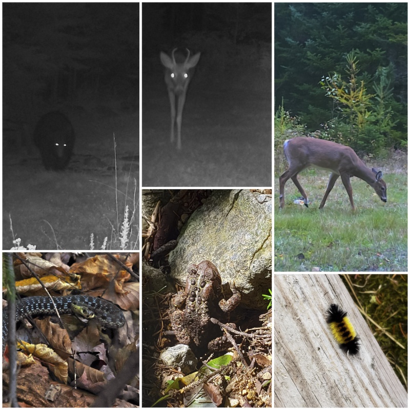 Note at this point you’re will in the woods and you’ll still be descending most of the way losing those precious feet of elevation you'll need to make back up. Soon you’ll reach a junction where you’ll see an old forest road intersect the loose trail, after which turn hard right and then come across a register (see pic above). This marks the point that begins the remaining unmarked 3.5mi “herd path” to the summit of Allen. This point is psychologically important as you finally feel like you are closing in on the homestretch on this marathon of a peak. 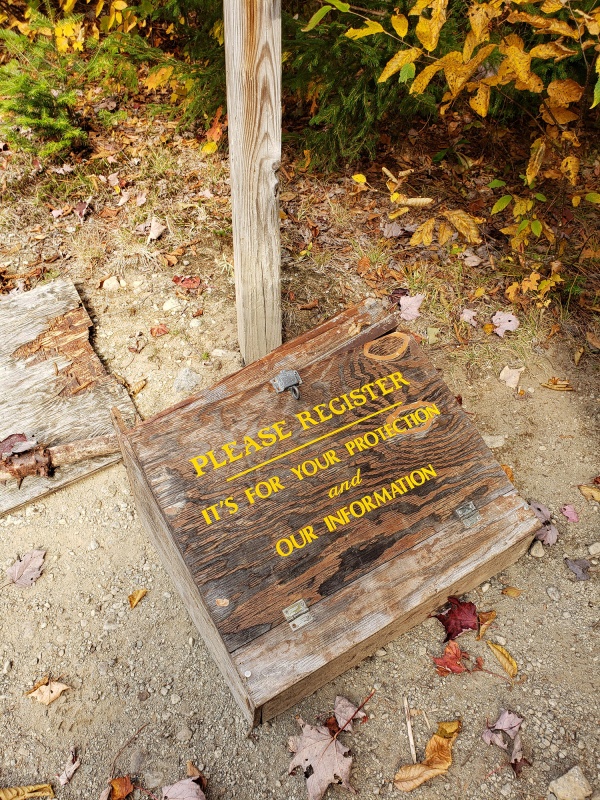
Most of this route while unmarked is generally identifiable with some solid trail sections and another loosely defined sections where with the autumn leaf fall was hard to make out in many spots. This will seem to go on forever. You’ll pass three water crossings while still in the woods, each getting wider and deeper and with each creek larger than the prior one you just crossed. The third crossing is Allen Brook, after which the route FINALLY starts ascending in earnest. 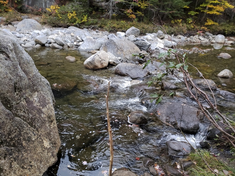 The ascent begins immediately and starts the typical Adirondack climb over exposed roots, slabs and mud on steep terrain. 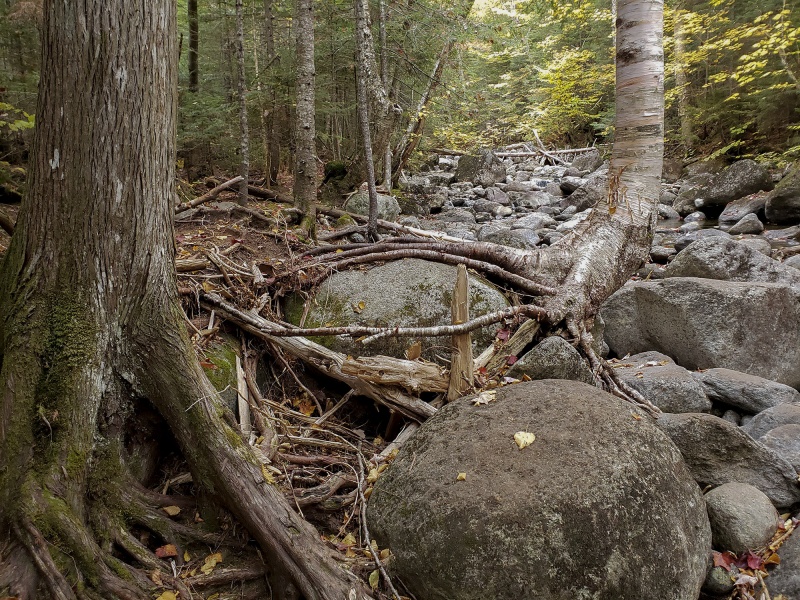 Plenty of roots and blowdown on this eroded route 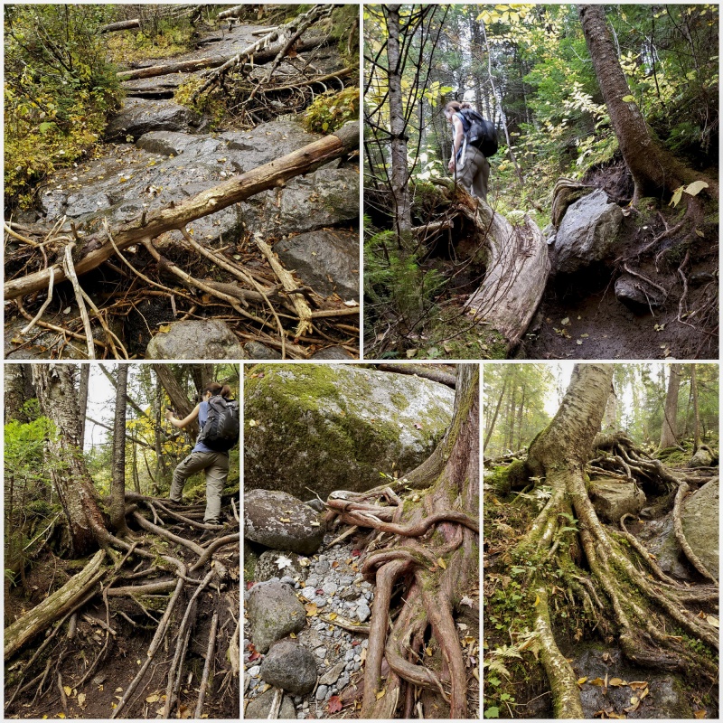 After 45min of being in the woods following crossing Allen Brook you’ll start ascending the slide. This is slick, steep and pretty smooth granite much of which has water running down and coated with a pleasant (NOT) reddish slime. 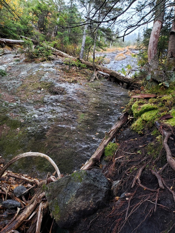 After some moderate scrambling up the lower angle slide, you’ll see a cairn which marks a directional shift up a steeper slide. 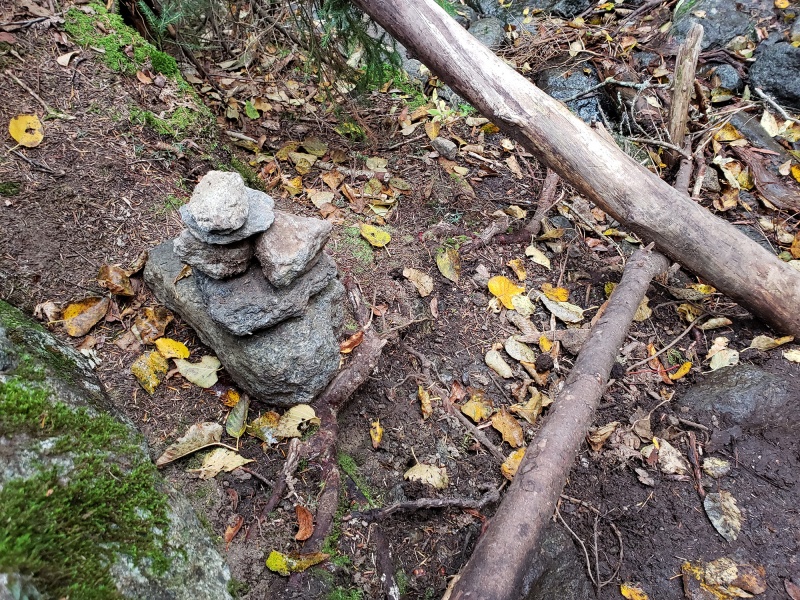 We finally saw other people! A couple just in front of us entering the beginning of the last slide, the top of which is obscured by low cloud cover. The route is up and to the right in the photo below. 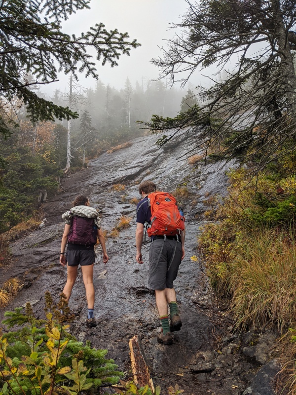 Given the angle and slickness it wasn’t really possible to climb up this straight away and roots and tree limbs are your ally here. Maybe microspikes could have helped here but we didn’t have them nor did anyone I see have them later on. Best way to ascend this was stick to any discontinuity/cracks and those roots that you know to be solid, so you need to test your holds this whole way up. 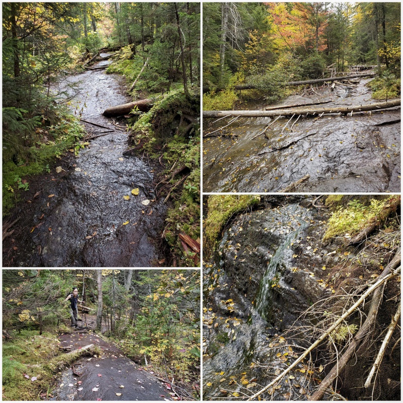 After some more punishing granite and a few class 3+ sections, the terrain will ease and without much warning the summit will appear in a clearing just big enough for a 3 person tent. 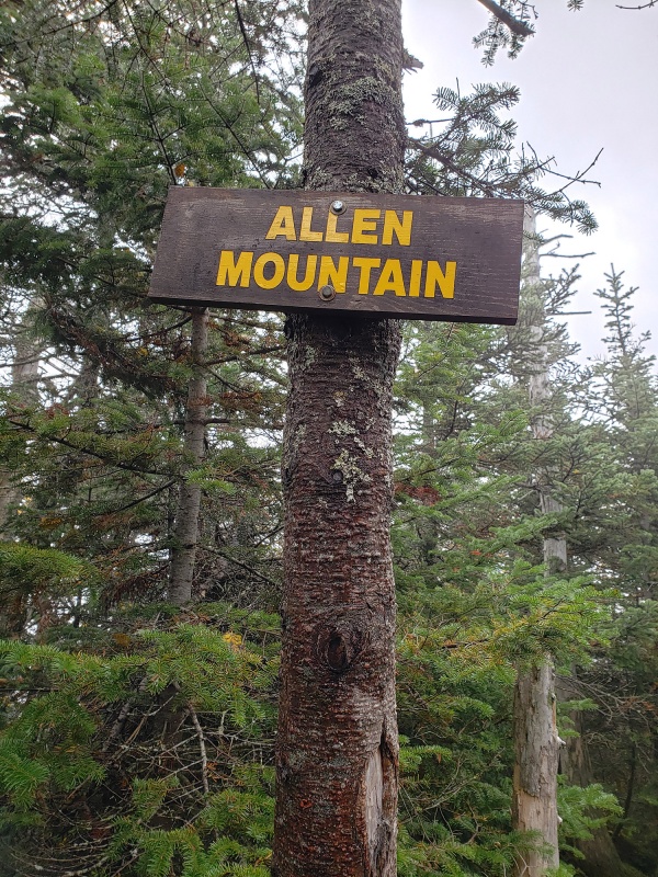
This was a very welcome sign to see. The hike out was a march that took nearly the same time as the ascent since coming off the slide was slow and tedious, then the last 5 miles were uphill. Despite the difficulty and length, Allen was a special place on a very diverse mountain and made a nice finisher! The tally for all 46 was 531 miles and +145,530 vertical ft. ******************************* Parting thoughts Living in New York, I’ve hiked in the Adirondacks for 25 years. Looking back I wish I had focused on named peaks sooner. Most of my earlier hikes were not summit climbs but forest hikes, some shorter some longer more down in the southern part of the park. After summiting Mount Marcy in 2007, I was only casually aware that there were other named “high peaks” around, but generally just hiked and climbed whatever I felt like, ranked or not. On that first hike we did up Marcy that November we were unprepared. We had extra clothing and food and water, but were not prepared for icy and snowy conditions, had no traction/spikes, no poles, had our water freeze in our then oft used camelbacks, snow creeping down our open neck and we must have slipped and fell on our butts a dozen times each scrambling up those cold icy slabs. Somehow, however that experience hooked me. Similar to the process for climbing the 14ers, in a large part due to ignorance I never intended on completing any “list” but as many of us experience, lists suddenly appear as we move down a path and then it seems to make sense to finish them. I became more aware of such designations when climbing the more popular mountains up here and was often asked by other peakbaggers “how many are you at now”? a question for which I had no answer as I wasn’t keeping track early on. This was around the same time where after climbing Longs that September I learned of the number of other 14ers there were in Colorado and after my first ascent of Mt Whitney that same Fall after which I started to keep better records of my ascents. I guess 2007 was the year I became a mountaineer. Winter and Spring brings a new challenge and different beauty to the peaks up here. From a far seems only the summits have snow, but that's misleading due to the forests on the peaks. There is deep snow all the way up and is more often mixed with frozen waterfalls and ice covered boulders. 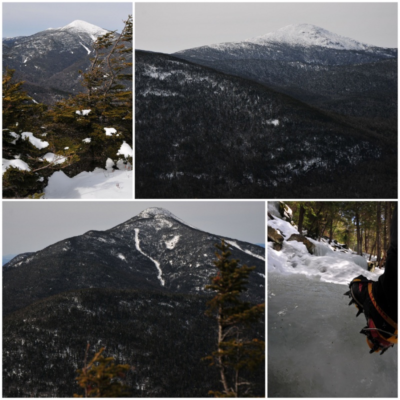 Mount Marcy and Whiteface Mountain Ancient looking Mount Marcy, New York's highest point and Whiteface Mountain, which stands alone from other peaks and was the site of the alpine skiing event of the Olympics  Ice and snow is par for the course in Fall through mid Spring on mountains up here. It's not uncommon to have to climb up frozen waterfalls and acres of ice covered rock lower down on routes. 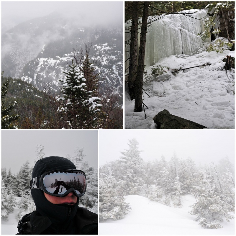 All that water during the warmer months now freezes 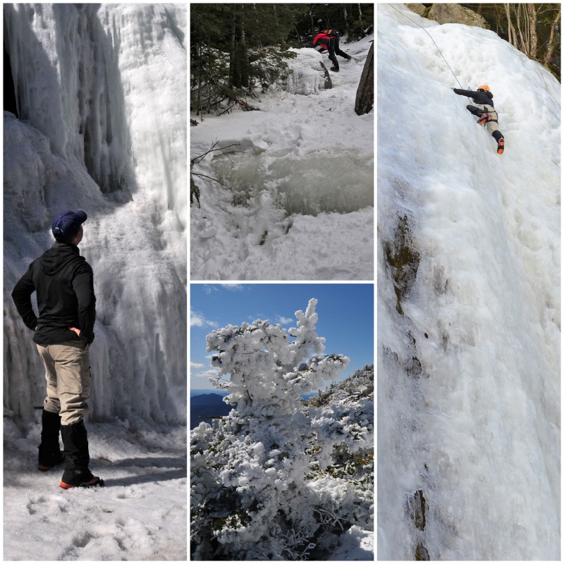 With every new climb I come to appreciate the mountains up here more. Not many of them have unobstructed views above treeline like every 13er or 14er has and with the exception of Marcy and Algonquin, they are all below 5,000ft in elevation, but they have a unique character all their own. What they lack in elevation they make up for in grit and unforgiving terrain. When standing on top of one of these 46, you get a certain feeling of accomplishment that one can only receive after being beat up and scarred, muddied up, scraped and bruised as you take a celebratory breather on top, wondering why you put yourself through it. To those who understand, there doesn’t have to be a reason. Four Seasons Forever Wild  References:
Thumbnails for uploaded photos (click to open slideshow): ")
")
")
")
")
")
")
")
")
")
")
")
")
")
")
")
")
")
")
")
")
")
")
")
")
")
")
")
")
")
")
")
")
")
")
")
")
")
")
")
")
")
")
")
")
")
")
")
")
")
|
| Comments or Questions | |||||||||||||||||||||||||||||||||
|---|---|---|---|---|---|---|---|---|---|---|---|---|---|---|---|---|---|---|---|---|---|---|---|---|---|---|---|---|---|---|---|---|---|
|
Caution: The information contained in this report may not be accurate and should not be the only resource used in preparation for your climb. Failure to have the necessary experience, physical conditioning, supplies or equipment can result in injury or death. 14ers.com and the author(s) of this report provide no warranties, either express or implied, that the information provided is accurate or reliable. By using the information provided, you agree to indemnify and hold harmless 14ers.com and the report author(s) with respect to any claims and demands against them, including any attorney fees and expenses. Please read the 14ers.com Safety and Disclaimer pages for more information.
Please respect private property: 14ers.com supports the rights of private landowners to determine how and by whom their land will be used. In Colorado, it is your responsibility to determine if land is private and to obtain the appropriate permission before entering the property.