Download Agreement, Release, and Acknowledgement of Risk:
You (the person requesting this file download) fully understand mountain climbing ("Activity") involves risks and dangers of serious bodily injury, including permanent disability, paralysis, and death ("Risks") and you fully accept and assume all such risks and all responsibility for losses, costs, and damages you incur as a result of your participation in this Activity.
You acknowledge that information in the file you have chosen to download may not be accurate and may contain errors. You agree to assume all risks when using this information and agree to release and discharge 14ers.com, 14ers Inc. and the author(s) of such information (collectively, the "Released Parties").
You hereby discharge the Released Parties from all damages, actions, claims and liabilities of any nature, specifically including, but not limited to, damages, actions, claims and liabilities arising from or related to the negligence of the Released Parties. You further agree to indemnify, hold harmless and defend 14ers.com, 14ers Inc. and each of the other Released Parties from and against any loss, damage, liability and expense, including costs and attorney fees, incurred by 14ers.com, 14ers Inc. or any of the other Released Parties as a result of you using information provided on the 14ers.com or 14ers Inc. websites.
You have read this agreement, fully understand its terms and intend it to be a complete and unconditional release of all liability to the greatest extent allowed by law and agree that if any portion of this agreement is held to be invalid the balance, notwithstanding, shall continue in full force and effect.
By clicking "OK" you agree to these terms. If you DO NOT agree, click "Cancel"...
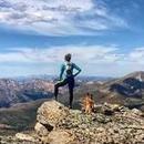
I have had my eye on Horseshoe for a long time. It shares a long ridge towards Weston Pass with the unranked high points of Ptarmigan Peak and Weston Peak that I did not want to leave out. Moreover, the idea of ascending Horseshoe's east slopes, descending to bag Finnback and back up Horseshoe didn't look like much fun and I surely wouldn't be making a trip out of bagging the two unranked 13ers along the ridge. So, several years ago I dreamed up an alternative that wouldn't require the re-ascent of Horseshoe. It turned out to be a fun day with almost 5 miles above 13,000 feet and I didn't see another human for the duration of the hike.
With my gear and bike all packed up, I headed for the summit of Weston Pass. The idea was to park there and hop on the bike and descend the west side Weston Pass road for 3 miles down to a side road that leads up into Gold Basin. Once there I was fully committed to completing this route because there was no way I was riding my back back up to the pass. I stashed the bike in some trees and started the walk up the road. Looking at Google Earth, one can see that this road continues straight up the west shoulder of Horseshoe and provides a well defined trail to around 12,700' where it finally disappears. From there the saddle between Finnback and Horseshoe is visible so I picked my way through grass and talus to that point and up to Finnback Knob.
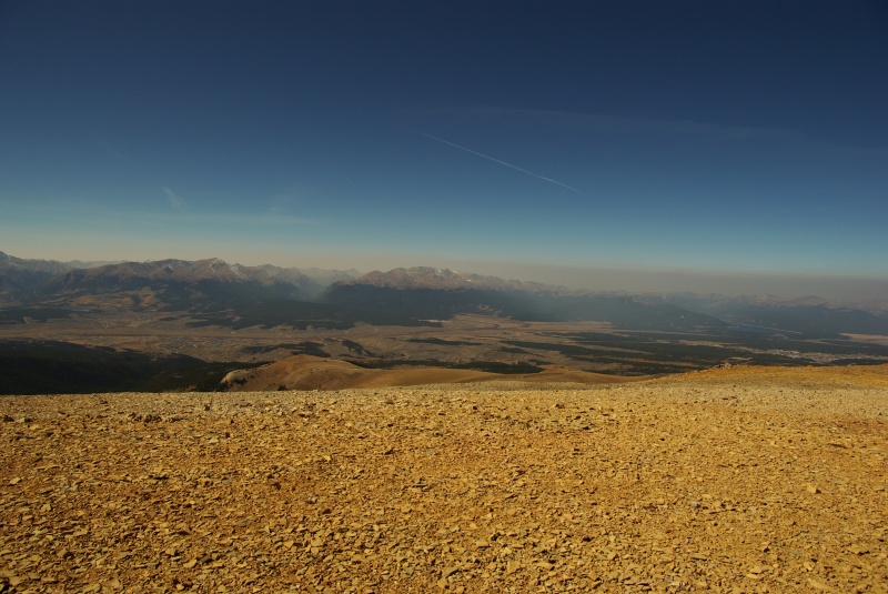
Looking west I noticed a long, thin smoke cloud that was beyond the Sawatch range, but by the forecast I knew that was going to be the reason for the 'areas of smoke' in the afternoon.
Smoke
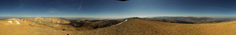
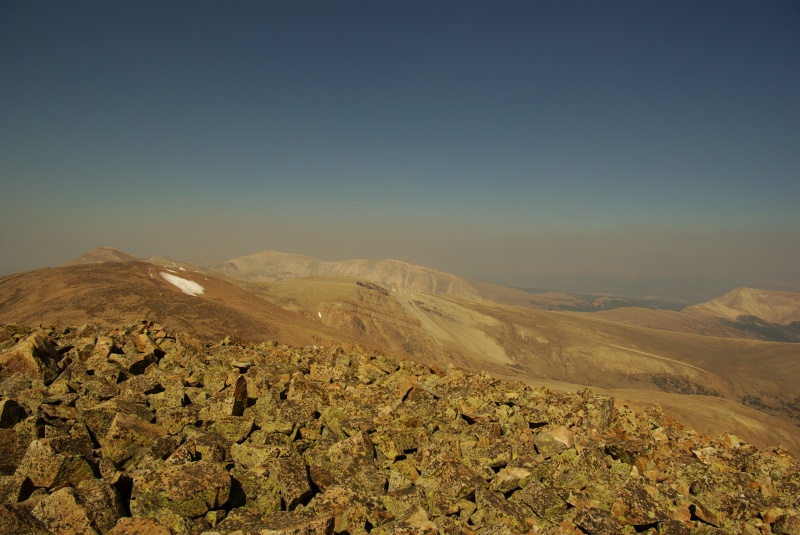
From Finnback, I ascended Horseshoe on sometimes steep talus and from there the remainder of the route is visible south back to Weston Pass. When I reached Horseshoe's summit, the smoke cloud had overtaken Holy Cross and was beginning to billow through the closer Sawatch valleys.
Horseshoe pano
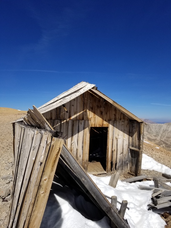
South of the summit of Horseshoe stands an old miner's cabin. I am flummoxed that it is still standing at this elevation. That's some solid architectural engineering.
cabin
By the time I reached Ptarmigan 2.7 miles south of Horseshoe, the smoke had overtaken. It wasn't particularly hard to breathe, but my throat was certainly dry and scratchy and my eyes were burning. Not a pleasant experience, but I covered my mouth with my balaclava and became a mouth breather for most of the rest of the day. It seemed to help.
looking north
Although, it's a rather uneventful slog up and over mundane high points, I really enjoy sustained, high ridges like this one. The monotony is broken up by peering down the huge east facing cirques carved out at several points along the ridge. Once I reached Weston Peak, it was a scree and grass trot back to Weston Pass. I highly recommend this option as an alternative and a longer day than the standard route.
My GPS Tracks on Google Maps (made from a .GPX file upload):
I was one of (I assume) many who stood on horseshoe, looked over to finnback and thought "there's got to be a better way" before deciding to skip the peak for the day and continue to sheridan. def coming back for this one
Yep. And if you just want to get Finnback, there is a pullout where you can park at the bottom of FS150 into Gold Basin. If you have good clearance and 4x4, you can probably drive up FS150 to the top of the hill. I'm just not brave enough for that in my stock Tacoma.
Gold Basin is an excellent route up horseshoe and it amazes me how little it is talked about. I got my stock 4Runner up the road without a ton of headache. Talk about a serene basin all to yourself.
I did this route yesterday and aside from the annoying wind and snow patches it was enjoyable. Originally I was only going to do Ptarmigan and Weston but adding the others gave some more vert and mileage! I probably should've brought the bike!
Caution: The information contained in this report may not be accurate and should not be the only resource used in preparation for your climb. Failure to have the necessary experience, physical conditioning, supplies or equipment can result in injury or death. 14ers.com and the author(s) of this report provide no warranties, either express or implied, that the information provided is accurate or reliable. By using the information provided, you agree to indemnify and hold harmless 14ers.com and the report author(s) with respect to any claims and demands against them, including any attorney fees and expenses. Please read the 14ers.com Safety and Disclaimer pages for more information.
Please respect private property: 14ers.com supports the rights of private landowners to determine how and by whom their land will be used. In Colorado, it is your responsibility to determine if land is private and to obtain the appropriate permission before entering the property.

")
")
")
")
")