| Report Type | Full |
| Peak(s) |
Quandary Peak - 14,272 feet Mt. Meeker - 13,916 feet Longs Peak - 14,259 feet Longs Peak - 14,259 feet |
| Date Posted | 03/01/2021 |
| Date Climbed | 09/13/2020 |
| Author | hogantheepic |
| Additional Members | gfwarlock |
| Kien to Finish |
|---|
|
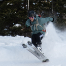
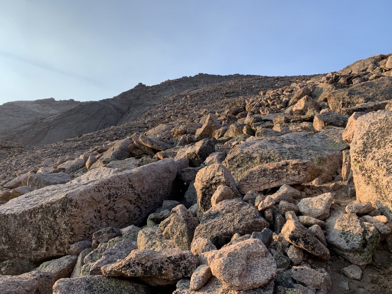
Kien to Finish 58/58 complete Sangre de Cristo complete* Front Range complete **did a compensation climb for Culebra peak All the trip reports I am writing for the summer is simply a byproduct of my thoughts, reactions, and experiences from my summer mountaineering project of climbing the 58 CO 14ers before I head back to CU in August. I hope that these trip reports help me to learn from mistakes, to document my experiences as beta for others, and to help me to think and become a better person and mountaineer. Thank you for reading and for your support! This trip report is all about my final finishings on my project. By now, classes at CU had resumed, and I only had the weekends available to finish my project. Working around 30 hours a week on top of full time college proved to be more of a challenge-though perhaps different- than my summer project of completing the 14ers, and I was not mentally prepared for this. Luckily, while by the end of my project I had grown weary and almost tired of 14ers, these lone days up in the mountains separated by a full week of civil frivolousness turned out to be some of the best days of the project. I did the first 14er of my project-Quandary- on February 29, 2020, and then the next one happened on April 25th with Bierstadt. I ended up redoing Bierstadt in August when I did the Sawtooth traverse, and so if I redid Quandary now, it would make my project start date be on May 6th, when I summited Sherman with my dad. I would essentially be shortening the amount of time it took me to climb the 58 from around 30 weeks to just under 20. My friend Hugh and I made plans to go do the West ridge of Quandary, a route involving class 3 scrambling, which I felt completely fine on but Hugh had never done a 14er route with class 3 scrambling, so it would be an exciting day for him. We drove up the morning of, and got to the Blue Lakes trailhead around 6:40 am, and started hiking 10 minutes later. Route finding was a little bit tricky in this first section because we somehow got off trail and ended up continuing around the lake near the bank for while and realized that there was no trail where we were. We found our way back up to the trail, and it was smooth sailing from there. It was kinda cold and windy, but we warmed up quickly as soon as we started moving. Before we knew it, we had made it up to the ridge, and by now we were nice and toasty. We continued up the ridge, where the class 3 sections would be found on our route. 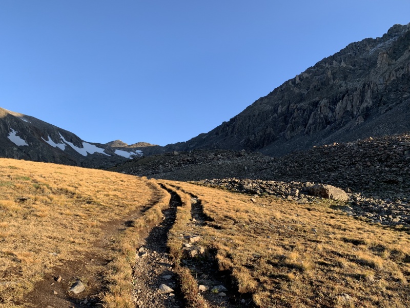

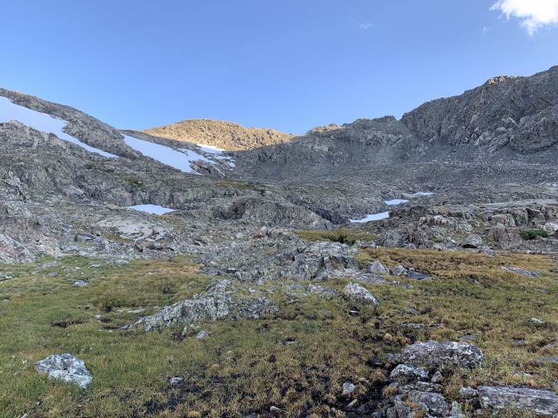
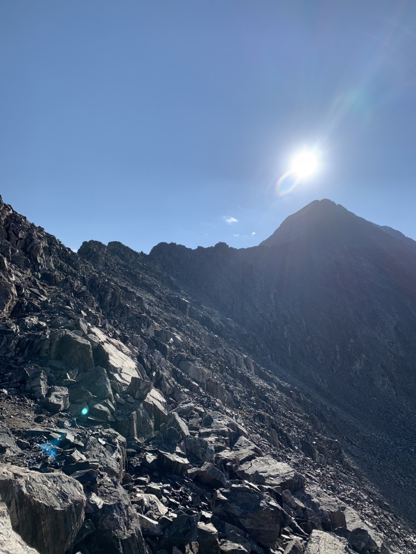
Apparently, a day or 2 before we did this route, it had snowed a little bit. We were doing this on August 30th, so snow had sort of surprised me, though I know that it isn't super uncommon for it to snow up in these mountains in the summer. The snow ended up turning the ridgeline route into a slightly more difficult route. The class 3 challenges are usually no problem, only requiring some committing moves over medium-level exposed spots, but today, the snow caused the rock to be super slippery and iced over, making the route pretty sketchy for someone who has never done a class 3 route before. 
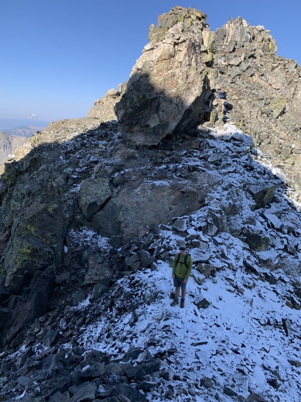

Luckily, Hugh made it up with me, and we were at the summit! It had been quite a fun little climb up the West ridge. We decided to descend via Cristo Couloir, even though it didn't have any snow in it at this point in the year. I suggested this route because it is literally almost the route of shortest distance to the car from the summit, and thus we descended down Cristo Couloir. It was pretty loose for the most part, and semi-steep. It would make for a very fun ski route in the spring, and I hope to come back to do this route. We made it back to the car, no problems, and headed on home! 


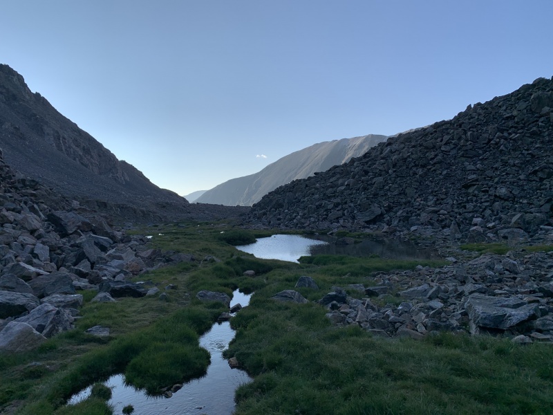
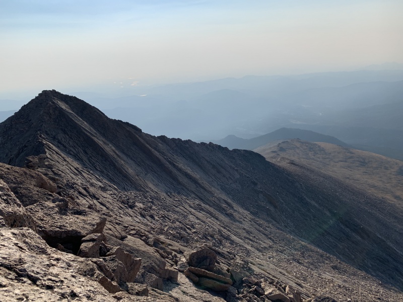
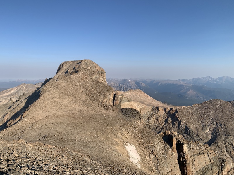
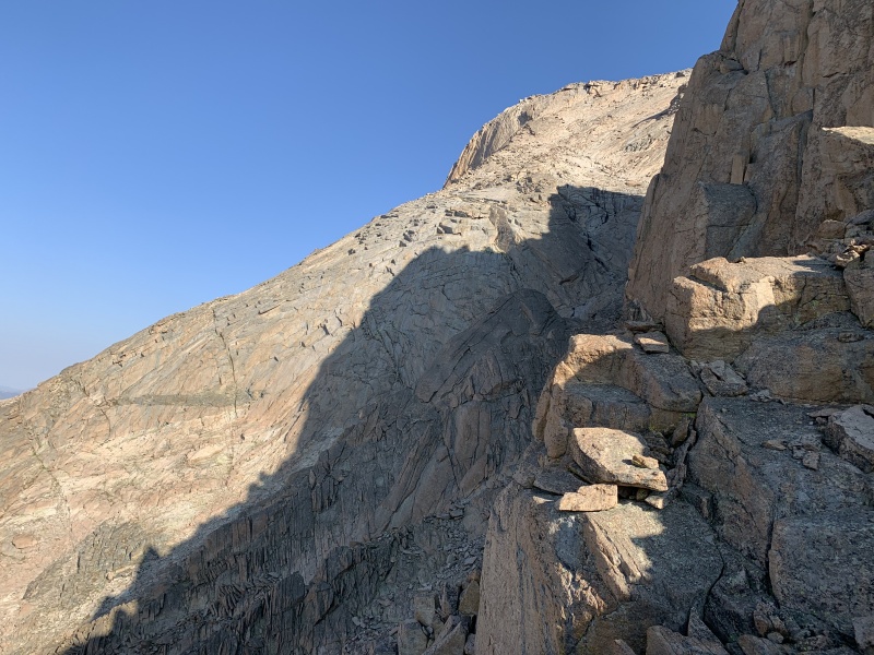
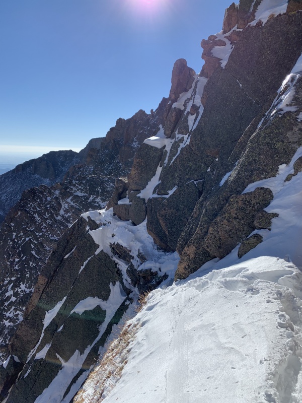
The next Sunday, I soloed Longs Peak via the Loft Route, also tagging Mt Meeker in there. This particular climb of Longs is a compensation climb for not being able to do Culebra this year, which, in my opinion, was much more fun than Culebra probably would've been, anyways. Why didn't I do Culebra? Basically, I missed the window to climb it this season. From the start of my project, I had been planning on trespassing my way up Culebra, but hadn't researched it too much. As I began to near the end of my project, I started looking into it more and more, and decided that I didn't want to trespass up it for 2 reasons: the 2 routes I had discovered were both extremely long routes that I had no real interest in doing, and there was actually quite a few security measures put in place for trespassers by the Cielo Vista ranch to catch and prevent people from trespassing up this 14er. With these 2 reasons combined, I decided to not trespass up Culebra. Unfortunately, by the time I made this decision, it was after July 31st, the end of Cielo Vista's hiking season, and thus I had missed my opportunity to climb Culebra legally. It was now hunting season, and I definitely did not want to be trespassing in hunting territory. And so, as a replacement for Culebra, I climbed Longs. I woke up at 2:30 am and left my apartment in Boulder. I was hiking by 4 am, where there were actually more people on the trail than I was expecting. This was the first hike of the summer where I carried rope and a harness, because I was planning on doing a tag-line rappel down the Cable route after summiting. I had my 30 meter 9.0 dry rope, a 30+ meter coil of paracord, my harness, a few locking carabiners, my belay device, and a couple slings. I was looking forward to this awesome solo outing, and set off up the trail super quick. In fact, the whole day, I was moving very fast. I probably could not have gone any faster without breaking into a jog. Climbing the entire summer was paying off, and I made it from the Longs Peak trailhead to the junction to Chasm Lake in a little over an hour, about 4 miles up the trail. After I split off towards Chasm Lake and then up Loft gully, I started to slow down to appreciate the views and the area I was in. The rock here is simply magnificent, and I can't wait to someday be good enough at rock climbing to start doing big routes here in the park. I made it up to the Loft, a large flat boulder field between Southeast Longs and Mt Meeker, and cut left on up Meeker. 

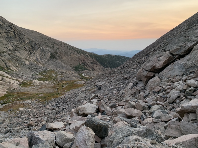


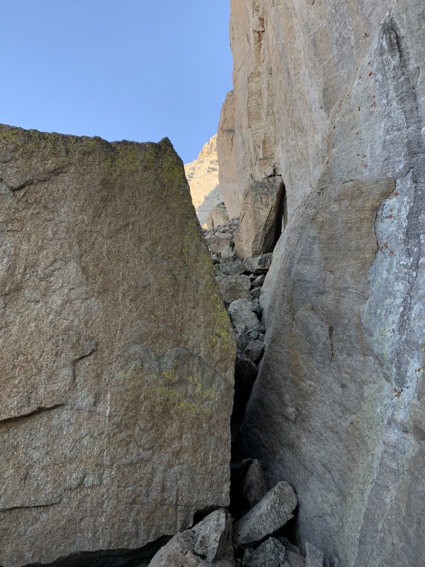
The last section from the Loft up to the summit of Meeker doesn't look too far, but don't be fooled; I felt like I was climbing for forever by the time I finally reached the ridge, where I tried to figure out which part was the actual summit of Meeker. It wasn't sure which one was the true summit, so I just walked along the whole thing to ensure that I had stood atop the summit at some point. I headed back down to the Loft, crossed the Loft, and began to run into route-finding troubles. I studied the pictures torturously, examined the topo closely (which turned out to not be super helpful on a confusing peak like Longs), and decided to just find the best way over the Keplingers myself. I was definitely not in the right place for most of the time, I never even saw Clarks Arrow, but I made it. I eventually began climbing back up and up, got back enroute, and made it to the homestretch. Not long after, I was standing on Longs Peak! 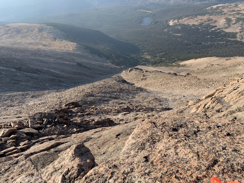


I took yet another glorious nap on this summit and headed down the north face. I had rappelled down these eye-bolts before a few years ago, and didn't have much trouble finding them again. It took me 3 pitches of tag-line rappelling to reach the bottom with my 30 meter rope. I coiled my rope, put all the gear back in my bag, and tramped down towards the trail and the campsites in the middle of the boulderfield. Once I reached the trail, I resumed my usual high-speed hiking, only this time, it was down the mountain and not up, and my body was itching to start running. So I did. It took me a little over an hour to run from the boulder field back to the car, where I was passing lots of people heading down, and some heading up. The speed at which I ran, even with a rope bouncing on my back, was mind-numbingly quick, and I didn't realize how fast I was actually moving until I reached my car, where I nearly threw up when I stopped moving. So, pretty much, it had been a great day! 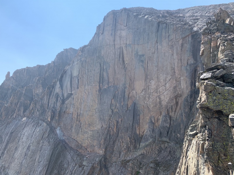
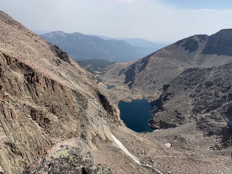

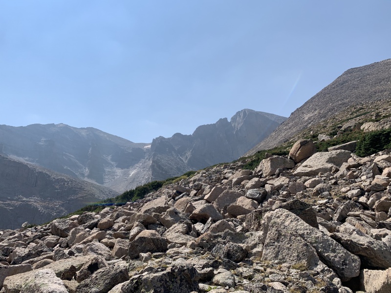
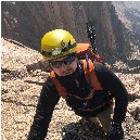
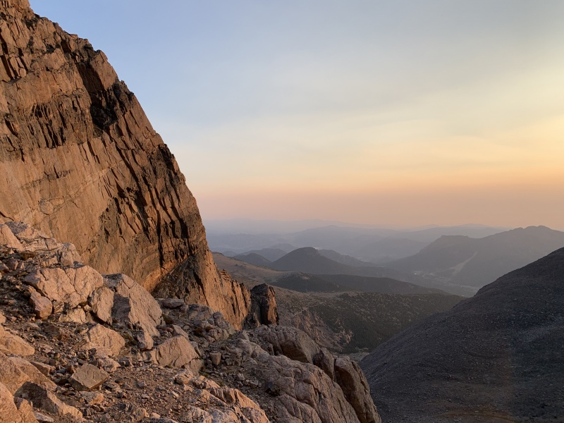
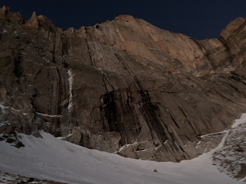
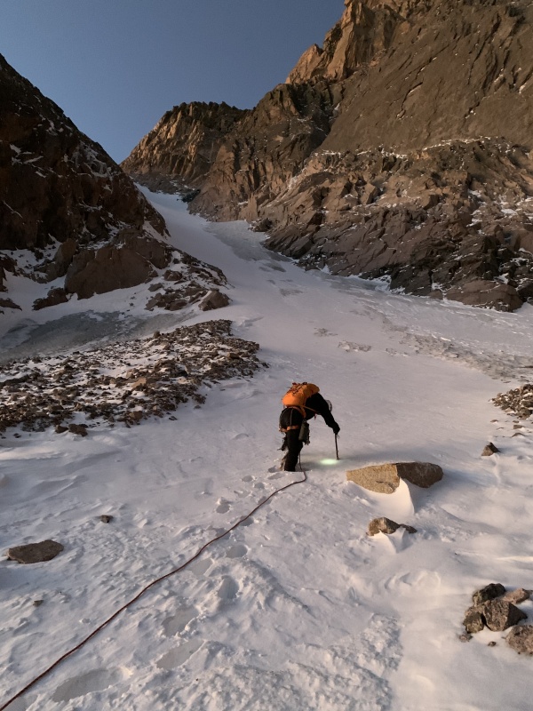
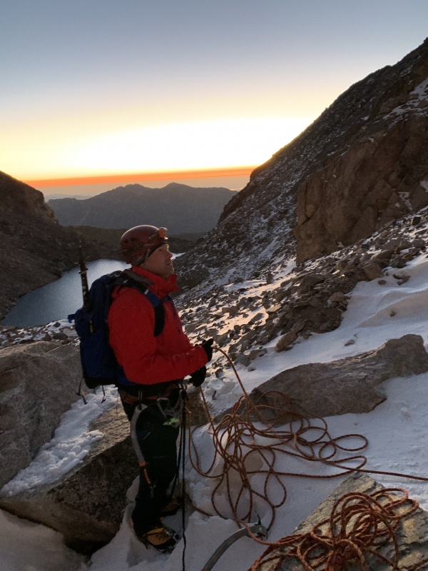
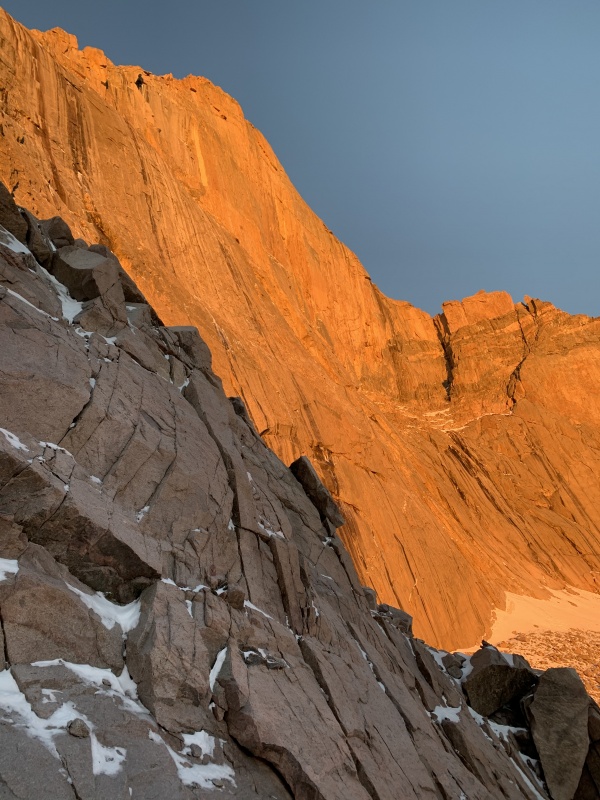
After this brilliant Sunday on Longs Peak, I somehow had the clarity to see that I could take mountaineering in a couple different directions: either get more into trail-running and start repeating easy summits for quick times, or to get into the technical world and start climbing more technically challenging routes. Recently, I have decided to go all in on the technically challenging routes because, for some unknown, subconscious reason, I am more attracted to the difficulty of rock and ice climbing than I am to the difficulty of trail-running. I knew these facts about myself back then, too. For a couple weeks, I had been trying to make plans to do Kieners route on Longs Peak as my final 14er of my journey. I didn't have all the gear, I certainly didn't have the experience required to lead it, so I began asking around. My dad has a pilot friend named Steve who one can describe as 'vastly overqualified' for a route like Kieners. He has been on 6 Alaskan expeditions, he has had an attempt on the Eigerwand, and he has been on multiple ice/mixed climbing trips to Scotland, to name a few qualifications. He is basically the ideal person to take my dad and I up Kieners. After getting off work at about 5:30 pm on Saturday, I drove home to Erie, where I met up with my dad. We drove up to near the trailhead, and camped out in the woods just outside the actual park under the stars. We parked at around 9, 9:30, and set our alarms to 12:30 am. It would be rough. After a restless 3 hours of sleep, we rolled up our sleeping bags, hopped in the car, and drove the last 5 minutes to the trailhead. We met Steve at the trailhead, and we distributed the gear. I ended up carrying the 60 meter rope and the other 2 split the cams and other gear between them. We set off from the trailhead at 1:30 am, by far my earliest start time of the summer. After a leisurely hike up to the Chasm Lake junction while talking about various big-brain topics, we set off up towards Chasm Lake. I guess I should provide a description of Kieners route and a little bit of it's history here, since pretty soon, we would be on it. Kieners Route, aka the Mountaineers route, is named after Walter Kiener, who made the first ascent of this route in 1924 (according to mountainproject.com). It is given a grade II rating, which in my opinion, is quite accurate and deserving of this grade. It ascends the East face of Longs Peak, practically tracing the outline of the famous Diamond. Kieners route first begins by ascending Lambs slide, a 1000 ft, 50 degree snow couloir rising above Chasm Lake. After this, the route follows Broadway, which is a natural ledge that bisects the Diamond into an upper and a lower section. After following Broadway for some time, the route then ascends up a few pitches of low 5th class terrain, slowly wrapping its way right towards the summit of Longs. After turning a highly exposed corner, the route climbs up a final short scramble to the true summit of Longs. 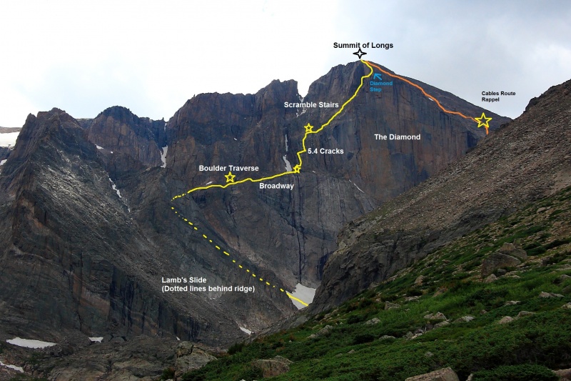
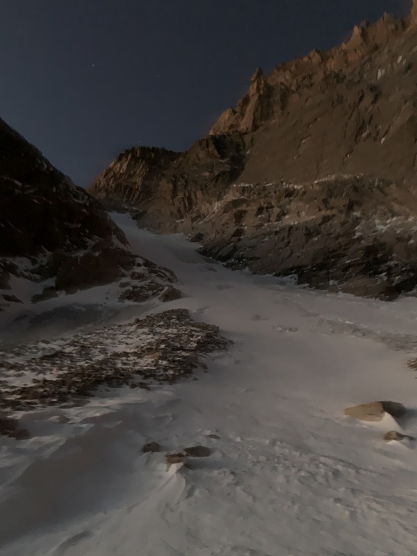
Ordinarily, this route is not too big of an undertaking, given that it is a grade II ascent. In summer, it has even been the subject of speed climbs by famous trailrunners. However, on September 8th, Colorado received a record-breaking early snow, in which Longs Peak saw around 18 inches of snow. 5 days later, we attempted Kieners route, with rather difficult conditions to battle. We simul-climbed most of the route, even on Lambs slide. There were ample places to put protection along the right side of Lambs slide. There was black ice covering much of Lambs slide, but due to the recent snow, most of it was covered by fresh snow. After digging down a little bit to examine the snowpack in Lambs slide, I realized that it had some rather dangerous layering at the time, with a base layer of black ice being covered by some 1F strength snow covered by a semi strong wind slab. If it slid, it would've been disastrous. We stuck to the right of the couloir the whole time, opting to climb the exposed black ice rather than the snow. 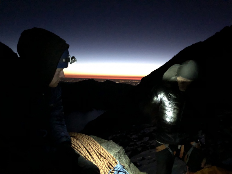
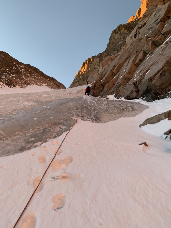
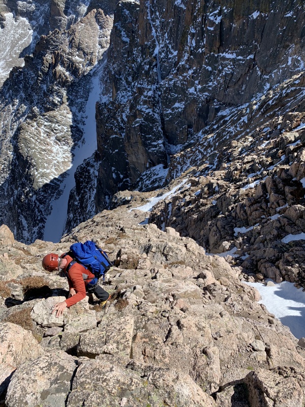
After we reached Broadway, we stopped simul-climbing for little bit, but then decided to go back to simul-climbing just to stay on the safe side. The snow on the route turned out to not be too much of a problem on Broadway. 
Once we reached the base of Notch couloir, the snow began to really increase the difficulty of the route. Since we were climbing this route 5 days after the snowstorm, there had been enough time for some of the snow to melt and freeze on the rock, turning these few pitches of rock climbing into mixed climbing. This ended up being an extremely fun 4 or 5 pitches of easy mixed climbing, though it was cold due to the shade being on us the entire time. Eventually, we made it past this part of the climb, and unroped for the rest of the climb. We were now in the sun, there was hardly any snow here, and it didn't take us long to reach the summit from here! 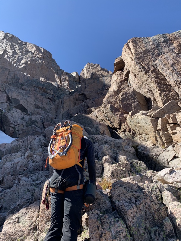
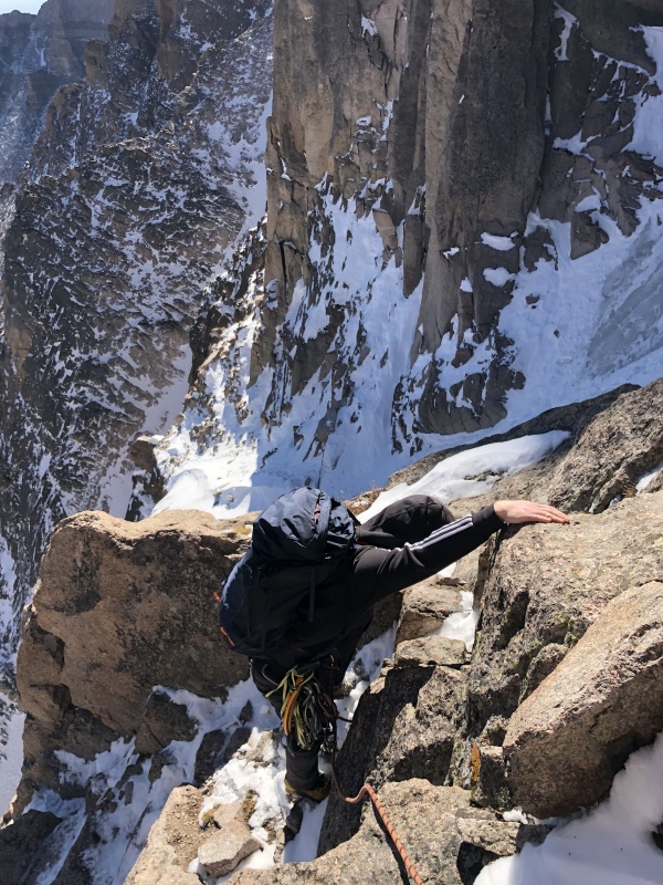
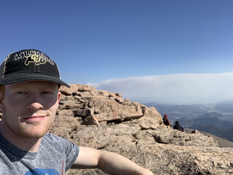
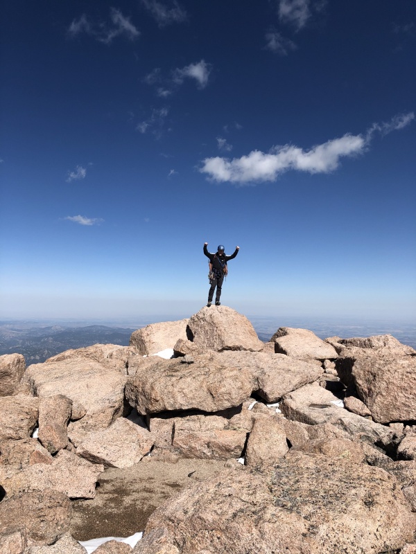
I reached the top, getting slightly emotional at having succeeded at my summer project, and stood on the summit rock. Victory! I had achieved my summer goal of climbing the 58 Colorado 14ers. In just under 20 weeks, I had stood atop them all (except Culebra, of course). I was rather relieved that the journey was over because I was starting to grow tired of dealing with talus fields and mindless hiking, but I am still grateful for what the project rewarded me with. 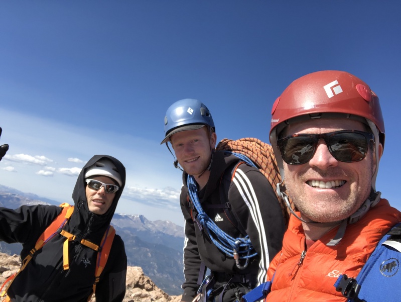
We chilled for a little bit at the summit, then took off down the north face, where there was quite a bit of snow and some ice. We found the eyebolts, rapped down, and continued on down to the trail. Once we reached the trail, we stopped and put our approach shoes back on. At this point, I split off from Steve and my dad and took off down the trail, exhausted, towards the car. I stopped for short rest periods a little too often, but eventually made it back to the car. It was about 6, 6:30 by the time we reached the trail in the boulder field, and it was like 10 pm by the time I made it back to the car. Around an hour later, the other 2 arrived at the parking lot. It had been a 21+ hour day for us, by far the longest day my dad and I had the whole summer. It was an awesome time, though. After the whole summer, I can safely say that Longs Peak is by far my favorite mountain, which may come as a surprise. I notice that lots of 14er finishers choose more obscure, less popular peaks to call their favorite, which I completely understand. However, in my mind, Longs Peak is the ultimate mountain in Colorado; it has ample opportunity for nearly every type of mountaineering discipline: rock climbing, hiking, skiing, ice climbing, high altitude, even big wall climbing. In addition to its potential mountaineering, Longs Peak also is one of the most aesthetic, one of the most beautiful mountains in Colorado, and has some of the most excellent views of the entire northern Colorado Front range. Most importantly, Longs Peak is the mountain that I have been staring at and been inspired by since I moved to Colorado in 2013. It is a deep part of my upbringing and my mountain education now, as it is truly my home peak. This is the final trip report in my mini series of my summer peak bagging project, and I would like to say thank you to a few people: thank you to all of those who have been reading my TR's since I began, you have generally been supportive of me, and I have learned at least a thing or 2 from you guys. Thank you to all of those who joined me on at least one peak this summer and for sharing an outstanding stoke for nature and all it has to offer us. Thank you to those I met on the mountains that I may have politely asked to practice certain LNT principles and who listened and respected the rules. It is this respect that will allow folks like me and you to continue to have this invaluable natural resource for the indefinite future. But thank you foremost to my parents, without whom I would not have even had this opportunity to pursue such a grand and classic exploration of the wonderful state of Colorado.
^^Quick throwtogether of some vids and pics from Kieners Route September 2020^^ As always, Risk is for managing, not for chance. ~Hogan Warlock~ For those who may mention something or other that I haven't actually completed the list because I haven't climbed Culebra, I say this: This is my project, and I defined the terms of what success means to me. I decided that I was ok with missing a single peak on the list, at least as long as I did something that could compensate for it. While I do sorely regret not just sucking it up and paying the cash for the permit to climb Culebra when I had the chance, I still consider my summer project to have been a complete success. I will likely still climb Culebra at some point in the future, though I have no set-in-stone plans for that at the moment. I thank you for politeness and support in the unfortunate error I made this summer as far as Culebra goes, and I hope to continue providing interesting mountaineering stories and good photos and (hopefully) decent beta for the fine folks of 14ers.com. Thumbnails for uploaded photos (click to open slideshow): ")
")
")
")
")
")
")
")
")
")
")
")
")
")
")
")
")
")
")
")
")
")
")
")
")
")
")
")
")
")
")
")
")
")
")
")
")
")
")
")
")
")
")
")
")
")
")
")
|
| Comments or Questions | |||||||||||||||||||||
|---|---|---|---|---|---|---|---|---|---|---|---|---|---|---|---|---|---|---|---|---|---|
|
Caution: The information contained in this report may not be accurate and should not be the only resource used in preparation for your climb. Failure to have the necessary experience, physical conditioning, supplies or equipment can result in injury or death. 14ers.com and the author(s) of this report provide no warranties, either express or implied, that the information provided is accurate or reliable. By using the information provided, you agree to indemnify and hold harmless 14ers.com and the report author(s) with respect to any claims and demands against them, including any attorney fees and expenses. Please read the 14ers.com Safety and Disclaimer pages for more information.
Please respect private property: 14ers.com supports the rights of private landowners to determine how and by whom their land will be used. In Colorado, it is your responsibility to determine if land is private and to obtain the appropriate permission before entering the property.