Across the Great Basin and Back | The Loneliest Road (Trip) in America
Thursday & Friday, September 3-4, 2020
After hiking to the top of White Mountain Peak in the morning and then stopping in Bishop for food and gas in the afternoon, it was time for me to head back into Nevada on US Route 6 so I could climb Boundary Peak located at the very northern end of the White Mountains. Since I had hiked Wheeler Peak on Wednesday which is considered the ‘highest peak’ in Nevada, I figured that I might as well climb the ‘highest point’ in Nevada too since I was going to be driving right near it. This would be my third peak in as many days and I was hoping that my legs would be up for it!
After entering Nevada I turned right onto the the dirt road that enters Queen Canyon and immediately had this view of Boundary Peak in Nevada on the left and Montgomery Peak in California on the right.

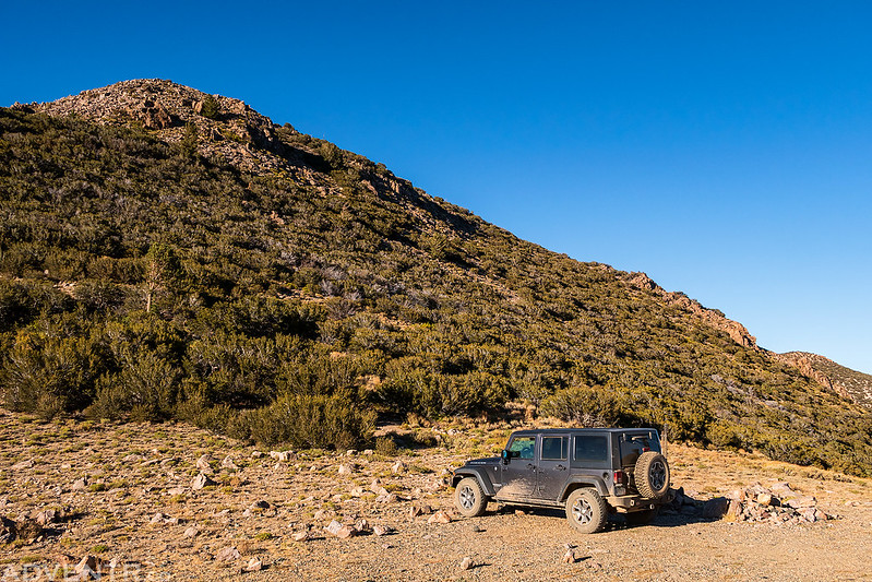
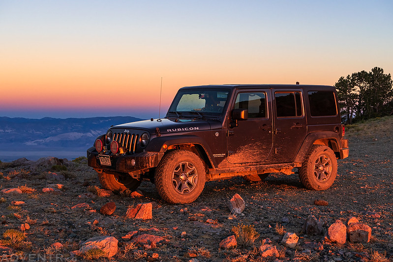
I drove up past the Queen Mine to the Kennedy Saddle and decided to camp up there since it wasn’t supposed to be windy overnight.
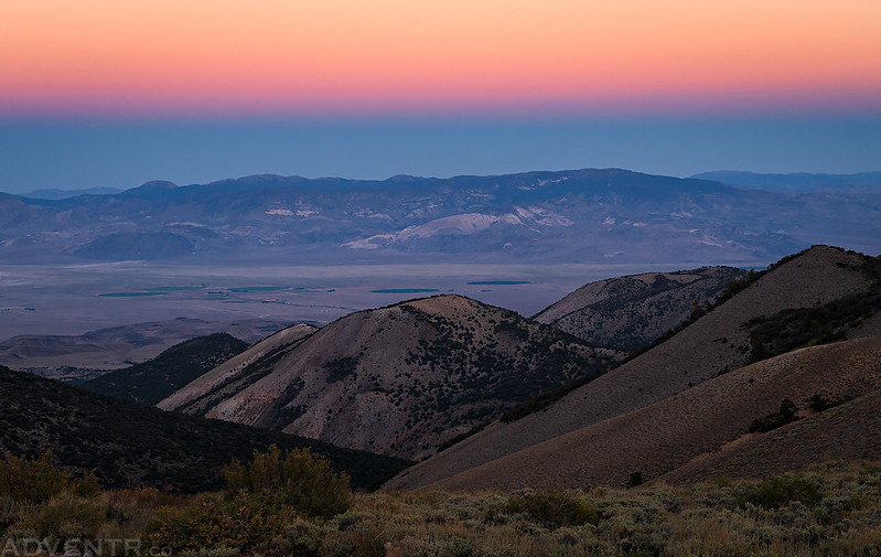
A smoky late afternoon view from the Kennedy Saddle.
Soon the sun began to set and the light got nice. This is a view looking east to Lone Mountain and the Weepah Hills.

The warm light was looking nice in Queen Canyon below.

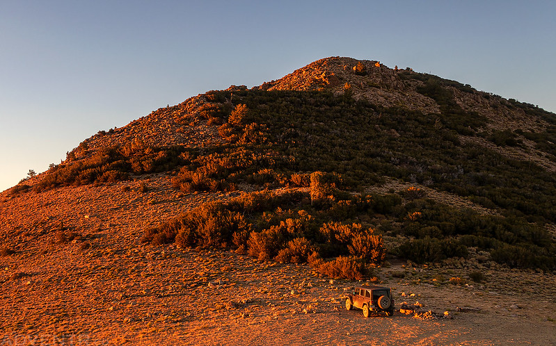
Warm evening light on Kennedy Point above my campsite.
While I liked the way the light was hitting the rocks in the foreground, I actually took this shot because of the way the magenta sky comes down to a point in the upper lefthand corner of the photo. I think that’s from the pass that I am standing in when I took this shot? I’ve never seen that before!

Jeep Light
Kennedy Saddle Sunset

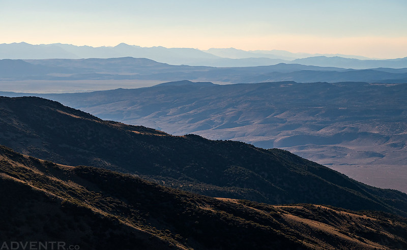
The Earth’s Shadow over Trail Canyon and the Fish Lake Valley.
On Friday morning I decided to get going a little later than I had the past couple of days and started hiking about 30 minutes before sunrise. I hoped that was enough time for me to get to the top of the first ridge so I could watch the sunrise on Boundary Peak.
After nearing the top of the ridge, I entered a Bristlecone Pine forest just as the sun was coming up and the red light was illuminating the ancient trees.

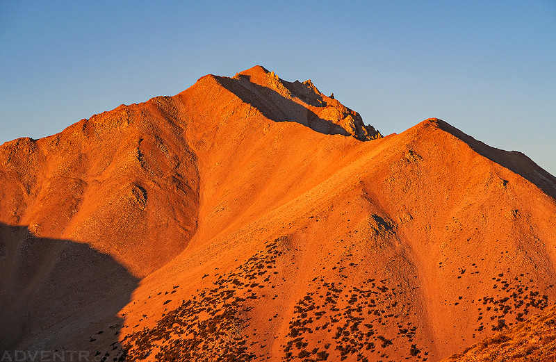
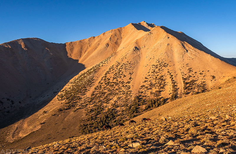
Then I reached the top of the ridge and was able to catch Boundary Peak bathed in the warm smoky light from the sunrise.

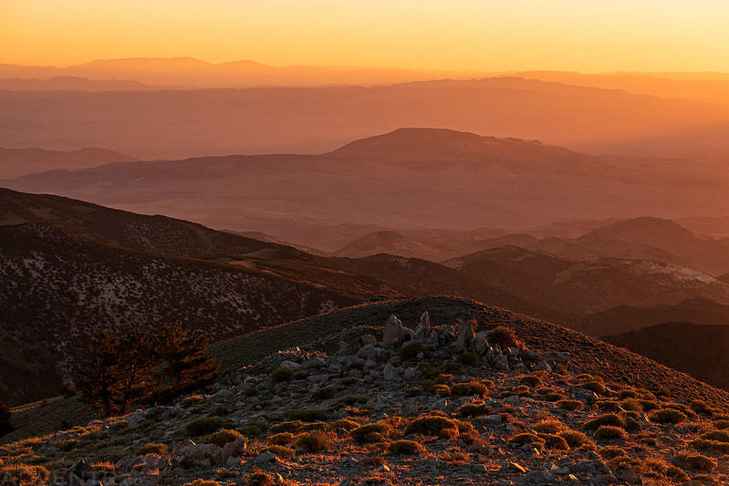
All that smoke in the air does make for some amazing colors at sunrise and sunset!
Here’s a closer look at Boundary Peak (13,143). I still had over 2,000 feet to climb…
I loved the way the light was striking these hills on the other side of Trail Canyon.
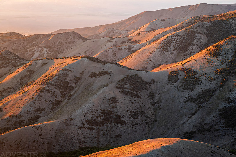
Golden Light of the Great Basin

Just another Bristlecone that caught my eye near the trail.

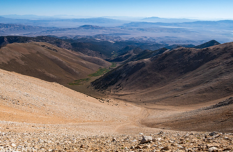
When I reached the first little saddle along the ridge I walked over to the edge to an overlook of the Queen Valley.

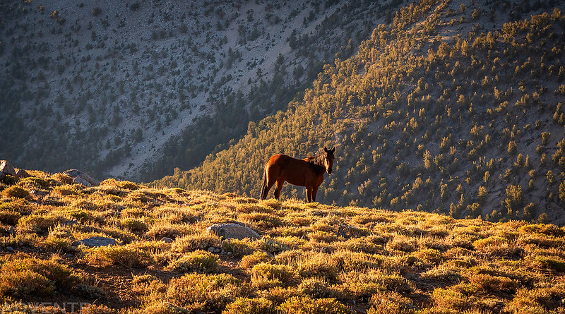
As I continued further along the top of the ridge I noticed five wild horses below me.
This was the only one that even looked at me briefly. They didn’t seem to be bothered by my presence and were only interested in foraging for their breakfast.
Walking Below
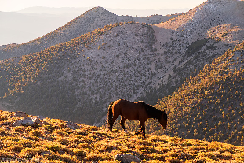
Five Wild Horses

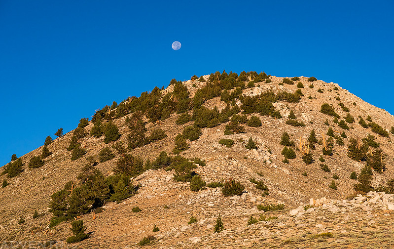
The Corn Moon was getting close to setting behind Trail Canyon Peak.
Once I reached the Trail Canyon Saddle the easy trail I had been following up until this point got much steeper, rockier and looser. It would pretty much stay that way until I reached the summit. I took this photo looking back down over the Trail Canyon Saddle.

After climbing the first steep and rocky section I reached an overlook with a good view of Boundary Peak. At this point I was starting to move slower as the three days in a row of hiking peaks was taking its toll.

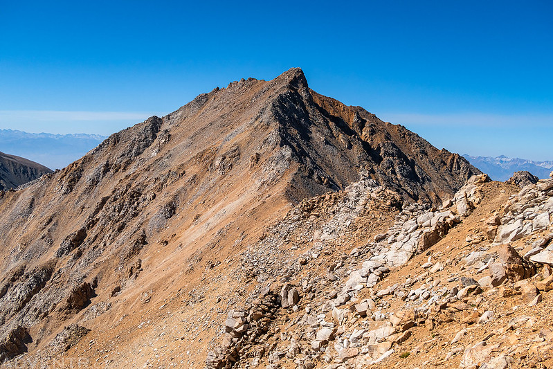
After the trail traversed around a high point on the ridge, there was a good look at the rocky ridge I would be following the rest of the way to the summit.

Here’s a view looking down into Trail Canyon. On my way back down from the summit I would see about five people way down there that were on their way up. That does not look like a fun route…
As I got closer to the top there were a number of different trails and routes to follow on the right side of the ridge. It was a like a choose your own adventure game, and if you chose poorly the hike could get a little sketchy!

As I neared the summit I had a good view across the ridge over to Montgomery Peak (13,441) in California. I had originally thought I might try to hike over to that one today too, but my legs were pretty tired and I was moving too slow, so I decided against trying it.
Finally, I reached the summit of Boundary Peak, the highest point in Nevada!

Boundary 1950

Looking to the south I could see past The Jumpoff (13,500) to White Mountain Peak (14,252) in the distance.

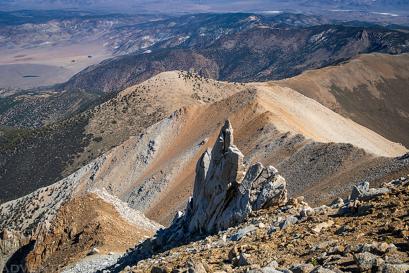
Below the summit there was a cool rock spire sticking out of the ridge.
The hike back to the Kennedy Saddle was pretty warm but there was a breeze that helped keep things a little cooler. I slowly made it back to the Jeep by 1:00pm and then drove back down to the highway. I headed east to Tonopah where I topped off my fuel tank and grabbed a bite to eat, then continued on to the next leg of my road trip Across the Great Basin and Back!
I didn’t take any photos on the return hike until I could see my Jeep parked below Horseshoe Rock at the Kennedy Saddle. Almost there!

Driving back down the Queen Canyon Road to the highway.

>> Boundary Peak Photo Gallery
>> The Original Trip Report on ADVENTR.co