Download Agreement, Release, and Acknowledgement of Risk:
You (the person requesting this file download) fully understand mountain climbing ("Activity") involves risks and dangers of serious bodily injury, including permanent disability, paralysis, and death ("Risks") and you fully accept and assume all such risks and all responsibility for losses, costs, and damages you incur as a result of your participation in this Activity.
You acknowledge that information in the file you have chosen to download may not be accurate and may contain errors. You agree to assume all risks when using this information and agree to release and discharge 14ers.com, 14ers Inc. and the author(s) of such information (collectively, the "Released Parties").
You hereby discharge the Released Parties from all damages, actions, claims and liabilities of any nature, specifically including, but not limited to, damages, actions, claims and liabilities arising from or related to the negligence of the Released Parties. You further agree to indemnify, hold harmless and defend 14ers.com, 14ers Inc. and each of the other Released Parties from and against any loss, damage, liability and expense, including costs and attorney fees, incurred by 14ers.com, 14ers Inc. or any of the other Released Parties as a result of you using information provided on the 14ers.com or 14ers Inc. websites.
You have read this agreement, fully understand its terms and intend it to be a complete and unconditional release of all liability to the greatest extent allowed by law and agree that if any portion of this agreement is held to be invalid the balance, notwithstanding, shall continue in full force and effect.
By clicking "OK" you agree to these terms. If you DO NOT agree, click "Cancel"...
"Fortress Peak" AKA "Montrose Peak" AKA "U3" Elevation: 13,241 ft. Rank: 393 Date Completed: September 19, 2020 Mileage RT: ~5 Gain: ~2500
Fortress isn't supposed to be a difficult peak...if you can find the correct route. Hence, I'm guessing, the name. Fortress has been taunting me for four years now, ever since I wrote my first trip report ever for another peak in the Cimarrons. Now every time I visit my grandparents in Montrose I look out their front window and see this lonely little peak sitting between Precipice and Redcliff that remains unfinished. When my cousins invited me out for their annual fall camping trip to Silverjack I knew the moment to strike was upon me. It was time to infiltrate the Fortress.
With few reports and no GPX files I thought I'd give this one a go after some careful research and take my chances at adding some good new reliable beta to the .com. To prepare for this one and try to avoid the mistakes that others have made on this site, I had to do some off-14ers.com research. There is one helpful report on SummitPost but the awesome Tim and Carrie Cooney of Climb13ers had the best beta by far and we ended up using most of their route. I've included a downloadable GPX at the end of this report for others to use, which for the most part mimics their ascent. I had the initial goal of trying to find Furthermore's crossover from the gully south of the one we took for our descent but see later in this report for why we ultimately just decided to go back down the way we came.
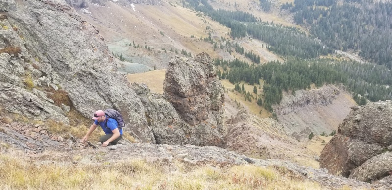
I would call the majority of this route "tedious class 2" with just a couple of very minor and brief class 2+/3- moves. There is minimal exposure on this route but there is a lot of loose terrain, some of which includes large boulders and one-path rock gullies so if I were to do this again I'd probably bring my helmet just in case.
The trailhead for Wetterhorn Basin over in West Fork is much the way I remember it from my previous trips to this drainage. An AWD vehicle with decent clearance, good tires, and a careful driver could likely make it the entire way this time of year. There aren't any obstacles with the creek crossing running really low, so Kyle's 4wd CVT-engine Jeep Patriot made it without any issue. In the past we've had to park our 2wd vehicles about a mile and a half down the road soon after the Courthouse trailhead, and our low-power CVT Jeep Patriot right at the creek crossing about .6 miles from the trailhead when the creek is running high in early summer.
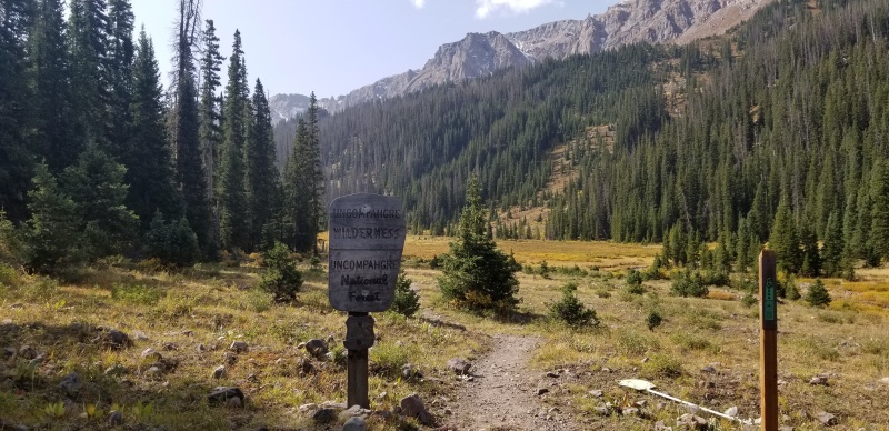
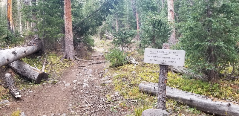
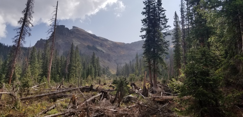
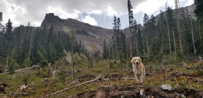
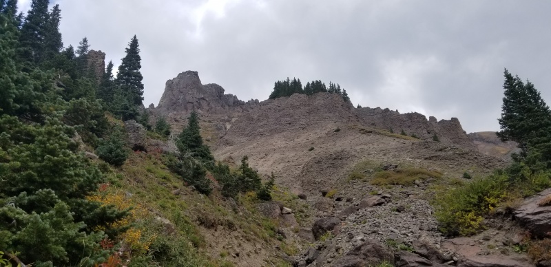
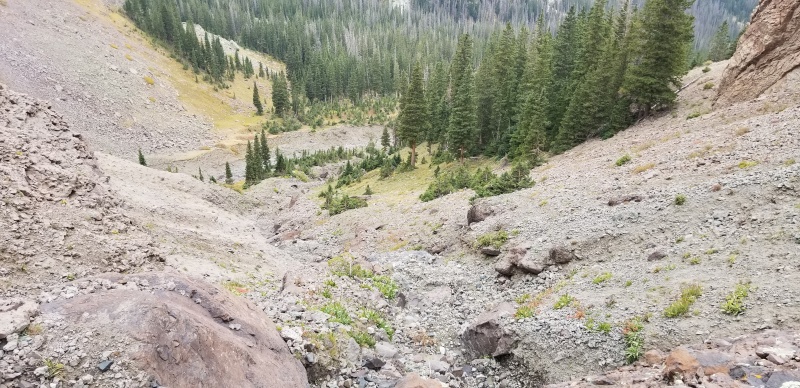
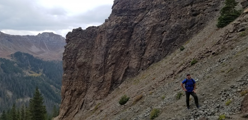
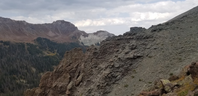
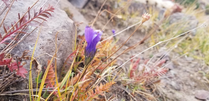
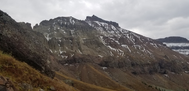
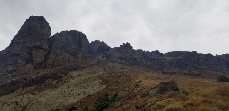
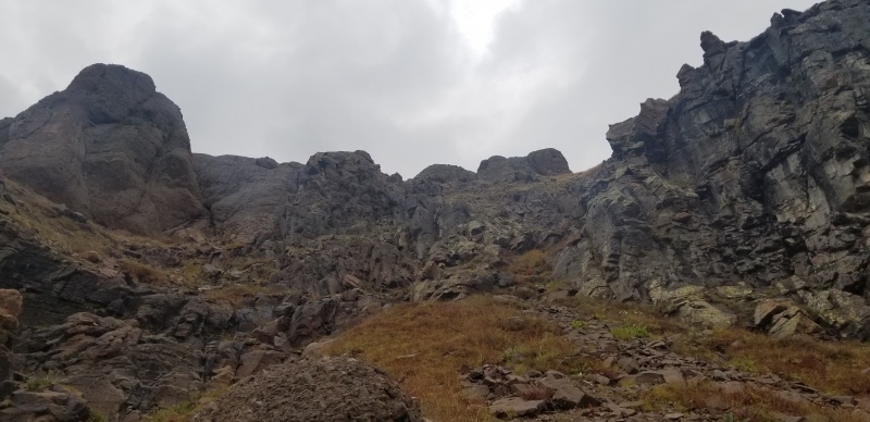
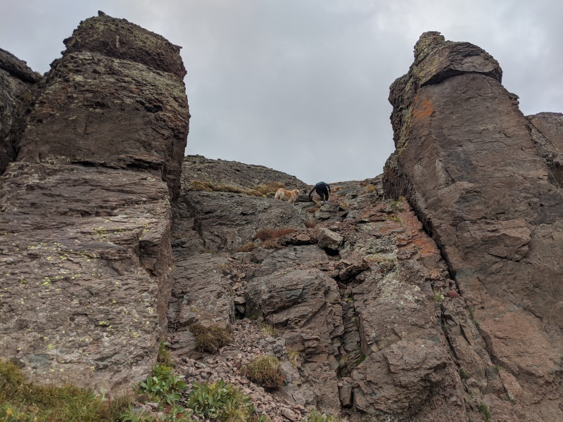
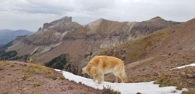
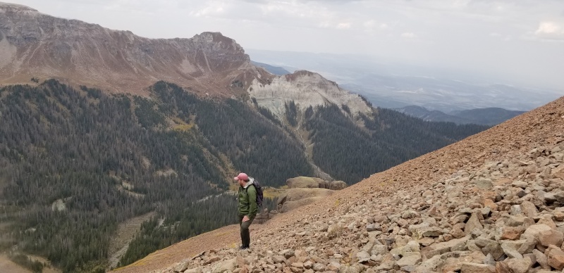
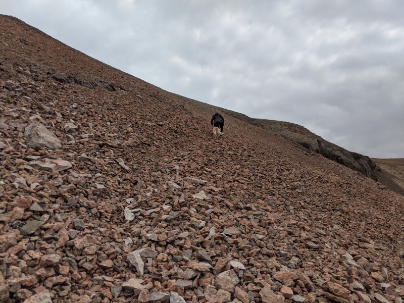
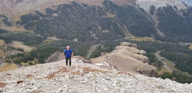
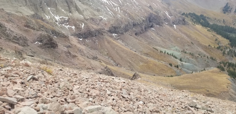
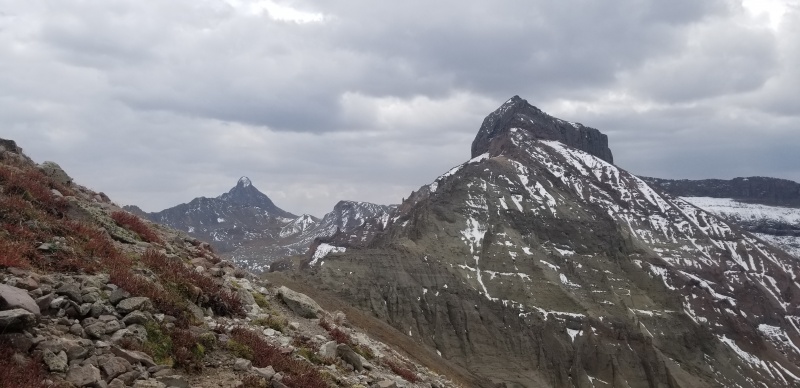
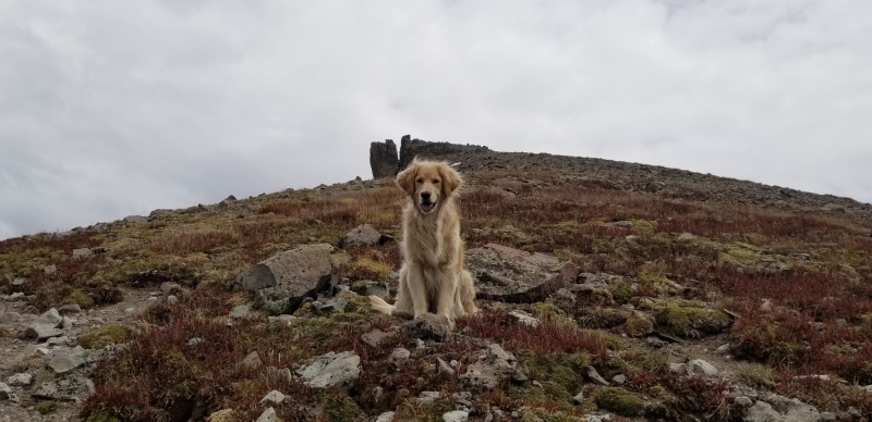
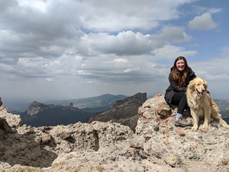
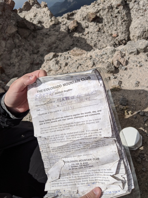
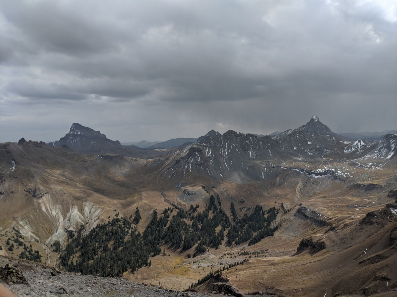
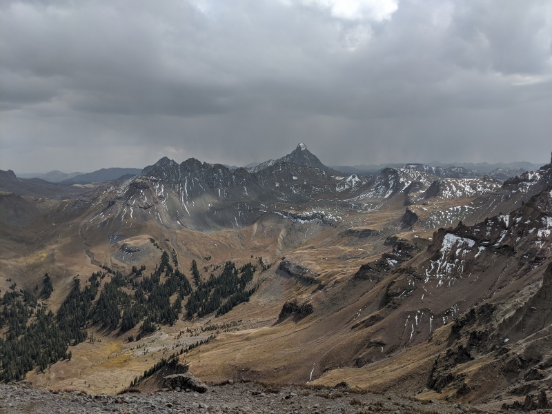
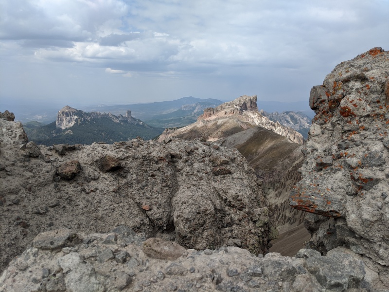
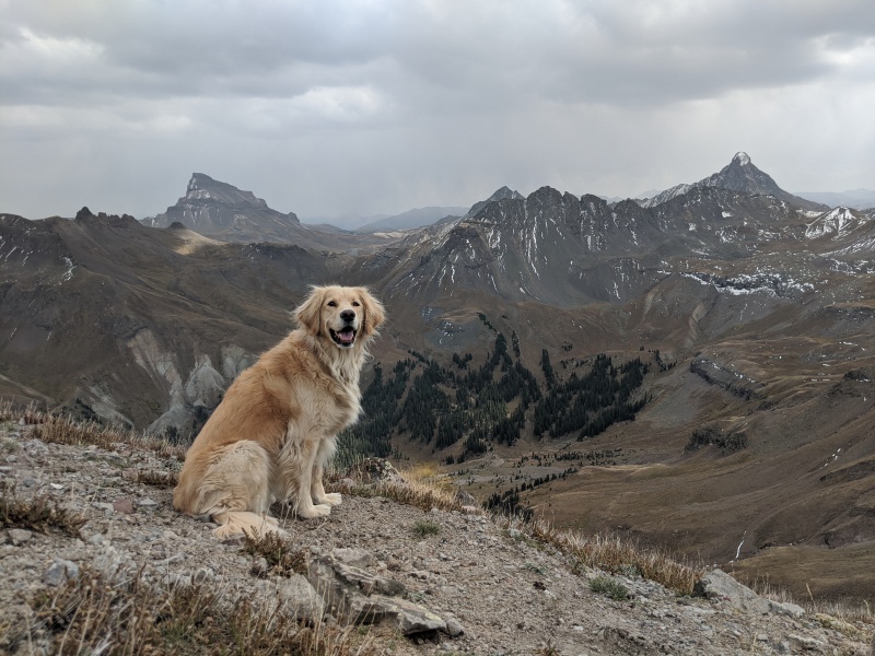
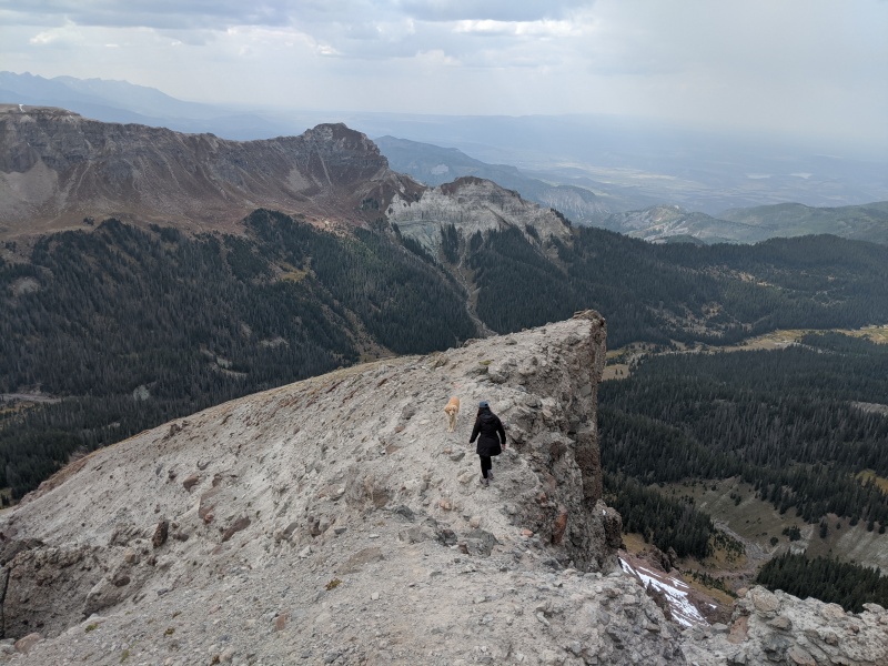
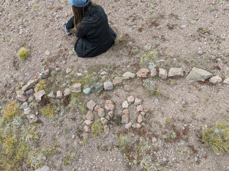
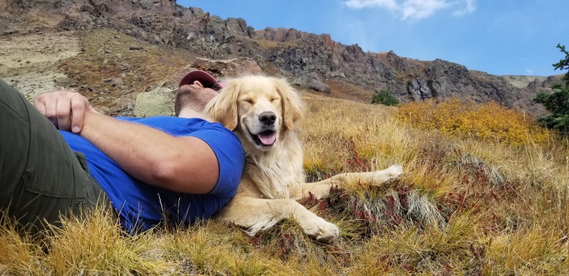
My Precipice report started out this way, so it's only fitting. This place is gorgeous year-round and the dog is never-changing. This is the large field between the creek crossing and the 4wd trailhead.The trailhead for Wetterhorn Basin. There is a register here that you should be sure to sign before recreating in this rugged area.After about 1.2 miles of walking on the really good, pretty flat, Wetterhorn Basin Trail you'll reach this sign. The next drainage to the left is the one you'll be taking up for this route.And then, when you get to this drainage, you'll likely have a momentary heart attack as you look up at the glorious crap that lies ahead before you can reach the summit. First up, the avalanche debris, followed by the rock chute, then the cliff bands, then the scree fest. We really love what we do!"What, like this is hard?"This is the rock gully that you'll enter to the left of the avalanche debris before the end of that drainage. It's somewhat flat to this point (but annoying, considering you have about 75 trees to jump over to get here) and this is where the true difficulties begin. We opted to walk up the drainage a bit before hopping off to the left on the grassy but steep slopes before joining the drainage again briefly to finally cross above the trees you see in the center of the photo above. Above this patch of trees is what you are aiming for. This will lead you to the bottom of the cliff bands.Looking down the suckage. If you've done Precipice or Redcliff you know this stuff already. It's loose dirt filled with deceiving rocks that crumble just as you think you have a foothold. All three of us rained rocks and dirt at least four times, and this is why I'd recommend a helmet on this one especially if you are hiking with others. The good news is that the gully is relatively short and you can jump on grass intermittently for a break.Kyle as we started heading back to the right to pass above the tree patch."I know the way!"Thankful that is not the way. This is such a geologically interesting part of the state.A few scattered gentians were the only wildflowers left.Redcliff's uninviting north side was our constant companion for this route. We looked at him almost the whole time.Once you get out of the rock gully and onto the grassy slope above the tree patch, this is your view of the first cliff band. Here, I think we deviated from Climb13ers route and just went up the way that looked easiest to us. The break we took is the grassy one just right of center. It was easy climbing up.A closer look at the break we took in the first cliff band. Easy peasy.The second cliff band is shorter, but the break we chose had a lot more loose rock. We took turns going up and all three of us sent down some pretty big rocks. Harper never needed a leg up, so I'd just call this class 3-.Kyle coming out of the steep exit to the second cliff band.Harper playing in the fresh snow with Precipice in the back. We took a little break at the top of the cliffs, knowing that the "tricky" part was over but that we still had tedium ahead.Our lunch spot is on the bench to the right of Kyle. You can't go ridge proper from here, but to our surprise there was something that resembled a trail on the red rocks that skirt the first hump. We followed that for a bit before it ended, then went straight up to meet the ridge to the summit. Loose rock the whole way.Hunched over the "trail" because it is just that steep!After we regained ridge proper, the rest of the way was pretty obvious.Side note: I'm including this photo because this is the way Furthermore came. If you look closely you can see a little trail leading out from the end of the grassy slope nearest me. It may just be a goat trail. It may go for humans. Who knows. We were never able to get a good look at the crossover from that point to the point we were at, which is where all routes lead to for the summit. This is in part why we decided to just go down the way we came instead of finding his route.More Redcliff, with imposing Wetterhorn now in view too.Harper patiently waiting on her humans to catch up so she can make the summit. It gets a little interesting again from here that's not obvious from this picture.You might have an "oh sh!t" moment when you get closer to the summit but fear not, this point that at first looks higher than everything else is in fact NOT the summit which is a good thing because I think you'd need a pole vault to get over there.Victory at last! Four year goal peak completed with our first ever 13er behind us! Worth mentioning also is that Courthouse was my first Colorado mountain at 9 years old. My family has been vising the Cimarrons for decades, and on one of those trips my dad took me and my cousin up and the two of us allegedly wore flip flops the whole way. I think my choice of hiking footwear has changed somewhat since then.Lots of cool names on this register and only about five pages filled out since 2010. I always feel weird signing my name next to the likes of the Kirks and Derek Wolfe.The views from the summit were incredible. Here, we have Uncompahgre to Wetterhorn with Heisshorn providing me some nightmare fuel in the middle.More Wetterhorn, with my target peaks of UN 13,377 and "Cox Beak" for my next Cimarron trip.Beautiful Precipice in the sunshine from the summit, with guest stars Courthouse and Chimney.My joyful and proud little golden girl in her happy place. She's done Uncompahgre twice and Wetterhorn once. Fortress marked her 94th unique ranked 13k+ summit.There's a narrow but solid and short crossing point that leads up to the ridge to the final 50 feet or so to the summit that's worth mentioning. On the right is a steep drop off. On the left is a rock chute. We didn't see it as much of a problem.This was interesting. Back on the lower ridge right above the cliff bands I took a short break to wait for Kyle to catch up. I don't usually think of myself as an oblivious hiker but I have some self-reflection to do as just before I sat down I noticed this rock sign that someone had left that we completely missed on the way up and that I nearly missed on the way down. It points out to where Furthermore's route would be, and the best I can guess is that maybe that route just no longer "goes." It wouldn't surprise me at all, as the phrase "geologic time is now" probably applies better in this area than in most others of the state with the prevalent loose sandstone rock that changes with each hiker and goat that passes over. If anyone on this site wants to chime in on this, I'd be really interested in hearing a story.On the way down we missed our exit point for the cliff bands and had to retrace our steps a little. Not a bad mishap, but pay attention. Kyle wanted to try a new gully but I wasn't hearing it. The way we came up did just fine and after the eerie "NO" sign I was a little wary of unknown paths on this mountain.Harper is happy to play pillow for a mid-descent break!
We made the rest of the way down without incident aside from seeing some VERY fresh bear scat in the avalanche debris close to the rejoining of the trail. Our total time for this short but strenuous and tedious hike was about 7 hours but take that with several grains of salt as: 1) we are slow movers 2) we don't even try to move fast and 3) we take lots of breaks. The weather was off and on cloudy, snowy, and sunny but the entire route was dry and the snow never stayed for more than a few minutes. In all, it was another great day to be in the Cimarrons!
My GPS Tracks on Google Maps (made from a .GPX file upload):
I did manage to find his route 3 years ago, but was coming from back Redcliff so I approached it from the high meadows. In all honesty I don't think your route looks any better or worse than his - just different. That Cimarron choss is some "fun" stuff!
I made my first couple trips to the area this year for Precipice, Redcliff, and Heisshorn. It's a great area with unique geology and huge views. You'll probably want to leave the pup at home for Heisshorn ;)
Caution: The information contained in this report may not be accurate and should not be the only resource used in preparation for your climb. Failure to have the necessary experience, physical conditioning, supplies or equipment can result in injury or death. 14ers.com and the author(s) of this report provide no warranties, either express or implied, that the information provided is accurate or reliable. By using the information provided, you agree to indemnify and hold harmless 14ers.com and the report author(s) with respect to any claims and demands against them, including any attorney fees and expenses. Please read the 14ers.com Safety and Disclaimer pages for more information.
Please respect private property: 14ers.com supports the rights of private landowners to determine how and by whom their land will be used. In Colorado, it is your responsibility to determine if land is private and to obtain the appropriate permission before entering the property.


")
")
")
")
")
")
")
")
")
")
")
")
")
")
")
")
")
")
")
")
")
")
")
")
")
")
")
")
")
")
")
")
")
")
")