Download Agreement, Release, and Acknowledgement of Risk:
You (the person requesting this file download) fully understand mountain climbing ("Activity") involves risks and dangers of serious bodily injury, including permanent disability, paralysis, and death ("Risks") and you fully accept and assume all such risks and all responsibility for losses, costs, and damages you incur as a result of your participation in this Activity.
You acknowledge that information in the file you have chosen to download may not be accurate and may contain errors. You agree to assume all risks when using this information and agree to release and discharge 14ers.com, 14ers Inc. and the author(s) of such information (collectively, the "Released Parties").
You hereby discharge the Released Parties from all damages, actions, claims and liabilities of any nature, specifically including, but not limited to, damages, actions, claims and liabilities arising from or related to the negligence of the Released Parties. You further agree to indemnify, hold harmless and defend 14ers.com, 14ers Inc. and each of the other Released Parties from and against any loss, damage, liability and expense, including costs and attorney fees, incurred by 14ers.com, 14ers Inc. or any of the other Released Parties as a result of you using information provided on the 14ers.com or 14ers Inc. websites.
You have read this agreement, fully understand its terms and intend it to be a complete and unconditional release of all liability to the greatest extent allowed by law and agree that if any portion of this agreement is held to be invalid the balance, notwithstanding, shall continue in full force and effect.
By clicking "OK" you agree to these terms. If you DO NOT agree, click "Cancel"...
After our two-week trip to the San Juan Mountains in August, Randy had two of Colorado's bicentennial (200 highest) peaks left: "Magdalene Mountain" (13,762') in the Sawatch and Mt. Powell (13,580') in the Gore Range. Randy decided that Mt. Powell would be a better finisher, and I have to agree.
Thursday, Aug. 27, 2020. Randy and I drove up the washboard County Road 390 to Rockdale, where we turned and drove past a parked ramp truck to the Clear Creek crossing. The steep climb out of the creek is the crux of 4WD road to Clohesy Lake. About a mile up the road, someone's vehicle was getting an expensive tow down the road, and the reason for the ramp truck at Rockdale became apparent.
We set up our tent about 1/4 mile before the end of the road. Avalanche debris soon blocks the road, so there's no point in trying to continue farther. Tomorrow's weather forecast wasn't good (60% chance of afternoon rain), and we hoped the rain would wait until we were off Magdalene Mountain.
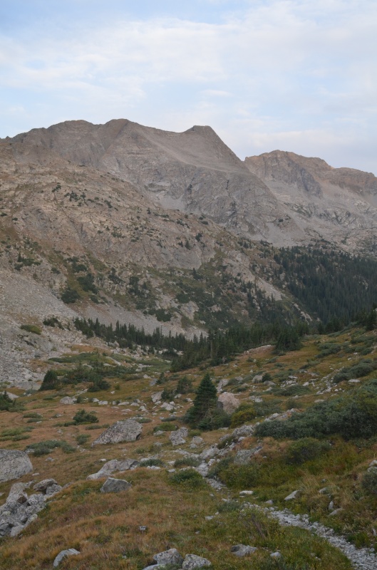
Friday, Aug. 28, 2020. We followed the trail south past Clohesy Lake and managed to lose the trail in the dark. Back on the trail again, we continued over the pass between "Pear Peak" (13,462') and Emerald Peak (13,904') to Pear Lake, where the trail ends.
Looking southwest at Pear Peak from the trail to the Pear Peak - Emerald Peak pass
Looking northeast at Emerald Peak as we neared the Pear Peak - Emerald Peak pass
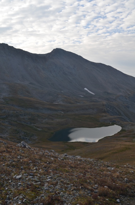
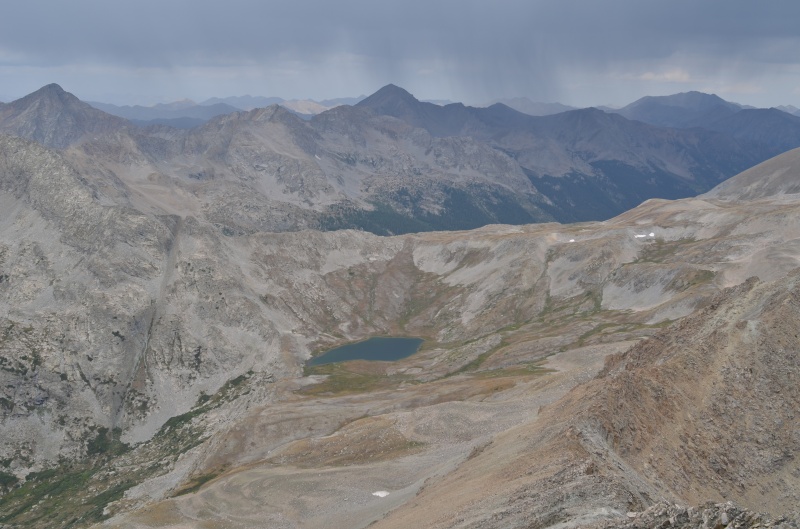
Magdalene Mtn. and Pear Lake from near the Pear Peak - Emerald Peak pass
As we descended on the trail to Pear Lake, we could see someone packing up a tent near the lake. By the time we reached the north side of Pear Lake, that person was gone. We contoured SSE toward Magdalene Peak and then climbed ESE toward Magdalene's western summit.
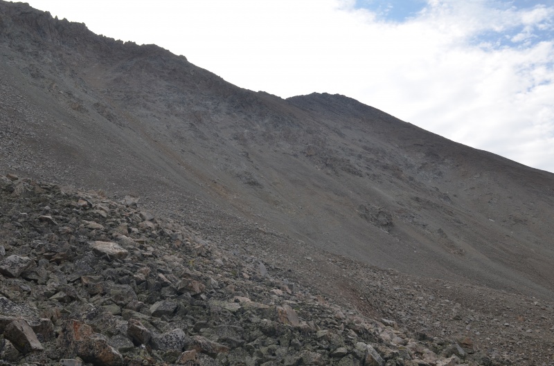
Lots of tedious scree awaited us on the way toward Magdalene Mountain's 13700' western summit
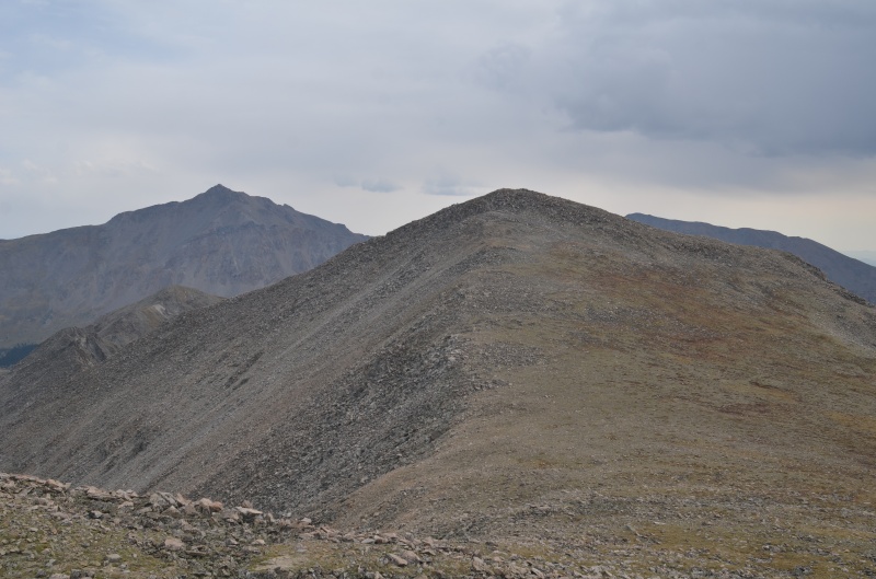
From Magdalene's western summit, the true summit is an easy stroll. Mt. Harvard is in the distance to the left of Magdalene Mtn.
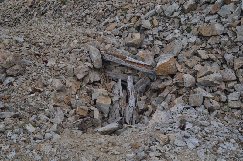
A prospect not too far from the Magdalene's summit
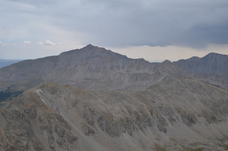
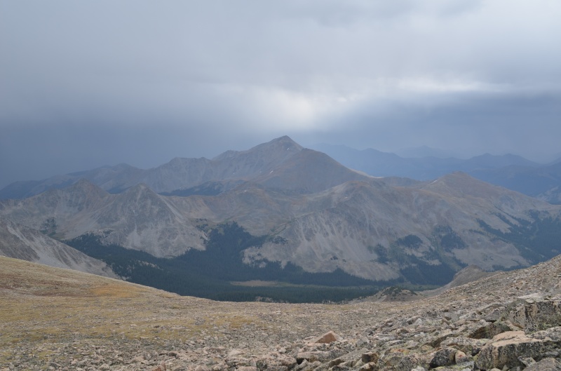
Mt. Harvard from the summit of Magdalene Mtn., with unfriendly clouds nearby
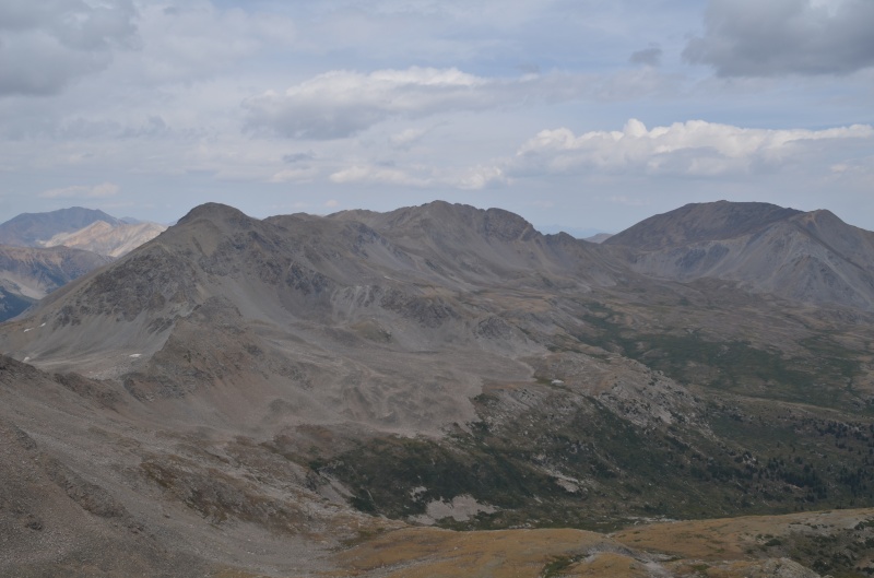
Looking north from the summit of Magdalene Mtn. toward Emerald Peak, Iowa Peak, and Missouri Mountain
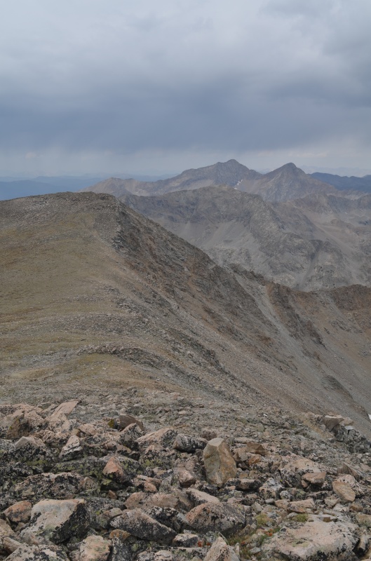
Looking west from the summit of Magdalene Mtn., with its western summit at left
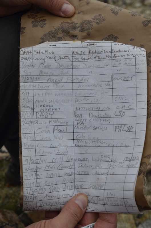
In 1994, the peak was known as "Silver King Peak." The register's still in good condition.
Even though though a CMC register has been on the summit for close to 30 years, someone also left a makeshift register. We signed both.
Looking NW toward Pear Lake from Magdalene's western summit, with unfriendly clouds in the distance
Another view from Magdalene's western summit. Yes, that looks like the 60% chance of rain in today's weather forecast
Given the clouds in all directions, we hustled back to Pear Lake. Rain began before we reached the lake, but it felt good for Randy to reach 201/202 bicentennial peaks. (A five-way tie for no. 198 results in 202 bicentennial peaks, not 200.)
We returned to our campsite, packed up, and drove past Vail for an attempt on Mt. Powell tomorrow from the Piney Lake trailhead. The weather forecast was less than ideal: a 40% chance of rain in the morning and 80% chance of afternoon rain/thunderstorms.
Saturday, Aug. 29, 2020. We got an early start in an attempt to stay ahead of the afternoon rain, figuring we wouldn't care if the rain began as we descended from Mt. Powell. Unfortunately, steady rain began about 6:30 AM, and about 200' below Kneeknocker Pass we decided to call off today's climb. A finisher peak should be fun, not a slog in the rain, so we decided to return over Labor Day weekend when the weather would be better. Mt. Powell won't be going anywhere, right?
Thumbnails for uploaded photos (click to open slideshow):
Just collecting data on that creek crossing here... what kind of car do you drive? I'm starting to get the vibe that the exit after the crossing is a little overhyped and most likely doable for stock high-clearance.
Patrick: We drove Randy's stock 3rd-generation 4Runner. The exit from the creek crossing definitely had gotten a lot worse since I was there in Sept. 2016, but on 8/30/2020 someone smoothed out the road with a bunch of rock and made it a lot more drivable.
Caution: The information contained in this report may not be accurate and should not be the only resource used in preparation for your climb. Failure to have the necessary experience, physical conditioning, supplies or equipment can result in injury or death. 14ers.com and the author(s) of this report provide no warranties, either express or implied, that the information provided is accurate or reliable. By using the information provided, you agree to indemnify and hold harmless 14ers.com and the report author(s) with respect to any claims and demands against them, including any attorney fees and expenses. Please read the 14ers.com Safety and Disclaimer pages for more information.
Please respect private property: 14ers.com supports the rights of private landowners to determine how and by whom their land will be used. In Colorado, it is your responsibility to determine if land is private and to obtain the appropriate permission before entering the property.

")
")
")
")
")
")
")
")
")
")
")
")


