Download Agreement, Release, and Acknowledgement of Risk:
You (the person requesting this file download) fully understand mountain climbing ("Activity") involves risks and dangers of serious bodily injury, including permanent disability, paralysis, and death ("Risks") and you fully accept and assume all such risks and all responsibility for losses, costs, and damages you incur as a result of your participation in this Activity.
You acknowledge that information in the file you have chosen to download may not be accurate and may contain errors. You agree to assume all risks when using this information and agree to release and discharge 14ers.com, 14ers Inc. and the author(s) of such information (collectively, the "Released Parties").
You hereby discharge the Released Parties from all damages, actions, claims and liabilities of any nature, specifically including, but not limited to, damages, actions, claims and liabilities arising from or related to the negligence of the Released Parties. You further agree to indemnify, hold harmless and defend 14ers.com, 14ers Inc. and each of the other Released Parties from and against any loss, damage, liability and expense, including costs and attorney fees, incurred by 14ers.com, 14ers Inc. or any of the other Released Parties as a result of you using information provided on the 14ers.com or 14ers Inc. websites.
You have read this agreement, fully understand its terms and intend it to be a complete and unconditional release of all liability to the greatest extent allowed by law and agree that if any portion of this agreement is held to be invalid the balance, notwithstanding, shall continue in full force and effect.
By clicking "OK" you agree to these terms. If you DO NOT agree, click "Cancel"...
I decided to hit Jupiter, Grizzly C and McCauley from the south. I considered a shorter approach from the scenic Lime Mesa, but chose the more customary Endlich Mesa approach because of the established trail. En route to Durango City Reservoir, I deviated from the trail to ascend the 12ers to the right, terminating in the aesthetic Sheridan Mountain (12,795). The USGS map shows a trail on the near side of Sheridan, but on my descent from the summit, all I found were annoying game trails that contoured the north slopes. After wasting 40 minutes, I contoured back to the main trail for the descent to the lake.
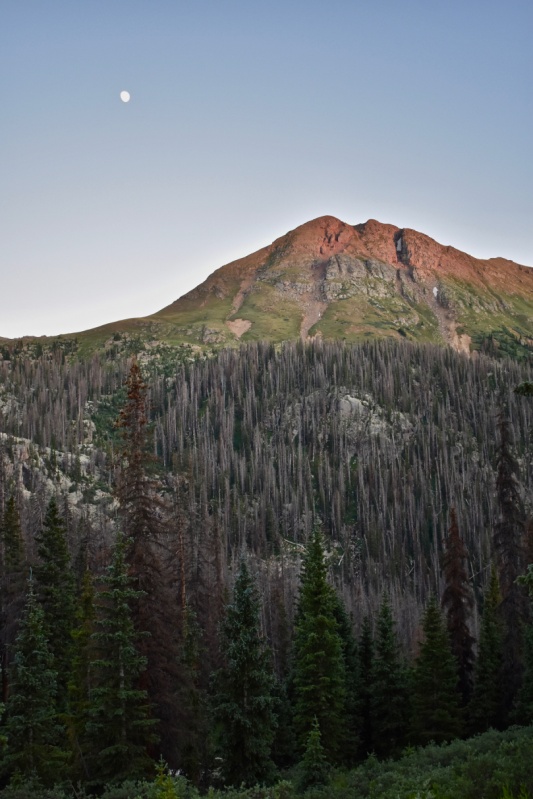
Rising moon and setting sun on Sheridan Mountain.
Camping is not allowed by the lake, so I continued around it and on the trail that leads to Lake Marie and also up to Silver Mesa. I didn't take the turn to Lake Marie but continued up the Silver Mesa trail. I camped on a broad grassy shelf - either the one below the 11,600 contour or above, not sure - but a camp by Lake Marie would have been prettier.
I was tired from my 12 hour work day on Friday and the drive and slog from Denver on Saturday, so I slept in and didn't hit the trail until 6:30. The trail up Silver Mesa went well. The southern end is dotted with some ponds and the whole of the mesa is interspersed with rock slabs and outcrops. The trail that is so strong up to the mesa and then along the largest pond suddenly vanished in some boggy grass and I followed cairns and posts from that point on. The cairns and posts are separate systems, but intersect in several places. Generally, the posts stick closer to the eastern edge of the mesa.
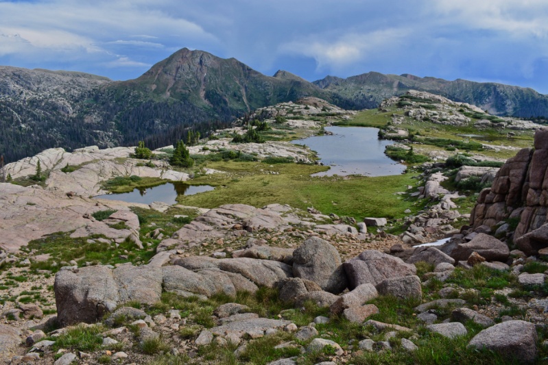
Southern end of Silver Mesa, with Sheridan in the background (taken on descent in afternoon).
The romp across the mesa made me think of Scotland or northern England, and then I found myself at Trimble pass, where the north wind, which had been calm to this point, greeted me with a steady blast. The excellent trail makes an efficient high traverse of the basin and at one point I walked an avenue of wildflowers. I followed the trail to Columbine Pass, just to look down into Chicago Basin, where I'd been 11 years ago, before turning my attention to getting over to 12,800' high pass between Columbine Lake and Hazel Lake. I had originally thought to tag the summit of unranked Hope Mtn from there, but skipped it because the morning sky did not look as clear as the forecast.
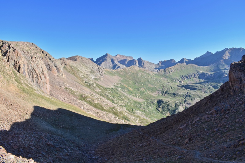
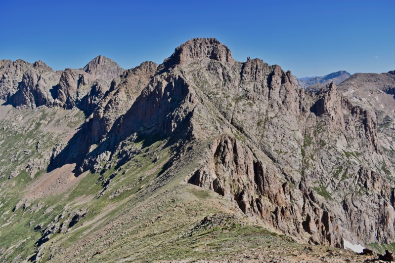
The view from Trimble Pass. Eolus center, Sunlight, Windom and Jupiter at right.
I traversed above the north shore of Hazel lake and then made an ascending traverse to the saddle between Grizzly C and McCauley. The route up McCauley was nothing more than a walk, while the way up Grizzly from the saddle appeared much more formidable.
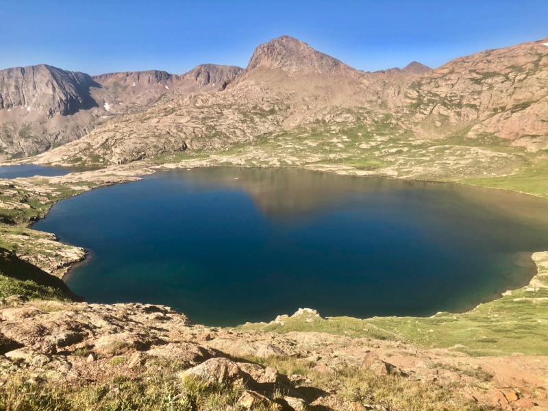
Hazel lake and unranked Hope Mountain from the shore beneath McCauley's west face.
Grizzly C (with Windom in background) from the Grizzly-McCauley saddle.
Having read Derek's and Natalie's reports (Furthermore, Snowalien) earlier enabled me to make quick work of the route finding to reach the summit pitch for Grizzly. In short, the ridge goes until it makes sense to traverse beneath it on the right. I walked the entirety of the generous ledge beneath the squarish summit block that is a morass of slabs and pinnacles, looking for what seemed like class 4 terrain. Then I walked around the SE corner. The edge of this corner sports an airy upswept slab, but as I moved along beneath and past that, I was surprised to find easy class 3 terrain leading upward. I took that route to the summit. This was my main reason for writing this report: to let people know that Grizzly C goes at class 3 from both sides.
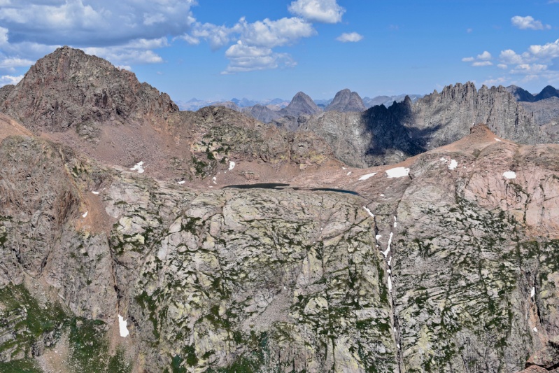
View N from Grizzly C. Windom dominates left, while Arrow and Vestal show their butts at center and Jagged suits its name at right.
The descent of Grizzly's north side went easily and I traversed high beneath Jupiter. I climbed a convenient gully north of point 13155 to gain the ridge, and followed the well-cairned route up to Jupiter's summit. The skies had darkened and I determined that a continuation to Aztec and then Valois would not be in the cards.
I enjoyed a snack and chatting with kmikwilliams on the summit, and then I hurried down the ridge toward Columbine Pass. At some point subsequent to the small saddle SW of point 13155, the ridge does not provide great passage, and so I'd have been better off simply dropping down to the trail from the saddle. I was halfway up the climb to Trimble pass when the wind picked up again and it began graupeling. The adverse conditions motivated me along the mesa and quickly these winds of change brought a return to sunny weather. I unlaced my shoes and soaked my feet in the large pond by the trail, opting for a quick rest in the sun over any notion of heading back up the trail for Aztec. I value efficiency in my peakbagging exploits, since time is at a premium, but I wouldn't mind a return to the southern Weminuche.
I walked down the trail to my tent, hungry for dinner and excited for the next day's itnerary of the Amherst group.
Thumbnails for uploaded photos (click to open slideshow):
Great info and report, thanks!! Planning to climb some of these summer 2024
Caution: The information contained in this report may not be accurate and should not be the only resource used in preparation for your climb. Failure to have the necessary experience, physical conditioning, supplies or equipment can result in injury or death. 14ers.com and the author(s) of this report provide no warranties, either express or implied, that the information provided is accurate or reliable. By using the information provided, you agree to indemnify and hold harmless 14ers.com and the report author(s) with respect to any claims and demands against them, including any attorney fees and expenses. Please read the 14ers.com Safety and Disclaimer pages for more information.
Please respect private property: 14ers.com supports the rights of private landowners to determine how and by whom their land will be used. In Colorado, it is your responsibility to determine if land is private and to obtain the appropriate permission before entering the property.
")
")
")
")
")
")


