| Report Type | Full |
| Peak(s) |
Mt. Hope - 13,939 feet Quail Mountain - 13,465 feet |
| Date Posted | 08/29/2020 |
| Date Climbed | 08/22/2020 |
| Author | madmattd |
| Hope and Quail from the East |
|---|
|
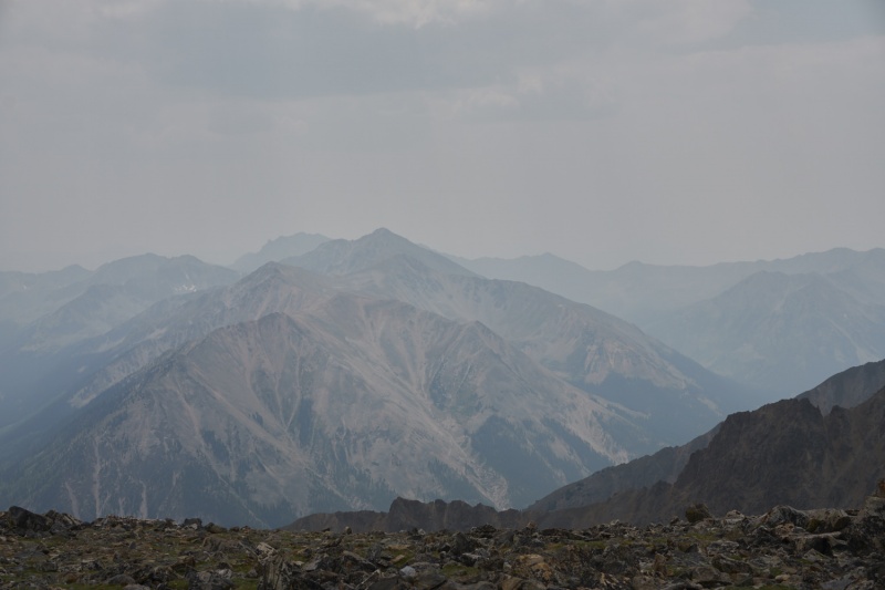
I write this mainly as potential beta for future hikers. I'm sure we are not the first to hike these peaks from this direction, but we found no information about it before we headed out. As it turns out, this is a solid way to access both of these peaks, and as the entire hike is above treeline, the views should be great on a normal day (it was so smoky that Elbert and Belford/Oxford/etc were only barely visible much of the day). The standard route to Centennial Mount Hope is from Sheep Gulch, and Tri-Centennial Quail Mountain is a common (enough) add-on. Word on the street is the hike is a pretty stout one, and certainly the ~5000ft of gain in 8-9mi backs that up as a solid day. Certainly doable, but a good day nonetheless. Somewhere along the line, we realized there is a 4WD road to the East that climbs up to 12,500'; this road is known in the 4WD community, though how popular I don't know, as it was pretty quiet on this day but that might have been due to all the smoke. Take a look for Lost Canyon Road (FR398), it heads up past the active Columbine Mine. Again, with limited beta we didn't know what we would find, but a stock Tacoma had no issues on this road. I'll quote from my peak conditions report here "Mild 2WD road to the upper switchbacks (~11,000ft, ~3mi from the end of the road), a little clearance would help in a few mild spots but otherwise in very good shape (14ers.com 1.5 road difficulty). Not really any public parking in this area. Above there, 4WD and clearance recommended, though I think a solid driver could get an Outback/Forester type vehicle up there with care (I would place this as a 3.5 road difficulty). No issues in a stock Tacoma, we did air down a little just to smooth out some bumps up high but not entirely necessary. There's room for 5-6 vehicles at the end of the road at 12,500' where there are signs stating no vehicular traffic beyond (foot/bike/etc all good)." Yes I put x.5 ratings on the road, sue me. The road doesn't end, doesn't have a gate either, but there are signs where we parked stating the road beyond was closed to non-administrative motorized traffic (probably has to do with a couple radio towers on a nearby point). So we parked and set off on foot up the road which goes all the way to the top of Pt. 13,130' where it ends at a couple radio towers. You have a nice view of what looks like an easy ridge to Quail Mountain from here: 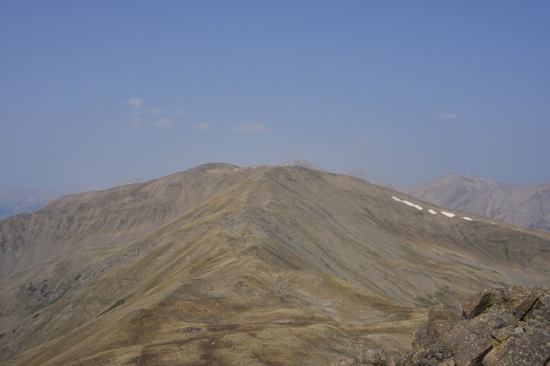
This point doesn't miss out on being a ranked 13er by much; there's a steep and rocky descent to a col around 12,850'. From there it is indeed a nice cruise up to Quail Mountain; old use trails run much of the way and there's some old mining debris in the 13,130-Quail col. Other than the simple last ~50' ascent, the route is tundra and nice walking: 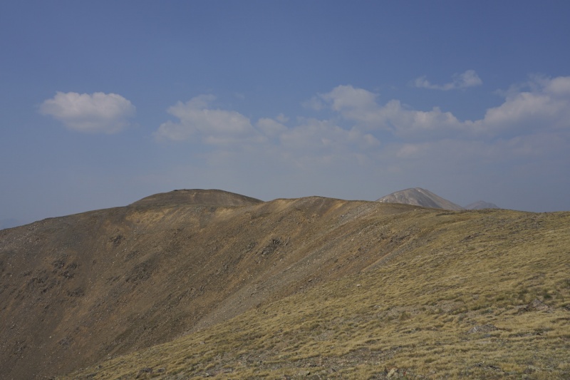
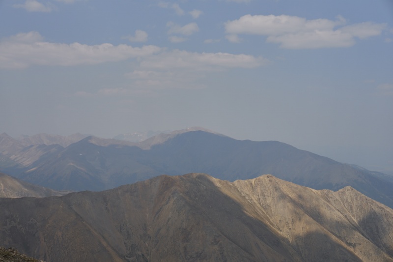
From Quail to Hope and back we took more or less the standard route. It's a steep and at times rather loose descent off Quail to Hope Pass, definitely not a fan favorite, especially for me since I had forgotten my trekking poles at home. Reaching Hope Pass the weather seemed to be holding (we were keeping eyes on the clouds as it was around 11:30 owing to a late start, but NOAA was only calling for an 8% chance of rain), so up Hope we went. Somewhere partway up we both started to feel some affects from the smoke, but the ascent itself was actually pretty fun. We managed to find solid rock most of the way, and we stuck closer to the ridge in the center part and avoided the gullies. The whole ascent went just fine at the 2+ rating, we skirted the top of Hopeful Couloir, and then we were at the top. 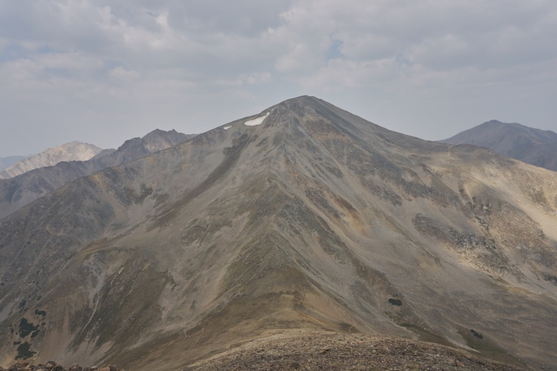
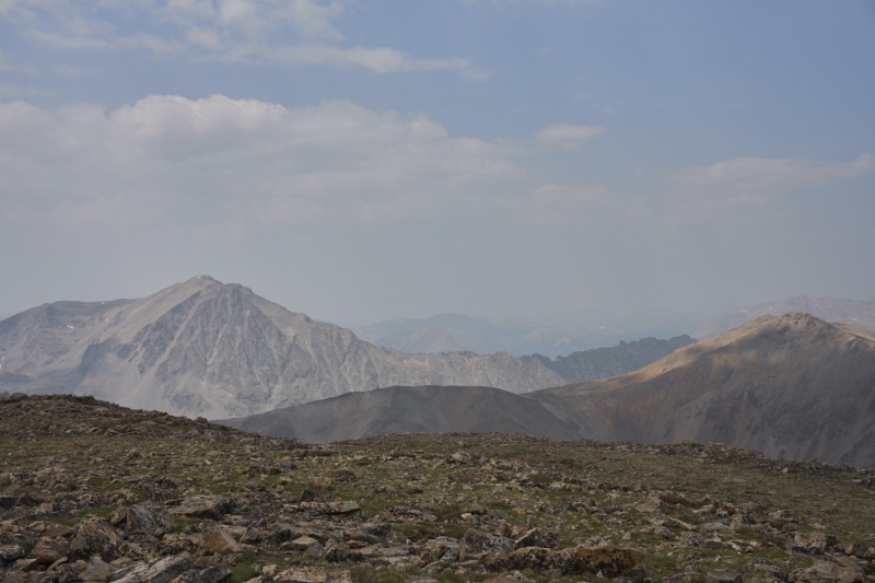
The descent back to Hope Pass took close to an hour (versus the 1:15 up), mostly owing to my slowness heading down, but we followed pretty much our same line until near Hope Pass where we found a use trail that skirts the first knob out of the pass and thus avoids the minor scrambling along the ridge there that we did on the way up. Somewhere during our descent of Hope the skies started to clear and we actually had a solid dose of sun and blue skies for a while, plus visibility of neighboring peaks drastically improved. Re-climbing Quail from the pass was as unpleasant as the descent, but we got it done, and then enjoyed the nice trek back toward 13,130'. We did skirt around the South side of this point on tundra slopes, thus avoiding the steep rocky reclimb (and also the last ~100' of ascent for what that's worth). 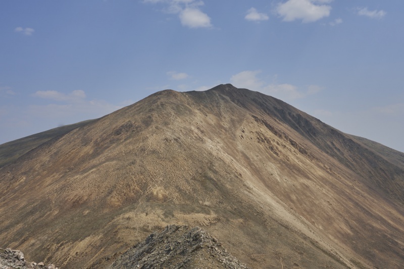
All in all we both agreed this was a terrific way to climb these peaks if you have a good weather window (again, we started the hike well above treeline and never neared a single tree). It was also a quiet way. We saw a couple people near both summits, but there was plenty of traffic through Hope Pass (most of which we only encountered from afar), and we had both summits to ourselves for the duration of our stays. There was one other truck (an older Tundra full cab) at the "parking lot" when we returned, but we never encountered anyone East of Quail Mountain's summit. This route also chops this hike down to roughly 8mi and 3825' of elevation gain, with the single largest climb being Hope from Hope Pass. You're going up and down at/near 13,000' all day this way! 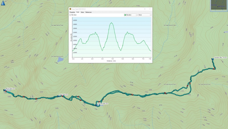
Thumbnails for uploaded photos (click to open slideshow): ")
")
")
")
")
")
")
")
|
| Comments or Questions |
|---|
|
|
Caution: The information contained in this report may not be accurate and should not be the only resource used in preparation for your climb. Failure to have the necessary experience, physical conditioning, supplies or equipment can result in injury or death. 14ers.com and the author(s) of this report provide no warranties, either express or implied, that the information provided is accurate or reliable. By using the information provided, you agree to indemnify and hold harmless 14ers.com and the report author(s) with respect to any claims and demands against them, including any attorney fees and expenses. Please read the 14ers.com Safety and Disclaimer pages for more information.
Please respect private property: 14ers.com supports the rights of private landowners to determine how and by whom their land will be used. In Colorado, it is your responsibility to determine if land is private and to obtain the appropriate permission before entering the property.


