| Report Type | Full |
| Peak(s) |
Ice Mountain - 13,960 feet North Apostle - 13,869 feet Emerald Peak - 13,916 feet |
| Date Posted | 08/26/2020 |
| Date Climbed | 08/19/2020 |
| Author | PeakSixTD |
| Apostle traverse with a twist |
|---|
|
On 8/18/2020 I had to be in Chaffee county on business, so naturally I decided to capitalize on the opportunity by squeezing in a climbing trip! Certainly didn't hurt that my birthday was the next day either. No better way to spend my 26th than bagging some centennials! After I was all finished with my obligations for the day, I made the short drive to the 390 road. I managed to find a wonderful campsite with a fantastic view about a mile before the turnoff on the 390B road. I was sure to give myself enough daylight to be able to sit and relax out in the wilderness for a while before retreating to my tent for the night. After all, isn't that the best part of climbing these peaks? The forecast called for 40% storms by noon, so I figured a 5am start would be sufficient enough. The next morning I made the short drive to the upper Lake Ann trailhead and saw a few hikers preparing for the day ahead. I figured we wouldn't be going for the same objectives and that I would likely be alone for the duration of my trek. I was correct in that assessment. Back in May I summited Ice Mountain via Refrigerator Couloir, so I was very familiar with the route through the forest to Apostle basin. During that trip, I had made the decision not to go for North Apostle due to mushy snow near the summit of Ice. I had heard many great things about the Apostle traverse so i had no opposition to coming back to this beautiful area again! I found myself at the summit of my first objective for the day before i knew it. It was an enjoyable but rather uneventful ascent to this point. On to Ice! The route to Ice looks much more intimidating from North Apostle than it does when your nose to nose with it. Funny how that works! 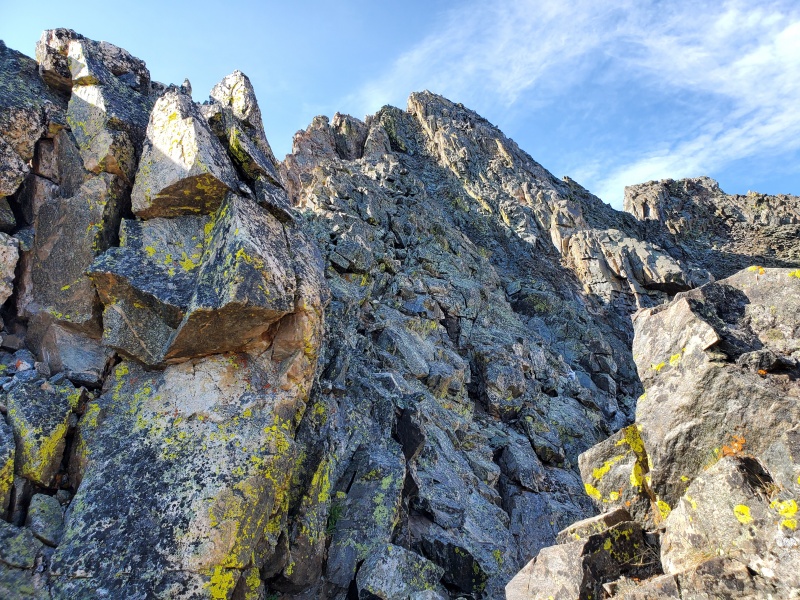
I was moving so quickly that i ended up deviating from the standard line at the crux. I realized my mistake, but decided to check out the options in front of me anyways. I like to spice things up when i can! 
Nothing looked overly precarious, so i chose a good line and stemmed my way up this chimney. Fun moves! 
Once above this pitch, i had a narrow ridge traverse to get back onto the standard line. Highly enjoyable climbing here. A couple more moves and i was on the summit of Ice, for the second time in 4 months! 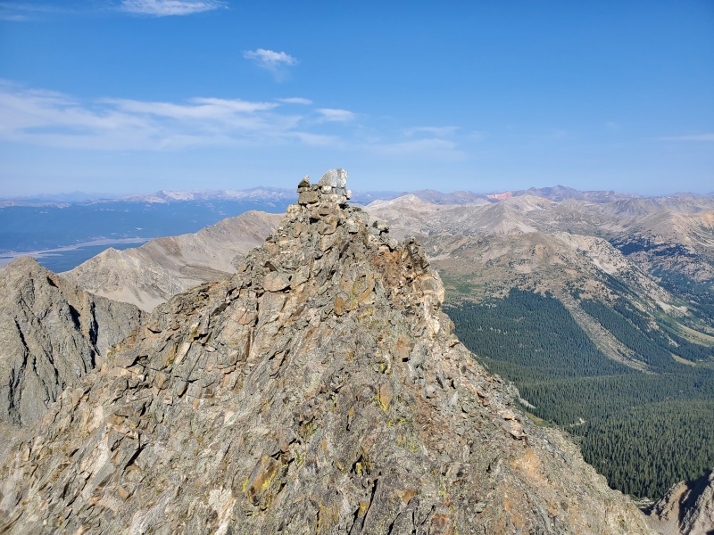
I opted against taking the standard deviation down the SW slopes of Ice over to West Apostle. Instead I decided to stay directly on the highly exposed west ridge of Ice. The fridge was still holding snow at the top, so I had to find a way around the deep notch between Ice Mountain and this gnarly looking tower that I was intent on summiting. Had to drop about 100 feet on the south side of the mountain to find a nice bypass. 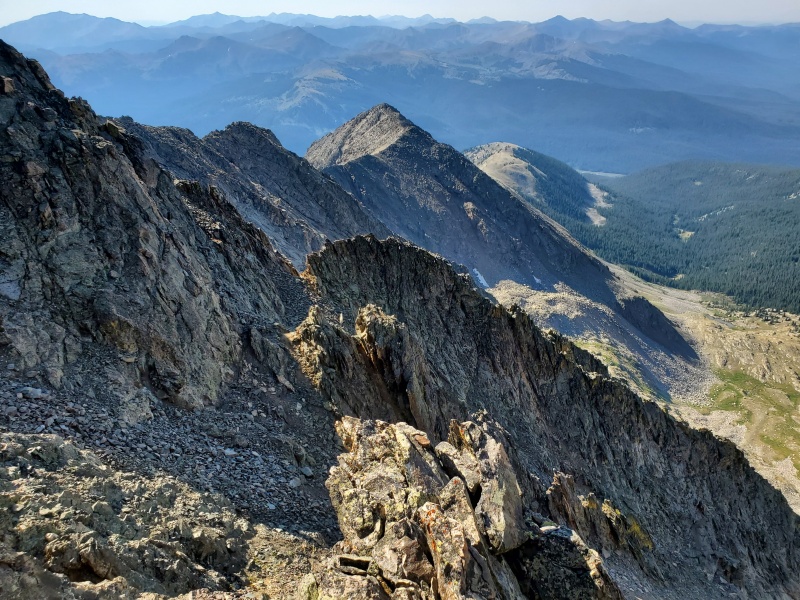 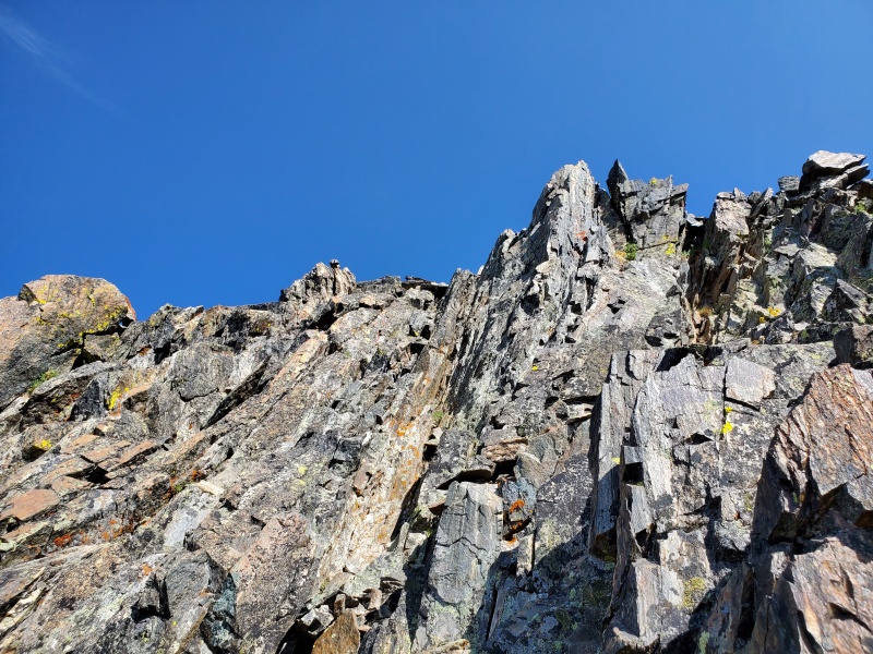
I turned the corner to check out some cliffs and lo and behold! A wonderfully solid cliff system that enabled me to gain the ridge right where I was wanting too. Finding this sweet line was a nice little victory for me. Up up and away I go! Now for the spicy stuff. 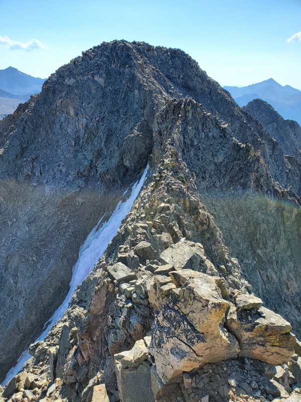
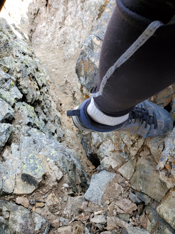
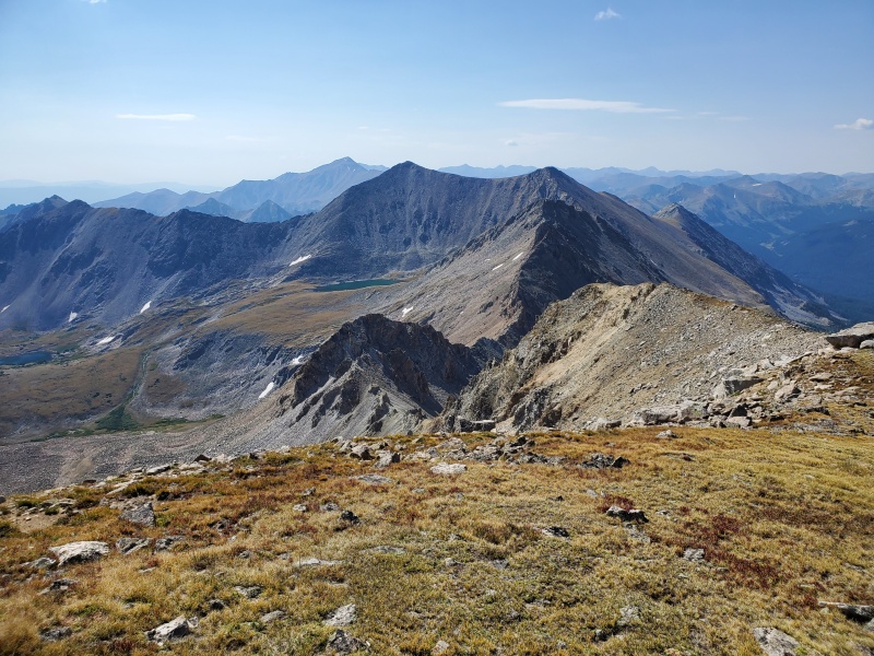
The line I took spit me out right about where the fridge meets the ridge in front of it (on the opposite side of the snow of course). The next step was traversing that mean looking ridge you see in the picture above! None of the moves were that difficult, but my goodness was it exposed. Careful attention had to be paid when choosing footing here! Mostly solid, but some very large blocks move much more than I would have liked them too. 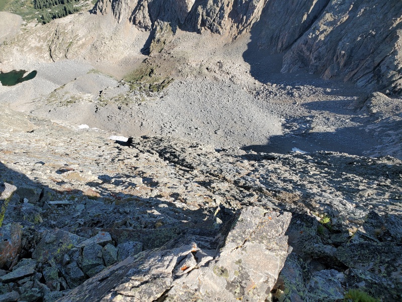
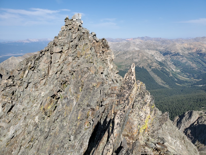
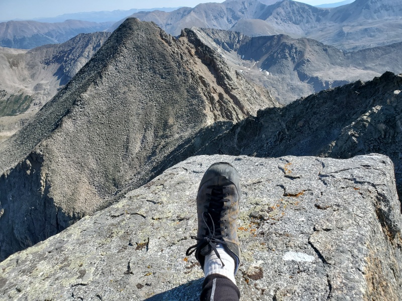
The moves to gain the tower's summit after the ridge were probably on class 3 or maybe 4, but they felt big. After this section the moves became easier, but still quite exposed. 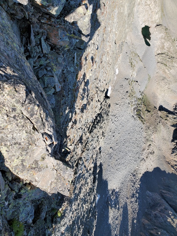
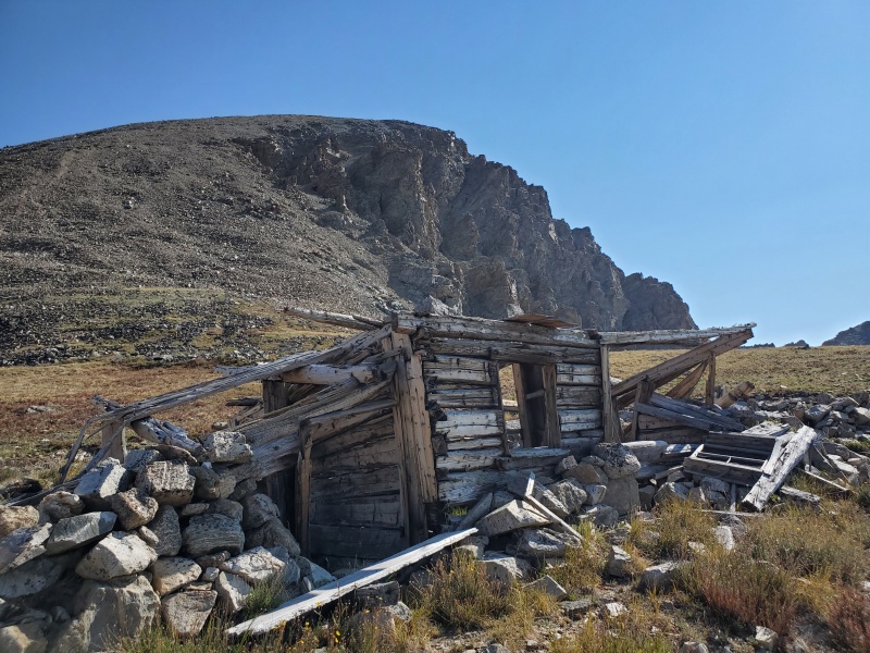
While there wasn't a single 5th class move on this ridgeline, it was very much reminiscent of the Little Bear Blanca traverse. Atleast for the first 1/3 of the ridge that is... after that the exposure relents significantly. There are many bumps on this ridge that obscure your line of sight, slightly adding to the sketch factor. I usually like a good preview of what's coming up next, but that was a luxury that I would not be afforded on this day. Fortunately, every time i surmounted one of the bumps, I was presented with a very manageable line to the next bump. It might be worth noting that there are plenty of bail off opportunities after the cruxy stuff past the tower. That made me feel pretty secure about continuing on. If you get through the exposed section without issue, than you should probably continue on the ridge. Just test your footing! I would recommend this variation of the traverse to anyone who is experienced with ridge traverses and can keep a cool head while dealing with exposure. If the ascent of Ice was hard for you, just take the SW slopes over to West Apostle. The last summit of the day was much easier than it appeared! From a distance West Apostle looked absolutely menacing. This proved not to be the case, as the climbing was straightforward class 2 scampering. The descent to Lake Ann looked confusing at first, however there are a series of carins right at the junction that would be fairly hard to miss. The route down to the lake is hard packed steep dirt and scree. I chose to stay on rock as much as i could to avoid the slipping and sliding of the steep hard dirt pitches. Lake Ann was amazing and I made sure to stop off and spend some time down by the electric blue green water. Shortly after departing from the lake, I observed the largest herd of goats i had ever seen! I lost count near 30. They seemed to be disturbed by my presence so i didn't linger in that particular area. Right when I thought I wouldn't see any people on this trek, I randomly hear the phrase "Mom and dad don't know everything!!" uttered rather angrily. Umm... what?? Perplexed, I look around and spot two guys climbing up a random slope in the area. What a strange way to have the solitude broken. 
I proceeded to make good time down the Lake Ann trail, and was back to my Jeep in a round trip time of under 9 hours after departure... but I wasn't done yet! This was my birthday climbing trip so I wanted to make the most of my time in the area. Emerald peak was on the agenda for the next morning! I chose the route from Rockdale because it didn't look too far from the other trailhead on a map, and it didn't entail ascending Elk Head Pass twice in one day. 60% chance of T-storms so I figured it was best not to linger above 13K for long periods of time. Now I just have to find this obscure Rockdale trailhead! I hopped in my Jeep and started cruising around looking for anything that might indicate where the trail was. Up and down the road I go... I noticed it seemed to be just past the Sheep Gulch trailhead, which I was familiar with after climbing Mt. Hope last November. I found the Sheep Gulch TH and kept cruising around in confusion... when finally it dawned on me. You were camped at Rockdale TH dummy! Oh goodness... not my proudest moment. Sigh... I woke up the next morning with the intentions of driving up to the 4WD parking area in my Jeep Cherokee. I forded the first river without much issue when I was presented with the second crossing. Not too difficult either, but the crux to regain the road after the ford looked absolutely insane! I thought that if this was what the road was going to be like, i'll just hike it! No sense in beating up my Jeep when I have two perfectly good legs. 14 miles here I come... About 30 minutes into the hike, I was kicking myself for not driving up it. After that one section the road improved significantly! Could have been in 2WD the rest of the way. Oh well. My only concern was that I had T-storms to beat and quite a bit of ground to cover. Needless to say, I didn't hike slow! 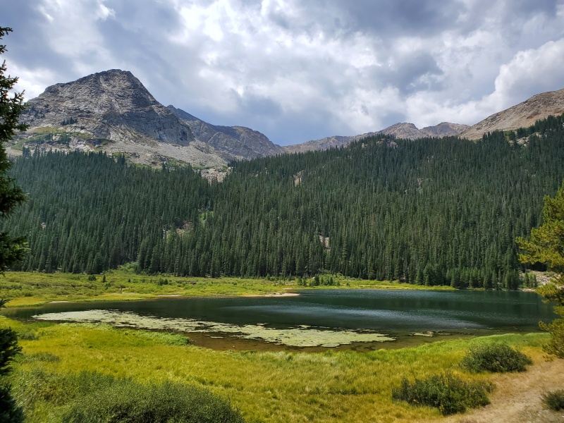
I didn't stop to take many pictures on this hike, as I was pretty keen on getting in and getting out in a timely fashion. The trail is hard to follow in a few areas, but other than that this is a fairly straightforward ascent. This is a very wild place for sure, I imagine it doesn't get much traffic at all. The trail is overgrown most of the hike. I kept on gaining elevation and was quite pleased that the weather seemed to be cooperating with me. At 8am the skies were almost entirely bluebird! 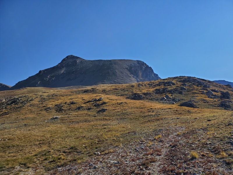
Tagged the summit and hungout for about 10 minutes before heading down. I was starting to see some cloud buildup occur out of nowhere so I chose not to linger. The 600 foot scree slope was much easier to come down than it was to go up. Fortunately the weather seemed to be stabilizing for the time being. Looks like i'm getting lucky with both the smoke conditions and the weather! ...At this point that is. By the time i reached Clohesy Lake again, I started to notice a slight shift in the weather... as to be expected. Cooked down the rest of the trail and managed to get my tent torn down and packed up right as the storms were moving in. Shortly after getting in my Jeep the skies opened up! Heavy rain and thunder accompanied me for the duration of my trip home. I drove through four separate cells on my two hour drive home. Looks like my concerns about timing were justified. This ended up being a fantastic trip and a great way to celebrate my birthday! No place I would have rather been. Thumbnails for uploaded photos (click to open slideshow): ")
")
")
")
")
")
")
")
")
")
")
")
")
")
")
")
")
")
")
")
|
| Comments or Questions | |||||||||
|---|---|---|---|---|---|---|---|---|---|
|
Caution: The information contained in this report may not be accurate and should not be the only resource used in preparation for your climb. Failure to have the necessary experience, physical conditioning, supplies or equipment can result in injury or death. 14ers.com and the author(s) of this report provide no warranties, either express or implied, that the information provided is accurate or reliable. By using the information provided, you agree to indemnify and hold harmless 14ers.com and the report author(s) with respect to any claims and demands against them, including any attorney fees and expenses. Please read the 14ers.com Safety and Disclaimer pages for more information.
Please respect private property: 14ers.com supports the rights of private landowners to determine how and by whom their land will be used. In Colorado, it is your responsibility to determine if land is private and to obtain the appropriate permission before entering the property.


