| Report Type | Full |
| Peak(s) |
Middle Teton 12805' South Teton 12513' |
| Date Posted | 08/18/2020 |
| Date Climbed | 08/11/2020 |
| Author | jfm3 |
| Grand Teton National Park Mini Camp |
|---|
|
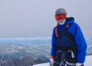
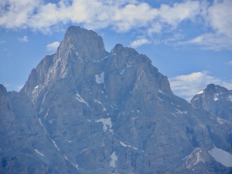
This report details a 3-day trip I took to Grand Teton National Park this August. My original cross-country skiing summer training camp plans this year were completely canceled due to the coronavirus pandemic. I was going to go to Oregon in May to ski at Mt. Bachelor and climb Mt. Hood, then go to Alaska in July for a week of summer skiing on the Eagle Glacier outside Anchorage. I still wanted to arrange a trip to somewhere with world-class mountains for several days of focused training. After planning and rearranging, 3 days in the Tetons in my home state of Wyoming was the best I could do with all the logistical difficulties caused by the pandemic. The first day of the trip was a hike/climb up South Teton and Middle Teton from the Lupine Meadows trailhead in the middle of the park. I hiked up the trail into Garnet Canyon (https://www.trailrunproject.com/trail/7000324/garnet-canyon-trail) to the glacial moraine, then took the northwest couloir up South Teton (https://www.mountainproject.com/route/106006234/northwest-couloir) and the southwest couloir up Middle Teton (https://www.mountainproject.com/route/105933255/southwest-couloir). This outing was harder than any 14er I've done in Colorado except Snowmass (snow climbing is a completely different beast) and maybe the Kit Carson/Challenger combo starting from the bottom. It's a huge amount of vert and the upper mountains, particularly Middle Teton, had tedious terrain. I left Jackson at 4:15 AM and got to the trailhead at 5:10. Parked in the first cluster of spots. It was still dark so I slept for 40 minutes in the front seat. I got geared up while gazing at Teewinot and set off at 6:20. The gradual approach to the mouth of Garnet Canyon was easy and quiet. Not very steep climbing and great trail. A few people were ahead of me. I saw the sunrise on the Grand & Teewinot for a few minutes. 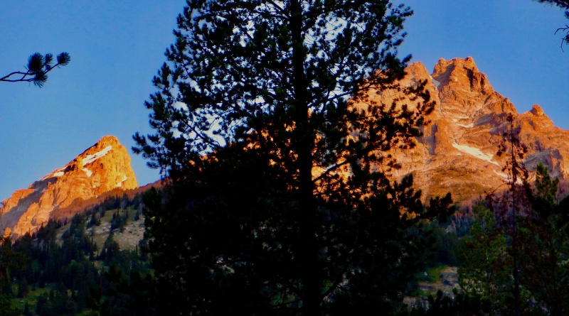
As I got into the canyon a few groups came down with large packs & climbing gear. The middle of the canyon slowly unfurled and Middle Teton loomed overhead. I hit the meadow campsites in 2 hours and took a break. The trail ended at the meadow. The Grand towered 4500' directly overhead. Even the slope to the lower saddle looked hard, to say nothing of the full Exum Ridge. 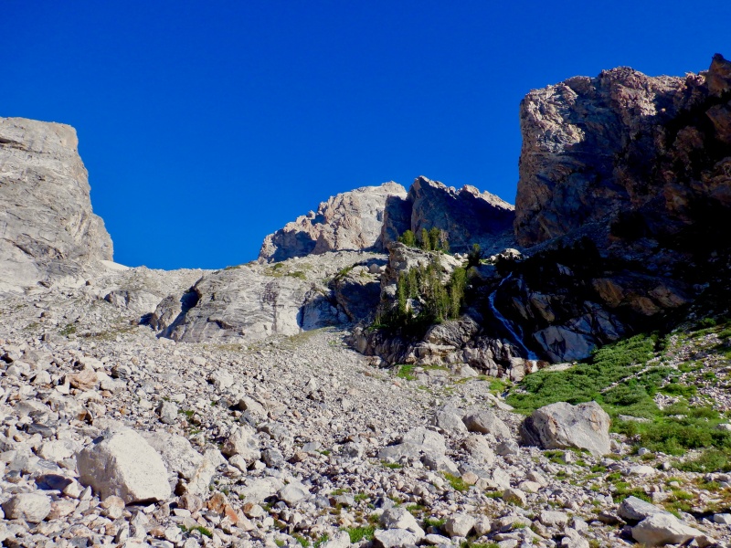
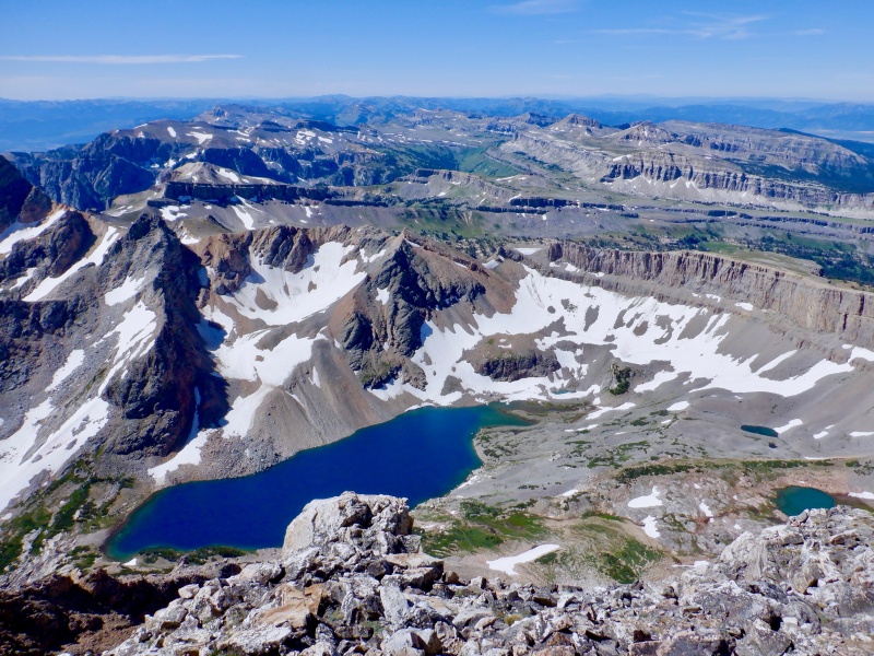
Some easy wending through the talus brought me to the first of 3 snowfields. I put on the spikes and unstrapped the ice axe and blazed right up. More rock and then the next snowfield, this one an upward sloping traverse. I stowed the snow tools after this and continued up the moraine, keeping the line direct and finding stable rock. Middle & South rose far above. I crossed the 3rd snowfield at a narrow spot- 20 steps across. From there it was more rock up to the saddle. I did a good job picking a direct line and didn't waste any elevation contouring through the rock. I hit the saddle in under 2 hours from the meadow and took another break looking down at Icefloe Lake. 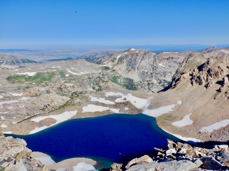
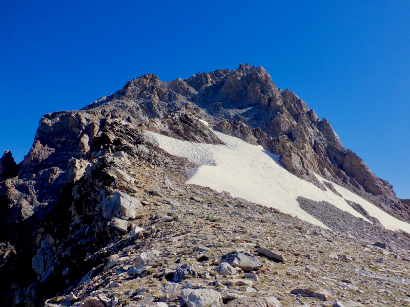
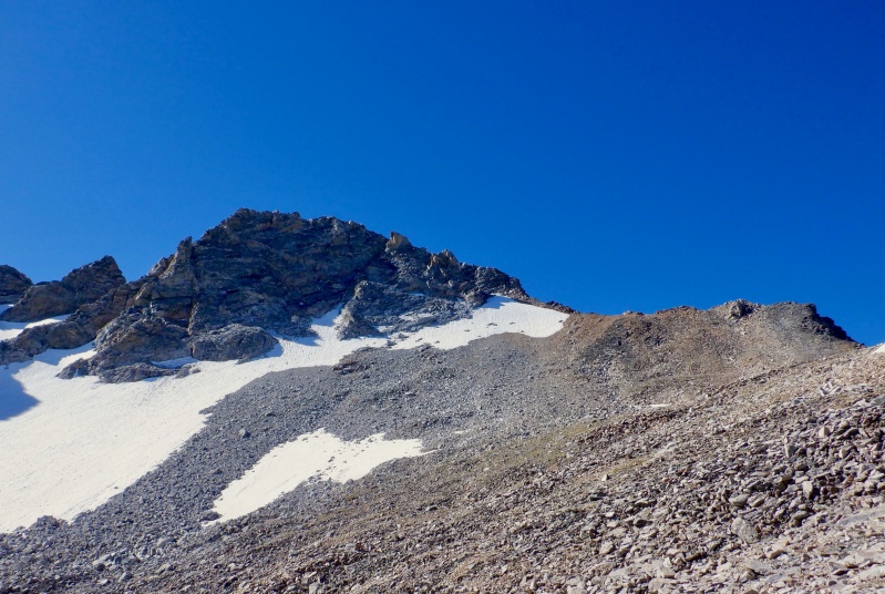
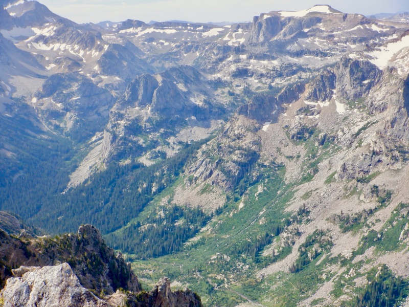
South Teton looked far away and Middle looked even farther. I found a direct route up good rock to the upper ridge. Had to stop for a bathroom break on the way. On the upper ridge the top of the Grand was visible above Middle. I crossed above the snowfield on the ridge crest and passed 4 people at the bottom of the couloir. The gully was short, without too much loose rock, and even some path segments. After popping out on the ridge, with enormous views to the south, it was a short jog to the top. 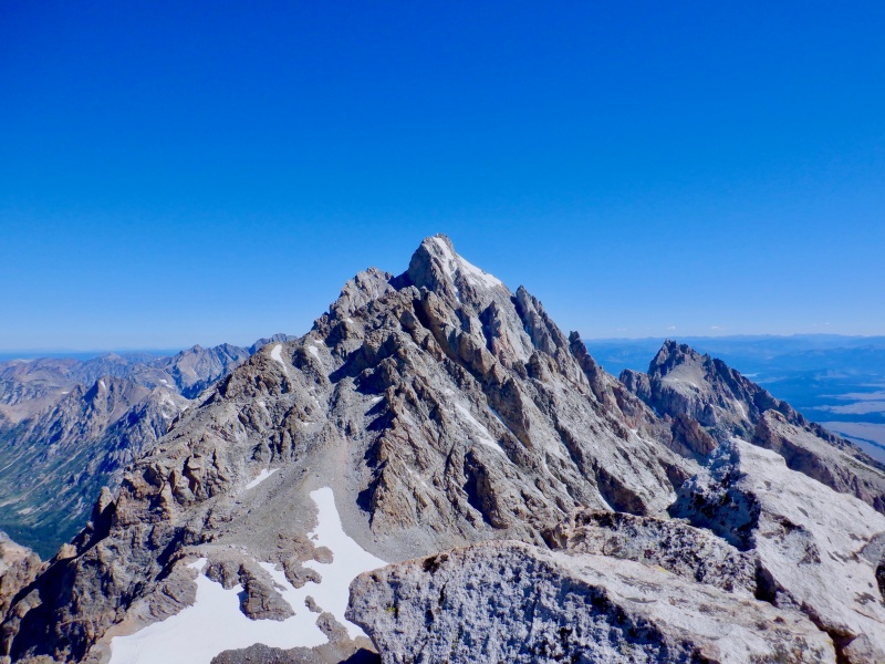
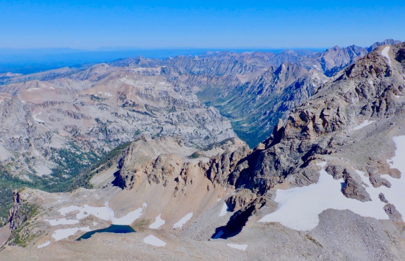
The views were expansive and outrageous. The valley floor was very distant. So was Idaho. I could see people on the summit of the Grand and on the ridge at the upper saddle. Buck Mtn. & JHMR were below too. I sat there awhile, gazing around. The summit views here are the best I've had since I was in Switzerland. 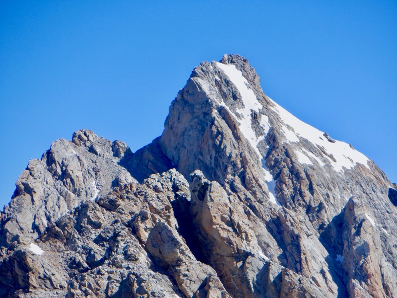
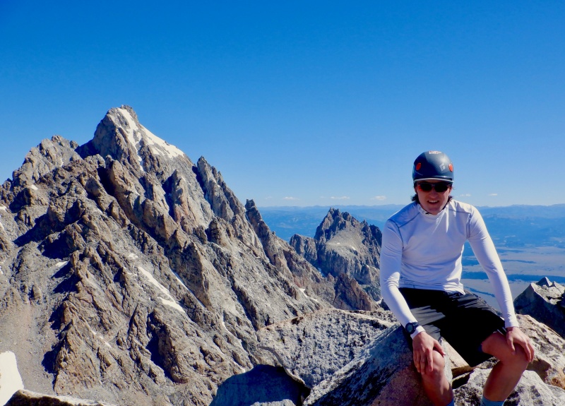
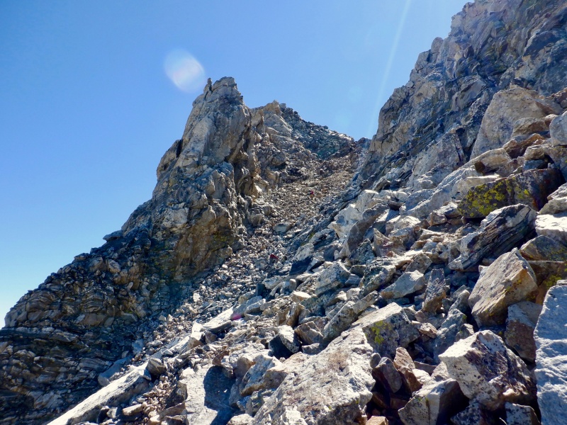
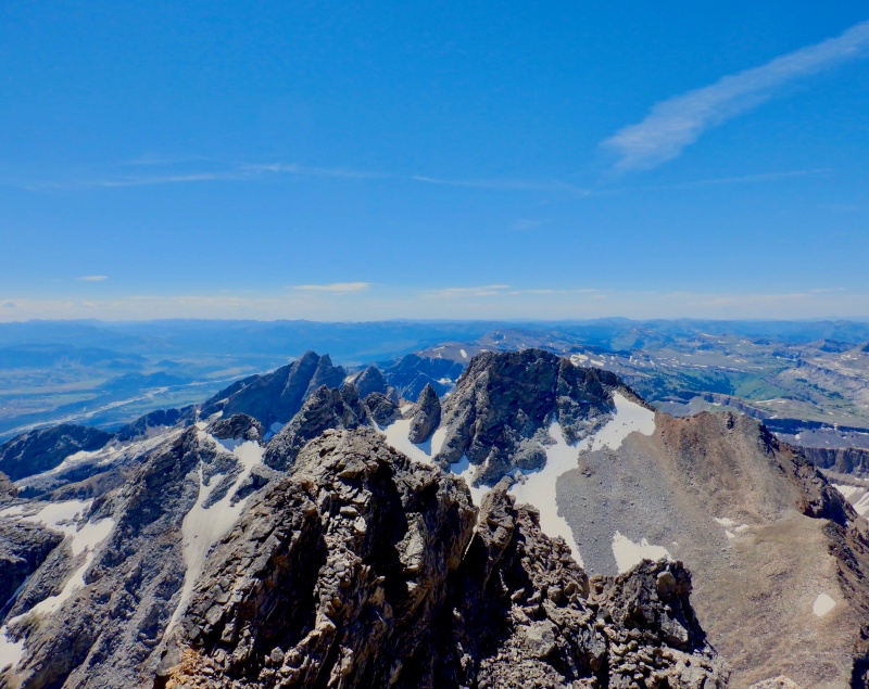
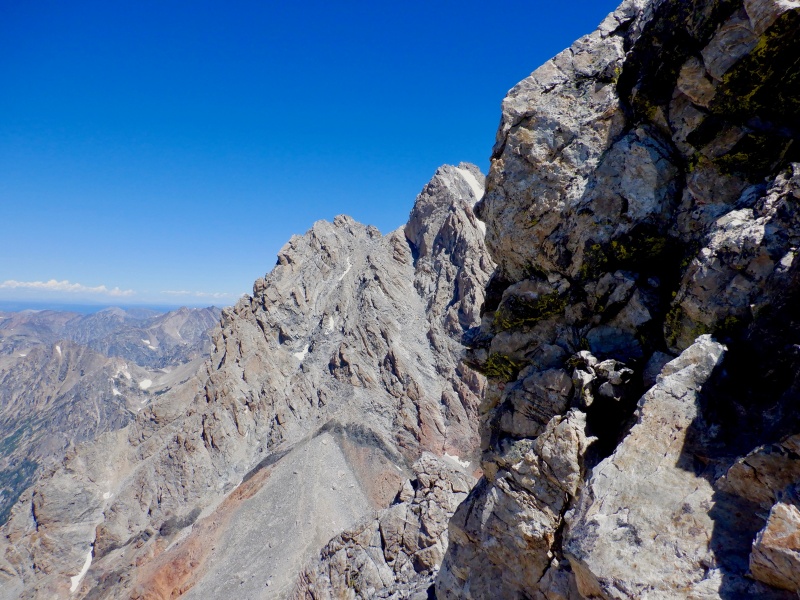
The descent back to the saddle took longer than the ascent. I didn't find a great line and got into some loose rock & scree. I continued across and navigated a snowfield by taking some ledges to the west. Across a flat spot and then I was at the bottom of the couloir. 1500' of the hardest terrain of the day. The rock got steeper and looser as I went up and the top was a real challenge. There were 2 class 4 steps and care was required to keep rock from sliding down. Not very exposed but really steep at the top. I came up to a notch that immediately cliffed out 1000' to the lower saddle. A short jaunt to the right led to the summit with big air on all sides. 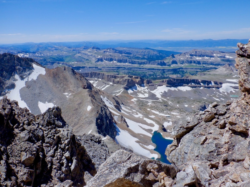
I tagged the top and retreated to the notch to take a few pictures. The climber camp for the Grand was below on the saddle. The Grand just looks scary. So much exposure up there. 
I wanted to descend the couloir while it was still fresh in my mind so I didn't wait long. The descent was tedious and slow but I made it without incident. It was nice to get back to the saddle but the enormous approach guaranteed a long hike back to the car. I again moved quickly and picked good lines through the talus. I shoe-skied the upper snowfield, walked down the middle and had a miserable half-slide down the lower one. Too steep for spikes. I had to refill water in the meadow. After so much travel on the moraine and all the hard terrain up high I was just about done mentally. 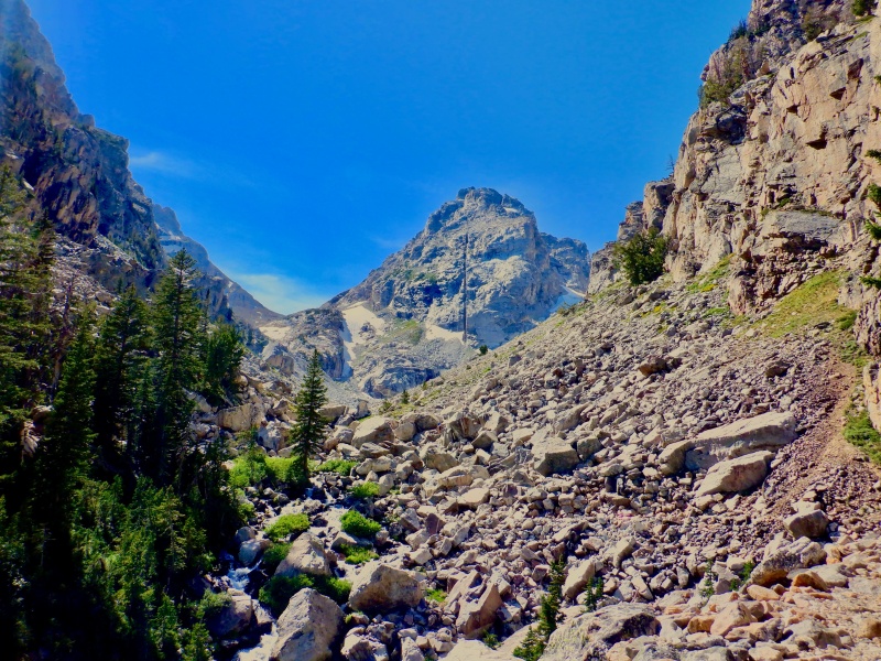
The remaining descent to the car was a death march. So many hours on my feed, too many clothes weighing down the pack (never needed all the heavy stuff- a nice zephyr & sun all day kept things warm) and almost no food left. The valley floor took a long time to arrive. Eventually the trudge ended and I reached the car. It was a great day but man are these mountains big. The next day I did a 40-mile classic rollerski from Jackson to Jenny Lake and back on the paved bike path that parallels US 89 through the Snake River Valley and Teton Park Road west of Moose. The terrain is almost flat but a brutal headwind on the 20-mile return to Jackson made for a slow, difficult day. 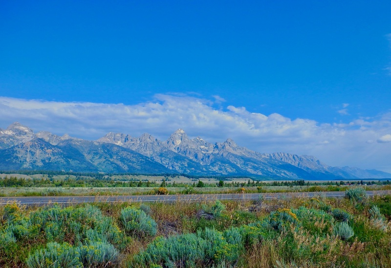
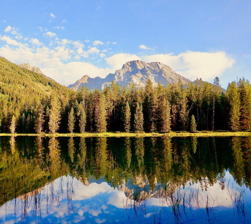
For the final day of the trip, I ran a 21-mile loop up Paintbrush Canyon and down Cascade Canyon (https://www.trailrunproject.com/trail/7000241/paintbrush-divide), starting & ending at the Leigh Lake trailhead. This is a fairly easy loop with extraordinary views of the backside of the Cathedral Group (Teewinot, Mt. Owen, the Grand) on the descent down Cascade Canyon. I drove to the trailhead as the sun rose. Saw 1 mule deer and 5 elk on the way in. The parking lot was quiet as I geared up. I glanced up at Mt. Moran at the same moment a bald eagle flew across my field of vision. Totally calm as I set off with Moran and the Cathedral Group reflected in the lake. 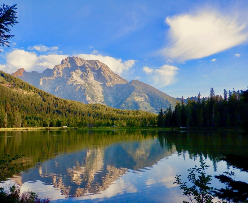
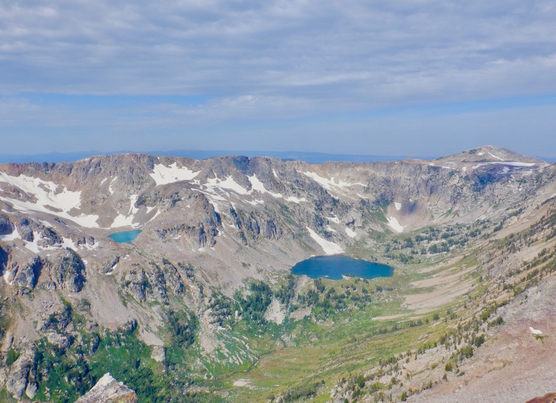
The trail was gradual enough to mostly run up to the mouth of the canyon. Once I crossed the lake outlet the forest closed in and there wasn't much to see. I passed a few groups and caught glimpses of Jackson Lake through the trees. I had to stop to shed & stow my sleeves as I went uphill. A few minutes later I came around a bend to see 4 people stopped looking north. There was a small black bear about 30 yards away. I saw it for a few seconds before it moved into the bushes. I power hiked most of the remaining climb to Paintbrush Divide. Legs had some soreness from the last 2 days but my heart rate stayed low. The scenery opened up as the trees thinned out. The ridgelines were jagged all around. Lots of paintbrush flowers grew next to the creek. The wind picked up as I meandered through the upper basin. I stopped 600 feet below the Divide to put on my sleeves, gloves & windbreaker. The final climb skirted some snowfields and quickly rose to the pass. Huge views south & west from the top. I saw a small point about 200 feet above the col so I went up to the top for a break. 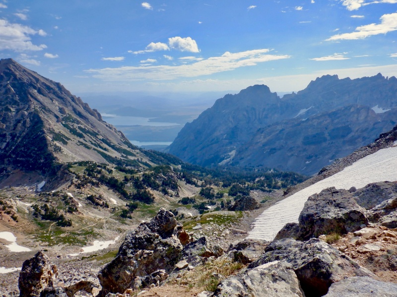
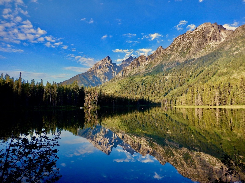
The view from this little summit was astounding. The Cathedral Group rose 3000' above across the sky and Cascade Canyon unfurled 3000' below. Absolutely incredible views to the central mountains & glaciers. I spent 10 minutes up there taking pictures and gazing around. The scenery from this vantage point is as good as anything I ran in Canada or Switzerland. I ran back down to the trail and cruised down the long switchbacks to Lake Solitude. I kept stopping to take pictures. The views truly blew me away all the way down from Paintbrush Divide. 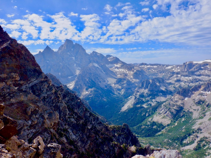
I took a break at the lake to take off clothing, eat and put on more sunscreen. From the lake it was an easy 100-minute cruise down Cascade Canyon to Jenny Lake. The outrageous mountain scenery captivated me the whole way. There was a nearly-constant stream of people going both directions. I tripped a few times because I kept glancing up at the Grand. One was so bad I thought I was going down but I somehow saved it. As I entered the lower canyon it got hot and I splashed in the creek a few times. 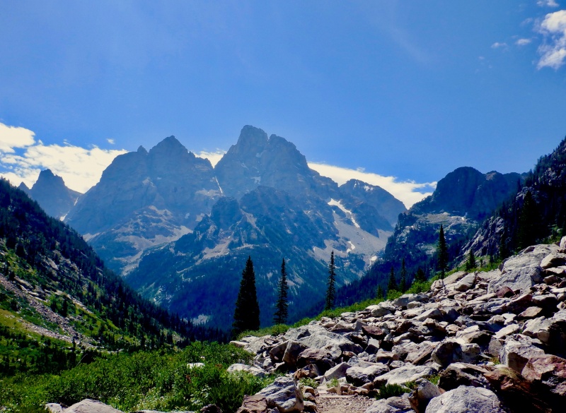
The lower canyon was even more crowded, with some ill-prepared tourists mixed in. I slowed down a bit with all the traffic and the nearly flat trail. Still great views of the Cathedral Group directly overhead. I somehow missed the turn that bypassed Inspiration Point, so I had to navigate hundreds of people there. Just above Jenny Lake there was a group watching a large black bear in the bushes. It was eating and didn't seem bothered at all. I took a quick picture and continued on. It was another 30 minutes of hot running around the shore back to the car. At the very end I took off my shoes & vest and waded into String Lake and dunked under. Very refreshing. The lake is so shallow that the water was warm-ish, not freezing. 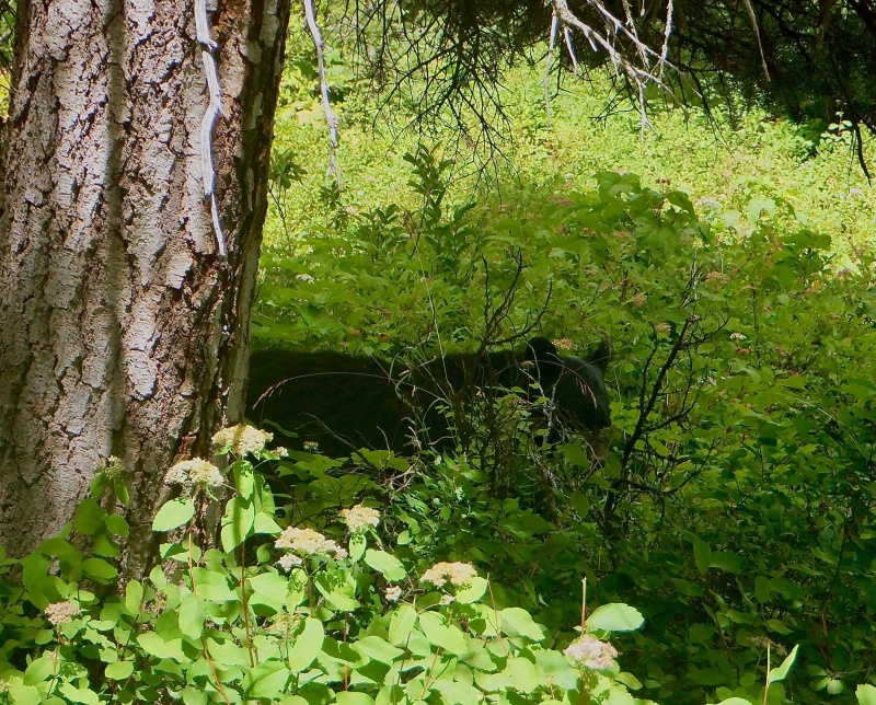
I packed up, dried off and got changed at the car as the tourists circled like sharks. Stopped at the visitor center in Moose on the way out to get some stickers & trinkets. This was an unexpectedly good training camp. I expected the Tetons to be a high-quality location but I was surprised and impressed with the scale and difficulty of the mountains. Totals for Grand Teton National Park Mini Camp Strava links South Teton + Middle Teton hike/climb: https://www.strava.com/activities/3900462700 Teton Valley classic rollerski: https://www.strava.com/activities/3905176316 Paintbrush Canyon-Cascade Canyon mountain run: https://www.strava.com/activities/3911685154 
Thumbnails for uploaded photos (click to open slideshow): ")
")
")
")
")
")
")
")
")
")
")
")
")
")
")
")
")
")
")
")
")
")
")
")
")
")
")
")
|
| Comments or Questions | ||||||||||||
|---|---|---|---|---|---|---|---|---|---|---|---|---|
|
Caution: The information contained in this report may not be accurate and should not be the only resource used in preparation for your climb. Failure to have the necessary experience, physical conditioning, supplies or equipment can result in injury or death. 14ers.com and the author(s) of this report provide no warranties, either express or implied, that the information provided is accurate or reliable. By using the information provided, you agree to indemnify and hold harmless 14ers.com and the report author(s) with respect to any claims and demands against them, including any attorney fees and expenses. Please read the 14ers.com Safety and Disclaimer pages for more information.
Please respect private property: 14ers.com supports the rights of private landowners to determine how and by whom their land will be used. In Colorado, it is your responsibility to determine if land is private and to obtain the appropriate permission before entering the property.