Download Agreement, Release, and Acknowledgement of Risk:
You (the person requesting this file download) fully understand mountain climbing ("Activity") involves risks and dangers of serious bodily injury, including permanent disability, paralysis, and death ("Risks") and you fully accept and assume all such risks and all responsibility for losses, costs, and damages you incur as a result of your participation in this Activity.
You acknowledge that information in the file you have chosen to download may not be accurate and may contain errors. You agree to assume all risks when using this information and agree to release and discharge 14ers.com, 14ers Inc. and the author(s) of such information (collectively, the "Released Parties").
You hereby discharge the Released Parties from all damages, actions, claims and liabilities of any nature, specifically including, but not limited to, damages, actions, claims and liabilities arising from or related to the negligence of the Released Parties. You further agree to indemnify, hold harmless and defend 14ers.com, 14ers Inc. and each of the other Released Parties from and against any loss, damage, liability and expense, including costs and attorney fees, incurred by 14ers.com, 14ers Inc. or any of the other Released Parties as a result of you using information provided on the 14ers.com or 14ers Inc. websites.
You have read this agreement, fully understand its terms and intend it to be a complete and unconditional release of all liability to the greatest extent allowed by law and agree that if any portion of this agreement is held to be invalid the balance, notwithstanding, shall continue in full force and effect.
By clicking "OK" you agree to these terms. If you DO NOT agree, click "Cancel"...
Now that Rose is a Centennial finisher, I can't convince her to do just anything because it's on the list. Nope, now I have to make it worth her while to get her to drive 6 hours and pack in for 16 miles just to get a look at the peaks we want to climb.
So I did. I half jokingly floated the idea of Peak Fifteen while we were hiking Coxcomb a few weeks ago, as it fit the motif we've seemingly cultivated of only climbing cool stuff together. By the end of the hike, we'd sort of talked ourselves into this being a good idea, despite needing to approach from Purgatory due to the train getting COVIDed. I had never hiked in from Purgatory for my prior forays into Chicago and Noname Basin. Needless to say, I was naively gung-ho about the whole plan, and Rose, a seasoned Purgatory veteran, was kind enough to humor me.
We loaded our gear into her car Wednesday afternoon and began the long drive to the western side of the state. I neglected to tell her until our bags were loaded and the car was running that I can't drive a stick, meaning I was confined to the passenger's seat and Rose was going to have to grind this drive out. Oops. We made good time to Alamosa, stopped for burgers (I may have ordered a second entree for the morning), and arrived at a pullout just past Purgatory around 11 for some sleep.
Day 1: Hike in to Ruby
We drove the short distance to the trailhead and started hiking at 6:30 Thursday morning. We were shocked how many cars were at the trailhead for a weekday morning: at least 25 or so. The Purgatory trail descends a demoralizing 700 feet in the first mile to reach the flats, and continues for another 3 1/2 miles and 300 feet of loss to reach the Animas River trail. From there, we hung a left and cruised the remaining 6 or so miles to reach the Needleton bridge, arriving somewhere around 4 hours and 45 minutes after departing the trailhead. Congrats, you've now hiked 10 1/2 miles and lost 500 net vert!
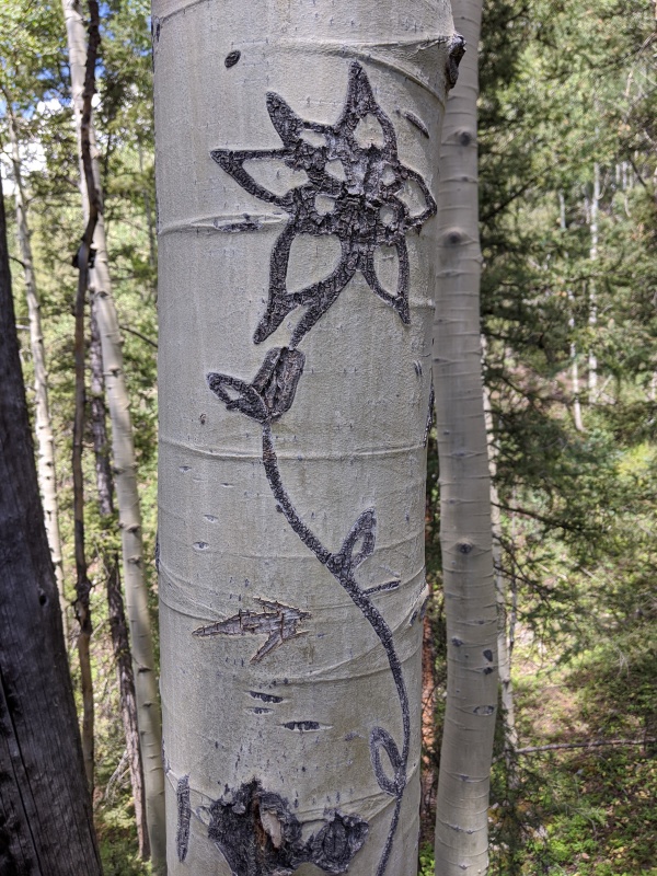
After a lengthy break at Needleton, we began death march #1 up the trail to Ruby basin. We zigged through the camper's meadows and came to the long, left-angling traverse up the slope. It was hot! That slope gets drilled by the sun and we were hiking it at 1 PM. Our pace slowed substantially, and our mantra became "get to the creek crossing!" Eventually we did, took the right of the two trails on the opposite side of N Pigeon creek, and found the columbine tree with no problem.
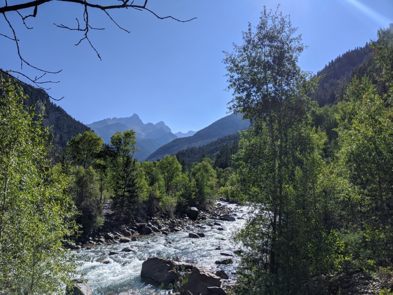
Crossing the Animas. Somehow our legs needed to take us to the other side of that peak???
Columbine tree, take the left path
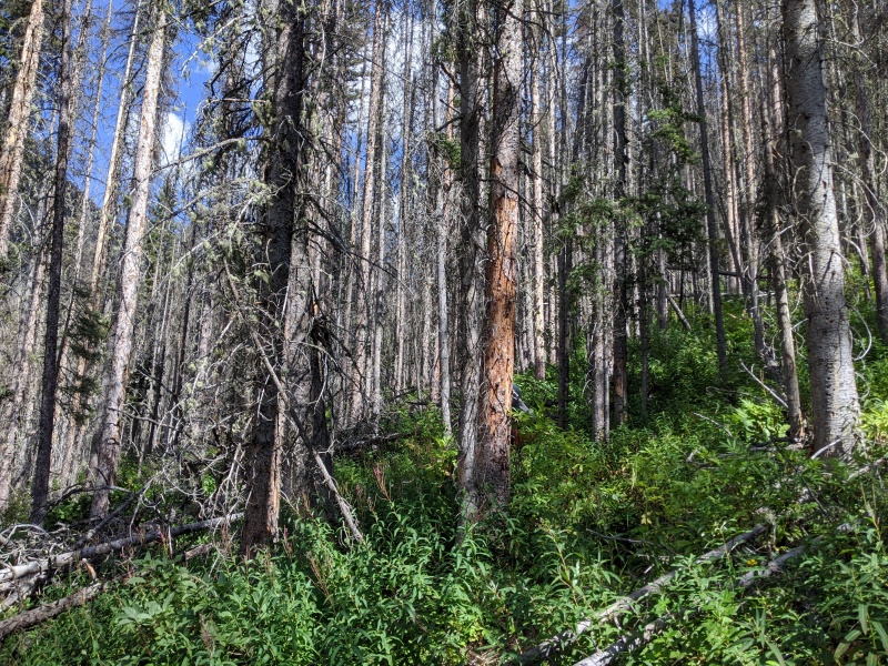
After passing the trail junction at the columbine tree, the trail spit us out on the slopes of Ruby basin. The trail drops 150 feet or so before beginning a more permanent uphill disposition. There is a fairly strong trail all the way, but the lack of trail maintenance rears its ugly head during this section, as almost every tree is dead and a good number of them have fallen. And why does every tree that falls seem to fall across the trail? Murphy's law, I guess.
Dead trees, dead trees everywhere!
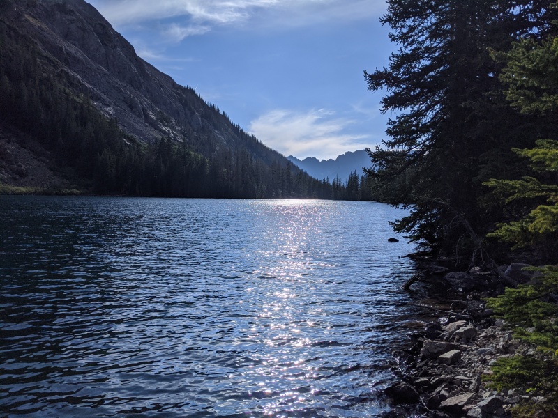
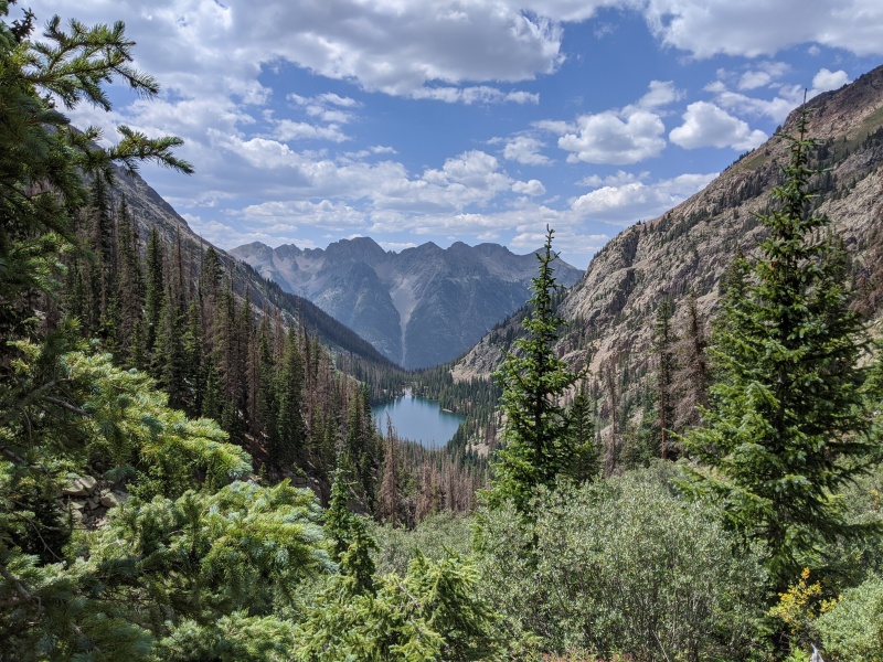
We finally reached Ruby Lake at 10,850. Our intention was always to camp in the upper meadow, but we were beat. I asked Rose if she wanted to stop here and camp, or if she wanted to grind up the headwall separating the lake from the upper basin. She replied: "I've got one hour left in me." Alright, let's see what we can do! We navigated around the rocky shore of the lake, through the forest beyond, and up the headwall. The trail disappeared at times, but we were able to locate it fairly easily before the ascent up the headwall. We found a wonderful campsite at 11,400, right when the trail takes a hard left to enter the willows. Across the stream, there's a small meadow tucked behind some trees and rocks that isn't visible from the trail.
Ruby Lake
All in all, it was somewhere near 17 miles and 4000 feet of gain to reach our campsite. We arrived about 12 hours after leaving the car. As Roach (and Brian) would say, "the introduction is over." We made it to RUBY RUBY RUBY RUBY!
Day 2: Peak Fifteen and Sixteen
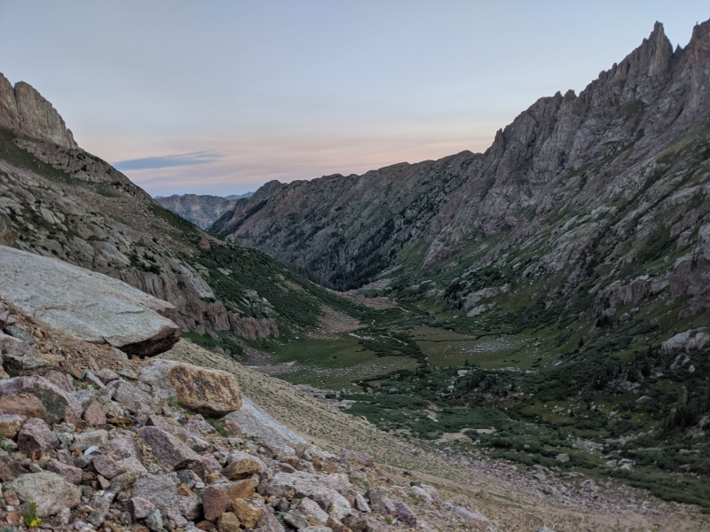
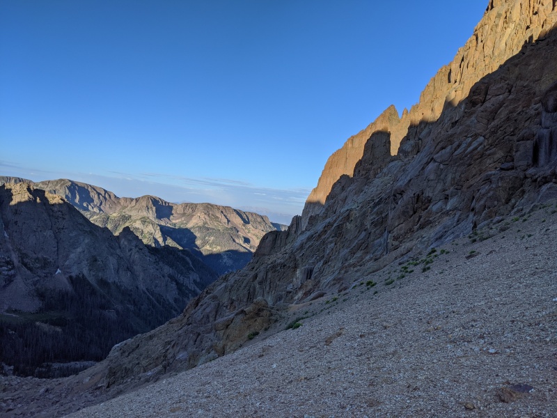
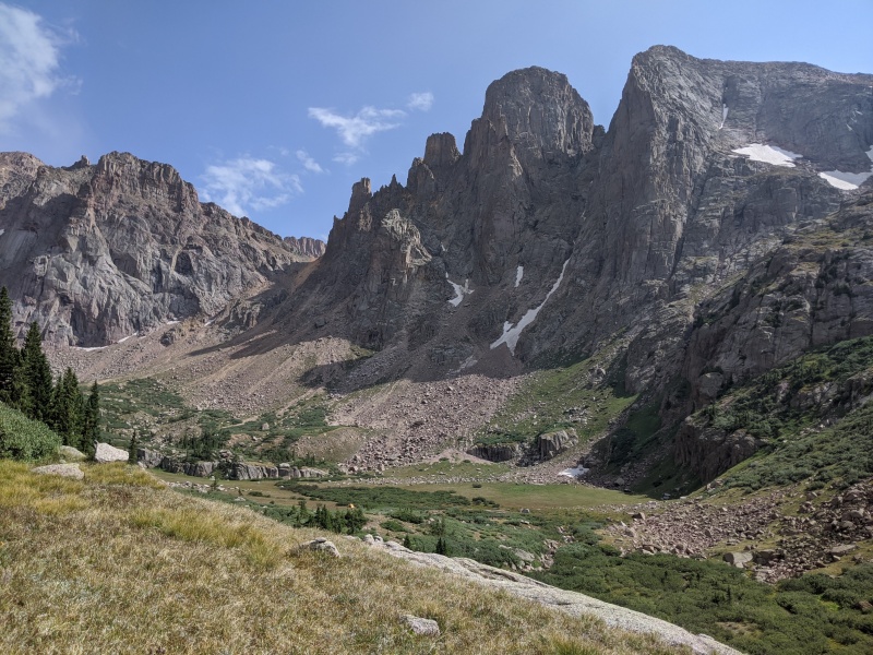
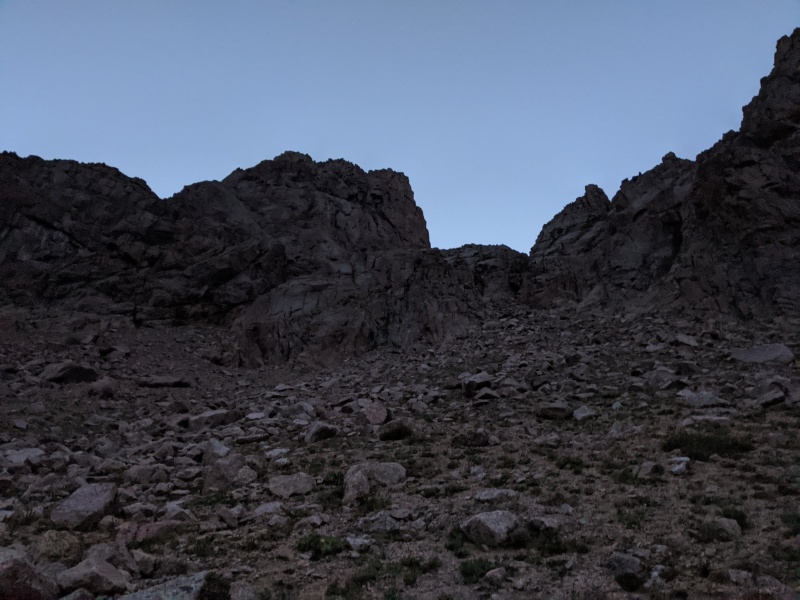
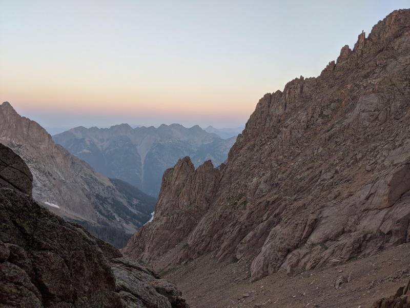
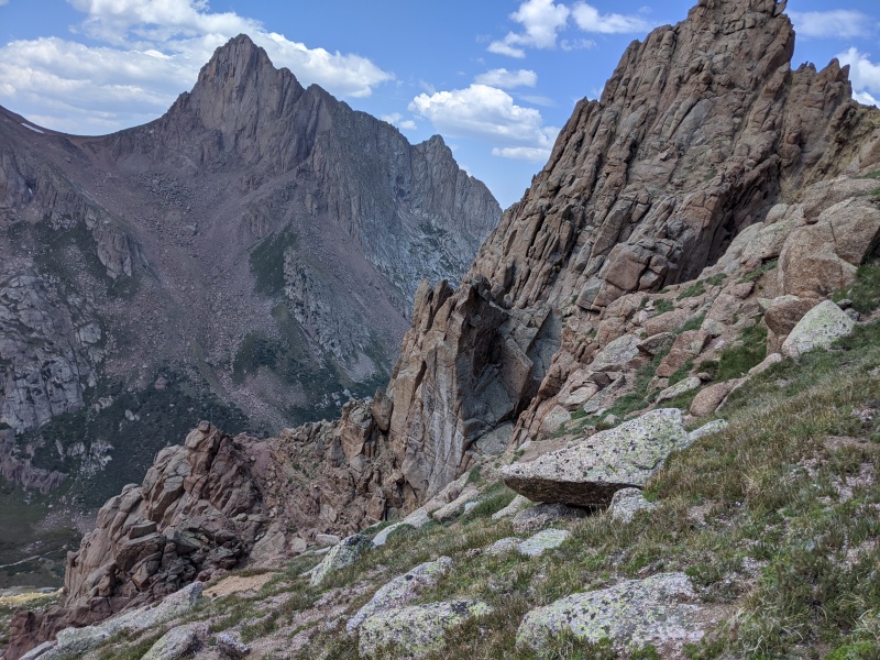
After an unsatisfying night of sleep, we woke up and hit the trail at 4:30. We bashed through the initial willows (0 for 1) before finding the trail that leads to the upper meadow. From there, the objective is clear (in the day): ascend 1,000 feet of the finest San Juan scree to reach the saddle between Little Finger and Pt 13,290. In an effort to find better rock, we tried to ascend to the base of the cliffs coming off of Turret/Peak Fifteen, but the correct ascent gully is guarded by cliffs at around 12,000 feet, so staying high isn't optimal. It's better to just suck it up, hike to the base of the gully, and hit it head-on.
Sunrise over Ruby Basin, traversing into the ascent gully
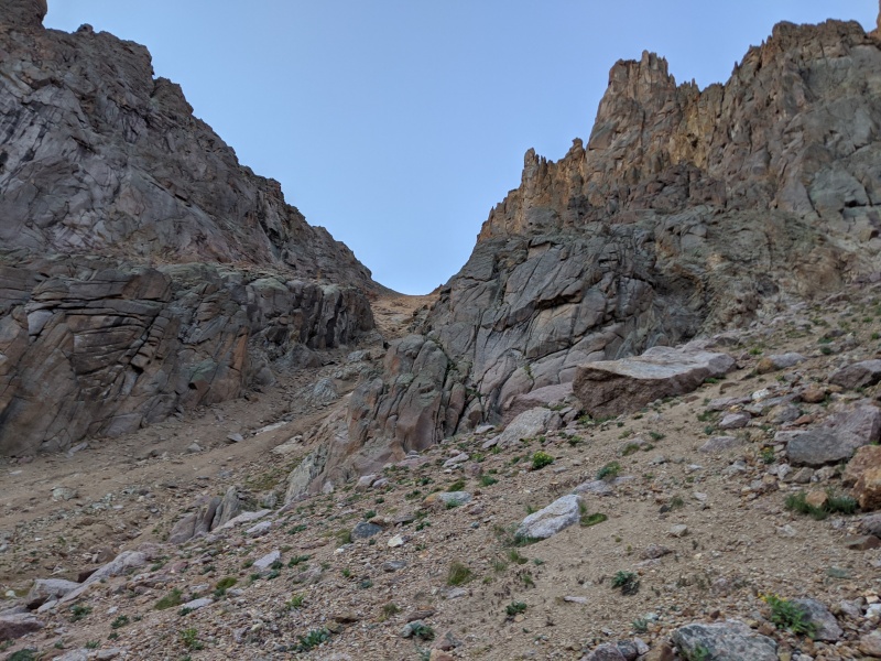
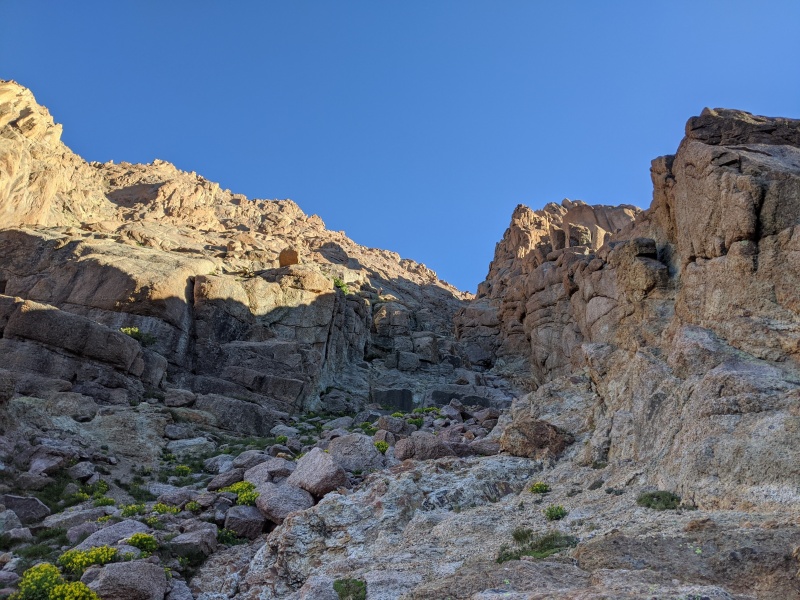
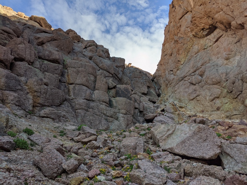
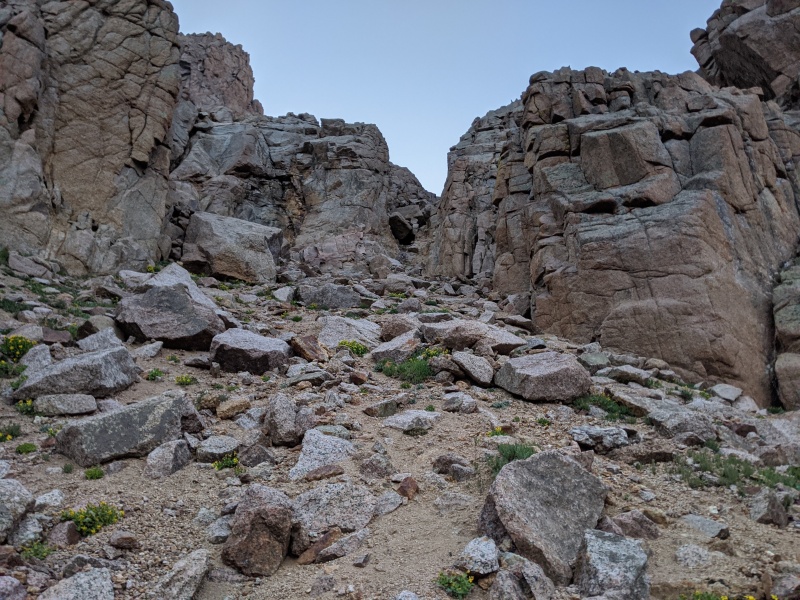
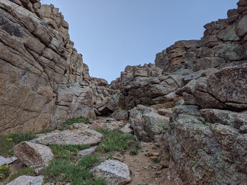
The gully comes into view. Looks fun!
The gully was exactly what you expect out of a remote San Juan peak: 2 steps forward, 45 steps back. The ground was primarily kitty litter, but occasionally had hardpan below it so you'd slip and fall on your face if you weren't expecting it. Hugging the sides provided occasional relief via slabby scrambling, but that would always run out and you'd be forced back to hiking up a gravelly slip n' slide. It took longer than expected to reach the saddle (theme of this mountain), but once there, we saw the descending traverse to reach the SW couloir on Fifteen wouldn't be as bad as expected. We only dropped to about 12,475 and entered the couloir at 12,500.
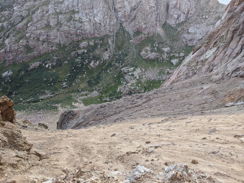
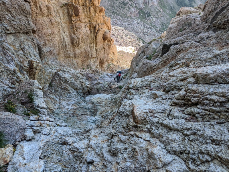
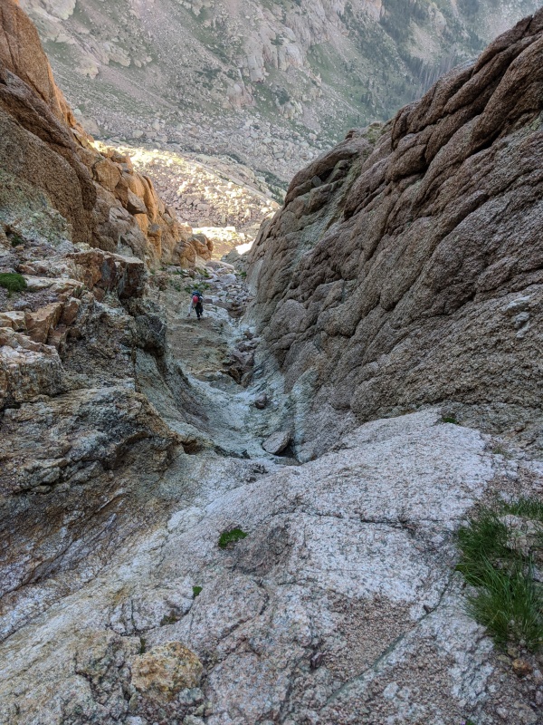
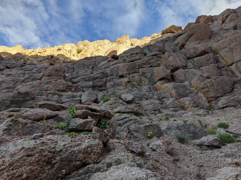
Upper ascent gully to the saddle
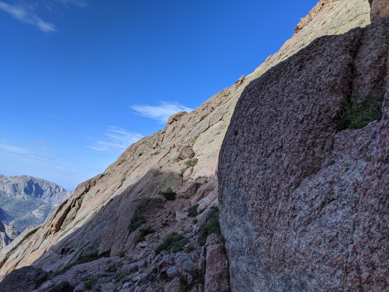
At the saddle, looking at the descending traverse to get into Peak Fifteen's SW couloir. Just get under those cliffs and go sideways.
Our entrance into the couloir
The couloir was surprisingly fun! It consisted of a couple of sections of steep, solid rock, and lower angle sections of talus embedded in more gravelly terrain. The first scramble came about 100 vertical feet after entering the couloir. We found a bit of water running down the first class 4 crux; I found a circuitous scramble around it, Rose went right over it. We dispatched the second crux without incident and ascended until the gully forced us out.
Rose scrambling up the couloir pt. 1
Rose scrambling up the couloir pt. 2
Eventually, the gully becomes less hospitable; cliffs crowd from the left side, the gully narrows, and a large chockstone blocks easy passage. Turn left here, ascend ledges to the left, then traverse back right toward the gully to reach the ledge that takes you toward the base of the crux pitch.
When you see this, turn left...
...and ascend these ledges to gain the ground above the cliffs. Once it makes sense, traverse back toward the right.
Ledge to the 5.4 pitch
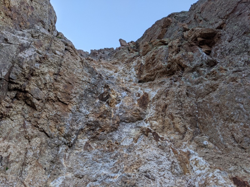
We arrived at the base of the crux pitch right as the sun began to hit it. This has been a hot summer, even on the high peaks! We delayered and geared up to climb. There really wasn't anything marking the pitch; we just traversed the ledge, happened to look up, and thought, "hey, that looks pretty climbable!" The easiest way to know you're there is if you look up and see a right angling flake with a prominent horn about 100 feet up. About 20 feet beyond that is the ledge with the bushes.
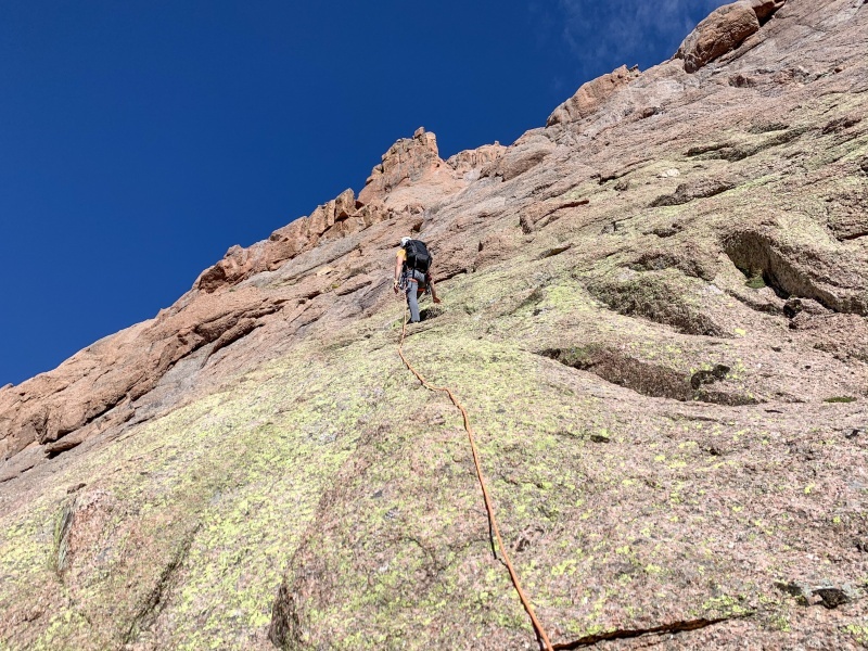
I geared up and began the climb, with Rose belaying me. We'd brought a set of nuts and 3-4 midsized tricams. The first 60 feet or so were 3rd or 4th class scrambling on slabs. The rock was that San Juan quartzite type with little crystals protruding out. It varied drastically in solidity. Much of it was solid, but when it wasn't, it disintegrated at the slightest touch. Not confidence-inspiring when there's 1,500 feet of air under you! After 70 or so feet of climbing, I arrived at a horizontal crack with a flake hanging over the slabs. I placed a midsized nut to protect the move and climbed over. I trended left after that, as the climbing looked easier, but found myself in horrifically rotten rock. I'd recommend going straight up or even slightly right after that flake, even if the climbing is harder, as the rock is better. I traversed back to the right as quickly as possible, and a minute or two later reached the bush ledge. I slung a solid block, set up a belay for Rose, and called out for her to climb. Five minutes later she was at the ledge and we were stowing the gear.
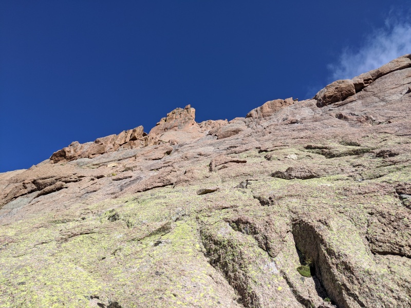
Looking up at the pitch. The right angling flake we aimed for is visible directly under the high point in the middle of the picture.
Me heading up the easy portion.
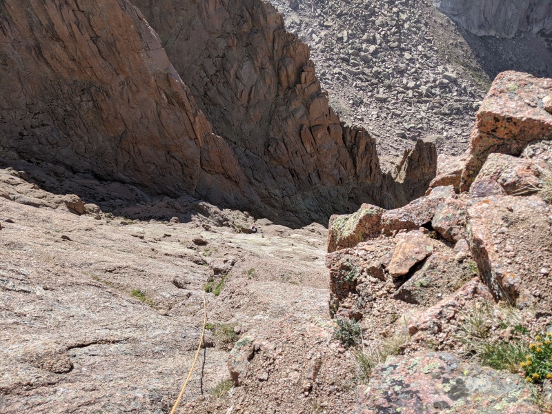
At the belay, with Rose visible at the base.
We felt that the crux pitch was....anticlimactic. The climbing wasn't as hard or sustained as we expected, and the rock quality wasn't consistently good. Most of that pitch was 3rd/4th class, with a few moves of 5th. Exposed, consequential....yes, but meh, I was hoping for more. We both felt we'd have been okay soloing the pitch, though a little protection helps the psyche.
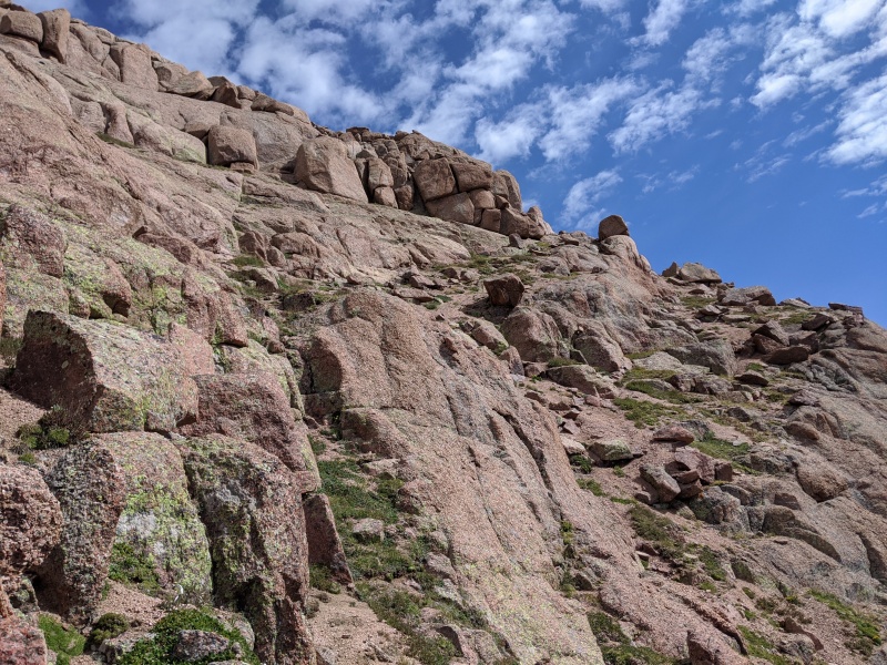
From the bush ledge, we worked our way up ledges and chimneys, generally trending back toward the right. A lot of this part of the route blended together. All I remember is there were multiple viable ways of gaining the ridge, all reasonable scrambles, and once on the ridge, it's a quick stroll to the summit.
Grassy ledge we took back toward the right to gain the summit ridge
Rose coming up the summit ridge
Success! We summited after 5 1/2 or 6 hours of climbing. It's not a long route, but don't underestimate how freaking long it takes to get it done. We were keen to get back to safe ground, so we didn't linger long; just long enough to send a few texts (yes we had service!) and chow on some much-deserved snacks.
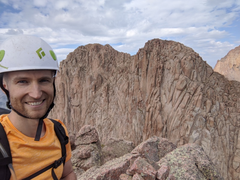
Summit selfie #1 with Turret
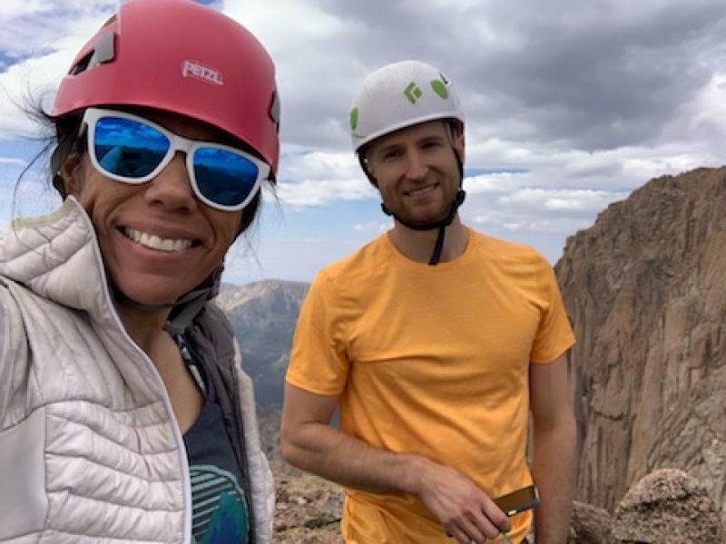
Summit selfie #2
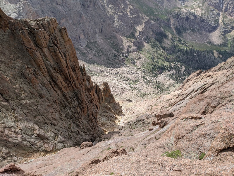
For the descent, I knew the raps were close to the ridge crest. What I failed to remember, however, was that the initial rap was about 100 feet onto the face above one of the chimneys. As a result, we missed this first rap station and instead downclimbed near the ridge crest down to the second (our first) rap station. We had a 60 meter rope, and while it easily reached the anchor for the next rap, it wasn't long enough to reach all the way to the saddle. Not sure a 70 would either. Instead, we did a short second rap to the saddle with Fifteen and Sixteen.
Looking up at our downclimb
As we were rapping down, we saw movement in the gully.....another group! We were shocked, as we hadn't seen anyone else yet since passing the Needle Creek junction the day before. When they came up, we learned it was two other 14er users, Chicago Transplant and Floyd! They were headed up the Garrett and Martin route. This was Chicago Transplant's 3rd to last 13er (wow!), so huge congrats to them! Pretty crazy that a peak that hadn't seen a summit since early July (per the register) suddenly had two successful summits.
I spy, with my little eye, Floyd and the transplant from Chi.
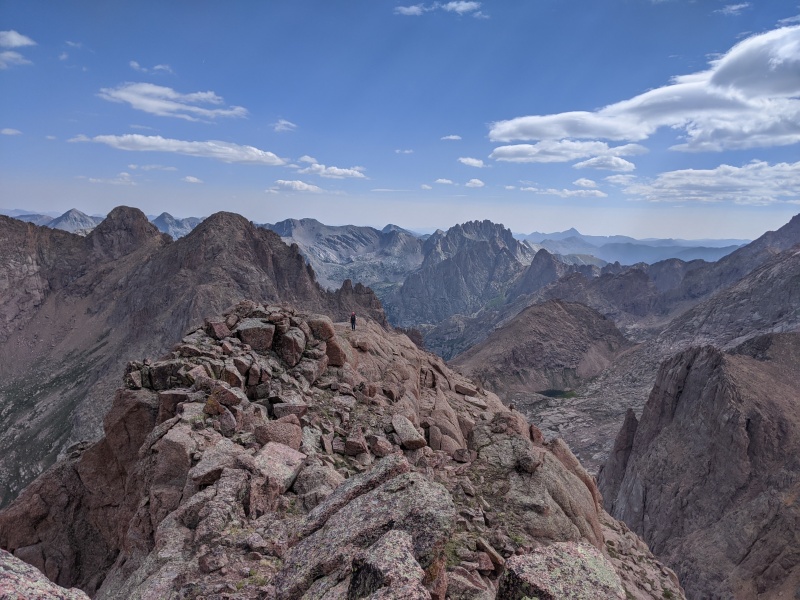
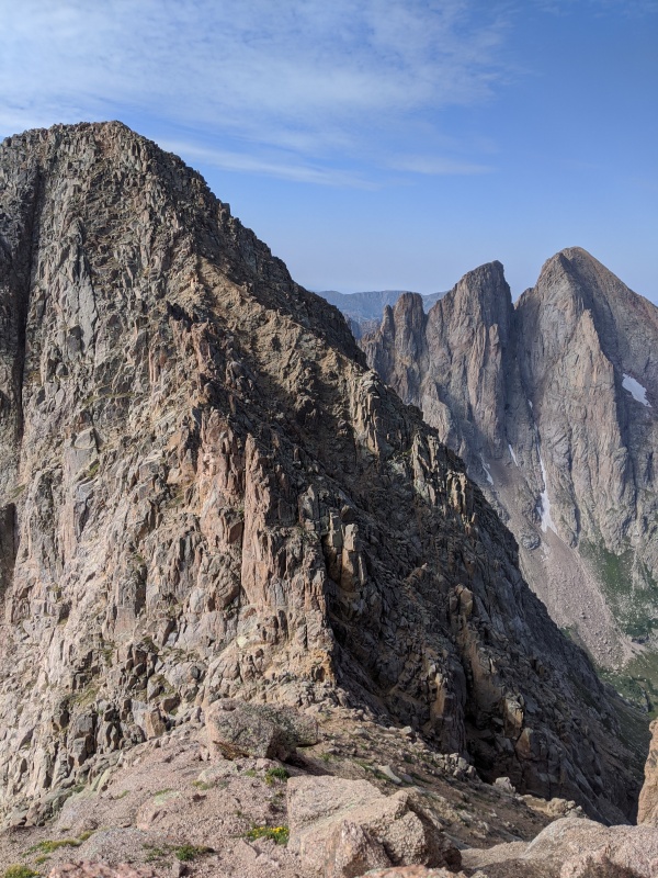
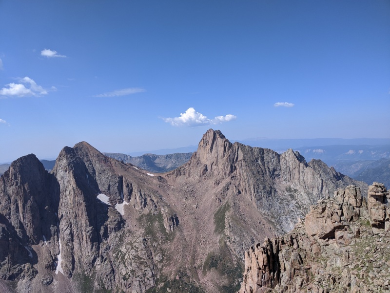
Since it was there, we did a quick scramble to the top of Peak Sixteen. The climbing was awesome on that peak, certainly some of the best of the weekend. And the view of Fifteen ain't too shabby.
Fifteen from Sixteen
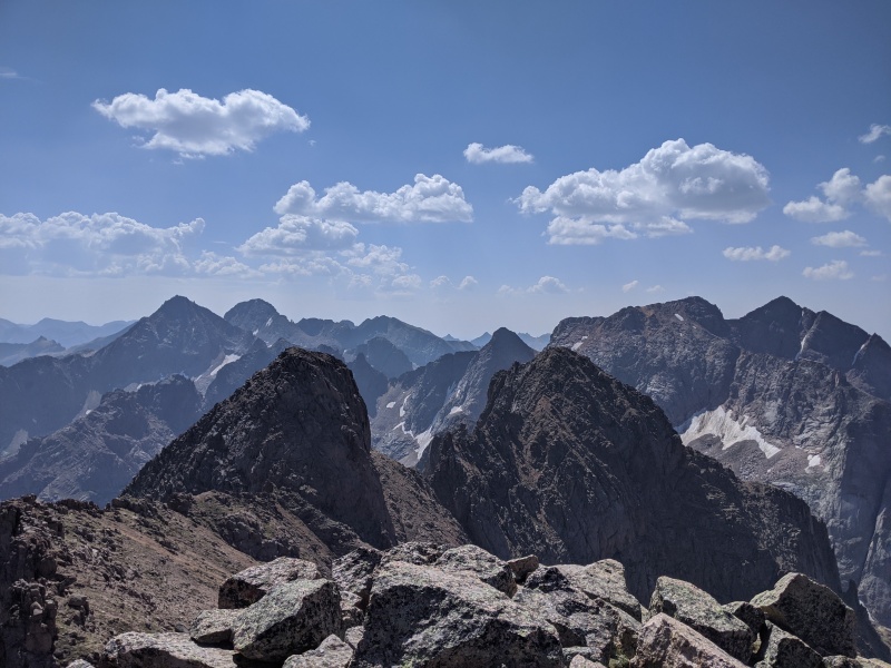
Sixteen summit views, back toward Chi Basin peaks
We downclimbed Sixteen back to the saddle, said our farewells to the others (for now), and traversed back on the ledges to reenter the gully. We elected to rap the two cruxes, as the anchors were set up and bomber, and let's be honest, rapping is way more fun than downclimbing. We grabbed our stashed poles at the bottom of the gully, made our way back to the Little Finger/Pt 13,290 saddle, and slid down the ascent gully back to the meadow and the relative comfort of the trail.
Rose rapping a crux in the gully.
We met two other hikers, Mike and Sarah (I believe that's right! Sorry, I was mentally worked at that point) in the meadow. They'd hiked Jupiter and hoofed it over Twin Thumbs Pass to make an attempt on Pigeon and Turret the next day. It was great meeting you! Little did we know, our friend Robin joined them later that afternoon. Somehow our paths didn't cross, but congrats on the succesful summits, all of you!
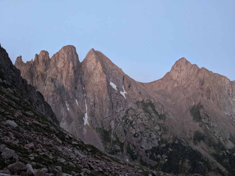
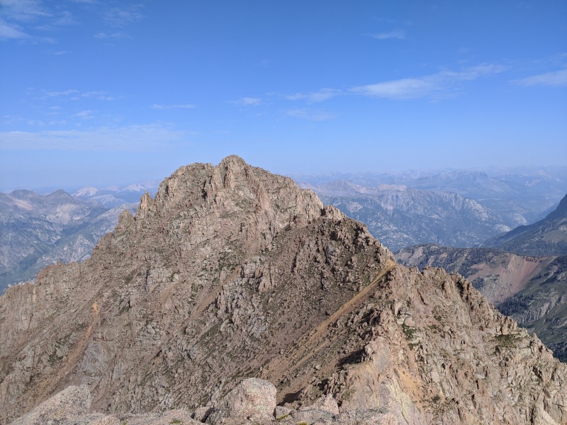
Parting shot of Little Finger, Sixteen, Fifteen, and Turret, L to R. Spy the tent in the meadow!
We stumbled our way through the willows, I got lost again at the last section (0 for 2), but made it back to camp around 4:30, for another 12 hour day. We could definitely get it done faster, but 12 hours the day before didn't exactly speed us up. We ate, napped, and refueled as best as possible, so we could be ready to do it all again the next day.
Day 3: Monitor, Thirteen, Animas
We had big plans this day: summit 3 peaks, pack up camp, and get all the way to the Animas River before dark. We woke up at 3:30 and were moving by 4 this morning, again bashing our way through the first part of the willows (0 for 3) before finding the trail. Right when we reached the upper meadow, we angled left up, fought through more willows, then began ascending a steep grassy slope, headed for the basin under Peak Thirteen.
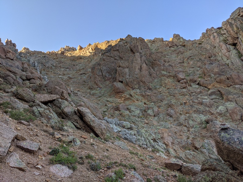
Grass was better than scree, and we made decent time despite our tired legs. I knew the route: locate and take the upper right angling ramp, cross a couple of sandy gullies, then go up. But I had a GPX track that I was following and that track was taking us toward a gully to the right of the ramp. The gully looked like it went, and when in doubt I prefer to stay on my electronic track, so we angled into the gully rather than the ramp.
Above the grassy slopes, ramp on left, gully on right
Morning light on P&T&15&16&LF
Right below where the gully steepens
A short class 4 pitch in the gully
Sunrise down the basin
The gully went just fine. There were two 8 foot sections of class 4, but they were solid. Here's where things could have gone better. What we should have done was find a weakness in the rock rib on the right and descend into the broad gully on the right, which led to the summit ridge. What we did was climb up and down this whole damn mountain trying to find a way that would go. If you reach the ridge crest, you've gone too far. The ridge proper doesn't go without some serious climbing.
Mistake number two was relying too heavily on the GPX track. That track seemed to be in impossible places constantly. On top of spires, on the ridge crest, on the other side of the ridge (more on that later), etc. I should have put it away and just trusted myself. But I didn't (yet), and ended up wasting probably a half hour trying to find the right way. I finally climbed to the top of the rib on the right, managed to spot a couple cairns in the broad gully, and descended to them to get back on track.
Upper gully. Should have found a weakness and gone right
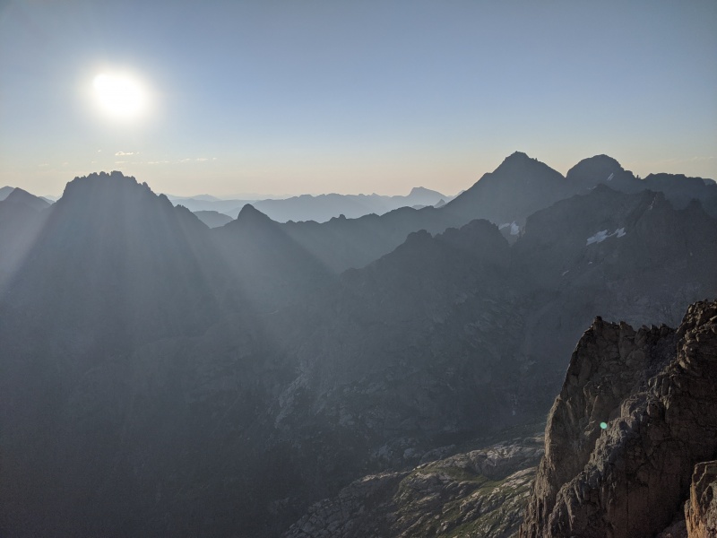
On the bright side, if I didn't get lost and scramble to the ridge crest, I wouldn't have got this picture of Jagged piercing the sun
This is the gully you want! Once in here, ascend to the ridge crest.
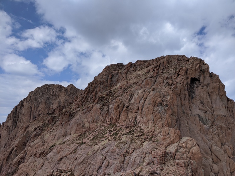
Once we were finally in the right gully, it was a quick ascent to the ridge crest, where a short scramble on largely solid blocks takes you to the summit of Monitor. The views toward Jagged are out of this world!
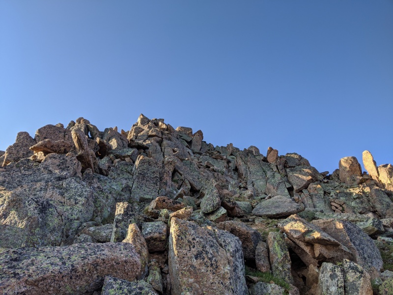
Last scramble to the summit
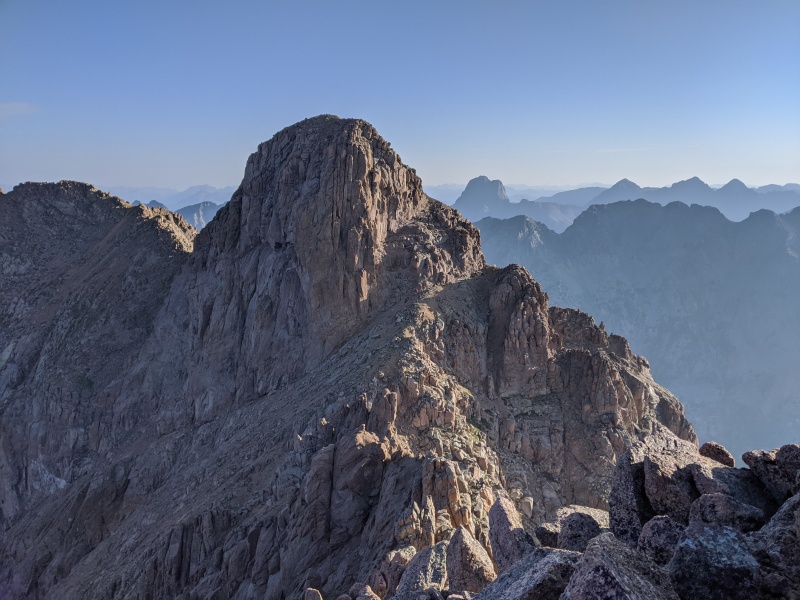
Looking toward Peak Thirteen. Note the lower bench and the upper bench on the right side of the mountain. Also, find the mountain goat!
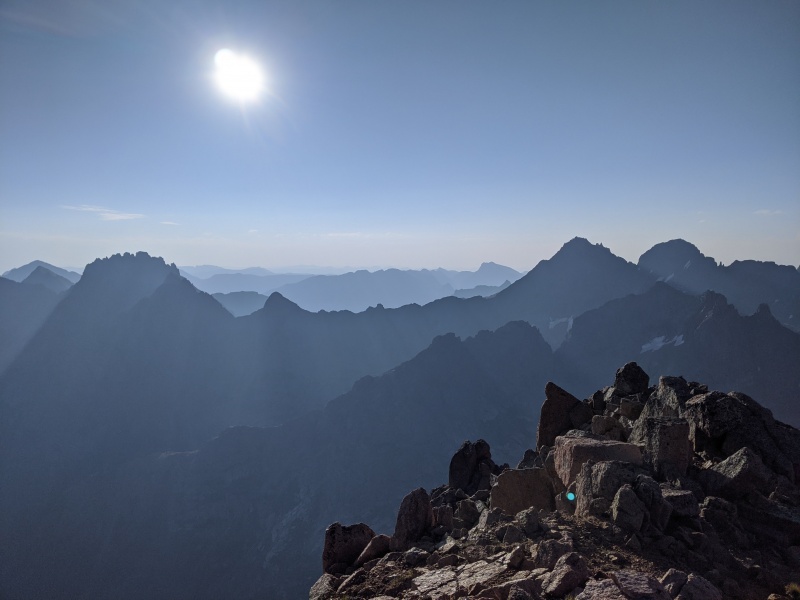
Jagged and co.
We began our descent, hoping to be more efficient than we were on the way up (we weren't). We knew that we needed to get to the Peak Thirteen saddle, then could figure it out from there. But I hadn't learned my lesson and still followed that stupid GPX track. The track took us all over again. What we should have done was descend the main gully, cross over a couple of gullies and rock ribs, and climb to the saddle. What we did.....well I don't even know. We somehow ended up on the other side of the ridge, downclimbed some serious terrain, and lost a trekking pole. Not ideal. But we eventually made it to the saddle in one piece.
From there, it's a hike along the first bench until you see an obvious weakness in the cliffs to the left. Climb up to the second bench there. Then wrap around the far side of the mountain, pick a route, and go up. Any number of options deposit you on the summit ridge of Thirteen.
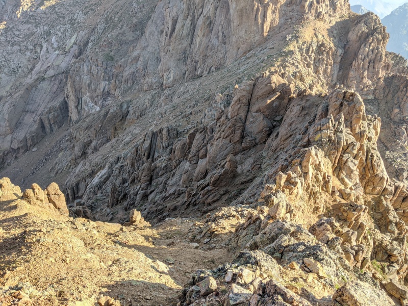
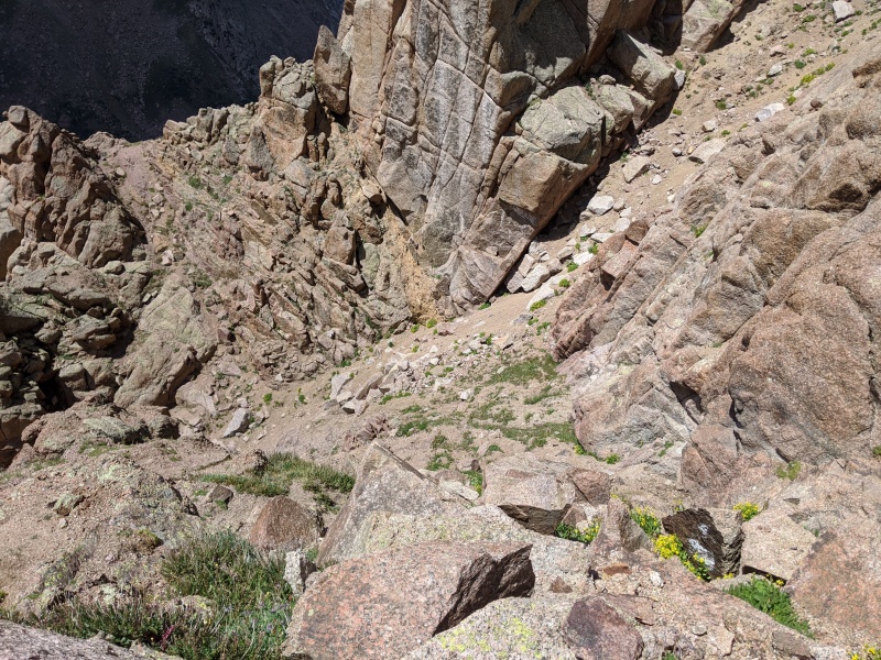
Descending Monitor. Just go down the gully and traverse until you hit the sandy slops below the saddle. Don't go right don't go right don't go right oh god they went right
Complicated terrain on Monitor from the slopes of Thirteen. The correct gully is below the prominent ridge that Ts into the summit ridge. Lots of confusing areas between that gully and the saddle.
After the foray onto the wrong side of the Monitor ridge, I decided to put the GPS away for good. And what do you know, routefinding went off without a hitch after that! We summitted Thirteen about an hour and a half after reaching Monitor, due in large part to us getting lost. The summit register was soaked, and we weren't done, so we took a couple of photos and descended off the other side toward Animas.
Animas from Thirteen
For the descent from Thirteen, this time you actually want to stay primarily on the right side of the ridge, as the terrain is gentler. Once about 150 vertical feet down the ridge, the terrain eases and you're deposited at a saddle between Thirteen and the grassy/rocky high point on the ridge. We traversed around the actual high point to the left to reach the 13,500 foot saddle that marks the ascent up Animas. Take note of this saddle, as it's your descent route.
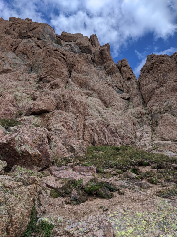
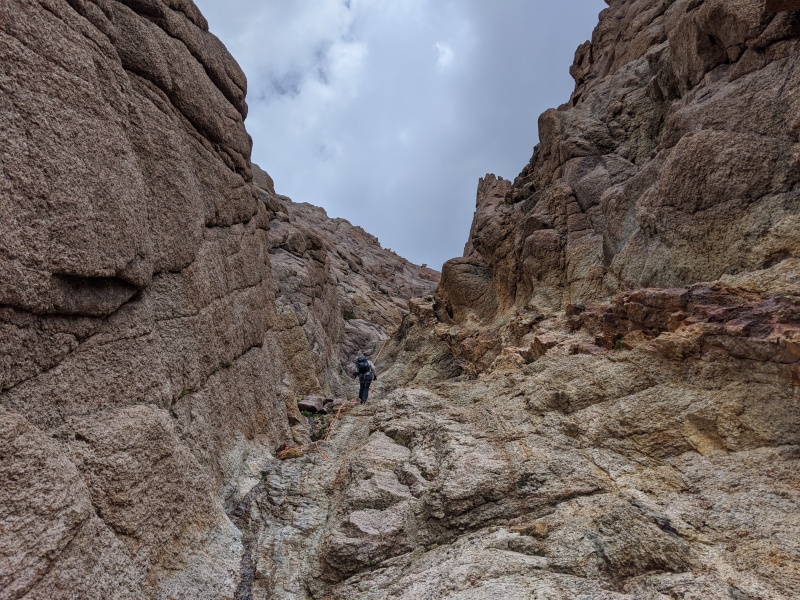
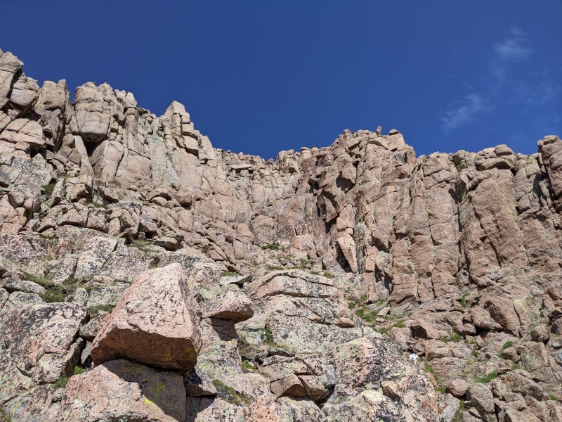
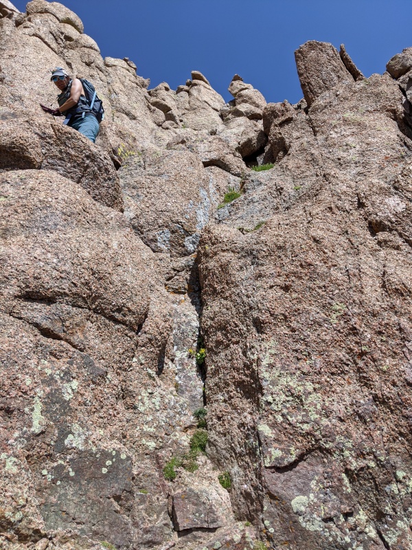
Animas begins with 200 feet of sandy ascent, which places you in a mini-cirque of steep cliffs with one weakness at the back. That weakness is 10 foot chimney that takes you above the initial cliffs and onto some class 3 ledges that lead to the summit. I agree with previous reports; the initial moves up the chimney are 5.0 with minimal exposure, and quickly ease into easier terrain. A couple of minutes later we were on summit number 3 of the day and 5 of the trip!
Upper cirque of Animas, chimney at the back.
Rose above the chimney
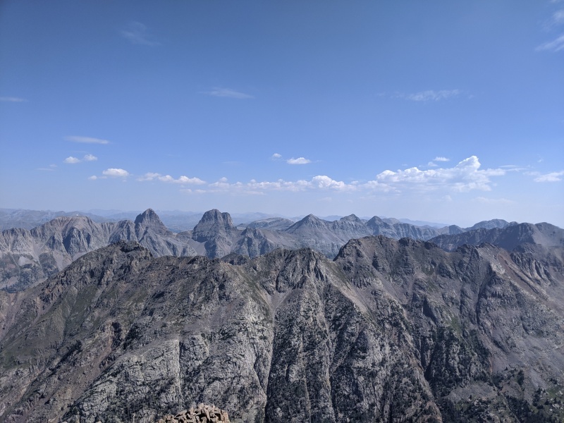
P&T&15
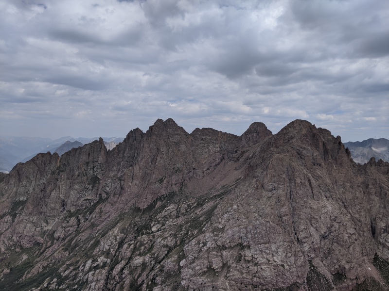
Looking back on Thirteen and Monitor
Grenadiers
We'd like to have lingered longer, but we still had a pack out to do. We retraced our route to the 13,500 saddle (the saddle closest to Animas), and started descending. The terrain is very loose kitty litter, but it's consistent, making it one of the best scree skis I've had in a while. We descended until the gully terrain gets more serious, around 13,050, and traversed skier's right onto ledges and grass. This gully cliffs out before you reach the tundra below, so you must leave it at this point. We traversed two gullies to the right until there is no further to traverse. We dropped into that gully, which is quite gentle and drops you off on the same grassy slopes we ascended up Monitor.
Here, we ran into Chicago Transplant and Floyd again. They had elected to skip Thirteen, as it's unranked, and Floyd was taking the direct ascent up Animas. Chi had already been up Animas, so he elected to join Rose and I for the descent. We followed him on his descent route sidehilling above the willows to hopefully make that part less sucky, and for the most part were successful. I managed to find my way through the last of the willows (1 for 4!) and we were back at camp, around 9 hours after leaving in the morning.
This wall blocks further traversing and forms the far wall of the descent gully.
Looking down the last gully, nice and sandy and gentle.
We quickly fueled up and packed up camp, and started our hike out of Ruby Basin. We knew this was going to be death march #2, and it did not disappoint. The prior 3 days' efforts were catching up to us. We limped our way down the hill, got passed by the guys again, and made it to campers meadow, where we realized that life would be better if we camped somewhere with a water source other than the Animas. We begrudgingly trudged an extra mile to a beautiful camp spot just shy of the Chicago Basin/Animas River Trail junction and 100 feet of Needle Creek. We hastily set up camp, ate, and zonked.
Above Ruby Lake, start of the grind out
Day 4: Hike out to Purgatory
We wanted to get back to the front range at a reasonable time (and also real food was calling our name), so we woke up at hit the trail by 4. The hike out was long, but descending out of Ruby the night before was a life saver. We just put one foot in front of the other, and 5 hours later we were back at a completely full Purgatory trailhead.
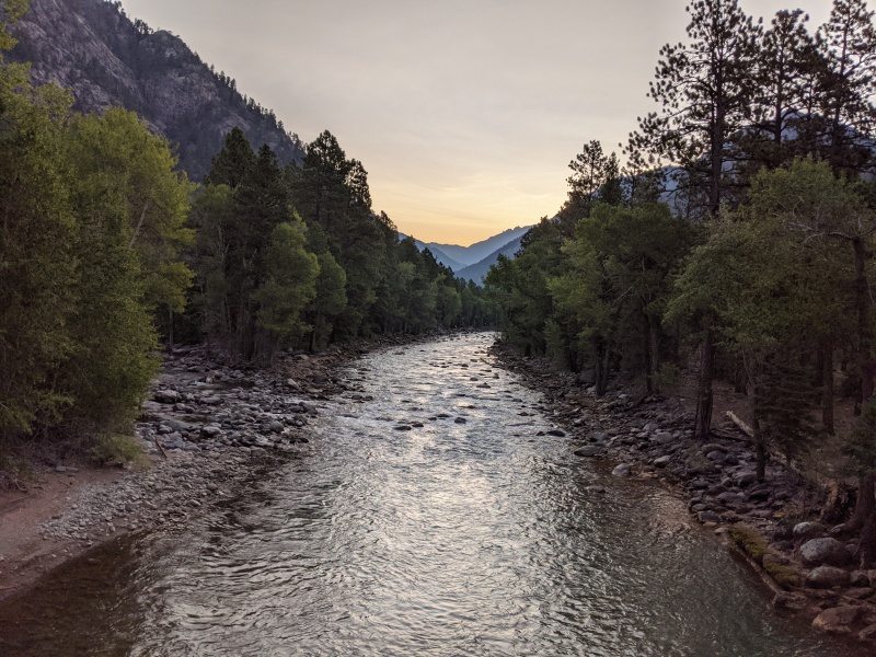
Sunrise crossing the Animas
We stopped for breakfast in Durango (mmmm pancakes, eggs, bacon never tasted so good), and Rose made the caffeine and sugar fueled drive back to the Springs, where I grabbed my car, headed toward Denver, and promptly hit stopped traffic on Monument Hill.
The experience and location of Ruby Basin is unmatched. It is remote and wild. The peaks here are unforgiving. It was truly a blessing we were able to go 5/5 on summits and experience one of those special places Colorado has to offer.
PS my GPS always seems to frazzle in this area. Same thing happened on Jagged. Wish I knew why or how to solve the problem, but I'll post the tracks anyway.
And thank you to Rose! She's always down for stupid long and difficult adventures at a moment's notice. She's a stupendous and very capable partner and climber. Can't thank you enough!
My GPS Tracks on Google Maps (made from a .GPX file upload):
Super bummed I didn't run into you guys. I had no idea anyone would be in that basin, let alone 2 sets of friends! Nice job on those peaks, and great write up as usual. Let's get out soon!
Nice write up, and really nice running into you and Rose and of course getting to chat on the way down from Animas! With the approach and the technical challenges, setting up and taking down 5 raps. This one may not have the hardest technical moves but as an overall experience it is easily top 5 hardest 13ers for me. Quite an adventure!
Also, nice meeting zdero1, we chatted on our way out with your group but never introduced ourselves. Hope you enjoyed Pigeon and Turret.
If I woke up with my head sewn to the carpet, I wouldn't have been any more surprised as when we approached the Pk15 ascent gully and Mike said, "I think I see hiking poles." That basin will take it out of you both mentally and physically. I had had it when I looked at that wall to gain the upper ledge on 13. The grassy ascent for Animas was the right choice for me. You guys crushed it. Congrats on some well-earned summits and I hope our paths cross again.
@floyd you too! Congrats on all the summits and success! I was honestly surprised there were people in the basin on a Thursday, let alone anyone else going up peak fifteen. Hope we run into each other on a climb again too!
Thx for all the beta . Not many reports as good as this. Great job summitting all those
Eventually working on more of the bicentennials after finishing up the centennials in the next couple of years.
No area like that in Colorado so spectacular
And free of people : we saw like two people when we did pigeon and turret
thanks for the kind words! Yeah, Ruby is a place where you can actually find some solitude. Best of luck on your goals!
Caution: The information contained in this report may not be accurate and should not be the only resource used in preparation for your climb. Failure to have the necessary experience, physical conditioning, supplies or equipment can result in injury or death. 14ers.com and the author(s) of this report provide no warranties, either express or implied, that the information provided is accurate or reliable. By using the information provided, you agree to indemnify and hold harmless 14ers.com and the report author(s) with respect to any claims and demands against them, including any attorney fees and expenses. Please read the 14ers.com Safety and Disclaimer pages for more information.
Please respect private property: 14ers.com supports the rights of private landowners to determine how and by whom their land will be used. In Colorado, it is your responsibility to determine if land is private and to obtain the appropriate permission before entering the property.
")
")
")
")
")
")
")
")
")
")
")
")
")
")
")
")
")
")
")
")
")
")
")
")
")
")
")
")
")
")
")
")
")
")
")
")
")
")
")
")
")
")
")
")
")
")
")
")
")
")