Download Agreement, Release, and Acknowledgement of Risk:
You (the person requesting this file download) fully understand mountain climbing ("Activity") involves risks and dangers of serious bodily injury, including permanent disability, paralysis, and death ("Risks") and you fully accept and assume all such risks and all responsibility for losses, costs, and damages you incur as a result of your participation in this Activity.
You acknowledge that information in the file you have chosen to download may not be accurate and may contain errors. You agree to assume all risks when using this information and agree to release and discharge 14ers.com, 14ers Inc. and the author(s) of such information (collectively, the "Released Parties").
You hereby discharge the Released Parties from all damages, actions, claims and liabilities of any nature, specifically including, but not limited to, damages, actions, claims and liabilities arising from or related to the negligence of the Released Parties. You further agree to indemnify, hold harmless and defend 14ers.com, 14ers Inc. and each of the other Released Parties from and against any loss, damage, liability and expense, including costs and attorney fees, incurred by 14ers.com, 14ers Inc. or any of the other Released Parties as a result of you using information provided on the 14ers.com or 14ers Inc. websites.
You have read this agreement, fully understand its terms and intend it to be a complete and unconditional release of all liability to the greatest extent allowed by law and agree that if any portion of this agreement is held to be invalid the balance, notwithstanding, shall continue in full force and effect.
By clicking "OK" you agree to these terms. If you DO NOT agree, click "Cancel"...
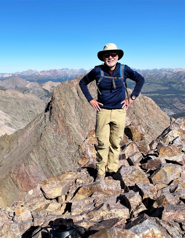
It felt great to finish the Centennials on August 15, though it was a few years behind schedule. After climbing seven in 2016 my count was at 87, so figured I could finish in two more years. But it took twice as long, geezers move slowly. Nevertheless, maybe it’s more noteworthy to finish after turning 70. Started climbing centennials over a decade ago while finishing the 14ers, would use them as warmups before climbing some of the more difficult 14ers. By the time I’d finished the 14ers on Little Bear in 2013, I’d climbed 17 of the centennial 13ers so was on my way.
With only two remaining at the beginning of this year, I was on a mission to finish. But with the possibility of snow on Vestal’s northern approach I waited until August to attempt a climb. I started watching the weather forecast in late July hoping for a dry spell. The Silverton forecast was dry for the week of August 10 so I tried contacting potential partners for a trip to Vestal. Unfortunately, because of injury, fitness, and schedules (some Covid constrained) I couldn’t enlist any of the usual suspects and had to go solo.
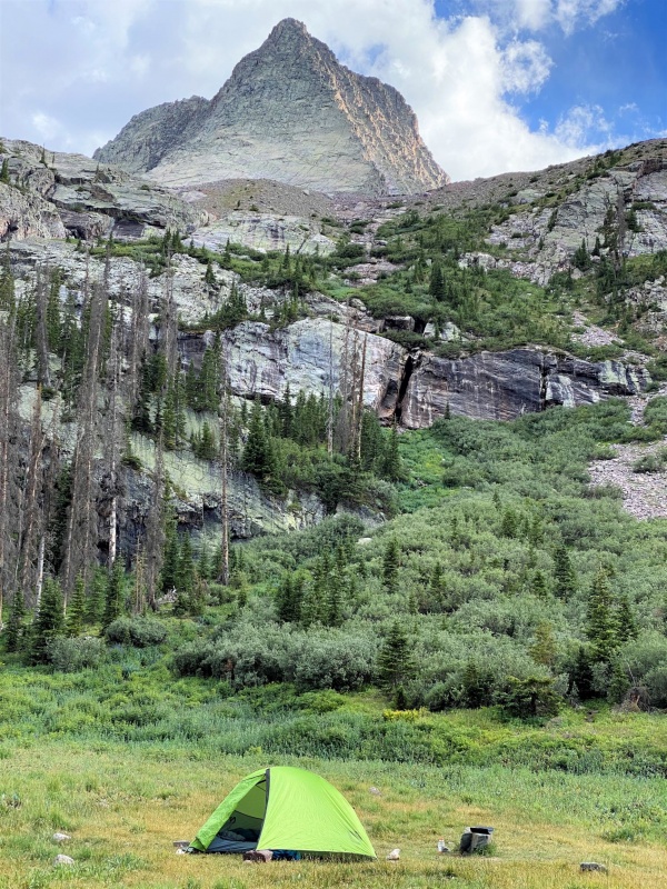
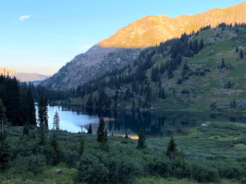
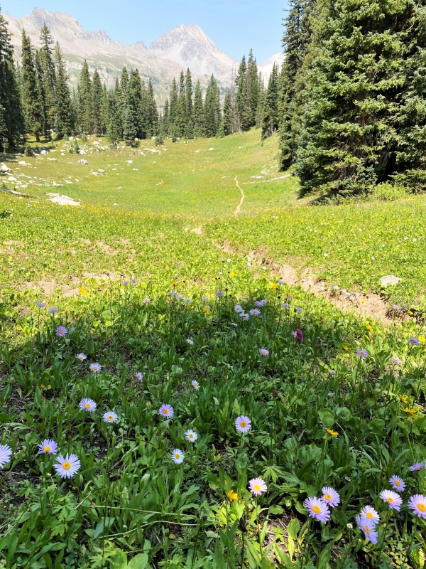
With the train idle this year, the approach to Vestal is from Molas pass about five miles south of Silverton. The route follows the Colorado trail for about eight miles, then turns south and climbs two miles to a meadow below the Arrow-Vestal saddle at 11,400 ft. The meadow has several great campsites, and after setting up my tent I went to introduce myself to two other campers who were hanging out at the edge of the meadow. Larry, an ER doc, and his son Wes were also targeting Vestal the next day, so we agreed to climb together. At my age I should probably have an ER doc on all my climbs.
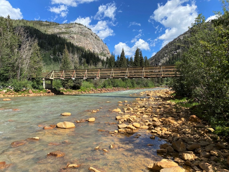
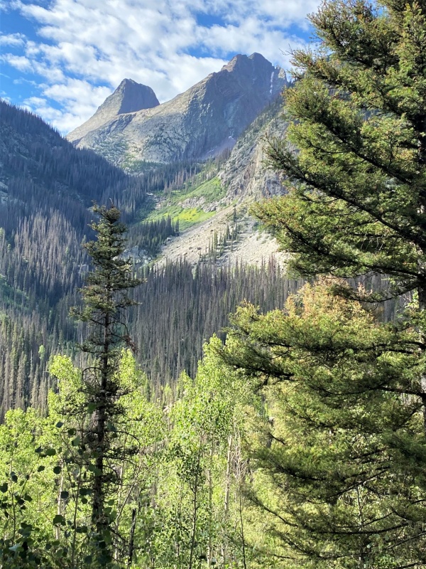
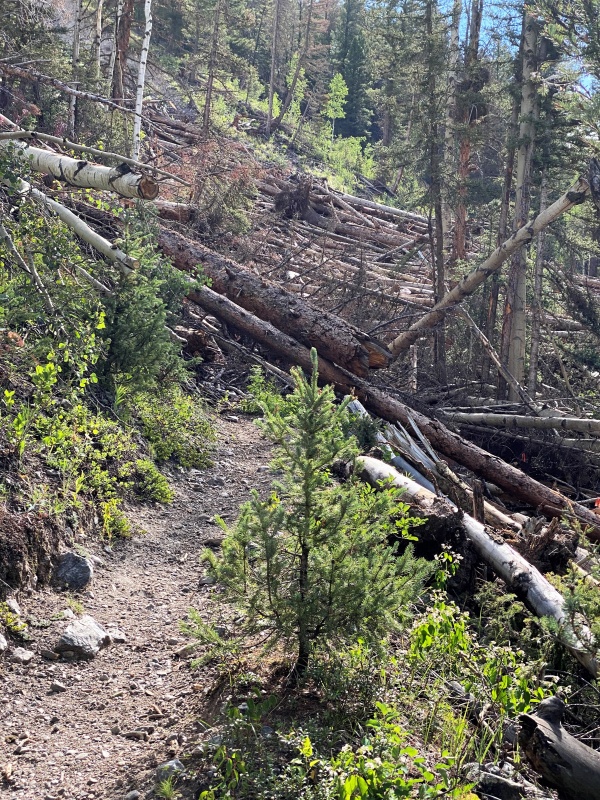
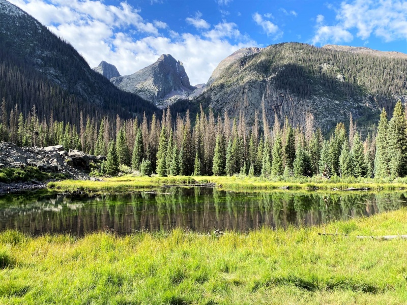
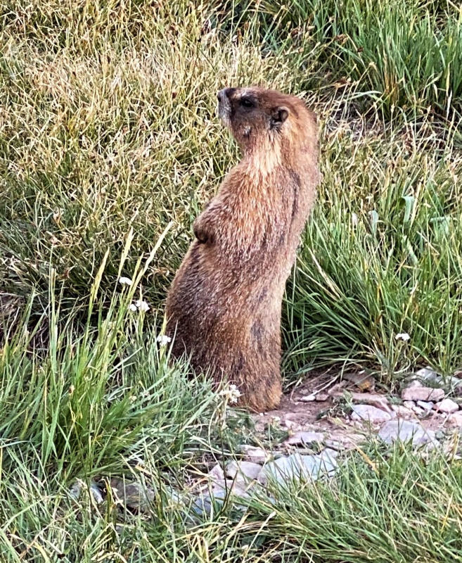
Colorado trail crosses the Animas River about 4 miles from Molas PassAbout six miles from the trailhead get view of Vestal Peak (left) and Arrow Peak (right)Great trail until you avalanche debrisView of Vestal and Arrow from beaver pond where route leaves the Colorado TrailCampsite in meadow with view of Vestal PeakMany marmots in meadow, this one was most sociable
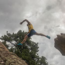
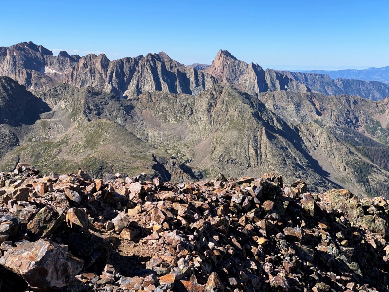
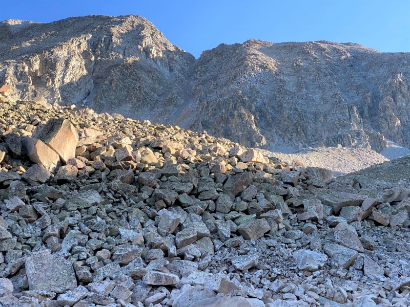
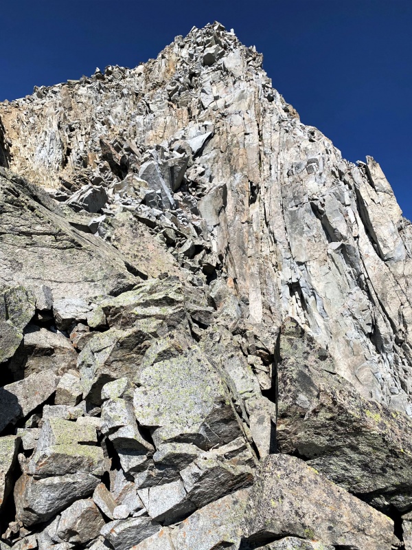
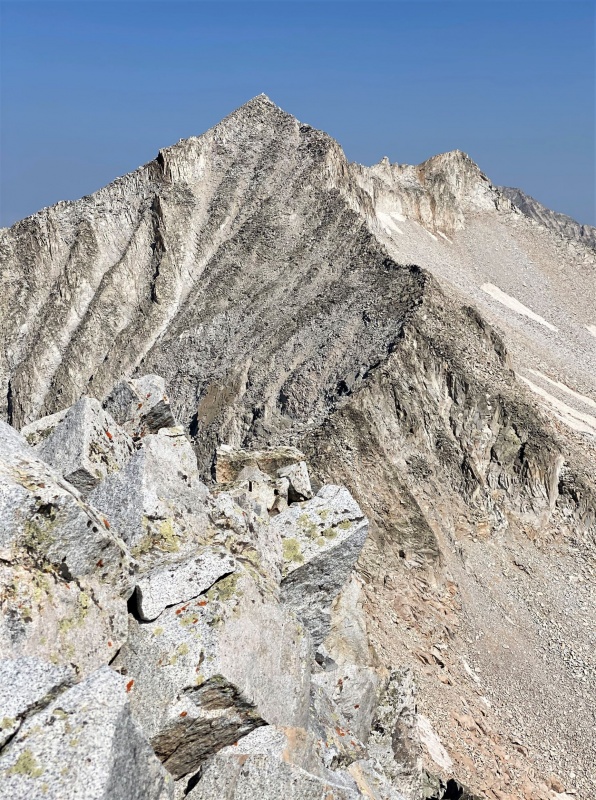
The crux of the route is the climb to Vestal’s saddle. Roach calls it the “Dues Collector,” a steep lane of loose dirt and scree. Larry had been to the saddle twice before on unsuccessful summit attempts and suggested climbing further west on a mix of loose dirt and talus. This was an excellent recommendation, the saddle is lower further west and the route a little more stable. I would compare it to the route from Willow Lake to Challenger, though there is no defined trail to Vestal’s saddle. During our return to camp we chatted with a trail runner/climber from Grand Junction who was on a day trip, running in from Molas Pass, going up Wham Ridge to Vestal, then to Arrow, and back to the trailhead in a day. About 25 miles and two summits, unbelievable! Anyway, he came down the Dues Collector and said it was the worse piece of mountain he’d ever been on.
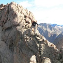
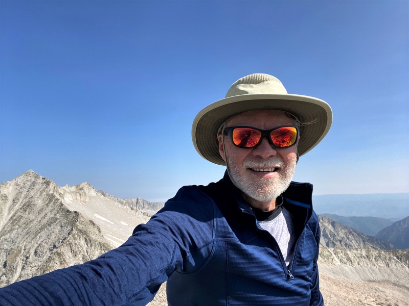
Summit shot, Arrow Peak in backgroundView south toward Needle Mountains
After descending back to the meadow, Larry and Wes packed up and headed out, and I had the meadow to myself. I had fantasized about climbing Arrow, but was too fatigued. I hadn’t taken time to acclimate, drove from Kansas City to Montrose on Sunday, then hiked 10 miles to camp on Monday with a heavy overnight pack. I felt much more energetic on Wednesday during the hike out, even during the 1600 ft. climb from the Animas River back to Molas Pass.
An interesting aspect of the trip to Vestal was a glimpse of the thru-hike culture on the Colorado trail. Round-trip, I was on the trail about 16 miles, and chatted with a few thru-hikers during rest breaks. The most interesting was a guy named Batista who was carrying a pack smaller than my standard day-pack. How could this be? Other than food, the heaviest and bulkiest components of a pack are typically the tent, sleeping bag, and sleeping pad. Batista had none of these, only a hammock and light quilt. The obvious question is: what good is the hammock above tree-line? Batista said he slept on the ground only two nights, and the alpine tundra is pretty soft. He talked about being tutored by another thru-hiker, who was trying to hike the entire 486 mile trail without being resupplied with food. She gave him tips on finding edible roots and mushrooms along the trail. Others I talked to were more conventional.
After returning to Silverton on Wednesday I pondered my next move. I wanted to attempt Hagerman, but didn’t want to drive my vehicle back to Crystal. When I first drove my light-duty SUV (RDX) up that nasty Jeep road last September I swore: “never again.” Unfortunately, the geezer memory is weak, so ten months later in July 2020 I drove there a second time, and swore: “never again, and this time I mean it.” My first climb in 2019 was aborted because of weather. After rising in the dark and hiking for about an hour and half from Crystal toward Geneva Lake I watched the sunrise reveal about six inches of fresh snow that fell overnight high on the mountain. When I tried again in July 2020 I got off-route in the wrong gully after leaving the trail, and became physically and emotionally exhausted on some sketchy terrain.
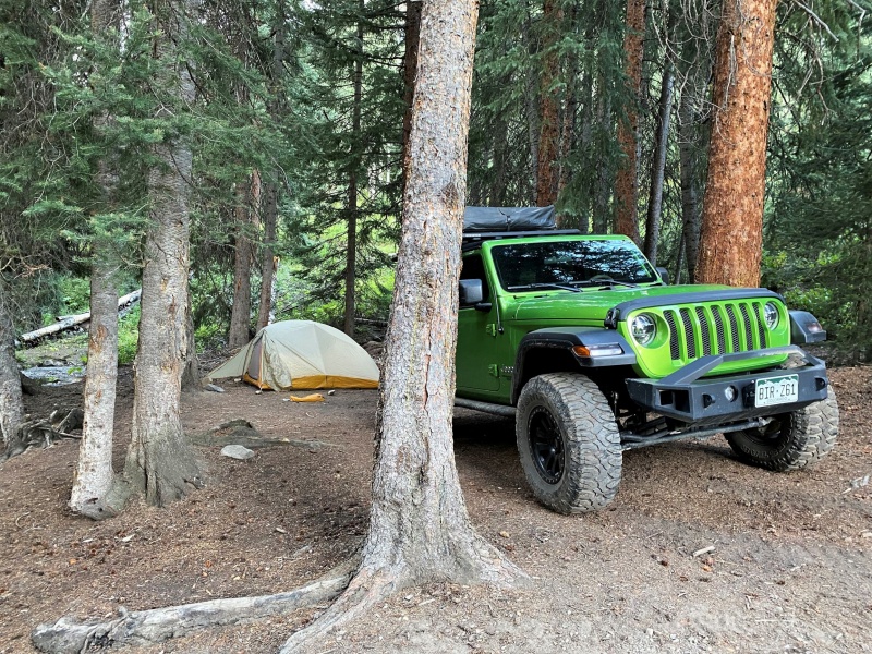
I found a Jeep for rent in Glenwood Springs, so decided to attempt Hagerman on Friday after resting on Thursday. The drive to Crystal in the Jeep was a pleasure, must have been smiling the entire way. So much better than the white-knuckle drive with my low-clearance SUV. The road above Crystal gets much worse, very rocky and some minor cliff-bands, but only a few white-knuckle moments. I set up my tent by a stream near the Lead King Basin Trailhead. Happy to start at the higher TH, Hagerman is not a cakewalk.
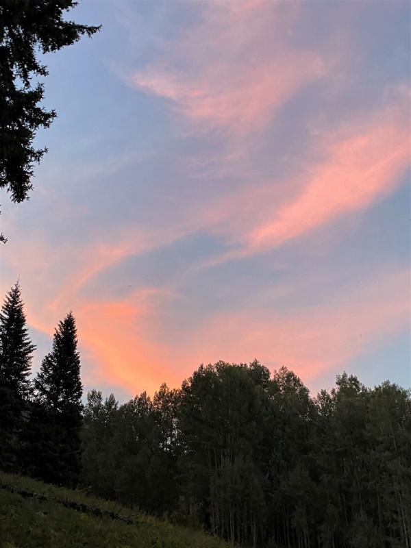
The Mean Green Machine at Lead King Basin campsiteLead King Basin sunset
The route up Hagerman gets progressively more challenging. A great trail for about two miles to Geneva Lake, and for another mile toward Trail Rider Pass until leaving the trail near 11,500 ft. elevation. From here, the gully to the north and north-east is easy when the stream is low. You can usually follow the bank along the edge of the stream, and when the bank gets steep, you can easily climb up rocks in the middle of the stream-bed. At about 12,000 ft. elevation, the route takes you across a large boulder field toward the crux, which is the gully to the saddle between Hagerman and Snowmass Peak.
Sunrise over Geneva LakeView of gully from boulder field
This loose gully is probably the most challenging 1100 ft. elevation gain of any mountain I’ve climbed. Loose rocks lurk everywhere, waiting to slip out from under your feet or pulled loose by your hand to launch a major rock-slide. This is definitely a mountain to climb solo. Although Roach rates it as class 2+, I felt far more comfortable on the solid rock on my three ascents of class 3 Crestone Needle. Thunder Pyramid also has a bad reputation, but I found it much less hazardous than Hagerman’s gully. I even felt more comfortable on my roped class 5 climbs, the three Centennials plus Granite Peak in Montana. I’ve repeated all the difficult 14ers, and am usually willing to climb any again, Little Bear being the one exception. Of the Centennial 13ers, Hagerman is my least favorite, followed far back by Cathedral. Cathedral’s sketchy section is short compared to Hagerman’s. The only way I’d go back up Hagerman is if Scarlett Johannson asked me to guide her, or maybe Selma Hayek.
The final ridge to the summit is a fun scramble. I’d put it at Class 3 rather than Roach’s Class 2, but I think Roach generally underrates the Centennials compared to the 14ers. Another example is Mount Adams southeast face that takes you to the northeast ridge. Roach rates this 2+, but Tallgrass and I navigated that route together and neither of us could avoid a few Class 3 moves. Still, solid rock and a great climb. Similarly on Vestal; Larry, Wes, and I all made a few Class 3 moves in the gully approaching the final ridge.
Ridge from saddle toward summit (really Gerry, class 2?)Summit selfie toward SnowmassRidge toward Snowmass MountainFlowers along trail, Meadow Mountain in background
Some final observations on the Centennials. I did most of them solo, but have also had some awesome climbing partners. Special thanks to Tallgrass for leading me up Teakettle and Dallas, and Mason (San Juan Mountain Guides) for Jagged. I went up Jagged the year before the chockstone fell into the upper chimney, so will probably never know whether I could climb it in current conditions. Other awesome partners include billelliot, invisiblebear, rockchalker, JChitwood, sunny1, fishdude, spiderman, RobertKay, and Exiled Michigander. Several others not on this site, and maybe some on this site I’ve forgotten. Hell, my mind is deteriorating faster than my body. Need to start looking at assisted-living facilities. Maybe can find one whose “social activities” include mountain climbing. Still need five more summits to complete second circuit of 14ers.
It’s been great to reach a climbing goal, but I haven’t decided on whether to set another one. For me, it’s mostly about getting outside, getting exercise, and staying fit, rather than achieving a specific goal. As added motivation, many experts say Vitamin D is especially important for a healthy immune system in these difficult times. Of course, the mountains are still special places. Whether formed by molten lava escaping the earth’s mantle and gushing up through weaknesses in the earth’s crust, or by dramatic uplift caused by the collision of the earth’s tectonic plates, they can lift the spirits of those seeking inspiration or seeking meaning, from within or from above.
Thumbnails for uploaded photos (click to open slideshow):
Vestal's unique facade has always fascinated me but your photos make an impressive subject look even more incredible! Congrats on the accomplishment and thanks for sharing!
Most excellent trip report. What an accomplishment to knock off all the Cents. So John if you went up the gully in your picture entitled View of gully from boulder field then up the ridge from the top of the gully that would appear to be Roach's East Ridge route which even he describes as difficult class 3. Gerry's narrative is funny describing the route as a ridiculous place for a large party and the ridge you climbed in your Ridge from saddle toward summit photo as a loose, undesirable place. Don't know maybe you wanted to climb the tougher route for your Cent finisher, but it appears the easier South Face route ascends the terrain to the left of the gully in your photo. But what do I know I haven't been up there three times like you have. Either way, great job wineguy.
I missed having your navigational skills. Looks like I missed the easy way. I need to spend more time looking at route descriptions. I should have known something was off, Roach has the easy route topping off at 13,800 ft. on the ridge, but the saddle I hit was lower. My photo of the ridge is below 13,800 ft., where Roach's standard route hits the ridge. Guess I'll have to go back there with you and you can show me the correct route.
And perseverance, both of which you have.
This is a great read, John, and excellent accomplishment.
Congrats again!
p.s. I'm starting to think you must have restless leg syndrome... :)
Caution: The information contained in this report may not be accurate and should not be the only resource used in preparation for your climb. Failure to have the necessary experience, physical conditioning, supplies or equipment can result in injury or death. 14ers.com and the author(s) of this report provide no warranties, either express or implied, that the information provided is accurate or reliable. By using the information provided, you agree to indemnify and hold harmless 14ers.com and the report author(s) with respect to any claims and demands against them, including any attorney fees and expenses. Please read the 14ers.com Safety and Disclaimer pages for more information.
Please respect private property: 14ers.com supports the rights of private landowners to determine how and by whom their land will be used. In Colorado, it is your responsibility to determine if land is private and to obtain the appropriate permission before entering the property.
")
")
")
")
")
")
")
")
")
")
")
")
")
")
")
")