Download Agreement, Release, and Acknowledgement of Risk:
You (the person requesting this file download) fully understand mountain climbing ("Activity") involves risks and dangers of serious bodily injury, including permanent disability, paralysis, and death ("Risks") and you fully accept and assume all such risks and all responsibility for losses, costs, and damages you incur as a result of your participation in this Activity.
You acknowledge that information in the file you have chosen to download may not be accurate and may contain errors. You agree to assume all risks when using this information and agree to release and discharge 14ers.com, 14ers Inc. and the author(s) of such information (collectively, the "Released Parties").
You hereby discharge the Released Parties from all damages, actions, claims and liabilities of any nature, specifically including, but not limited to, damages, actions, claims and liabilities arising from or related to the negligence of the Released Parties. You further agree to indemnify, hold harmless and defend 14ers.com, 14ers Inc. and each of the other Released Parties from and against any loss, damage, liability and expense, including costs and attorney fees, incurred by 14ers.com, 14ers Inc. or any of the other Released Parties as a result of you using information provided on the 14ers.com or 14ers Inc. websites.
You have read this agreement, fully understand its terms and intend it to be a complete and unconditional release of all liability to the greatest extent allowed by law and agree that if any portion of this agreement is held to be invalid the balance, notwithstanding, shall continue in full force and effect.
By clicking "OK" you agree to these terms. If you DO NOT agree, click "Cancel"...
“Every Mountain” – 13691 & “Cooper Creek Peak” – 13688
RT Length: 12.93 miles
Elevation Gain: 3987’
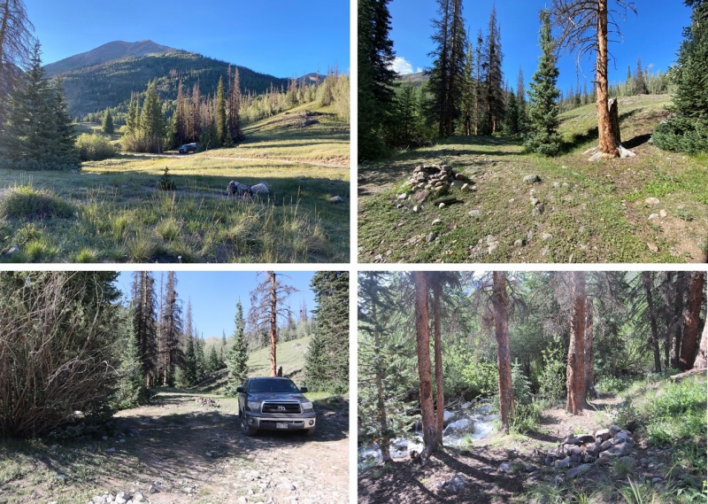
The Cooper Creek Trailhead is located about a mile past the Silver Creek/Grizzly Gulch trailhead on 30 past Lake City. There were cars parked and camping at the trailhead, so I parked at a dispersed camping spot right next to Cooper Creek.
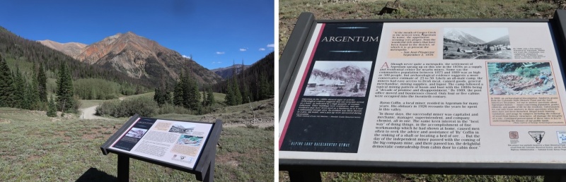
It was still early so I decided to take a look around. The Cooper Creek Trailhead is located in the historic town/settlement of Argentum, and there were still some old structures in the area.
It was an uneventful night. I slept soundly until midnight, when campers at the spot across from me returned from their outing. They weren’t loud, but they did wake me up. I went back to bed and didn’t wake up again until my alarm went off. I was on the trail at 5am. The Cooper Creek Trailhead is just to the west of Cooper Creek, visible from the road.
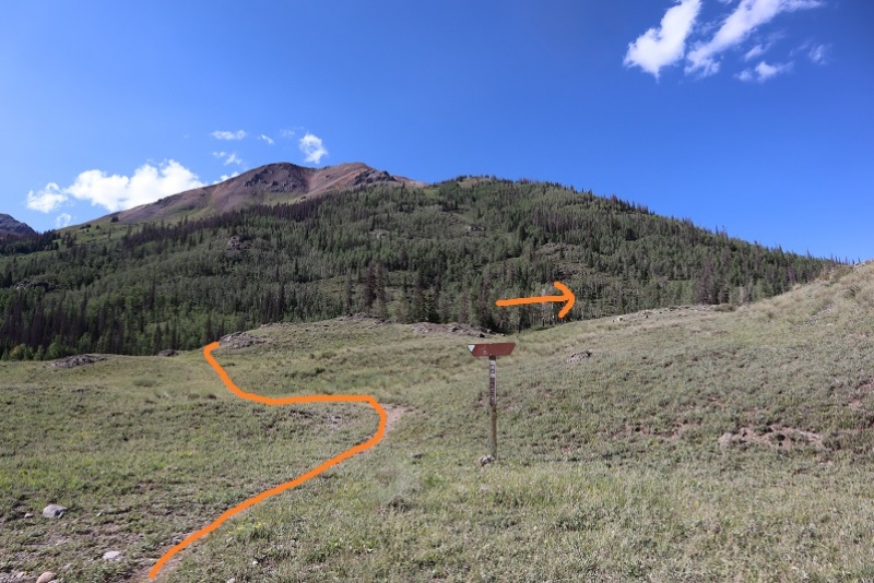
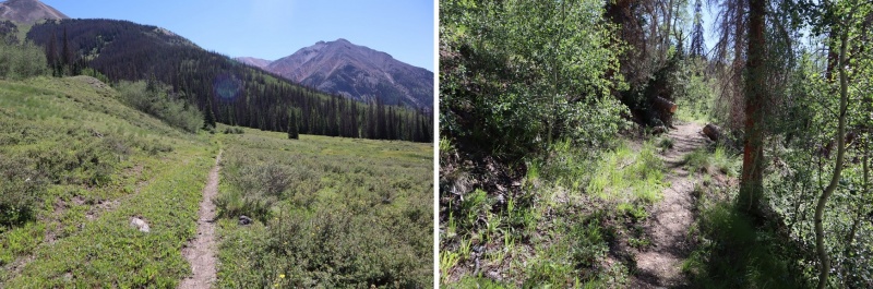
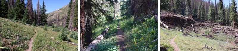
The trail is class 1 for the first 3 miles, and seems to follow an old mining road.
After hiking for 1.5 miles the trail crosses Cooper Creek, just where an overturned trailer sits in the water. It looks like it’s been there for a long time.
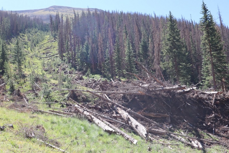
The trail continues to follow the creek up to the basin, passing a fresh avalanche area (there was still snow under the trees, but there was a clear path to follow)
After 3 miles of hiking along this class 1 trail it abruptly stopped. I crossed the creek and headed northeast along the mountainside, eventually picking up another class 1 trail (I’m not sure where it had started, as I crossed the creek at a couple of cairns and must have missed the trail)
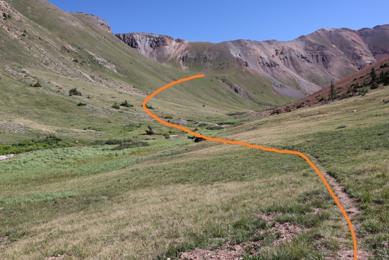
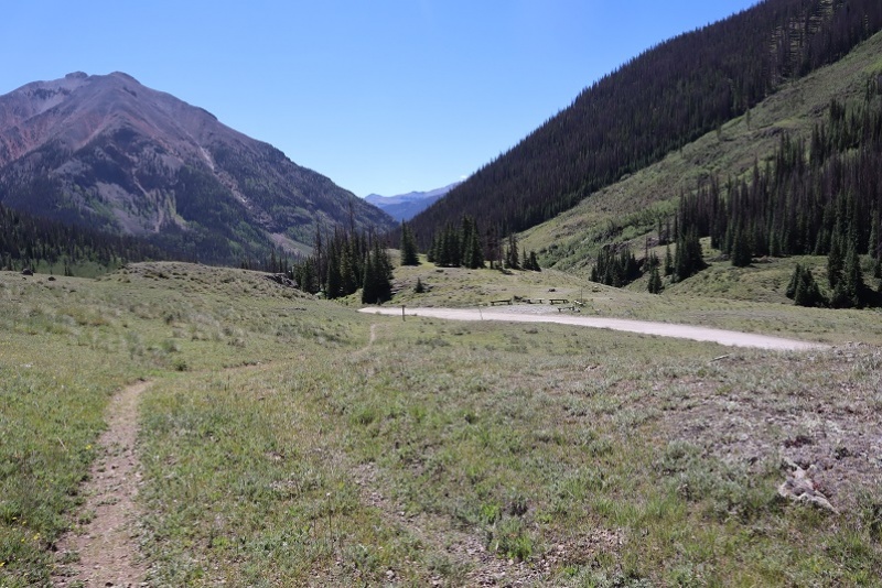
The trail eventually leads to a lake in the upper basin (going left), but I didn’t follow it that far. Instead I crossed Cooper Creek one more time and headed towards an old mine to check it out. If you don’t want to check out the mine, here’s the overall route to gain the ridge.
The creek crossing was simple
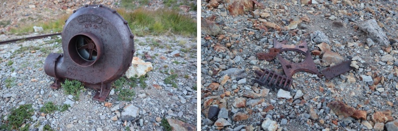
The mine was filled in, but there were some pieces of equipment lying around.
I turned around and noticed 2 tents set up along the trail that leads to the lake and a couple other 13ers in the area. It was just starting to get light so I decided to be quiet as I gained the ridge. Eventually I found a trail here that led to the ridge as well (it actually goes up and over and down into the basin on the other side of the ridge)
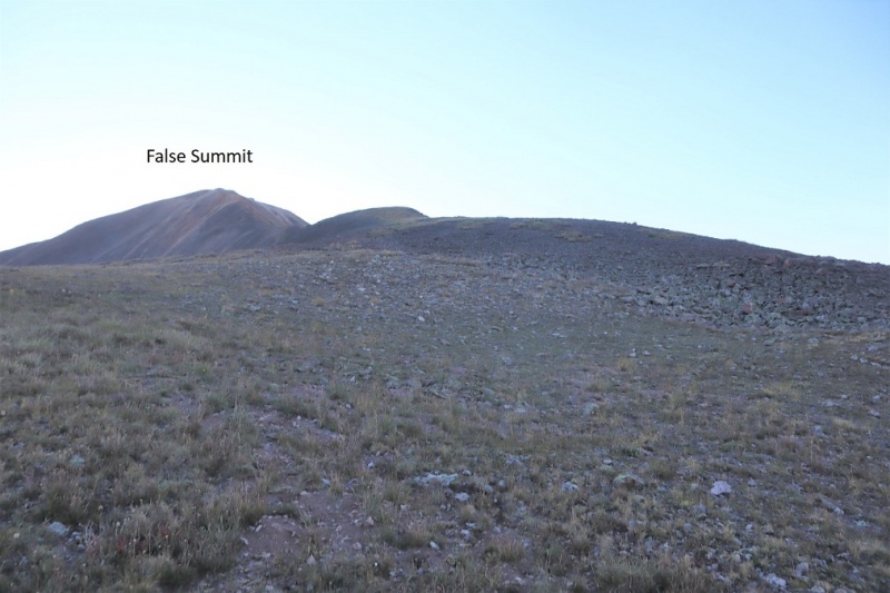
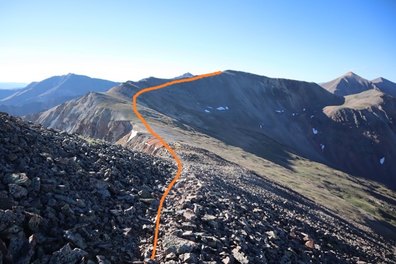
Once I gained the ridge I turned right (east) and followed the ridge towards a false summit.
After reaching the false summit it was a half mile hike along the ridge to the actual summit. This was class 2, with no real obstacles to overcome.
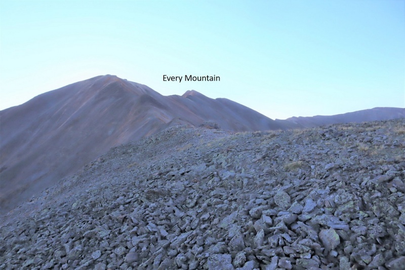
I made it to the summit of Every Mountain at 7:55am
“Every Mountain”
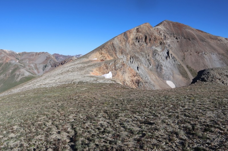
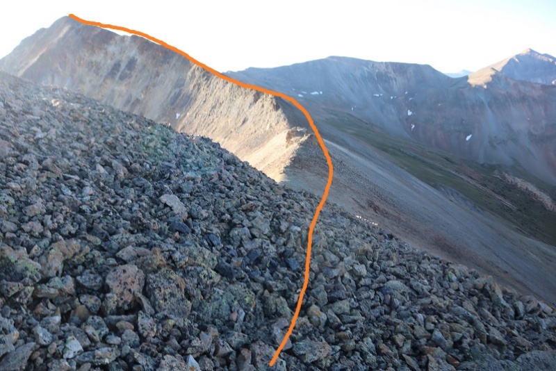
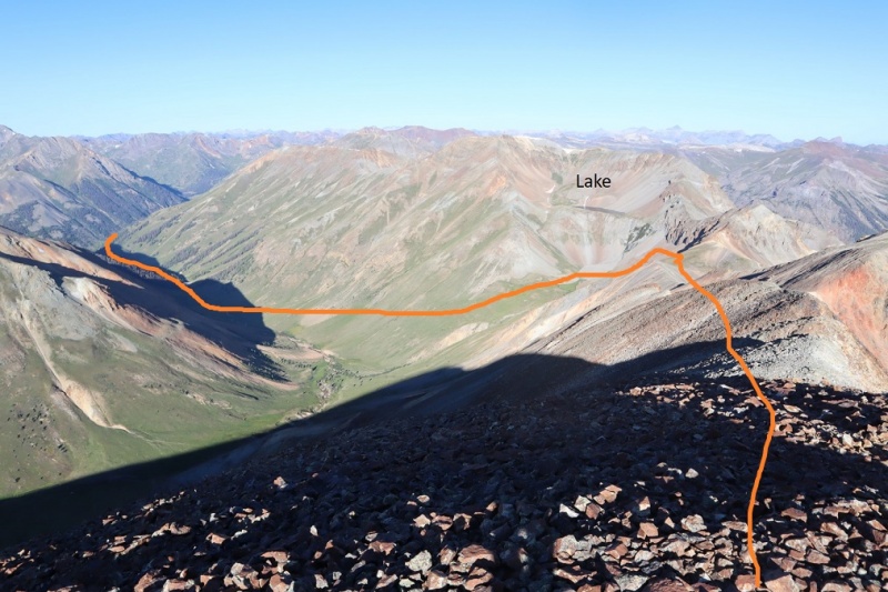
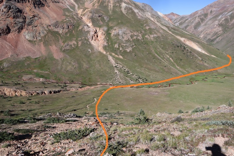
Here’s a look back at my route in
Here’s a look at the route over to Cooper Creek Peak
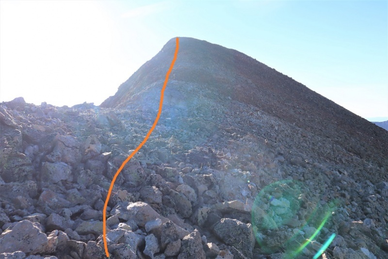
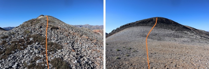
This was another easy class 2 ridge hike without any difficult obstacles. At times there is even a trail. Actually, there are quite a few game trails here.
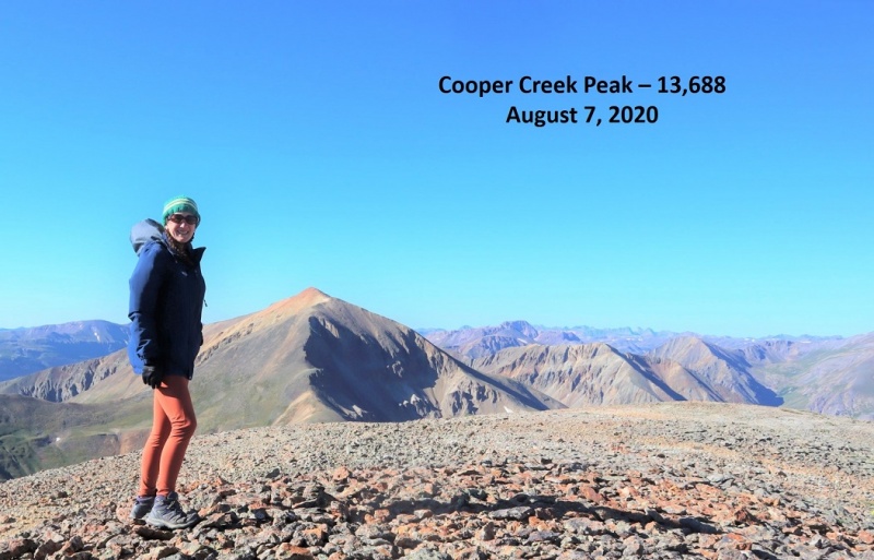
I summited Cooper Creek Peak at 8:50am. It was very, very windy.
“Cooper Creek Peak”
Because it was windy it was also cold, so I didn’t stay long on the summit. Instead I headed back down to the Every Mountain/Cooper Creek Peak saddle and from there down into the basin
Here’s the overall route
I hiked down the grassy slope, aiming for the creek. I then crossed the creek and stayed a little high to avoid the muddy areas
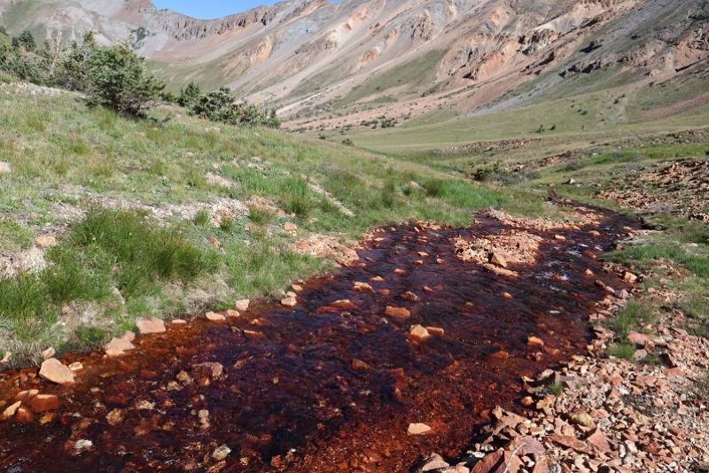
The creek didn’t look like it had water fit for filtering
Still, I followed it back to the trail
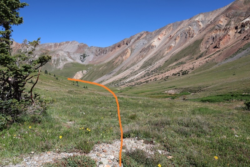
Here’s a look back at my way down the basin
And the route back on the class 1 trail
Back across the creek
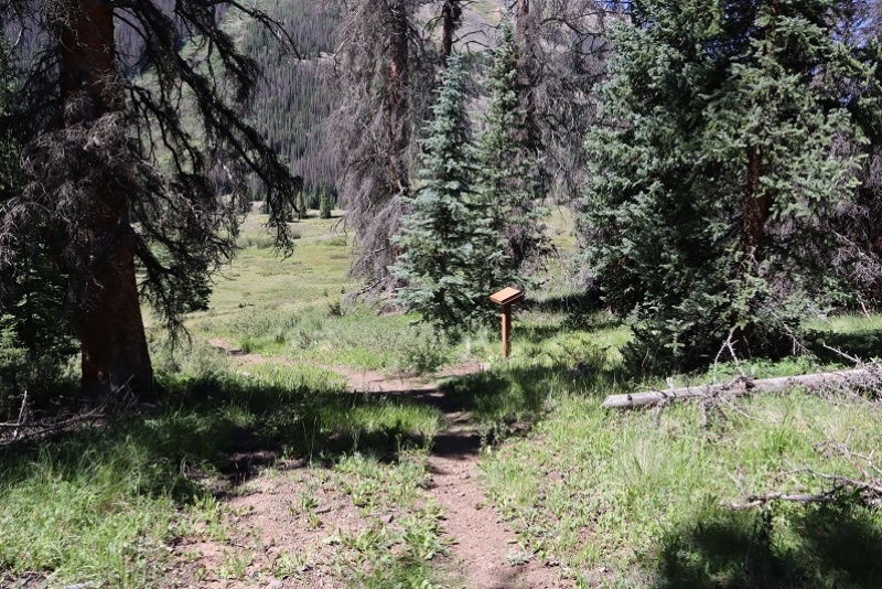
And back to the trailhead. On my way out I noticed a trail register I hadn’t seen on my way in
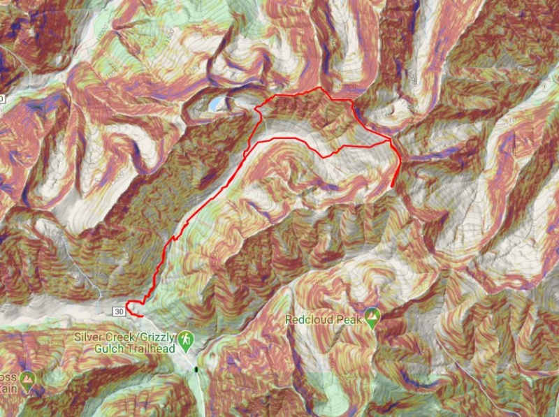
I made it back to my truck at 11:10am, making this a 12.93 mile hike with 3987’ of elevation gain in 6 hours, 10 minutes. Here’s a topo map of my route:
It was still early and I wasn’t yet tired, so I decided to drive to the next trailhead and get in a few more peaks for the day…
Thumbnails for uploaded photos (click to open slideshow):
We followed basically same route. Fairly nice terrain and game trails the whole way.
Caution: The information contained in this report may not be accurate and should not be the only resource used in preparation for your climb. Failure to have the necessary experience, physical conditioning, supplies or equipment can result in injury or death. 14ers.com and the author(s) of this report provide no warranties, either express or implied, that the information provided is accurate or reliable. By using the information provided, you agree to indemnify and hold harmless 14ers.com and the report author(s) with respect to any claims and demands against them, including any attorney fees and expenses. Please read the 14ers.com Safety and Disclaimer pages for more information.
Please respect private property: 14ers.com supports the rights of private landowners to determine how and by whom their land will be used. In Colorado, it is your responsibility to determine if land is private and to obtain the appropriate permission before entering the property.


")
")
")
")
")
")
")
")
")
")
")
")
")
")
")
")
")
")
")
")
")
")
")
")
")
")
")
")
")
")
")
")
")
")
")
")
")
")
")
")
")


