| Report Type | Full |
| Peak(s) |
Hunts Peak - 13,061 feet Cottonwood Peak - 13,597 feet Mt. Marcy - 13,504 feet Mt. Adams - 13,937 feet Challenger Point - 14,086 feet Kit Carson Peak - 14,167 feet Columbia Point - 13,986 feet Broken Hand Peak - 13,575 feet California Peak - 13,854 feet Ellingwood Point - 14,057 feet |
| Date Posted | 08/03/2020 |
| Date Climbed | 07/26/2020 |
| Author | astranko |
| Additional Members | zephyr_pelicante |
| Everymans' Sangre de Cristo Traverse | |||||||||||||||||||||
|---|---|---|---|---|---|---|---|---|---|---|---|---|---|---|---|---|---|---|---|---|---|
|
Everyman’s Sangre de Cristo Traverse Sixteen Days, 63,000ft of Gain, 112 Miles, and Two Determined Fools Days 1-6: Anthony Stranko Days 6-16: Anthony Stranko and Colby Renfro First, I have to thank those that made this all possible. Thank you to Larissa, Blair, Mitch, and all the other random people who helped and supported us along the way. This was not in any way the efforts of a pair of men plunging into the unknown, but a patchwork of love and effort from people who had no investment but care for the two of us. People who would have preferred us home and safe put in more than can be described here, and we couldn’t have done it without them. Second, if we talked to you on the trails or in the basins and want to go on a hike sometime, feel free to reach out via 14ers here. Everyone who provided route beta, walked out trash for us, etc was a pleasure to talk to and I’ll happily buy the beer afterwards. Finally, this is going to be a long trip report, but it was also a long trip. The report will be lighter on beta, because there is good route information for most things we’ve done here, but anyone is welcome to reach out to get information about different sections. This trip was constructed of information taken from a myriad of different sources and trip reports, so the least I can do is act as a resource for others. The idea behind the trip was simple: walk the ridge. You can see the bones of the concept in every map of the area. It just looks walkable! No scratching your way up crumbing passes, no time in transitionary terrain, just a solid ridge of Sangres rock. Principally though, this would have to be a trip that was designed for normal human beings, or at least non-freak athletes. There are a few other people who have done a Sangre de Cristo Traverse, but they were either driven off due to weather (Brendan Leonard and Jim Harris 2013), took a substantially different route (Cam “Swami” Honan, 2016), were high level ultra-runners (Nick Clark and Cam Cross, 2018), or were professional Enduro-mountaineering-fastpackers (Justin Simoni, 2019). All six of them are outdoor professionals in some way. Brendan is a part time ultra-marathoner and outdoors-lifestyle writer. Swami at one point had the FKT for the Calendar Year Triple Crown. Nick, Cam, and Justin were (or still are) semi-professional athletes at some point. Jim Harris’s resume doesn’t show up as readily on a google search, but I’m sure he’s quite the man too given the company. There was also a group that finished very recently led by John Paul Ogden and Bill Hilty. There doesn’t seem to be much readily available information on their route or time, with the only information I could find on Justin Simoni’s website. They did it in honor of the late Dirk Anderson, Colorado outdoorsman and founder of Loki Outdoor Gear. Still, from what I can tell, at least John Paul Ogden is an ultra-marathoner, having completed multiple 100-mile races. Colby and I, however, are just guys. We both have day jobs and backpack for fun. Neither of us have competed in any kind of organized athletics since high school. Neither of us were good at it. Before this, my most substantial backcountry achievement was doing a myriad of 14ers and a few medium scale backpacking trips. Colby has summited all the 14ers, and according to him “close to 150 overall summits”, which while substantial compared to many, isn’t much compared to those who we were following. Establishing that we wouldn’t be doing the most complicated terrain freed us up to skip things as we saw as necessary. The “Traditional Traverse” started in Salida and ended in Lake Como, but from Salida to Methodist Mountain and “Comm Tower Mountain” was a 4500ft day almost entirely on 4x4 roads. Pass, thank you. Similarly, we skipped the most annoying 12er on the planet, Mt. Zewischen, located in Great Sand Dunes National Park. In lieu of bushwhacking for 9 miles through dense deadfall, we had a leisurely time going down and around to see the dunes. Plus, one of the standout features of the entire range is the Great Sand Dunes, so of course a tour of the range should see it. The goal was to hit the best of the best and see as much as we could, which we sure did. Day 1: Plunging in. FSR 990 to Merkt Creek Spring As I got out of the car at the start of FSR 990 and looked out at a barbed wire fence that had a small “Your National Lands” sign affixed to it, I began to have a sinking feeling I was getting in over my head. I could see, off in the distance, the faint remains of the road that was supposed to be my way into the Sangre de Cristos. 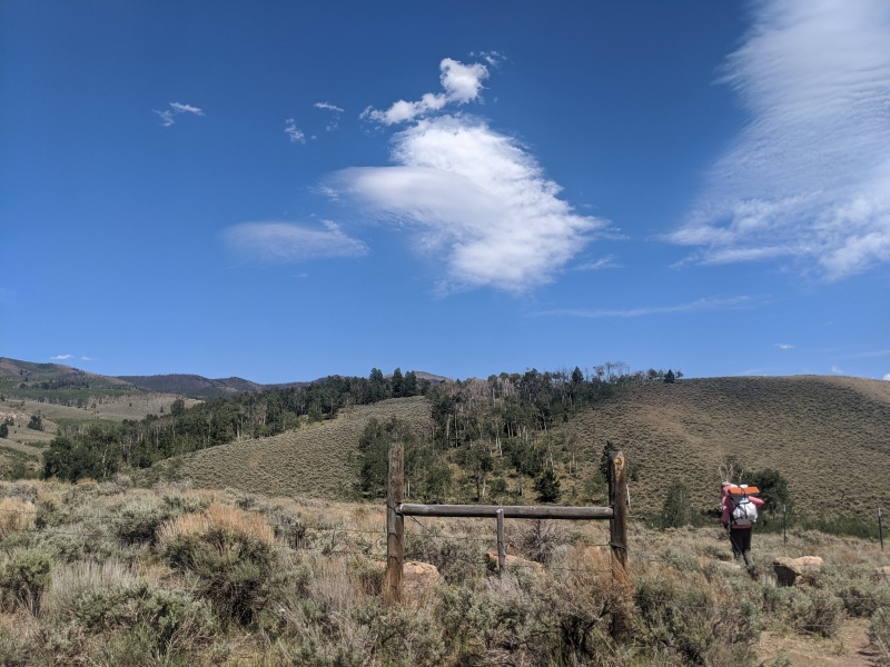
A friend moved the barbed wire aside, I said my goodbyes, and I was in. Instead of following the faint road, I followed what I assume were use trails from the horse ranch nearby. As they faded in and out, my route went along the BLM boundary until it reconnected with the former FSR 990. Despite the deadfall and light bushwhacking, I was feeling good and moving good. 990 was easy to follow, although maintenance on it seems to have stopped immediately after it was built. Flowing from side to side, over, under, and around deadfall, I arrived at the end of the road. 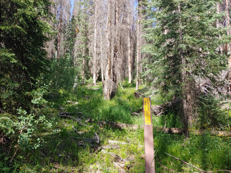
The beginning of the Simmons Peak Trail just isn’t. Or at least it doesn’t seem like it. Careful probing by plunging straight in lead me to an overgrown, patchy trail. There were times where visual inspection would fail, and I’d just have to rely on the relative flatness of certain areas vs others to carry me along. That was until encountering the burned areas. 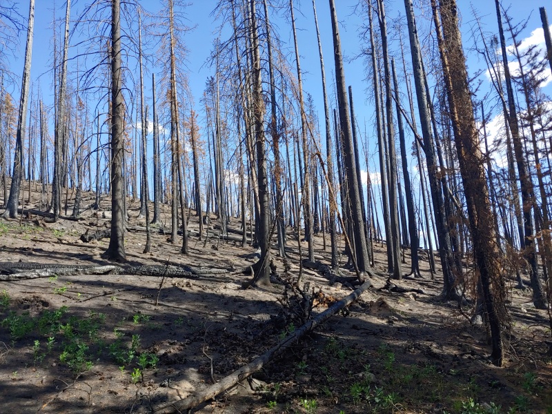
If the trail was faint in the forest, the ash and standing dead from the 2019 Decker Fire completely obliterated any trace of trail. I leaned on the GPS and kept onwards, each step covering and choking me with ash. Great start. Those that go into the mountains for fresh air should probably avoid this area. Rolling between high montane forest and burn scar, I find my destination for Day 1: Salamander Lake. Unfortunately, Salamander Lake is Salamander Mud Puddle, and I had my first real dilemma. Stay and filter chocolate milk shake to drinking water, or see what else I can find? Checking my map set, I saw a listed spring about a half mile away and headed for it. The first audible ended up being a success, albeit a limited one. Merkt Creek Spring was faintly running when I got to it, though choked with ash from the burn scar it was inside. Preferring to filter water with ash floaties than concrete slurry, I settled. I set up camp on the least ashen and flattest spot I could about halfway between the Lakes and the Spring, and rested up for the first real day tomorrow. Distance: 5.39 mi Gain: 3250 ft Loss: 1400 ft Day 2: Meet the Ridge, Your New Friend Merkt Creek Spring to West Creek Lake Strike camp, filter some ashen water, and point yourself uphill. Besides the ash, this essentially becomes the pattern from here on out. I plotted a line on the north side of the gulch formed by Merkt Creek and gained the ridge for the first time of the trip. From there, it was a short push to break through treeline for the first time of the trip. Onwards from here, I will spend more time above treeline than below for the next two weeks. The titular Simmons Peak is a small pile of talus that begins a hundred-mile line of talus. 
The first real target of the day was Hunts Peak, which was 3.5 miles and a series of rolling talus 12ers away. It was good to be above treeline, good to be moving, and good to be able to see my first of many 13ers in the distance. The routefinding above treeline in the Sangres is almost idiot proof, and today was my first exposure to it. Point south, stay on the ridge, and walk till you hit the big lump. The pathfinding, however, was a little more tedious, with blocky talus catching at feet and ankles and turning what would be an hour or two or trail walking into a substantially longer endeavor. Everything in the northern section ends up being harder than expected due to the complete absence of tundra. Talus up, talus down, with the occasional scree to spice things up. The ridge is narrow and the relief is sharp. 
The destination for the day is West Creek Lake over Red Mountain. After clearing Hunts Peak, the gravity of my decision begins to hit me. The ridge is rough but stable, requiring either carefully picking your way through the lines of talus or just powering over the blocks. I am not an athlete, I have never competed in even a high school varsity sport. In preparation for this trip I ran for a couple months, topping out a an absolutely monster 30 miles per week. Owing to this, “power over the talus” technique ran out of steam rather quickly, especially with a full load of food. Picking your way, while more energy efficient, doesn’t really crush miles in the same way. This was going to be a long trip. I am going to have pay attention to every footfall for the next two weeks. Oh. Red Mountain came and went, and I descended into the West Creek Basin. This basin was one of the highlights of the trip, with no trails in or out. Mixed tundra turned into more talus finally turned into the idyllic West Creek Lake. 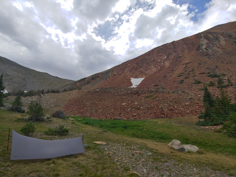
While there is a full gear-list at the end, I want to briefly discuss my living situation for the trip. Home for the next couple weeks would be a Gossamer Gear Twinn Cat-Cut Tarp, a space blanket groundsheet, a Katabatic Flex 22 quilt, an Argon90 Borah Gear Bivy, and a Nemo Switchback with 2 panels cut off. While spartan, it provided more than ample protection for all the weather I experienced, including three bouts of hail, multiple huge storms, and all the wind that an alpine basin could throw at it. The tarp went up first thing when setting up camp, and everything else followed. If it looked like it was going to be stormy, I pitched low and windproof, otherwise it went up so I could sit upright underneath. Because the tarp is open at two sides, I always pitched it at a 90-degree angle relative to the basin, so that I never accidentally got to test the aerodynamics of my quilt. It was annoying to have to hunt for flat, wind sheltered spots at a 90 degree angle to the basin, whenever I put in the effort to find a truly good spot I was rewarded with good, calm sleep. Distance: 6.47 mi Gain: 4800 ft Loss: 4000 ft Day 3: “That One Really Hard and Awful Day” West Creek Lake to Black Canyon Up early, very early, because the storms we’re coming, and I needed to clear some distance. After evaluating my pace from the day before, I knew I had my work cut out before the afternoon storms if I was to keep schedule. The southern section of the northern Sangres doesn’t really have much human interaction, with trails only into and out of a few select basins. Really, the entire Sangres doesn’t have much human interaction, but the northern section extra doesn’t. I was up and out of the West Creek Basin early, back onto the talus of the ridge. The first target of the day was the Twin Sisters, of which there is a higher northern peak and a lower southern peak. Twin Sisters North has the honor of being the lowest ranked 13er in the Sangres, but it was a difficult 2000ft climb to its summit, including a bit of ridge roll over PT 12,924. The weight of a full pack and 3.7L of water to start the day was heavy on my shoulders. As I approached Twin Sisters North I entered into the roughest section of the northern Sangres, with the narrowest ridgeline and steepest talus. 
The rest of this section blurs into a continuous field of talus, with views of the rough eastern aspects giving sharp relief to the sloping western aspects. The entire time I’m pushing over the ridge, I can see dark clouds moving in from over the San Luis Valley, pushed by strong south-westerly winds. Of course, I am also being pushed by the same winds, but I don’t seem to glide quite as effortlessly over the terrain. The entire section went at a consistent, athletic, unrelenting Class 2, with essentially no respite from the talus. Despite this, the section between Twin Sisters North and Bushnell Peak was one of the highlights of the whole trip. The section is rugged and un-routed, with no discernible use trails, which gave it a sense of wildness that’s hard to find. 
By the time I’ve worked my way over Bushnell Peak, the rain is absolutely on its way from across the valley, and I’m well past the point of accessible places to drop off. I pick up the pace to try and clear Mt. Otto and Galena Peak before noon. The talus makes quick travel difficult, even when focusing on trying to keep the pace up. By the time I’m on my final push up Galena Peak, the sky is grey and I can hear peals of thunder starting up. I am starting to flag a bit at this point, but I pick up my pace from “moving fast” to “oh shit I don’t like lightning” and push around and over Galena. There are multiple features on Galena which aren’t adequately captured on topo maps, including some deep gullies that seem to pop up out of nowhere and disappear just as quickly. Navigating around them, I expected the terrain on the south ridge of Galena to relent. Instead of transitioning to grass, it transitioned to scree, which after a few hundred feet lead to a bad use trail after PT 11,870 and thankfully some trees. Eventually, I hit Hayden Pass around 12:30pm, exhausted. By this point I’ve done 6.5 miles, 4800ft of gain, and 5800ft of loss almost exclusively on talus in about 7 hours. 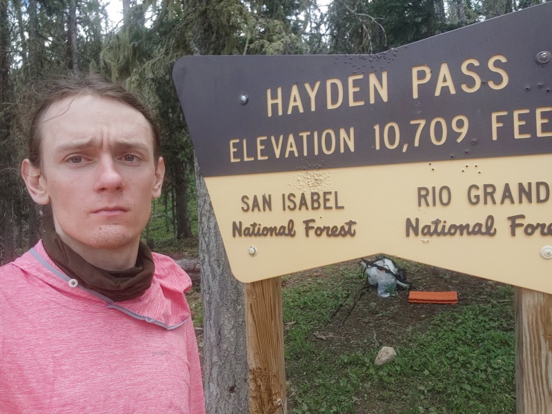
If this was the end of the day, this day wouldn’t be called “That One Really Hard and Awful Day.” Water access at Hayden Pass is… bad. The nearest reliable water near Hayden is below 8000ft, and the pass sits at 10,700ft. By this point, I am also nearly out of water, despite starting with a full load of 3.7L and drinking a good bit with breakfast. It is also beginning to rain. In an attempt to stay useful while hunkering down, I lost a few hundred feet to check if the intermittent stream on the west side of the pass was flowing. Of course, it was bone dry, so back to the pass I go. Sitting, waiting for the rain to pass, thankful that I’m not slipping over any talus to get down here, I hear a noise in the distance. I hurry back to the pass and see my first human in three days! We chatted for a bit, he gave me a liter water and words of encouragement, and off he went. The liter he gave me probably saved the trip. As he left, the rain relented, and I got into the bad part of the day. The Black Mountain Trail, while good when starting off at Hayden, quickly devolves into a mess of deadfall, overgrowth, and nonsensical carins. Up, over, and around I go, trying to use my small gap in the rain to get to my destination for the day: Steel Canyon. 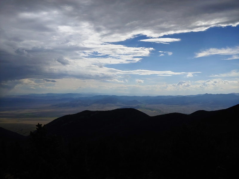
A series of small problems presented themselves as I continued: First, I was exhausted, just absolutely beat, even with the rest at the Pass. Second, I was dehydrated, which was affecting my focus. The nonexistent Black Mountain Trail blended seamlessly with existent game trails which gently tugged me off course, necessitating correction and endless yo-yoing up and down grassy slopes. Third, and most glaringly, the Steel Canyon Trail doesn’t exist. Maybe it once did and is now gone, maybe it’s a holdover from old maps, maybe in my exhaustion I just couldn’t find it; for me, however, it was lost to the ether. I did know that the Black Canyon was real, however, and knew that eventually the trail into it reformed into something coherent. The gap in the clouds narrowing, I pushed on. Unfortunately, the gully that leads into to the Black Canyon was another 900ft of elevation gain and loss on top of the approximately 2000ft of gain and 900ft of loss I had done since the pass. By the time I clear the ridge that leads into the gully, I’m really suffering. I ran out of water completely after the first 1000ft of gain from the pass, and by this point had done 7,700ft of gain for the day and had been actively exercising for something like 13 hours. I stumbled down, down, down into Black Canyon, thankfully on a good trail. Anytime I can hear water, I check my maps and look around to try and find a way down to it. I was consistently thwarted by the density of the growth, steepness of the terrain, and my own tiredness. I opted to follow the good trail down until I either found water or was out for good. Sometime during this period, it began to drizzle, just to add to the fun. Luckily, I found water before I walked out. Luckily, it ran clear and clean. Luckily, I managed to slowly set up camp and set about the work of rehydrating and eating. None of these actual tasks went very well. My dizziness made setting up camp difficult, and my dehydration and exhaustion made eating difficult. Eventually I ended up getting things set up, crawling into my sleeping bag, and choking down almonds one at a time. Cold, exhausted, damp, I went to sleep. Distance: 13.6 mi Gain: 7,650 ft Loss: 9,250 ft Day 4 – A Recovery Drive Over Cottonwood Peak Black Canyon to Cloverdale Basin I woke up in a fog the next day, feeling like I had managed to bonk overnight. Breakfast went down with difficulty, with nausea pushing back at me. I did my best to clean up and get moving early, but having gotten difficult and insufficient sleep last night I kept having to stop to focus. Up the Black Mountain Trail was difficult, and I had to stop to sit and wait out dizziness multiple times. During this time, I was formulating a plan. There were multiple low 12ers between me and Cottonwood Peak if I took the ridge proper, but I thought I had seen ways to sidehill them as I dropped into Black Canyon overnight. I figured I’d just go until I really couldn’t, wasn’t that what I was out here for? Plus, I couldn’t disappoint Colby and bail on our meetup. He was so excited. Tired, moving slowly, I broke away from the Black Mountain Trail and headed south along the side slopes of PT 12,578 and PT 12,658, bumbling across bad scree fields and better grassy slopes, hoping to hit the low saddle between the two. Multiple times I slipped on wet grass or scree, but caught myself more times than not. Turns out your feet don’t really want you to eat it, regardless of if your head is in it. At some point I realized I was going to need to regain the ridge, and began working my way there, hopping between grassy bands to reach the first good sitting spot of the day. 
I was here. I was less than 2,000ft from clearing Cottonwood Peak. I was so close. After taking a few minutes to air out some of the accumulated moisture from sleeping near a creek in a drizzle, I pushed on. The north ridge to Cottonwood Peak was quite interesting, with a section of huge blocky talus that kept things lively. 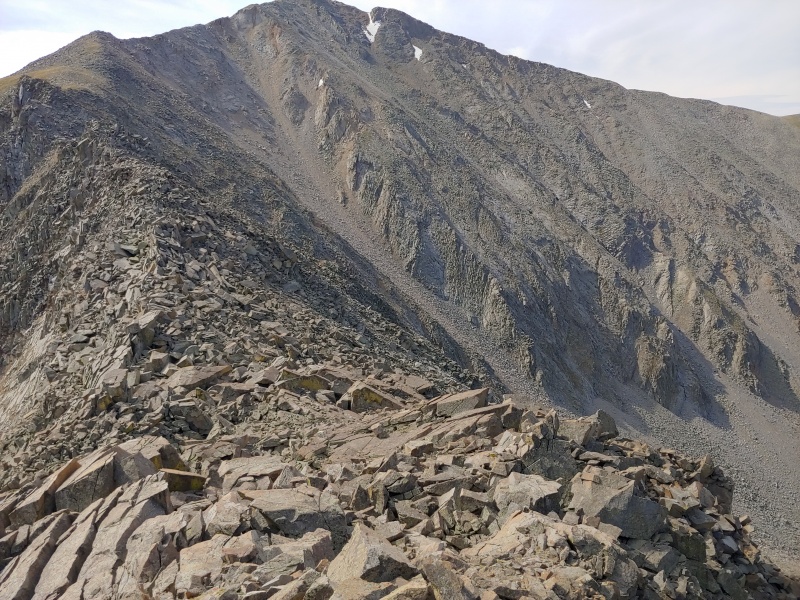
The small-looking gendarmes at the end of the field required some class 3 moves to circumnavigate, but nothing too extreme. Despite my condition, I managed to clear Cottonwood Peak at around 11 AM. 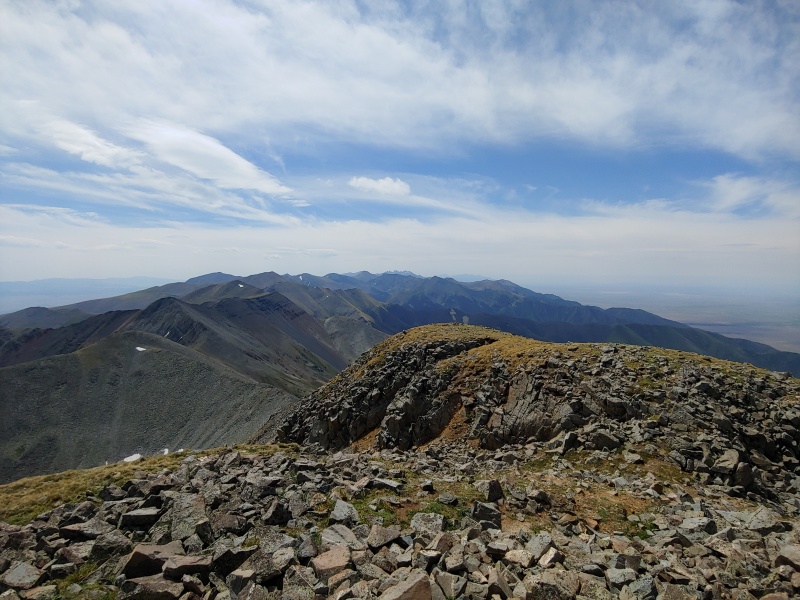
The process of heading into Cloverdale Basin was frustrating. There seemed to be storms brewing, surprise, so I took the crappy trail from the saddle until it petered out at the entrance to a massive bank of willows. Taking the apron of a talus field to the north proved to be the smart choice, but ultimately, I was exhausted. The last thing I was interested in was using talus to skirt dense willows. A consistent theme of this trip ended up being “there’s a trail on the map, but that doesn’t mean its there,” which ended up being the case for Cloverdale Basin. I end up getting camp set up just in time for it to rain on and off for the next 12 hours. Dry, fed, watered, and exhausted, I slept hard.
Gain: 3,400 ft Loss: 3,150 ft Day 5 – Hitting my Stride Cloverdale Basin to Middle Brush Creek Bang. I’m a human being again. I wake up, and despite still feeling a bit off, I’m mountains better than Day 4. The process of getting out of the basin was slower than I wanted it to be, taking over and hour to get to the saddle from camp. 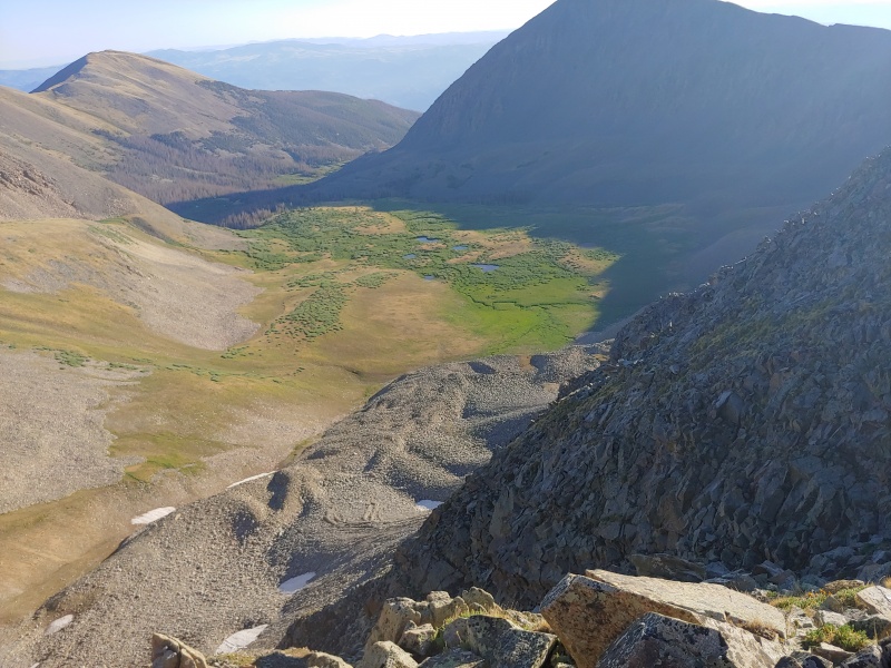
A text comes in on my inReach that informs me that Rissa, my lovely girlfriend, will be coming in to meet with us as a resupply on Day 6. Originally Colby was just going to walk me in my food from his entrance point, hand it off to me, and off we go. Some logistical complexities that I created made it much more convenient for us to have a 3rd person come in with us, thus Rissa. One of those complexities I created is that sometime on Day 3 my shoes began to fall apart. I’ll spare the gory details, but one of the bits of webbing that attaches the laces to the body of the shoe apparently doesn’t like talus that much and began to wear through. It’s hard to be a mountain climber without shoes. “How could he have done that?!” you may ask. Turns out, when you plan a 15-day backpacking trip, and subtract 15 days from the last day you plan on being out, July 26th, to get July 11th, that’s wrong. I was eventually informed by Colby that this is called an “off-by-one error” in computer science, which I think is accurate descriptor. Rissa, in addition to hiking me in a pair of shoes that stay together, will apparently also be putting me together an extra day’s worth of food. Most people, at this point, would’ve had to just go home shoeless and hungry, but she really did save the trip. If it’s hard to be a mountain climber without shoes, its probably even harder to be one without shoes or food. Thankfully I never had to find that out. Day 5 itself was very rewarding. The ridge riding for Thirsty Peak, Lakes Peak, an Electric Peak is beautiful and wide. The talus of the northern section slowly and surely relented into rolling mixed tundra. 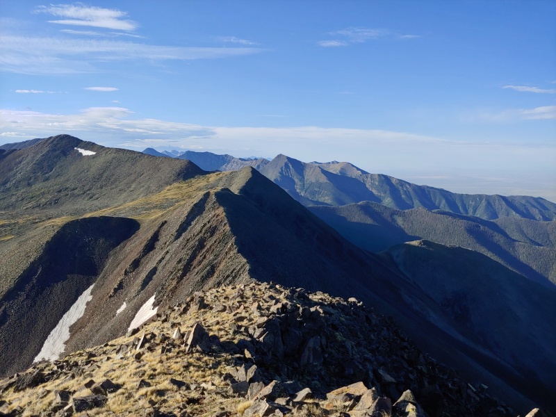
Thirsty Peak was all talus, and the path to Lakes Peak was steep but easy enough, especially compared to the last two days. The sun was shining, there was a gentle breeze, and I managed to finally get my socks and quilt good and dry at a brief stop between Thirsty and Lakes. Life was good and I was looking forward to the grassy sections which I kept seeing in the distance. Electric Peak was where I really hit my stride, pushing the pace up its grassy slopes to see how I was feeling. Despite the last few days, I cleared the distance from a bit below PT 13,220 and Electric Peak in about 20 minutes, at a reasonable 1200ft per hour. It was just good to feel good for the first time in a few days, and I felt my first glimmers of hope of completing the traverse. Food was coming, shoes were coming, a partner was coming, and I was going to get to see Rissa. What else can I ask for? The original plan for the day, again, got thrown off a bit. I was going to go down past Banjo Lake into Middle Brush Creek Basin, but as it had been, the trail didn’t exist. The South Brush Creek Basin ended up being perfect, with lush greenery and a beautifully constructed trail down into it. Distance: 5.2 mi Gain: 3,400 ft Loss: 3,200 ft Day 6 – Classic Sangres Middle Brush Creek to Rito Alto Lake “Nothing is going to get in between us meeting up,” I think to myself as I crawled out of bed at 3:45am. With the spats of rain from the last few days, I had opted to get going a bit early to ensure I was on track for the food-shoes-hugs-friends-rendezvous. Moving early, the grass from Day 5 held, and I made quick work to the South Brush Saddle and up over De Anza Peak. 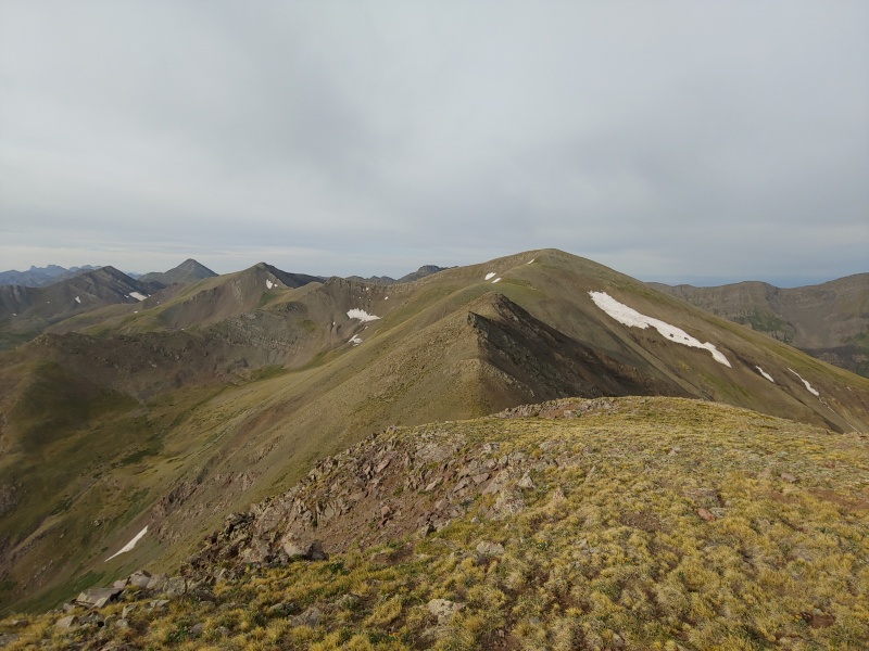
Skipping Gibbs because it seemed far away and covered in dreaded talus, I cruised up over PT 13,335 and Mt. Marcy, stopping for a slight break below the peak to get out of the wind and refuel a bit. Next, and finally was PT 13,513 or “Lakes Peak”. This portion of the ridge was one of the most memorable of the trip, with slight exposure and solid rock that all went at Class 2+. 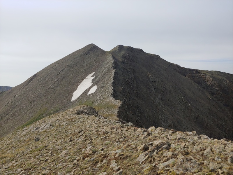
This beautiful section was followed by a less than beautiful section, with some low gendarmes made of looser rock blocking access to the upper reaches of Lakes Peak. A couple Class 3 moves here, a couple curses there, and I cleared them and had found my last summit of the day. We had chosen to meet up on the trail before Rito Alto Lake. Dropping down to here allowed me to bypass a Class 4 section of ridge between Peak of the Clouds and Lakes Peak and afforded me respite from my already reasonably big day. The Iris Lake Basin was another highlight of the trip, with soaring relief and sheer faces surrounding a lush basin. Good trail lead from Cotton Creek Pass down into it, allowing me time to marvel at the views. 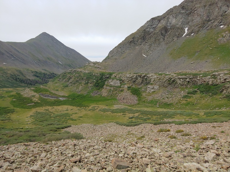
Meetup, hugs, kisses, “You’re not dead!”, “No, but I sure tried.”, etc. Rissa, Colby, and I all head up to Rito Alto Lake to pitch camp, talk about the trip, and prep for the coming days. I had a full bag of food, a working pair of shoes, and Colby now. Rissa knocked the food for the extra day out of the park, bringing ample and delicious snacks to cover my mistake. I want to reiterate how this wouldn’t have happened without her, in this moment she truly saved the trip, and I can’t thank her enough for that. 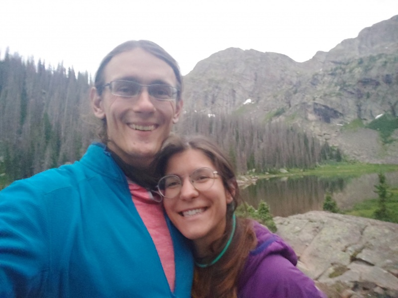
Distance: 7.6 mi Gain: 3,900 ft Loss: 4,700 ft Day 7 – Colby, Ridge. Ridge, Colby. Rito Alto Lake to Comanche Lake 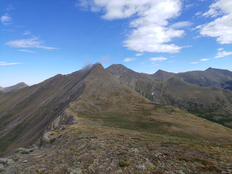
Up afterwards was Eureka Mountain, another slog straight up a steep mixed-tundra-talus hill. The morning was brisk and windy, and we made an effort to keep on the leeward side of the ridge whenever possible. In these winds, we found another opportunity to ride some narrow, stable ridgeline. 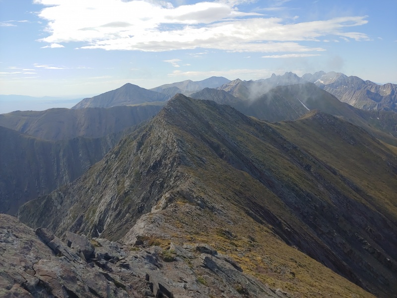
The section between Eureka Mountain and PT. 13,254 was another highlight, possibly my favorite section of the trip. The views are far-flung and unobstructed, and there’s something satisfying about traversing what appears to be complex terrain smoothly and easily. All the fun, half the risk. If you’re in the Venable Pass area and interested in some extra credit, find your way over to Eureka. You won’t regret it. Over PT. 13,254, we traversed some looser gullies to reach Venable Pass, one of our few on-trail portions of the trip. The Phantom Terrace trail, built right into the mountainside, took us over to Comanche Lake, and down we went. 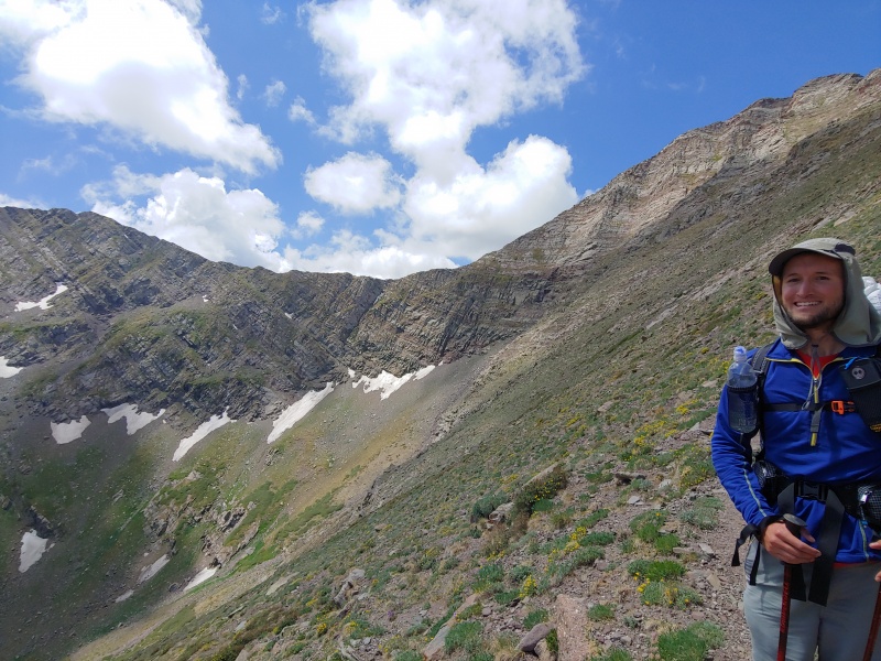
Comanche Lake had a number of available and protected campsites, perfectly situated for another batch of evening and overnight storms. This was also the night that our shelters first got put to the test, as one of the storms brought about 45 minutes of hail with it. Thankfully, my little 10D silnylon tarp held up, and Colby’s little .5oz/sq yd DCF tent did too. It is a little bizarre sitting at treeline with essentially see-thru shelters getting blasted with hail and staying totally dry and warm inside, but I’m not complaining. With all the storms we ended up riding out over the trip, the feeling of being inside our shelters during heavy winds or storms went from anxiety to cozy calm. 
Distance: 6.8 mi Gain: 4,600 ft Loss: 4,300 ft Day 8 – Flex Day Baby! Comanche Lake to Horn Lakes The original plan for Day 8 was supposed to be the crux of the entire route. Up early, out and over Comanche Peak and Fluted Peak, and then onto the Fluted-Adams Traverse, an un-routed supposedly Class 4 traverse with minimal beta and lots of exposure. The advice gained from Justin Simoni (thanks for the help!) was to “stick to the ridge as much as you can.” While that may be enough for people that eat 5.low for breakfast, it didn’t sit quite as well with me. This is also probably a good time to mention that Colby had been having some digestion trouble for the last two days. Strong early morning nausea turned into low-level, consistent nausea, which prevented him from eating as much as he otherwise should have been. He estimated that for the first four days he was running on less than 1,500 calories per day, and I would emphasize the “less than” part. Despite this, he pushed on admirably. Clearing his walk-in day to Rito Alto Lake, a 4,600 ft day, and Days 8 and 9 on about a large pizza’s worth of calories is really a different type of challenge. Plus, by not being able to eat his food, his pack stayed heavy while mine got lighter and lighter. Also, Rissa had started texting me the weather in two day increments on the inReach. It looked like our day over Kit Carson was in danger of some serious weather. We didn’t want to play games with the traverse from Kit Carson to Columbia Point in thunderstorms, oddly enough. As such, it was very helpful to take the extra day I created to skip the true crux, give Colby some time to acclimate, and maybe hope for a better weather window. We decided to take the Fluted-Little Horn Saddle down to the Horn Lakes, and then up and over Mt. Adams the next day. The climb up over Comanche Peak was direct and beautiful, affording great views of the route to come. Because it was a “short” day, we took some rest on the leeward side of PT 13,419, looking out at Fluted and what was going to be our crux. Up and over Fluted, we got our first good look at it. No thanks, appreciate it though. I, at least, didn’t miss the crux. Colby insisted that we could’ve done it, and I believe that we could have. After 8 days in the backcountry, with my backpack heavy from resupply, it was nice to just take a day to munch on some food and get some R&R. 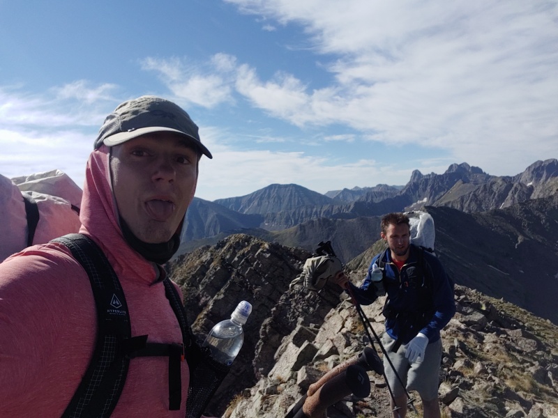
We hooked over to the Fluted-Little Horn Saddle and I went up to inspect the summit of Little Horn. It’s still there, if you were wondering. 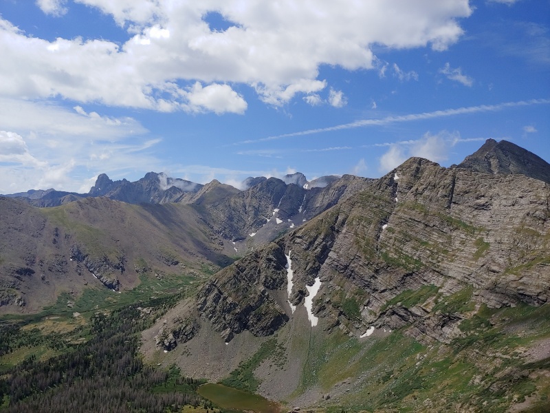
Down the grassy ramp to the Northern Horn Lake, some bushwhacking to the Southern Horn Lake, and we set up camp for the evening. The weather was mostly grey and stormy for the evening, with periodic bouts of hard rain forcing us into our shelters early. Oh, the joys of the alpine. At camp, we did meet some nice folks from Westcliffe. On top of offering us some bourbon, they took a few baggies of dry trash from us. It was nice to talk to some people, and even nicer to shave some ounces off our bags. If you all are on here, feel free to reach out, beer is on me! Gain: 4,100 ft Loss: 3,950 ft Day 9 – Better Out Than In, I Think Horn Lakes to Willow Lake Day 9 was exclusively a centennial day: Mt. Adams. With every day beforehand being an unbroken chain of peaks and ridges, there was some nice simplicity in making our way up and over just one mountain, especially because it isn’t that wild of a mountain. There is a good description of the route up Mt. Adams from Horn Lakes in Best Summit Hikes in Colorado: The Only Guide You'll Ever Need by James Dziezynski. Over the course of the trip, both Colby and I found that being aware of the various routes up and down what we were climbing was helpful, even if we weren’t planning on using them. This is one such example where prior preparation allowed us the flexibility to make the trip successful. We first had to clear PT 13,325, which was the definition of a grass slog. After pushing through some willows to get onto its bare southeastern slopes, we worked our way up 1,300ft of grass in 0.5mi. Sometime during this slog, I told a particularly long-winded joke, and Colby subsequently vomited. I didn’t think it was that bad of a joke, but I guess that coupled with pushing down a Clif bar at the wrong time was too much for poor Colby. 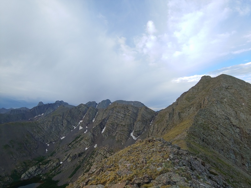
We reached the ridge, put on our helmets, and set onwards, setting a careful pace to keep from overtaxing Colby as he tried to refuel and rehydrate. The scrambling on the ridge was fun and solid, with some easy routefinding spicing things up for us. 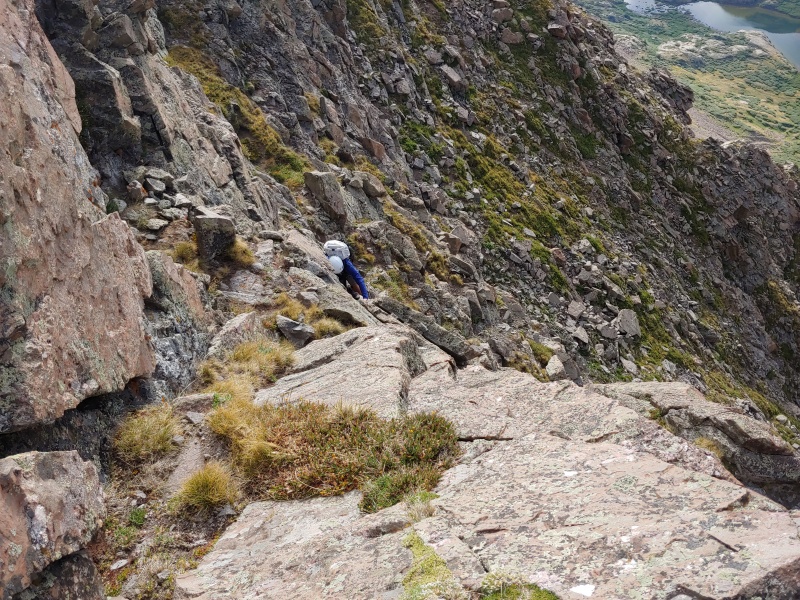
The true reward was the views of Kit Carson, Challenger, and Columbia from the top. If you’re looking for a centennial to try, go here. It’s truly beautiful and worthy of all the praise heaped upon the Kit Carson group. 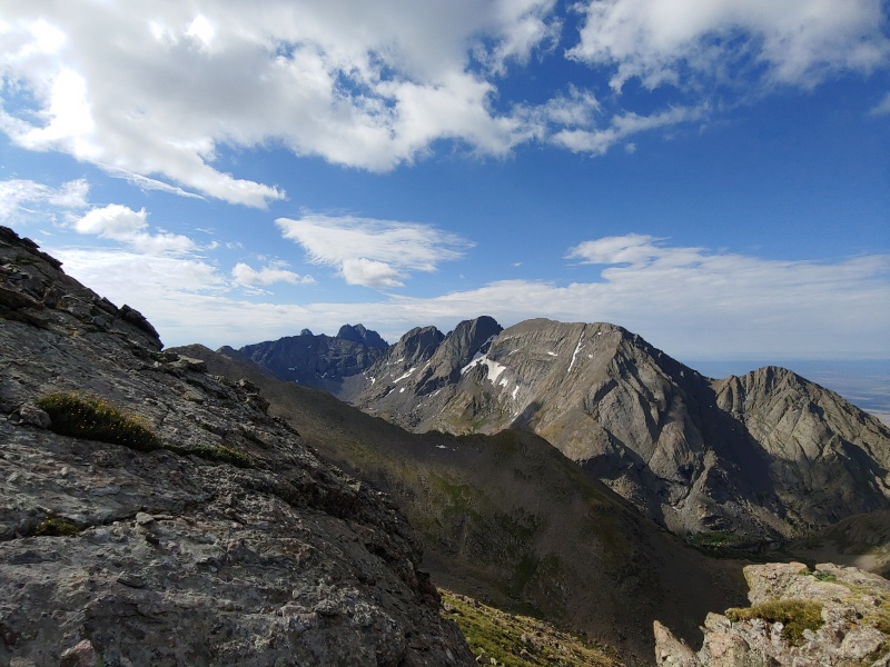
Down into the upper basin, and down a single crappy, chossy slope, and we entered the lush basin north of Willow Lake. As we set up camp, we chatted with some climbers who had done Kit Carson’s North Ridge about beta for the main trail. As we talked and ate, some storm clouds rolled over and we had another exciting bout of hail. More secure in the strength of our shelters, Colby and I rode out the storm in comfort. When I checked the clock, it was just about when we would have been on the Kit Carson-Columbia Traverse. Good planning and good timing allowed us to sit high and dry at Willow Lake in lieu of fighting hail and lightning on Kit’s East Ridge. Whew. Special thanks again to those climbers, who took out another small bag of trash for us. Distance: 2.6 mi Gain: 2,300 ft Loss: 2,450 ft Day 10 – Sometimes You Just Have to Do It Willow Lake to South Colony Lakes The process of getting up Challenger at the crack of dawn was a little arduous. As those who have done the standard route know, it’s a pleasant 2,000ft of gain in .6mi, made alternately of scree or washout. The trail crews in the area provided some relief up to about 12,500ft, but after that its open season. We huffed and puffed and hemmed and hawed, Colby’s nausea alternately flaring and dropping, until we reached its summit around 7 am. From there we saw what would become the true entertainment of the day: ice. 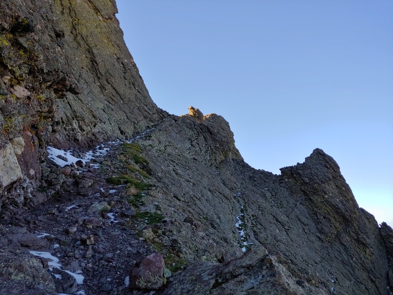
Yesterday’s hail storm had accumulated in all the flat and shaded spots of the Kit Carson massif. The heat of the evening and cold of the night had covered most of the normal route in ¼ to ½ inch of soft ice. On the Avenue this didn’t end up being an issue, and we moved down and around to the base of the climb to the top. Colby, having summited before and needing some time to slowly eat, let me summit Kit myself. 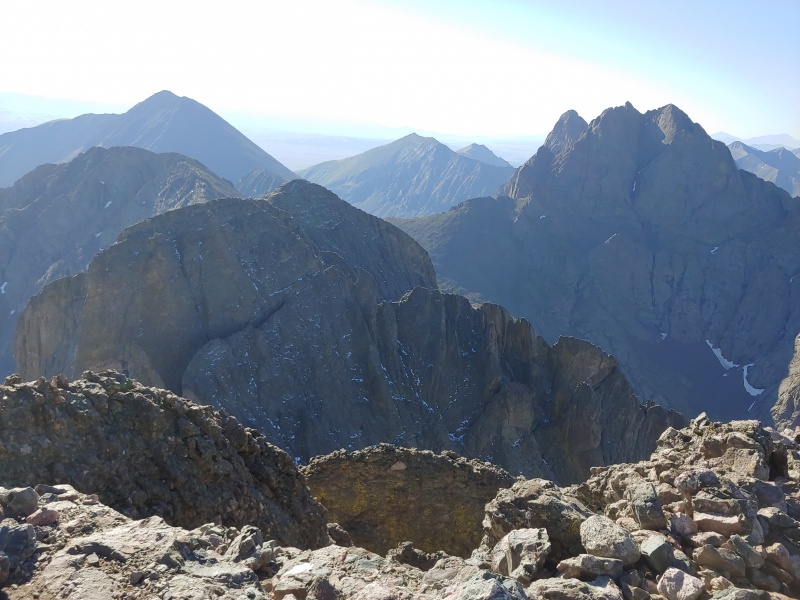
As you can see in the photo above, the ice on the Avenue wasn’t the only ice around. The gullies over to Columbia were chock full of soft, melting ice. Those who are familiar with the East Ridge route up Kit can probably identify the three gullies from the photo seen above, I sure could at the time. We took the avenue down to where it intersected the scree gully between the two peaks. Retrospectively we dropped too low, but at the time the ice on the avenue complicated the solid route to the top of the gully. From the intersection of the avenue and gully, we climbed scree gully. Loose and covered in mixed ice, the ascent was a taste of what was to come. This climb led us to the base of the third gully. Already, the mountain had eaten a poorly secured water bottle and tube of sunscreen (sorry, everyone! It wasn’t on purpose). We battened down the hatches and headed up, principally trying to gain elevation so that we could ensure we were in the right place and get away from the ice. 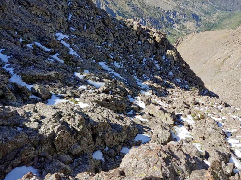
We made our way over to Columbia Point, safe, and happy. Crux of the entire trip was over, and all we had to do was get down. 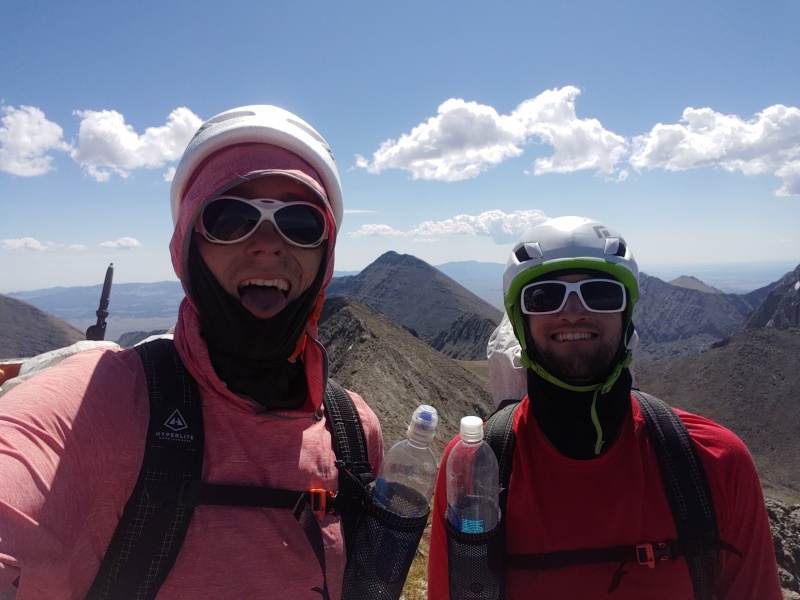
The route down was uneventful, if long. We opted to go straight over Obstruction because I hadn’t summited it before. As we were coming over Obstruction Ridge, storms started to blow in from the North, and so the lazy stroll we had hoped for became a hurried stroll, hoping to beat the storms to the Humbolt saddle. Successfully out-hurrying the storms, we ate and drank at camp, enjoying having made it through the most technically complex day. Two particularly crazy chipmunks kept divebombing our food, but compared to the tension earlier in the day, it was a pleasant diversion. Tiredness drove us to bed early, feeling hopeful for tomorrow. Distance: 4.4 mi Gain: 4,550 ft Loss: 4,250 ft Day 11 – The Three Pass Line South Colony Lakes to Sand Creek Basin Morning saw us up and over Broken Hand Pass quickly, with Colby’s nausea receding faster than previous days. Turns out coming up Broken Hand Pass when there’s daylight and no one around isn’t even that bad! A little bit of loose rock, but a far cry from the mad game of dodgeball that happens on a nice weekend in the summer. The climb to Broken Hand Peak was also lovely. The route is grassy and direct, with a fun little summit block that had multiple lines of varying gullies and fins. 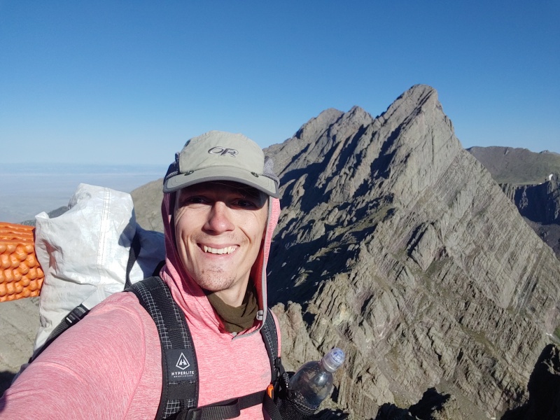
We dropped down its west face to the top of untrailed Crestolia Pass. Surrounded on both sides by the high conglomerate of Crestiola and Broken Hand Peak, the pass was another one of my favorites of the trip. I won’t spoil the route finding for those tempted enough to venture there, but it really is a treat. The area, at least in midsummer when we were there, was lusher than it had any right to be. Wildflowers and high grass intermingled with lumps of conglomerate, forming intricate patterns underfoot, while Pico Aislado’s high face soared from across the valley. 
We navigated the cliff bands separating the pass from the South Cottonwood Basin, and took a long rest near a waterfall at their bottom. Previously, Colby and I had scouted this area, with rumors of an unmaintained trail over Milwaukee Peak called Cottonwood Pass tempting us. Turns out, the trail is not only real, but its phenomenally well built. It exploits the natural features of the high Milwaukee massif to lead directly through very complex terrain. 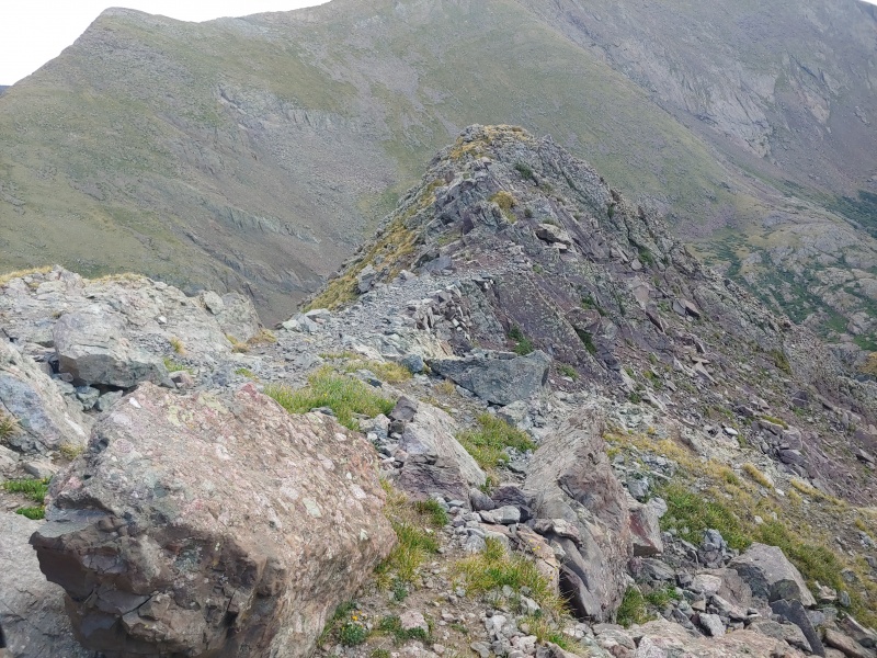
The original plan for clearing the pass was to take the ring of 13ers, including Marble Mountain, to the east to reach Music Pass, but impending weather drove us down the cairned route into the basin. This shortened the day and gave us a chance to do some laundry in Sand Creek. After laundry, we went back to get some more water and found the river radioactive green with some USFS workers standing next to it. They chatted with us for a while, telling us about the invasive species remediation they were doing in the area, and recommending we didn’t drink the neon green water. Wonder why? Distance: 5.2 mi Gain: 3,050 ft Loss: 3,850 ft Day 12 – Not Everything May Be Hard, but Nothing is Easy Sand Creek Basin to Mendano Basin Day 12 was going to be the start of a few “easy days”, where the ridge was lower, and climbs were shorter. This, of course, turned out to be ridiculous. As it turns out “lower” means bushwhacking, and “shorter climbs” means ridge roll. Oh, how fun. Taking the trail from camp to Music Pass, we set out towards Snowslide, Blueberry, and Blizzardine Peaks, which admittedly had some of the most colorful names of the trip. Bushwhacking eventually turned into weaving between rocky, Class 2+ fins near Snowslide Mountain. The morning views of the Sand Creek Basin made up for it a bit though. Once we were out of the trees, Blueberry Peak offered the stiffest climb of the day. At a balmy 12,005ft, it was the lowest peak on which we found a summit register. Blueberry might rank as the silliest 12er of the trip, in terms of location and effort to get there. With 2.5 miles of bushwhacking, 1400ft of gain, and for some reason sustained Class 2+ ridge to reach it, its truly for the dedicated Music Pass aficionado. Over Blizzerdine and taking some kind of old trail around PT 12,647, we found ourselves once again bushwhacking through the forest. Down and down we went into the bowels of the Hudson Branch, until game trails led us to a rough use trail through the dense forest. That linked us up to the Hudson Ditch, which eventually put us at Mendano Pass. 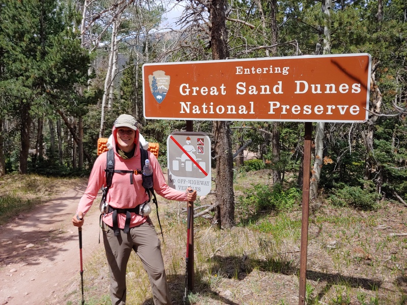
4x4 road led to a marked campsite which led to some lounging and R&R. The worst part of the day was finding that our nice campsite had a bag of rotting garbage in the bear box. 4x4ers sure are a treat sometimes. You can drive in a pizza, but you can’t drive out the box? Distance: 11.8 mi Gain: 3,100 ft Loss: 5,750 ft Day 13 – My Body Can Sense the Micronutrients Mendano Basin to Mosca Pass Day 13 was resupply day. Day 13 was easy and lazy and beautiful. We got the latest start of the trip, waking at 6:00am to stroll down the 4x4 road until it met the Sand Ramp Trail. Taking the Sand Ramp Trail, we moved through one of the unique ecosystems in Colorado, where montane forest meets sandy beach. 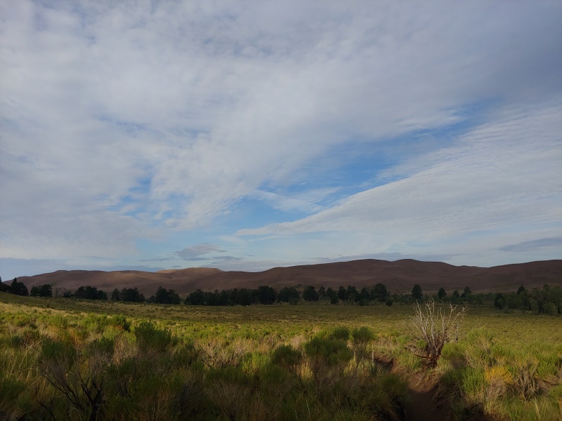
Unsurprisingly, the Sand Ramp Trail is made of sand, and the hardest part was just moving through the sand itself. After nearly two weeks in the alpine, the new walking surface stumped us both a bit. We both felt like we should be moving much faster. Maybe all the extra sleep wrapped around and made us morons? Who knows? We reached the visitors center early and set up a little outpost on the shade on its backside, alternately stretching our legs and chatting with the rangers. Ranger Sarah, in particular, was keenly interested in our trip. She went above and beyond, printing us the weather report for Blanca, lending Colby a phone charger, and giving us some delicious snacks. What a saint. Thank you, Sarah, for your kindness. Colby’s father, Blair, puttered into the park with three large pizzas, two 32oz health food smoothies, two pints of ice cream, and a resupply for us. Colby and I had shipped him the food in the weeks leading up to the trip, and we spent most of the afternoon chatting away while we demolished the feast before us. Colby managed to get through ¾ of the pizza, while I managed a measly half. Somehow, I was more drawn to the Kale-blueberry-peach-flaxseed-protein shake. It didn’t even taste that good, but when you haven’t had a real vegetable in two weeks I guess your body can tell. We strolled up towards Mosca Pass in the late afternoon, safe below treeline and looking for good camping. Most of the sites had “no camping” signs on them, so we moved upwards till we found a suitable spot. Water flowed nearby, but was just a trickle, so we counted our blessings and conked out for the night. Distance: 9.15 mi Gain: 3,000 ft Loss: 1,900 ft Day 14 – Oh You Liked Bushwhacking? How About Cloudy, Windy Bushwhacking? Mosca Pass to Huerfano Basin Mosca Pass fell easily enough in the morning, and a former trail, now game trail, became our principal line of attack at Carbonate Mountain. The weather night had been foul, and as the morning went on, we found ourselves alternately sprinkled on a buffeted by winds. Low, oppressive clouds kept us concerned and cold. The use trail eventually found the end of its usefulness and we went back to bushwhacking up to Carbonate. From its slopes, we found some nice views of the Sand Dunes to the northwest and of the Wet Mountains to the East. 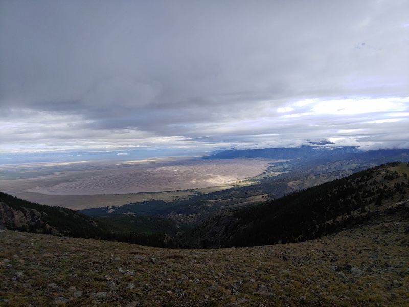
As we cleared treeline, the wind picked up from the southwest, forcing us to do the ‘ol “lean into the wind so that it doesn’t knock you over”. Good times. Thankfully we were lower than previous days and were on non-technical terrain, so while inconvenient, wasn’t killer. A few miles of soft, rolling, windy-as-hell ridge later and we found ourselves at Raspberry Pass, which had a well-built trail leading down into the Huerfano Basin. The original plan was to end up at Montez Reservoir, but we luckily found a bubbling little seasonal stream higher than originally planned. 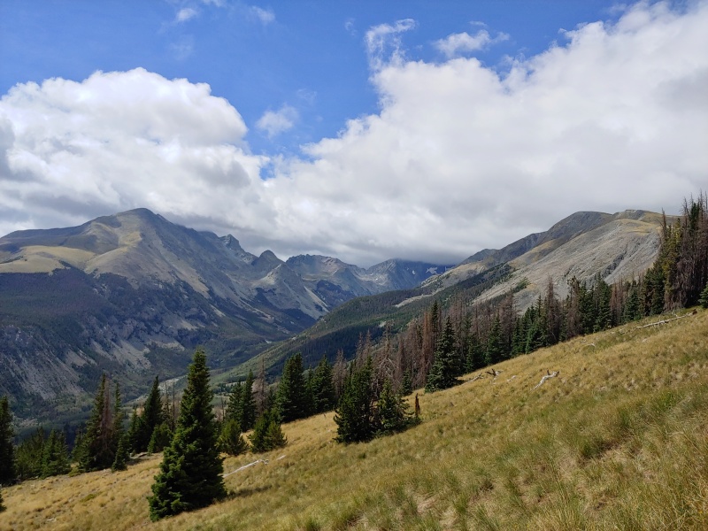
We found some flat, mostly dirt spots to keep our impact down. Our little camp showed no evidence of prior use. That, plus our picturesque surroundings, really drove home how special this trip had been. That night, we received some of our worst storms of the trip. While it didn’t hail, it rained heavily for most of the night, keeping us both awake as it thundered around us. Distance: 7.4 mi Gain: 3,800 ft Loss: 2,750 ft Day 15 – I Think We’re Gonna Make It Man Huerfano Basin to South Zapata Lake We both knew that Day 15 was the make or break day going into it. The weather forecast we got from both Rissa and Ranger Sarah showed a chance of morning storms and near certainty of afternoon ones. We had to be up early, moving early, and not lose any time during the bushwhacking or the climbs. The principle goal was to clear California Peak as early as possible, and then rest as long as necessary to stage up high in the Zapata Creek Basin. It was a couple hundred feet of bushwhacking to find the Raspberry Trail, then about 1,000ft to the pass, and finally another 2,000ft of untrailed tundra and talus to the top of California. Rissa has messaged us the night before and informed us that she was going to wait and see whether we cleared California to go to either Zapata Creek or Lake Como to pick us up. We cleared California in less than 2 and a half hours. 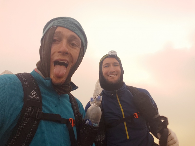
We were both up and moving at the right time, somehow managed to locate the trail via landmark navigation in the dark, and then just moved. Raspberry Pass came and went quickly, and as we pushed up California we were both feeling great. Buffeted by the same strong winds from the day before, and ascending into dense fog that made the talus slippery and routefinding trickier, we still cruised our way over California. There were some moments where we both flagged, but mutual encouragement and resolve met the challenge. 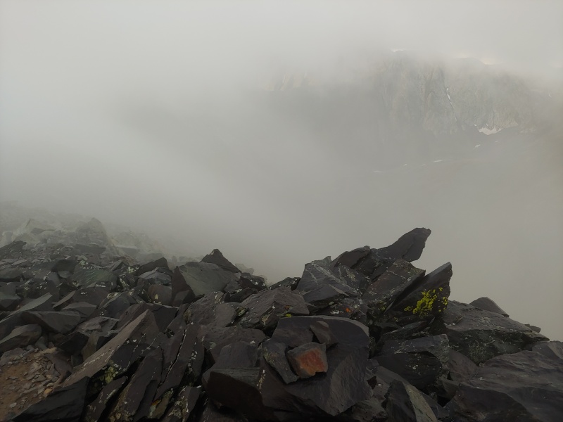
By the time Rissa woke up, we had already cleared it. We descended the west ridge of California, alternating between talus and grassy slopes. The best views of the day were afforded when we finally broke below the clouds. 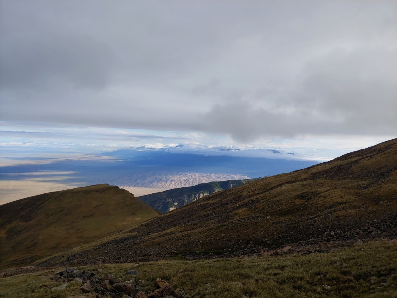
The route down was fragmented. Occasionally very well cairned, occasionally just mixed talus in trees, we eventually found our way to the North Fork Zapata Creek Trail, and finally to the Zapata Creek Trail. We chatted with some friendly guys, filled up on water and snacked away for a while, content with our achievement. After an hour, we made our way up to South Zapata Lake to scope our route for tomorrow. 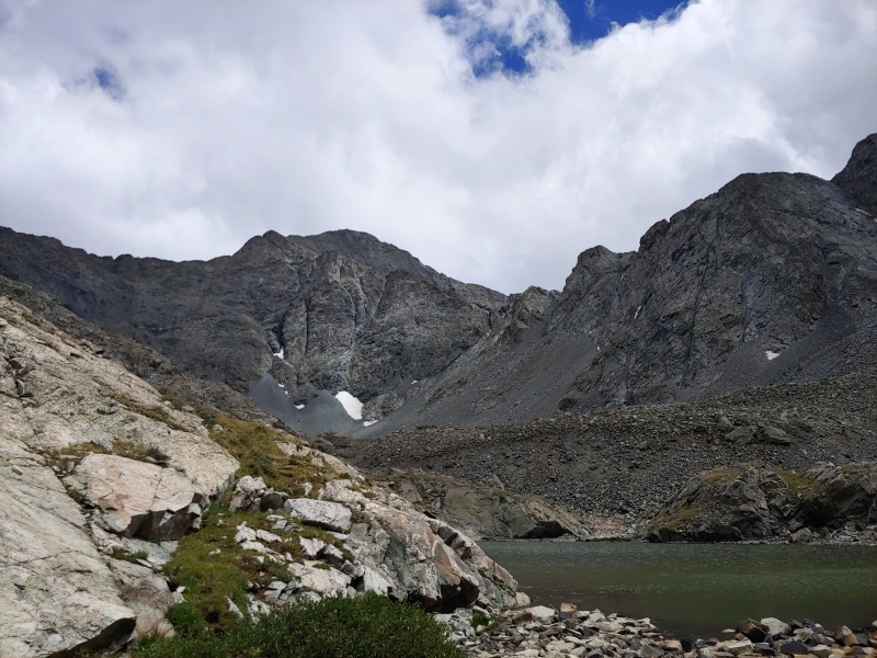
Some friendly guys stopped to answer some questions about the C2 Col and their experience up Ellingwood, and again, took out some trash for us. Thank you both, beers are also on me if you reach out. Based on the trip report we had seen just before we left, Colby and I had planned on taking C3 up over to Ellingwood, but thanks to the beta provided by these two we got to shave some extra work and go up the supposedly more fun way. Great! Another evening early to bed, but I had a surprising amount of trouble sleeping. As the wind blew and it rained on and off, we could both hear the telltale sounds of rockfall throughout the night. It’s a little disconcerting thinking about the loose col you’re supposed to be climbing in the morning as rockfall tinkles around you all night. Colby, however, had one of his best night of the trip, apparently undisturbed by rockfall while being soothed by the sweet sounds of Marvin Gaye. Distance: 7.4 mi Gain: 4,750 ft Loss: 3,700 ft Day 16 – Through the Fog South Zapata Lake to Lake Como When we woke up at 3:30am and couldn’t see the stars, we figured we might be in for something. We hurriedly packed camp, donned our helmets, and found our way onto the use trail that led to C2. A little bit of bumbling on the apron at the bottom of the Col brought us to the cairn that marked its entrance, and up we went. The col itself was at least fun in retrospect. Colby loved it the entire time, but I found myself less amused with the looser sections. We climbed, and I periodically asked Colby if we were in the right place and he, in turn, assured me that we totally were. We were. We both knew it. In the dark, with the rockfall the night before, and the rocks still slick from the rain, it was nice to hear him say it. 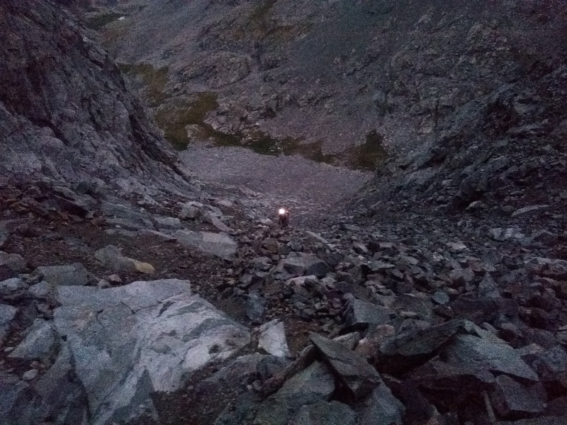
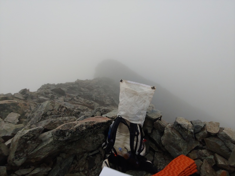
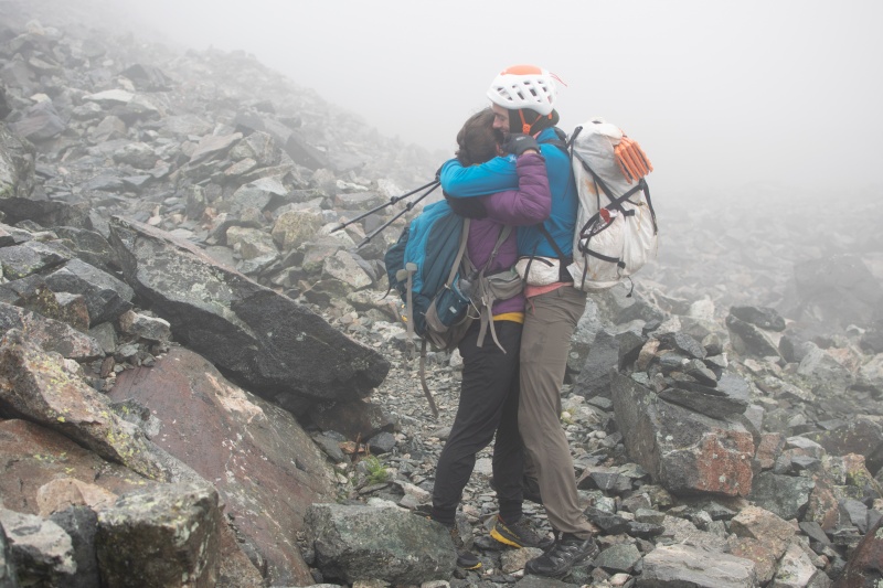
As we climbed and the sky progressively lightened, we found ourselves moving upwards into another bank of dense fog. As such, our visibility stayed limited to roughly headlamp length the entire day. The route description provided on 14ers is great, and we didn’t encounter any real trouble until we were up near the crux. The clouds and cold had coated a number of the rocks in slick verglas, perfect for the Class 3 climbing we were doing. The limited visibility, slick climbing, and caution limited the pace somewhat, but eventually we did it. Hugs were had and there wasn’t a dry eye on Ellingwood, especially considering we were the only ones on the summit. 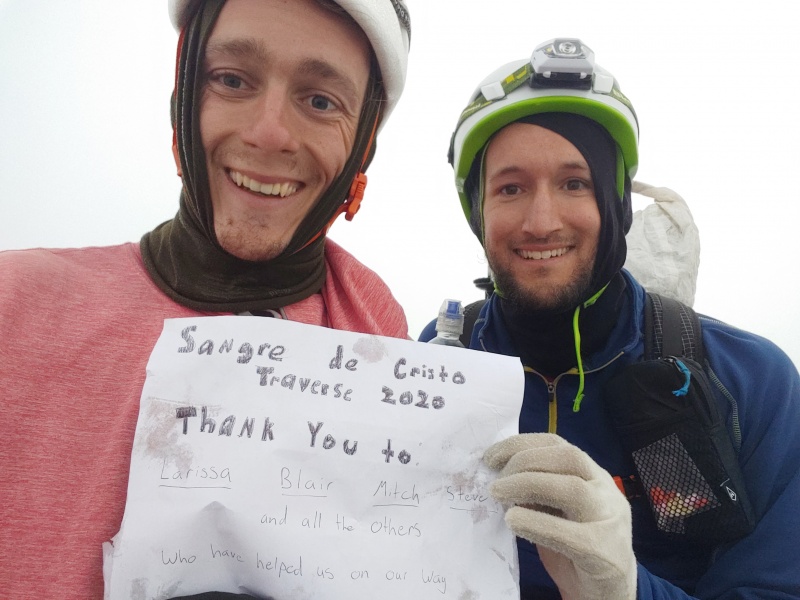
We opted not to go for Blanca, wonder why? And so down, we went, for the last time, occasionally finding cairns and trail segments. More often than not, however, we were just going down the slick, shifting talus of Ellingwood’s face, aiming for the rough center of the basin. We found Rissa and Mitch near the trail not far from Crater Lake. Mitch is a bit of a photographer, so most of the photos are his from now on. 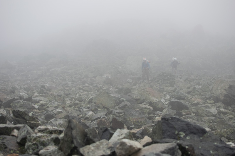
And down and out we went. The Lake Como Road was even longer than usual, but eventually we made it. 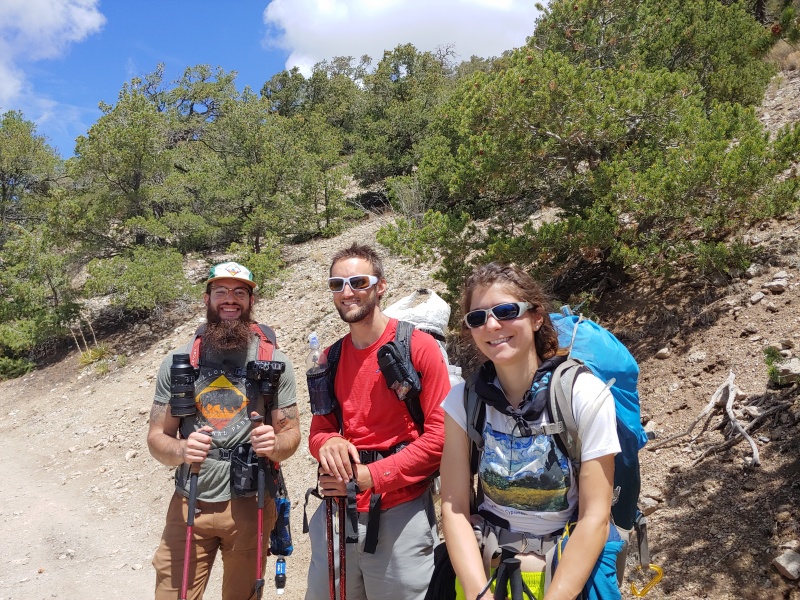
Distance: 7.9 mi Gain: 2,500 ft Loss: 6,500 ft So that’s it. The Everymans’ Sangre de Cristo Traverse. What a trip. Again, special thanks to Rissa, Blair, and Mitch. We couldn’t have done it without your love and support. We couldn’t have done it without people giving us beta or taking out our trash. We couldn’t have done it without the 14ers community who provided such accurate information on the area. Final Stats: Days: 16 Distance: 112mi Gain: 63,000ft Elevation Change Per Mile: 1130ft/mi
Anthony's Lighterpack: https://lighterpack.com/r/h38mqe Colby's Lighterpack: https://lighterpack.com/r/1ubo38 Original Route Caltopo: https://caltopo.com/m/JQ1K Final Caltopo with Our GPX: https://caltopo.com/m/D55G My GPS Tracks on Google Maps (made from a .GPX file upload):
View on the Map
Thumbnails for uploaded photos (click to open slideshow): ")
")
")
")
")
")
")
")
")
")
")
")
")
")
")
")
")
")
")
")
")
")
")
")
")
")
")
")
")
")
")
")
")
")
")
")
")
")
")
")
")
")
")
")
")
")
")
")
")
")
|
| Comments or Questions | |||||||||||||||||||||||||||
|---|---|---|---|---|---|---|---|---|---|---|---|---|---|---|---|---|---|---|---|---|---|---|---|---|---|---|---|
|
Caution: The information contained in this report may not be accurate and should not be the only resource used in preparation for your climb. Failure to have the necessary experience, physical conditioning, supplies or equipment can result in injury or death. 14ers.com and the author(s) of this report provide no warranties, either express or implied, that the information provided is accurate or reliable. By using the information provided, you agree to indemnify and hold harmless 14ers.com and the report author(s) with respect to any claims and demands against them, including any attorney fees and expenses. Please read the 14ers.com Safety and Disclaimer pages for more information.
Please respect private property: 14ers.com supports the rights of private landowners to determine how and by whom their land will be used. In Colorado, it is your responsibility to determine if land is private and to obtain the appropriate permission before entering the property.