Download Agreement, Release, and Acknowledgement of Risk:
You (the person requesting this file download) fully understand mountain climbing ("Activity") involves risks and dangers of serious bodily injury, including permanent disability, paralysis, and death ("Risks") and you fully accept and assume all such risks and all responsibility for losses, costs, and damages you incur as a result of your participation in this Activity.
You acknowledge that information in the file you have chosen to download may not be accurate and may contain errors. You agree to assume all risks when using this information and agree to release and discharge 14ers.com, 14ers Inc. and the author(s) of such information (collectively, the "Released Parties").
You hereby discharge the Released Parties from all damages, actions, claims and liabilities of any nature, specifically including, but not limited to, damages, actions, claims and liabilities arising from or related to the negligence of the Released Parties. You further agree to indemnify, hold harmless and defend 14ers.com, 14ers Inc. and each of the other Released Parties from and against any loss, damage, liability and expense, including costs and attorney fees, incurred by 14ers.com, 14ers Inc. or any of the other Released Parties as a result of you using information provided on the 14ers.com or 14ers Inc. websites.
You have read this agreement, fully understand its terms and intend it to be a complete and unconditional release of all liability to the greatest extent allowed by law and agree that if any portion of this agreement is held to be invalid the balance, notwithstanding, shall continue in full force and effect.
By clicking "OK" you agree to these terms. If you DO NOT agree, click "Cancel"...
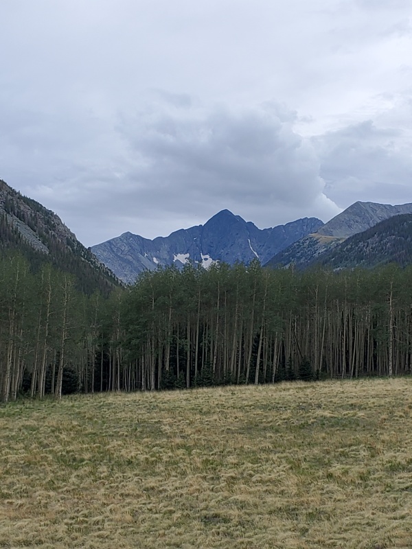
Well it was time to get back down to the Sangre range for a couple more peaks. We made the 5 hour plus drive and finally arrived at the little town of Westcliffe hoping for a great pre-hike meal. Unfortunately everything was either closed or out of business due to COVID. Even the gas station doesn't let you inside. We managed a dinner of hamburger and fries at the bowling alley and then got back on the road to the trailhead. It takes at least an hour to get to the trailhead after you turn off the road past Gardner. Nice scenery on the way up. Some campers next to the creek lower down where it wasn't private.
The 2 miles of 4 wheel drive road was rough but not too bad. There are a lot of nice campsites and plenty of camping at the trailhead, especially car camping. A site just down from the trailhead got Craig's approval for flatness for the tent and we settled in.
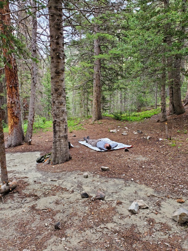
The creek wasn't close to the road in this area, so we just went to bed.
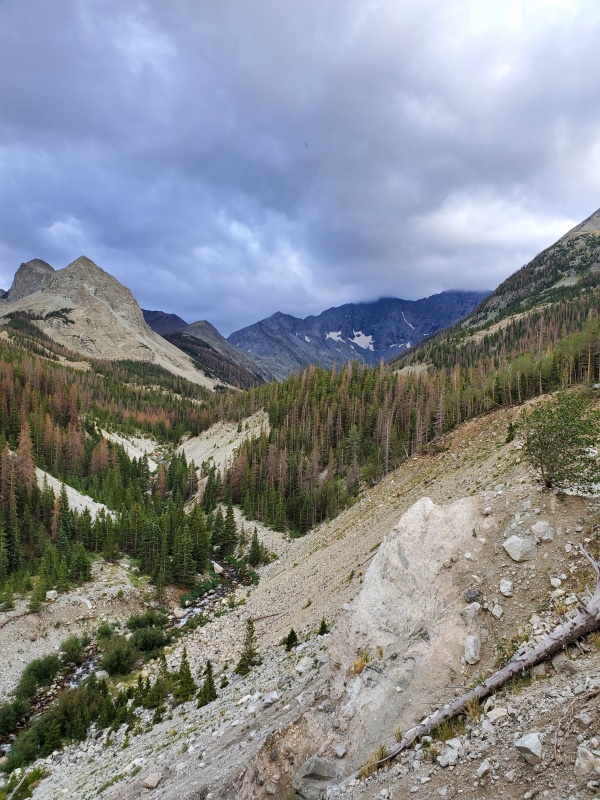
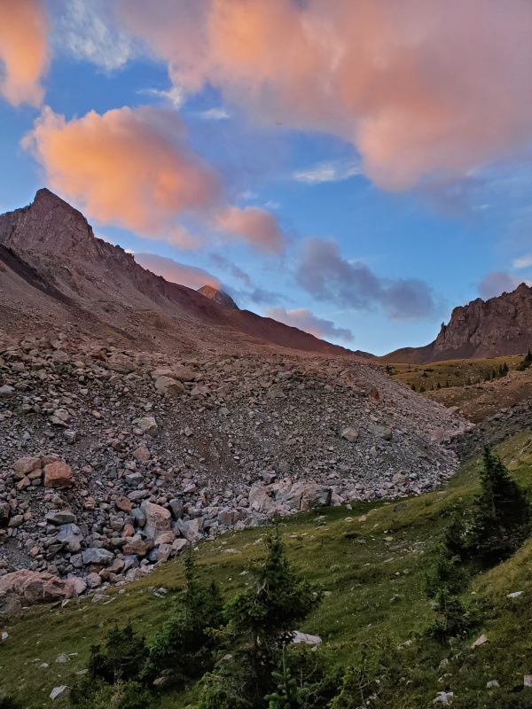
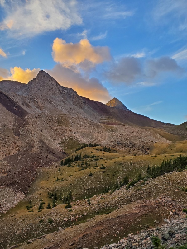
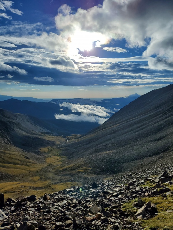
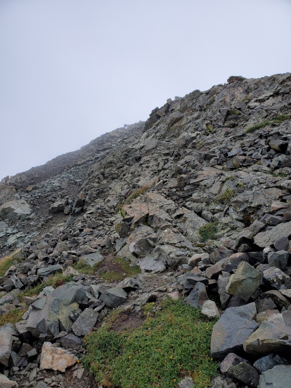
We got going at 445 am. It is a steep hike. Such a beautiful valley. We got to it in time for sunrise.
out of the trees by 6 am
Caption Here
Caption Here
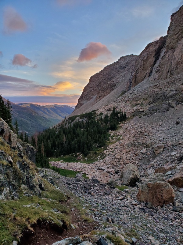
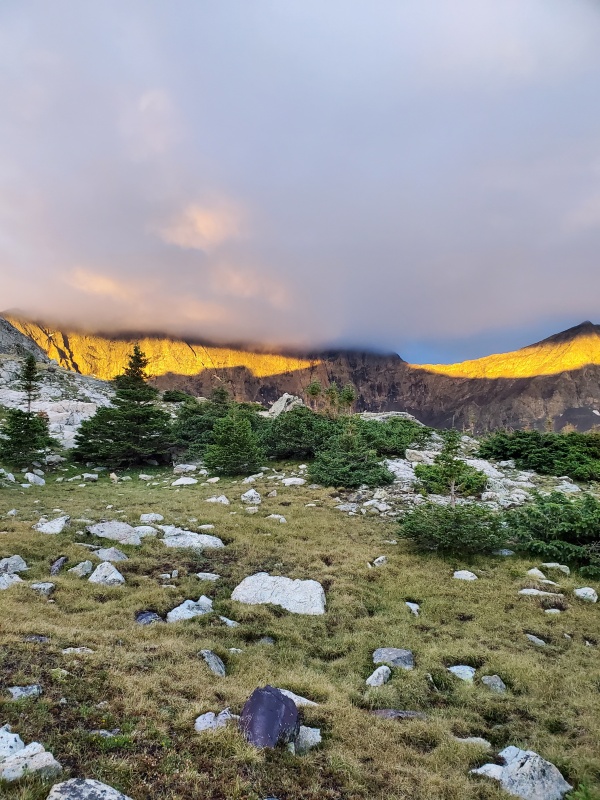
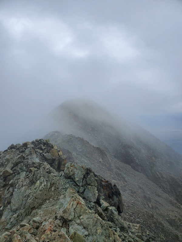
Blanca and everything else in the clouds the whole time
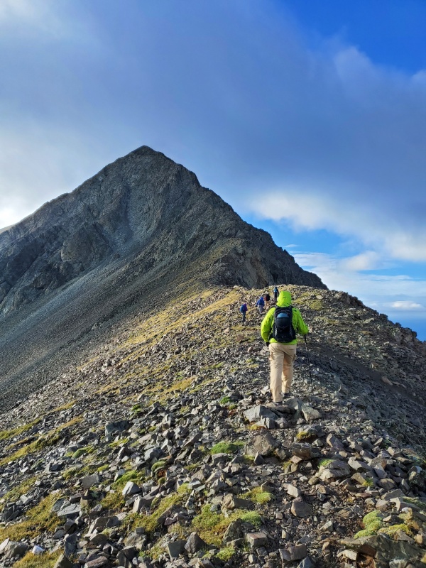
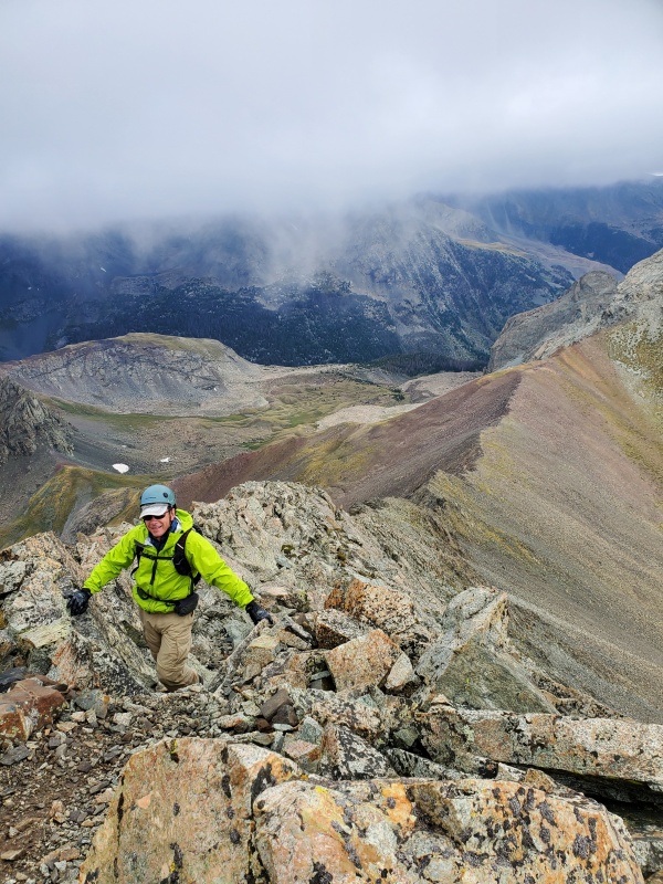
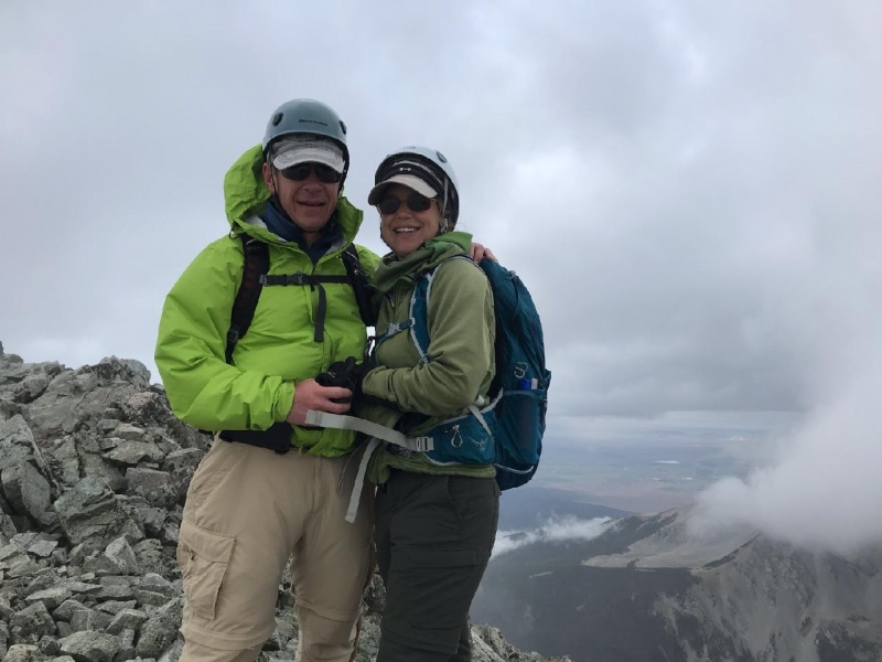
It was around 720 that we got to the ridge. Classic pics.
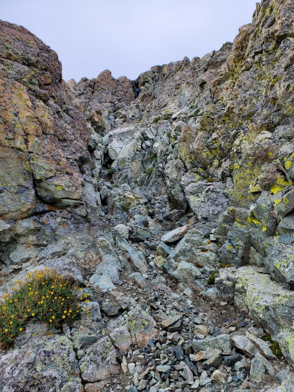
The gully option did not look fun
Caption Here
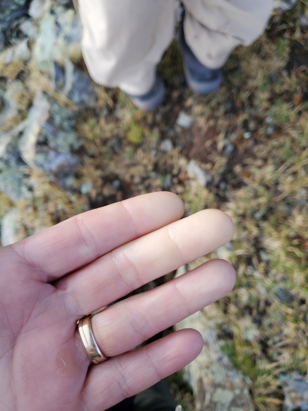
It was really windy up top. My hands don't do well in cold plus wind even with gloves. Sucks to have Raynauld's phenomenon. Now was not a good time for my hands to be numb.
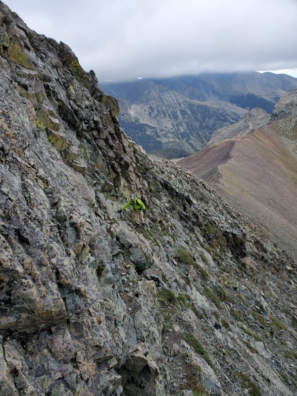
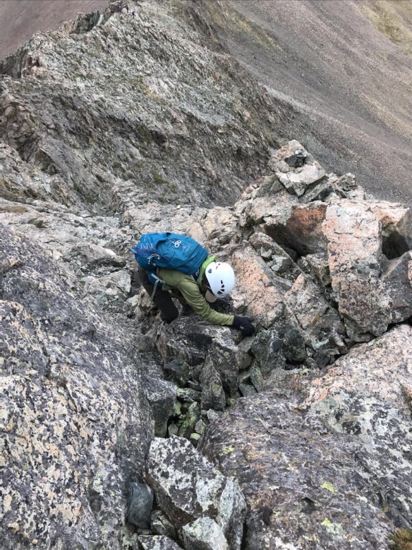
But I was able to warm them up enough to get feeling back for the ridge which was great fun. It is stable rock and has so many hand holds that it is enjoyable rock to climb on. It reminded me of Crestone Needle. The are multiple ways to scramble, whatever you are comfortable with.
Caption Here
Caption Here
Caption Here
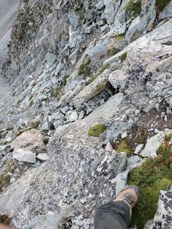
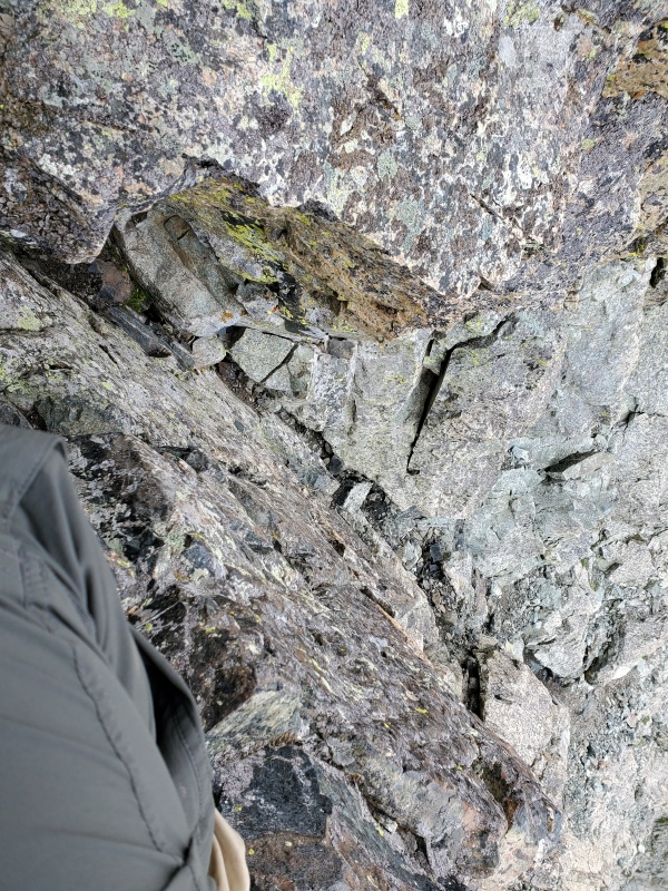
The wall was not difficult although one move at the top was tougher. I went up the middle. Finding good hand and toe holds before the next step is key. Coming down is harder.
Caption Here
Caption Here
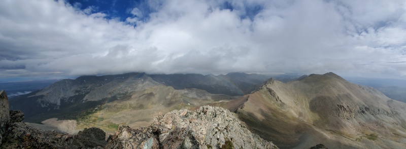
We picked our way up the rest of the ridge. There was a little bit of fog at the top which also reminded me of the Needle and Blanca.
Uneventful
Caption Here
We summited at 840, got a couple pics and headed down to where it might be warmer.
Caption Here
Is Blanca always in fog?
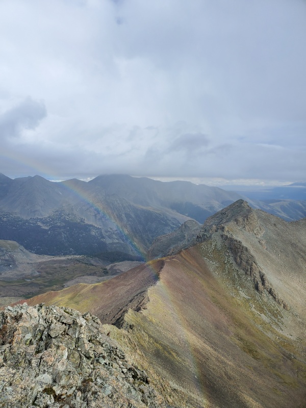
It is a little harder to follow your route on the way back down. Cairns and easier terrain will suck you down into the gully I think. We climbed back up on the ridge because I really wanted to go back down the wall. We pretty much stayed on top the ridge. It was safe. Cool rainbow on the way back.
Caption Here
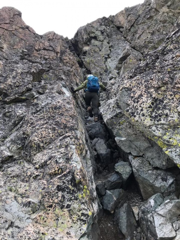
The top of the wall is a little daunting to go back down. One hold at a time.
Caption Here
This is the most difficult step. You can go around to the right instead.
After down that area, I went around to the left instead of going down the middle again. It was a fun alternative and would have been a good way up too. No route difficulties from there.
Back down to the valley and back to break camp...after a little bit of fishing!
Thumbnails for uploaded photos (click to open slideshow):
Great job. I did Lindsey last summer and was frankly surprised to find it a bit more challenging than I'd expected (even after doing Little Bear, Crestone Needle, and other tougher peaks).
If anyone is interested, one way to approach it would be to camp in the lovely, grassy basin above where you come out of the trees and cross the creek.
I bought some heated lined gloves for skinning this year and put those on at the top. I look forward to trying it more. Worked great for the first time.
Caution: The information contained in this report may not be accurate and should not be the only resource used in preparation for your climb. Failure to have the necessary experience, physical conditioning, supplies or equipment can result in injury or death. 14ers.com and the author(s) of this report provide no warranties, either express or implied, that the information provided is accurate or reliable. By using the information provided, you agree to indemnify and hold harmless 14ers.com and the report author(s) with respect to any claims and demands against them, including any attorney fees and expenses. Please read the 14ers.com Safety and Disclaimer pages for more information.
Please respect private property: 14ers.com supports the rights of private landowners to determine how and by whom their land will be used. In Colorado, it is your responsibility to determine if land is private and to obtain the appropriate permission before entering the property.


")
")
")
")
")
")
")
")
")
")
")
")
")
")
")
")
")
")
")
")
")
")
")
")
")
")
")
")
")
")


