| Report Type | Full |
| Peak(s) |
Unnamed 13145 - 13,145 feet Unnamed 13307 - 13,307 feet |
| Date Posted | 08/18/2020 |
| Date Climbed | 07/19/2020 |
| Author | Tony1 |
| Columbine No-Names |
|---|
|
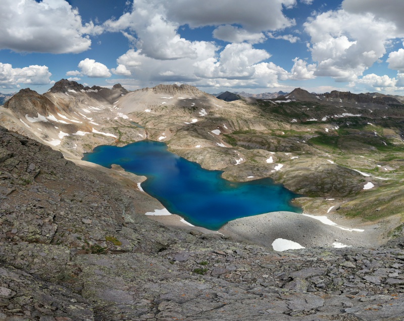
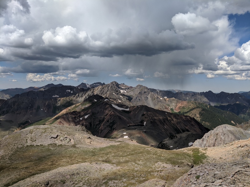
PT 13,159' Sunday, July 19, 2020 Party of 1: Tony Columbine Lake is a mystical place flanked by a few 13ers. Two of these 13ers are unnamed and were on my personal list. These two unnamed 13ers also have the interesting situation where the higher one is unranked (via its connection to Lookout Peak). I slept in Hotel Golf once again in a pullout just off the beginning of the Ophir Pass road and drove down to the area by the bridge over Mineral Creek in the morning, parking and leaving the car there at 6:45 am. I walked along the Ophir Pass road for a hot minute before turning right/north onto FR 820 toward the Columbine Lake trailhead. 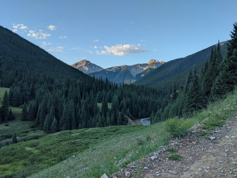
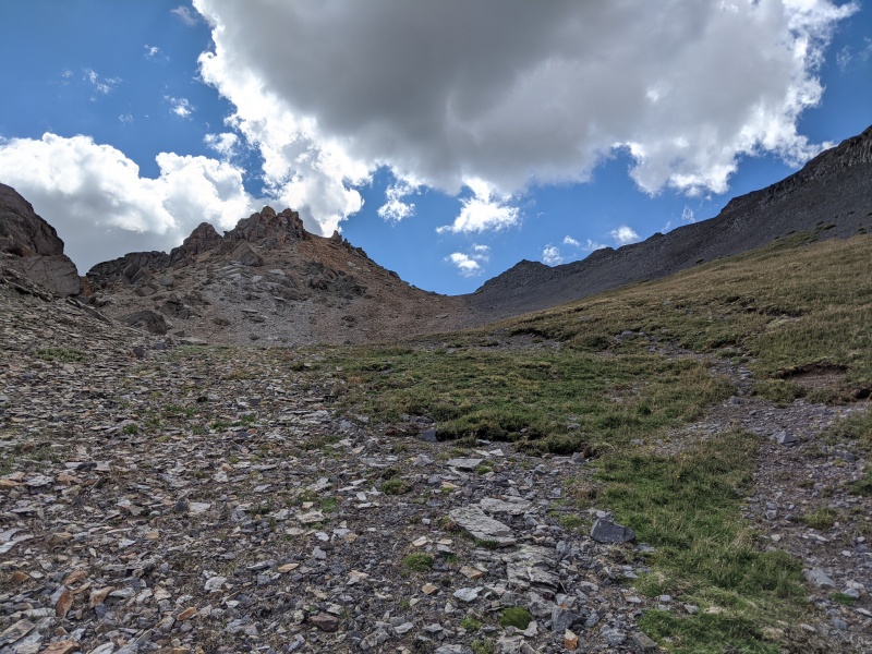
After walking about 0.8 miles, I reached the start of the Columbine Lake trail at 7:10 and hiked on up. It's damn steep below treeline, so I reached the alpine bowl meadow before I knew it. The grade doesn't relent here either. I followed the trail up and over the saddle where the view of the Mill Creek Basin opens up and a couple minutes farther where the trail begins turning back due west in its traverse across the basin's slopes. 
I started eyeing the terrain to my left (south) for an opening up to the summit of 13,159. I saw a gentle grass slope leading to a wide, shallow dirt/scree gully up to the ridge. I turned due south and up the grass at 8:30, which shortly gave way to slightly steeper hard-packed dirt and a little scree. Upward progress was easy. I encountered a pair of hikers coming down from the summit; their next objective for the day was Bridal Peak, across the basin. They did tell me that the ridge to the summit was fun and somewhat simple. 

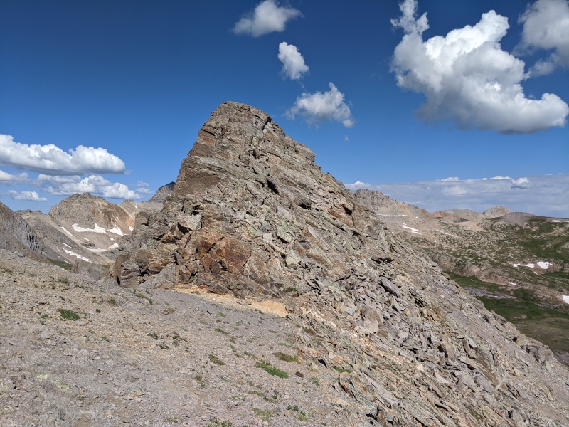
I reached the ridge at a grassy low spot and paused for a minute. The ridge westward to the summit looked simple enough. I continued on, now reaching more of the typical San Juan scree and loose rock outcroppings along the ridge. I mainly stayed on the crest, which lead to a few small leaps of faith from one protruding rock to the next. I deviated a couple times to stay slightly to the north (climber's right) of the ridge crest, but for the most part, I found the ridge to the summit to be a pretty straightforward class 2+ hike. 
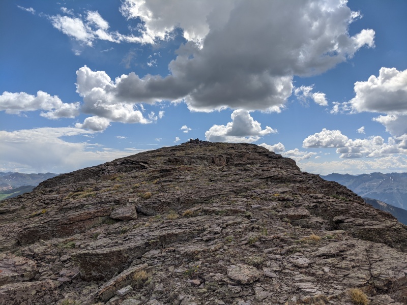
Shortly after, I stepped onto the summit to admire the view at 9:00. Not wanting to roll the dice with the weather too much, I didn't stay too long, and at 9:20 re-traced my steps down the ridge. I did deviate more this time to avoid descending leaps of faith across a couple rocks, and the bypass was easy: just a few feet down to the north of the ridge crest on easy dirt and some scree. After reaching the grassy low spot, I made a beeline northward and down the same area I hiked up half an hour prior. After reaching the grass, I took a slight leftward/westward trajectory to rejoin the trail slightly west of where I left it earlier. 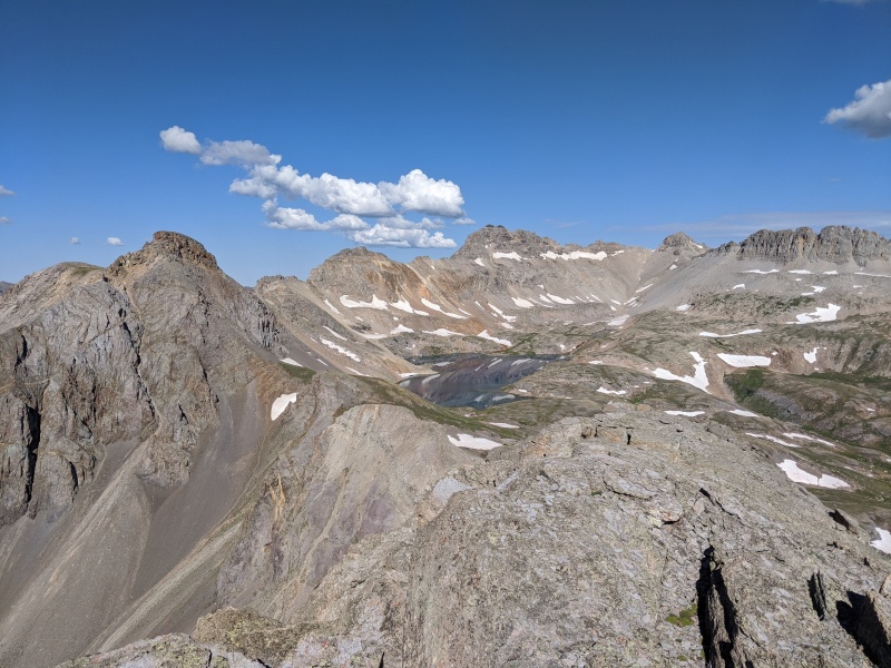

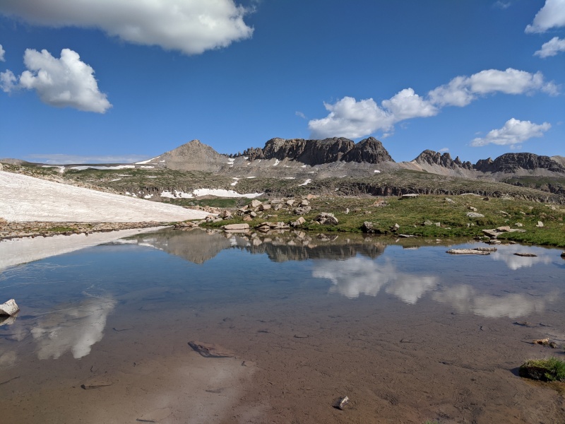
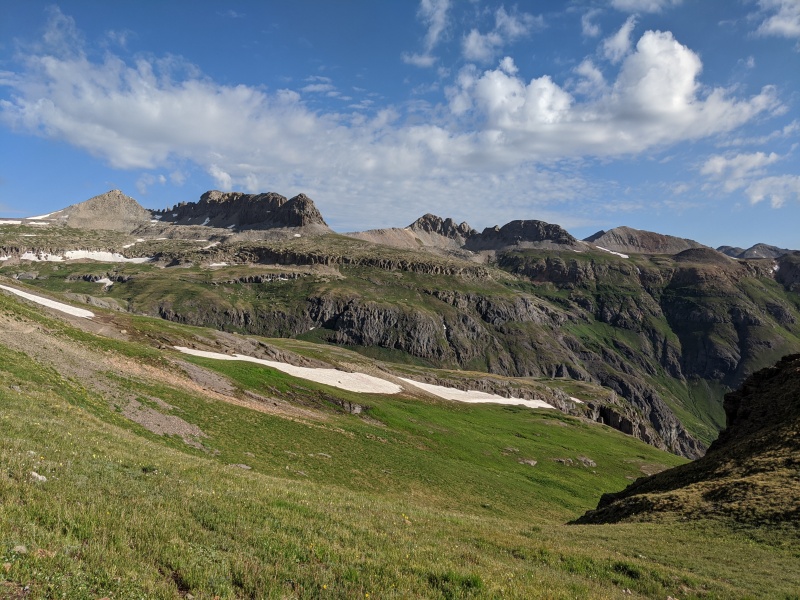
Now for 13,300 E! I reached the trail at 9:40 and followed it to its end at Columbine Lake at 9:55. I knew that if I could get to the south side of the lake, there is a nice grassy, shallow gully which leads most of the way to the summit. I contoured around the east side of the lake as the terrain got progressively more scree-covered and loose. 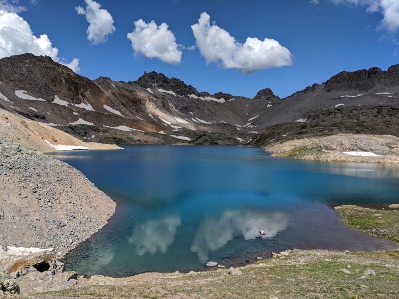
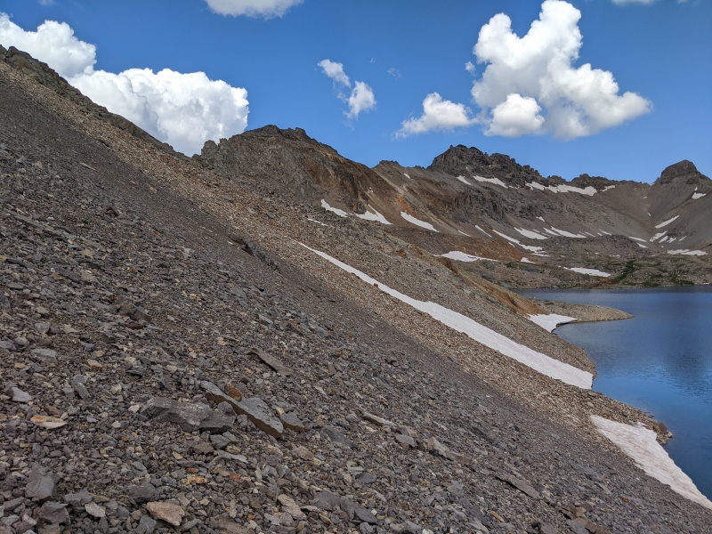
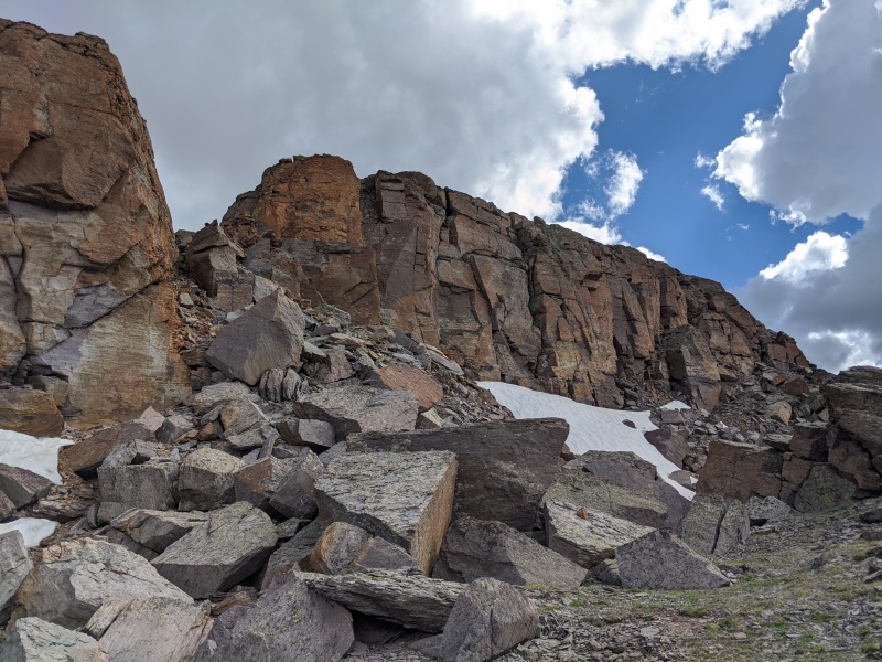
I made an ascending traverse above the south side of the lake across the sloped terrain covered in rocks that seemed too big to be scree but too small to be talus. It was loose but not the worst thing ever. I reached an actual talus field, which was quite stable, and used it to gain a little more elevation before returning to scree. Immediately past this area, I found a faint trail in the scree leading toward the grassy slope. 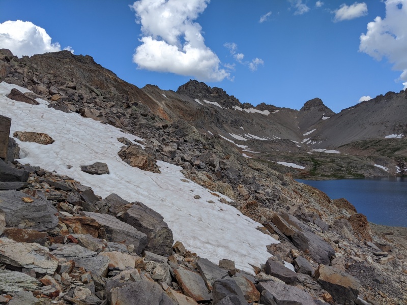
I got to the grassy slope, and it promptly brought me up to a wide notch in the ridge just a couple hundred feet below the summit. Now it was back to loose scree. I went straight up the ridge from here and slightly around to the south (climber's right) to a broad flatter area just below the summit (back on grass for the relatively flat area). 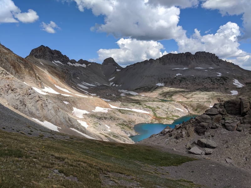
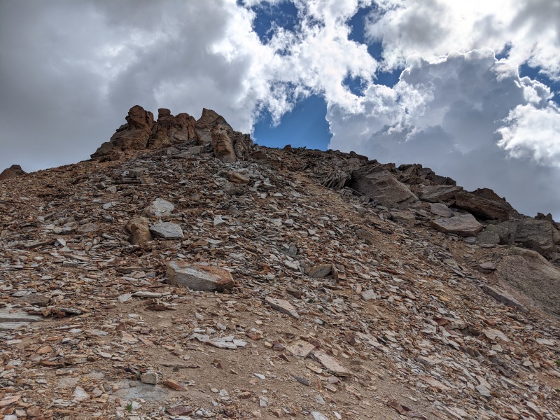
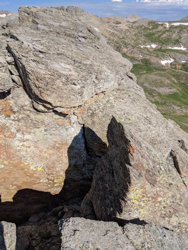
I walked around this area for several minutes, looking for the best way up. I knew it shouldn't get above class 2+, but I wasn't finding an easy route. Eventually I found a weakness in the summit ridge a bit farther to the east (but not all the way east, more like the center of the ridge) and got myself up into the notch via some big, blocky boulders. Here, I had to consider again if this was a good way up. I figured it must go and I crossed to the north side of the ridge where it was more exposed and hiked/scrambled up a few rocks that were solid enough. This brought me right up to the summit plateau, so I waltzed on over to the summit cairn for my break at 10:30 (I was trying to haul a bit). 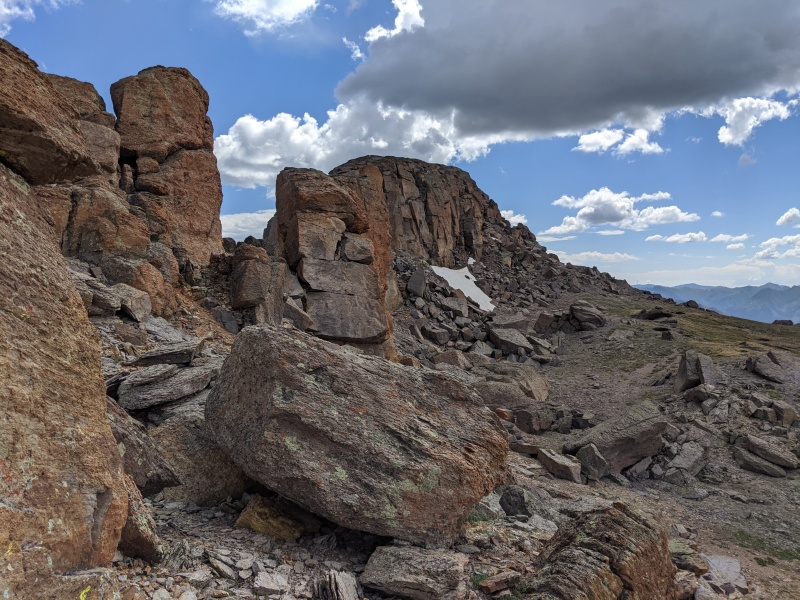
Another trip report for this peak (published while I was hiking, go figure) mentions an easy gully on the east side of the summit ridge, so if I'd walked all the way across the flat area, I may have found it. That's probably the best way to go. My route wasn't so bad, though. At 10:45 I re-traced my steps back to the notch and then down the big blocks to the flat area, then across to the loose area on the ridge, and finally the wide notch. 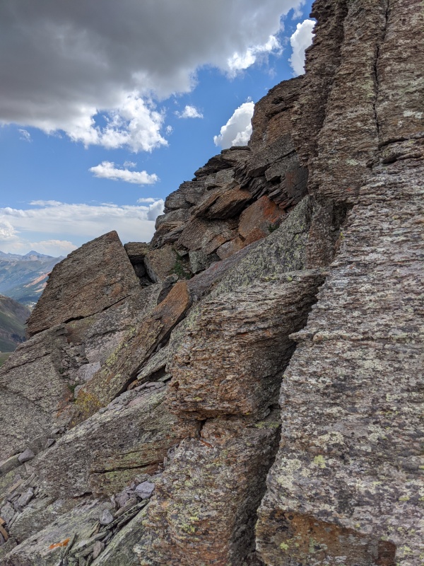

I went back down the grass gully/slope and made the split-second decision to keep going around the west side of the lake, continuing the clockwise wander around I'd started an hour earlier. I wouldn't call it any less tedious, as I still had to find my way across ridges here and there, and deal with more elevation up-and-down. It did provide a great way to see the entire lake, though. 
I met up with the end of the lake trail and hauled down after a short break, reaching the car at about 1:10 pm and closing out yet another fantastic San Juan day. 

Thumbnails for uploaded photos (click to open slideshow): ")
")
")
")
")
")
")
")
")
")
")
")
")
")
")
")
")
")
")
")
")
")
")
")
")
")
")
|
| Comments or Questions | |||
|---|---|---|---|
|
Caution: The information contained in this report may not be accurate and should not be the only resource used in preparation for your climb. Failure to have the necessary experience, physical conditioning, supplies or equipment can result in injury or death. 14ers.com and the author(s) of this report provide no warranties, either express or implied, that the information provided is accurate or reliable. By using the information provided, you agree to indemnify and hold harmless 14ers.com and the report author(s) with respect to any claims and demands against them, including any attorney fees and expenses. Please read the 14ers.com Safety and Disclaimer pages for more information.
Please respect private property: 14ers.com supports the rights of private landowners to determine how and by whom their land will be used. In Colorado, it is your responsibility to determine if land is private and to obtain the appropriate permission before entering the property.


