Download Agreement, Release, and Acknowledgement of Risk:
You (the person requesting this file download) fully understand mountain climbing ("Activity") involves risks and dangers of serious bodily injury, including permanent disability, paralysis, and death ("Risks") and you fully accept and assume all such risks and all responsibility for losses, costs, and damages you incur as a result of your participation in this Activity.
You acknowledge that information in the file you have chosen to download may not be accurate and may contain errors. You agree to assume all risks when using this information and agree to release and discharge 14ers.com, 14ers Inc. and the author(s) of such information (collectively, the "Released Parties").
You hereby discharge the Released Parties from all damages, actions, claims and liabilities of any nature, specifically including, but not limited to, damages, actions, claims and liabilities arising from or related to the negligence of the Released Parties. You further agree to indemnify, hold harmless and defend 14ers.com, 14ers Inc. and each of the other Released Parties from and against any loss, damage, liability and expense, including costs and attorney fees, incurred by 14ers.com, 14ers Inc. or any of the other Released Parties as a result of you using information provided on the 14ers.com or 14ers Inc. websites.
You have read this agreement, fully understand its terms and intend it to be a complete and unconditional release of all liability to the greatest extent allowed by law and agree that if any portion of this agreement is held to be invalid the balance, notwithstanding, shall continue in full force and effect.
By clicking "OK" you agree to these terms. If you DO NOT agree, click "Cancel"...
The kids and I decided to drive to Colorado (from Ohio) this year, for our yearly 14er trip. We started the 20+ hour drive on Friday night, and ultimately arrived in Colorado late afternoon on Saturday. We didn't drive straight through. We stopped at a rest stop around halfway to sleep. Initially I wasn't sure how long it would take, and how we would feel after such a long drive. So, I wasn't planning on hiking on Sunday. But, as we got closer, it seemed like we were making great time, and honestly, we were feeling pretty rested. I mentioned to the kids about maybe doing a 13er on Sunday, as a warm-up. They were agreeable to the idea. So, we set the GPS to arrive at the Blue Lakes Trail Head, so that we could attempt Fletcher on Sunday. We arrived at the trail head around 8 pm at night. We decided to just sleep in the car, at the trail head. As we tucked into bed, Nolan was feeling a bit rough, from the elevation. Sleeping at 11,700 ft upon arrival in Colorado - first day - was definitely a concern. After some water and a few puffs of the inhaler, Nolan felt good enough to sleep. He didn't have any additional issues with elevation the rest of the trip.
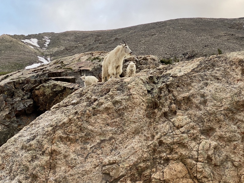
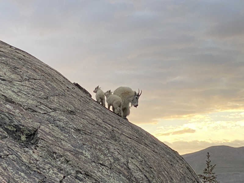
Goats at the trailhead
Goats at the Trailhead
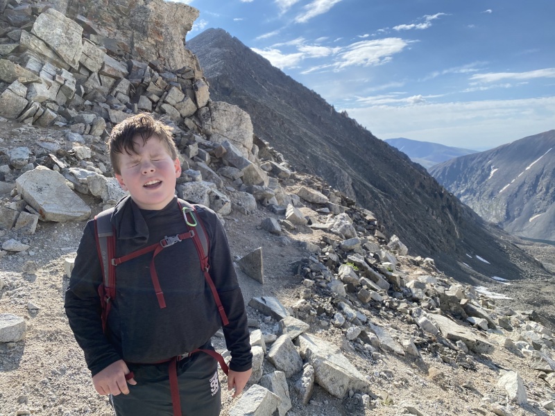
Nolan delayering, near the lake
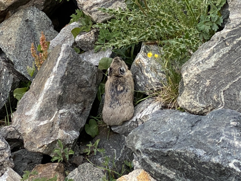
Pika, just as we got started
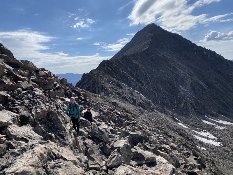
Headin up towards the basin; snowfields along the saddle
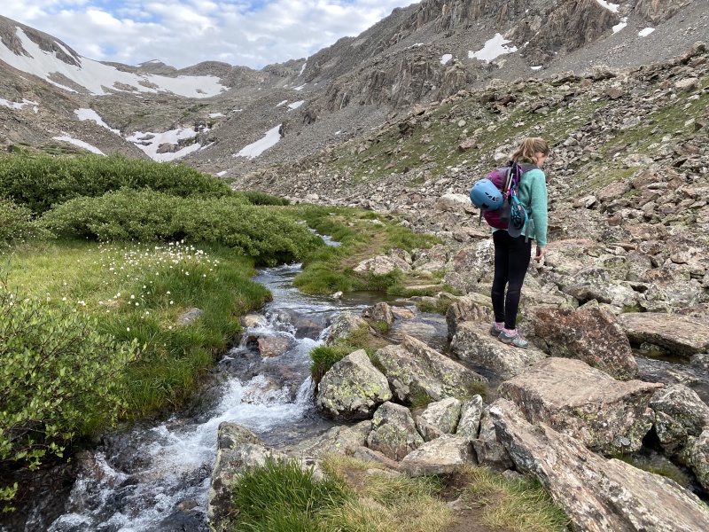
Creek crossing in the basin
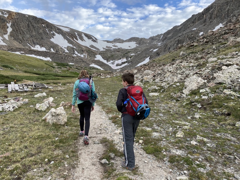
We woke up around 5:30 am, ate and got started around 6 am. In theory, Fletcher should have been an easy, warm-up day. I was actually hoping to connect with "Drift Peak" also, and give the kids a bit of class 3 scrambling. For various reasons, it did not turn out to be an "Easy Day." The hike started off easy, the trail begins at the North side of the dam fencing. It climbs pretty quickly to get high above the lake. Then, the trail gradually climbs, along the base of Fourteener, Quandary Peak. Everyone felt pretty good for the first mile or so. As the trail climbs into the basin, it becomes more difficult to follow a clear path. From the basin, we should have taken a direct route, straight towards Fletcher. But, there were some large snowfields towards the saddle that I wanted to try to avoid. So, instead we took a hard right, up the lower slopes of the Quandary West Ridge route. This ended up being a lot more worked than it looked like it would from below. The route up the slopes was loose and frustrating. At no point was it dangerous, but it was definitely exhausting. By the time we made it to the saddle, the kids were complaining pretty loudly and were very tired. I think the off route ascent was hard on them; on top of being out first day at elevation.
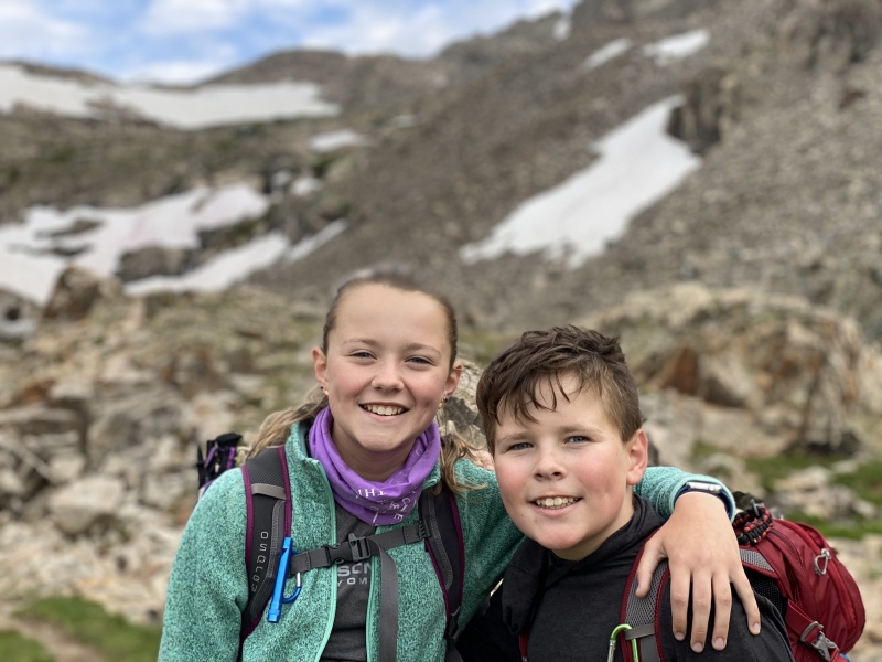
Anna and Nolan with Fletcher in the background
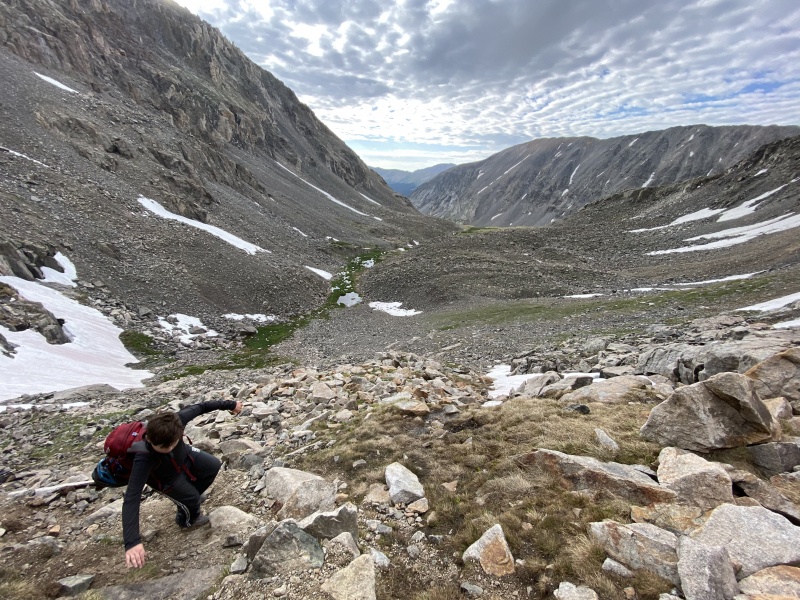
Nolan scrambling
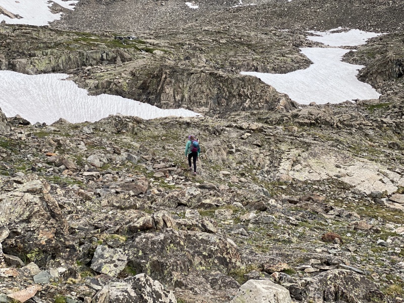
Anna heading up the slopes
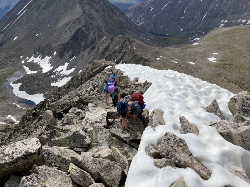
Nolan at the top of the loose scramble
Shot back at Quandary, as we tackle the last bit to the summit
Sketchy section at the top; drop off to the kids right is no joke
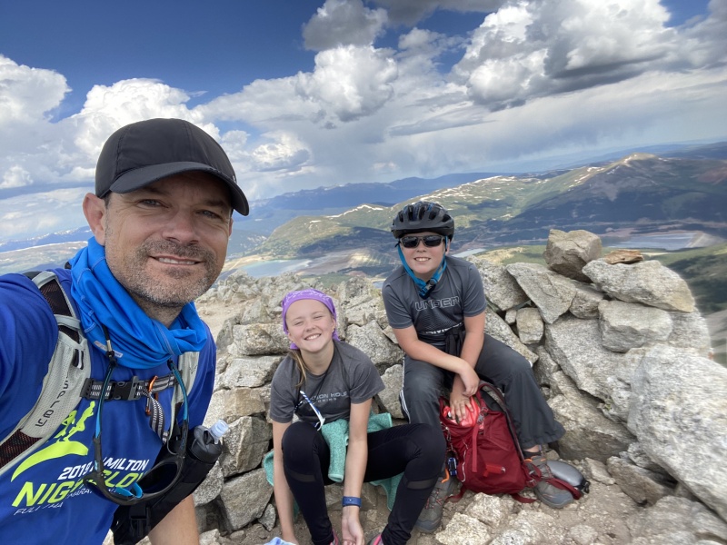
Summit Selfie
The rest of the hike to the summit was pretty easy. If the slope scramble has not been so challenging, I think that the kids would have rocketed to the top. They were dragging a bit as we approached the summit. We reached the summit is just over 4 hours (~ 3 miles). At this point, it was 10 am, and the skies were not looking friendly. There were some rain clouds in the area, and we even saw lightning in the distance. We spent 10 minutes on top, then started back towards the trail head. During the descent, Anna's feet were hurting badly. This was the third year using the same hiking shoes, and they were probably a half size small at this point. She complained about here toes getting slamming, during the downhill. We moved as fast as we could during the descent. The top section was pretty rocky, and really hurt Anna's feet. I really wanted to get off of the rocks - and onto dirt trail - before the rain started. Eventually we made it back down onto a more solid trail, and into the basin. The walk down the basin, and along the lake was long, but much easier than the rocks. We descended from the summit, back to the car in about 2.5 hours. Our next destination would be Buena Vista, and new shoes for Anna.
My GPS Tracks on Google Maps (made from a .GPX file upload):
How wonderful to see families having so much fun in the Colorado mountains.
Caution: The information contained in this report may not be accurate and should not be the only resource used in preparation for your climb. Failure to have the necessary experience, physical conditioning, supplies or equipment can result in injury or death. 14ers.com and the author(s) of this report provide no warranties, either express or implied, that the information provided is accurate or reliable. By using the information provided, you agree to indemnify and hold harmless 14ers.com and the report author(s) with respect to any claims and demands against them, including any attorney fees and expenses. Please read the 14ers.com Safety and Disclaimer pages for more information.
Please respect private property: 14ers.com supports the rights of private landowners to determine how and by whom their land will be used. In Colorado, it is your responsibility to determine if land is private and to obtain the appropriate permission before entering the property.

")
")
")
")
")
")
")
")
")
")
")
")
")


