| Report Type | Full |
| Peak(s) |
Mt. Elbert - 14,438 feet |
| Date Posted | 08/27/2020 |
| Date Climbed | 07/23/2020 |
| Author | rob runkle |
| High Point of Colorado with the kids |
|---|
|
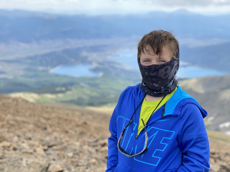
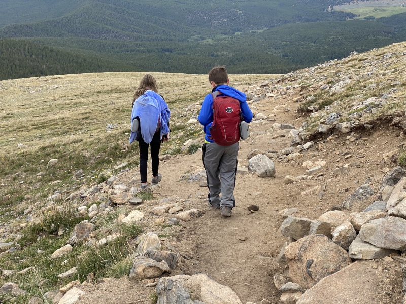
After a tough day on Fletcher (Day 1 at Elevation) on Sunday, a pretty good, but LONG day on Yale, on Tuesday, we decided to take another break day on Wednesday. We decided to go horseback riding. After a morning of horseback riding, we pulled up our camp in Buena Vista, and headed to Leadville. We spent sometime in downtown Leadville, shopping and eating ice cream. Then, we drove to the Mt Elbert trail head campground. We ended up getting an awesome camping spot, right next to the flowing creek. We setup camp, ate dinner, and Dad was able to partake in a few cold IPAs. Since the Yale hike went so well, I felt that the kids were up for a slightly longer hike. So, we chose Mt. Elbert, via the Northeast Ridge (standard trail). Since Elbert would be the longest Fourteener for the kids,, I wanted to get a slightly earlier start. We woke up at around 430am, and were at the trail head by 500am. Our camp spot was well located, just across the road from the trail head. So, we left the tent up, and left the car parked at the camp spot. 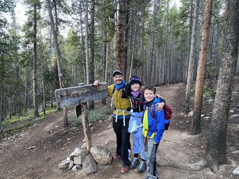

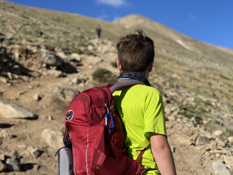
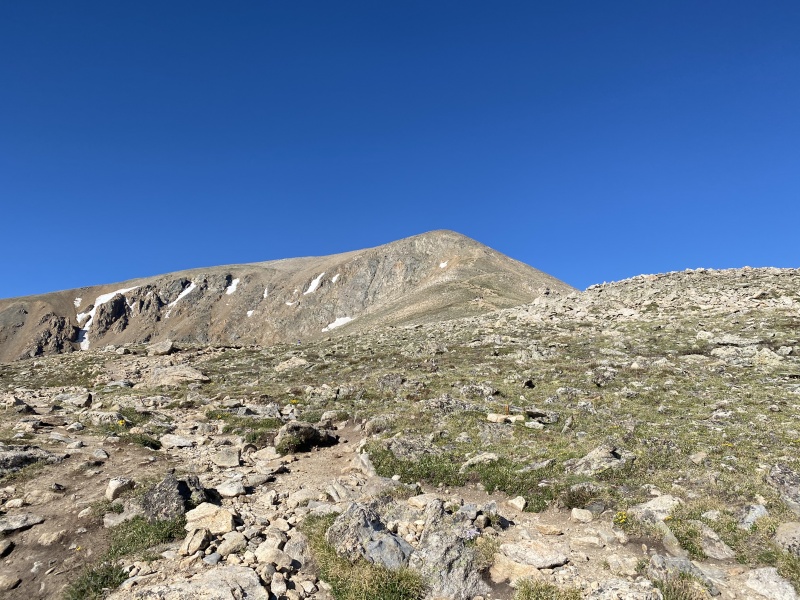
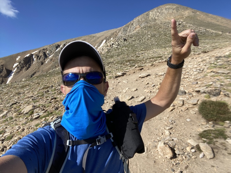
The route was a very nice grade. We made amazing progress below treeline, and rarely needed to stop for a break. We also, were able to keep around the same pace as most of the other hikers. I could definitely see an improvement in our pace and effort, compared to the first two hikes. We reached treeline in around 4 hours. We were holding pretty close to a 1 mile per hour pace. That was great for the ascent. After we got above treeline, Anna pulled ahead of Nolan and I. Anna stayed in front of us the rest of the way to the summit. The trail was super easy to follow, and there were plenty of other hikers on the route. So, I was not worried about Anna losing her way. We cleared a few false summits, and ultimately made the summit in around 5 hours and 20 minutes. The route description shows ascent at 4.75 miles. So, we were just under 1 mile per hour pace. Overall the route was class 1 the whole way. This was another reason I selected Elbert. Yale had required a bit of scramble towards the top. And, I wanted to give the kids a mental break, and something that would just required walking, and not scrambling. Elbert definitely delivered on that order. 
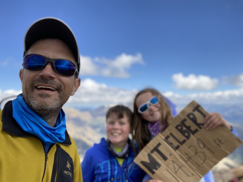
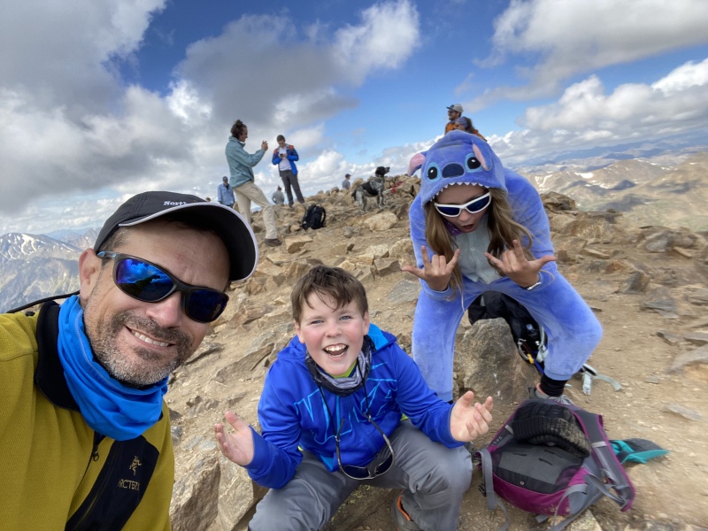
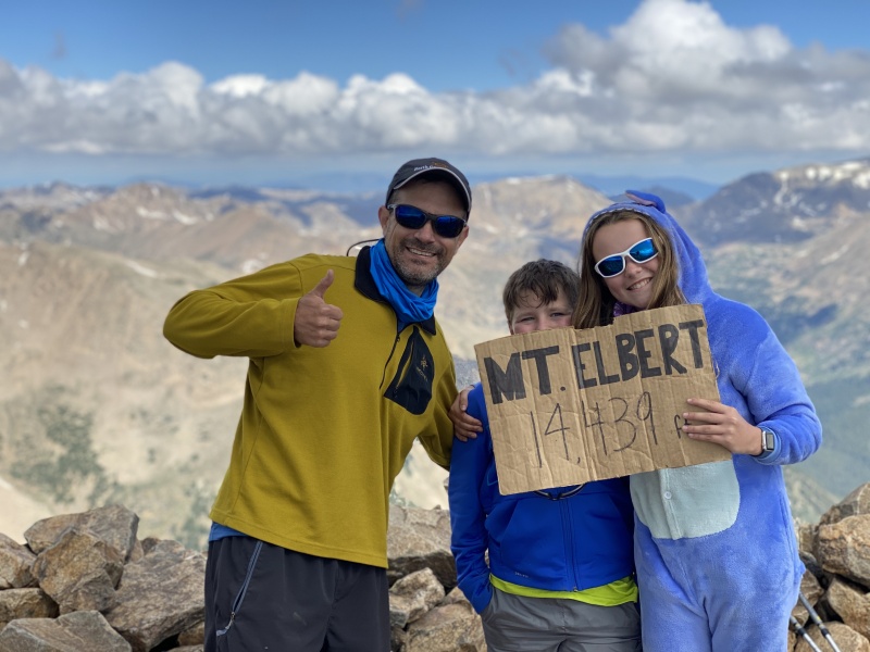
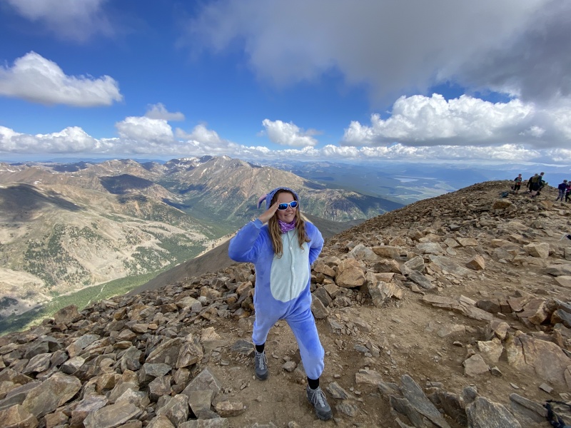
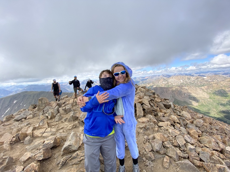
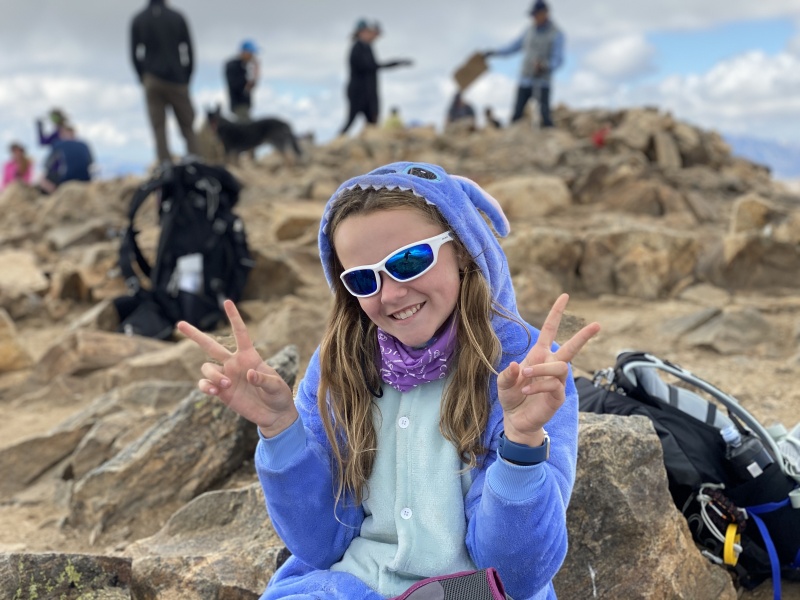
We spent 30 minutes on the summit. Again, the skies were not looking great. There were no obvious bad clouds in the area, but it was mild overcast, and looked like it could build up at any moment. Our descent was pretty fast. Since we didn't have to worry about scrambling, we didn't have to worry much about tripping and falling. We got back to the trail head 3 hours and 5 minutes after we left the summit. Total round trip time was 8 hours 55 minutes. The kids did awesome, and achieved another fastest overall pace for a fourteener (~50 minutes per mile average). It was great to see the kids get faster each day, as they became more acclimatized. Our GPS showed around 10.5 miles round trip (compared to the standard route description of 9.5 miles). After we got back to camp, we packed up, and headed towards Guanella Pass, in preparation for the last hiking day. Thumbnails for uploaded photos (click to open slideshow): ")
")
")
")
")
")
")
")
")
")
")
")
")
")
")
")
")
")
")
|
| Comments or Questions |
|---|
|
|
Caution: The information contained in this report may not be accurate and should not be the only resource used in preparation for your climb. Failure to have the necessary experience, physical conditioning, supplies or equipment can result in injury or death. 14ers.com and the author(s) of this report provide no warranties, either express or implied, that the information provided is accurate or reliable. By using the information provided, you agree to indemnify and hold harmless 14ers.com and the report author(s) with respect to any claims and demands against them, including any attorney fees and expenses. Please read the 14ers.com Safety and Disclaimer pages for more information.
Please respect private property: 14ers.com supports the rights of private landowners to determine how and by whom their land will be used. In Colorado, it is your responsibility to determine if land is private and to obtain the appropriate permission before entering the property.


