Download Agreement, Release, and Acknowledgement of Risk:
You (the person requesting this file download) fully understand mountain climbing ("Activity") involves risks and dangers of serious bodily injury, including permanent disability, paralysis, and death ("Risks") and you fully accept and assume all such risks and all responsibility for losses, costs, and damages you incur as a result of your participation in this Activity.
You acknowledge that information in the file you have chosen to download may not be accurate and may contain errors. You agree to assume all risks when using this information and agree to release and discharge 14ers.com, 14ers Inc. and the author(s) of such information (collectively, the "Released Parties").
You hereby discharge the Released Parties from all damages, actions, claims and liabilities of any nature, specifically including, but not limited to, damages, actions, claims and liabilities arising from or related to the negligence of the Released Parties. You further agree to indemnify, hold harmless and defend 14ers.com, 14ers Inc. and each of the other Released Parties from and against any loss, damage, liability and expense, including costs and attorney fees, incurred by 14ers.com, 14ers Inc. or any of the other Released Parties as a result of you using information provided on the 14ers.com or 14ers Inc. websites.
You have read this agreement, fully understand its terms and intend it to be a complete and unconditional release of all liability to the greatest extent allowed by law and agree that if any portion of this agreement is held to be invalid the balance, notwithstanding, shall continue in full force and effect.
By clicking "OK" you agree to these terms. If you DO NOT agree, click "Cancel"...
Saturday, July 18, 2020 Trailhead: Base of Imogene Pass 14.0 miles ~5100' total ascent
Party of 1: Tony
Something I have wanted to do for a while is hike a couple of the "T" peaks near Imogene Pass via the pass road. Although I do have a 4x4, my daily car is a much more comfortable ride, so I figured why not use it for the weekend and just hike a little more? We can consider this a 2WD trip report for the "T" peaks of T-8, T-7, and T-ride (just to keep with the theme here).
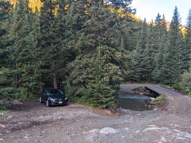
I arrived at the base of the pass at about 9:30 on Friday night, planning to set up the back of the car for sleeping. The parking lot there has a sign saying "day use only," but there's a small camp spot just behind and below the parking lot, so I backed into there and turned in for the night. In the morning, I could conveniently just begin hiking from here. So convenient.
Perfect.
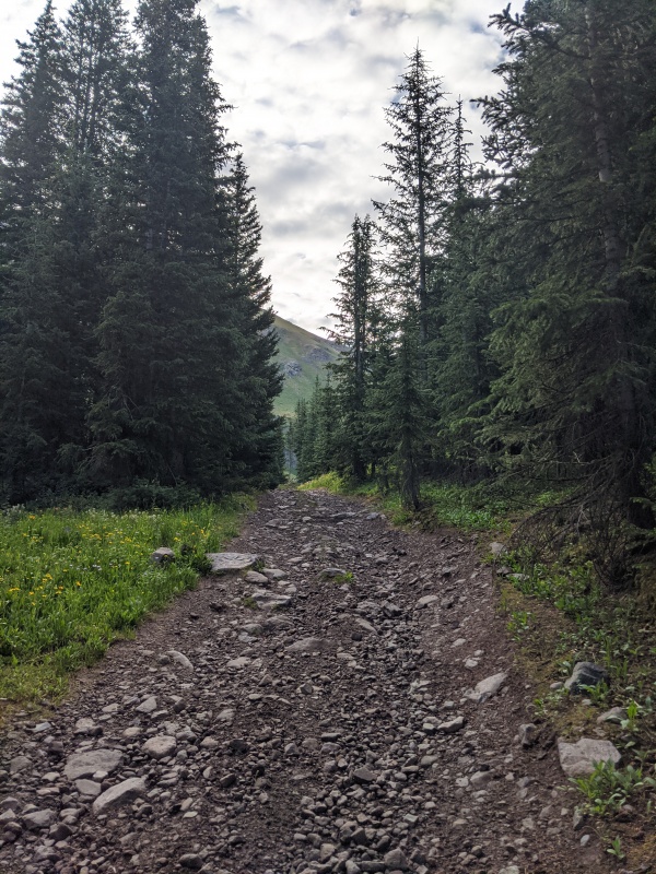
I started up the road at 6:30 in the morning, soaked my left foot at the very first creek crossing, and promptly made it to the junction with the Camp Bird road (perhaps the alternate base of Imogene Pass). Here is where the elevation gain started, but it wasn't that steep. It wasn't too long before I hit the Richmond Basin junction at 7:20.
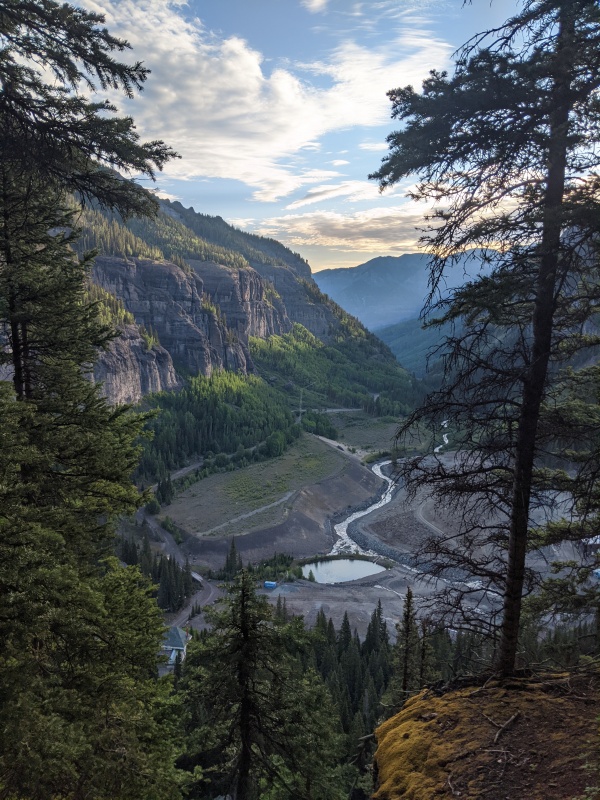
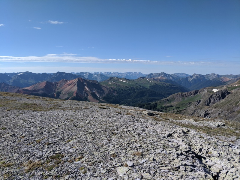
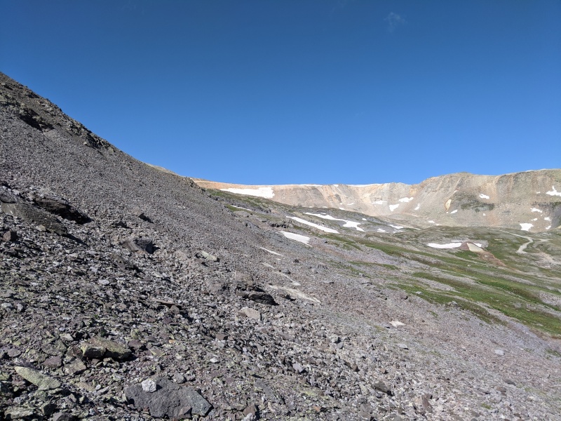
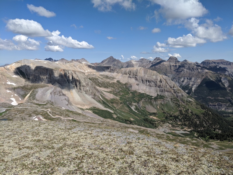
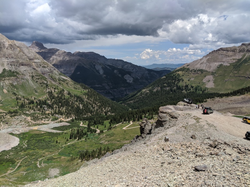
I turned to follow the Richmond Basin road in its entirety from below treeline to almost 12,800'. For a road walk, this part was super enjoyable. The road is narrow, so it feels more like a trail, and although it gets more scree-heavy above treeline, it's still a road, so the level of tediousness never got very high. As I made my way up the road, I periodically turned to admire Sneffels and Potosi across the valley, revealing themselves more and more.
The Richmond Basin road.Sneffels & Potosi (Sniffles & Pelosi) saying good morning.
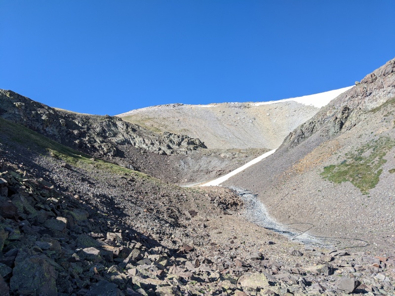
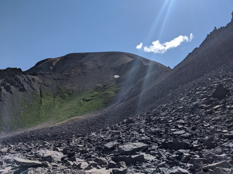
The end of the road is just a few hundred feet below the summit, so I figured this last push would be somewhat straightforward and quick. I reached the end of the road at 8:30 and turned south to hike a grassy slope up and around some scree, joining up with the valley flowline at the entrance to a small circque just below the summit of T-8.
At the end of the road, shooting for the other side of that grassy slope.The entrance to the mini-cirque below the T-8 summit.
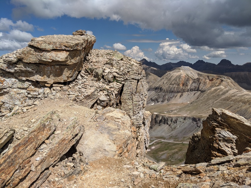
The little cirque bends around to the west, with the summit of T-8 sitting only a couple hundred feet above. Here, there was a choice between going left and right to gain the ridges to the summit. They both looked the same; I chose to go right and walk up some grass to the broad ridge. From here, the last push to the summit involved hiking up a hundred feet or so of easy, gray scree. Before I knew it, I crested the easy scree and walked over to the summit at 8:50.
Just below the summit of T-8 in the mini-cirque.A bit of scree to the top.Partial T-8 summit view.
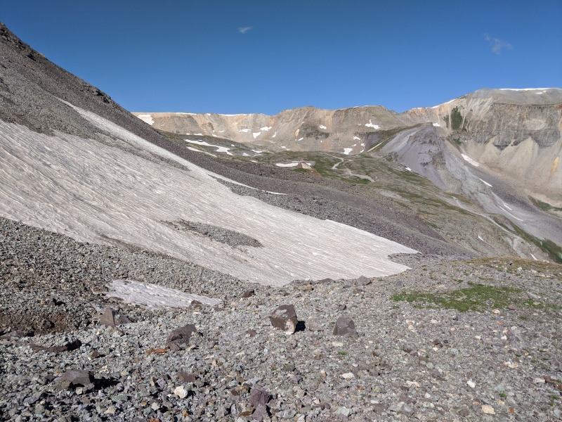
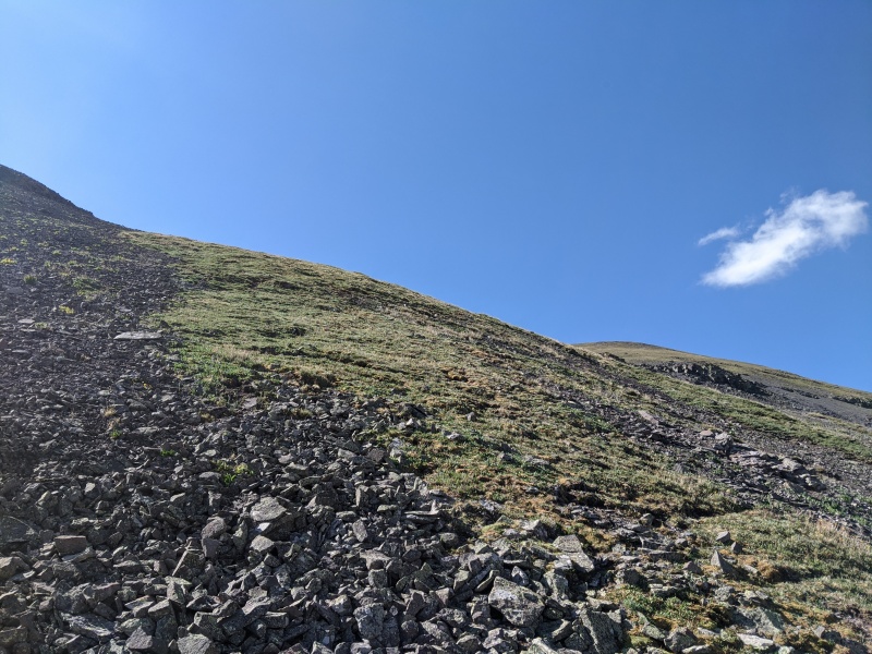
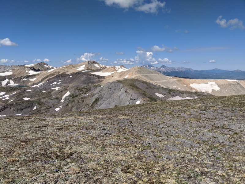
I admired the views for a brief period and decided to continue at 9:10. From studying previous reports, I knew that the ridge between T-8 and T-7 doesn't go all that well, so I planned to descend around and to the west (Imogene Basin side) of it, then re-gain the ridge on the other side. After a couple hundred feet down the ridge, I turned off of it and walked down an initial section of scree followed by a steep grassy and flowery slope.
Looking ahead toward T-7 after starting down the connecting ridge.
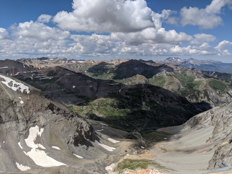
This slope brought me down to a snowfield (same as shown above), which I assume is present for a while every year since the San Juans ended their winter quite dry and this one was present on July 18. I crossed the snowfield and contoured around and below the ridge difficulties. I'd say I was at the low point of the traverse at around 9:30. I kept going until I could see grass above me, which would be used to re-gain the ridge. I ended up going slightly farther than optimal, but it still worked out very nicely.
Cool find. Will anyone else stumble upon it?The snowfield I walked across.Continuing the contour around the difficulties.Looking back.Now, upward!
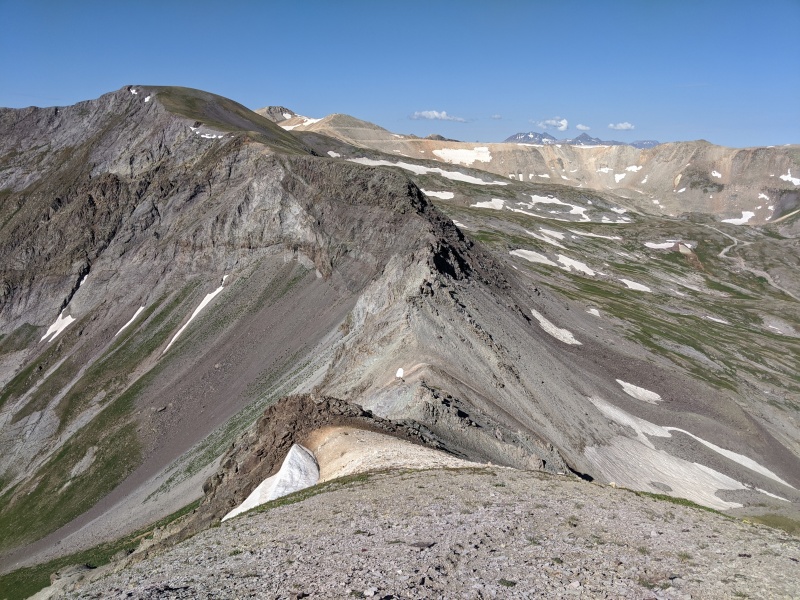
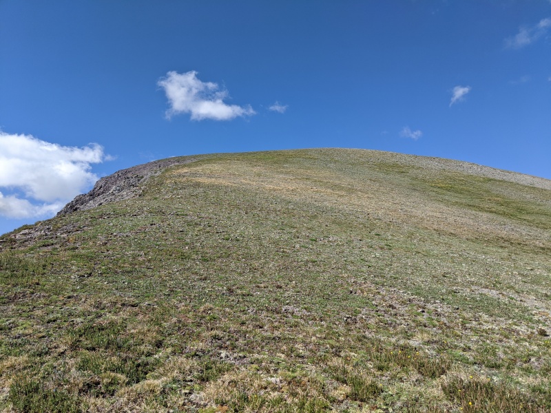
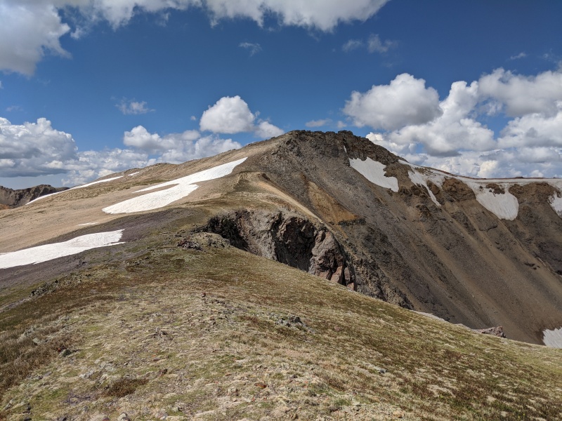
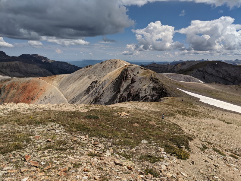
Shortly after, I was back on the ridge and almost at the summit of T-7. That was fast! I finished up T-7's ascent at 10:10 and once again sat down to admire the views for a brief period.
Well that's just easy peasy, isn't it?Partial T-7 summit view.Looking over to T-Ride, which is just left of center. On the very left is PT 13,510 B.
At 10:25, I began the descent down the easy ridge to the saddle and then up toward the spur road off of Imogene Pass. As I passed through the area, one of those tour Jeeps drove by, full of puzzled-looking tourists in the back. One woman who had the most WTF face I'd seen in a while asked me "Did you hike up here?" "Yeah." "...You need a ride down?" "Nah I'm good." Has she ever heard of hiking?
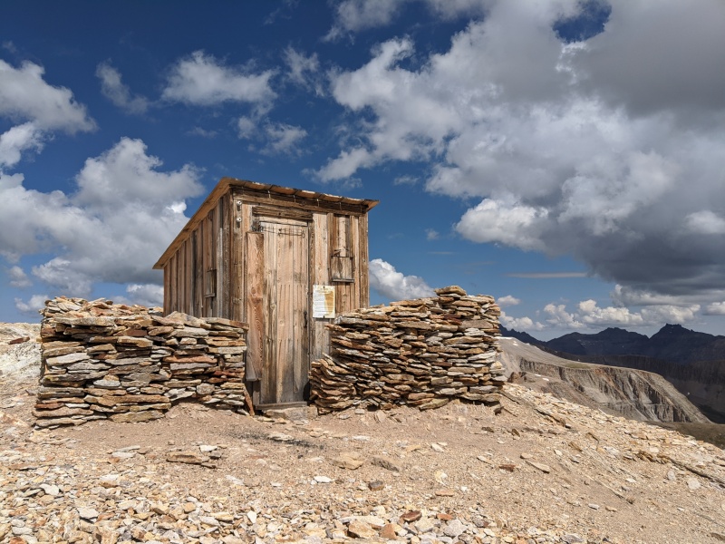
I continued up toward an old wood structure and then left (southward) toward T-Ride.
Old but preserved structure.Not far now!
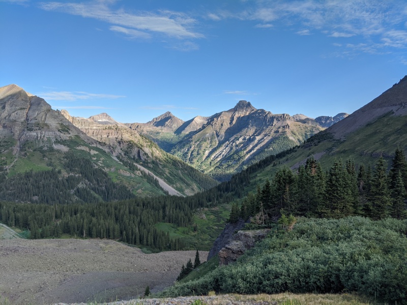
There were clouds developing now, especially over Sneffels, but the summit of T-Ride wasn't far away at all. I followed the ridge, hiked up some scree, and arrived at the top where it got much rockier and exposed at the very last bit, hitting the summit at 11:00.
Last little bit to the T-Ride summit.Partial view from T-ride (okay; Telluride Peak).
The views were great from the summit of T-Ride, and I'd say they were the best of the day. Two trail runners joined me, having come up the west ridge. We made small talk briefly and then all continued on our way at 11:10, with them running toward Imogene Pass and me making a brisk walk of it.
Descending the ridge back toward Imogene Pass.
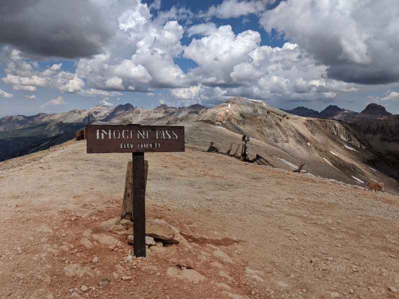
The weather was holding, so I decided to go over to the Imogene Pass summit, sit down for a while, and people-watch a little, arriving at 11:30. Tourists can be an interesting breed, but hey, everybody's a tourist sometimes.
First time up this bad boy.
I started the brisk hike down the Imogene Pass road at 11:50, sometimes passing vehicles that were going super slow with it. I walked by one area where people were waiting in line for their turn to pull their vehicle onto a rock outcropping for photos. I couldn't' help but think that - as they say - geologic time is now.
It could be RIGHT NOW.
Farther down the pass road I went, watching the storm over Sneffels get larger. Eventually the cloud grew enough to cover up the sun and rain started to fall over on Potosi, but not me. Before long, I passed the Richmond Basin junction once again. Not long after that, I reached the Camp Bird junction. Light rain was finally starting to fall as I made my up the slight uphill grade, one final section of elevation gain for the day. Before I knew it, I was back at the base of the pass and my car at 1:30.
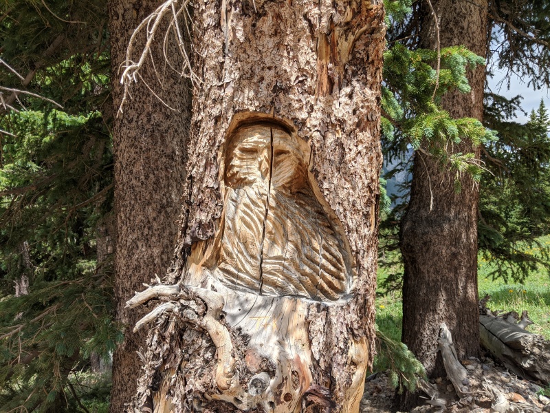
I passed this carving on the way down. The tree was already a dead but tall stump. It's definitely impressive; I suppose it's acceptable since a dead tree is just a log? Not sure.
Overall, it was a great day. I can't say I recommend against hiking Imogene Pass to access peaks; it's really not that bad at all. Have at it.
Thumbnails for uploaded photos (click to open slideshow):
Thanks for sharing! I walked up a drawbridge last week which is Florida's version of a 5k vert day - gotta live vicariously through you. This looks like a great little day trip!
Cool carving, but I'd say it's a LNT no-no. People's art rarely beautifies the mountains (they don't need any help) and that artist may have disturbed some animal that calls that dead tree home. Like, maybe an owl... Pretty simple really: leave nothing but footprints.
At least it looks skillful, unlike all those stacked rock piles that bored hikers leave behind.
My wife and I followed this tr to a tee, the beta is spot on. We made it to the top of T8 in around 2:15. While we are still pretty fast for our age I have to say that we bailed and turned around descending off of T8, too steep for us in our 40's. I'd suggest people do this in reverse or with snow as the descent was steeper than I care for these days. You'd probably tomahawk if you fell descending between t8 and t7. All in all a good day and thanks for the route description.
Caution: The information contained in this report may not be accurate and should not be the only resource used in preparation for your climb. Failure to have the necessary experience, physical conditioning, supplies or equipment can result in injury or death. 14ers.com and the author(s) of this report provide no warranties, either express or implied, that the information provided is accurate or reliable. By using the information provided, you agree to indemnify and hold harmless 14ers.com and the report author(s) with respect to any claims and demands against them, including any attorney fees and expenses. Please read the 14ers.com Safety and Disclaimer pages for more information.
Please respect private property: 14ers.com supports the rights of private landowners to determine how and by whom their land will be used. In Colorado, it is your responsibility to determine if land is private and to obtain the appropriate permission before entering the property.


")
")
")
")
")
")
")
")
")
")
")
")
")
")
")
")
")
")
")
")
")
")
")
")
")
")
")


