Download Agreement, Release, and Acknowledgement of Risk:
You (the person requesting this file download) fully understand mountain climbing ("Activity") involves risks and dangers of serious bodily injury, including permanent disability, paralysis, and death ("Risks") and you fully accept and assume all such risks and all responsibility for losses, costs, and damages you incur as a result of your participation in this Activity.
You acknowledge that information in the file you have chosen to download may not be accurate and may contain errors. You agree to assume all risks when using this information and agree to release and discharge 14ers.com, 14ers Inc. and the author(s) of such information (collectively, the "Released Parties").
You hereby discharge the Released Parties from all damages, actions, claims and liabilities of any nature, specifically including, but not limited to, damages, actions, claims and liabilities arising from or related to the negligence of the Released Parties. You further agree to indemnify, hold harmless and defend 14ers.com, 14ers Inc. and each of the other Released Parties from and against any loss, damage, liability and expense, including costs and attorney fees, incurred by 14ers.com, 14ers Inc. or any of the other Released Parties as a result of you using information provided on the 14ers.com or 14ers Inc. websites.
You have read this agreement, fully understand its terms and intend it to be a complete and unconditional release of all liability to the greatest extent allowed by law and agree that if any portion of this agreement is held to be invalid the balance, notwithstanding, shall continue in full force and effect.
By clicking "OK" you agree to these terms. If you DO NOT agree, click "Cancel"...
It was a later start then we wanted. Seems like it always takes at least an hour or more to go up these roads to the trailhead from town. Certainly not a bad road but washboard roads are not my favorite. There are so many campsites that it certainly would have been easy to camp.
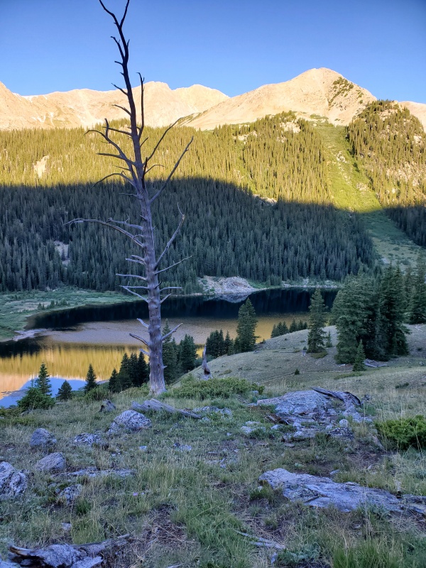
What we would have liked to have done if we could have left home earlier on Wednesday would be to backpack the 3 miles, 1000ish feet to the lake and camp there. Could have slept in and got an earlier start! Beautiful place to camp and fish if you like. Bugs are bad right now. Wear mosquito clothing.
We missed the Rockdale turnoff and had to turn around. Not a long delay, but would have been nice to be better labeled. Maybe we just didn't see it. There is a road number which we have forgotten. Then you have to know to go left to the creek. Not sure where the road to the right goes.
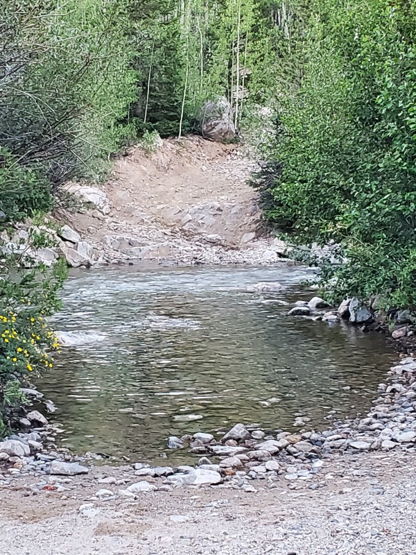
So, at 545 we were finally checking out the creeks. We didn't pause at the first stream for long, it was relatively low. Was a little deeper at the end. We could definitely see why you wouldn't want to cross this in the early season.
We decided against the second stream, not because of the water but because the exit from the stream was so uneven on a steep incline. There would not be any way to back up or adjust if needed. Pictures don't do it justice. There is room between the streams to park so we settled on the idea of crossing that cold ass stream on foot.
No where to cross on rocks or logs
We had neoprene socks for fishing in the truck so we used those with our croc's and hid them in the bushes on the other side. On toward the lake. Parts of that road are pretty rough but wouldn't have been too difficult to drive. I think it was here that I realized I forgot my microspikes.
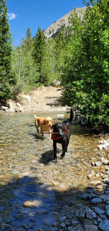
The trail wasn't hard to follow after the gate. Taking the left trail, there was a pretty short but steep section to hike along the stream. We didn't care to take the short cut. The stream was nice.
Stashed our fishing stuff for after the climb.
Last chance for filtering water
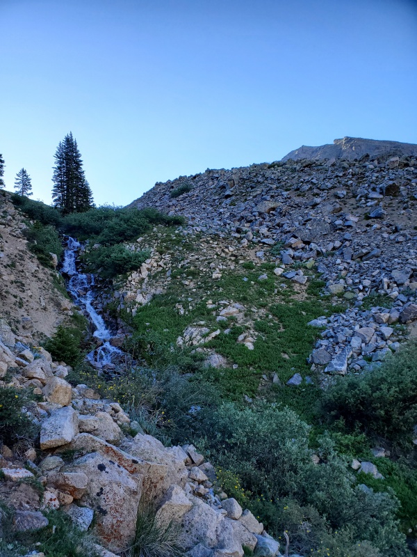
Once out of the drainage, we got a good look at the long grassy slope to go up next.
With every step I fumed more and more about the forgotten microspikes. This was the perfect terrain for them. It is an interesting mental game on these climbs sometimes. The funk of negativity builds on itself. More things irritated me and I began feeling like crap. Once I changed my attitude and thought about all of the positive things around me, I felt so much better.
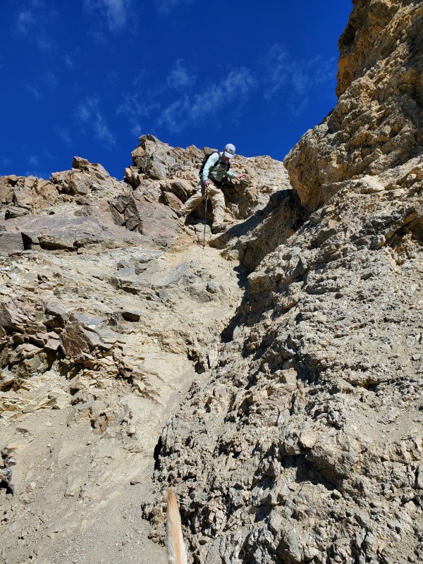
The ridge was really fun and a nice break from the grassy slope. The crux was nowhere near as difficult as I thought it might be for the dogs. It looked like banana peel dirt down the middle so I downclimbed over on the left side.
Sammy checking it out
No problem
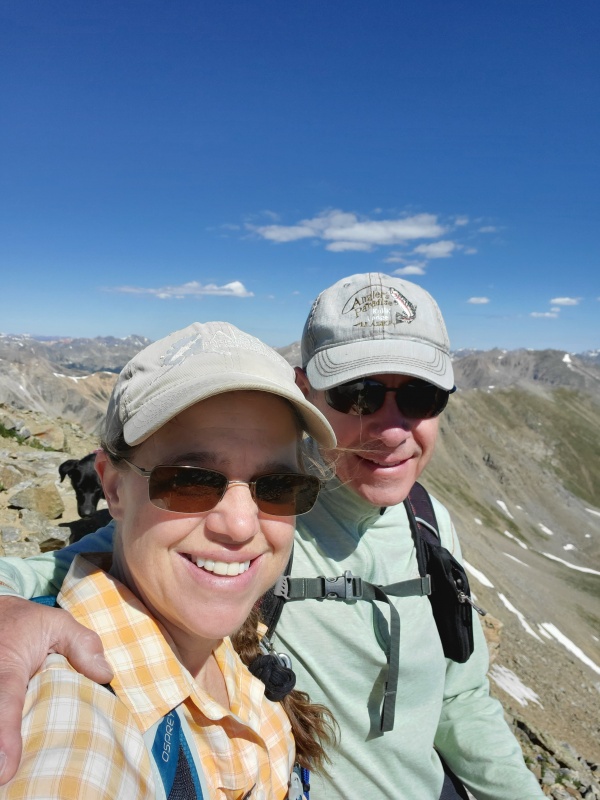
We reached the summit at 10 and spent some time up there since it was nice. Congrats to the young guys who climbed Belford and Oxford then Missouri on no sleep. That is a lot of elevation at one time.
We headed back and my heart sunk a little at the top of the grassy hill. But I am blessed with a husband who so graciously lent me his spikes for the downhill slog. So grateful!
I offered to hang them on the dog's collar and have them brought back to him but turns out you can hike pretty well without them. I just feel a lot more stable and have less slipping with them.
We made it back to the lake around noon and was able to fish for an hour and a half. The lake is beautiful and good for small Brook trout. The inlet was fun.
We all were able to enjoy the cold stream back at the truck. It got pretty warm that day, 70s I think. Back by 3.
Rocky's first 14er. We lost our last black lab in November. This one was for him.
Thumbnails for uploaded photos (click to open slideshow):
This is an excellent alternate route to the standard. I thoroughly enjoyed it several years ago. The Crux did almost get me though. Nice job! Pictures are great!!
Caution: The information contained in this report may not be accurate and should not be the only resource used in preparation for your climb. Failure to have the necessary experience, physical conditioning, supplies or equipment can result in injury or death. 14ers.com and the author(s) of this report provide no warranties, either express or implied, that the information provided is accurate or reliable. By using the information provided, you agree to indemnify and hold harmless 14ers.com and the report author(s) with respect to any claims and demands against them, including any attorney fees and expenses. Please read the 14ers.com Safety and Disclaimer pages for more information.
Please respect private property: 14ers.com supports the rights of private landowners to determine how and by whom their land will be used. In Colorado, it is your responsibility to determine if land is private and to obtain the appropriate permission before entering the property.


")
")
")
")
")
")
")
")
")
")
")
")
")
")


