Download Agreement, Release, and Acknowledgement of Risk:
You (the person requesting this file download) fully understand mountain climbing ("Activity") involves risks and dangers of serious bodily injury, including permanent disability, paralysis, and death ("Risks") and you fully accept and assume all such risks and all responsibility for losses, costs, and damages you incur as a result of your participation in this Activity.
You acknowledge that information in the file you have chosen to download may not be accurate and may contain errors. You agree to assume all risks when using this information and agree to release and discharge 14ers.com, 14ers Inc. and the author(s) of such information (collectively, the "Released Parties").
You hereby discharge the Released Parties from all damages, actions, claims and liabilities of any nature, specifically including, but not limited to, damages, actions, claims and liabilities arising from or related to the negligence of the Released Parties. You further agree to indemnify, hold harmless and defend 14ers.com, 14ers Inc. and each of the other Released Parties from and against any loss, damage, liability and expense, including costs and attorney fees, incurred by 14ers.com, 14ers Inc. or any of the other Released Parties as a result of you using information provided on the 14ers.com or 14ers Inc. websites.
You have read this agreement, fully understand its terms and intend it to be a complete and unconditional release of all liability to the greatest extent allowed by law and agree that if any portion of this agreement is held to be invalid the balance, notwithstanding, shall continue in full force and effect.
By clicking "OK" you agree to these terms. If you DO NOT agree, click "Cancel"...
The infamous Mummy Mania route has been hanging in the back of my head ever since I started hiking and climbing seriously in RMNP but it wasn't until this year that I got to a point in my physical and mental training that I felt like I might actually be up to the task. I've been in and around the Mummy Range a number of times in the past years but had yet to tackle the central cluster of peaks. There were also quite a few less obtrusive peaks that I wanted to check off my list so I spent a lot of time researching and experimenting with ways to link mountains together. The idea behind Mummy Mania is to knock out an entire mountain range in one go, so it seemed in keeping with the spirit of the hike to add on as many of the smaller summits that could be reasonably included into one big traverse. I had originally intended to save this one for a bit later in the year so the rest of the lingering snow fields would be gone, but recent opening of Old Fall River Road and the absolutely perfect weather forecast this weekend was too tempting to pass up. I left Boulder around 2:30 am and started my trek from the Chapin Pass TH just before 5.
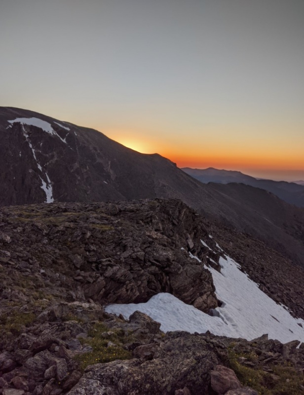
Sunrise over the Desolation group on the way up the CCY trail
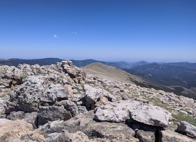
I quickly made it up to the first summit of the day, Mt. Chapin (12,460'). I chose to hike the trail all the way to the saddle before cutting up to the top, the hiking is easier and you can do it pretty fast.
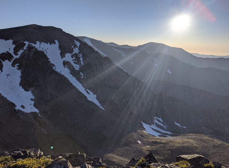
Local sunrise from Chapin, looking east over Chiquita's limb
Next up was Mt. Chiquita (13,075'), RMNP's lowest 13er. The trail is easy to follow and quickly gives way to easy rubble as you get onto the summit block.
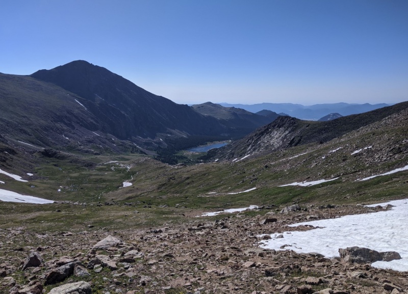
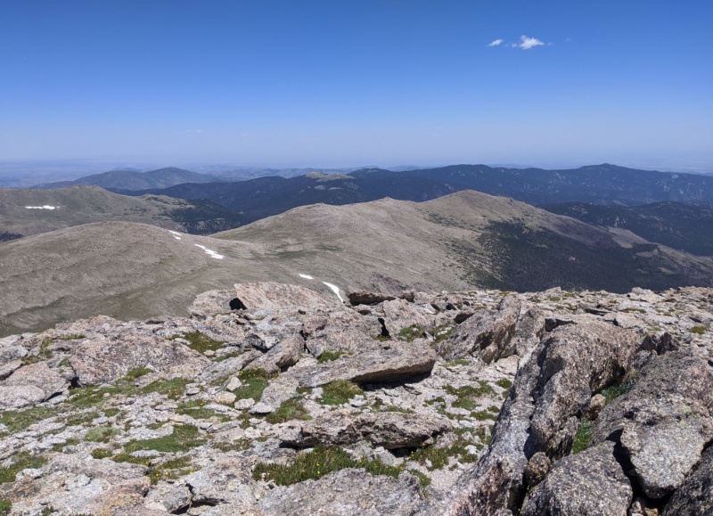
Mummy Mtn looking impossibly far away from Chiquita, with Ypsilon at left. Mummy would be my 9th summit of the day and I definitely had some doubts I was going to make it that farA great view of the iconic Blitzen Ridge
The hike from Chiquita to Ypsilon Mtn (13,520') isn't bad, but the trail becomes hard to follow pretty quickly and you end up just taking the path of least resistance up the scree. There are a few false summits before the top, but soon enough I was standing atop the first major checkpoint for the day. Moving beyond Ypsilon basically meant committing to exiting at a different TH from the one I'd started at, necessitating a pickup or car shuttle. From here on out the terrain would also get more difficult, with no trail and lots of Class 3 and 4 for the next four miles or so. I ate a quick bite and began down Ypsilon's winding north ridge toward the imposing Fairchild Mtn (13,508').
Following the ridge toward Fairchild. I stayed low off the ridge to avoid most of the snow
As you lose elevation off Ypsilon the going gets slower as you move onto huge talus fields. Many of the rocks are loose and will shift or settle under your feet, so you have to be pretty careful. I would have liked to stay on the ridgeline, but there was enough snow still lying around that I moved east to save some time.
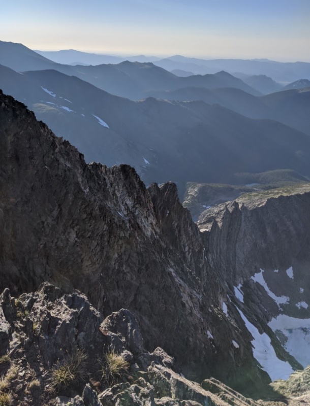
Looking northwest at East Desolation Peak, one of my favorite hikes in the whole park
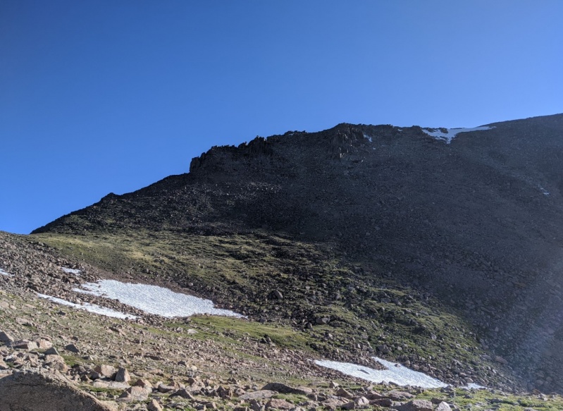
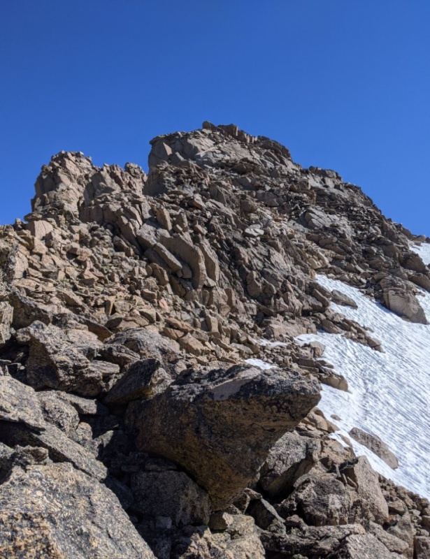
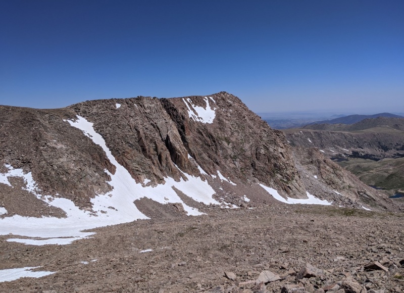
Finally I reached the saddle and began moving up the south slope of Fairchild Mtn. The summit is ringed by a steep cliff band that can be bypassed through a large, loose gulley in the southwest face.
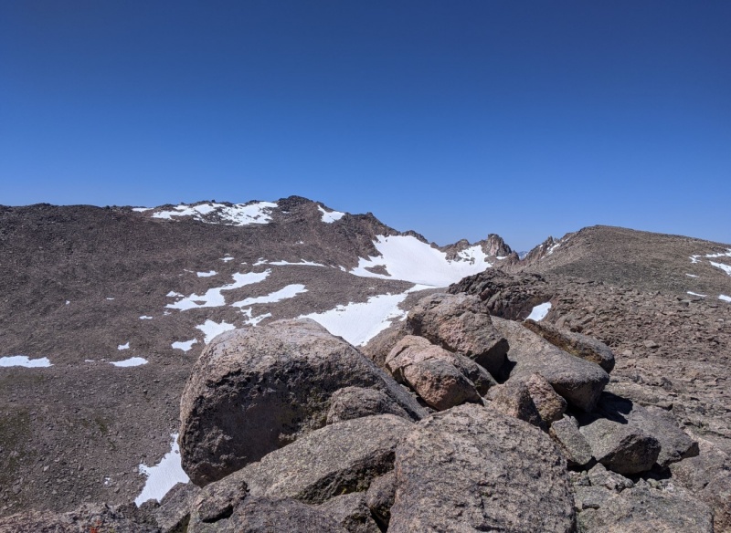
The best way to access the summit block is to pick a line that goes in between the two large outcroppings near the center of this image
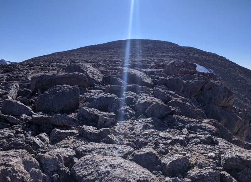
Once above the cliffs, the summit is an easy walk over stable talus
I made it to the top of Fairchild around 8 am, and took some time to eat and relax. It was warming up pretty quickly but there was a strong wind blowing in from the west so I kept my windbreaker on. The view from Fairchild is absolutely incredible; it's centered in the heart of the Mummy Range and overlooks huge valleys in all directions.
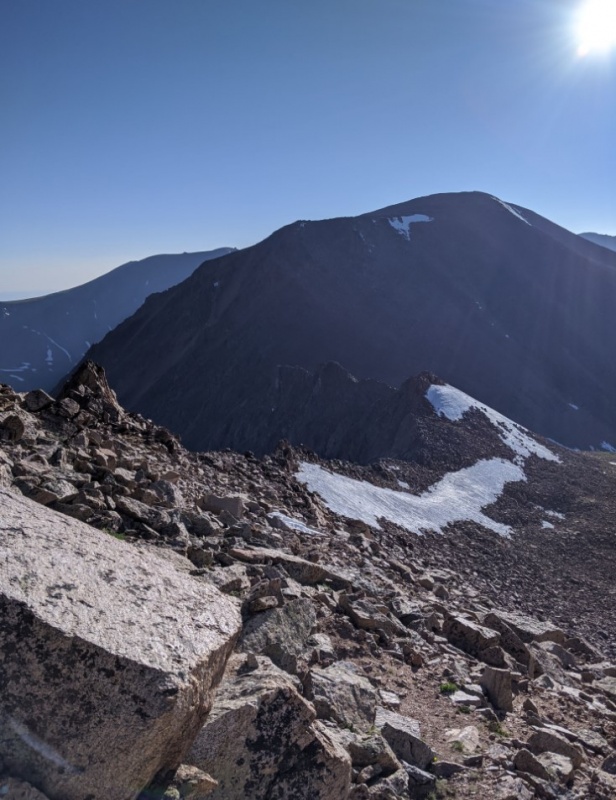
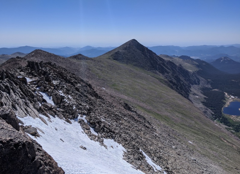
Looking back at Ypsilon from Fairchild
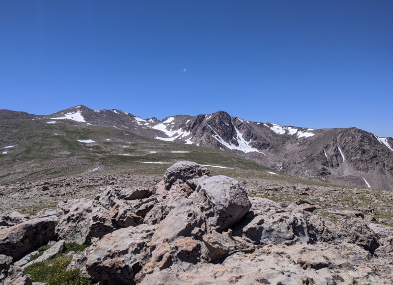
Soon enough it was time to press on. The next obstacle is the intimidating Hagues Peak (13,570'), which would be the technical crux of the route. Like Ypsilon-Fairchild, the ridge to Hagues has a very deep saddle that requires losing more than 1,000 feet of elevation gain that must then be immediately regained. The hike down Fairchild's north face is easy and stable tundra, a nice change from all the loose stuff.
Looking north toward HaguesMummy Mtn standing sentinel over Lawn Lake from the Hagues saddle
The ascent up Hagues' south ridge starts easy enough, with a series of small humps that get increasingly steeper and more rocky. About 500 feet below the top, the ridge narrows and becomes a series of jagged protrusions that can either be scrambled or bypassed over talus to the east. I opted to stay as near to the ridge direct as possible, picking a line over easy 4th class that occasionally touched the extreme exposure over the west side of the ridgeline.
Fun 4th class on the summit ridge. A less exposed line could easily be found along the top of the snow field at right
The nice thing about Hagues is there are no false summits; once you make it up over the last pinnacle you're on top! There's a small weather station and a BLM benchmark overlooking the Lawn Lake valley.
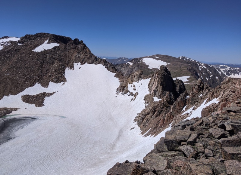
Looking southwest to Mummy Mtn from Hagues Pk
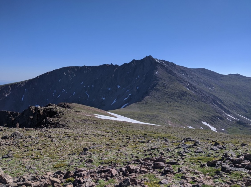
From Hagues you have two options: scramble the ridge direct to Rowe Peak (13,404'), or hike north down the face and circle Rowe Lake to access its east ridge. The ridge looked fun, but I hadn't done any research into that particular stretch and didn't know if I'd be able to get around the big gendarme in the middle. I didn't want to risk having to backtrack because at this point I was starting to feel the effects of all the elevation gain on this hike.
Rowe Lake is apparently the third highest named lake in the continental USViewing the Hagues ridge from the summit of Rowe Mtn
From Rowe Mtn it's a short half mile walk over to Rowe Mountain (13,404'), a soft ranked peak that overlooks Hague Creek and the western valleys of RMNP. This was peak number 6 for the day, which meant I was halfway done. Most of the elevation gain was thankfully behind me, but I hadn't yet hit the halfway point in terms of mileage. I didn't spend too much time on top because the wind was pretty brutal on the west side. I tagged the summit and quickly bee-lined over a mixture of talus and tundra to Gibraltar Mountain (13,300').
Looking back at Rowe Lake from the top of Gibraltar
After Gibraltar I had to make my way back over to the east shoulder of Hagues to access Mummy Mountain (13,425'), the eponymous peak of the range. I tried to contour around the south slope of Gibraltar to avoid losing any elevation. It was here that I ran into the only people I would see that day; two hikers who had camped at Lawn Lake and were dayhiking Mummy and Hagues.
Gibraltar Mtn from the east shoulder of Hagues
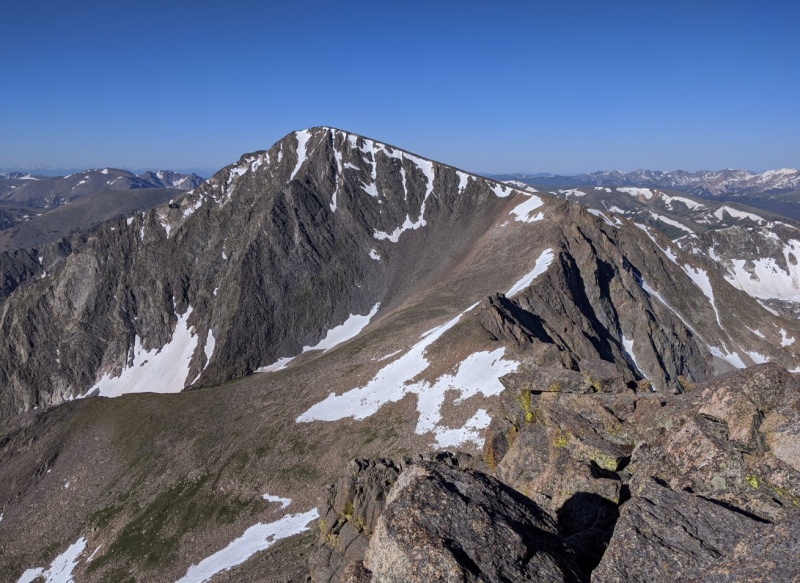
I gradually gained elevation again until I found a good spot to cross over the ridge and start moving directly toward Mummy Mtn. I've climbed Mummy before from the other side; it looks a lot sharper from this angle!
Mummy from the Hagues ridgeline
Getting up Mummy's summit block was pretty miserable. I had been above 12,000 feet for the last 8 hours and the miles were taking their toll. It was worth it though; the view from the top is second to none in the park.
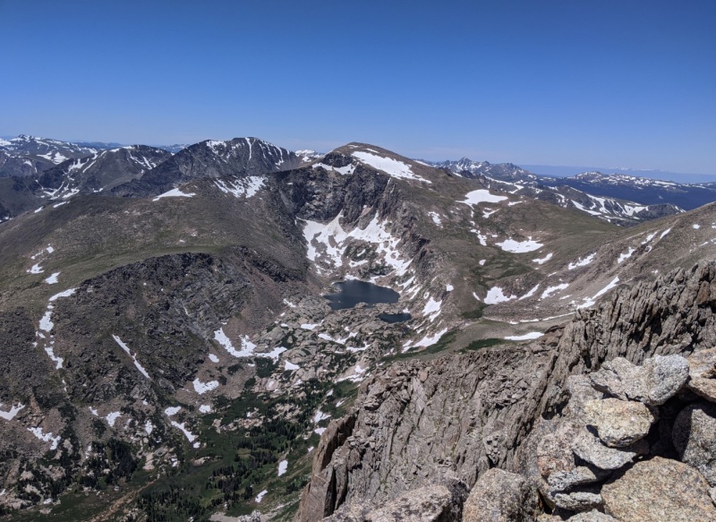
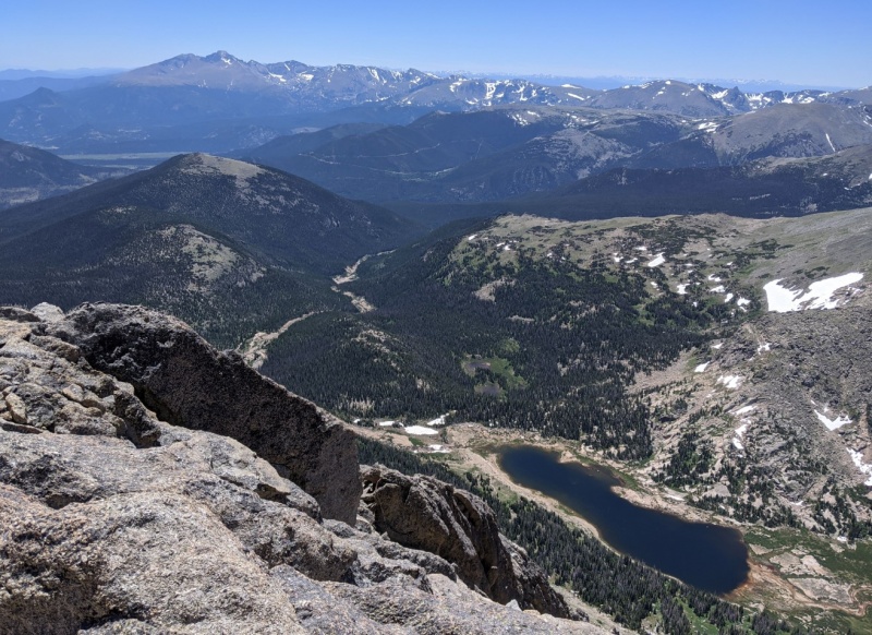
Chiquita, Ypsilon, and Fairchild over Crystal Lake from the summit of Mummy MtnLooking south, the Longs Peak group and the peaks of the Continental Divide over Lawn Lake
Mummy is the 6th and last summit of the traditional Mummy Mania hike, but unfortunately for me there were still three more mountains I wanted to knock out. I had tried to tackle them earlier in the year, but seasonal road closures and trailhead closures due to COVID had thwarted those attempts. Adding them on to the end of this hike was no small ask; their inclusion meant that Mummy was only the halfway point for the total mileage.
Looking north to my final three goals for the day
Descending off Mummy was easy at first, but soon forced me to cross a huge snow field that had gotten pretty soft in the afternoon sun. Once past that I trudged to the top of the tallest of my three remaining peaks, Mount Dunraven (12,571').
Looking west from Dunraven, Gibraltar at center
From Dunraven I was just following the highest line on the wide ridge to the next high point, the unranked 'Dundicking' (12,312'). The going got easier as the terrain became more grassy, but the tundra always gave way to blocky talus hopping near the top.
Looking east from Dundicking at my last summit, Mt. Dickinson
The last stretch of ridge to Mount Dickinson (11,836') was a lot longer than it looked on the map. The talus gave way to annoying scree fields punctuated by larger gendarmes that poke out of the gravel. After what seemed like an eternity, I was standing on top of my 12th and last peak of the day.
From Dickinson, looking north to the Stormy Peaks group
Relieved to finally be done with any real elevation gain, I took a long break and refueled for the next obstacle, which proved to be even worse than I had anticipated. From Dickinson, you have two options: descend south to meet the faint and poorly maintained Husted trail, which takes you southwest to the McGraw Ranch trailhead, or head northwest to meet the North Fork trail along the Big Thompson River. I opted for the latter route in an attempt to save some mileage, but that turned out to be a mistake. The bushwhack off Dickinson was one of the worst I've ever experienced; an endless slog of incredibly dense bushes and brambles that quickly turns into thick forest filled to the brim with deadfall. It didn't help that in that solid mile of misery also had nearly 1,200 feet of elevation loss, making the descent uncomfortably steep and brutal on my already tired knees. To add insult to injury, when the slope finally relents and you reach the valley floor, you have to cross several hundred feet of marshy reeds to reach the river and finally get on the trail. Thankfully I'd thought to bring extra socks.
Meeting up with the North Fork trail at last! From here it's an 'easy' six miles to the Dunraven TH
The hike out was on a very well-kept, gentle trail, but it felt like it would never end. I'm glad I was able to finally knock this hike out, but I can say with certainty that I'm never doing that particular route again. I hobbled my way out to meet my pickup at the Dunraven TH around 6pm; it had taken me nearly 14 hours to hike 22.8 miles with nearly 8,000 feet of elevation gain. It'll probably be a long time before I go back to the Mummy Range again!
Yep that's what you did! Not sure many Mummy Mania folks
have added peaks like Dunraven or Dickinson to their itinerary
but it was gutsy of you to do so. You documented your hike
with a nice narrative and great pics. I really enjoyed it.
One minor observation (as has been noted in other TRs
involving Hagues Peak): the consensus seems to be that the
equipment on Hagues' summit is a signal repeater for the
Park Rangers' radios.
way to push through all the extras, and that bushwhack at the end. FWIW, the east ridge through the trees from Dickinson is a much easier bushwhack, staying on the ridgeline, to pick up the North Boundary trail. Husted trail is actually in decent shape most of the way, especially below the burn. And you picked a good exit point at Dunraven TH vs Cow Creek - that ~800ft climb up the pass towards the end would be even more brutal. You still had a bit of uphill at the end of North Fork, but not as bad.
I think another variation of the Mummy Traverse is to go north to Comanche Peak or as far north as you feel if you have a ride waiting at one of those trailheads. Probably a bit longer, don't know of anyone doing that in one push, although I know someone who was considering it with a bivy, at least the terrain and grades are gentler.
cougar: good to know about Dickinson's east ridge; I had intended to hit those three earlier this year from that side, but RMNP kept the McGraw Ranch TH closed during the first phase of reopening. I think I read about adding the Comanche group to the Mummy Mania in Rossiter's guidebook. If I remember correctly he even mentioned looping back and hitting the Desolation group to end back at Chapin Pass. I think I'm gonna pass on that one!
Caution: The information contained in this report may not be accurate and should not be the only resource used in preparation for your climb. Failure to have the necessary experience, physical conditioning, supplies or equipment can result in injury or death. 14ers.com and the author(s) of this report provide no warranties, either express or implied, that the information provided is accurate or reliable. By using the information provided, you agree to indemnify and hold harmless 14ers.com and the report author(s) with respect to any claims and demands against them, including any attorney fees and expenses. Please read the 14ers.com Safety and Disclaimer pages for more information.
Please respect private property: 14ers.com supports the rights of private landowners to determine how and by whom their land will be used. In Colorado, it is your responsibility to determine if land is private and to obtain the appropriate permission before entering the property.


")
")
")
")
")
")
")
")
")
")
")
")
")
")
")
")
")
")
")
")
")
")
")
")
")
")
")
")


