| Report Type | Full |
| Peak(s) |
Mt. Emma - 13,592 feet |
| Date Posted | 07/07/2020 |
| Date Climbed | 07/03/2020 |
| Author | WildWanderer |
| An Imminent Strike |
|---|
|
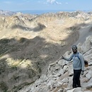
Mt Emma – 13,581  RT Length: 4.48 miles Elevation Gain: 1861’ After summiting Cirque and Gilpin it was still early in the day and the weather seemed to be holding so I decided to try and get one more bicentennial in. I drove down from Yankee Boy Basin to the junction with Governor Basin Road and took that 4WD road all the way up to Governor Basin. This is a narrow road and 4WD but luckily I only had to pass OHVs. 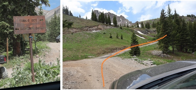  Originally, I parked at the top of the hill and started walking down into the basin, but when I saw other vehicles parked below I got back in my truck and drove all the way to the bottom.  Here’s an overview of the entire route: 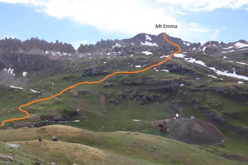 From the parking area I crossed a small creek and followed the 4WD road. 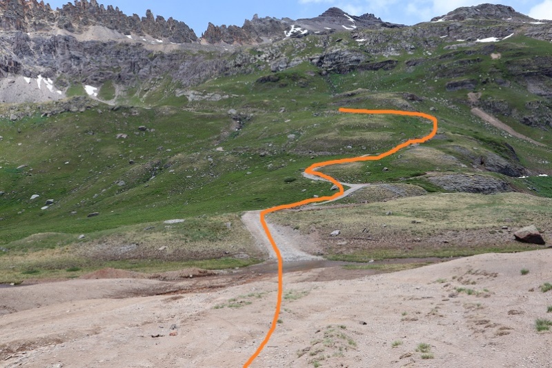 When the 4WD road intersected with a small waterfall/drainage I turned right and headed northwest up the side of the mountain  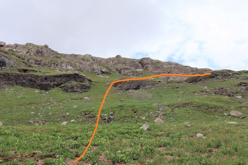 This led me to a faint game trail that brought me around the mountain 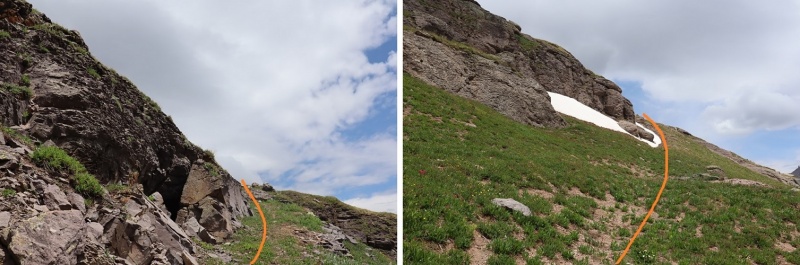 There was a neat cave here that looks like it used to be a mine but now belongs to an animal (hence the game trail) 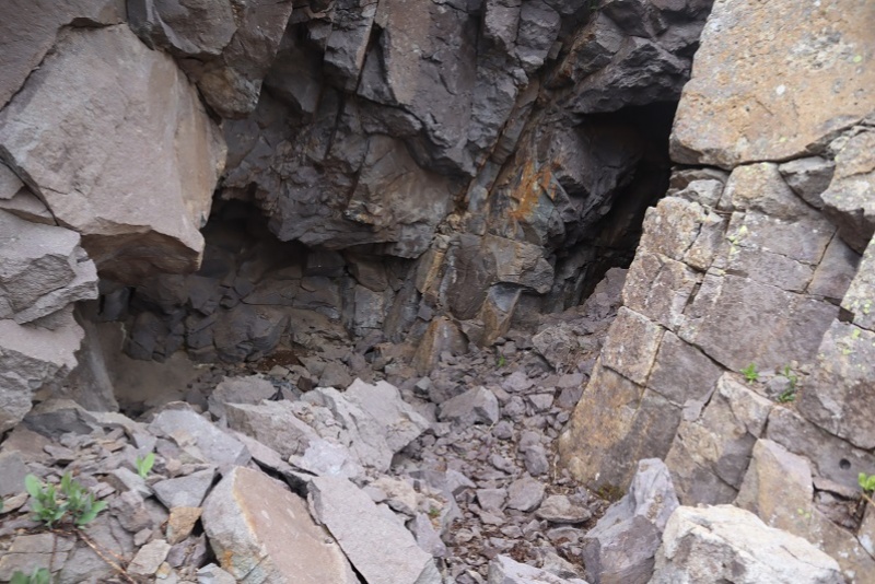 I rounded the corner of the mountain and Mt Emma came into view  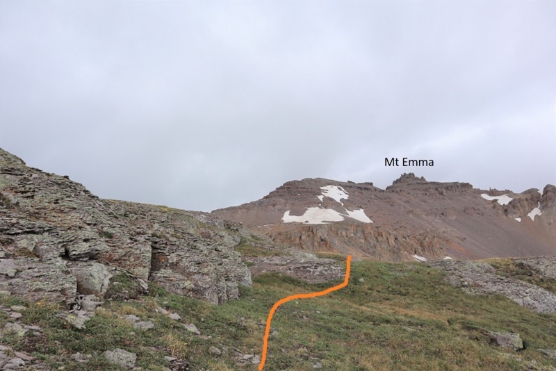 I walked across the basin, crossing a small area of firm snow, and then continued hiking up the scree filled gully 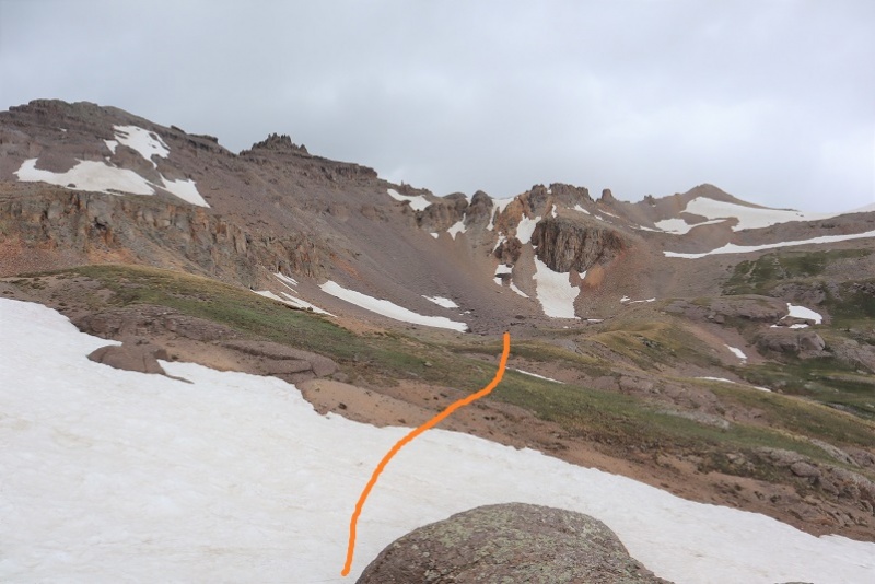 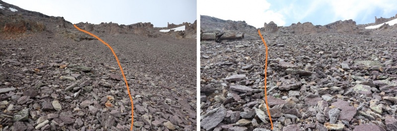 This gully was very loose and for every two steps I took forwards I took a step back sliding down scree. I tried to stick towards the larger rocks when possible because they afforded me more traction hiking up. Towards the top of the gully the scree changed to rocks and I did a little scrambling to gain the ridge. 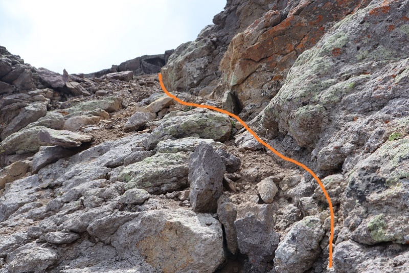 Once on the ridge I turned right and headed northwest towards the summit towers, putting on my helmet as I went. 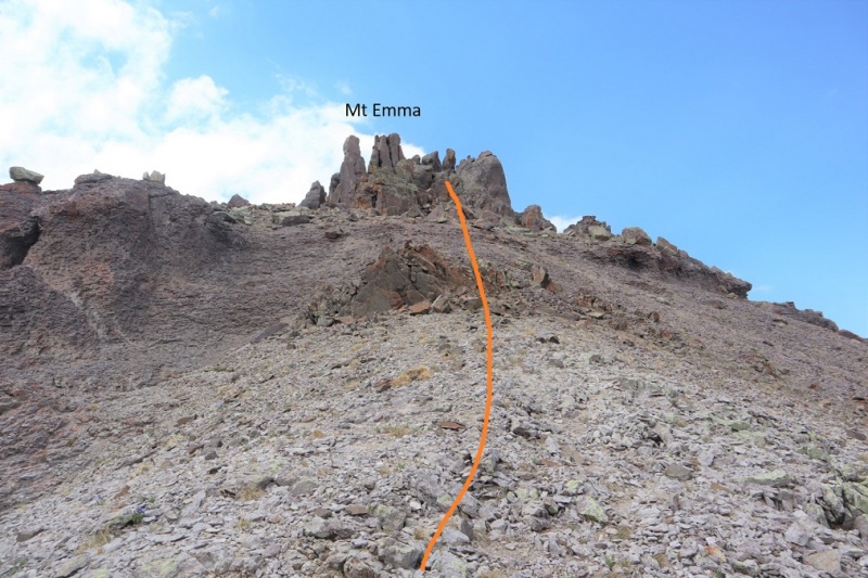 There seem to be endless ways to summit Mt Emma from this area, all class 3 and above. I summited by going right first, up a small gully and then back down another before ascending a third to summit. I took a different, more direct route on my way back. These gullies ranged from bare, solid rock walls to being filled with soft sand. Microspikes helped here. I wore them until I made it back down to tundra later in the day. Route on the way in: 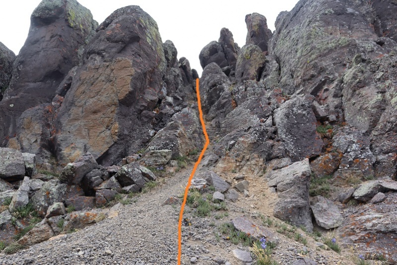  Back down another gully 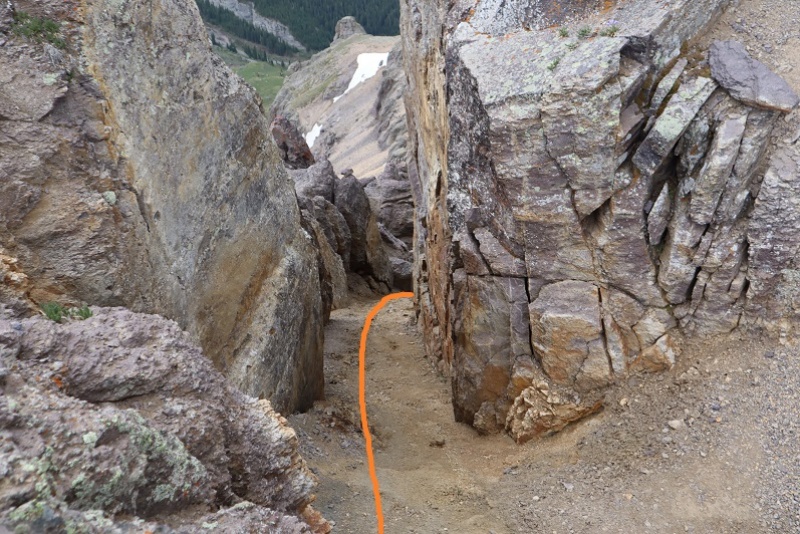 And back up a third gully 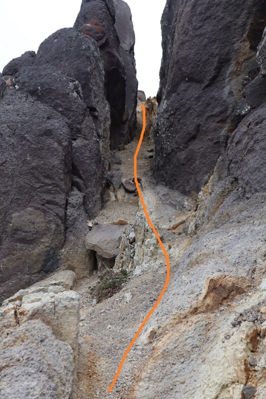 As soon as I went up this last gully I could see the summit 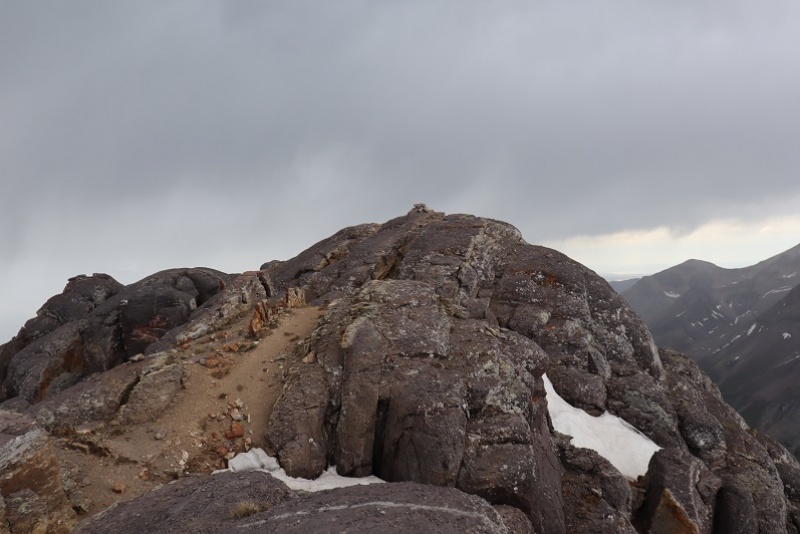 That had been easier than I’d expected. I snapped a picture, took two giant steps towards the summit, and felt it: Zzzzzzp! Zzzzzzp! Two quick buzzes just under my helmet accompanied by a tingling sensation. Even though I’d never felt this before I instantly knew what it was: indication of an imminent strike of lightning. I was just feet from the summit but I immediately turned and bolted for the gully I’d just ascended. Well, that was unexpected! Sure, there were clouds and mist all around me, but none of the clouds looked threatening. As I sat there in the gully, looking at the summit just a few yards away, it started graupeling. Then raining. Then graupeling again. I sat and considered my options. 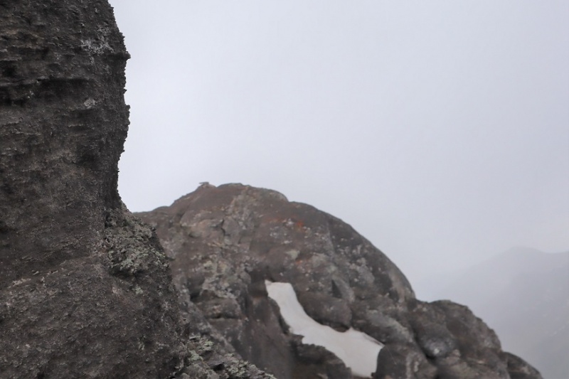 I could hike back down the mountain, but as soon as I left these gullies I’d be exposed for the rest of the hike. I did not want to be the tallest thing above treeline. I licked my finger and held it in the air to test the wind and watched the clouds: the storm was moving away from me. I looked all around and no, the clouds didn’t look menacing (even though it was raining all over). I decided to sit and wait the storm out. After about 30 minutes of sitting on the summit, not seeing any lightning or hearing any thunder, I tried again. I quickly left my spot and scrambled the last few yards to the summit 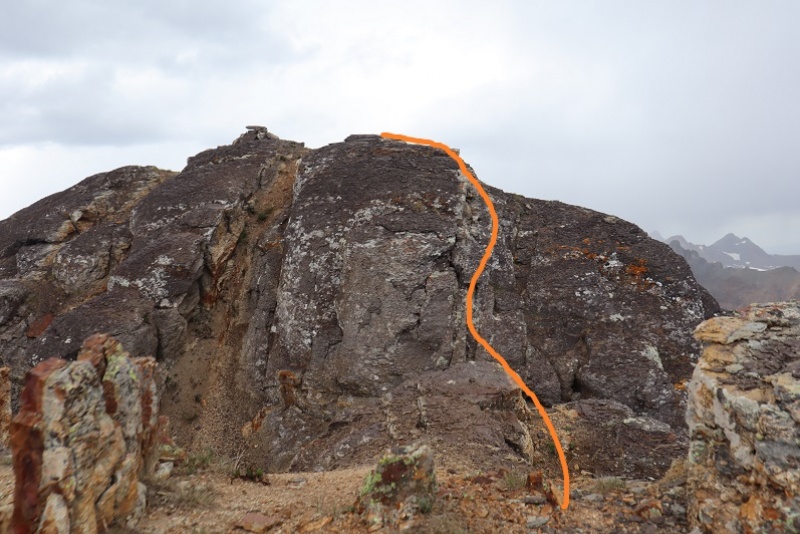 I summited at 2:15pm. I was still very scared of lightning and instead of taking the time to set up my camera I took a selfie with my cell phone and a very quick summit video. That’s a nervous smile by the way: I still didn’t completely trust the weather and wanted to get out of there. 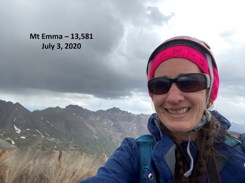 Mt Emma:
Despite my earlier plan of taking the time to check out the conditions of the peak for tomorrows hike I didn’t spend more than 30 seconds on that summit. I quickly turned around to head back. Circled in red is the entry point to where I’d spent the past 30 minutes waiting out the weather. This is also the access point to the gully I descended on my way back. 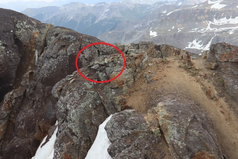 From the summit I could see a more direct route back through a different gully and decided to take that route down. It’s still class 3, but you can see your objective the entire time. I went back down the last gully I’d ascended 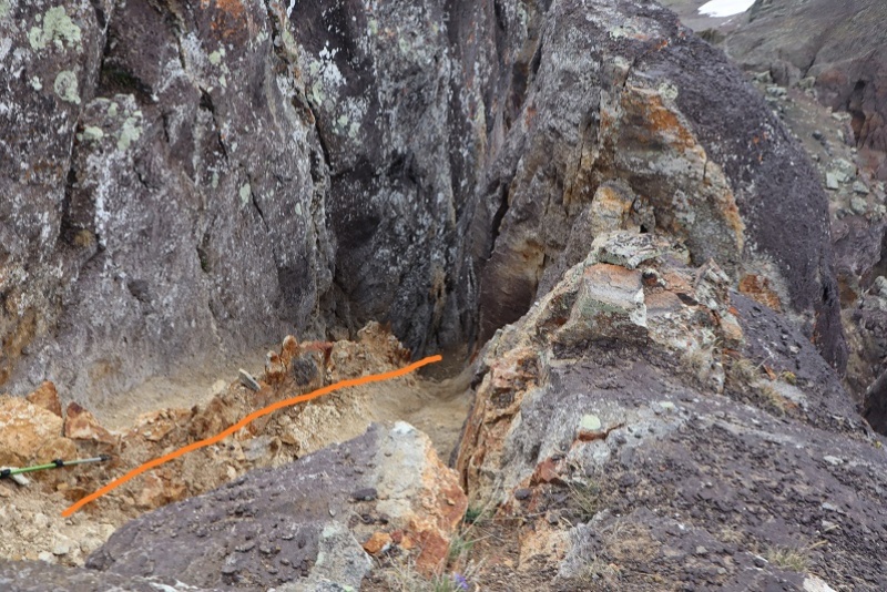 And east towards the small saddle 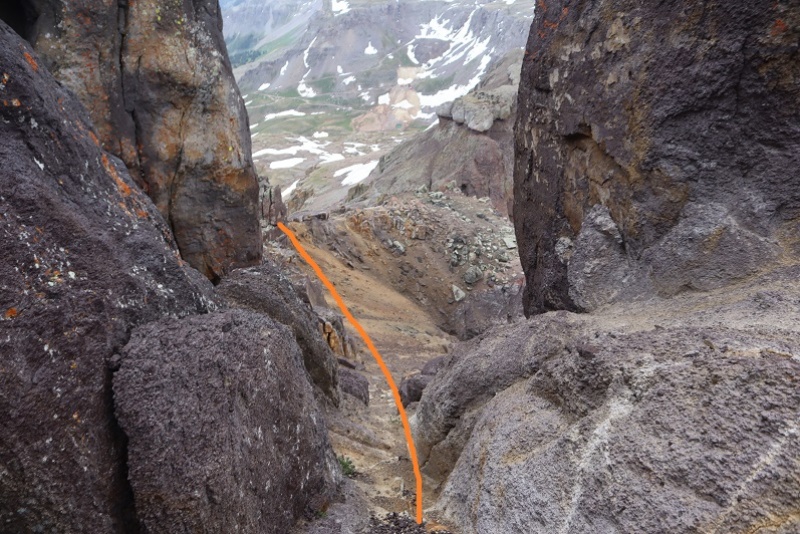 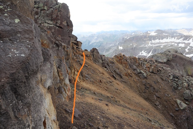 Here’s looking back for those of you who want to ascend this way (I’d recommend doing so, it’s entrance is to the left of center of the summit area) 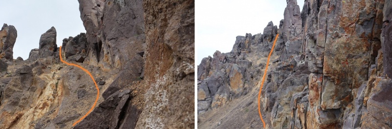 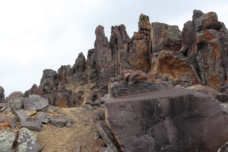 Back on the saddle the weather looked to be improving. I found the access point and headed back down the gully. 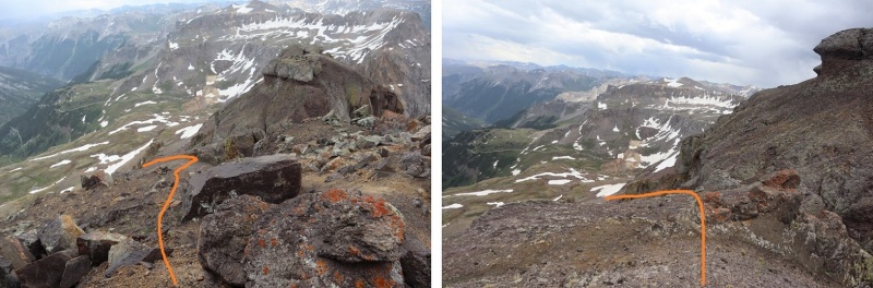 While descending I stuck to the areas of dirt and scree. My microspikes helped tremendously. At times the scree would give way and there would be sections of 10 feet or so where all of the rocks would loosen and slide together for a few yards. At one point my leg became buried in scree past my shin. My shoes had so much scree in them I had to take them off and shake them out twice before making it to the bottom. Tons of fun! 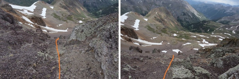 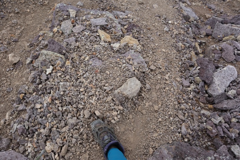 I retraced my steps out of the basin back down to my truck 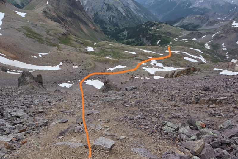 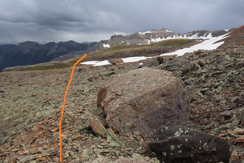 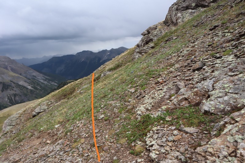 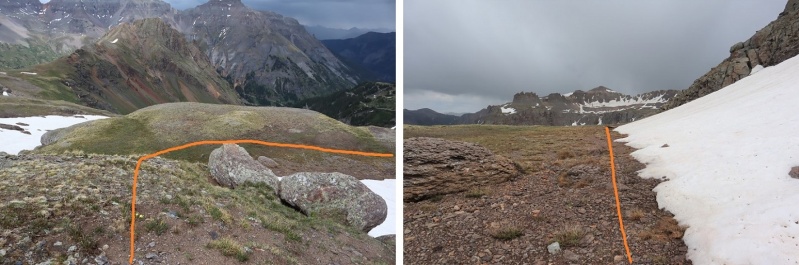 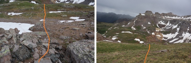 The small waterfall/creek/runoff is a great visual for how to make it back to the 4WD road 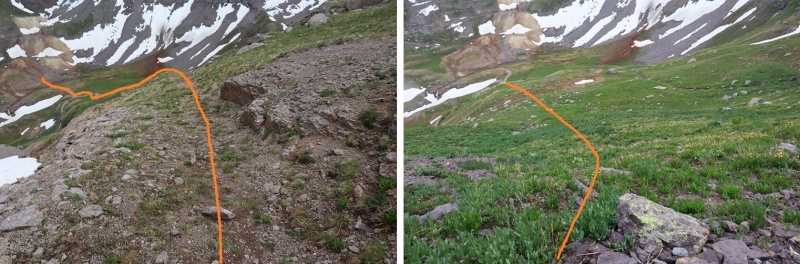  I made it back to my truck at 3:10pm, making this a 4.48 mile hike with 1861’ of elevation gain in 3 hours (including the half hour spent waiting out the weather). It was raining as I made it back to my truck. Here’s a topo map of my route 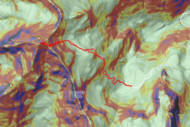 On to the next trailhead! Thumbnails for uploaded photos (click to open slideshow): ")
")
")
")
")
")
")
")
")
")
")
")
")
")
")
")
")
")
")
")
")
")
")
")
")
")
")
")
")
")
")
")
")
")
")
")
")
")
")
")
")
|
| Comments or Questions | |||
|---|---|---|---|
|
Caution: The information contained in this report may not be accurate and should not be the only resource used in preparation for your climb. Failure to have the necessary experience, physical conditioning, supplies or equipment can result in injury or death. 14ers.com and the author(s) of this report provide no warranties, either express or implied, that the information provided is accurate or reliable. By using the information provided, you agree to indemnify and hold harmless 14ers.com and the report author(s) with respect to any claims and demands against them, including any attorney fees and expenses. Please read the 14ers.com Safety and Disclaimer pages for more information.
Please respect private property: 14ers.com supports the rights of private landowners to determine how and by whom their land will be used. In Colorado, it is your responsibility to determine if land is private and to obtain the appropriate permission before entering the property.