Download Agreement, Release, and Acknowledgement of Risk:
You (the person requesting this file download) fully understand mountain climbing ("Activity") involves risks and dangers of serious bodily injury, including permanent disability, paralysis, and death ("Risks") and you fully accept and assume all such risks and all responsibility for losses, costs, and damages you incur as a result of your participation in this Activity.
You acknowledge that information in the file you have chosen to download may not be accurate and may contain errors. You agree to assume all risks when using this information and agree to release and discharge 14ers.com, 14ers Inc. and the author(s) of such information (collectively, the "Released Parties").
You hereby discharge the Released Parties from all damages, actions, claims and liabilities of any nature, specifically including, but not limited to, damages, actions, claims and liabilities arising from or related to the negligence of the Released Parties. You further agree to indemnify, hold harmless and defend 14ers.com, 14ers Inc. and each of the other Released Parties from and against any loss, damage, liability and expense, including costs and attorney fees, incurred by 14ers.com, 14ers Inc. or any of the other Released Parties as a result of you using information provided on the 14ers.com or 14ers Inc. websites.
You have read this agreement, fully understand its terms and intend it to be a complete and unconditional release of all liability to the greatest extent allowed by law and agree that if any portion of this agreement is held to be invalid the balance, notwithstanding, shall continue in full force and effect.
By clicking "OK" you agree to these terms. If you DO NOT agree, click "Cancel"...
Coxcomb. Cool peak! Cool name... okay I promise I won't (I'm an adult, but barely).
Redcliff. Slightly less cool peak, slightly less cool name, but still pretty freaking cool.
Sometimes plan B ends up for the best. The forecast for the 4th of July was not ideal for plan A, and our group elected to split and go after other objectives. But Rose and I were still trying to find something fun to go for on Sunday that had a good chance of us staying dry. The northwestern San Juans looked as opportunistic as anywhere. Rose suggested Coxcomb....perfect! It was on my list, but for some reason didn't cross my mind. We hatched a plan and agreed to meet along the road to West Fork of the Cimarron Saturday evening. Despite being the worst mountain traffic weekend of the summer, the drive went without incident and met up at the 2wd parking. We decided to hop in my Crosstrek and drive as close to the 4wd trailhead as we could get in the morning. I also found out Rose had hiked Stewart and Baldy Alto earlier that day and was planning for a double peak double-up....beast mode. We agreed on an early start and bundled up in our respective cars for the night.
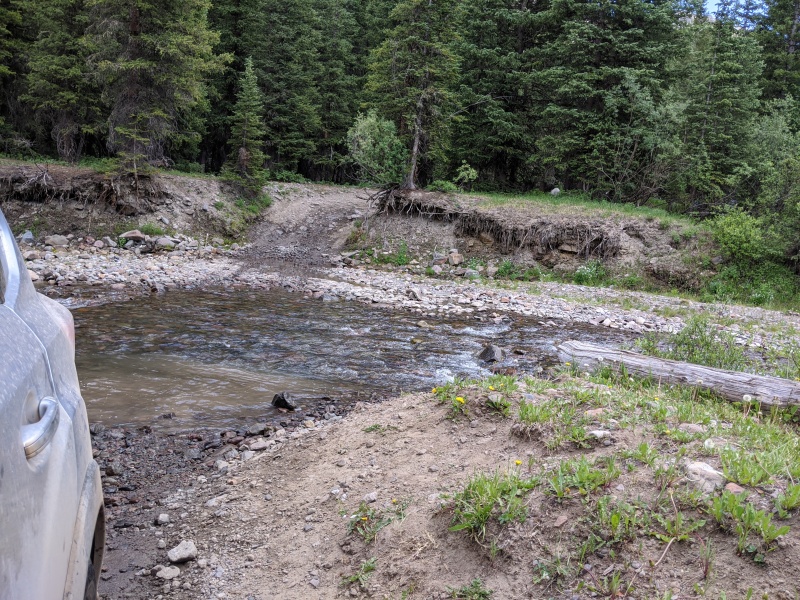
The alarms went off far too early, and before we were fully awake we were bouncing our way up the 4wd road. The road isn't too bad. The largest rock obstacle is 50 feet after the 2wd parking, and the hardest part of the road is the ascent out of the river crossing (which was running low and a non-factor, even in a Subaru). The road, using this site's ranking system, is probably a 3/6. We made it with no issues to the 4wd trailhead and promptly started hiking. I was carrying harness, 30 ft. of webbing, a couple of rap rings, and a 9.8 70m (oof). Rose had a 7.8 60m (much smarter!).
Steep exit out of the river cross. A little gas, a little momentum, no problem
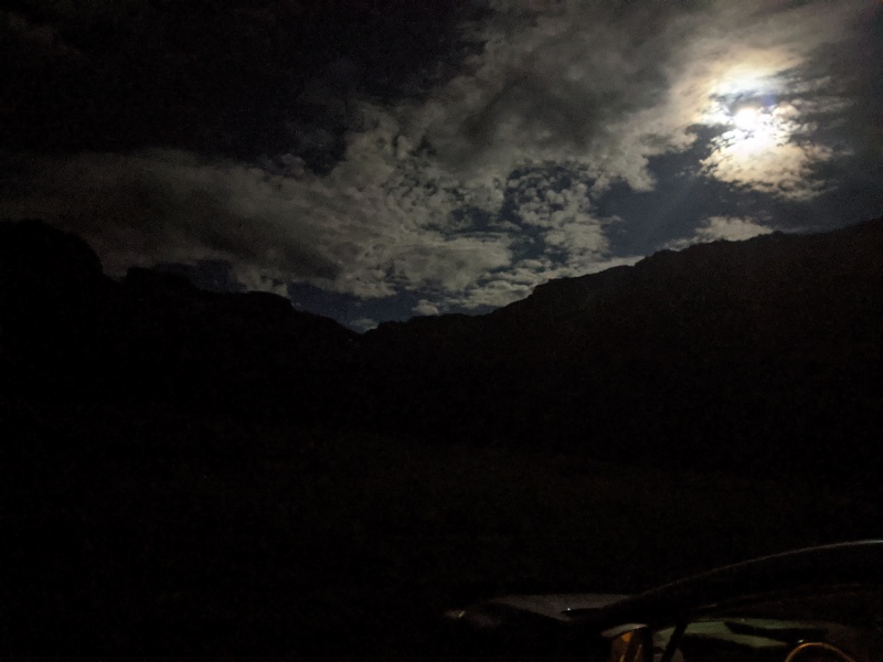
The moon was insanely bright that early morning! It was so bright that unless I had the brightness up high on my headlamp, it washed out my light. Not that it mattered too much, as the trail was easy to follow, even in the dark. The only troublesome areas are where the trail crosses a number of stream beds, some with water, some without. However, the trail always keeps going across them, and many times was staked with sticks.
Now that's a moon! Taken from 4wd parking
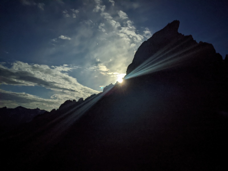
The route climbs to a pass west of Coxcomb at 12,500, then there's the option of staying high and sidehilling on talus, or dropping to ~12,100 in Wetterhorn basin and ascending a more head-on slope to reach the summit ramparts of Coxcomb. We elected to lose the elevation, hoping it would be less bothersome. I took almost no pictures of the route up to the pass (like I said, we started early!), but just follow the obvious trail and you can't go wrong. There was one small snowfield around 12,100, but we booted 50 feet up it and found the trail again.
Taken with nightsight. Believe it or not, this is the moon! At the 12,500 pass.
Wetterhorn comes into view as we are almost around the rock rib we're descending to avoid.
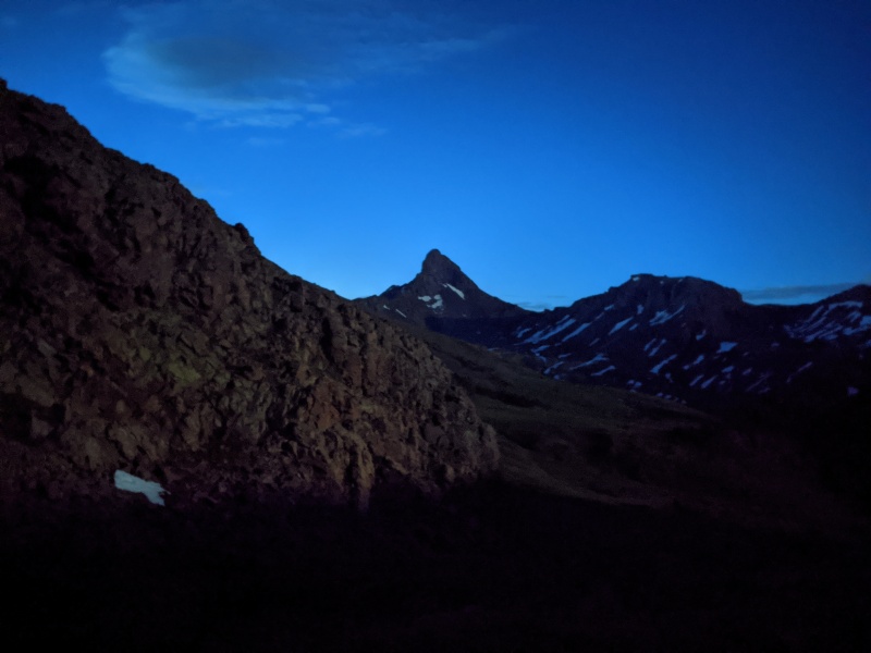
Silhouette of Coxcomb
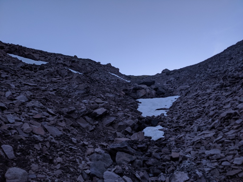
We spied a lower-angle ramp/gully on the east side of the slope. We agreed that looked better than a direct ascent up the slopes, so we fought our way across talus to those slopes and ascended up a combination of the rib and the center of the gully until we were able to reach grassy slopes to climber's right. The talus/gully was loose, but tolerable.
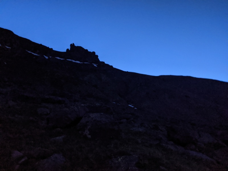
On the talus rib, gully just to the right. Oh yeah, still dark (told you we started early)
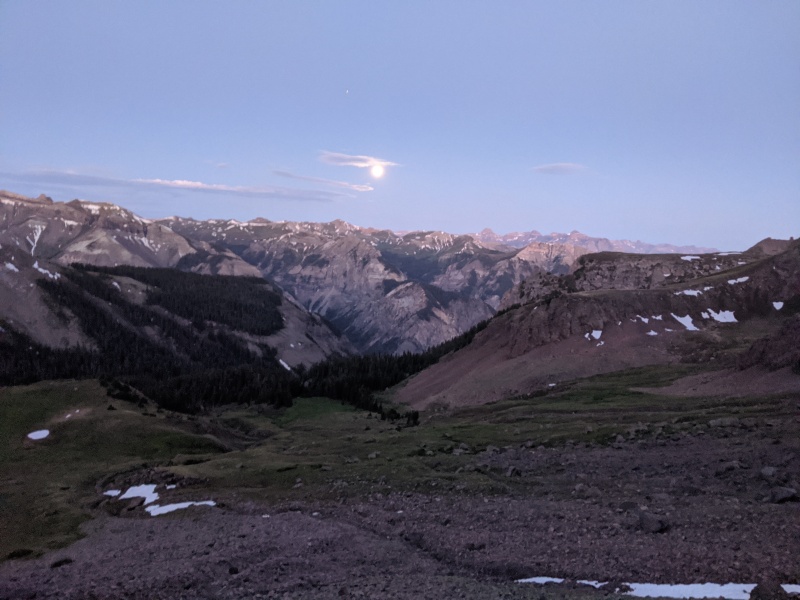
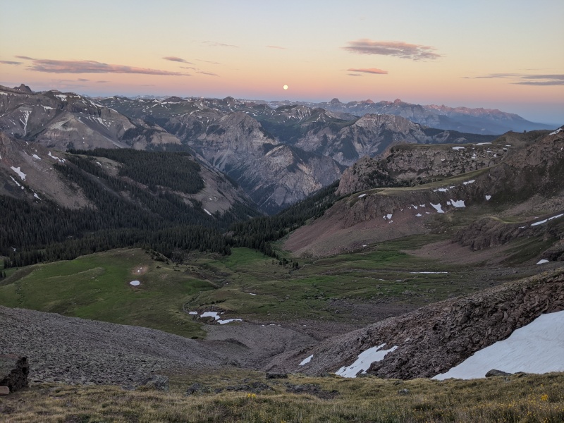
Moon floating above Wetterhorn basin
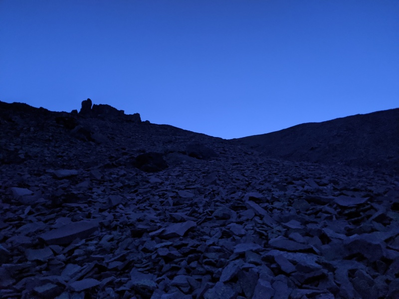
Gully conditions
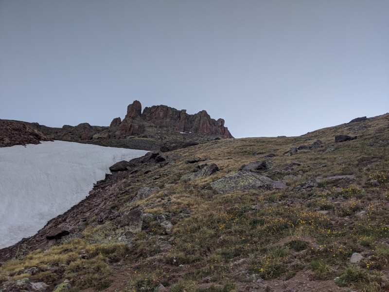
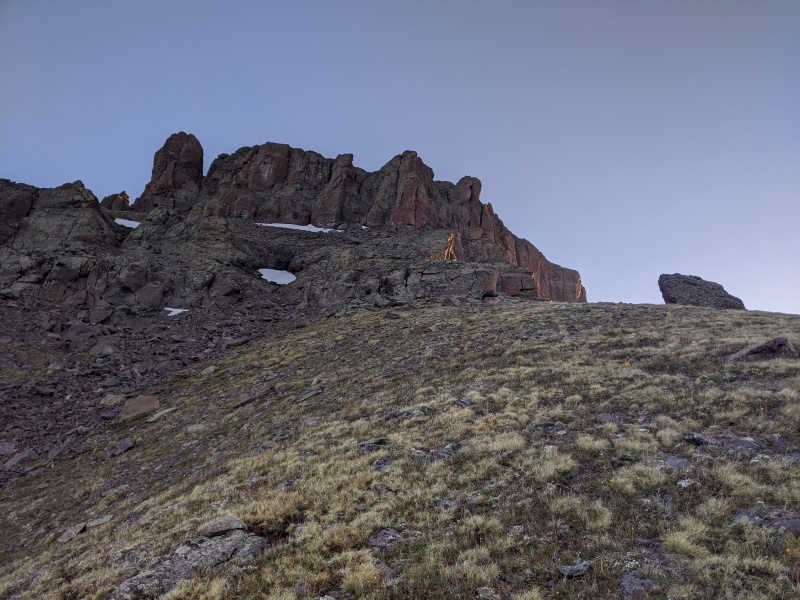
Finally reached the grassy slopes above the gully, summit block looks so close!
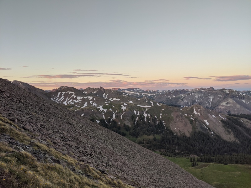
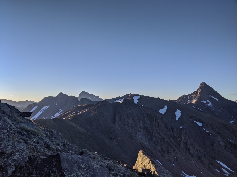
Sunrise!
Sunrise over the San Juans (that moon just won't quit)
From the grassy slopes around 12,700, there was about 600 feet of gain to reach the summit cliffs. We ascended the grass until it turned into a rocky bridge leading to the talus slopes below the cliffs. The bridge required some brief scrambling to reach the upper talus slopes, which ultimately led us to the SW chimney.
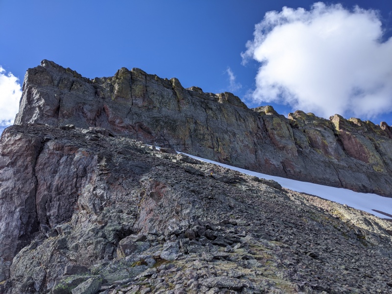
Rock bridge in middle of photo. SW chimney is directly below the slightly U-shaped horizon line at the middle of the summit cliffs.
Wet/Unc
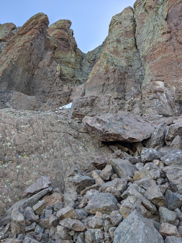
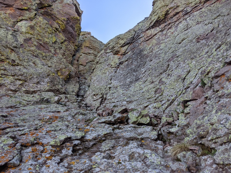
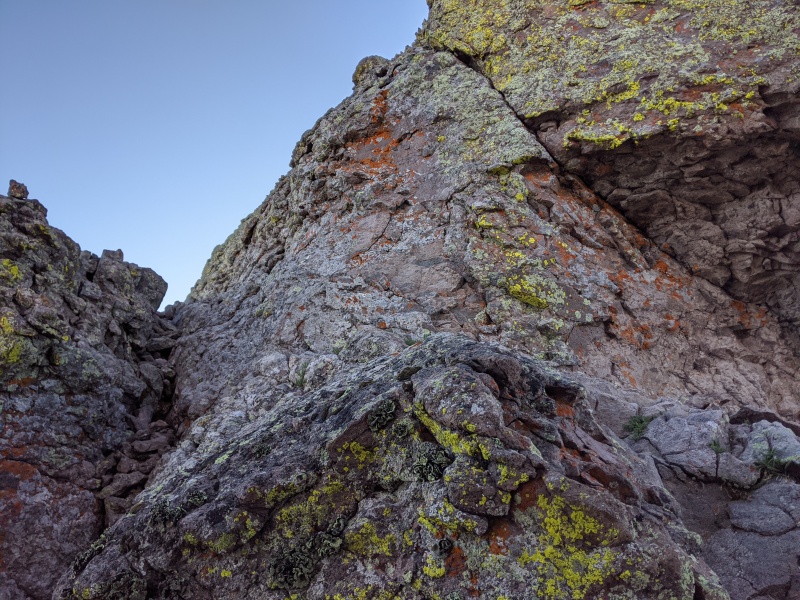
Entrance to the SW chimney. "Class 4" section is the dark crack/flake at the low point in the vertical face.
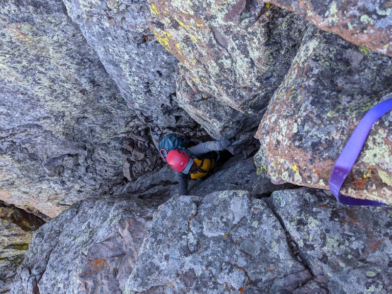
We arrived at the SW chimney, with the understanding that there was a brief class 4 section, then a class 3 scramble, then low 5th class for the upper chimney. We found the entrance to the chimney, but yeah......that's not class 4. Rose and I agreed it was the hardest climbing on the entire route. There's a narrow, vertical slot that sans backpack, one may be able to slide into, but anyone climbing this peak likely has a backpack/rope, so yeah, no way. I managed to pull a committing move to reach a high handhold on the left wall of the chimney and ascend, but Rose, being a foot shorter than me, couldn't reach it. Luckily, there's a rap station in good condition immediately above the chimney, so I set up a quick belay and Rose managed to make the tricking stem moves to reach the high handhold.
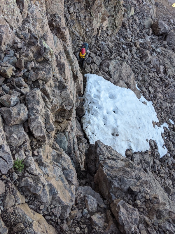
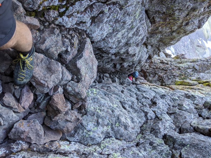
looking down the "class 4" section, with Rose contemplating the moves. Not wide enough for person + backpack.
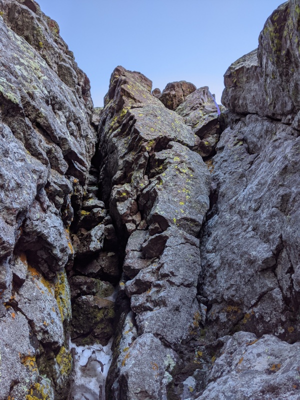
At the top of the Class 3 section, with the class 5 chimney to the right side of the inset.
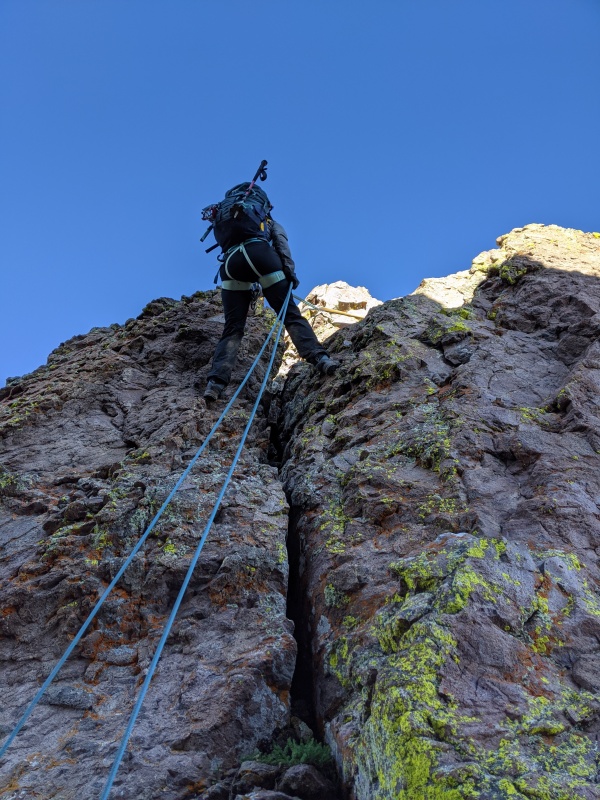
Once above the entrance, a quick, easy scramble led us to the base of the business pitch. The SW chimney consists of two vertical sections, both around 20 or so feet high, separated by a ledge. The rock was featured enough to make the mantling/stemming movements flow into each other, and we ascended the chimney without too much difficulty. Neither of us felt the need for anything other than boots. Really fun climbing!
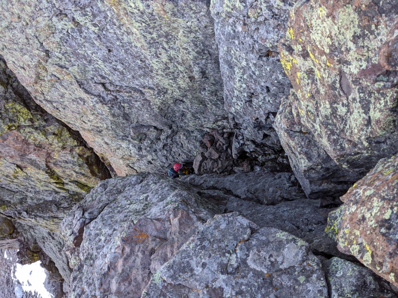
Halfway up, looking down as Rose enters
The top half of the chimney. We climbed the right branch. Left looks like it goes a little harder, but didn't explore it much
From the top as Rose comes up
Rose making the last moves in the upper chimney. The exit requires a high right onto the slightly reddish ledge seen in bottom center/left of photo.
Above the chimney, there's a quick scramble to the summit ridge. Oddly enough, during this scramble is where we saw the only cairn in the SW chimney area. I mean, if you've made it this far, you have to know where you are, right? If you accidentally went up this way, one cairn ain't gonna help you. Once to the ridge, the summit is close by, with what appears to be an easy walk in between. But after a short walk, you're confronted with a vertical notch and a gap that maybe an Olympic long jumper could clear, but us mere mortals must be more creative to surmount. We set up the rappel, which is only about 25 feet or so. It requires some awkward and exposed moves to get in position to reach the bottom of the anchor and the rap rings. I highly recommend clipping into the webbing while setting up the rappel, as one wrong step would remove the need for a rappel. I clipped in, tested the system, and descended. It was over just when it started to get good! We pulled the rope, neatly coiled it in the backpack (yeah right), and scrambled out the other side of the notch to regain the ridge, where the summit was just a couple of minutes away.
Summit ridge
Notch! View down the rappel. Anchor was good, no need for backup. Have to downclimb a bit to get to it though
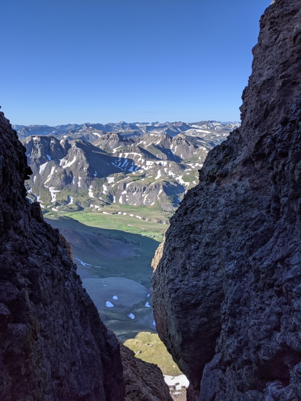
View south out of the notch over Wetterhorn basin
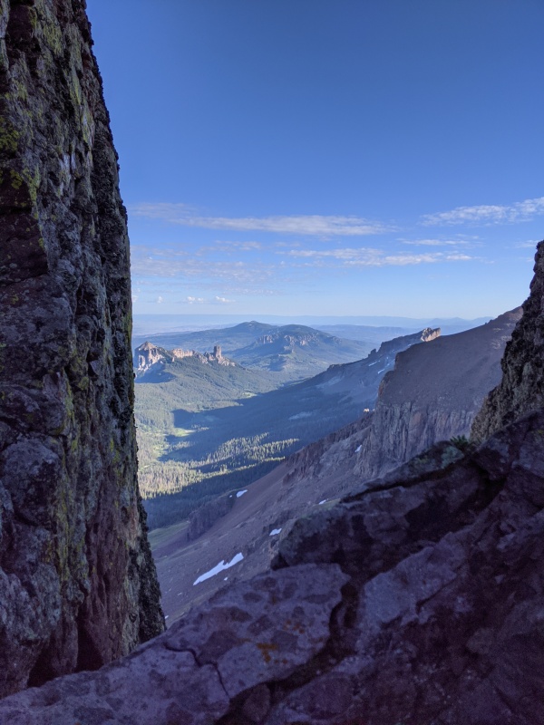
View north out of the notch into West Fork of the Cimarron
Rose on the notch rappel. Looks like a fun climb out! Maybe a different day...
Scramble out of the notch. Up and around to the left, then climb straight up to the ridge.
Rose topping out
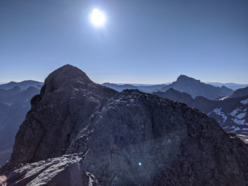
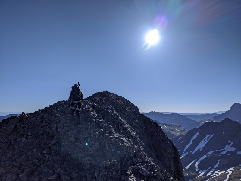
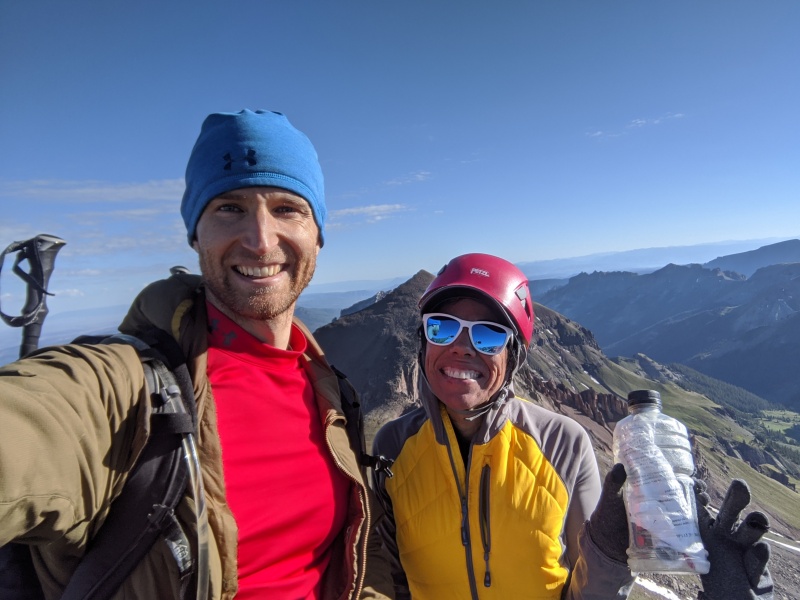
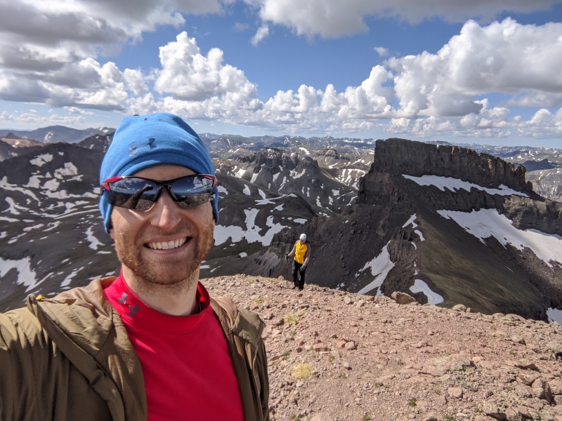
Summit! We reached the summit just before 8. Views were incredible in all directions. It was a beautiful day with almost no wind as well. Can't ask for a better summit!
Wet/Unc/Matt
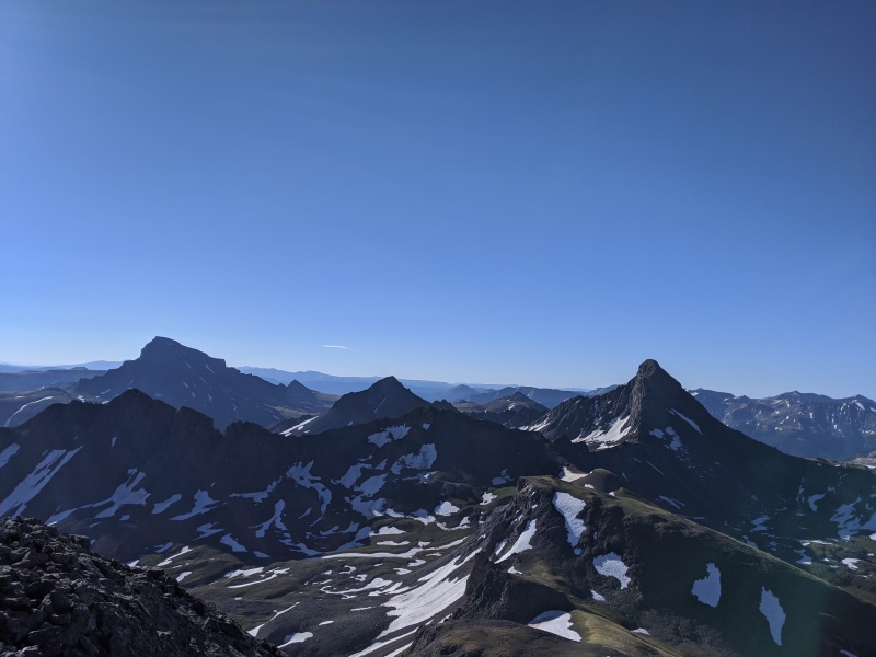
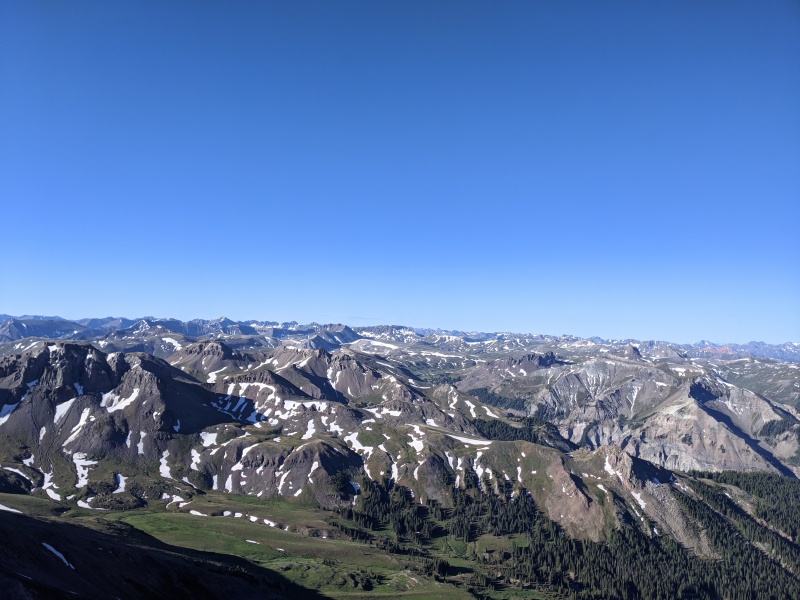
Sea of San Juans
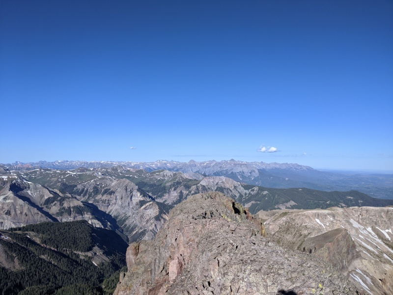
Summit ridge with Sneffels and co in background
West Fork
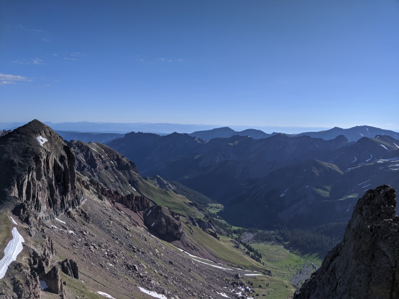
Redcliff and Middle Fork
All smiles!
But our day wasn't over! Getting up is only half the battle. We still had to get down, get up, and get down. All of our hard work for us each hauling a rope up to the summit was about to pay off. The north face rappel drops you directly on the route to the saddle to Redcliff, but it's 160-170 feet, so you need two ropes. It saves a bunch of time and headache (and joint-ache, probably), as it skips the sidehilling traverse around either the west or east side of Coxcomb. From the summit, the north face rappel station is obvious (and now even more so due to my bright red webbing). It's a short, loose descent to the rap station, where there was a cordalette and two fixed nuts with slings. I backed it up with webbing (note: to sling the whole block, you'd need probably 35-40 feet of webbing. I had to get creative on my slinging to make 30 ft work). Since we had two different diameter ropes, I tied them together with a double fisherman's, made sure everything was tight, and committed.
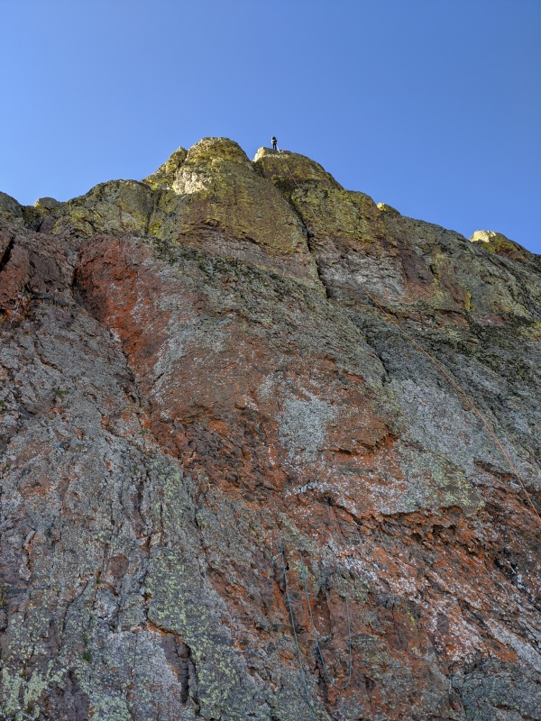
The rappel was phenomenal! Definitely top 1 rappel I've ever done. The face was completely vertical, with just two small ledges adding in texture. A third of the way down, the 7.8 had managed to figure 8 knot itself, so i sat on the autoblock and fixed it. I also seized the chance to take two of the more epic photos I've ever taken.
North face rappel station, pre adding webbing. It now looks the same, but with even more red!
Mid rappel, looking up
...and looking down (my throw was better than yours Rose)
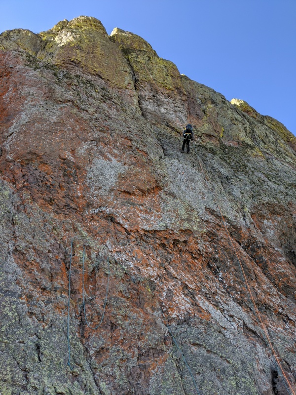
Rose committing to the rappel
Halfway down
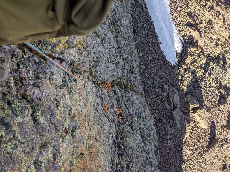
When Rose touched down, we were glad to be done with the technical portion of the day with just a walk-up to go. We couldn't believe how fortunate we were that there were no hiccups along the way. We grabbed the shorter 7.8 rope and pulled to retrieve it.
Then it stopped.
We couldn't believe it, because it was as clean of a pull as we could imagine. We tried again and again, but it was stuck. We tried whipping it up to try to get it unstuck. No luck. We whipped the 9.8. Still, no luck pulling it. We tried for at least 15 minutes in vain to get these ropes free. Nothing seemed to help at all. Finally, I tried pulling the blue rope, which we knew wouldn't pull because the knot would get caught in the rap rings. But it pulled about 3-4 feet or so. We started whipping the ropes to try to get them into a different fall line. We pulled on the orange rope again.......it moved! Slowly but surely, we were able to pull the orange rope down and free the pair. Our best guess is the double fisherman's had gotten caught on the one spot where the rope went over the edge of the cliff, and was too wedged in for our flicks to free it. But when we pulled the blue, it pulled the knot out and freed the restriction, allowing our flicks to reposition the knot to a place we could pull it. Relief doesn't even begin to describe the feeling when that rope started pulling!
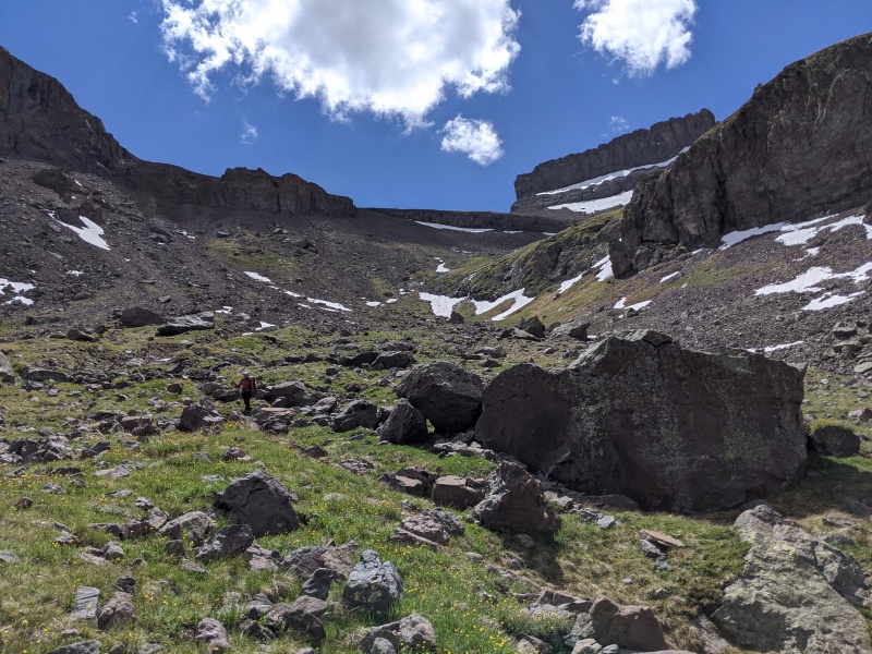
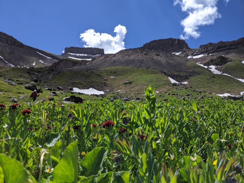
With the ropes safely and permanently in our packs, we slid down the loose talus to the grassy saddle with Redcliff. Redcliff, unlike its neighbor, holds no secrets, so we stashed our packs at the saddle, prayed to the marmot gods to spare our belongings, and went up. The route consisted of mildly loose talus yielding to scree, but it was relatively pain-free. We summitted right around 10, as non-threatening clouds built to our west.
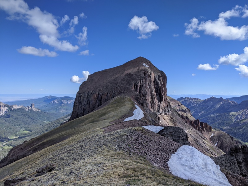
Nearing the saddle, looking back at Coxcomb and the north face rap
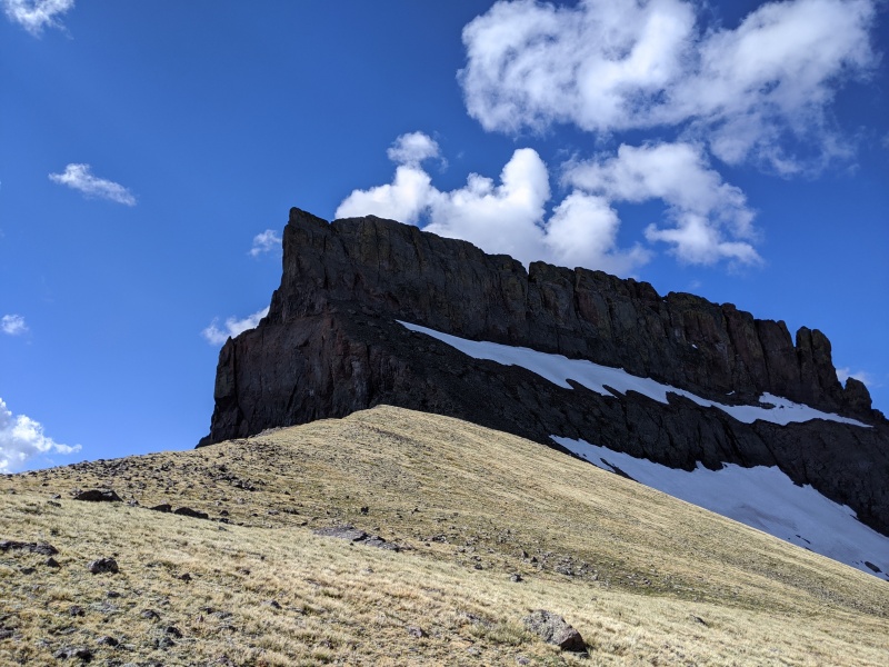
From the saddle, looking at Redcliff. Just go up
Light/dark
Redcliff terrain
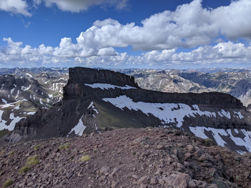
Summit! Looking toward Coxcomb
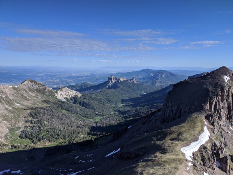
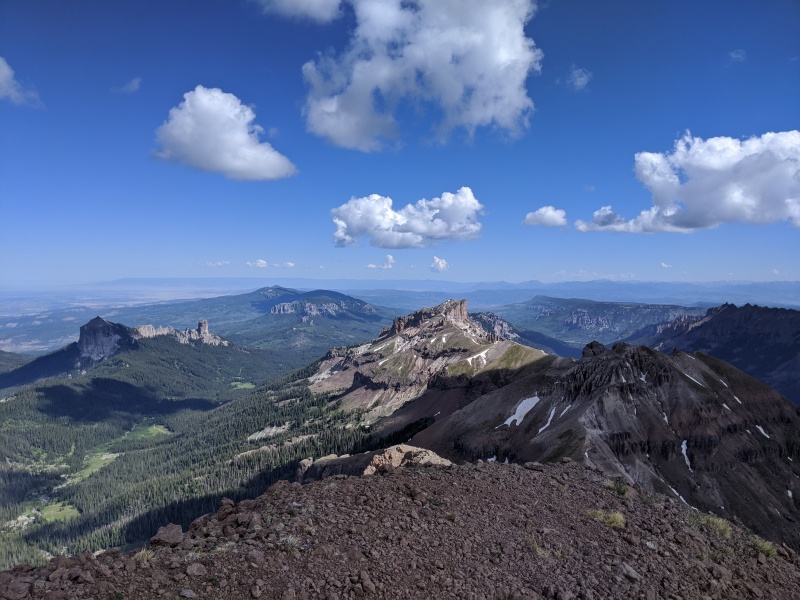
Fortress and Precipice
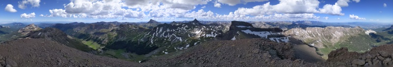
About as good of an area for a pano as I've seen
Rose coming up peak #2
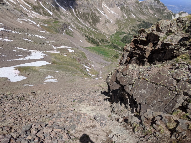
We didn't spend too much time on the summit, as our food and water were 500 feet below. A few quick pics, and we descended back to the our fortunately undisturbed packs on the grassy slopes. We followed cairns through a break in the cliffs to the grassy meadows below. The terrain was loose, but wasn't so steep traction was an issue. We navigated a couple of small waterfalls and found our way back to the trail, where we cruised the 2ish miles back to the car.
Descent route
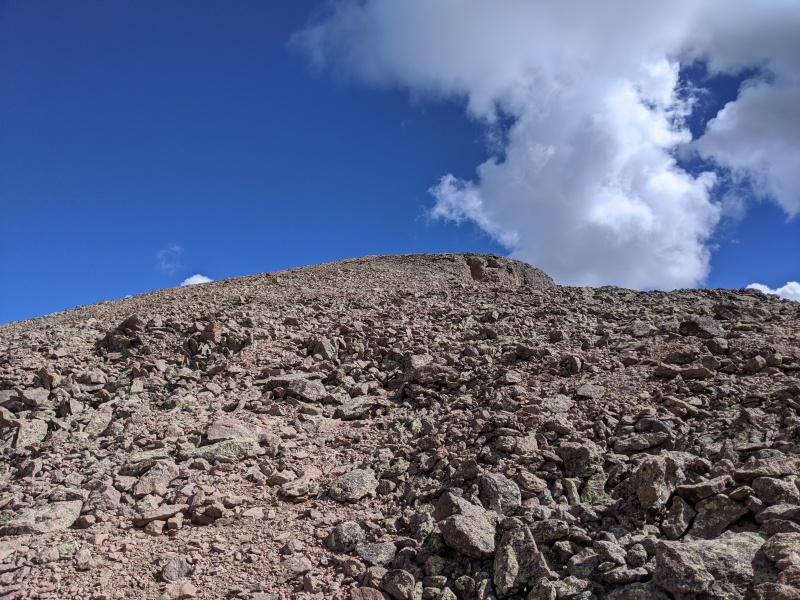
Looking up the descent route. We came down just right of the last cliffs off of Redcliff's slope
Heck of a place
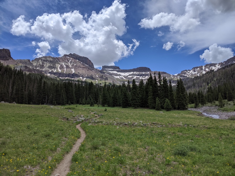
Trail out
We made it back to the car around 12:15, got hype listening to Travis Scott, and rumbled back down the 4wd road to the cars. We both loved these peaks and felt the route up and down Coxcomb was one of the best routes we've done. We were also blown away by the ruggedness and sheer beauty of the peaks in the Cimarrons. We were already talking about getting back here to explore some of the other peaks nearby. Looks like a trip into Middle Fork will be in the cards for the near future!
My GPS Tracks on Google Maps (made from a .GPX file upload):
First time I've seen you give a harder yds to a route than standard ratings. I know if you said it isn't c4, it's not.
I'm having a hard time not having mountain envy compared to the waterfall hike we did.
The view of wetterhorn from that vantage makes me droll.
Great write - up on a great climb!
You two are knocking off the hard ones.
It is my understanding that a EDK can be used on different diameter ropes and has less chance of snagging while being pulled down.
Great job, you two! If you liked Coxcomb, in that area you'd really like Chimney Rock. Turret Ridge too, although that's a definite step up from Chimney Rock. Again, great job!
Man, it stinks seeing the beetle move into those once pristine forests near Uncompaghre/Wetterhorn and now the Cimmarrons. I wish the forest service would come up with a way to protect forests from these devastating insects. Anyways, great report!
@tommy I don't think 50s would reach. I think the rappel is about 55m long, and it's not a great place to come up short.
@tom chimney rock looked awesome! We shoulda gone up a day early and climbed that too! When we come back to middle fork, we'll have to detour for it. And I've eyed turret ridge for a while, but for now that lead is out of my comfort level. Someday though!
@tom (man there's a lot of toms!) My understanding is an edk can drift and come loose with two different width ropes. Double fisherman prevents that.
@matt it definitely does suck. That being said, the Cimarron area was still pretty alive and green. I was in the la garitas last weekend, and that's another story....
Caution: The information contained in this report may not be accurate and should not be the only resource used in preparation for your climb. Failure to have the necessary experience, physical conditioning, supplies or equipment can result in injury or death. 14ers.com and the author(s) of this report provide no warranties, either express or implied, that the information provided is accurate or reliable. By using the information provided, you agree to indemnify and hold harmless 14ers.com and the report author(s) with respect to any claims and demands against them, including any attorney fees and expenses. Please read the 14ers.com Safety and Disclaimer pages for more information.
Please respect private property: 14ers.com supports the rights of private landowners to determine how and by whom their land will be used. In Colorado, it is your responsibility to determine if land is private and to obtain the appropriate permission before entering the property.


")
")
")
")
")
")
")
")
")
")
")
")
")
")
")
")
")
")
")
")
")
")
")
")
")
")
")
")
")
")
")
")
")
")
")
")
")
")
")
")
")
")
")
")
")
")
")
")
")
")