| Report Type | Full |
| Peak(s) |
Ice Mountain - 13,960 feet North Apostle - 13,869 feet |
| Date Posted | 06/29/2020 |
| Date Climbed | 06/27/2020 |
| Author | E_A_Marcus_949 |
| Additional Members | TwoMeterTrophy |
| Ice & N. Apostle - Not Your Typical Sawatch |
|---|
|
Ice Mountain 13,951 and North Apostle 13,860' The Long of It... My first attempt at Ice and N. Apostle was just about 2 years ago in July 2018. My friend Trevor (TwoMeterTrophy) and I made it to the basin, crossed the creek, and willow whacked our way across the basin... All during annoying rain and mist which shortly turned to hail. When that became too dense to get a good sense of where we were going we decided to turn back and get breakfast burritos in Leadville. And I think that is what kept us going and chugging along back to the trailhead in defeat after being soaked in the rain (with rain jackets but those dang willows will get ya!) for too long. We carpooled from Leadville and turned onto the quite familiar CR 390 and down to Clear Creek/S. Winfield. Per usaul, Missouri Gulch was packed, even at 4:30ish. Cars all along the road, up and down CR 390 - car camping, tents along the road, people gearing up... Mountains are getting more popular, but I think given the state of things right now, the outdoors are definitely getting more love. 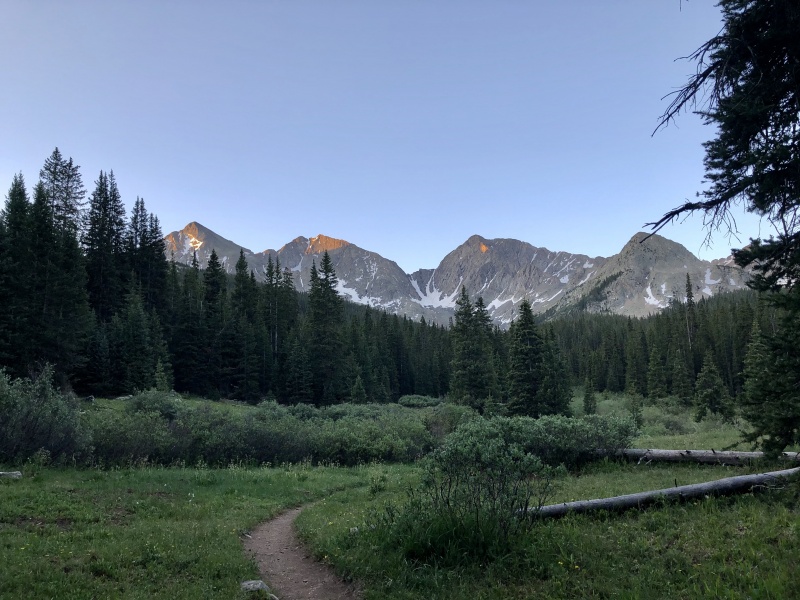
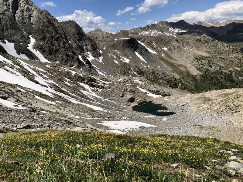
It was wonderful to hike to the willow basin, see the rock glacier, and cross the willows to the forest to trek to treeline without any rain and being able to see the goals for the day without low-hanging clouds. Great start! 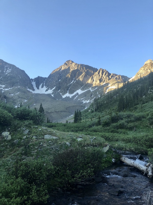
We didn't cross the creek here - this is where the trail dumped us, and it was too far across. We tried for that nice-looking log. Ice covered. Farther up, there was a good spot to cross with just one little leap of faith, which, in my morning stupor of not wanting to get my feet wet combined with short legs, caused me way too much pause (yep, I'll abashedly admit that creek crossings can get me too in my head sometimes). On the way back, no biggie - but now, I just didn't want to slip and fall into the creek! Wet shoes and socks suck. Thank goodness for the GPX file - that helped significantly with getting us past the willows, above the rocks, and through treeline. It may sound like a quick and simple cross the basin, skirt through the trees to treeline, but there was just a bit more time in trees than anticipated. And we're fairly decent at route finding. There were some trail segments here or there, possibly just game trails, but they were nice to use in the midst of all the down and old trees. Once we broke through, though, the views up through the rock basin were stunning. 
There is a trail through this flat-ish area and some cairns. If you can find it, they'll help quite a bit because, frankly, if you can avoid some rock hopping through here, you won't be disappointed to miss out on it - you have plenty coming up! After you get through this part and turn the corner, you'll be rewarded with views of the basin and your objective - climb up and over the little grassy section to the rock ribs then up to the saddle. 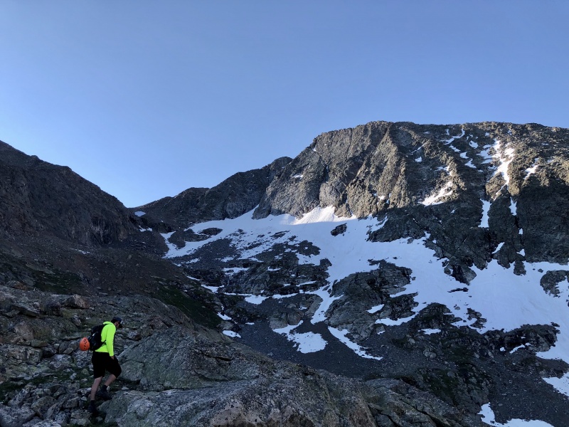
More of the same smaller rock hopping interspersed with some dirt and grass. Nothing too out of the ordinary for this range so far. Just a lot of rock. The closer you get to the base of these mountains though, the more imposing they are. They really do inspire awe and seem, at least to me quite different for this range. 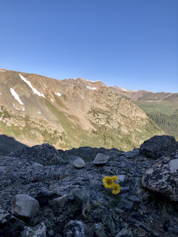
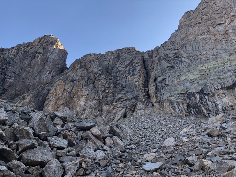
Did I mention how many rocks you have to go up and over and through and across yet? If not, well, it keeps going! 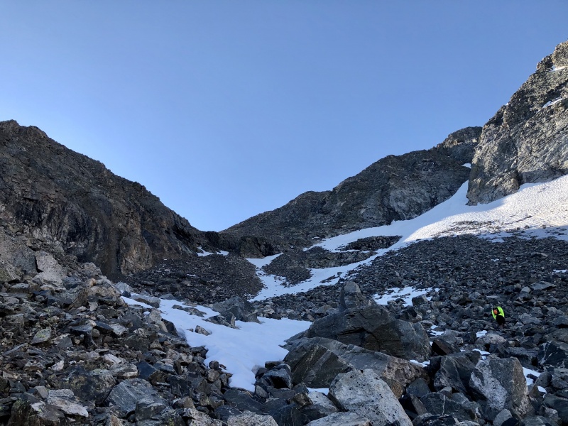
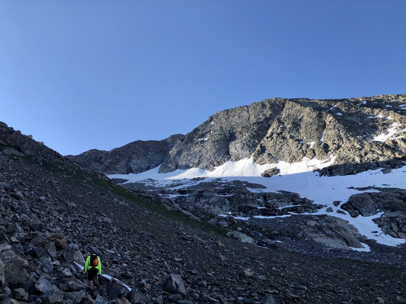
All the snow was avoidable. I actually managed not to step on or through any until the very end of the descent many hours later. So up we went aiming to the right of those rocks. I'm fairly certain the snowy area would have been preferable to the route I chose. I think I may have gotten in additional scramble that wasn't necessary... and by "think" I mean I did. No wonder Trevor had to wait so long for me at the saddle! I was going at a snail's pace after going up and over some crazy-loose rock and scrambling up and over things that I shouldn't have been. It was fun but slow-going and unnecessary. I went right. And then more right. The route description, after just looking at it again, looks to zig and zag. I forgot the zag and kept on the zig. 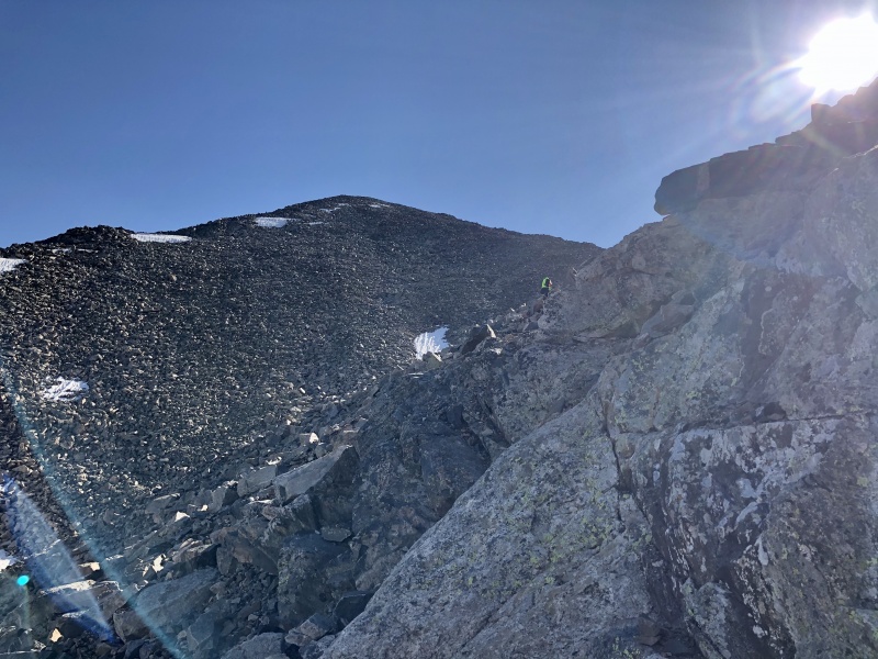
You're probably thinking "OK EMILY ENOUGH OF THE ROCKS". Well, lucky for you, we've reached the saddle! Time to don our helmets and head on up to the summit of Ice - but first, some fun class 3. 
Starts out mellower and increases as you go. Fun route. Some route finding but the route photos and description were helpful! 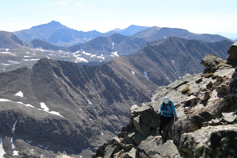
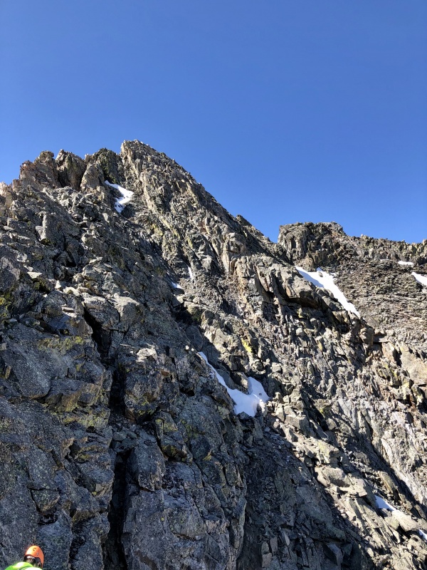
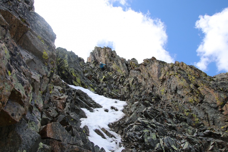
The above photo shows the remaining route for the most part, with the upper-most section to the right of the snow being the final crux (if I'm looking at it correctly that is!). Some of this route heading up there is loose, though. Reminded us a bit of Lindsay (but shorter and narrower). Definitely shouted "ROCK" at one point down into the empty basin (you never know) after I inadvertently sent a not-so-small one flying by accident. The rock itself is all really solid though. Great handholds and footholds. And definitely some fun scrambling. Crossing the dirt gullies or going up the ledges with some dirt and scree takes more patience and, to an extent, some finesse so as to stay stable and not send rocks flying around. 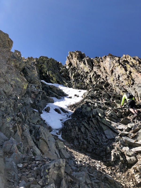
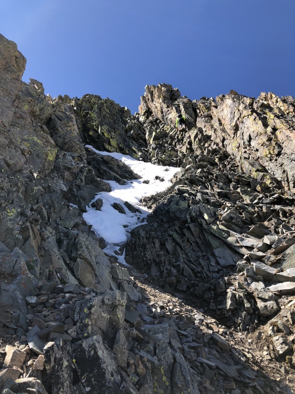
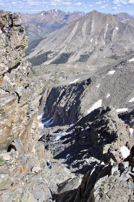
We followed the route through here - cross over to the right side of the gully and climb up the somewhat exposed but class 3 rock. I guess it's rated as a 3 because of how solid all the holds are and the fact that there are some ledges to stand on. That being said, I find if I don't turn around or look around much (i.e. "don't look down"), I'm set and good to go. If I do, I'll get in my head and second-guess myself. I took the above photos of Trevor from across the gully so as to be out of any potential rock-fall area. Once he got to the top, I crossed over and continued on up. 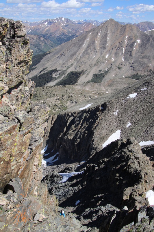
I can see why this is the crux. It definitely requires some concentration, a little coordination, and some trust in your abilities to get up there. At one point I said I have never been more grateful for picking up indoor (and 1x outdoor) rock climbing just to learn some technique and to trust myself more. My first class 3 was Longs and after that is when I started the rock climbing. Between that and more experience on the harder mountains, my skills have definitely grown. While it's been a while since I've rock climbed or done a class 3 (probably 2 years ago), I have done a handful of them. The time taken between them is what caused this to be a tad bit more nerve-wracking at times. No matter what, though, this was such a blast! What fun scrambling. I would say stick to the right of the crux. I used the wall on the side for some balance and good, grippy handholds. There was one part where I had to use my knee to help me up, but otherwise the handholds had enough ledge and grip to help. I found it key to remember to use your legs for steps up and bank on their strength rather than using your arms to pull you up throughout this part. 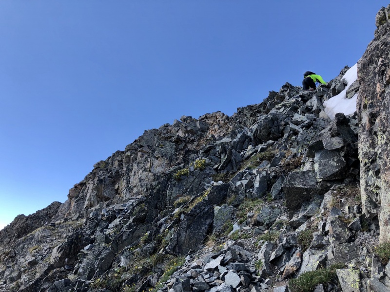
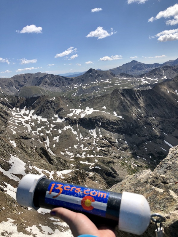
I like summit logs. I know there are a lot of differing opinions on them, but I think they're fun. I enjoy seeing how far back they go, how much traffic the mountains get, who the last person was, the comments people write, where they're from, etc. Of course I signed it! Lots of paper and pens in a plastic bag tightly sealed in the log itself, which is nicely attached to the rocks. 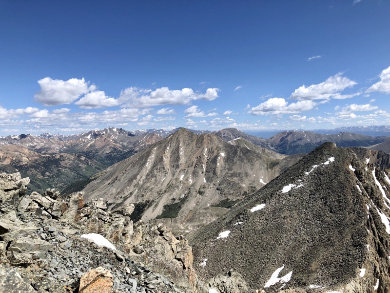
Soon the anxiety set in, though, that we had to down-climb everything. And frankly, I prefer climbing UP rather than DOWN. So after a few more photos and a sip of water, off we went. Me tailing behind, per usual. Trevor decided to down climb on the other side of the crux - opposite of the 'staircase' and snow. As I watched him descend I realized I did not want to go that way. While shorter, it looked ickier from my vantage point. And that was confirmed when he said there was a somewhat sketchy move that I wouldn't be able to do with my shorter limbs. I appreciate the honesty! 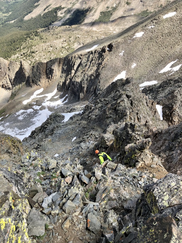
It seemed like people had suggested facing inward for the down climb. I decided to be a rebel and face out. I like knowing where I'm going, and if I can make it work I will. And I did. Maybe not always gracefully with some butt-scootchin' and crab-walking almost at times, but it worked, and I got down safely. It went quite well actually. Then I had to cross back over the dirt part of the gully, which is when the rock I mentioned earlier went flying. "ROCK!" Luckily that was the end of it. 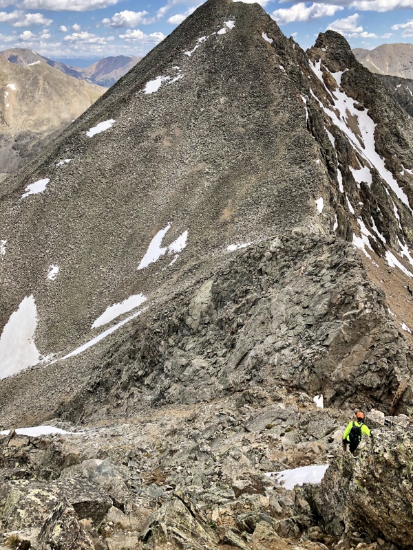
It was uneventful to the saddle. We dropped our packs, took our helmets off, and hoped no marmots would make our packs their lunch (we were lucky - none did). We kept up a pretty solid pace heading up N. Apostle, but the clouds were in our favor. There were some that could easily turn into thunderheads but they all moved around us. We were in a nice little nook in the Sawatch it seemed, and the universe was on our side with having this be a nice, calm, dry day for the two summits. 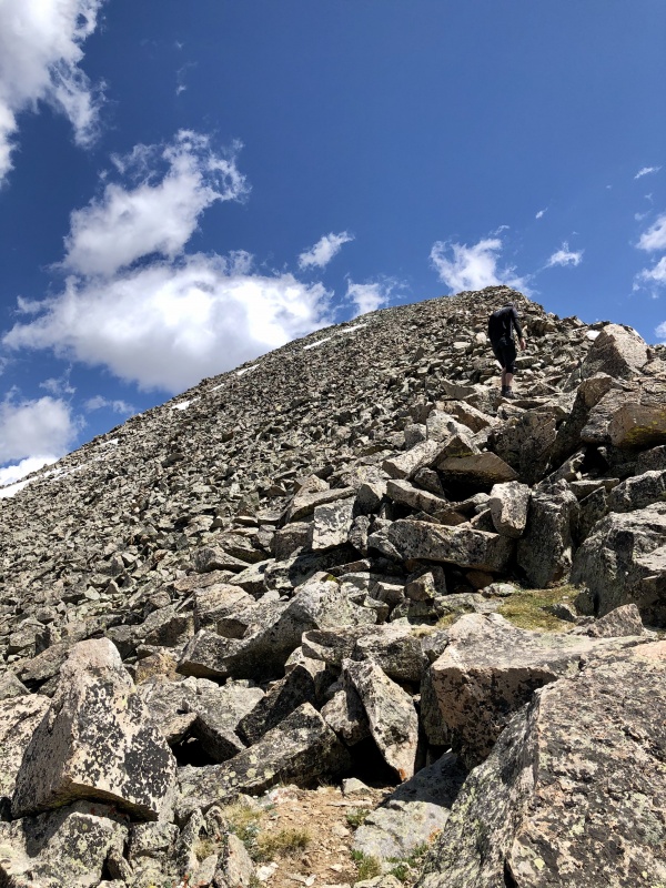
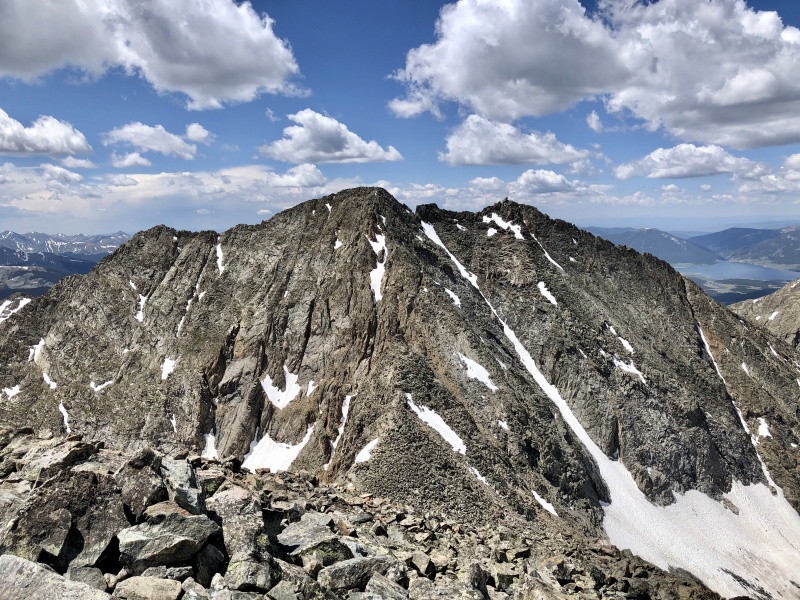
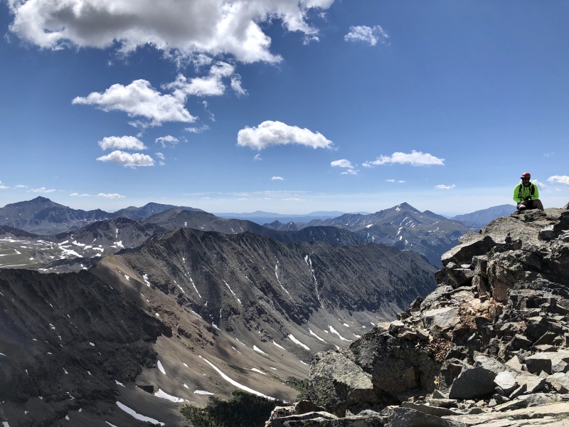
Looking over at Ice from the summit of North Apostle really shows how dramatic of a peak she is. She seems different than the rest of the Sawatch. Typical rocks and bouldering to be had, but she's a bit more ominous and rugged than the others. Definitely a good climb and glad we did that one first and left N. Apostle for the second summit of the day. 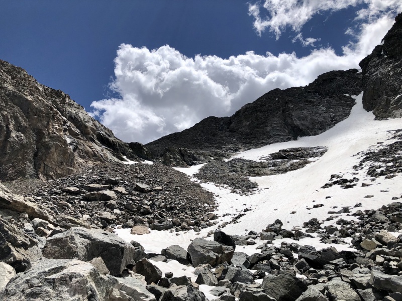
The farther down we got the more flowers and grass there was. We saw a few pikas and marmots too! They're so fun to watch. I think they weren't sure what to think of the weird two-legged creatures heading up their mountain, though. 
We followed the GPS track back through to treeline, the willows, and the creek. Honestly I never though I'd find myself saying "where are the willows" (and I'm still a tad ashamed to have said it), but my knees were starting to scream at me after all those loose rocks and impact of going down them. They won't stop me, I love these mountains, but I was quite happy to be on softer ground. 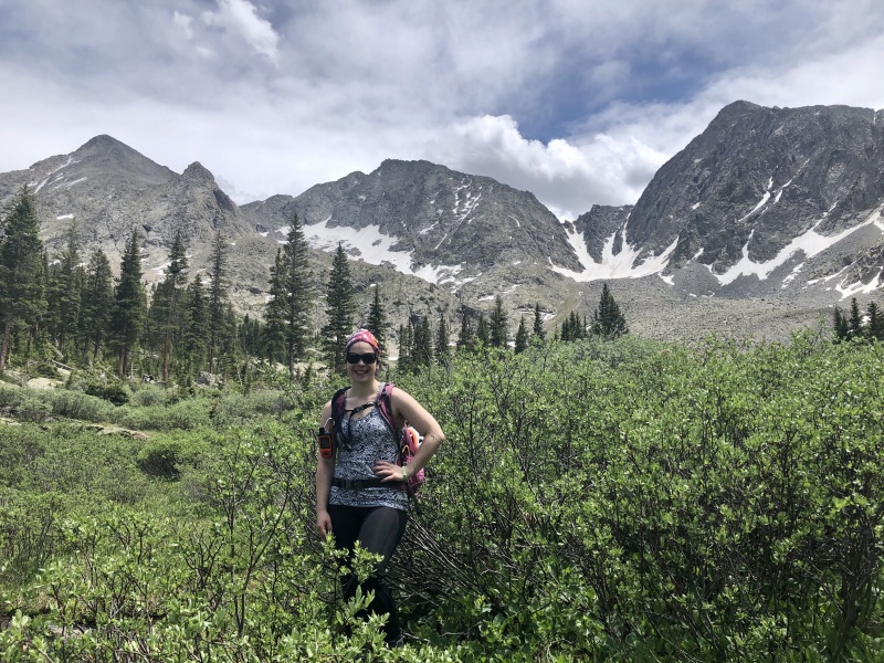
It was a tough climb, and it took significantly longer than either of us anticipated. And I still cannot figure out why Gaia showed 5,000' of gain when the site says 3500-3900'. We didn't go of route... And mathematically that makes sense too (the lower gain). It was a committing day, and after making it to the upper basin above the rock glacier, I am so happy we turned around 2 years ago in the rain when we did. The rocks and class 3 climb would have been even more challenging with rain water slickness. Thumbnails for uploaded photos (click to open slideshow): ")
")
")
")
")
")
")
")
")
")
")
")
")
")
")
")
")
")
")
")
")
")
")
")
")
")
")
")
")
")
")
|
| Comments or Questions | |||||||||
|---|---|---|---|---|---|---|---|---|---|
|
Caution: The information contained in this report may not be accurate and should not be the only resource used in preparation for your climb. Failure to have the necessary experience, physical conditioning, supplies or equipment can result in injury or death. 14ers.com and the author(s) of this report provide no warranties, either express or implied, that the information provided is accurate or reliable. By using the information provided, you agree to indemnify and hold harmless 14ers.com and the report author(s) with respect to any claims and demands against them, including any attorney fees and expenses. Please read the 14ers.com Safety and Disclaimer pages for more information.
Please respect private property: 14ers.com supports the rights of private landowners to determine how and by whom their land will be used. In Colorado, it is your responsibility to determine if land is private and to obtain the appropriate permission before entering the property.


