Download Agreement, Release, and Acknowledgement of Risk:
You (the person requesting this file download) fully understand mountain climbing ("Activity") involves risks and dangers of serious bodily injury, including permanent disability, paralysis, and death ("Risks") and you fully accept and assume all such risks and all responsibility for losses, costs, and damages you incur as a result of your participation in this Activity.
You acknowledge that information in the file you have chosen to download may not be accurate and may contain errors. You agree to assume all risks when using this information and agree to release and discharge 14ers.com, 14ers Inc. and the author(s) of such information (collectively, the "Released Parties").
You hereby discharge the Released Parties from all damages, actions, claims and liabilities of any nature, specifically including, but not limited to, damages, actions, claims and liabilities arising from or related to the negligence of the Released Parties. You further agree to indemnify, hold harmless and defend 14ers.com, 14ers Inc. and each of the other Released Parties from and against any loss, damage, liability and expense, including costs and attorney fees, incurred by 14ers.com, 14ers Inc. or any of the other Released Parties as a result of you using information provided on the 14ers.com or 14ers Inc. websites.
You have read this agreement, fully understand its terms and intend it to be a complete and unconditional release of all liability to the greatest extent allowed by law and agree that if any portion of this agreement is held to be invalid the balance, notwithstanding, shall continue in full force and effect.
By clicking "OK" you agree to these terms. If you DO NOT agree, click "Cancel"...
Teakettle has long been a peak that I wondered if I'd ever actually summit. At least twice I've been at or near the trailhead and never even got out of the car to start the hike. Weather cancelled other plans before I even made the drive to Ouray. My lack of confidence in my rope skills made it something I had been reluctant to attempt alone. This time the weather forecast looked cooperative and Brian was willing to make the drive with me and go for it. I took Friday off from work and we headed down around noon for the drive to Ouray. We found a place to camp a little before 8pm and settled in for a short night. Based on the forecast we planned to get up early and give ourselves the best possible chance to beat the weather.
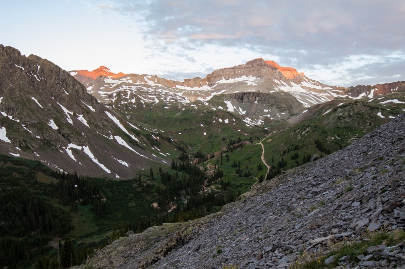
At about 5:15am the next morning we set off from the outhouse at the Sneffels trailhead and started up the hill. We saw two guys ahead of us (turned out to Mike Offerman and Luke Plumley) and another group that mistakenly thought that our trail was for Sneffels. We quickly corrected them and pointed them the right way and set off after the other two up the steep grass.
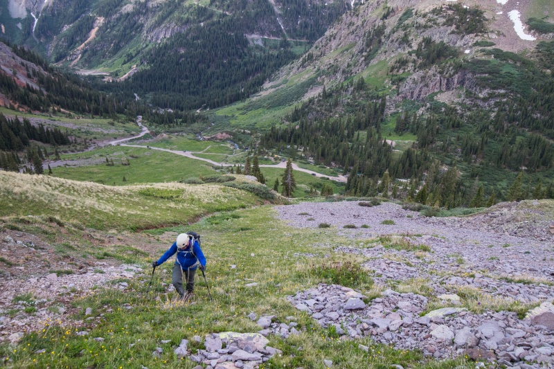
The approach. Or straight up the hill.
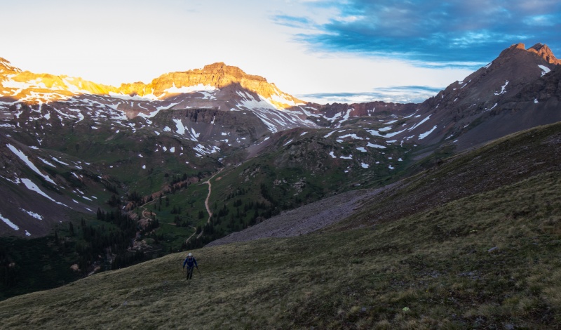
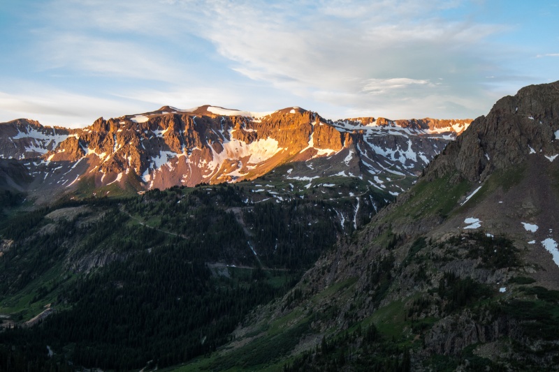
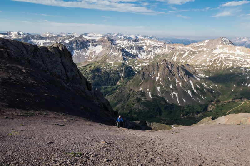
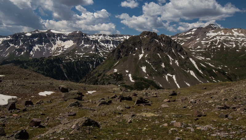
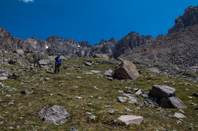
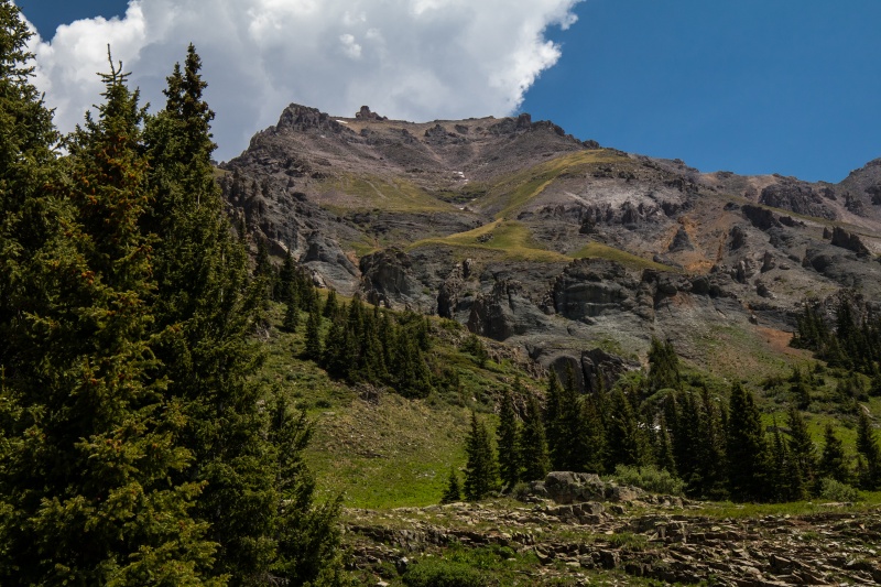
The other two guys raced ahead up the slope while we went our own pace. We angled towards Coffeepot and the slope that way at least looked like it would keep us on the grass for a while. It's still ridiculously steep but at least it wasn't loose. Yet. It had been years since I'd been in Yankee Boy Basin and it was amazing to get reacquainted with the views that surrounded us.
Brian headed up. Gilpin behind.Heading for Coffeepot (slightly left of center on the ridge)Have to admit the view is amazingThe view to the south
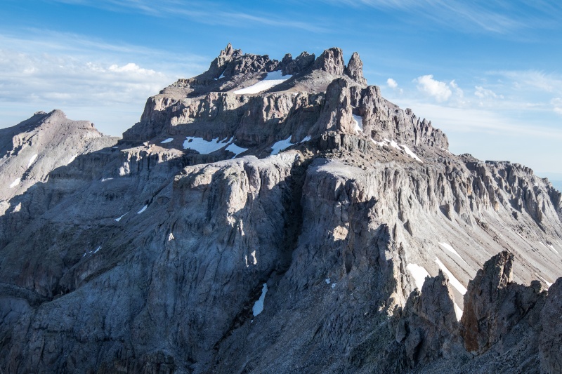
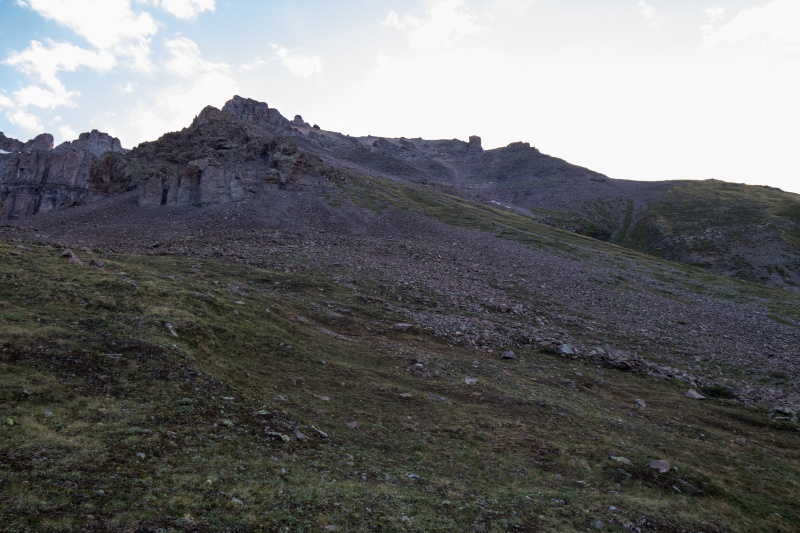
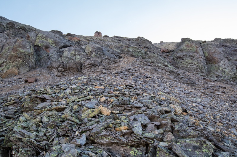
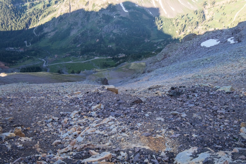
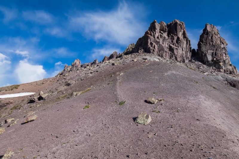
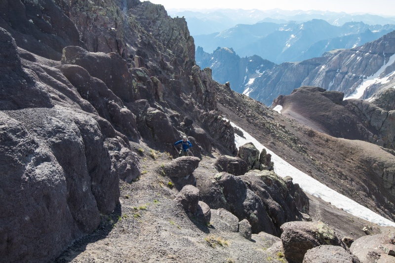
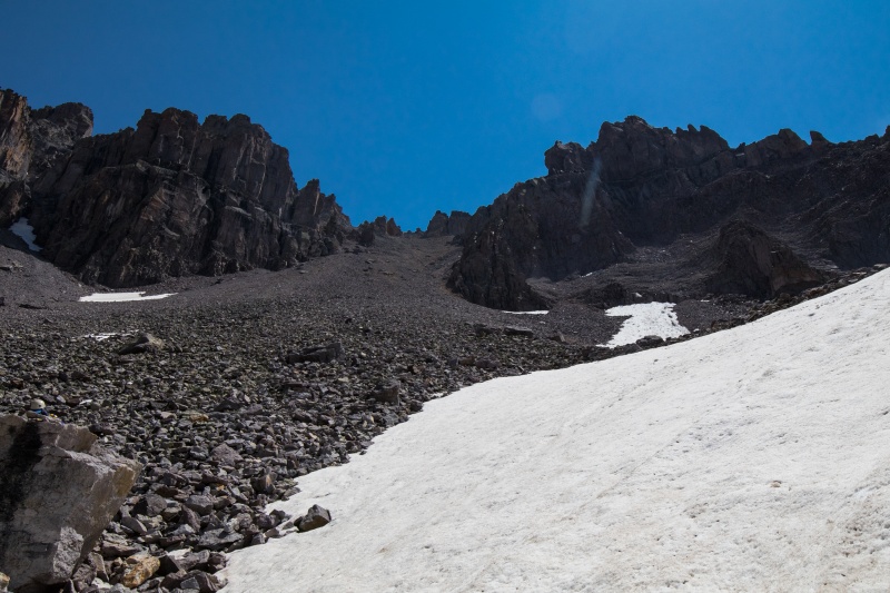
Eventually around 13,000 feet we ran out of grass and transitioned to....suck. Just plain suck. Finding secure footing was a challenge and forward progress became a game of figuring the least awful way to ascend. Brian and I tried to stay out of each other's path just in case of rockfall. I hugged the wall next to one of the towers for a while because at least the wall was solid even though the footing underneath wasn't at all.
Coffepot getting closer but we have to go up *that*Potosi across the wayYuck.
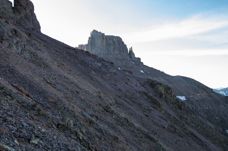
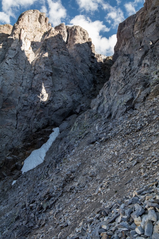
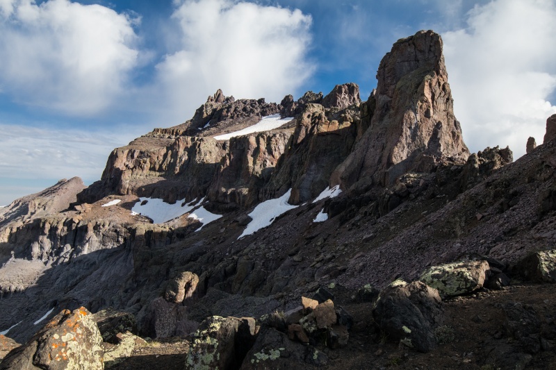
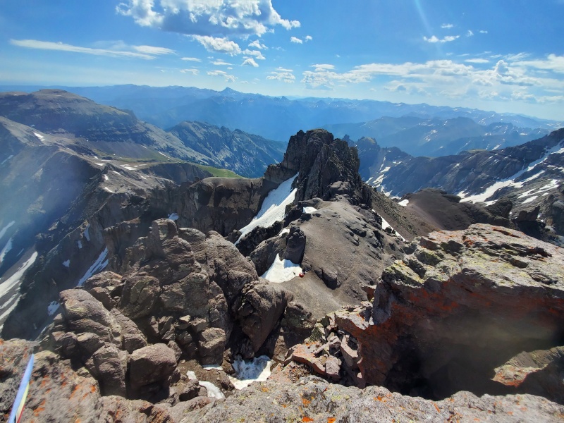
We finally topped out on the ridge near Coffeepot and tried to work out how in the world to get over to the black gully. Or as Brian put it "how are we supposed to get over THERE?". Eventually we figured out that the traverse started a bit lower down and carefully negotiated our way around a snowfield and across the loose stuff over to the base of the gully.
Might as well get a photo before we deal with the next part.
Oh yeah, that looks fantastic. I called it the poop chute.
Yay....
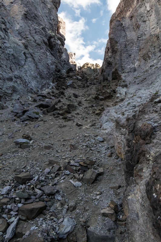
Brian exiting the black gully
We ascended the gully close together to minimize rockfall danger and carefully negotiated our way up. It's pretty awful but at least it went quickly and we took the left branch and Class 3 exit. At this point we felt like we were through the worst of it and we were mostly correct. There was still a bit of distance to go but the next gully was just loose dirt instead of loose dirt and rocks. So that was a plus. At the top of the second gully we ran into the other two guys coming down from the summit who gave us a bit of beta regarding the anchor on the summit block.
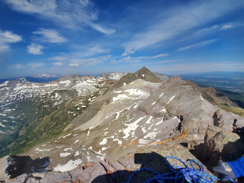
Coming up the second and much more pleasant gullyOut of the gullies and just some distance to traverse to the towerView from near the top of the black gully. Second gully is hidden around the corner.
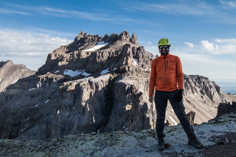
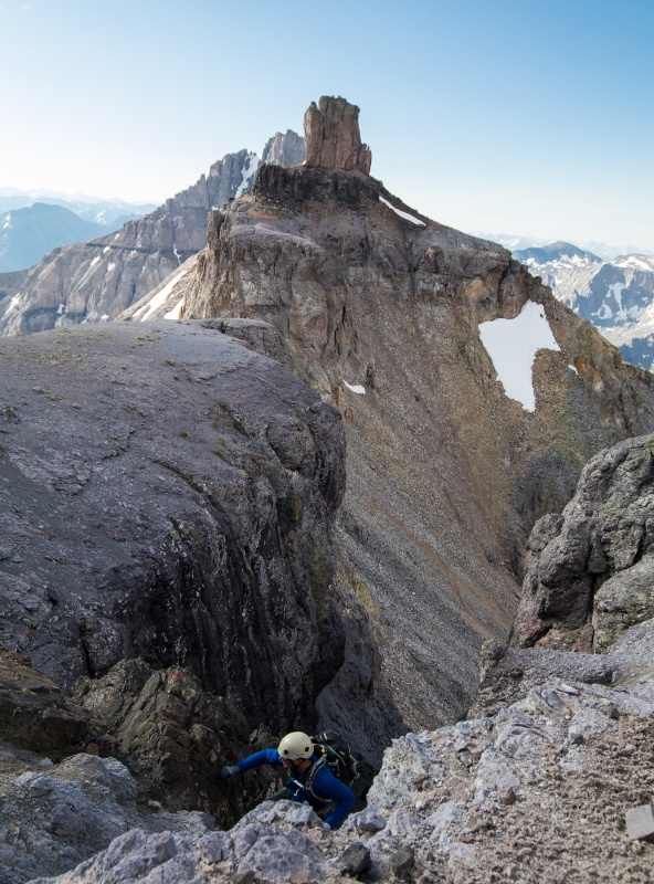
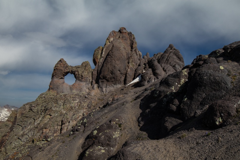
Coming up the last bit right before the summit towerWe have arrived
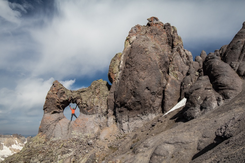
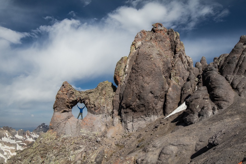
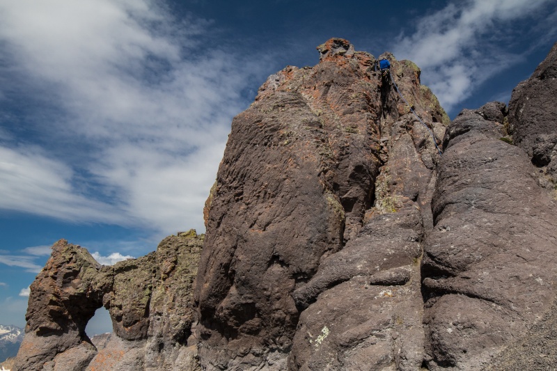
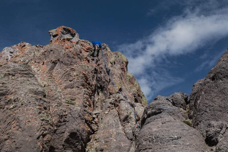
We spent a few minutes doing our obligatory photos in the handle and then got the gear out for the summit pitch. I brought a 30m rope and Brian brought some pro. The 30m rope ended up being plenty long enough and Brian put in two cams on the ascent while I belayed him up. I had forgotten my rock shoes and while the first part of the pitch went fine the second part became a bit of a pain when I couldn't get my boot to stick on the only foothold I could see. Eventually after a few attempts I managed to make the move and joined Brian on the tiny summit.
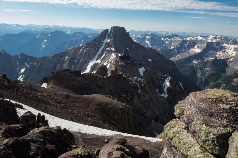
Me in the handleBrian being a poserGetting the rope sorted out for the rappelView looking eastSneffels over there.
We didn't spend much time on the summit as we still had to get down and we both agreed this was no place to be if the weather changed. It felt great to finally be on the summit of Teakettle after years and years of aborted attempts though and right at that moment the weather was perfect. I thanked Brian for leading the pitch and we started getting the rope rearranged for the rappel. I thought about how far I'd come as a climber that this felt....normal. I recalled back to when I was starting the 14ers and never dreamed I'd be doing anything like this in my life.
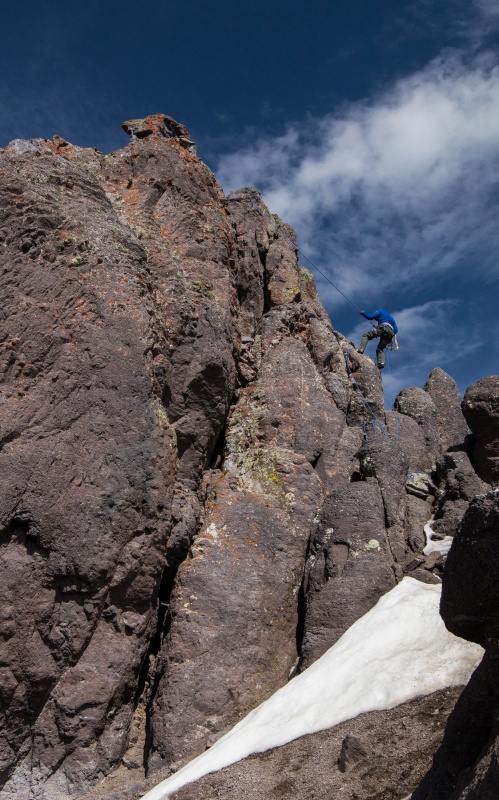
We got the rope figured out and set and I got ready to rappel down first. I didn't have any issues and landed right where I wanted and got off the rope so Brian could come down. I walked back over to get my SLR so I could take pictures of Brian coming down.
Brian starting downHero shotPotosi from near the top
We got packed back up after eating some food and then started to head back down. We had no route finding issues and found ourselves quickly back at the top of the black gully. Again we descended close together for safety and then debated our descent path. We knew we could go back to Coffeepot or we could just descend the slope below the black gully. We chose the closer option and while it was terrible, awful, and loose it got us down relatively quickly without injury and back on grass.
Don't go up thatGrass is wonderfulOff the hard parts
Back on the grass we headed back a bit to the east and found ourselves a few hundred feet above the car. A bit more steep downhill and we reached the car just after noon for a 6 1/2 hour roundtrip.
One last look
We quickly packed ourselves up and distanced ourselves from the tourist hordes. I drove slowly down the road while Brian contemplated his love for the shelf sections. Or not. Still feels like a bit of a whirlwind and amazing that I finally got this one done. Only 4 more to go.....
Thumbnails for uploaded photos (click to open slideshow):
Thanks for the great write-up and pictures. Looks like a great time!
Caution: The information contained in this report may not be accurate and should not be the only resource used in preparation for your climb. Failure to have the necessary experience, physical conditioning, supplies or equipment can result in injury or death. 14ers.com and the author(s) of this report provide no warranties, either express or implied, that the information provided is accurate or reliable. By using the information provided, you agree to indemnify and hold harmless 14ers.com and the report author(s) with respect to any claims and demands against them, including any attorney fees and expenses. Please read the 14ers.com Safety and Disclaimer pages for more information.
Please respect private property: 14ers.com supports the rights of private landowners to determine how and by whom their land will be used. In Colorado, it is your responsibility to determine if land is private and to obtain the appropriate permission before entering the property.

")
")
")
")
")
")
")
")
")
")
")
")
")
")
")
")
")
")
")
")
")
")
")
")
")
")
")
")
")
")
")
")
")
")


