Download Agreement, Release, and Acknowledgement of Risk:
You (the person requesting this file download) fully understand mountain climbing ("Activity") involves risks and dangers of serious bodily injury, including permanent disability, paralysis, and death ("Risks") and you fully accept and assume all such risks and all responsibility for losses, costs, and damages you incur as a result of your participation in this Activity.
You acknowledge that information in the file you have chosen to download may not be accurate and may contain errors. You agree to assume all risks when using this information and agree to release and discharge 14ers.com, 14ers Inc. and the author(s) of such information (collectively, the "Released Parties").
You hereby discharge the Released Parties from all damages, actions, claims and liabilities of any nature, specifically including, but not limited to, damages, actions, claims and liabilities arising from or related to the negligence of the Released Parties. You further agree to indemnify, hold harmless and defend 14ers.com, 14ers Inc. and each of the other Released Parties from and against any loss, damage, liability and expense, including costs and attorney fees, incurred by 14ers.com, 14ers Inc. or any of the other Released Parties as a result of you using information provided on the 14ers.com or 14ers Inc. websites.
You have read this agreement, fully understand its terms and intend it to be a complete and unconditional release of all liability to the greatest extent allowed by law and agree that if any portion of this agreement is held to be invalid the balance, notwithstanding, shall continue in full force and effect.
By clicking "OK" you agree to these terms. If you DO NOT agree, click "Cancel"...
The First Climb of My New Life: All Four of Adams' Ridges in One Day
The past five years of my life have been an interesting mix. I went from being a depressed, mediocre rock climber living in Wisconsin to a regular and still mediocre rock climber living in Colorado. I gave up family and friends to start a new life in a place I'd been to one time before, and while I have traveled elsewhere I can't imagine living anywhere else but right here in Colorado. As I plinked away in my fourteener quest I began to realize what a hindrance having a home/rental was. My home for several months at a time as I'd travel and climb was my Honda Civic, which quite obviously is less than ideal. I did the living out of a Civic thing for five summers. Five whole summers, and for each of them I knew I could do better.
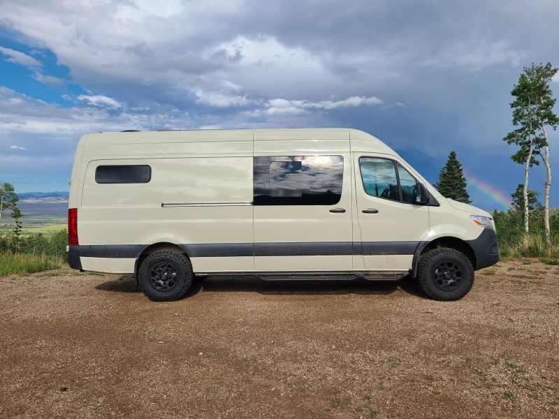
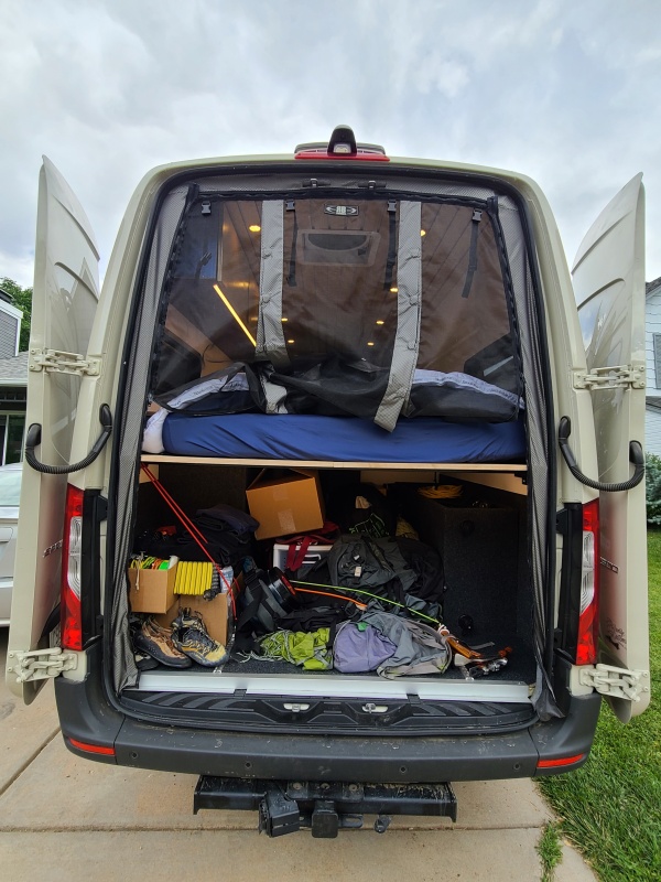
I began investigating what it would take to do the vanlife, and found myself completely overwhelmed by the sheer number of options and opinions. I whittled things down and eventually purchased a 2019 Mercedes-Benz Sprinter 4x4 with a 170 inch wheel base. While I was in the process of purchasing, which takes a year or two with the high demand for the 4x4s, I also came up with a design for the interior, then selected Denver-based Vanlife Customs to build it for me. I don't have those skills and I know I don't, so I let the pros do it. When I picked up the van I was ecstatic. It had taken me somewhere between two and three years of research, planning, designing, purchasing, and patience to make it happen, but it's got everything I need to live in it permanently, and so far it's been absolutely life changing.
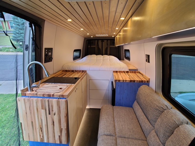
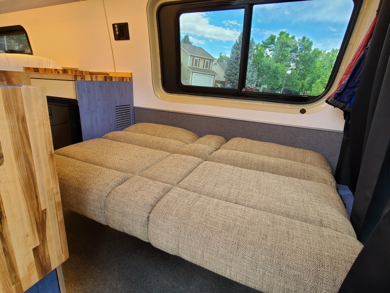
Taken a couple of weeks later at the Venable/Comanche trailhead, also near Westcliffe.It will never look this clean again, but this is it!Couch/guest bed for my fellow midgets.Garage and bed from the back. I haven't come up with a good organization scheme for all of my stuff yet, hence the haphazard chucking-in of everything I own.
I had to do a big climb to commemorate, so I went down to one of my favorite areas in the Sangre de Criso Range and climbed Mount Adams, Point 13,580 A, Point 13,546, and Point 13,153 with Whiley, Marisa, and Sam. This meant climbing every one of Adams' four ridges - northeast, south, west, and northwest, in that order - which is just what the doctor ordered.
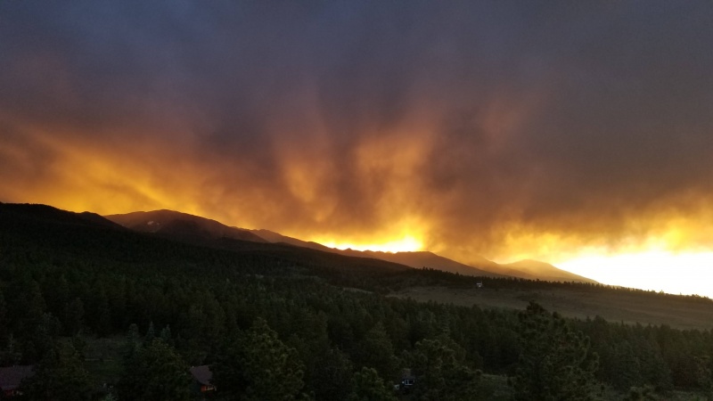
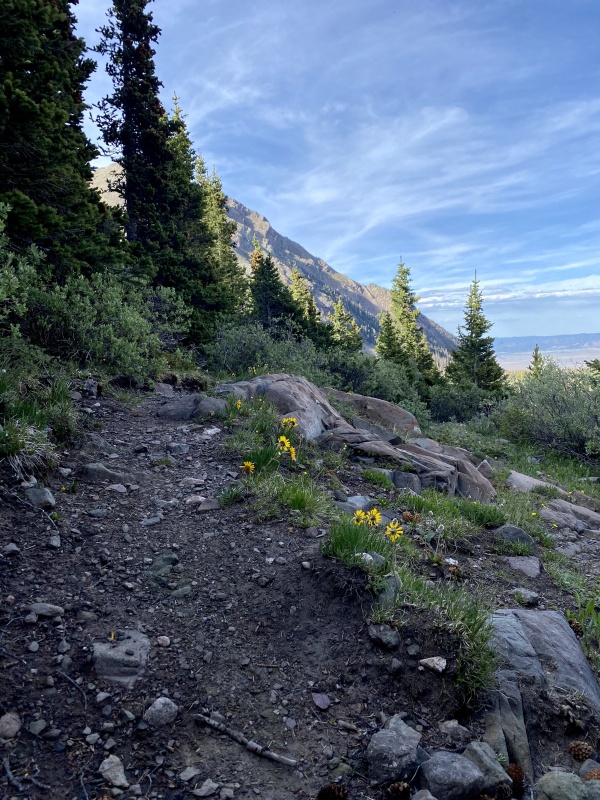
The day before we all met at the trailhead. I had never driven the van farther than Denver and had filled it up with all of the stuff I'd need to live in it. We were treated to an absolutely fire sunset before packing in for the night. For the first night in a long time prior to a climb I slept great. Must be the new queen bed in my van.
Photo: Sam S.Photo: Sam S.
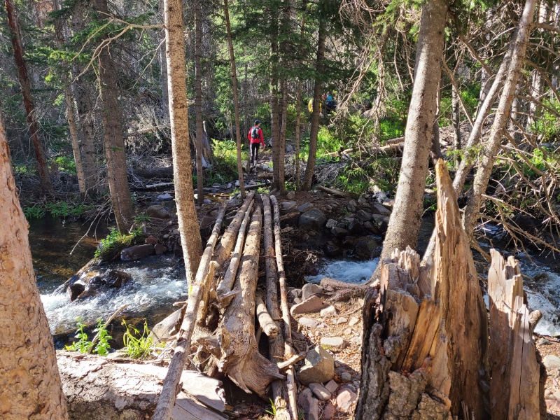
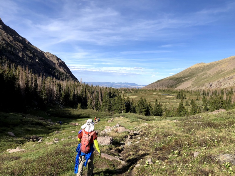
The next morning we started just after 7. None of us had been up the Horn Creek Trail but it was well marked (take the spur trail from the trailhead southwest for half a mile then turn north like the sign says, then west at another sign) and easy to follow. There were a couple of creek crossings but nothing major and we banged out the miles up the valley quickly.
One of the creek crossings.
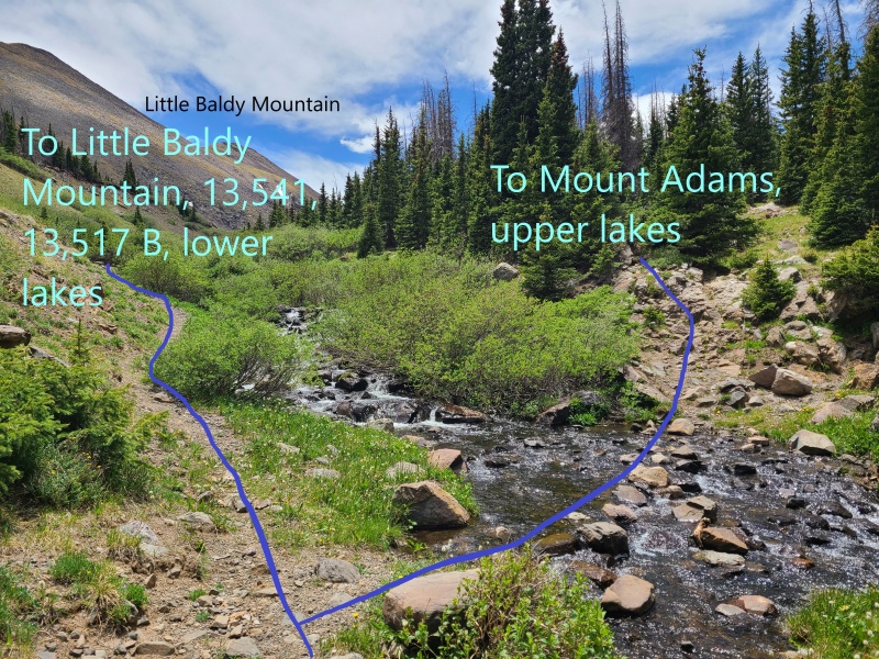
The trail eventually reaches a point where it appears to parallel the creek. There is a split here, with the right branch going to the upper lakes and the slope below Adams we'd have to climb, and the left going to the lower lakes and various other peaks.
Pretty self-explanatory.
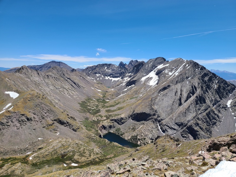
Sam and I took the left branch thinking that since it was especially beaten in that that was the way to go, and Whiley and Marisa caught up to us a couple of minutes later. This turned out to be the wrong branch, of course, but the views from the lower lake were superb and would actually end up being better than what we could get farther west.
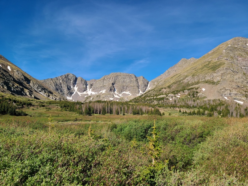
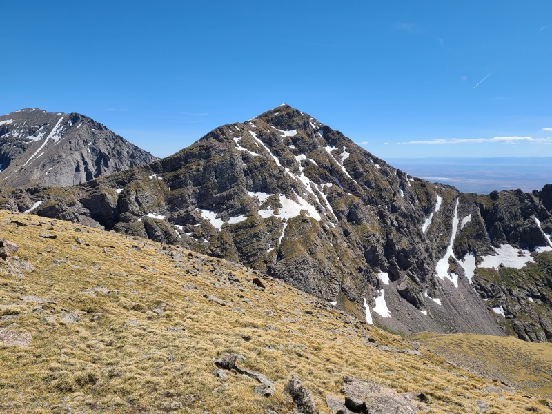
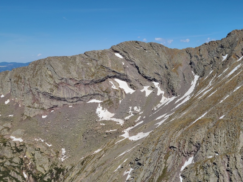
Point 13,517 B, Point 13,580 A, and Mount Adams A. The grassy slope on the right gives access to Adams' northeast ridge.
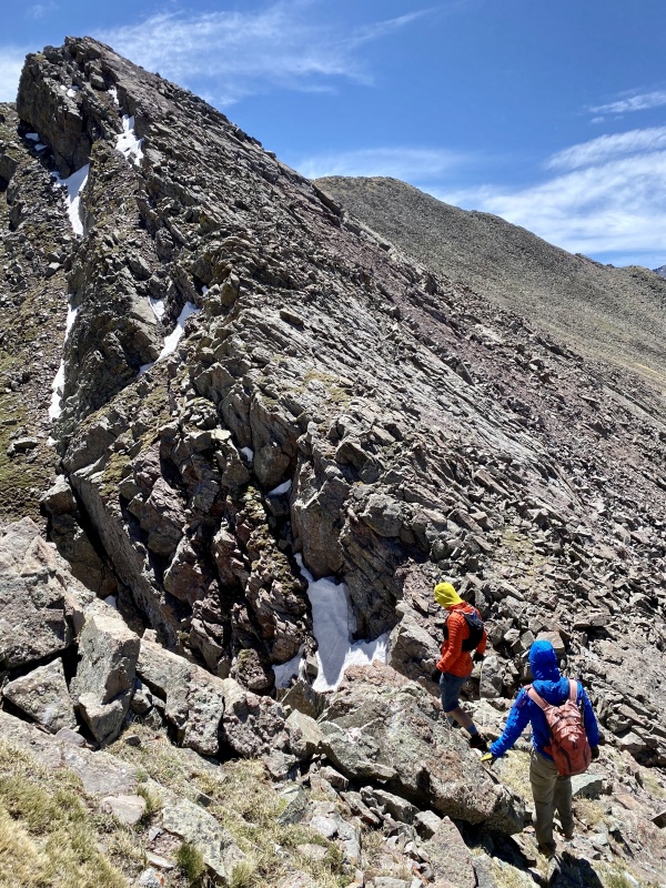
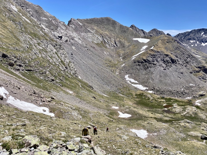
We hung out for a few minutes then returned to the proper trail branch and hiked to the base of an ugly looking slope up Adams' northeast ridge.
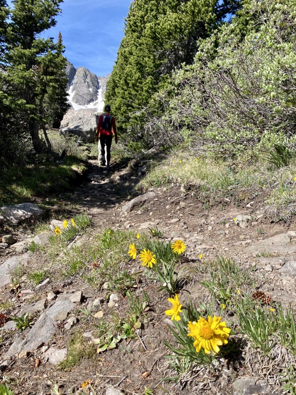
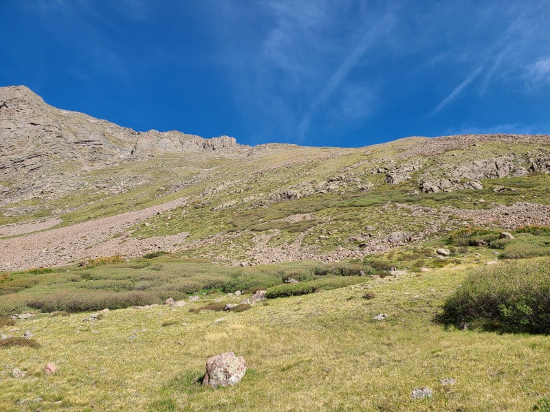
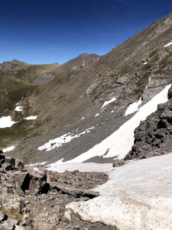
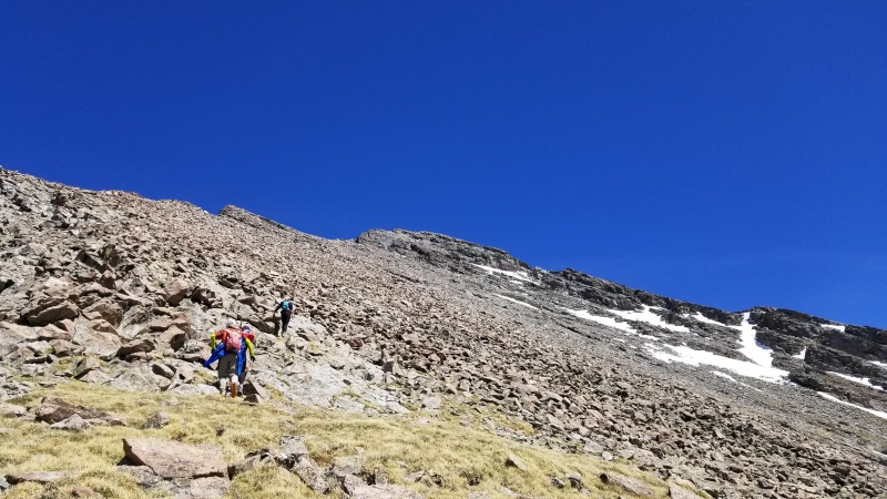
This hike is no slouch in the looks department. Photo: Whiley H.Up to the ridge crest right of the large rocks, while trying to avoid as much rock below as possible.
This slope wasn't a ton of fun, honestly. Steep, loose, and overall just kind of crummy, but it was the only way to access Adams from here; a trip up and over Little Horn Peak and Fluted Peak would also get us here, but this was faster.
Nice views, not nice climbing. Photo: Whiley H.
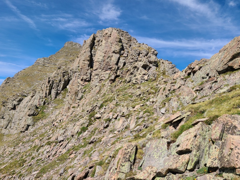
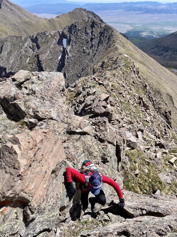
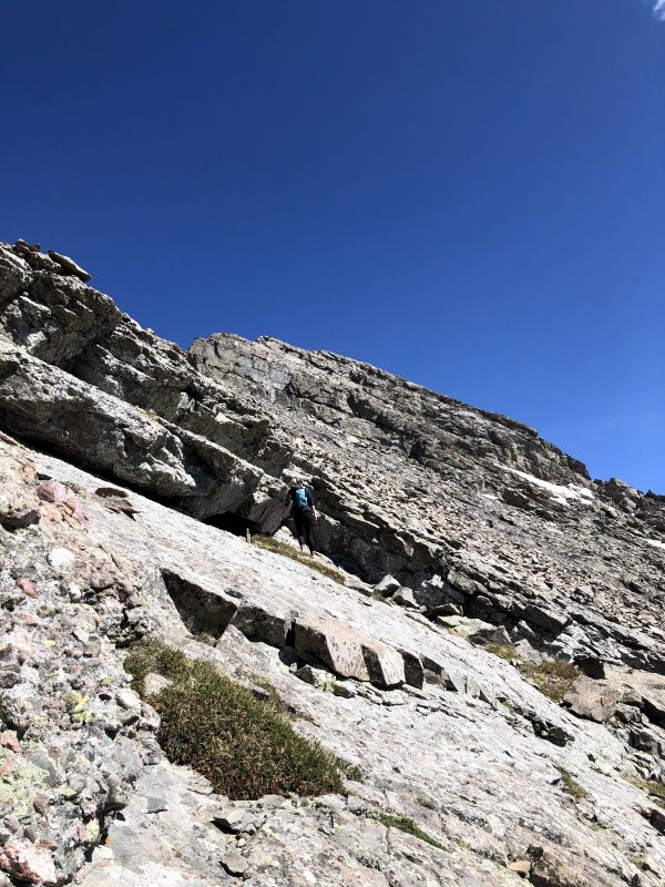
Whiley, Marisa and I went straight up the slope to the ridge; Sam went climber's left up a gully and said his option went at Class 4/Class 5.easy. Once the gals and I reached the ridge crest the real fun began: super nice scrambling on famous Crestone conglomerate.
Ok, the crap slope was worth it.
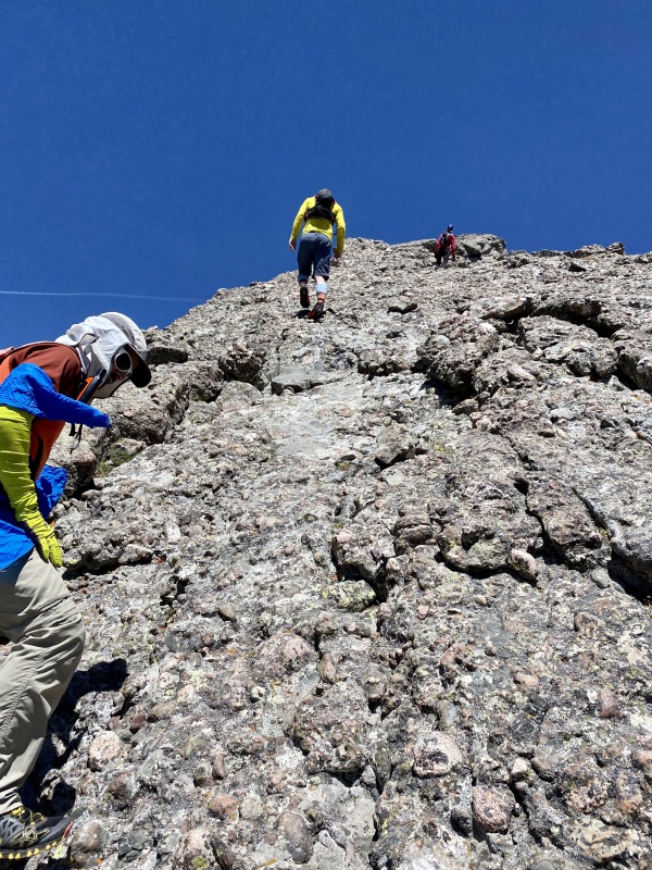
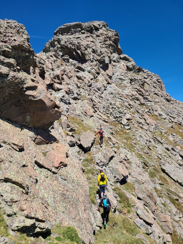
Scrambling along this ridge can be kept to Class 2+ as described in Roach's Colorado Thirteeners: From Hikes to Climbs but frequently by doing bypasses and ledges on rotten rock. The ridge crest offered delightful Class 3 and Class 4 options, so obviously we opted for the good scrambles vs janky bypasses.
So many options!Great rock here, and here, and here, and over there, and up here, and around that corner, and there too!A nice Class 3 chimney we ascended.Looking down the chimney. Photo: Whiley H.
Along the way I caught sight of the most absurd hanging Flatirons I've ever seen on the ridge to Fluted Peak. They looked filthy and still were beyond impressive.
How do these not just slide right off the ridge?
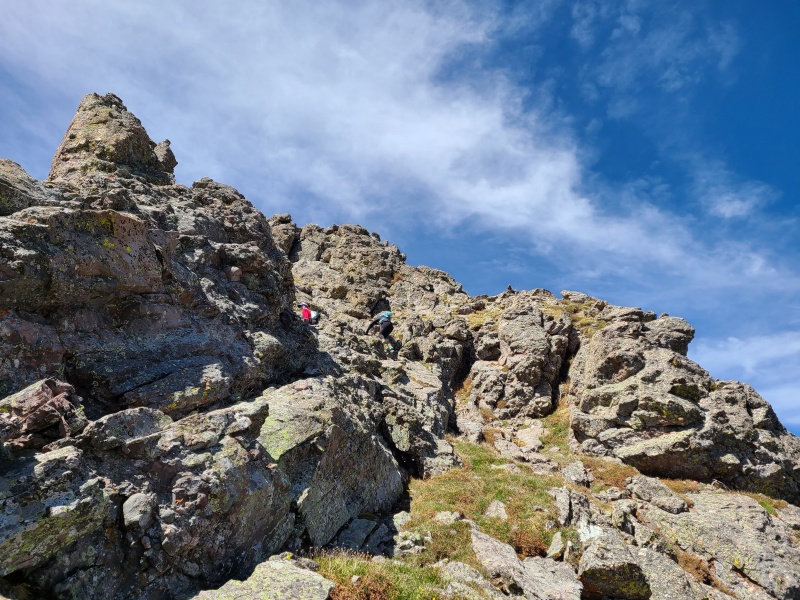
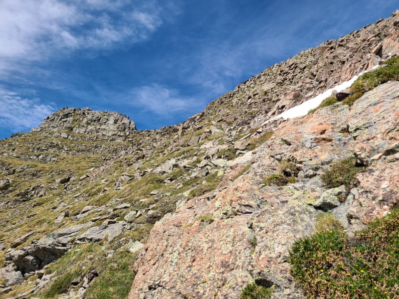
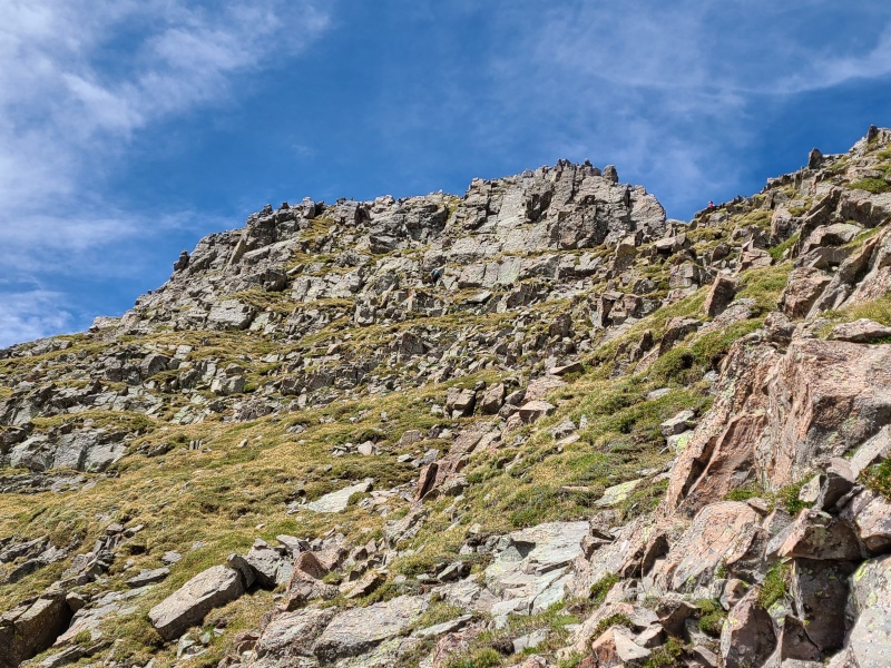
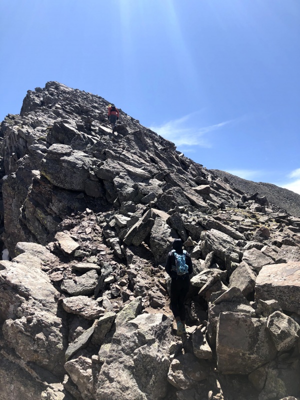
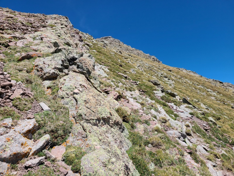
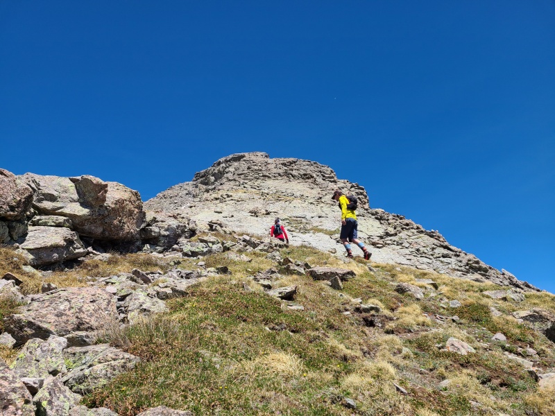
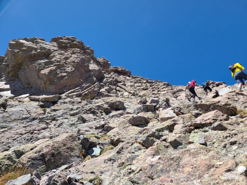
As we approached the summit block the difficulty dropped off to Class 2+ for a bit as we traversed grass and talus slopes below the ridge to the summit block, which went at Easy Class 3 for us (though could be kept to Class 2+ with more careful route finding than we did).
The last few hundred feet to the summit.Once again, plenty of options of varying difficulty.
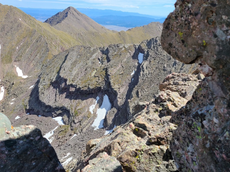
It had taken us just over three and a half hours to reach the summit of Mount Adams. From the summit we could see the size of the day we had in store for ourselves; massive drops to each peak, a massive ascent up Point 13,546 and slightly smaller ones up Point 13,580 A and Point 13,153, and two massive re-ascents of Adams from 13,546 and 13,153, which were essentially just out-and-backs. We hung out for a few minutes and snacked before dropping down steep ledges towards Point 13,580 A.
Just look at that crazy geology!
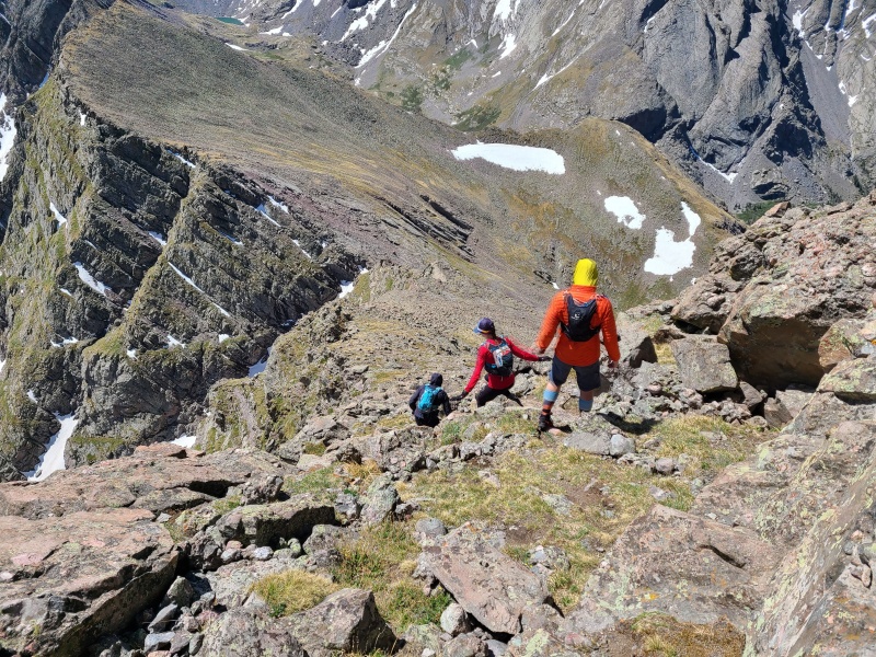
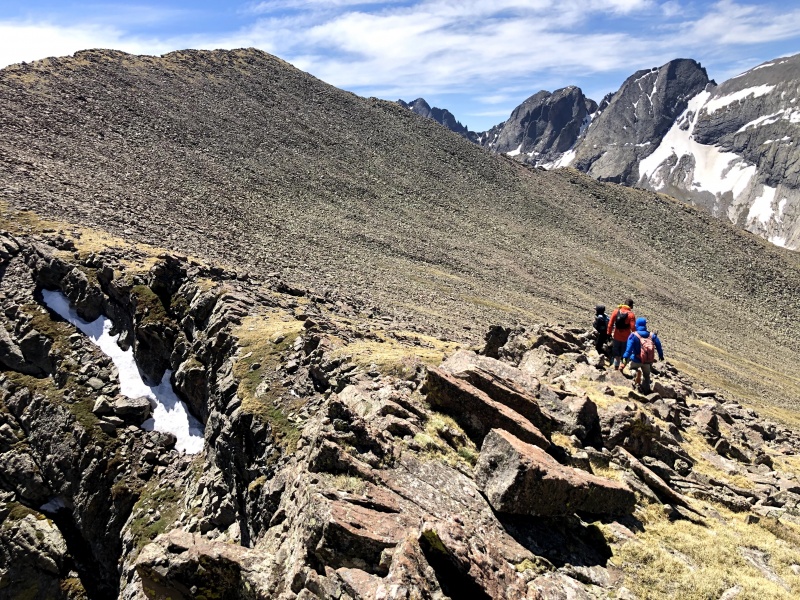
The down climb to the Adams/13,580 A saddle wasn't all that bad and consisted at first of switchbacking down grassy ledges, then Easy Class 3 scrambling down ledges and short slabs. Again, there were probably Class 2+ options with more careful route finding, we just went down whatever was right in front of us.
Still descending with the Crestones and Kit Carson massif nodding their approval. Photo: Whiley H.Photo: Whiley H.Typical terrain on Adams' south ridge down climb. Most rock was solid. Photo: Whiley H.
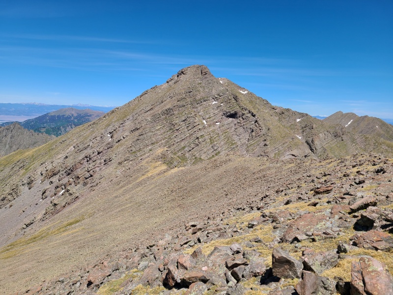
The ascent from the saddle was a bit rough and loose, but not technically demanding. A few hundred feet of broken slabs and scree took us to the summit ridge, which we traversed on stable talus.
Initial ascent from the saddle. The summit is visible on the right. Photo: Marisa W.Wider shot of the summit ridge. Photo: Marisa W.
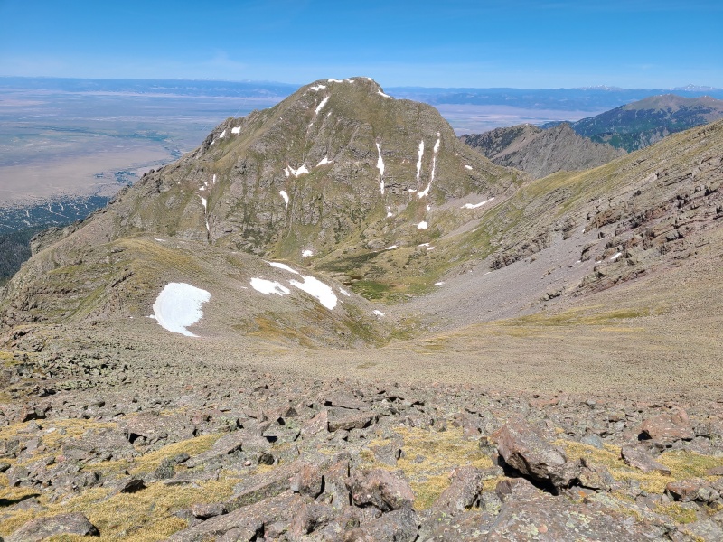
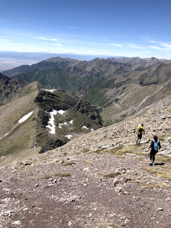
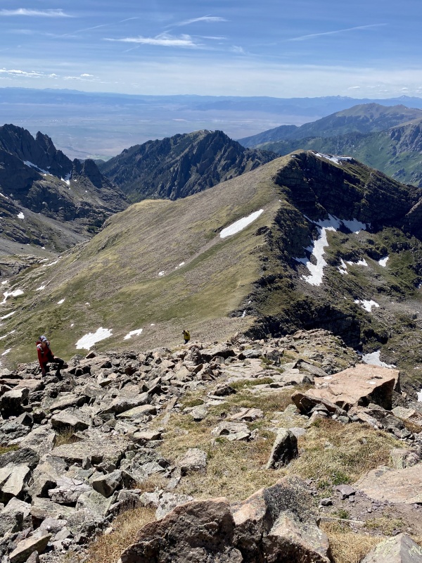
We wasted no time on the summit of Point 13,580 A. There was still several thousand vert and many miles to go, so we began dropping towards a small valley to the north of Willow Lake.
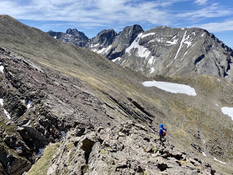
Looking back up Adams; the number of ledges, each its own distinct layer of rock, is obvious.Point 13,546 looking beastly large. I descended straight into the valley and the other three stuck to the ridge on the left.Sam frolicking. It's really hard not to in such a special place. Photo: Marisa W.
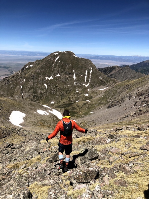
I made good time down into the valley; though the terrain was mostly talus it was generally stable and not that steep, so it went without much of a fuss. The others on the ridge were a bit slower, and I pointed out a hidden cliff band they then skirted to join me.
Our two routes are obvious: I went straight down (it's not as steep as it looks) and they went down the ridge, then looker's left around the cliffs. Photo: Whiley H.
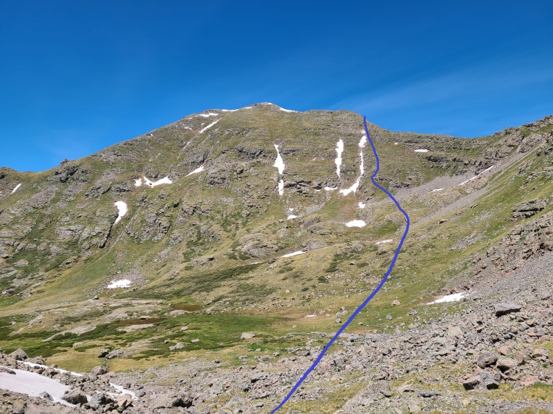
We noticed a couple of other people hiking through the valley towards the Adams/13,546 saddle but weren't close enough to talk to them. They'd eventually catch up to us on the summit since we took a different route up a grassy ramp, significantly shortening the ascent up 13,546, all of which was Class 2 or easier. The bottom of the valley was a little soggy and willowy but nothing we couldn't avoid. It was at least 1,000 vertical feet from the bottom to the top, and we were all starting to feel it by that point.
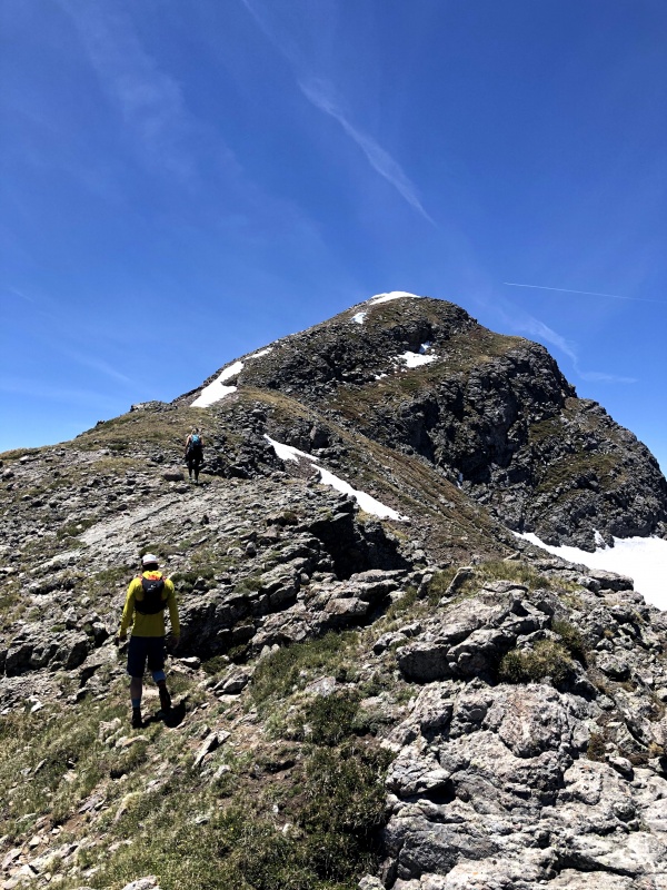
Our route up. We could have also ascended to the saddle and gone up the ridge but this was obviously more direct.Easy peasy ridge. Photo: Marisa W.
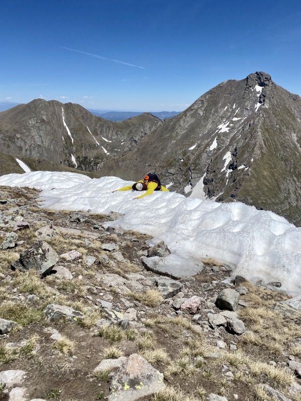
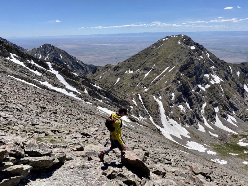
Near the summit we had to go around a long snow field lingering there, which Sam threw himself onto in an effort to cool off.
It's naptime. Adams' west ridge (on the right) looks kind of insane from here. Photo: Whiley H.
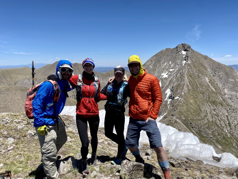
We ground out the distance and vert to the top of 13,546 and took a longer break here. Our compatriots caught up to us, and it turned out to be none other than 14ers.com members Darin Baker (d_baker) and Valerie (IHikeLikeAGirl)! We of course gabbed for a while on the summit and exchanged stories of our climbs. They had also come from 13,580 A and would be descending back to Willow Lake while we continued up and over Adams to 13,153.
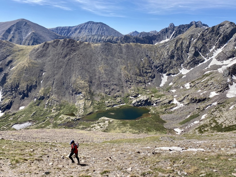
Willow Lake Basin with Humboldt, the Crestones, Kit Carson Peak, and Challenger Point, plus numerous thirteeners.Happy climbers (me, Marisa, Whiley, Sam) on 13,546. Photo: Darin or Valerie (can't remember who)
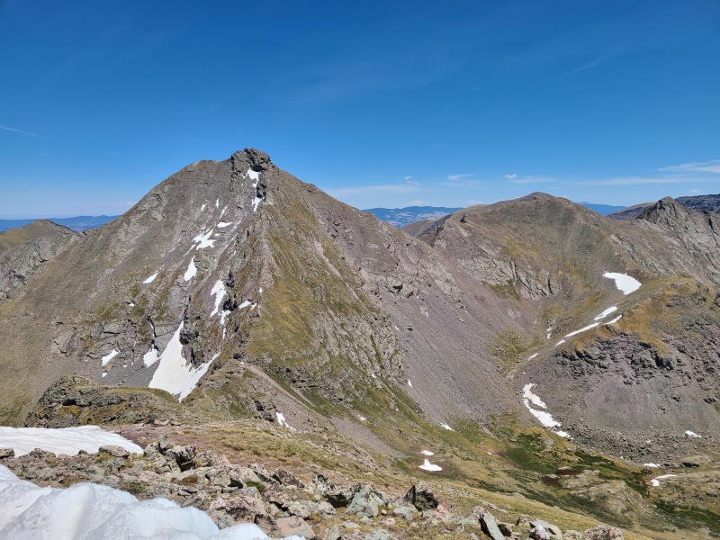
Now it was time to ascend Adams' west ridge; two down (northeast and south), two to go.
I'd annotate our route here but it'd be completely illegible. In essence: we came up the backside via the northeast ridge, down Adams' south ridge (right) to 13,580 A and into the valley, up to 13,546 (vantage point), up the west ridge (straight on view) to the summit a second time, down the northwest ridge (left) to 13,153 and back up it for a third summit of Adams, then down the northeast ridge again. We never claimed to be intelligent.
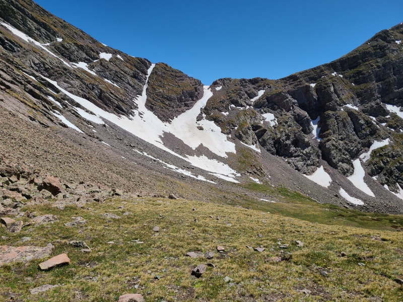
We descended to the Adams/13,546 saddle now, keeping our eyes peeled for a shortcut across the face. There were some chossy ledges that might have gone, and a broad snowfield on the north side of the saddle that definitely would have, but we didn't bring traction or axes so we were forced to go back up Adams instead. Nothing like padding the stats.
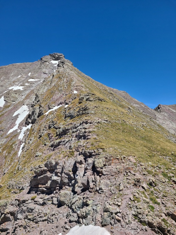
Up Adams' west ridge.The shortcut across Adams' northwest face, which required descending snow we didn't have gear for. Photo: Marisa W.
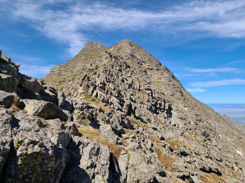
The west ridge looked more intimidating than it ended up being. Much of the crest is open slabs and the summit block is massive and overhanging, but keeping to the south side of the ridge enabled us to stay on grass most of the way up with a few wonderful Class 2+/Easy Class 3 slabs thrown in. The summit block we approached on more ledges then wrapped around to the east side and up the way we'd come from Horn Lakes.
Easy grass for the bottom third or so of the ridge.Approaching an unavoidable but easy slab.Who needs hands? Photo: Whiley H.Marisa: "That's the summit!" Ledges gave us multiple options for getting around to the backside of the summit block.Upper route before returning to the familiar east side.
On Adams for the second time we surveyed our route down to the saddle with 13,153. The descent was essentially a massive, 1,000 foot slab the entire way. Not hard or steep, just enormous beyond words. Unfortunately it was also covered in a layer of scree and talus. The underlying rock was great when it presented itself, but the layer of crap on top made it rather unpleasant.
Most of the descent. There's several ledges to scramble down but nothing serious. Photo: Marisa W.Across to 13,536 and the snowy saddle we wished we could have descended.
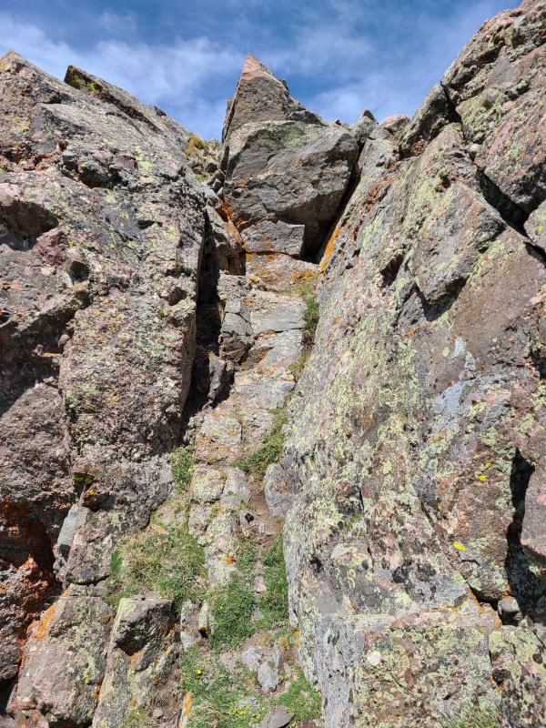
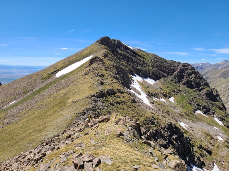
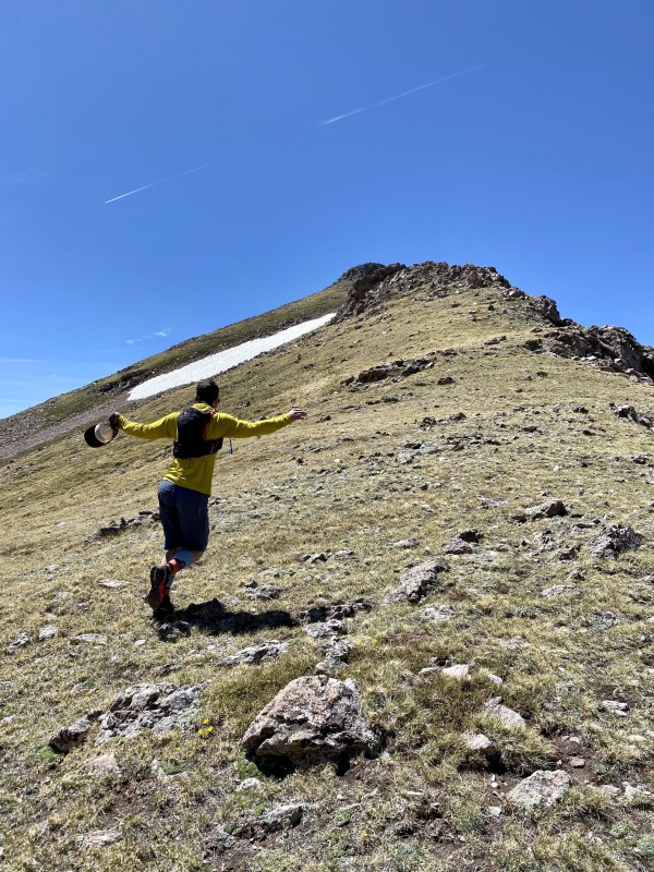
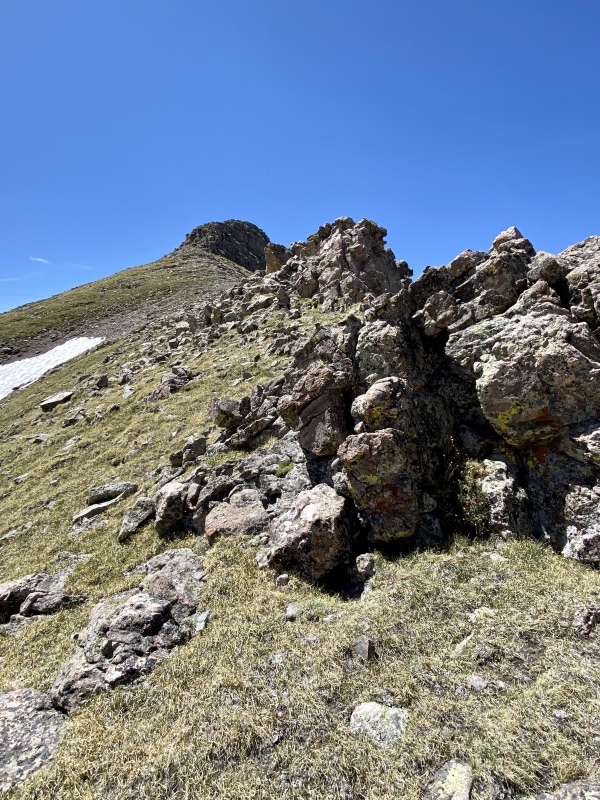
As with the south ridge there were a couple of big steps that needed to be navigated, but we made it easily to the saddle with our itsy bitsiest peak of the day, which consisted mostly of tundra, with a short scramble finish.
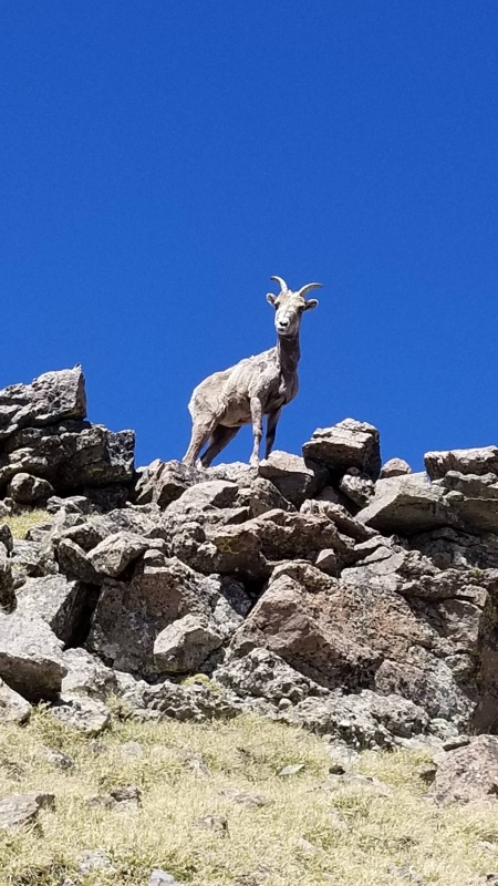
The easy ridge up Point 13,153.More frolicking, because frolicking is a necessary nutrient for a healthy, happy life. Photo: Whiley H.The saddle we wanted to come down. Dang that would have saved us a ton of effort.Easy terrain on the entire ridge with exception of the summit block. Photo: Whiley H.Some light scrambling to the summit.A rather emaciated (and pissed off) goat we came across. Photo: Sam S.
Having tagged our "final" peak of the day, we mustered the strength and gumption for yet another re-ascent of Adams, which would actually be our final peak of the day. No mas, por favor.
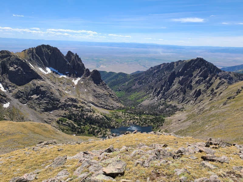
That is one stupid big piece of rock.North face of Point 13,546 with Challenger Point on the left.South Crestone Lake and the usual bananapants towers, spires, and insanity.
It's not like we had much of a choice, so we set off up Adams one more time, at least knowing this was our last time up.
At the bottom of the slab. Photo: Sam S.Head-on view of the amazing hanging slabs. There's got to be a bunch of unclimbed routes through them.Some of the better rock on the northwest ridge, showing the ledges we had to climb up and over. Photo: Marisa W.Such varied terrain on Adams! Photo: Whiley H.
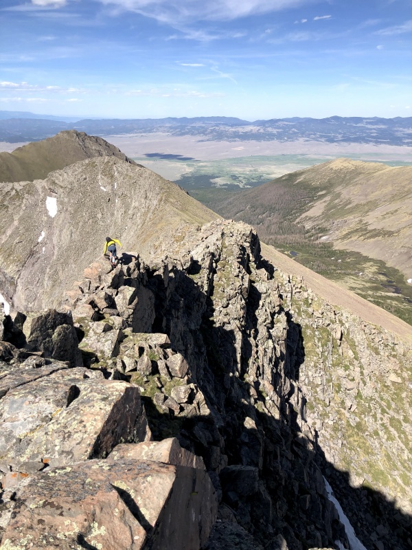
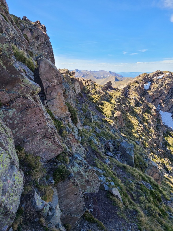
Eventually we reached the summit of Adams and began descending the ledges and outcrops of the northeast ridge to the choss slope above the lake.
Ridgy goodness.There are indeed some highly exposed but highly fun parts of the ridge. Photo: Marisa W.Ledgy traversing.
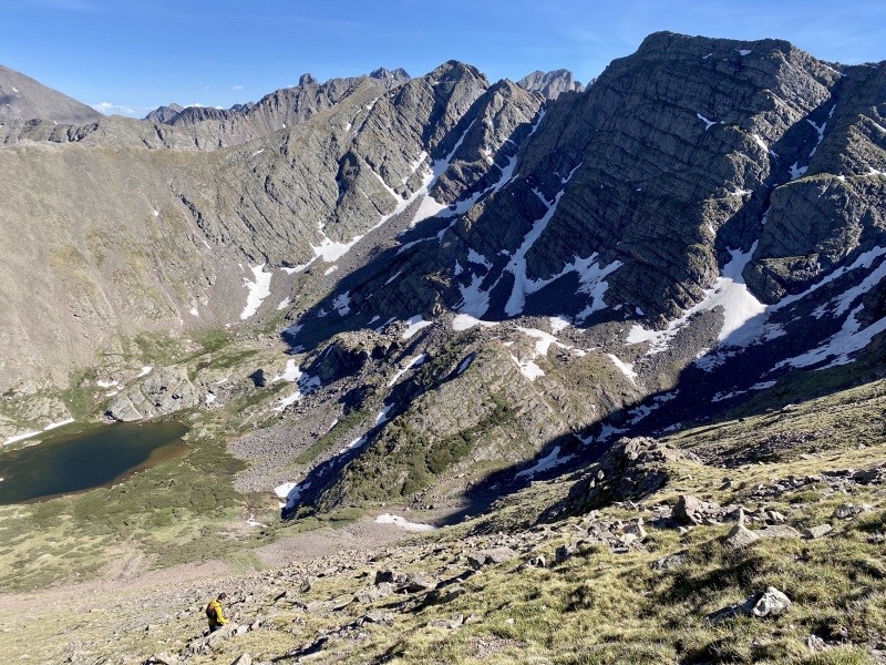
Whiley and Sam raced down the slope while Marisa and I plodded along behind. For some reason we found it much worse down than up, to which the other two stated the opposite.
The Sangre are so underappreciated. Photo: Whiley H.Not as pretty going up, but the ridge above keeps one waiting with anticipation. Photo: Whiley H.
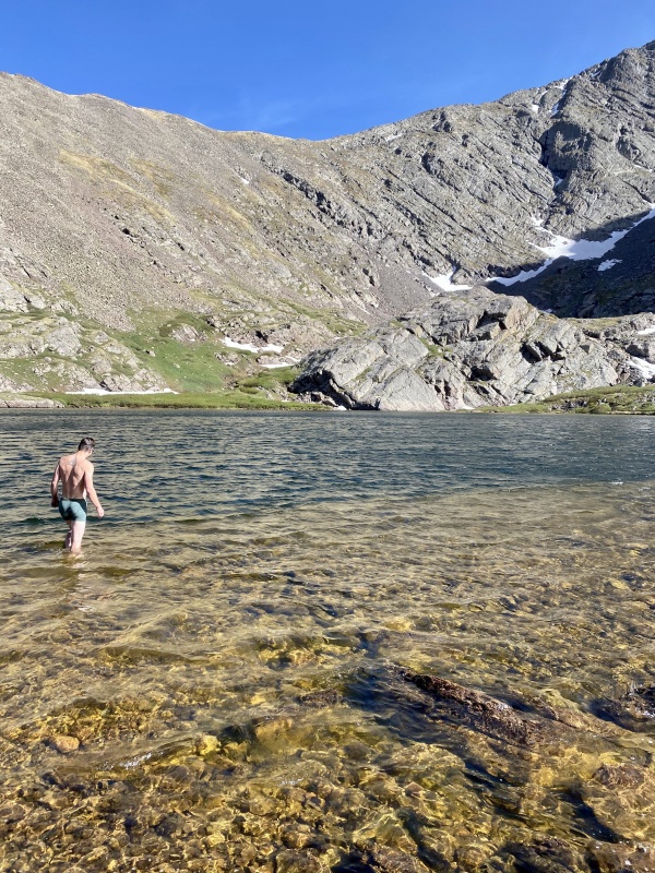
Sam had decided to swim in the lake while he had a moment, which looked tempting, but the rest of us were staying another day or two and had to worry about wet clothes the next day.
Looks like a refreshing dip after a huge day. Photo: Whiley H.
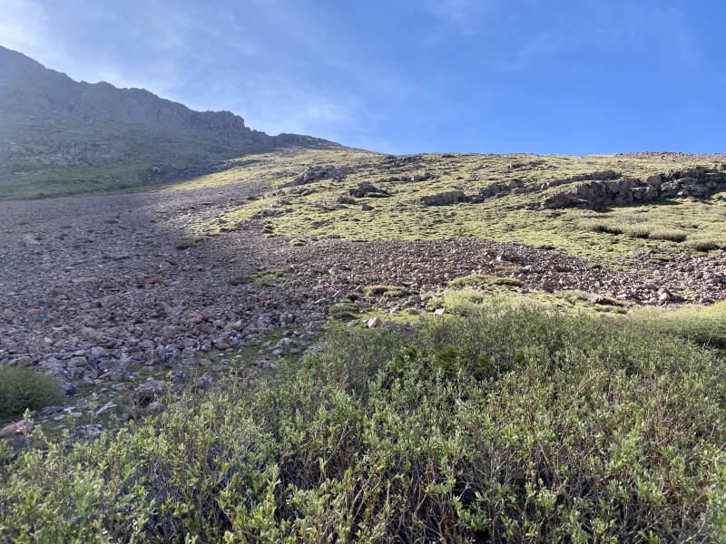
We hit the trail and made quick progress down the trail and back to the trailhead, happy that it was almost entirely downhill from here.
Bliss. Photo: Whiley H.Upper basin meadows There'd be ample camping here if desired. Photo: Marisa W.
When we got back to the trailhead we went into town and ate at Tony's Mountain Pizza, which is actually in Silvercliff. There's no distinction between Silvercliff and Westcliffe as far as I can tell, but I didn't care right then, I just wanted ungodly amounts of calories in my face. I ate an entire pizza, an order of garlic knots, and a salad, and still wanted more. Reluctantly we went back to the trailhead to sleep. Sam went back to Boulder the next morning and Whiley, Marisa, and I stayed to climb more 13ers over the next two days. A huge day this may have been, but to commemorate my new life I couldn't have asked for a better one on great peaks with great friends.
Statistics
Climbers: Ben Feinstein (myself), Whiley H., Marisa W., Sam S. Trailhead: Horn Creek Total distance: 19.17 miles Total elevation gain: 10,064 feet Total time: 12:08:56 Peaks: Four ranked thirteeners
Mount Adams A, 13,931'
Point 13,580 A
Point 13,546
Point 13,153
Splits:
Starting Location
Ending Location
Via Time (h:mm:ss)
Cumulative Time (h:mm:ss)
Rest Time (m:ss)
Horn Creek Trailhead
Mount Adams A
3:37:02
3:37:02
11:21
Mount Adams A
Point 13,580 A
0:37:26
4:25:49
0:00
Point 13,580 A
Point 13,546
1:20:38
5:46:26
33:53
Point 13,546
Mount Adams A
0:52:30
7:12:50
0:00
Mount Adams A
Point 13,153
0:46:37
7:59:27
9:33
Point 13,153
Mount Adams A
0:52:55
9:01:54
4:50
Mount Adams A
Horn Creek Trailhead
3:02:12
12:08:56
Trip End
My GPS Tracks on Google Maps (made from a .GPX file upload):
First off glad to see TRs from you again, I thought you were so busy doing peaks that you had forgotten to post TRs... 2nd- That van is freaking rad, nice home on the road! 3rd- Looks like a sweet day, Adams is one of my favorites, nice job exploring it from every side plus all the neighbors.
@Andrew: Thank you, and glad to be back! I have a few more already written, I just never got around to publishing them. That's what climbing 200+ 13ers in one year will do!
@Whiley: This is just one of many great days we've had this year. Between this and probably a dozen or more awesome San Juan climbs I'd say we've had ourselves a year to remember!
That was a great report with wonderful photographs.
Nice van.
I have the motel 6 version, which is a cheap twin mattress tossed in the back of my Durango.
Someday I'll hike mt. Adams.
I just ate pumpkin cheesecake, it was great 12/1/2020 10:32pm
@Dillon: He is a special boy, isn't he?
@Will: Mileage is something like 15 to 18. I don't know the exact number, despite what the computer says. I have slightly larger than stock tires on it which throws the mileage, speedometer, and odometer off and they can't legally modify it so I'm stuck with slightly-off readings. And yup, it's a diesel. Mercedes-Benz makes the 4x4 only in diesel, and I would have gone with diesel over gasoline if I had the choice anyway. I don't think any other manufacturers are making current production runs of true 4x4s, only MB.
@Darin: Agreed! We still need to get together and climb something one of these times when you aren't off rubbing elbows with and building golf courses for multi-gazillionaires.
@ltlFish99: Thank you! It was a great day, I would say Adams by darn near every route is a classic. You'll enjoy it a lot when you do it. I probably would have gone with a truck+mattress (or crash pad) in the bed if I didn't have the option to work remote full time, but I'm lucky in that my job goes anywhere with cell reception. The van made sense and has even gotten me up a few gnarly places like Endlich Mesa and Cinnamon Pass!
Great van dude. You are not allowed to take that thing up Stony Pass again. :P I drove it in my subie but will NOT be comfortable taking a van up there.
No kidding, Yusuf. Stony Pass was the first serious road I took the van up and I was literally shaking by the end the adrenaline was so high. I've been considering getting a lightweight dirtbike that I can attach to the hitch on the back for these kinds of things. Whiley and I are going to rent an ATV/Jeep for some of these gnarlier areas like Beartown, Pole Creek, Carson Pass, etc., so we don't wreck our personal vehicles, you should join us!
I would love to tag along for Beartown and those areas. I do have to tag some stuff in Carson area too. But yeah, let me know if you guys are gonna rent a Jeep, I would love to pitch in! My current plan was to bikepack those approaches in my mtn bike. :D
You can draft behind us on your bike as we scream up these passes in our rental, if you'd like. Actually, who am I kidding, they'd probably be faster on a bike. We'll be in touch as summer approaches!
Caution: The information contained in this report may not be accurate and should not be the only resource used in preparation for your climb. Failure to have the necessary experience, physical conditioning, supplies or equipment can result in injury or death. 14ers.com and the author(s) of this report provide no warranties, either express or implied, that the information provided is accurate or reliable. By using the information provided, you agree to indemnify and hold harmless 14ers.com and the report author(s) with respect to any claims and demands against them, including any attorney fees and expenses. Please read the 14ers.com Safety and Disclaimer pages for more information.
Please respect private property: 14ers.com supports the rights of private landowners to determine how and by whom their land will be used. In Colorado, it is your responsibility to determine if land is private and to obtain the appropriate permission before entering the property.


")
")
")
")
")
")
")
")
")
")
")
")
")
")
")
")
")
")
")
")
")
")
")
")
")
")
")
")
")
")
")
")
")
")
")
")
")
")
")
")
")
")
")
")
")
")
")
")
")
")
")
")
")
")
")
")
")
")
")
")
")
")
")
")
")
")